On the spur of the moment this week I decided to climb Mount Glendowan. Nugara describes it as a Moderate scramble, though there are areas that may be “moderate to difficult” depending on the route you pick. Online trip reports seemed to have a generally favourable opinion of the trip. Just last week Dave McMurray posted a report of his trip to the mountain, and he seemed to have a blast.
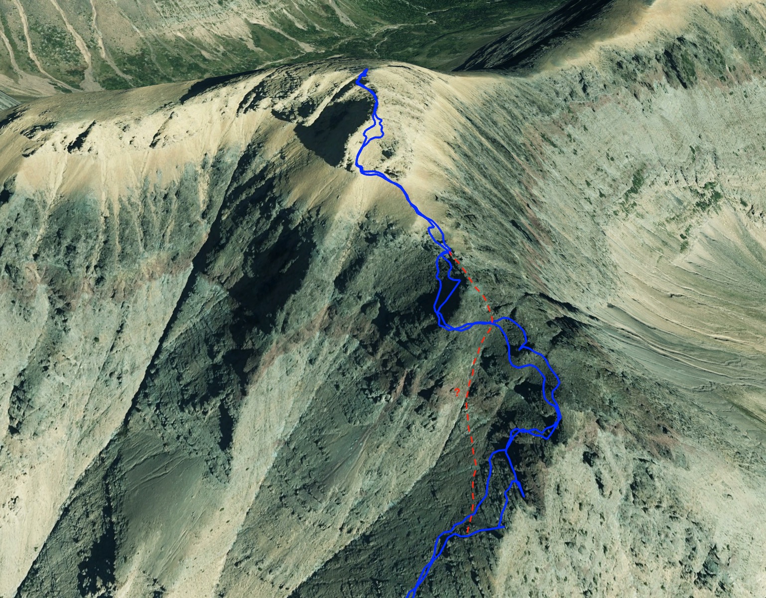
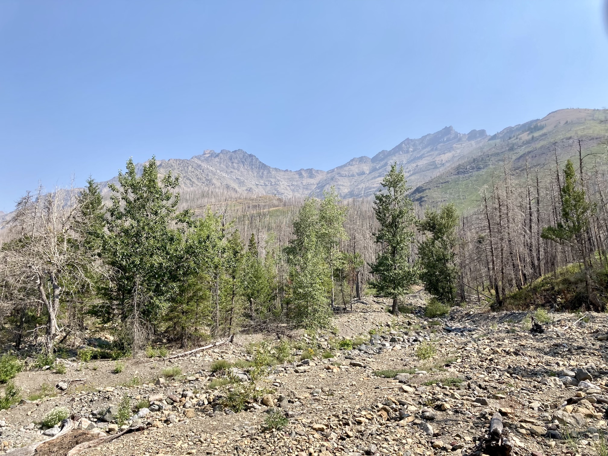
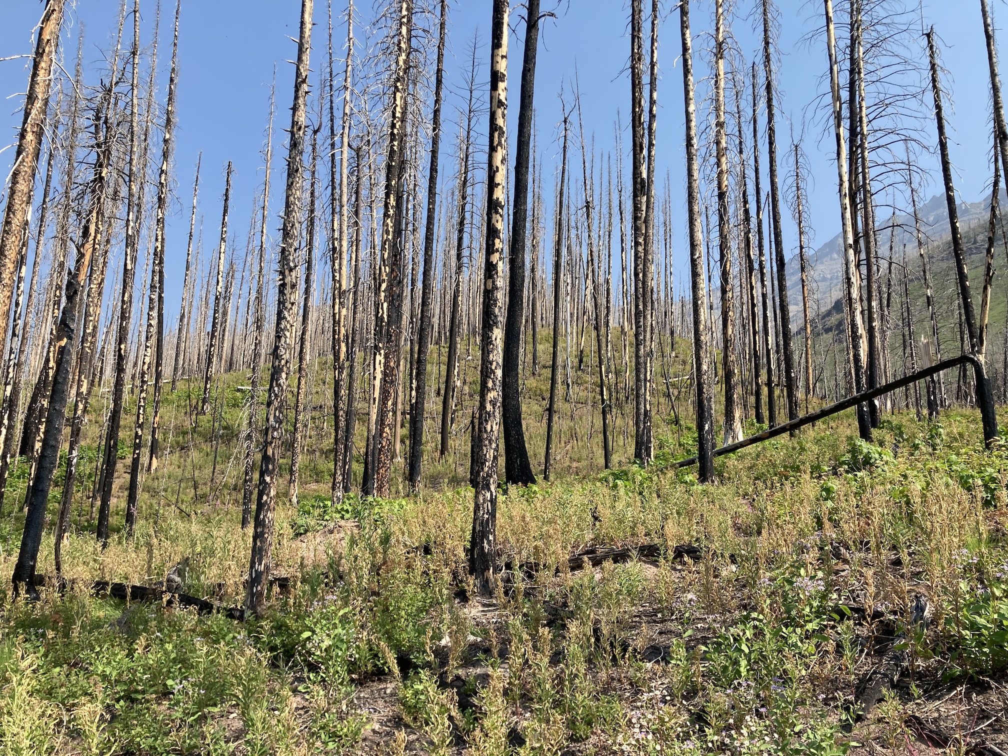
Glendowan is in Waterton Lakes National Park. Access is from the Red Rock Parkway. From the main parking area at Red Rock Canyon I set off along Snowshoe trail. Just over 2 km from the trailhead a major drainage crosses the trail. Off to the right (north) there are clear views of the southern face of Mount Glendowan and an unnamed southern outlier. This is the start of the route. I set off to the north, initially following the dried creek bed, then bearing left into the forest. A rounded ridge began to rise and I climbed onto it and followed it until I got out of the trees. This section of the forest was burned in the recent fires. All the old deadfall has been consumed and now there is only sparse new deadfall and relatively light vegetation among the burned trees. As the years wear on, this section will likely become pretty miserable to traverse as dead trees fall and clutter the forest floor.
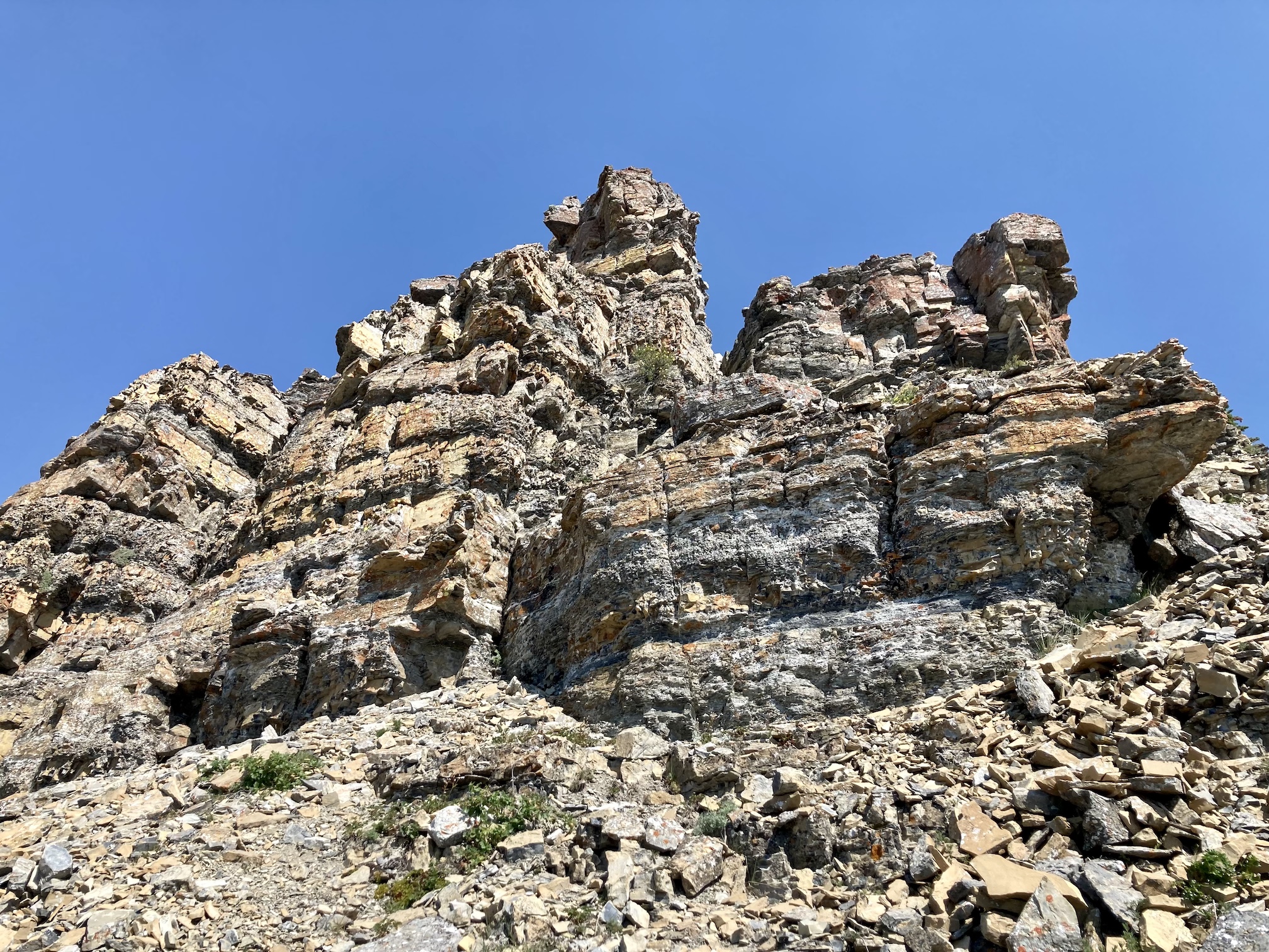
Once I was out of the trees, there was a very short walk up scree and rubble to the start of the scrambling. The entire remainder of the ascent was spent scrambling up successive rock bands on the ridge. Wherever things looked too risky for me I traversed left a bit to find a more agreeable route. Basically all of the scrambling could be avoided by staying far left from the ridge, but that would have turned this into a boring slog up scree on a hot and smoky day. Not exactly the reason anyone goes to the mountains. The rock along the ridge was mostly decent quality for scrambling, though the abundance of rubble on some ledges was aggravating. In a few places the rock was pretty awful – at one point I was very alarmed to pull a thick wedge of football-sized rock off a face I was about to climb.
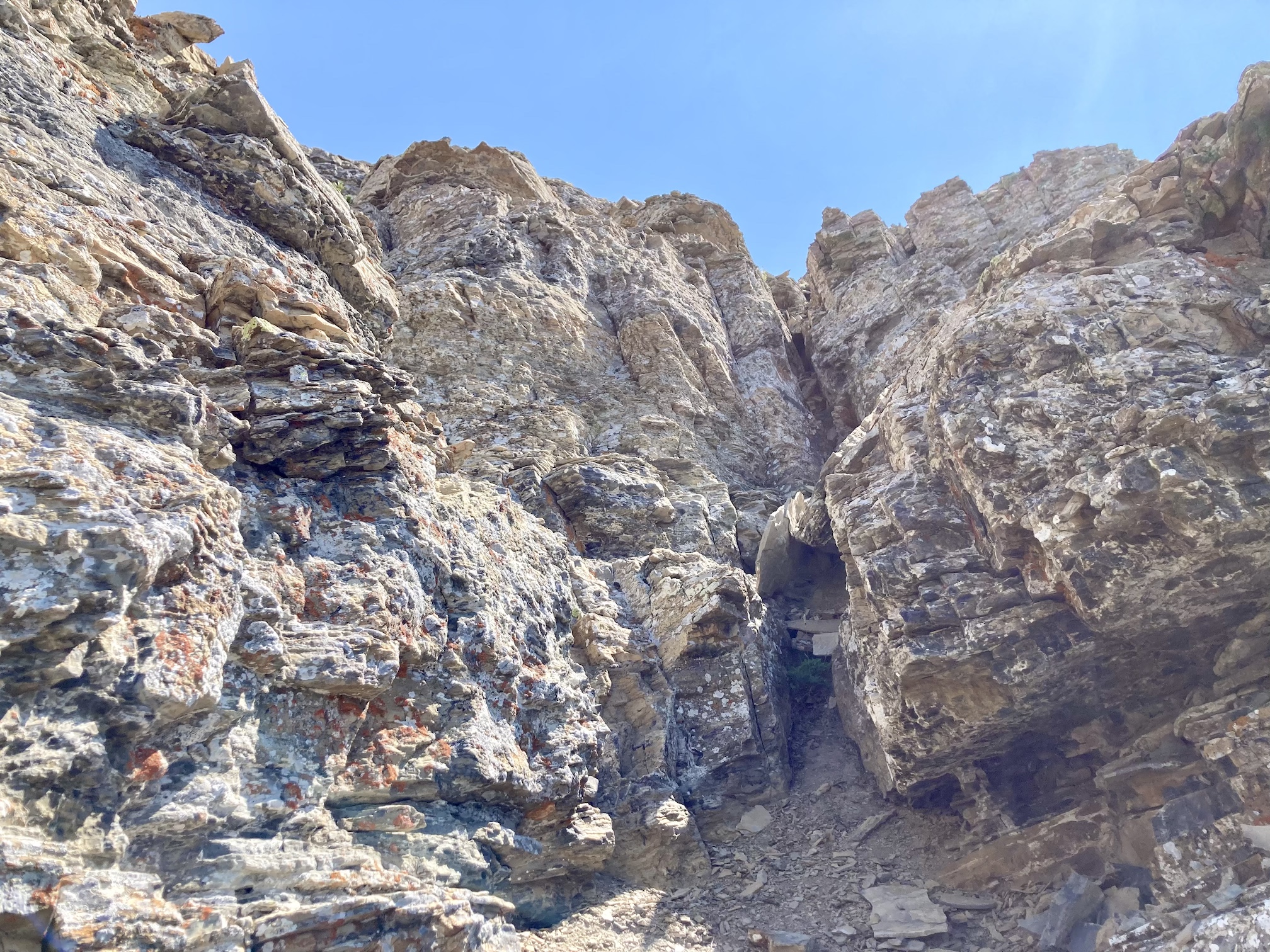
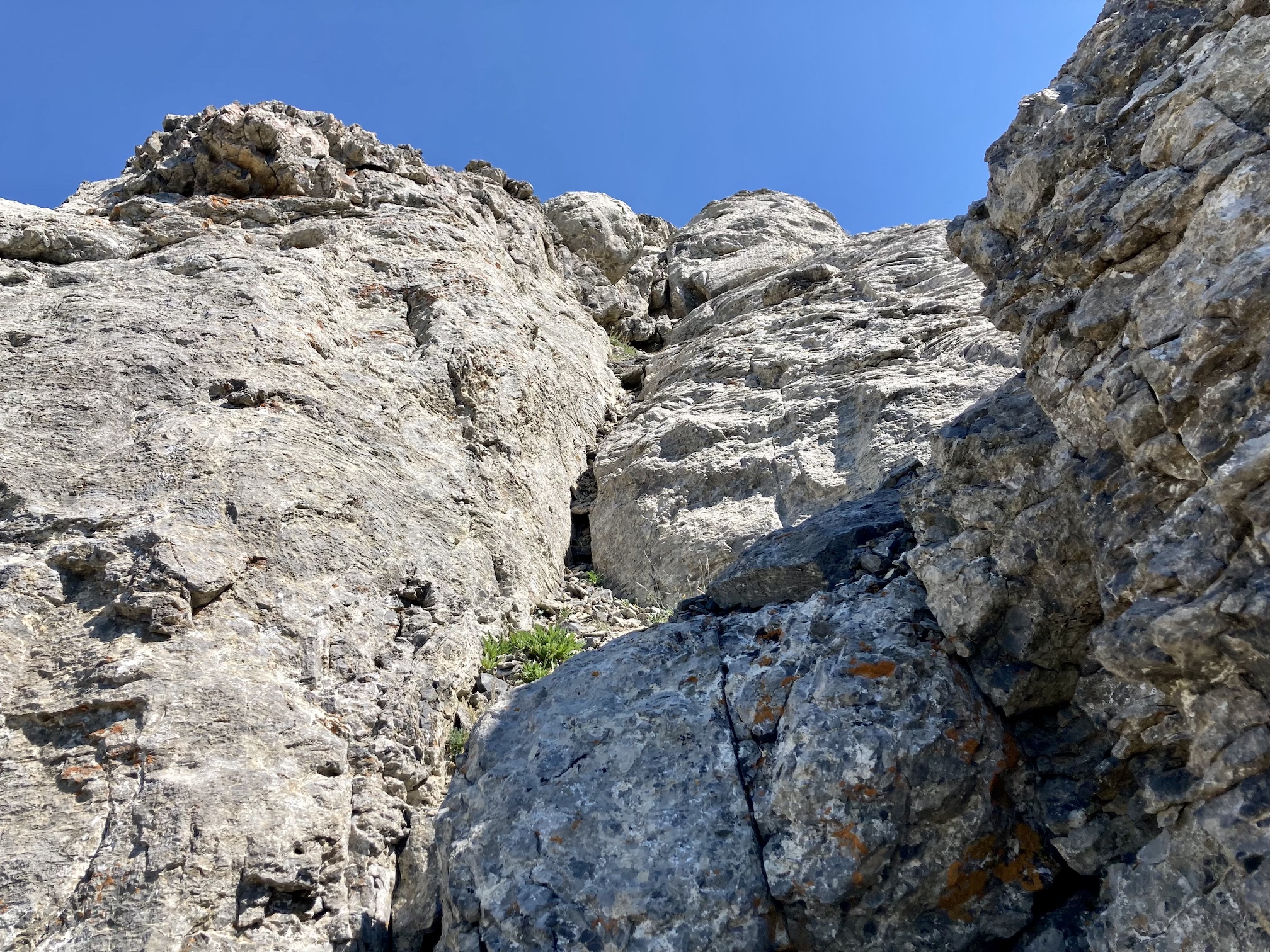
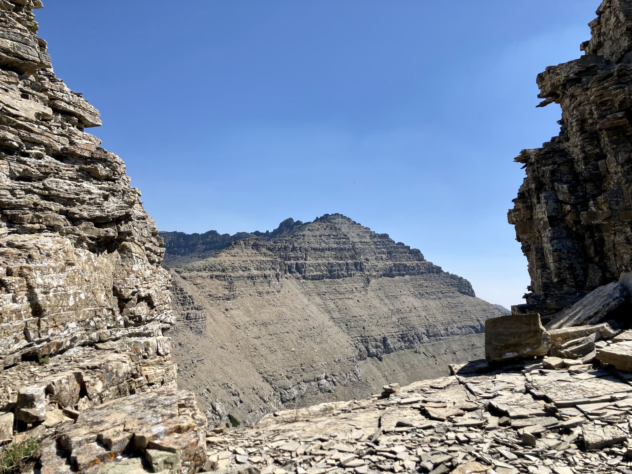
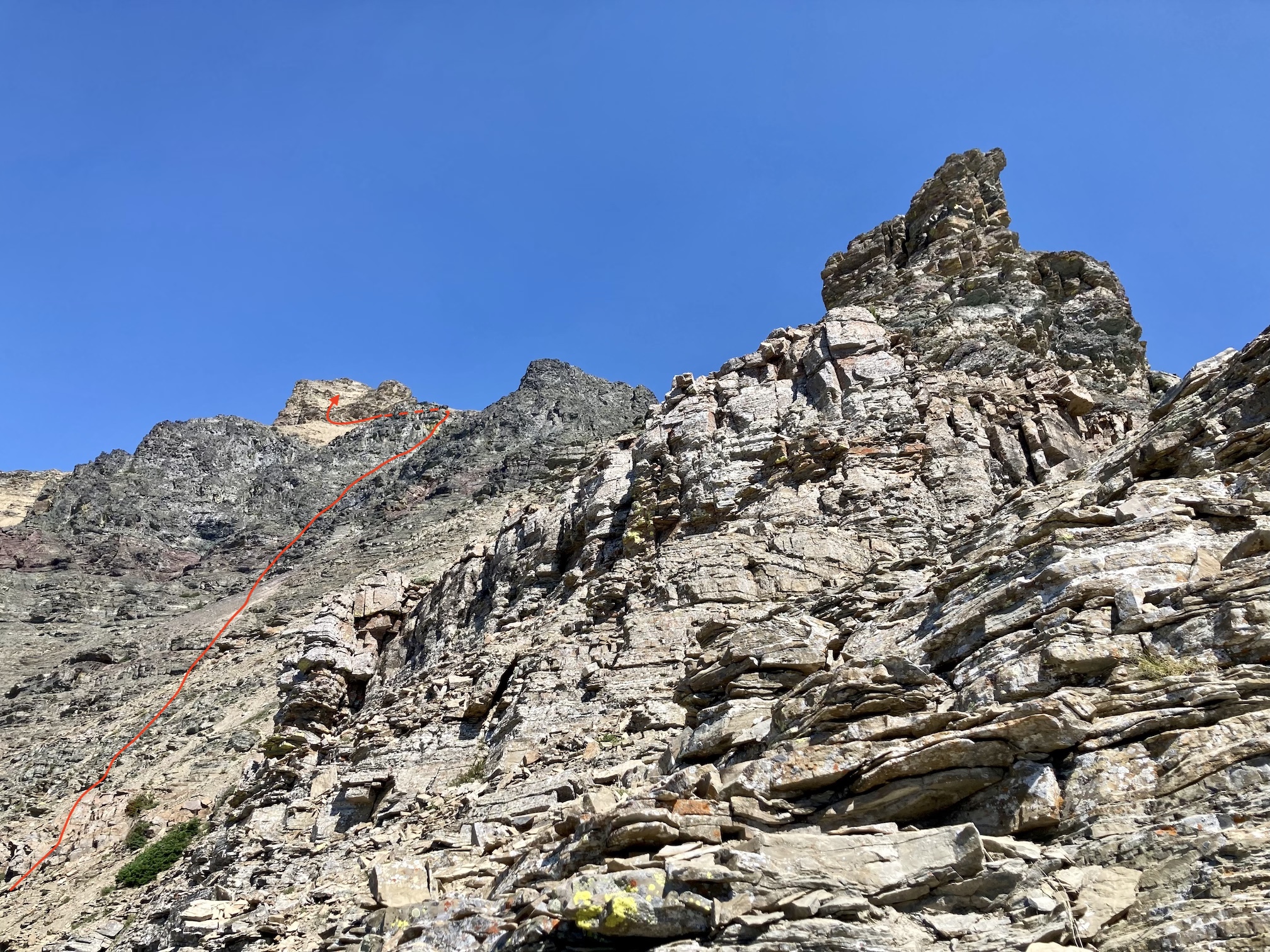
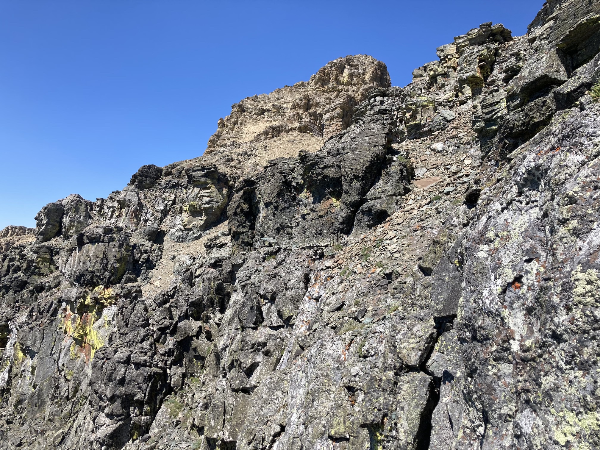
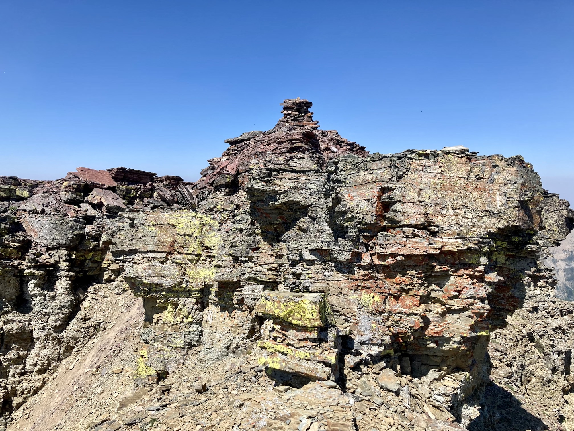
Like essentially all of the mountains in Waterton and the Castle, the rock changed to a black colour with green lichen near the top of the ridge. Nugara suggests departing the ridge at this point and traversing left to a boulder-filled gully, ascending it through the black rock band. I ended up staying on the ridge for some distance beyond that point (mostly because I forgot the advice) and engaged in some trickier scrambling. Eventually, while still on the black rock, I left the ridge and crossed to the left across a bay of rubble. On the other side of the rubble, I rounded a corner on the black rock and then traversed further until I found a weakness and ascended. Once back on sand-coloured rock I went left until I found a weakness. After ascending a scree slope I saw the summit a short distance ahead above one final rock band. A bit more moderate scrambling and I was up.
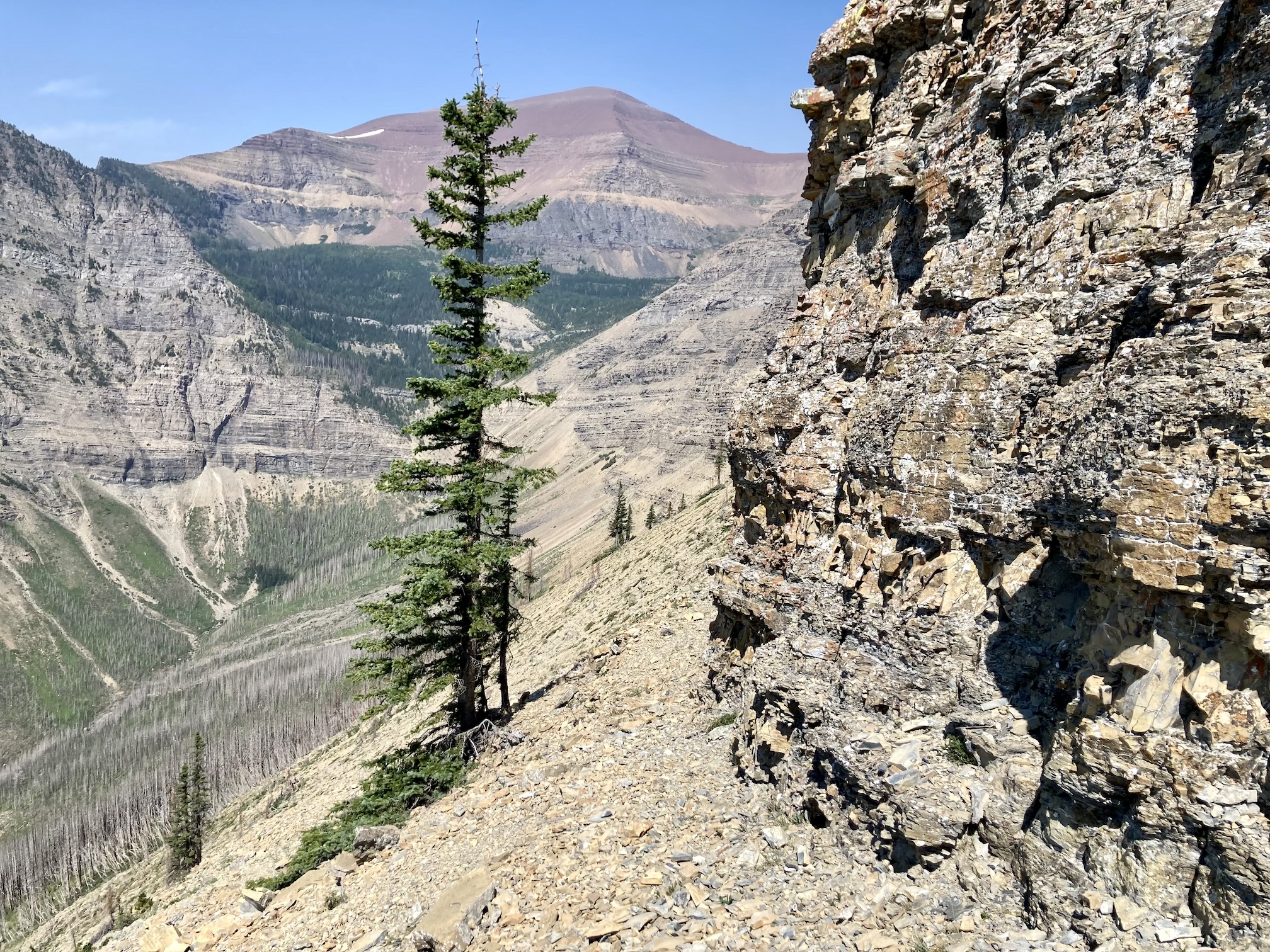
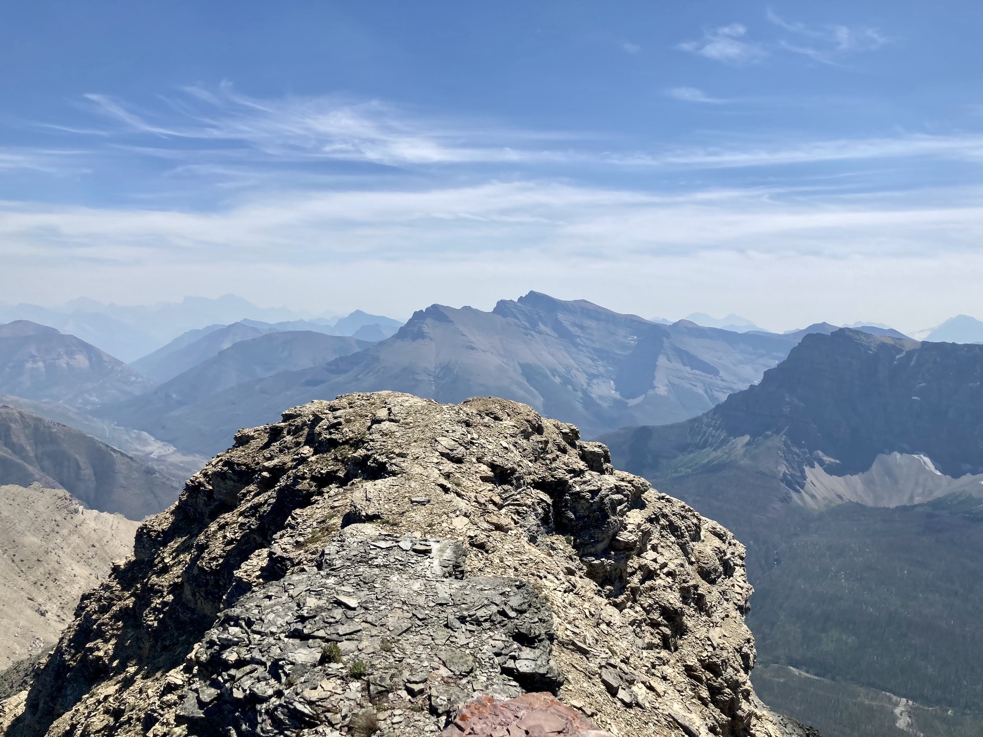
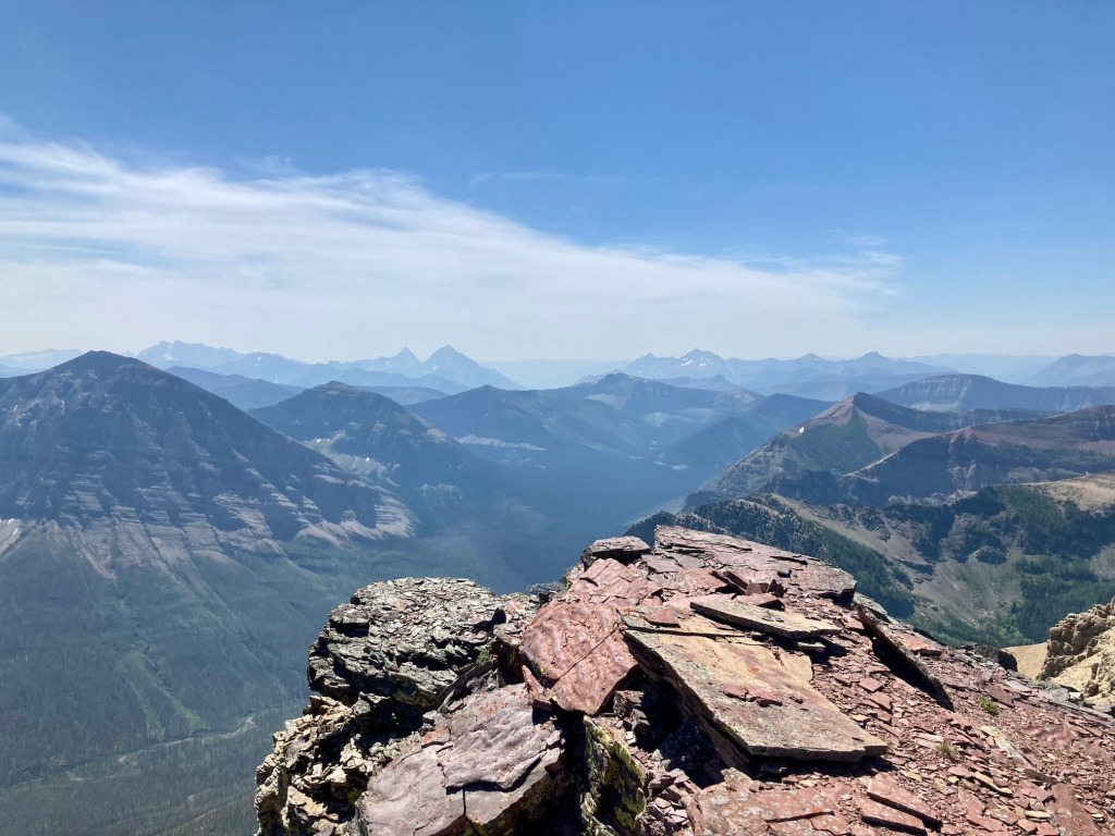
The smoke was thickest to the west and south when I reached the summit. Views to the north in the middle-distance were not bad. I had a good look at some of the peaks in the Castle. On a clear day I imagine there would have been great views all the way to the Crowsnest Pass in the north, B.C. to the west, and Glacier National Park to the south. I didn’t stay on the summit too long. It was very hot, the air smelled of smoke, and there were innumerable flies buzzing around.
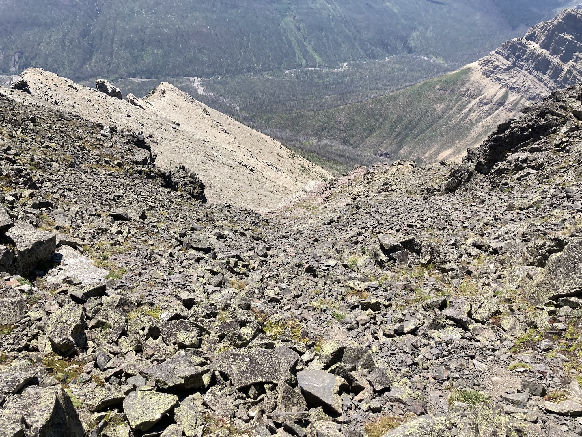
For my descent I retraced my steps. I bore a little to the right to bypass some down climbing, but I think I didn’t go far enough. I ended up dealing with annoying terrain that was scree-covered, but also strewn with slabs and ledges. I should have gone farther right to avoid the troublesome terrain then cut back to the ridge just above the tree line.
Click on the pictures in the gallery below to access full resolution images.
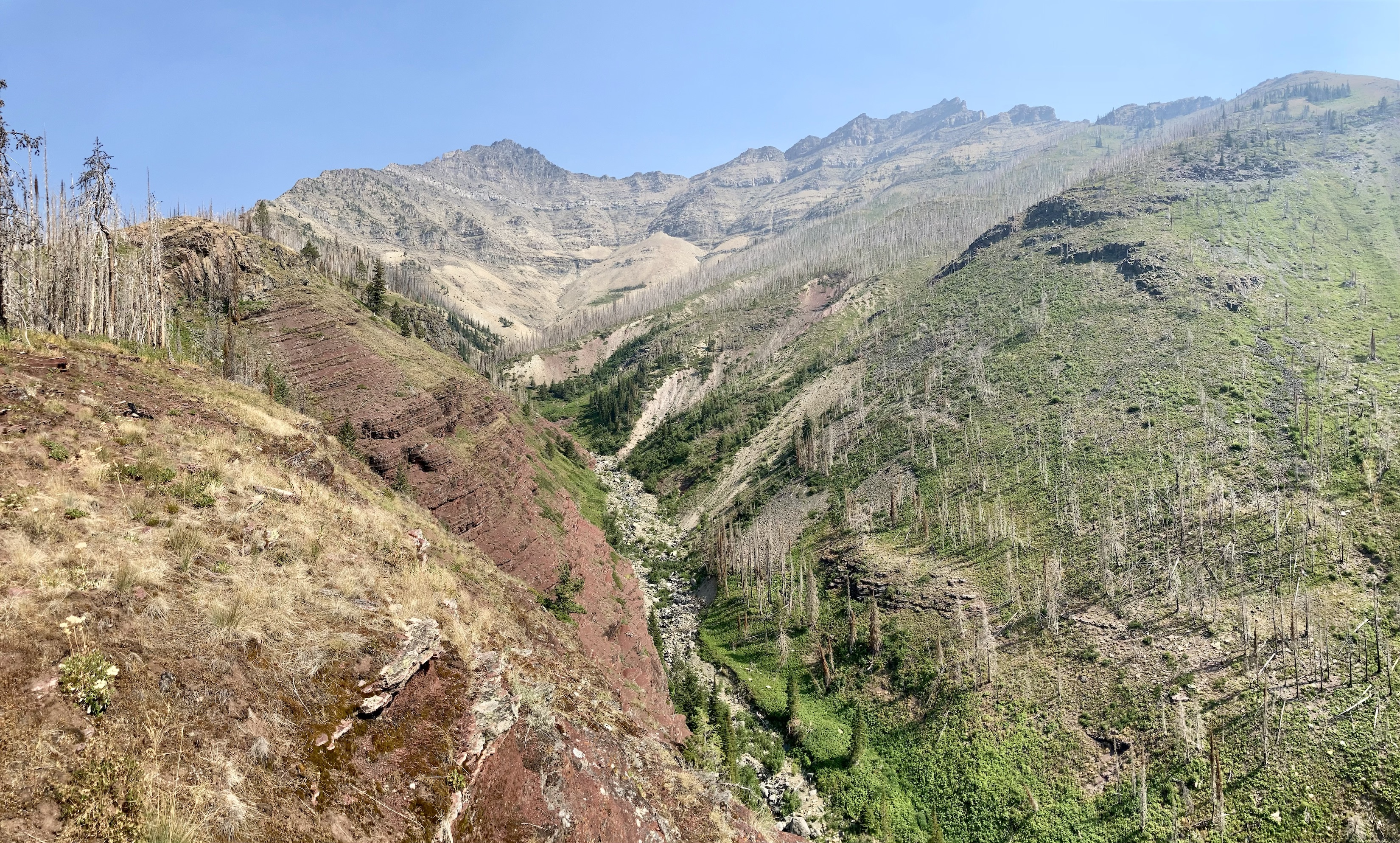
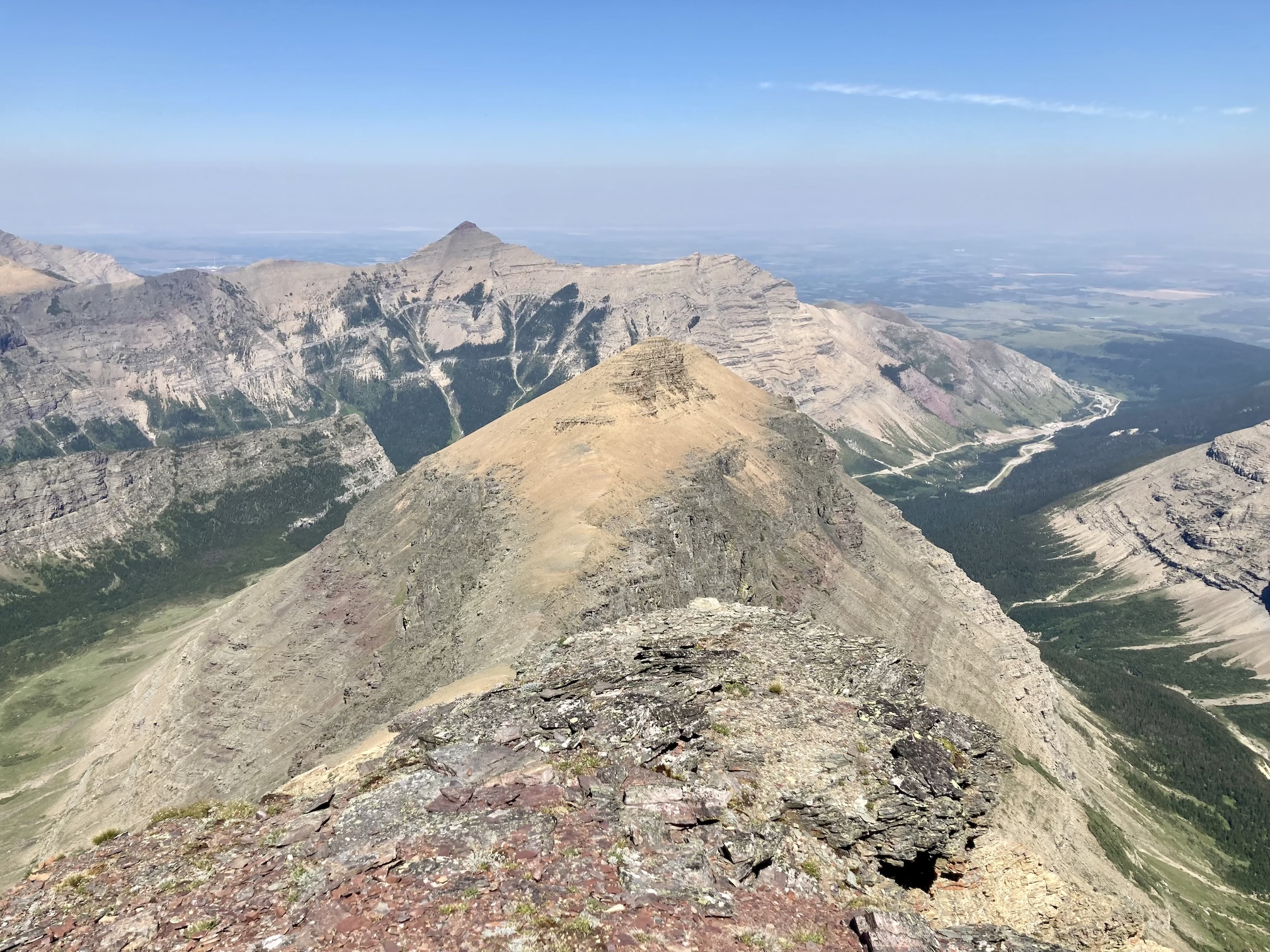
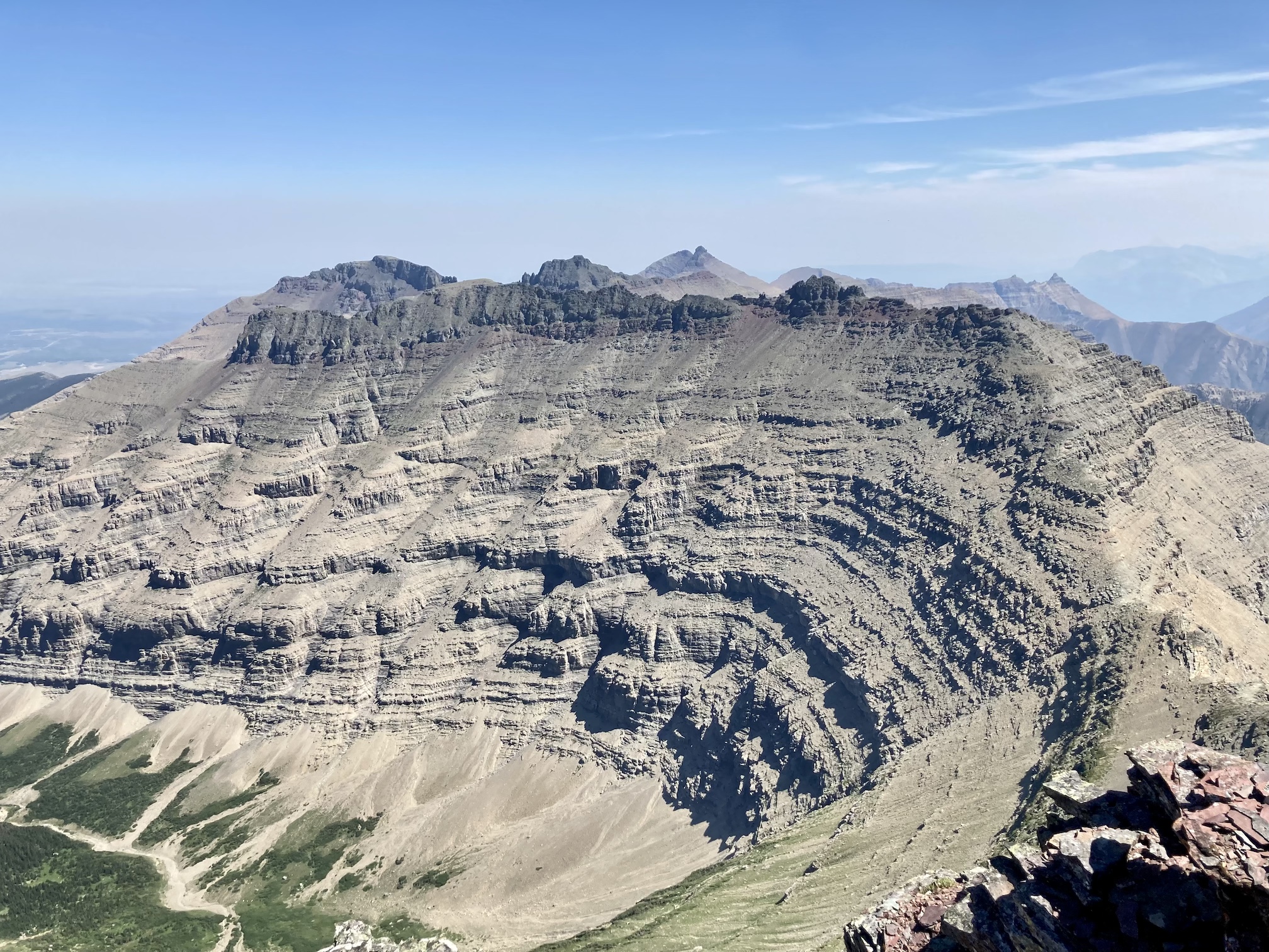
Route overviewA closer look at the route at and above the level of the black rocks. I sketched in the route that I think Nugara describes.The start of the off-trail route, a broad drainage a little over 2 km from the Snowshoe trailhead. I walked up it for a while then got up onto the left bank.After a short time, a slow and steady rise begins on both sides of the drainage. With the forest burned it’s easy to see which way to go. As long as you’re to the left of the drainage you can’t go wrong.If you stick near the edge of the trees, you’ll have a couple of chances to get nice views like this. The contour of the ascent ridge is apparent in the distance on the left – a series of rock bands with cliffs to the right side.Out of the burned forest. The scrambling starts straight ahead.Pick a route and go. Any place that looked too challenging for my liking I bypassed by going left until I found a weakness. The rock was reasonably supportive, but there was a lot of rubble and sometimes holds would pull out or crumble away.More scrambling.Traversing left around some vertical terrain. Newman Peak is in the background.A little chimney to ascend.Eventually I could see the black rocks in the distance. As much as possible I stayed on the ridge, but much of the scrambling could be avoided by heading left. At the top of the rocks straight ahead I found a little cairn.There was a white layer a short distance below the black layer. I once again found myself wishing I knew something about geology.The white rock was quite nice and solid. I climbed up here.Looking left, just above the white strata. The black rocks start soon.The smoke cleared briefly and I had a nice view south across the valley to Anderson Peak.Some pretty vertical terrain to the right side of the ridge.Taking a break in a little notch, looking towards the un-named outlier to the southeast.Almost to the black rocks. The red line is my sketch of what I’m guessing is Nugara’s suggested route. I ended up staying on the ridge and taking a more convoluted approach.One particular area of the black rocks had an interesting configuration, with a line like a zig-zag staircase up almost vertical rock. Notice that there are at least two large stones perched precariously over the edge at the top of this face.A red band interrupts the black rocks for a few meters.Climbing along the black rocks. Eventually I got to a point where I wasn’t so sure I’d be able to egress if needed. I started looking left.Crossing the bay of black rocks. In retrospect this may have been the upper reaches of the gully Nugara described.I went around the corner up ahead and found a way up. If the rocky bay was, in fact, Nugara’s ascent gully I just made things harder for myself. Oh well. It was all moderate scrambling terrain and I didn’t put myself into any precarious situations.After rounding the corner, I traversed left until I found a safe way up.Above the black rocks. The summit block is straight ahead, but the summit itself is still hidden.I wasn’t so sure I could climb this. I think McMurray did, though. I went left and found a short climb to a scree slope and ascended.A little cairn at the top of the scree slope, with the true summit and summit cairn beyond. I’m not sure what the little cairn was supposed to mark – maybe someone got to this point and said “screw it, I’m done”.The summit cairn. I didn’t capture it in this picture, but small pinnacles almost made a staircase from this spot up onto the summit.Summit panorama looking north. The long ridges and peaks of the Castle front ranges were out of the smoke for a short time. Newman Peak, Spionkop Ridge, Mount Roche, Loaf Mountain, Drywood Mountain, Pincher Ridge, Victoria Peak, and Windsor Mountain are visible. Lost in the haze in the distance are Mount Darrah and surrounding peaks.Looking down the ridge extending northeast from the summit, pointing towards Mount Roche (“Spread Eagle Mountain”).Looking east. Beyond the intervening ridge are Cloudy Ridge, Mount Dungarvan, “Rogan Peak”, and Mount Galwey.Looking south, where the smoke was more dense. Mount Blakiston dominates the view. The outline of Mount Cleveland can be seen in the background to the left.Anderson Peak directly across the valley. In the background are Kintla Peak, Long Knife Peak, King Edward Peak and Starvation Peak.Looking west into haze and smoke. Heading back down.Enjoying a break by the creek. I re-joined the initial ascent drainage a little upstream of where I left it so I could find some running water. It was a hot, smoky day.