I decided to visit Middlepass Lakes and Rainy Ridge as my first foray into the area accessible via the West Castle Valley beyond the Castle ski resort. The trip, or versions of it, are outlined in a number of guidebooks – most recently Nugara’s Popular Day Hikes: The Castle and Crowsnest. Much-needed regulation of vehicle access to this valley has rendered older descriptions obsolete. Nugara’s newest book has the most accurate description. I was fortunate enough to have a sunny, nearly windless day as well as complete solitude on this outing.
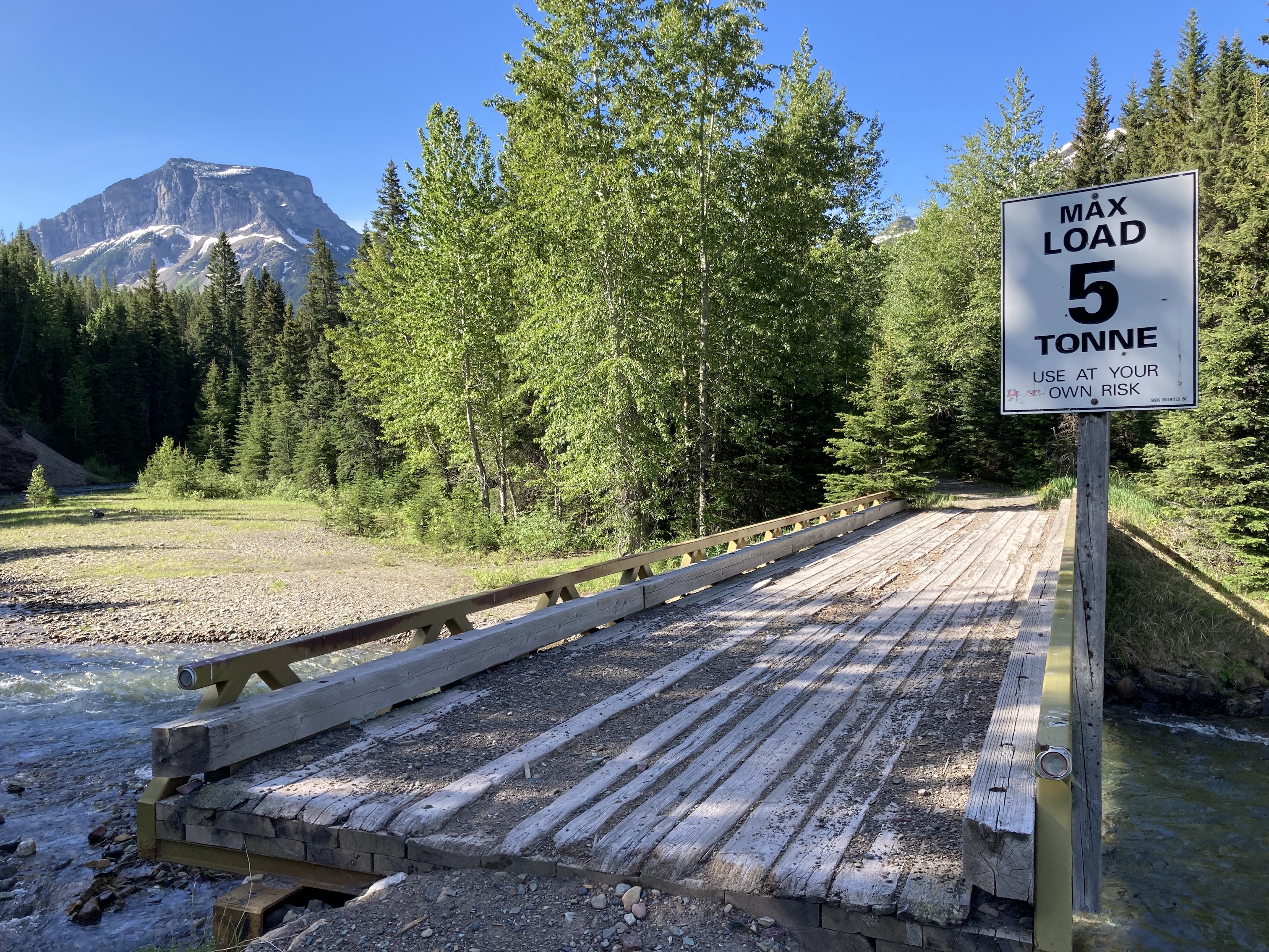
Access is from the parking lot of the Castle Mountain Ski Resort. From the southeast corner of the large parking area a road leads to a narrow bridge over the West Castle River. This is where the route starts. I brought along my bike for the initial portions of the route. I biked the wide, sometimes rocky road for 2.7 km to a large clearing. In older descriptions they describe vehicular access to this clearing, but that’s no longer permitted (or possible, given the narrow bridge at the start of the route). There is a signed branch in the road here, and I went right – following the signs to Middle Kootenay Pass. Two small bridges immediately followed, and I continued biking for about another kilometre until the rocky terrain and slightly steeper pitch resulted in my walking my bike up a switchback. I decided to stash my bike at that point, though I could have pushed it up a little further and gotten about another kilometre of use out of it if I’d wanted to.
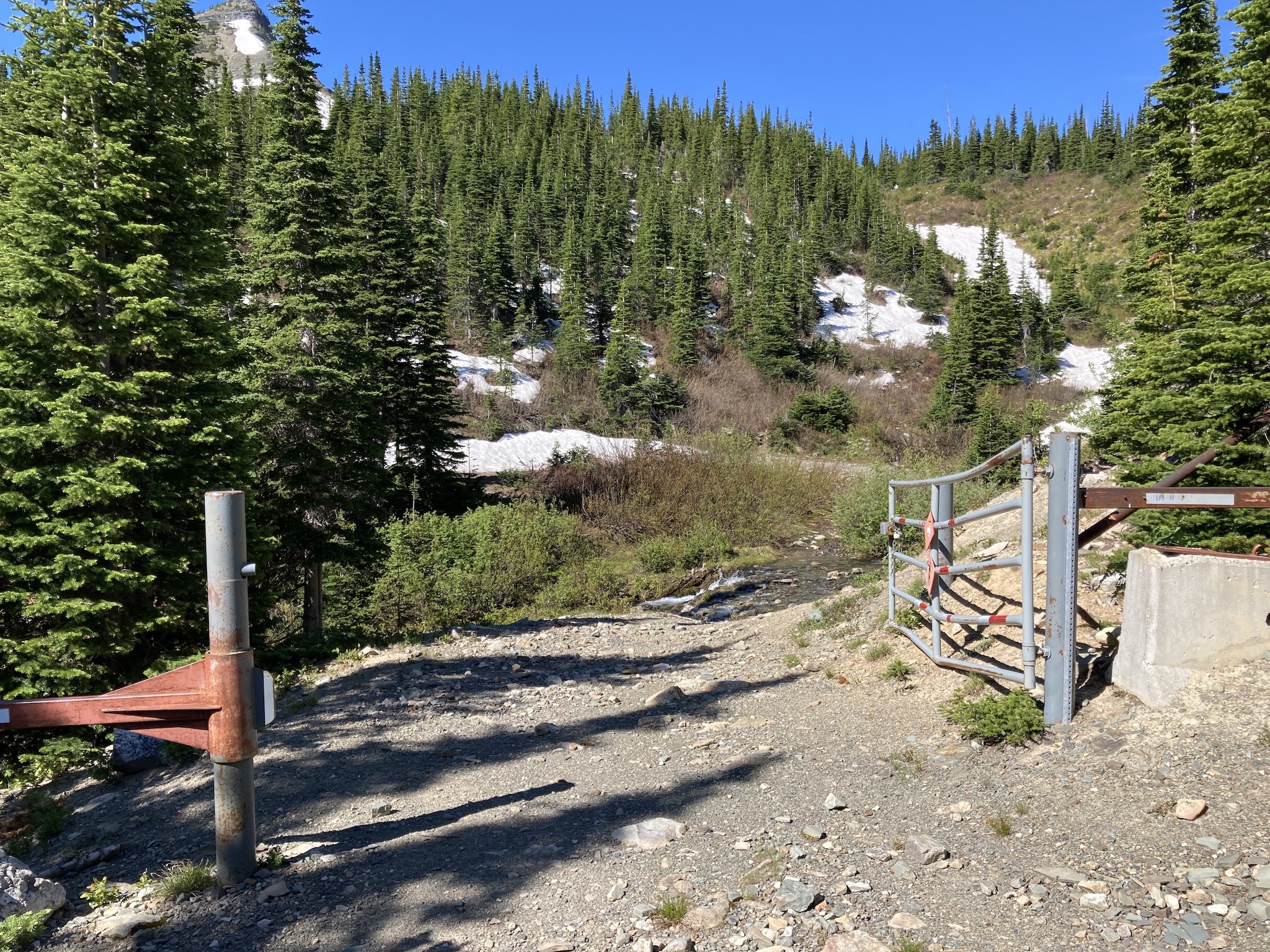
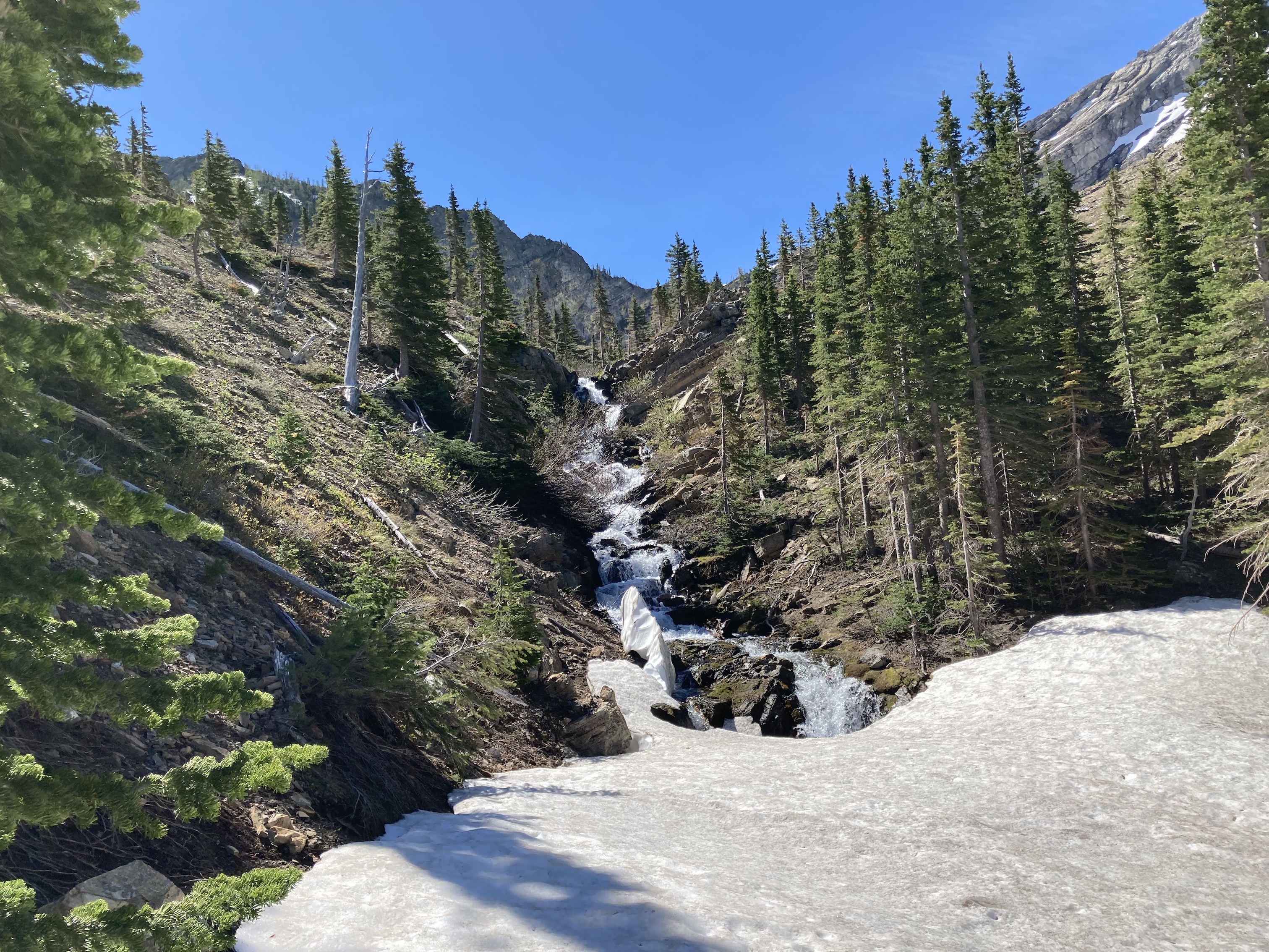
The road eventually reaches the edge of another clearing. This clearing is to the left of the trail with a row of white rocks arrayed across the grassy fork in the road that leads into it. This was apparently and oil well site several decades ago. Nugara writes that most people stash their bikes here. The trail continues to the right, becoming more rough and steep. Eventually a gate is reached (which was open at the time of my visit) and the trail is crossed by a couple of streams. Most route descriptions say there are 2, but there was enough runoff on the day I visited that there was a third (albeit smaller) stream crossing the trail. About 1.5 km from the gate the trail reaches the Middle Kootenay Pass. A small sign marks the edge of the Provincial Park boundary, and thus the provincial border.
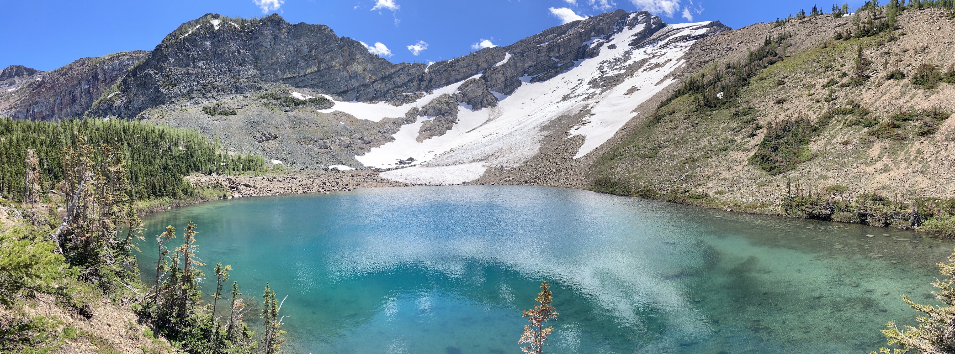
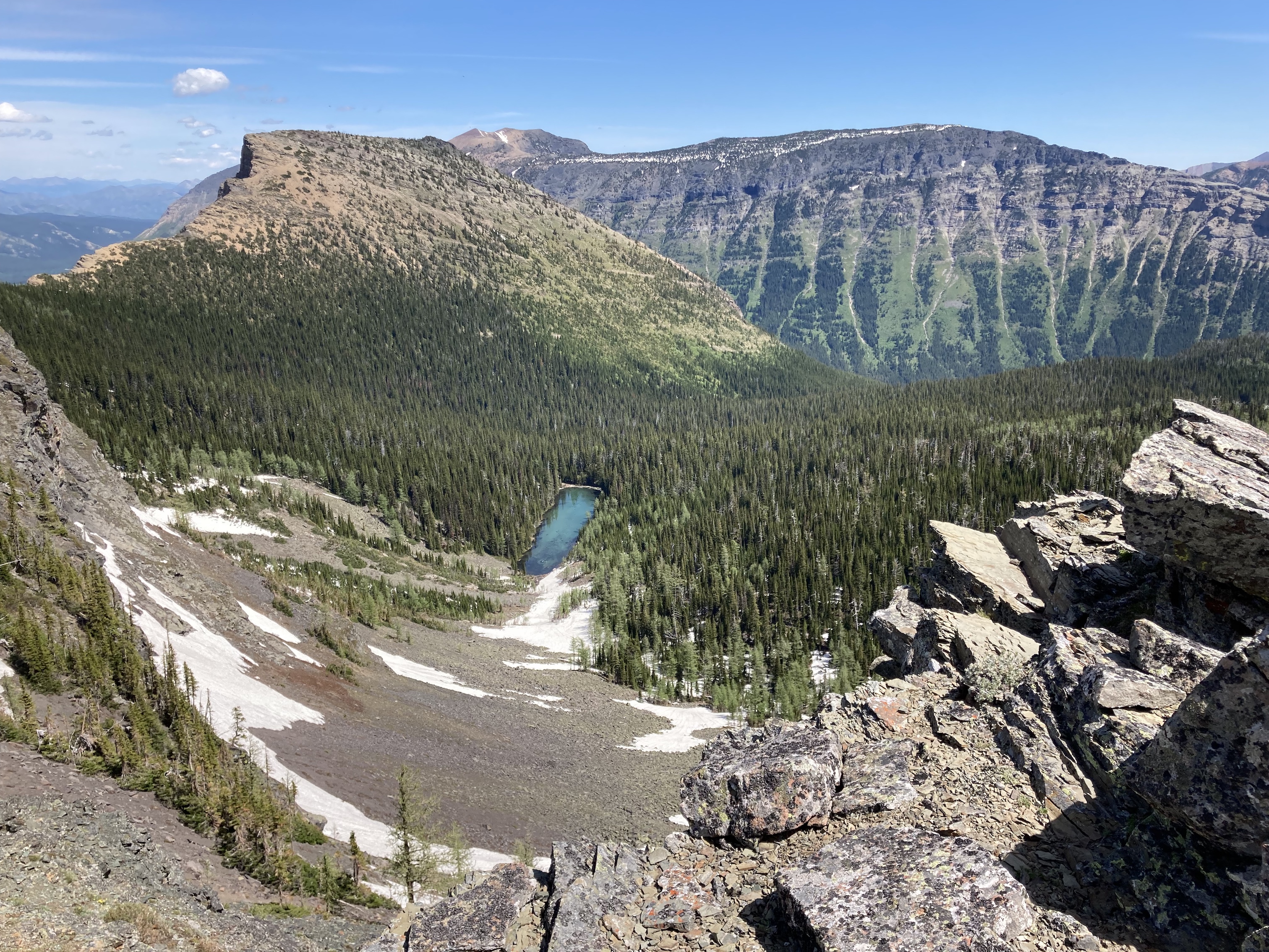
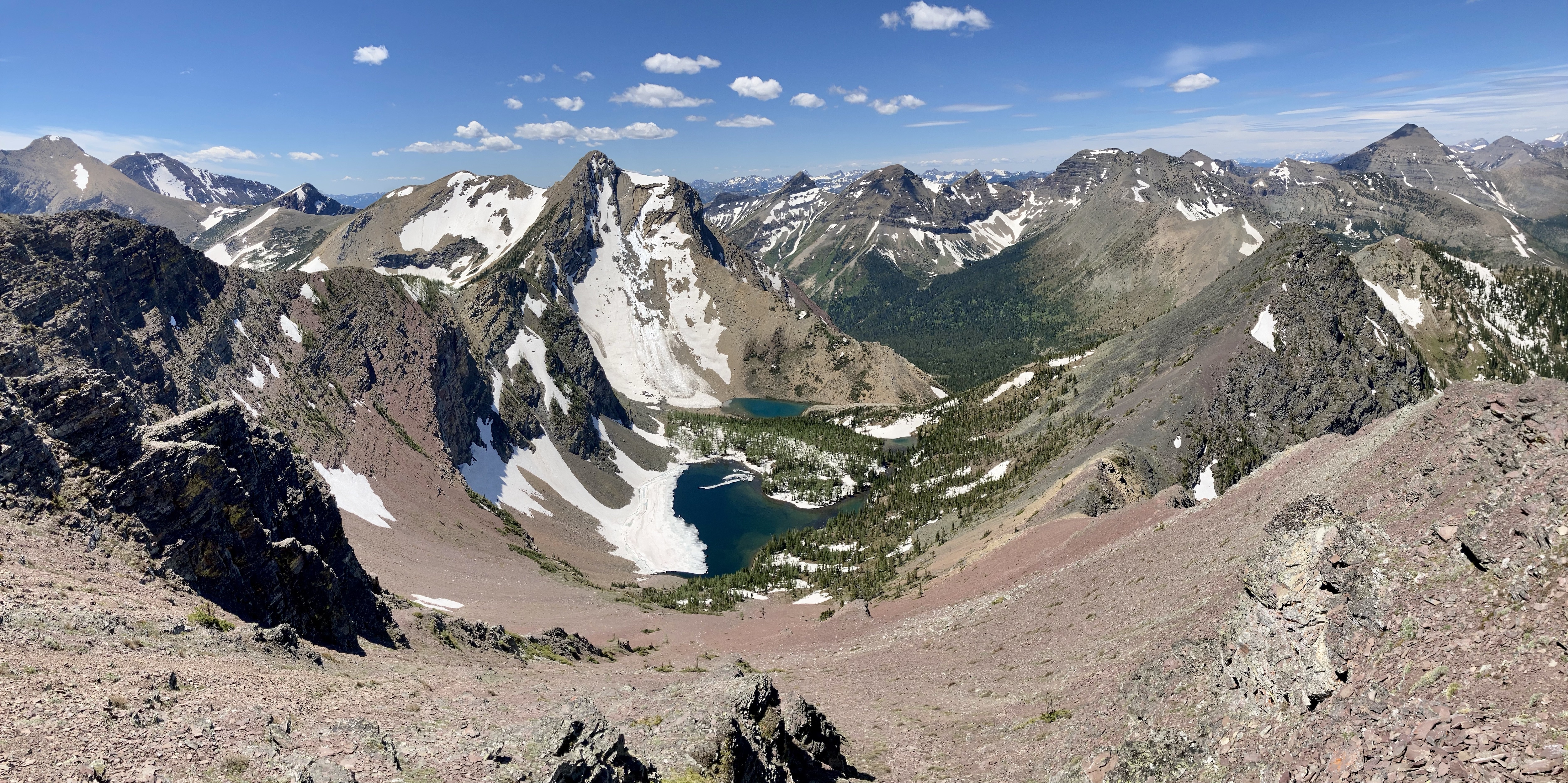
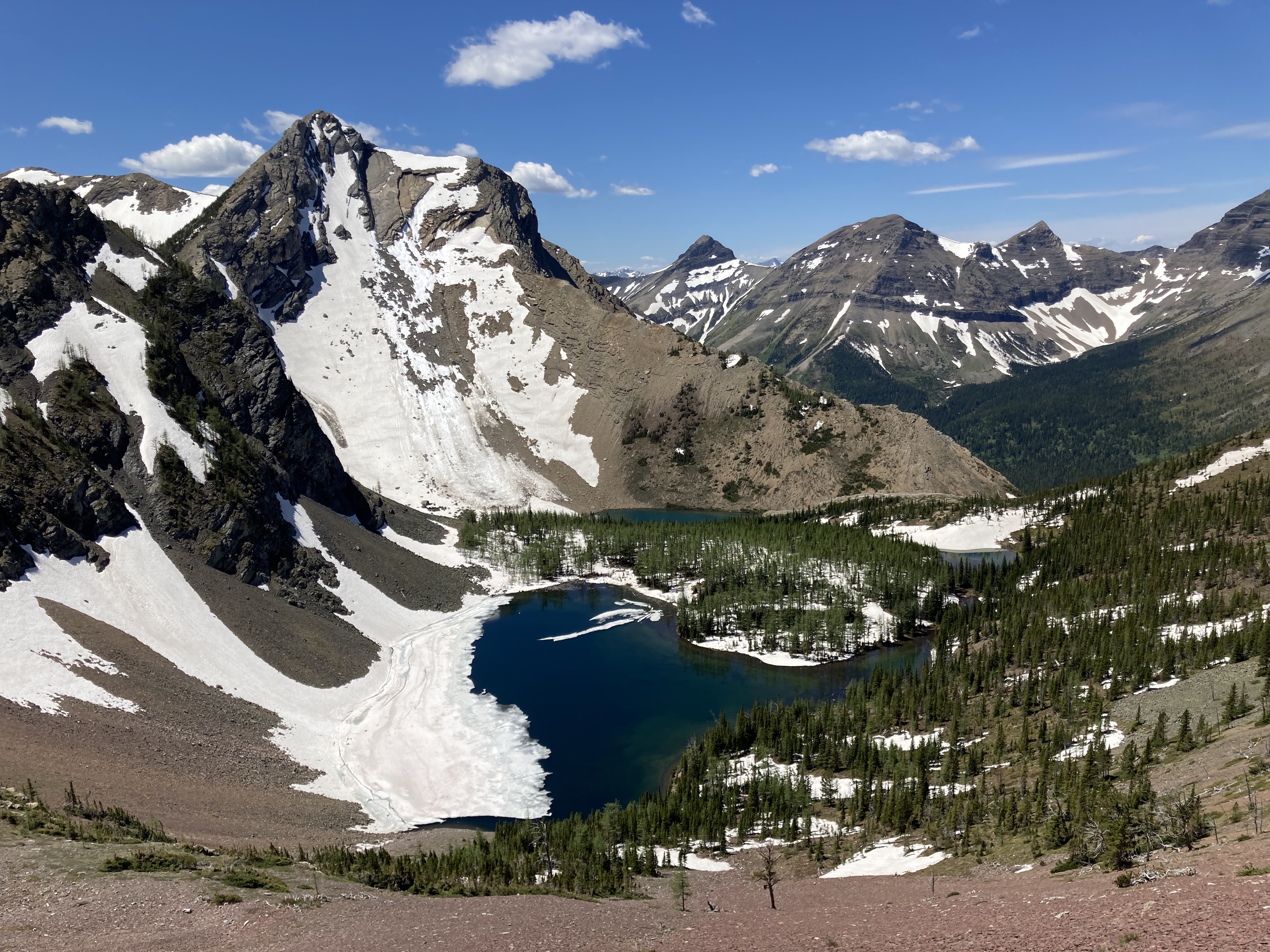
There’s the option of going hard left here and gaining the ridge to the east of the pass then following it all the way to the summit of Rainy Ridge. I decided I wanted to visit the lakes first, though. A trail was evident traversing along the open grassy slopes heading southeast. The lakes are hidden from view at this point, but the cascade of Middlepass Creek descending from the first lake could be seen in the distance. I followed the trail with no difficulty as it eventually reached the cascade and ascended alongside it. Soon I was standing alongside the turquoise waters of the first Middlepass Lake. It took 2h 33m to reach the lakes. The trail carried on to the second and third lakes in short order.
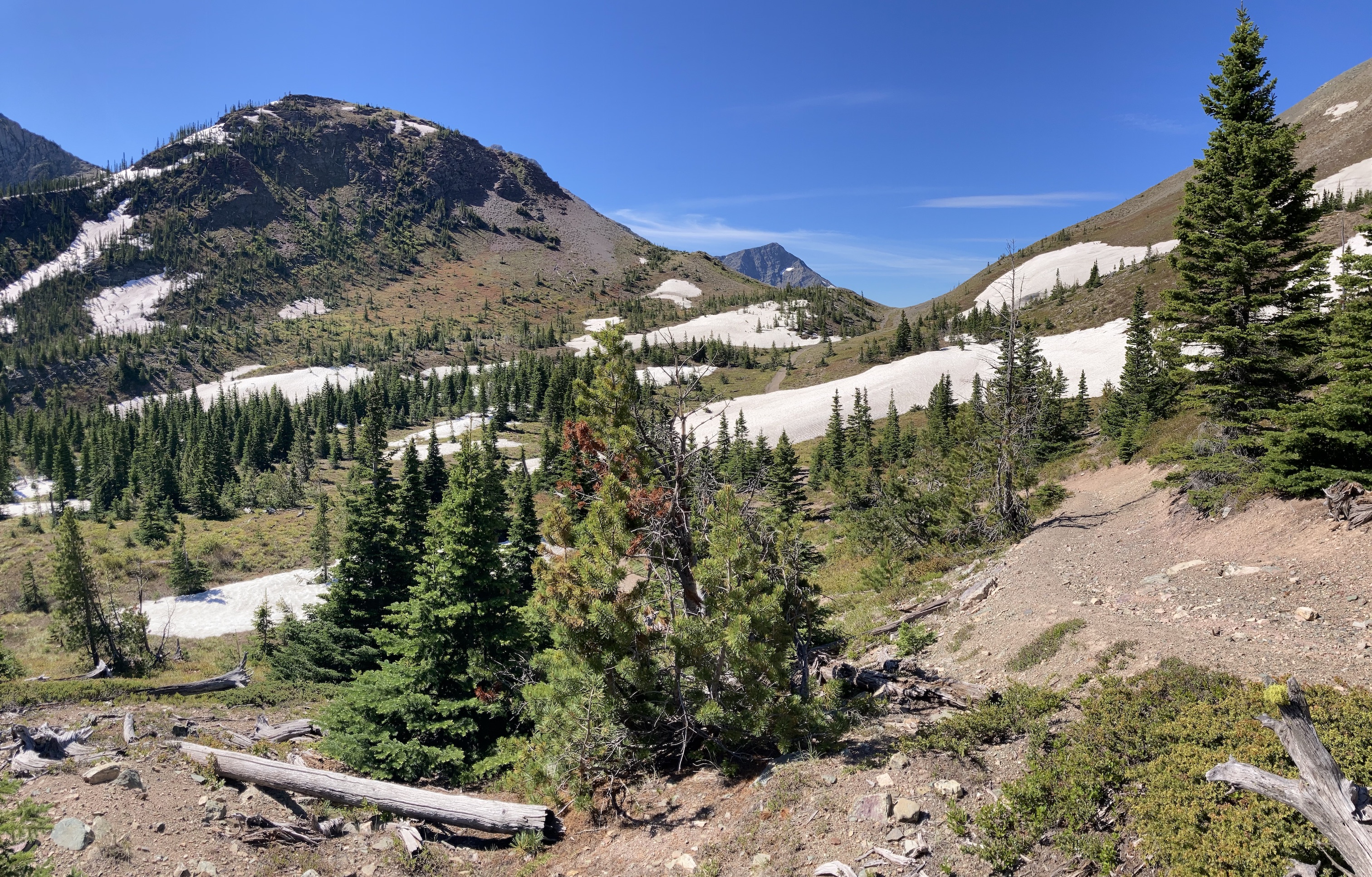
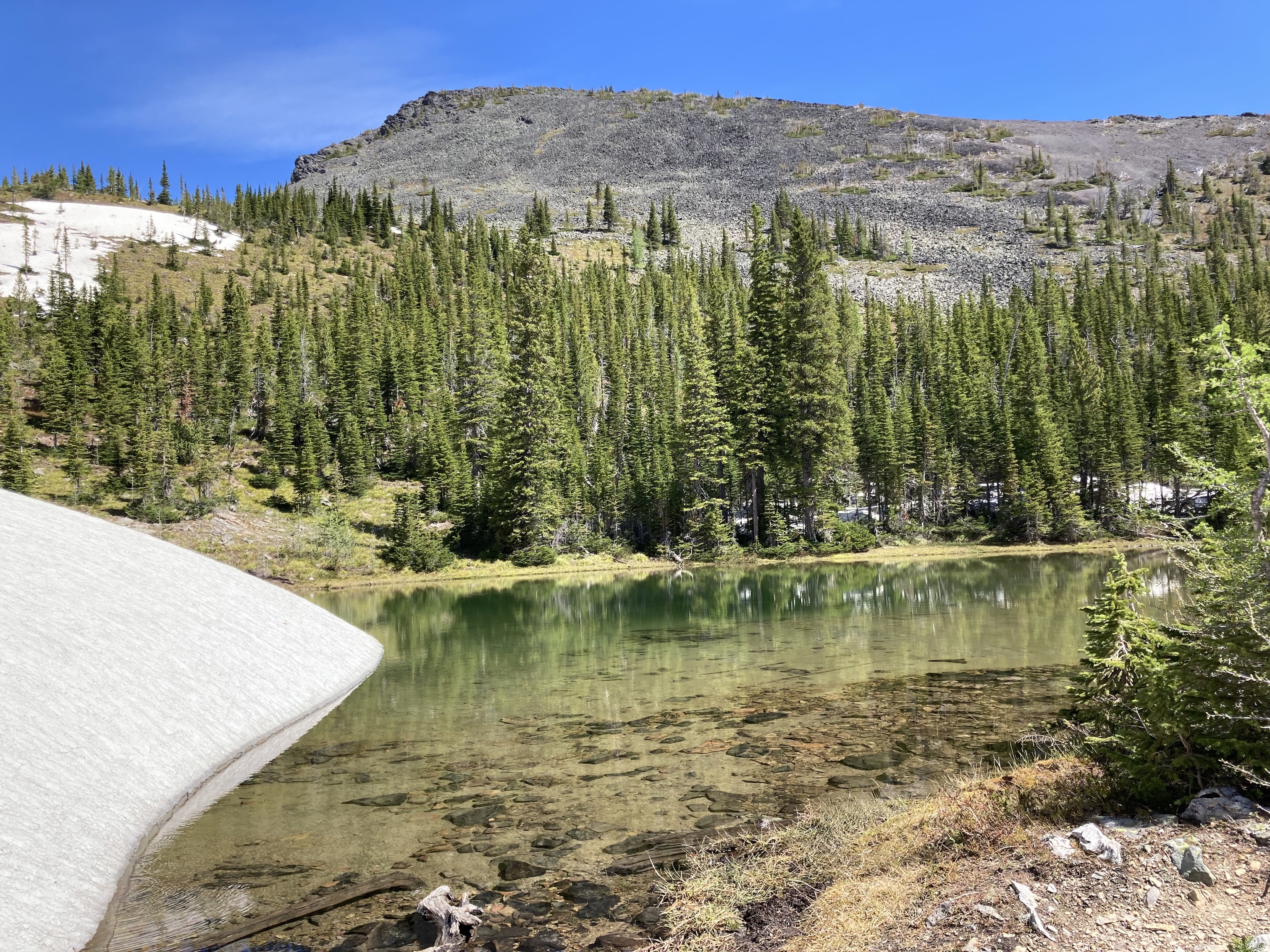
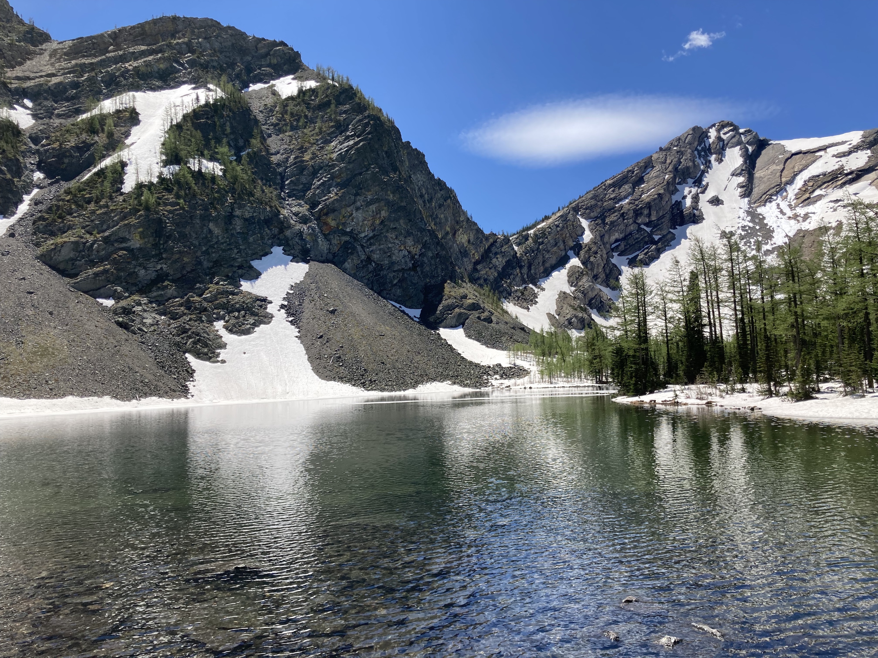
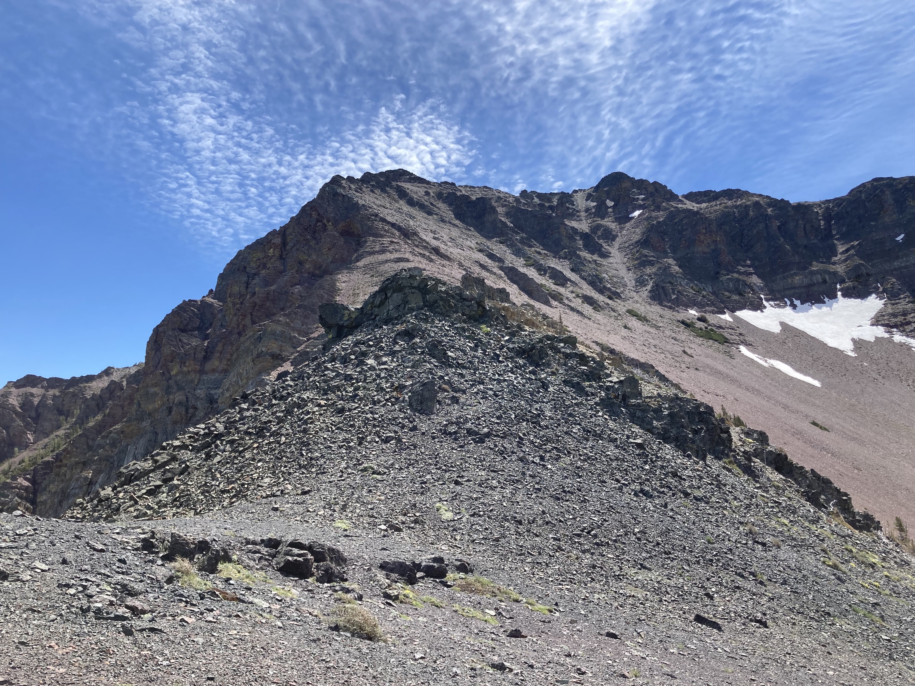
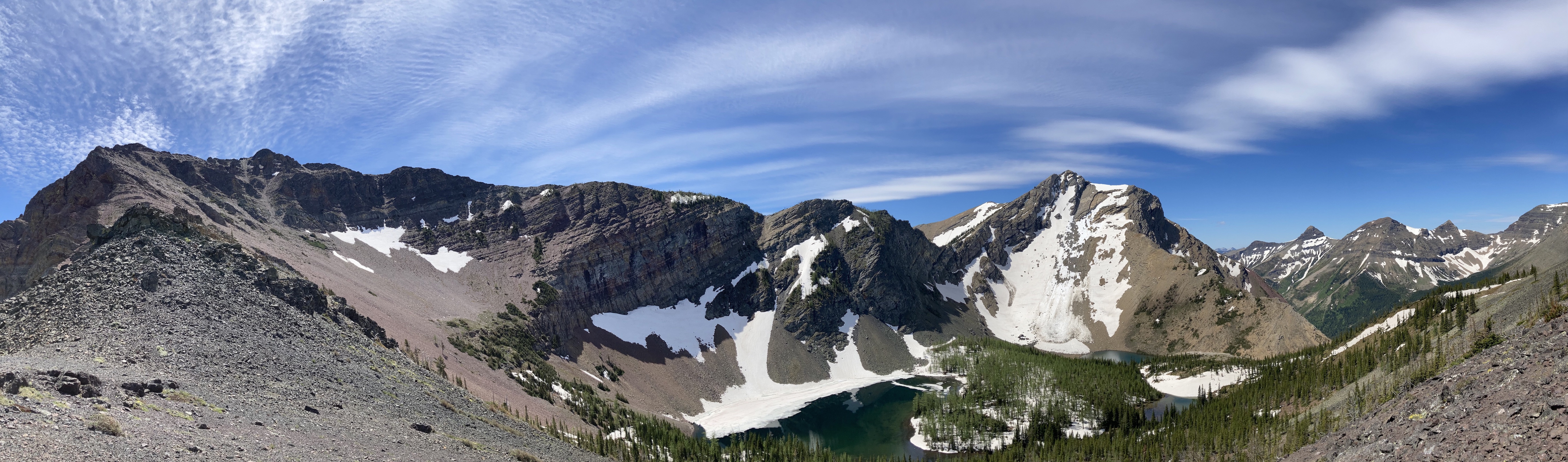
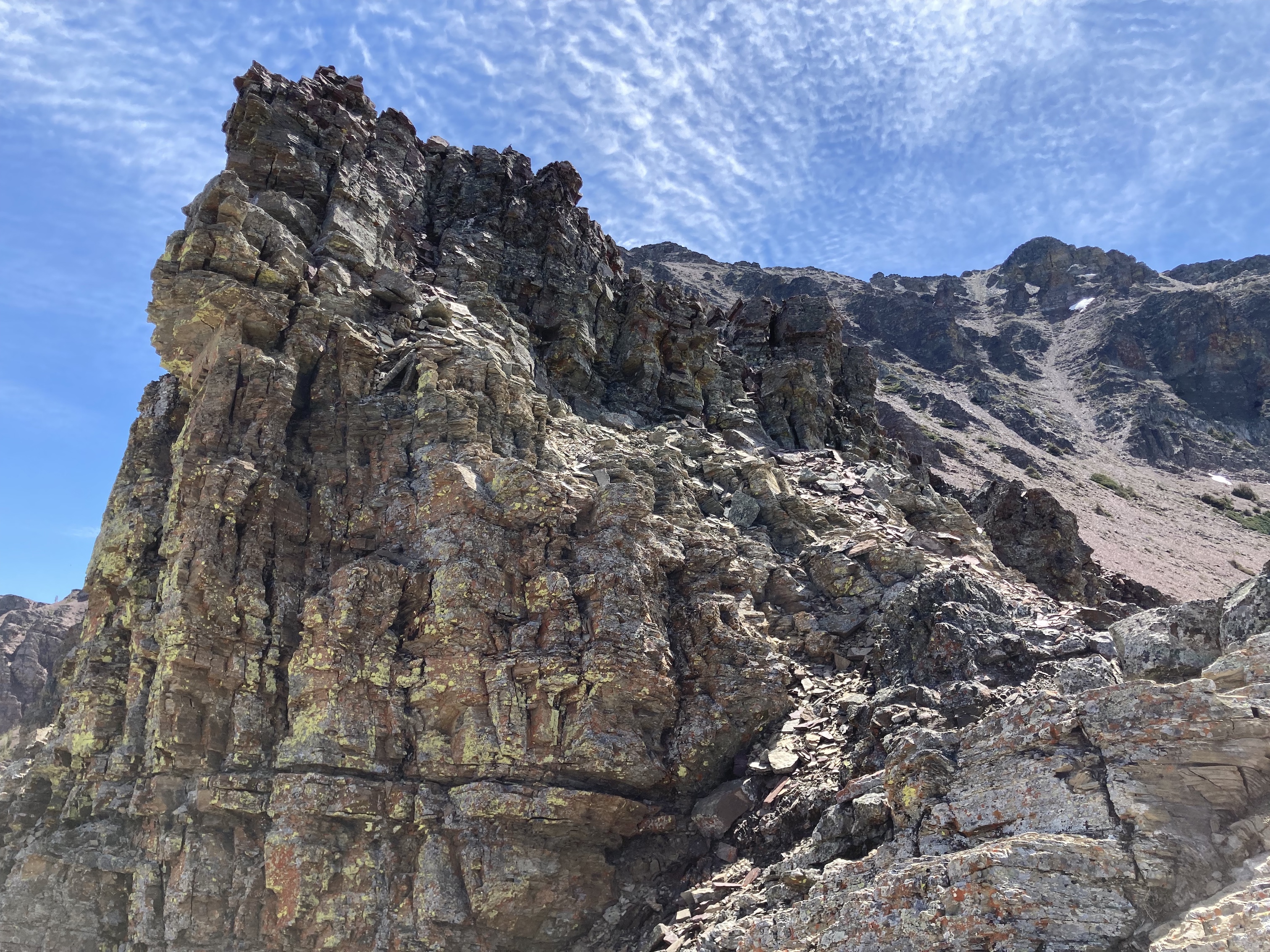
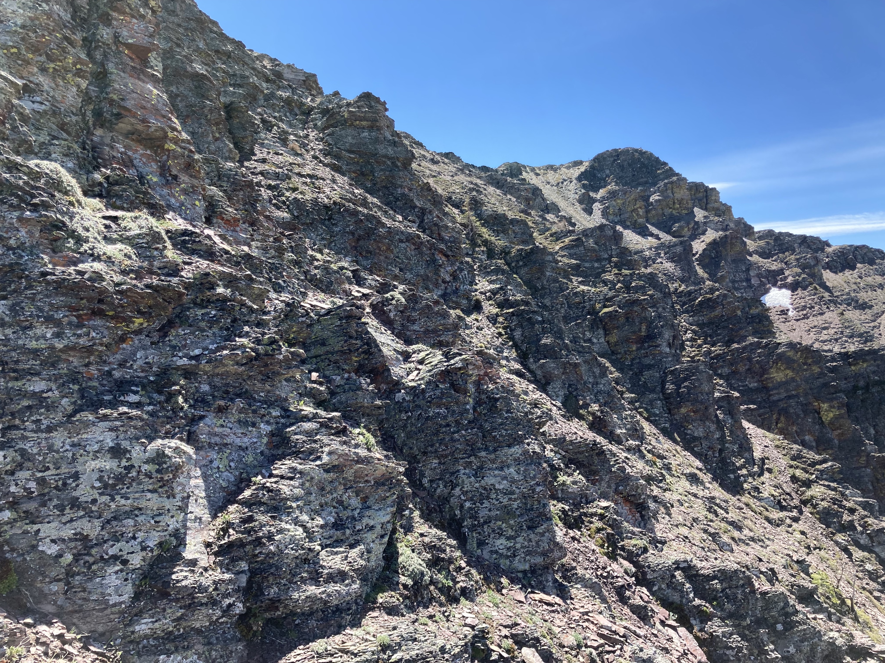
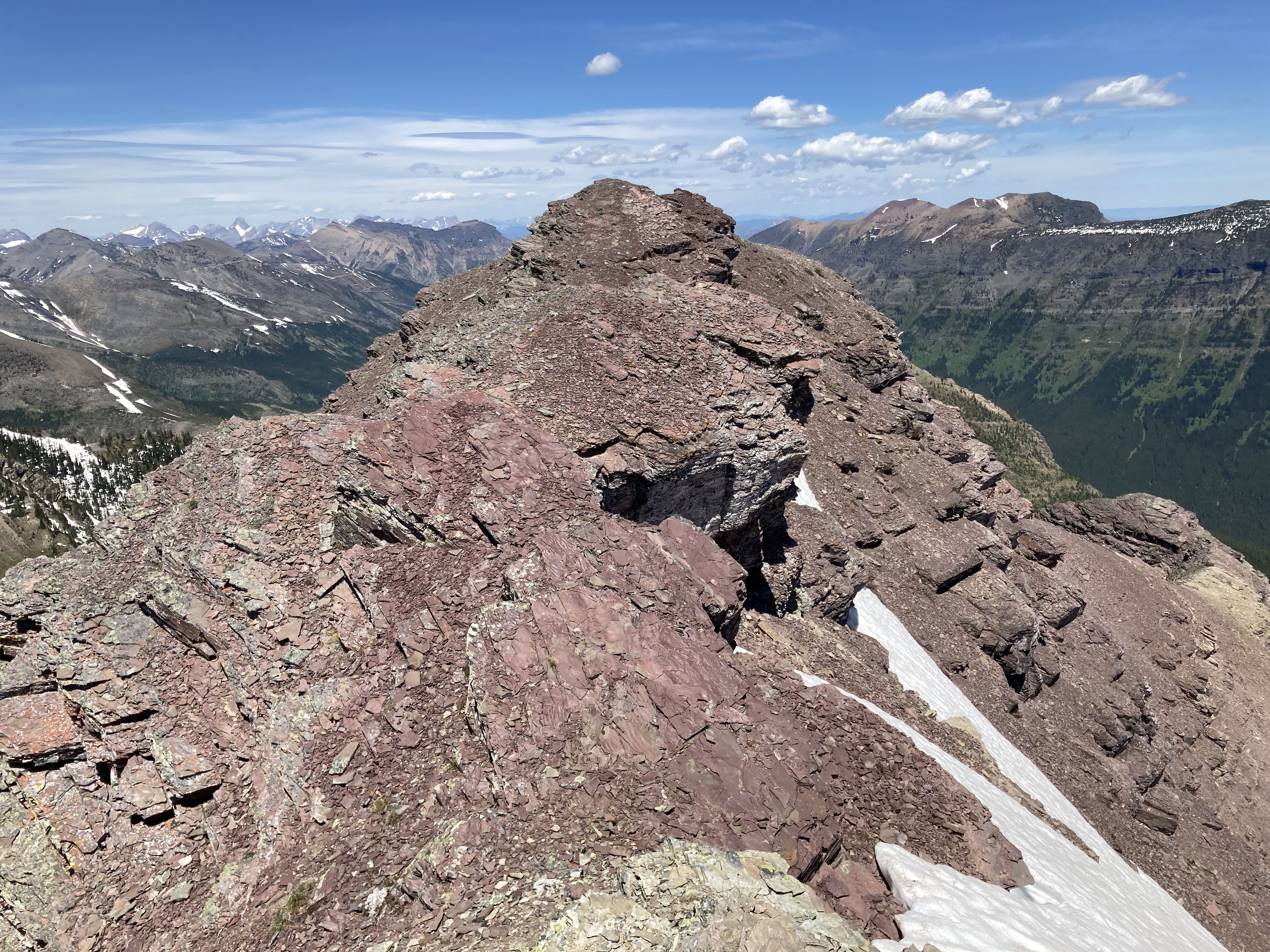
To get to the summit of Rainy Ridge, which looks down from directly above the third lake, I crossed over the outlet stream of the third lake and ascended lightly treed slopes directly north to the col. From the col I was treated to views of an adjacent, heavily treed valley containing two small lakes of its own. The Southern Alberta Backroad Mapbook 2nd ed. refers to these as the Rainy Ridge Lakes (not to be confused with the Rainy Lakes, which are in the next valley over). Turning right at the col, I enjoyed some straightforward scrambling up the ridge to the summit. The terrain wasn’t difficult and would at most be considered moderate in a guidebook. There was the option for bypassing rocky sections on scree to the right, but I found it much easier to stick to solid rock whenever possible and scramble up. I reached the summit at 3h 43m.
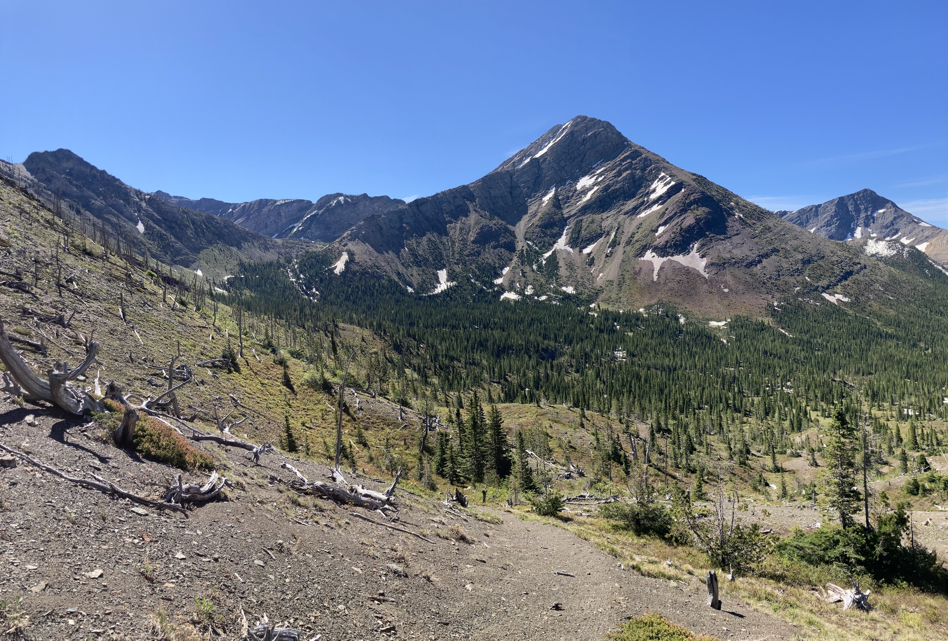
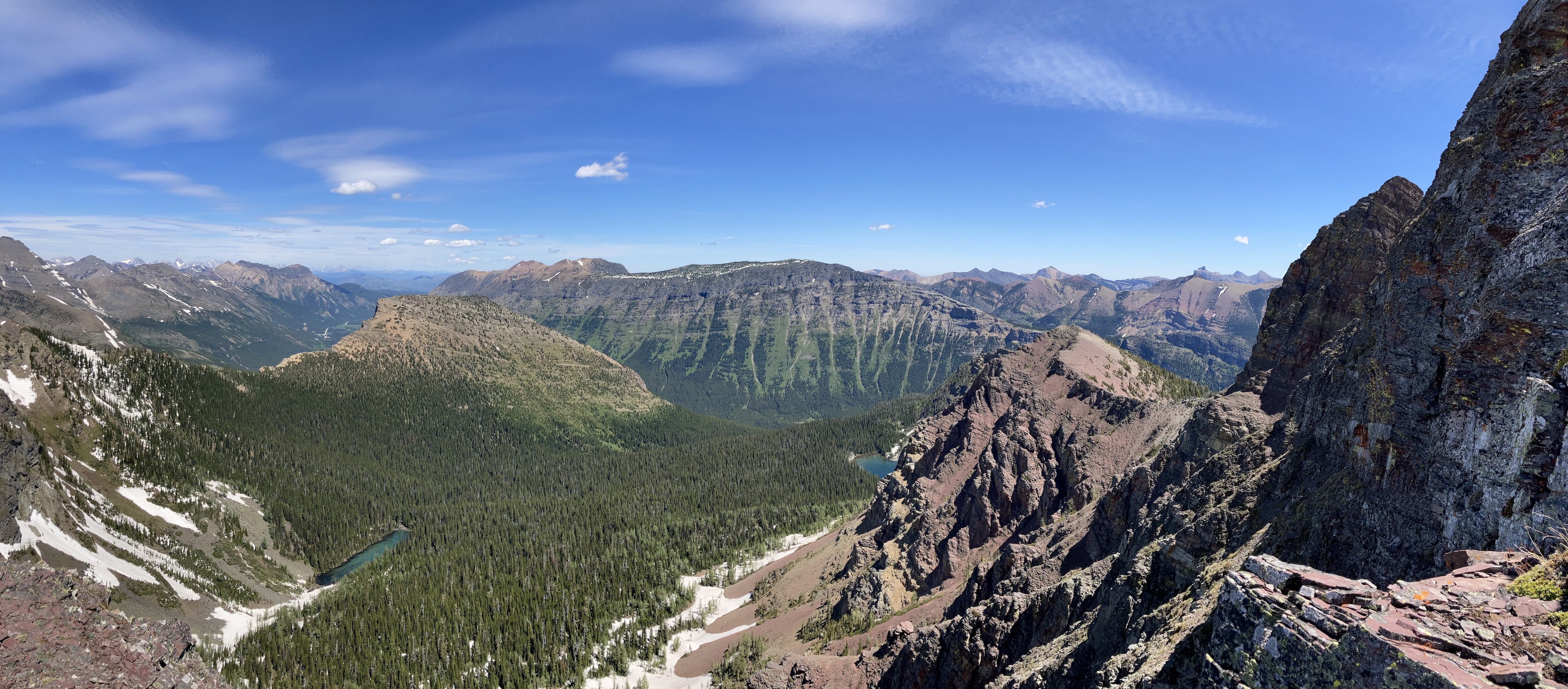
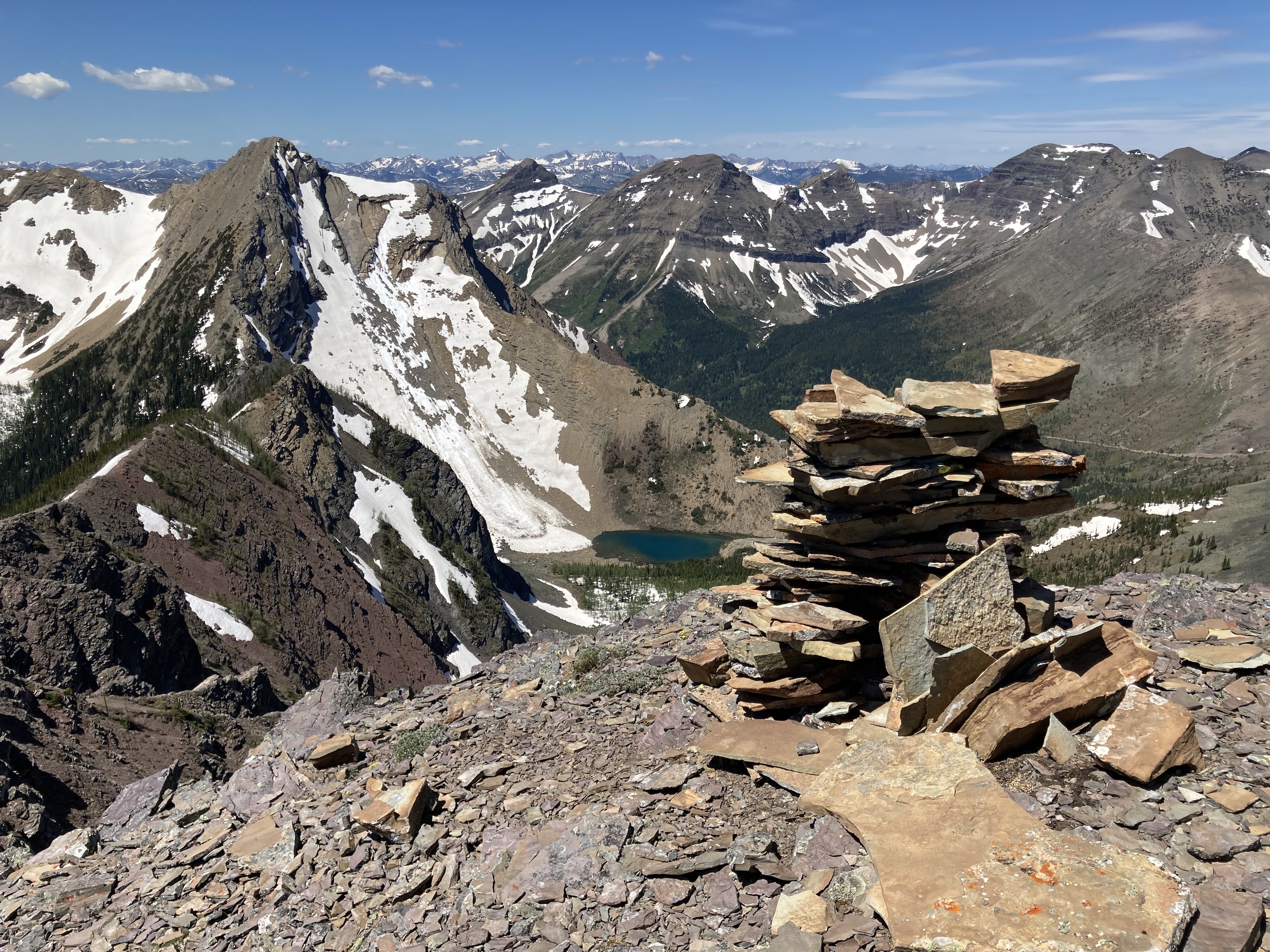
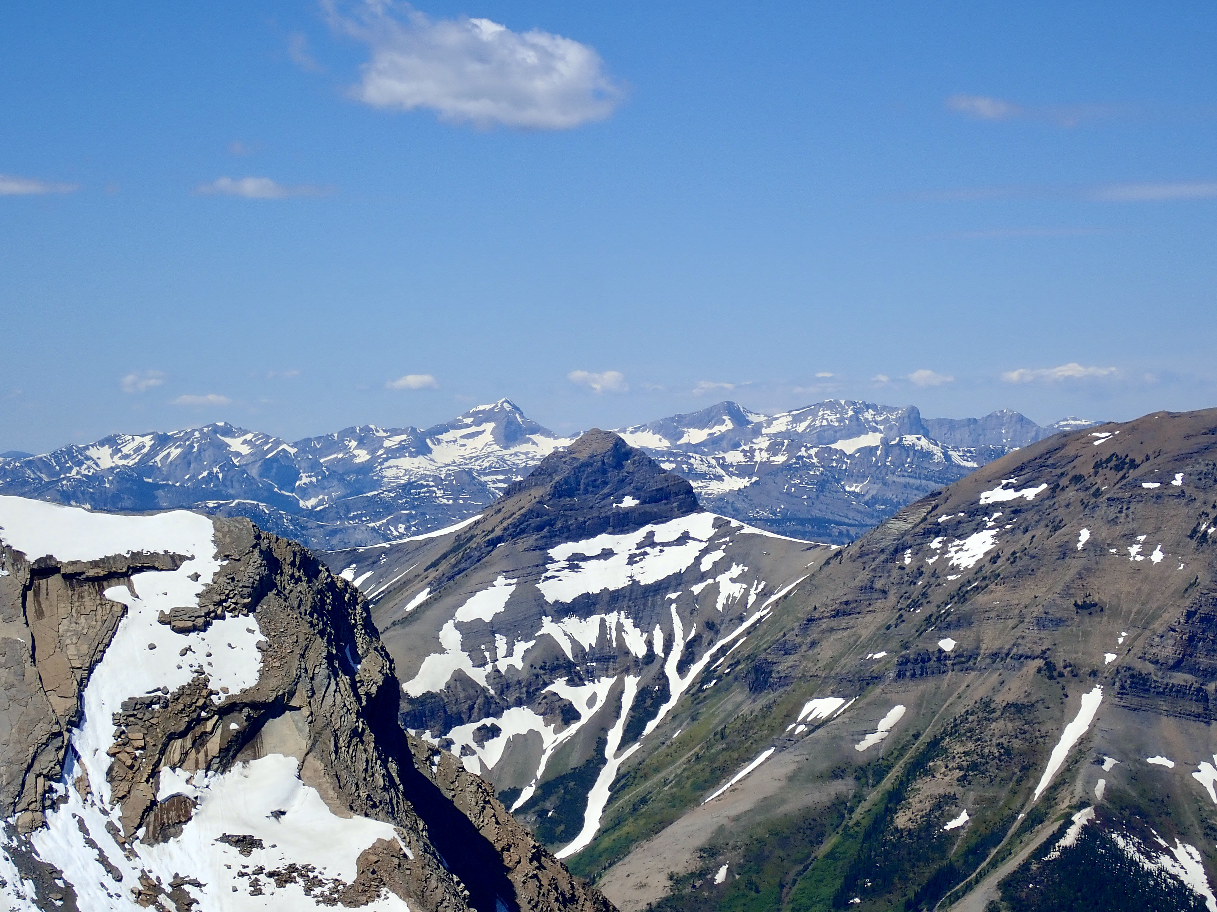
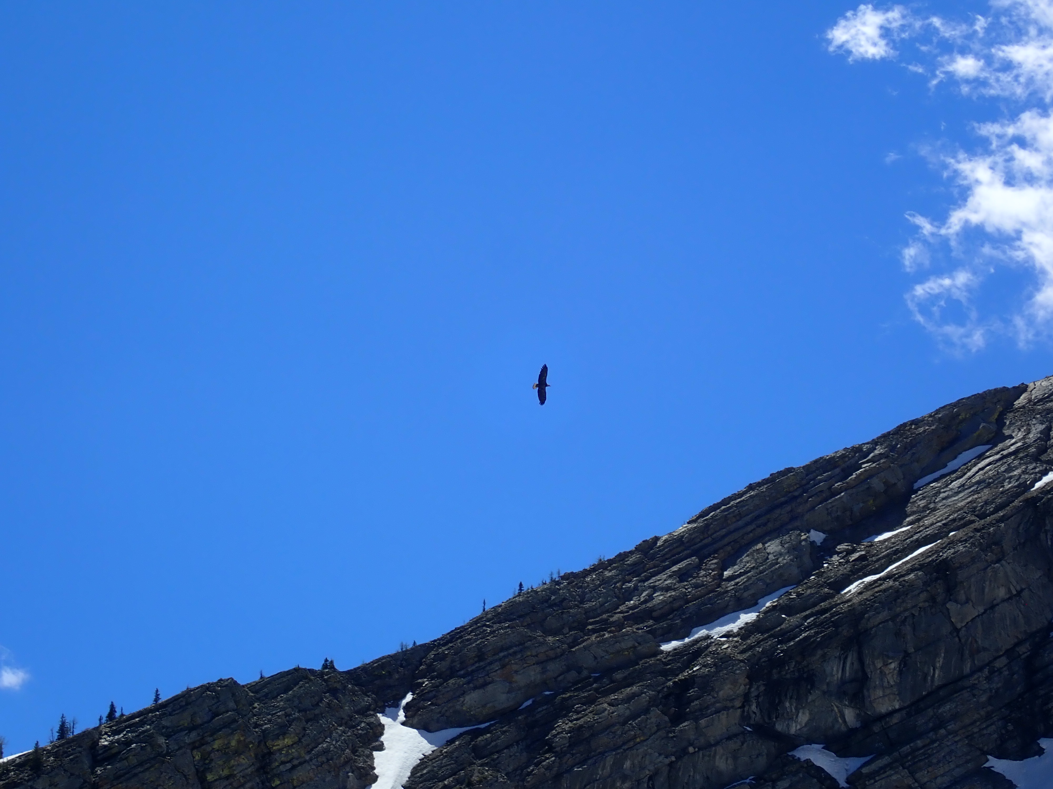
The summit sits on the continental divide, and the views were phenomenal. British Columbia’s Kootenay region is to the west, the Castle front ranges to the east, the peaks of the Crowsnest Pass to the north, and Waterton-Glacier International Peace Park to the south. To descend, I returned along the ridge to a point where I could see an uninterrupted scree slope all the way down to the third Middlepass Lake. This terrain allowed a rapid and direct scree skiing descent. I returned to the first lake and sat for a time watching a bald eagle circling overhead before setting off back to the pass. I encountered a party of two hikers as I left the valley – the only other people I saw the entire day.
Click on the pictures in the gallery below to access full resolution images.
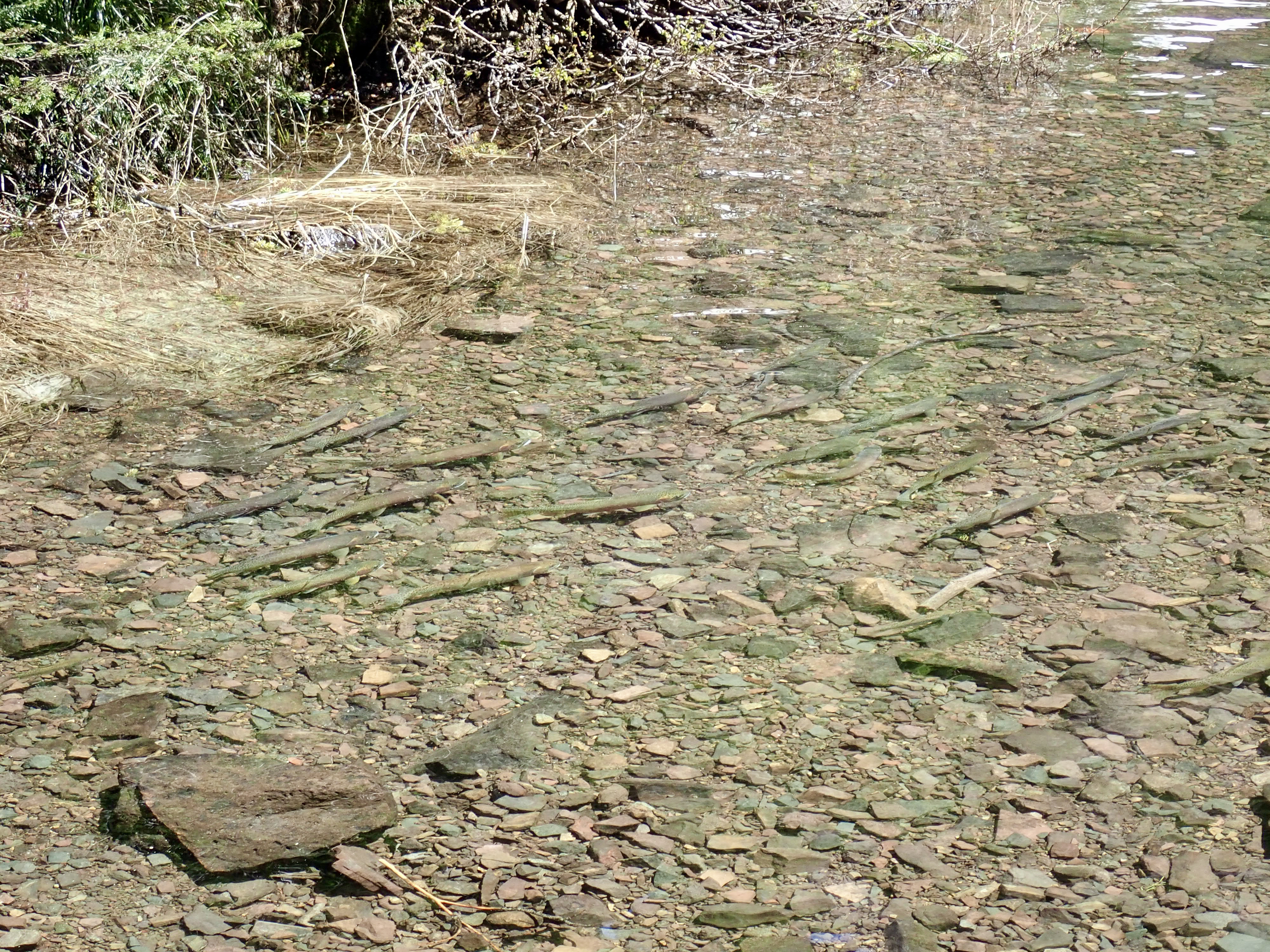
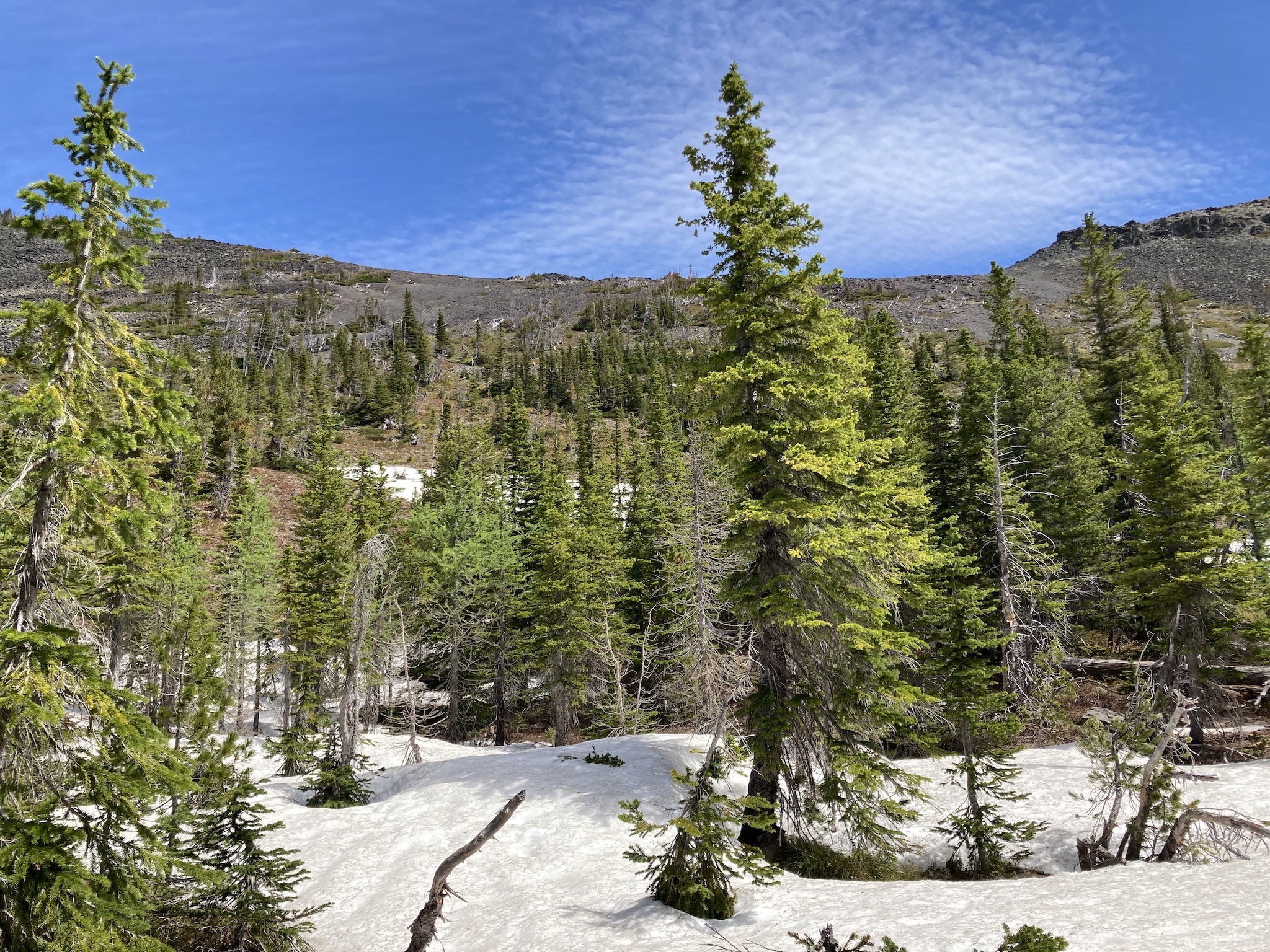
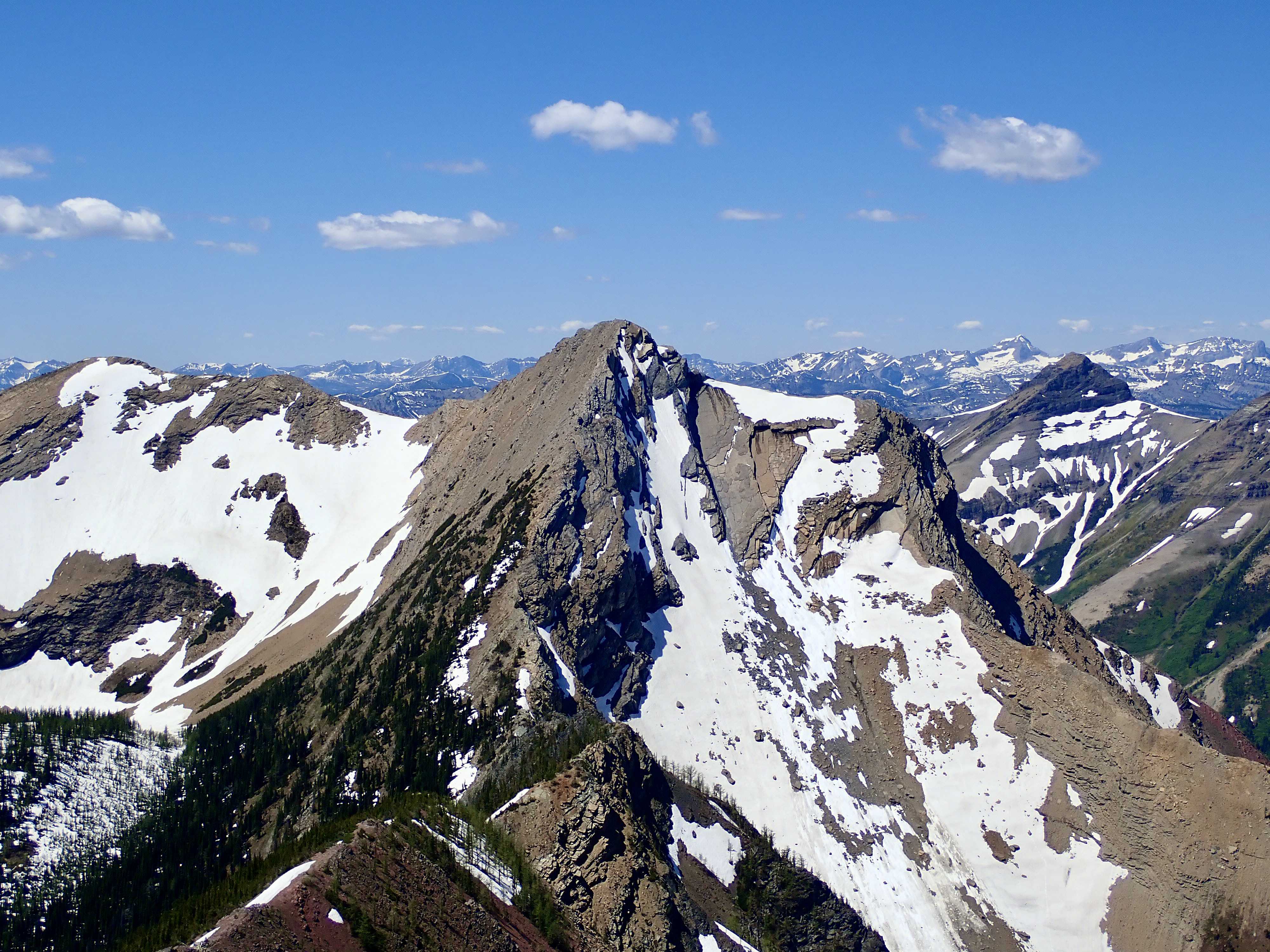
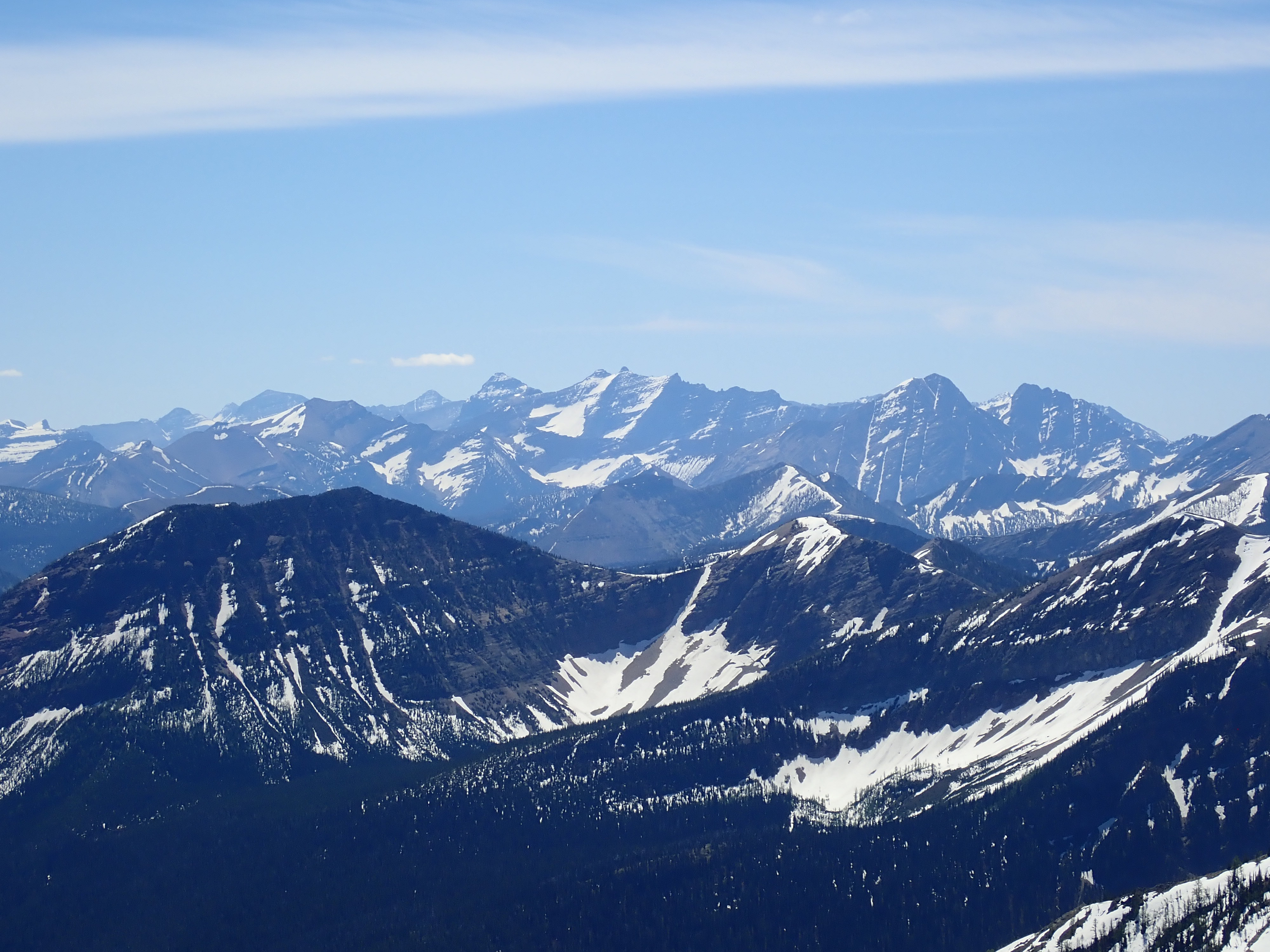
Route overviewA closer look at the area beyond the pass showing the ascent to the col, the scramble up the ridge, and the descent via the scree field. East is up in this picture.The start of the trip is just southeast of the ski resort parking lot – a relatively new bridge over the West Castle River. ATVs are banned from the area beyond, but snowmobiling is still permitted in the winter. A little under 3 km from the bridge the road passes through a clearing and then splits. Clear signage here points the way to Middle Kootenay Pass to the right.The first of 2 bridges beyond the clearing. Rainy Ridge’s northern outlier is in the background.The trail eventually skirts past this clearing and continues into the trees on the right. Nugara suggests leaving your bike here. I ended up stashing mine a short distance before this point. The white rocks cordon off the clearing from vehicle access, which I assume is a throwback to the time when trucks and ATVs were still able to drive to here. In Exploring the Castle, Robert Kershaw writes that this clearing used to be the site of a well.The trail becomes more narrow, rocky, and steep beyond the old well site. It eventually reaches this gate which once functioned to keep ATV users from further progress. Dirt tracks going uphill and around to the right show that many riders ignored these efforts. 2 creeks cross over the trail beyond here. the first is visible on the other side of the gate, the second is a short distance beyond. On the day I visited there was enough runoff that a 3rd little creek was still running over the trail.Looking at the swift flow of the 2nd creek after crossing over with mostly dry boots.There was still a fair amount of snow as I got closer to the pass. Looking back towards the northeast I had a nice view of Barnaby Ridge. Rainy Ridge’s northern outlier is to the right.Within sight of the pass.Crossing over the pass. A little sign notifies you that you’re leaving the Provincial Park (and therefore the province).The view to the west after crossing over Middle Kootenay Pass. The main trail carries on down the valley. The trail to Middlepass Lakes heads off to the left.The lakes aren’t visible from the approach trail. They’re hidden in a secluded valley that’s obscured by the intervening ridge coming down from the right in this picture. 2 white lines are visible in the trees. The one on the left is not just snow but also the tumbling white water of Middlepass Creek coming down from the first lake.Looking back towards the pass from partway along the trail to the lakes. The row of mountains in the background don’t seem to have official names. I believe they’re considered outliers of Mount Haig.Middlepass Creek coming down from the first Middlepass Lake.The first Middlepass Lake. The peak directly behind it is Three Lakes Ridge.The second Middlepass Lake is not as deep as the other two. I imagine it shrinks dramatically in late summer.The third Middlepass Lake.There were a lot of trout visible in shallow areas. This spot was where the third lake narrows to an outlet stream connecting to the second lake.To begin my ascent of Rainy Ridge, I crossed over the outlet stream from the third lake and ascended north towards the col. The trees were sparse enough that this wasn’t tough going.From the col, the way to the summit is clear.Panorama from the col.One of the Rainy Ridge Lakes in the adjacent valley.Some of the rocky scenery on the way to the summit.A look east from the ridge into the adjacent valley. The two Rainy Ridge Lakes are visible among the trees.Approaching the top of the ridge.Looking down at the lakes from a short distance below the summit.Another panorama of the scenery on the ridge.The summit block of Rainy Ridge.Looking back along the red rocks of the ridge before reaching the summit. Mount Darrah’s distinct shape is visible in the distance to the left.Mount Darrah, a little blurred by the slight haze that day.Cairn on the summit of Rainy Ridge.Summit panorama looking west to north. Three Lakes Ridge is to the left. Mount Haig is the triangular peak a little more distant to the right. In between is Tombstone Mountain and a number of unnamed outliers. There was slight haziness in all directions except west, allowing very clear views of the tall peaks in the distance. I’m not certain about all the names.A closer look at Three Lakes Ridge. It apparently feasible to scramble directly up those slabs to the right of the summit.A closer look at some of those distant peaks. The triangular peak dead centre doesn’t have an official name. The summit to its left in the background is Mount Doupe.Panorama looking north to east. Mount Syncline is at the left. Barnaby Ridge is in the mid ground extending from left of centre to right of centre. Lys Ridge is beyond it, extending all the way to the right. Whistler Mountain, “Frankie Peak”, “Larry Mountain”, Mount Gladstone, North Castle, Castle Peak, Victoria Peak, and Windsor Mountain are in the distant background.Panorama looking south. “Jake Smith Peak” is directly across the valley to the right. The more distant peaks in the background are in Waterton (left), Glacier National Park (centre), and southeast B.C. (right). Long Knife Peak is the serrated ridge in the distance slightly to the left of centre.A closer look at Long Knife Peak.King Edward Mountain, Kenow Mountain, and Miskwasini Peak.“Jake Smith Peak”, Scarpe Mountain, and Red Argillite Peak. One of the Rainy Lakes is visible just right of centre, surrounded by snow. Tuchuk Mountain is on the horizon, right of centre, in between Scarpe Mountain and Red Argillite Peak.Heading down. I retraced my steps until I had this view of uninterrupted scree down the the lake and skied down. If you start skiing prior to this point you could end up encountering some cliffs on the way down.A last look at the lakes before I lost all my altitude. I took many, many versions of this same shot on the way up the mountain, on the summit, and on the way down. The scenery was amazing – as good as the photos turned out to be, they don’t really do justice to the place.Making my way back around the third lake to the trail. The summit and scree slopes I used for descent in the background.A bald eagle above the first lake.
Par thanks for the great description of the hike. Can you tell me what lake has the Golden Trout fish in it. Or do they all have fish in it? Google name the two south lakes as Rainy Lakes.
Thanks, Skyler
Those fish were in the 3rd/upper lake, right where it narrows to a little outlet stream to connect to the 2nd/middle lake. I’d assume they’re also in the middle lake. I don’t know if they are in the first/lower lake. I’ve seen other trip reports mentioning the fish (like Dave MacMurray’s over at peaksandstreams.com) and it seems they’re mostly at the 3rd/upper lake. Thanks for reading!


State of art pics,description as always.
Much appreciated Par !!!
LikeLiked by 1 person
Thanks for reading, Ed!
LikeLike
Par thanks for the great description of the hike. Can you tell me what lake has the Golden Trout fish in it. Or do they all have fish in it? Google name the two south lakes as Rainy Lakes.
Thanks, Skyler
LikeLike
Those fish were in the 3rd/upper lake, right where it narrows to a little outlet stream to connect to the 2nd/middle lake. I’d assume they’re also in the middle lake. I don’t know if they are in the first/lower lake. I’ve seen other trip reports mentioning the fish (like Dave MacMurray’s over at peaksandstreams.com) and it seems they’re mostly at the 3rd/upper lake. Thanks for reading!
LikeLike
South fork lakes, Middle lake for golden trout. You will need extremely small gear.
LikeLike