October 2, 2024. Hiking to the summit of the tallest mountain in the contiguous United States.
- Region: Inyo National Forest & John Muir Wilderness, California. Traditional territory of the Paiute and Shoshone peoples.
- Distance: 35.2 km round-trip*
- Elevation Gain: 1873 m*
- Elevation of Objective: 4421 m
- Total Time: 15h 24m
- Safety and Disclaimer
*Note that because of the varying measurements by my own devices on this trip, the numbers above are the “official” ones.
Denali, the tallest mountain in the USA and all of North America, has never been on my radar as something to climb – it’s a remote and brutal mountaineering objective in Alaska. Definitely not in my wheelhouse. However, as I learned earlier this year, California’s Mount Whitney – the tallest mountain in the “Lower 48” of the USA – is relatively easy to access and has a well-maintained hiking trail all the way to the top. This sort of thing is more my speed. The only catch is that because of the phenomenal popularity of the trail a permit is required to hike it. These permits are distributed by lottery every year and are much sought after. Luckily, my frequent hiking buddy Bhaskar managed to score a permit this year and I was fortunate enough to be invited along for the trip. We were joined by Valentina and Doug, two more Calgarians with lots of hiking experience.
The Paiute name for the mountain is Tumanguya, which means “Very Old Man”. It was believed to be the dwelling place of the Great Spirit who watched over the Paiute people. There was a recent proposal to officially rename the peak but in the end Mount Whitney stuck. The official name is in honour of Josiah Whitney, chief of the California Geologic Survey from 1860-1874.
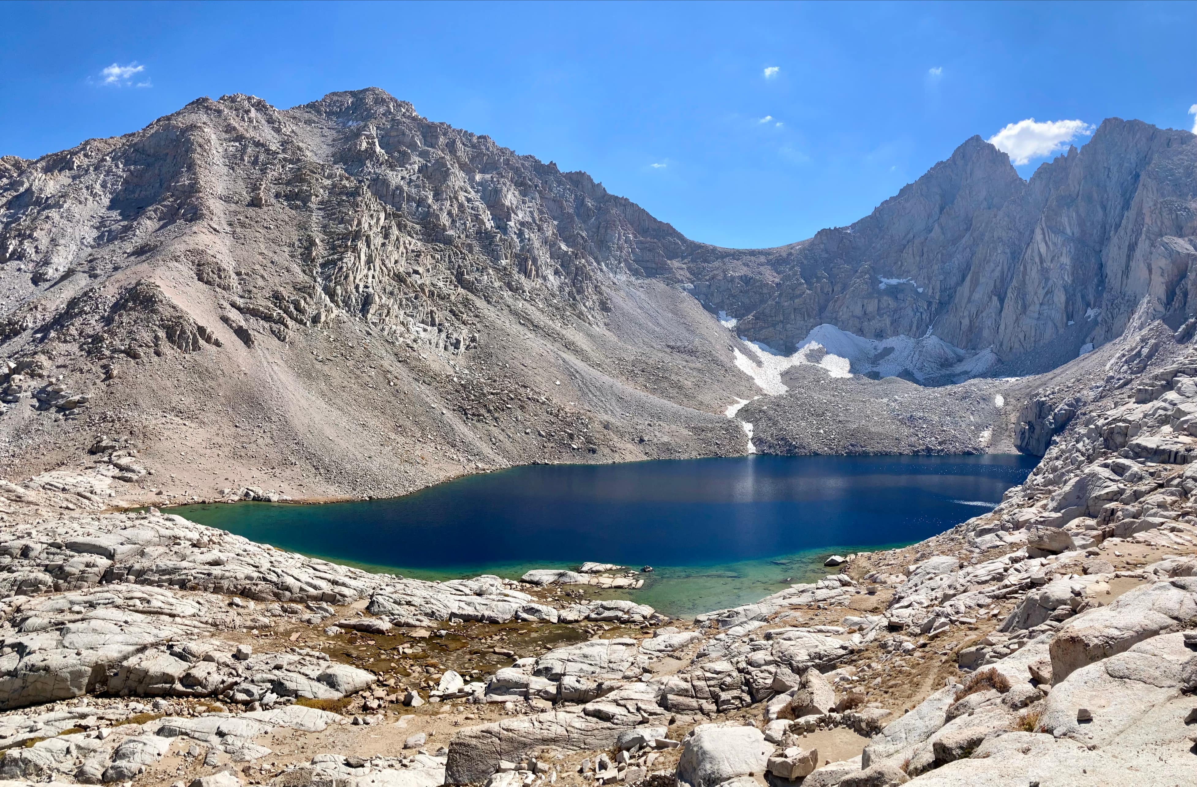
The trailhead is at the end of the Whitney Portal Road, a short drive west of Lone Pine, CA. This is a fairly busy place featuring a campground, picnic area, pit toilets, potable water, and a small store. We visited the day before our ascent to scout the area and do a short hike to Lone Pine Lake. It was helpful to see everything in the daylight and I’d recommend all groups do this bit of scouting unless they’re going with someone already familiar with the area. On the day of our Mount Whitney ascent we found trailhead parking easily for our 1:30AM start, but keep in mind that we visited during shoulder season. Overflow parking was available further from the trailhead, and I’ll guess that might be relevant during peak season. The trailhead is next to the Whitney Portal store and is clearly marked. There are a series of wooden frames at the start of the trail with information signs on them, as well as a place to pick up and drop off unused WAG bags. A special dumpster next to the pit toilets is where to drop of used WAG bags. There are no pit toilets anywhere along the route, even at the campsites, and all solid waste has to be packed out.
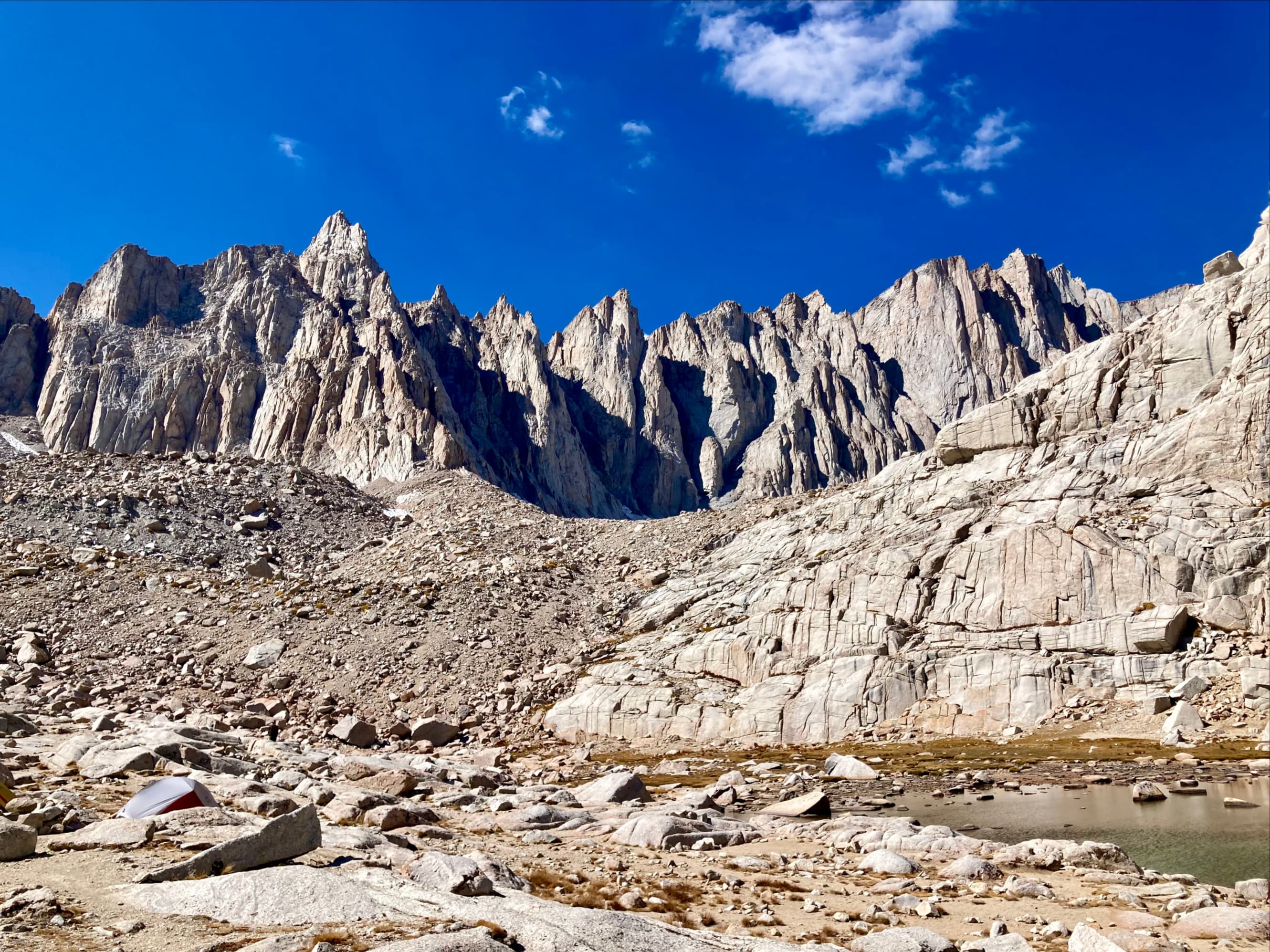
Given the length of the hike, it’s helpful to think of it in sections. The first section is from the trailhead to the boundary of the Whitney permit zone. The second is between there and Trail Camp – the higher of the two campgrounds along the trail, the lower one being Outpost Camp. The third is between Trail Camp and Trail Crest – the spot where the trail reaches Mount Whitney’s southern ridge and crosses over to the west side. This section features “the 99 switchbacks” and “the cables”. The fourth and final section is between Trail Crest and the summit. Here, the Whitney Trail is joined by the John Muir Trail coming up from Sequoia National Park to the west. The landmarks defining these section are marked on the topographic map above.
Setting out in the dark with our headlamps we didn’t see much for the first few hours. We made it to the sign indicating the start of the Whitney permit zone without any problem and took a break to do some stargazing and allow everyone to regroup. The previous day’s hike to Lone Pine Lake helped us feel comfortable in the environment despite the complete darkness. The second leg was also done completely in the dark. We took a break in a relatively flat area with some boulders just before the trail reached the first few tents of Trail Camp and waited for the party to regroup. It turned out to be a fairly long wait – everyone was actually moving well, but clearly going at different paces. We agreed to split into two groups so that nobody was getting rushed along and nobody cooled down too much from waiting. This arrangement worked well for the remainder of the trip.
As we started climbing the “99 switchbacks” there was light on the eastern horizon. As we ascended further we were treated to a glorious sunrise. I took the opportunity then to stop and take a breather. Along the 99 switchbacks is where the trail crosses 4000 m of altitude. This was higher than I’d ever been before – my previous highest point, Borah Peak, was 3859 m. I was pleased to find that aside from being a little short of breath I was handling the altitude just fine. Altitude impacts everybody differently, and apparently it can be different for the same person from one trip to another. There are a small number of things you can control that mitigate the impact (conditioning, acclimatization, rate of ascent) and some vulnerabilities you can’t change (age, genetics). I think our group did a pretty good job of optimizing those things that we could control. As a result, everyone was able to manage their altitude symptoms all the way to the top.
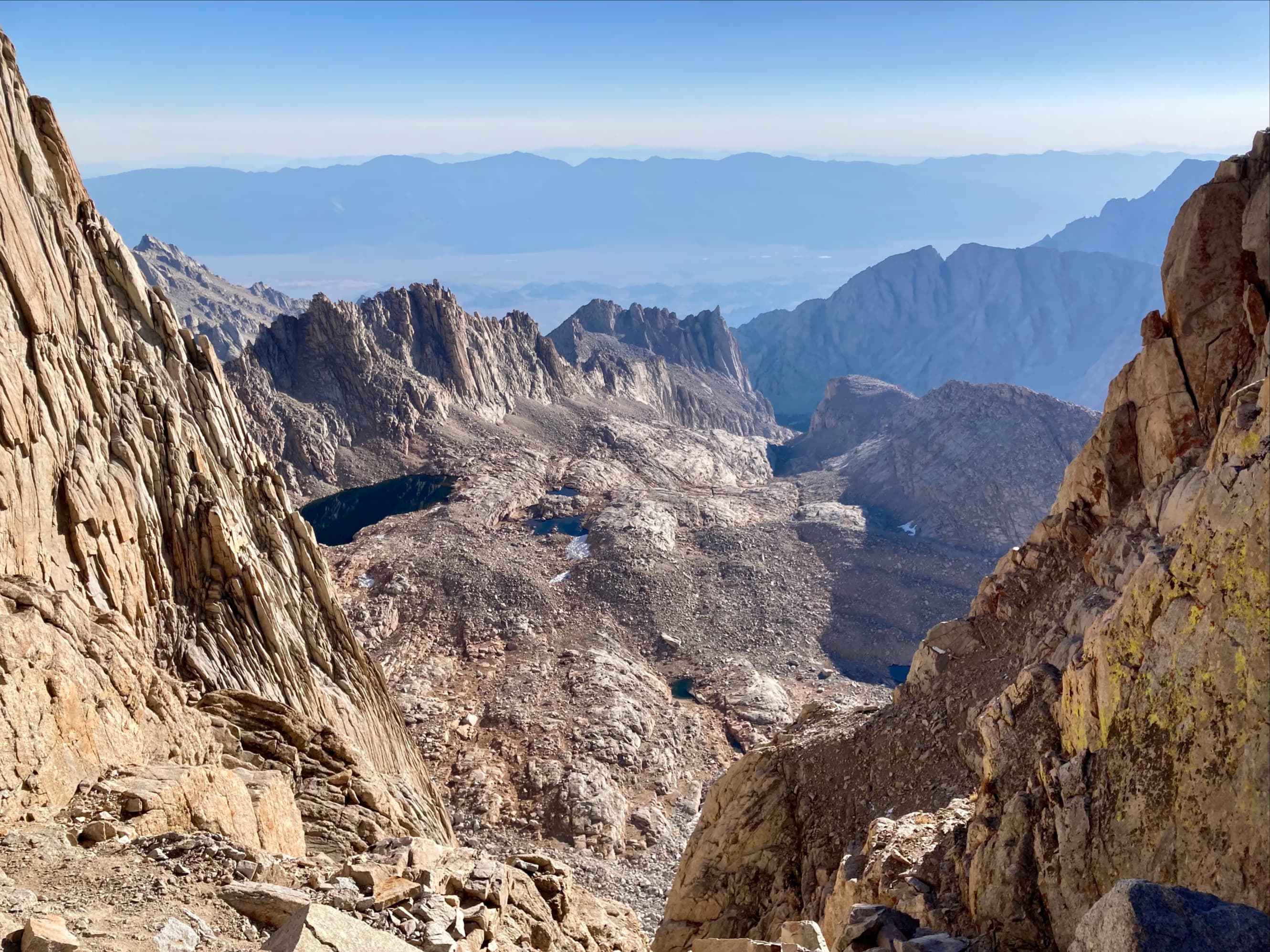
When the trail reaches Trail Crest there’s a dramatic change in scenery as the valley west of Mount Whitney comes into view. Directly across the valley is Mount Hitchcock with Upper and Lower Hitchcock Lakes at the base of its eastern slopes. Soon after Trail Crest, the John Muir Trail joins the Mount Whitney Trail. The remainder of the route to the summit stays to the west of the ridge, undulating up and down for a short distance before resuming its steady ascent to reach the summit at 4421 m.
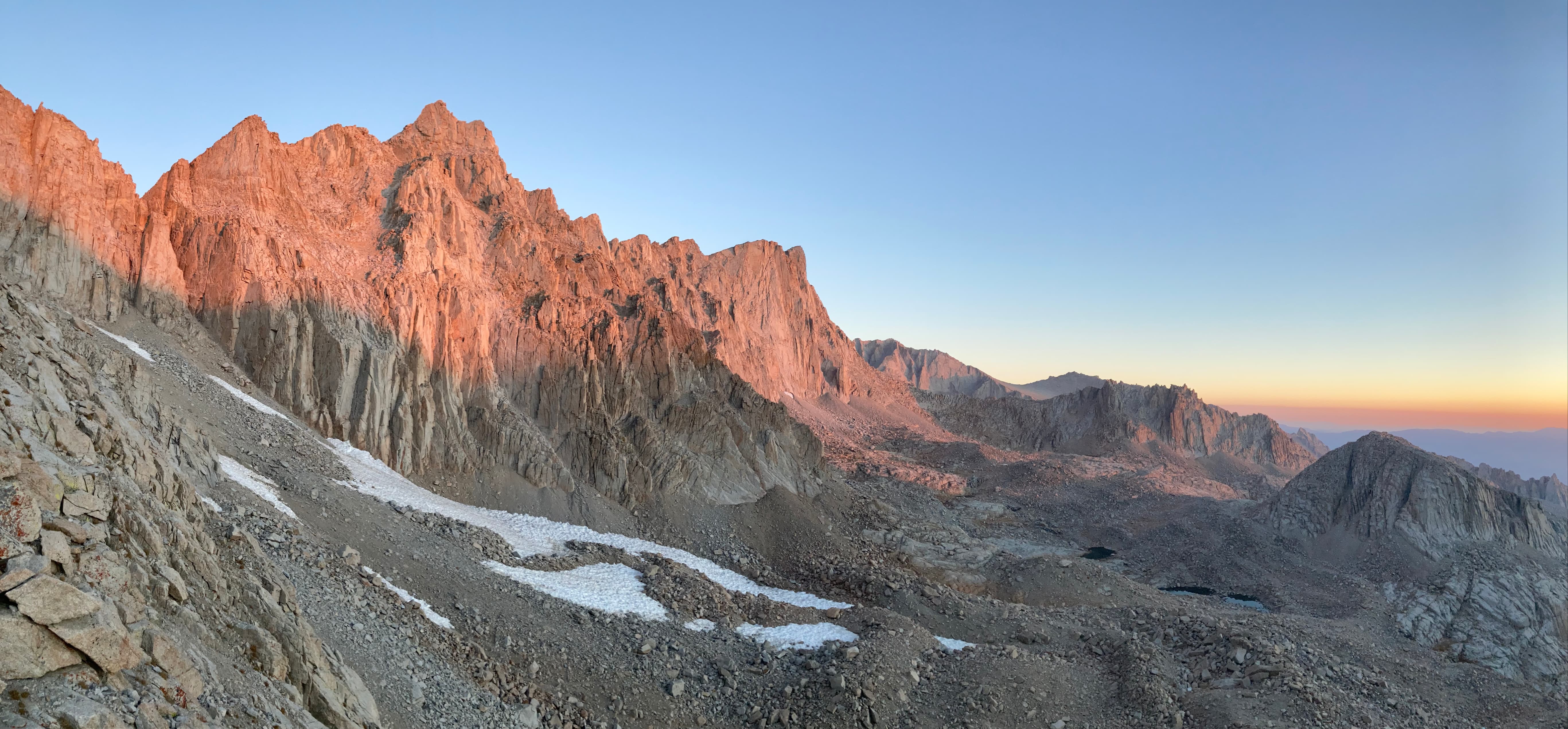
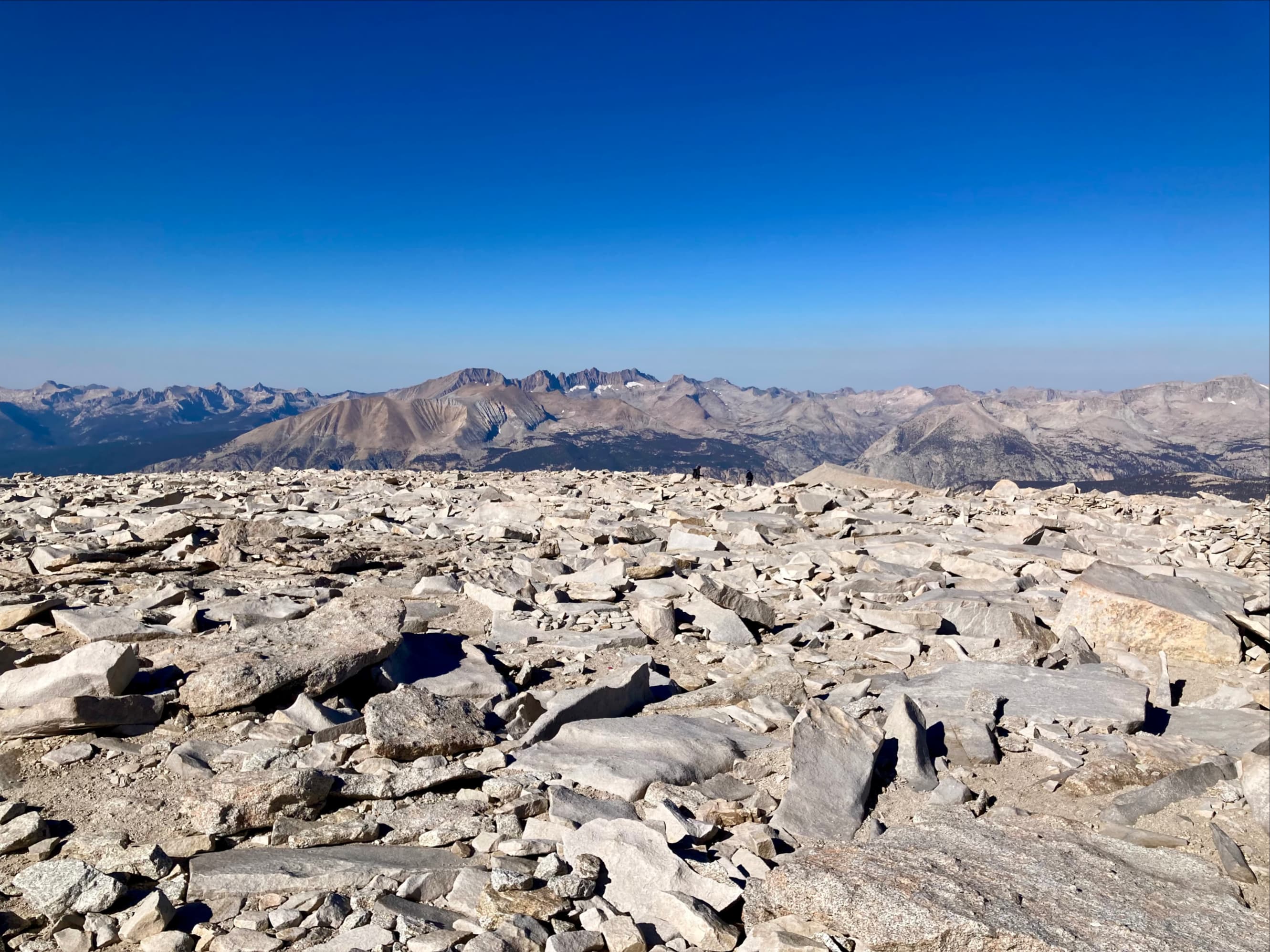
A small stone hut sits at the summit. A summit register sits just outside. A short distance away is a plaque on a broad rock slab commemorating the construction of the Mount Whitney Trail. We also found about a dozen people waiting their turn to hold up a laser-cut metal sign proclaiming that they’re on Mount Whitney, elevation 14,505 feet. The weather was clear and almost completely calm, which was fortunate because the slight breeze that occasionally blew was freezing cold. Smoke on the horizon blurred more distant views, but nearby and in the middle distance the air was clear. Contemplating the surrounding terrain, I thought about how different it was from the familiar Alberta Rockies. Everything was stark and stony. No trees or other vegetation gave contrast or scale to the landscape. It was like being on the moon. After almost 1 1/2 hours of lounging, snacking, and sightseeing on the summit we began our descent.
The descent was uneventful and fairly quick. I ended up stopping fairly often to take pictures between Trail Camp and Lone Pine Lake since we had hiked up that area in total darkness. It is amazing what you can walk by in the dark and be completely oblivious to. I ended up ahead of the rest of my crew and managed to make it to the trailhead before the store closed. I decided against ordering hot food since I wasn’t sure how far behind the rest of the party were, but I did buy a 6-pack of beer so I could hand everyone a nice cold drink as they reached the end of their 35 km hike. I quite foolishly forgot one of the party didn’t drink alcohol, though. I should’ve gotten a 6-pack of Coke, too.
Everyone made it off the trail in reasonably good shape and well before we lost the daylight. We returned to Lone Pine for some hard-earned food and rest.

A big part of being near Mount Whitney seems to be taking pictures of the summit from interesting places. The Alabama Hills near Lone Pine were perfect for that.


The first several hours of hiking were in complete darkness. The most interesting things to photograph were the signs along the trail.


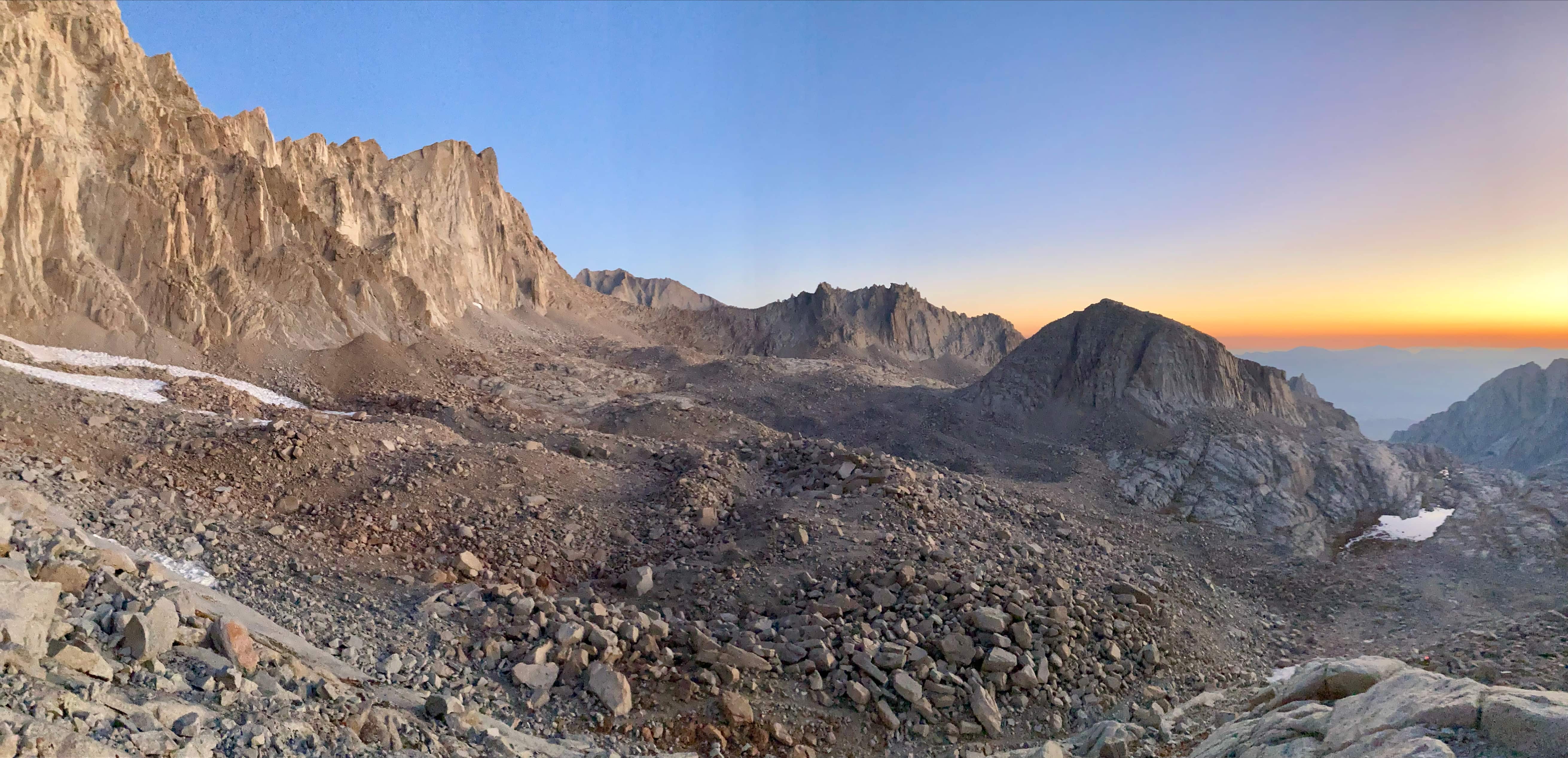
Past Trail Camp and on the 99 Switchbacks the sky began to brighten and we were treated to a beautiful sunrise.


Continuing upwards, I passed the section called “The Cables”. This area apparently holds on to snow and ice for the longest time into the summer. The posts were pretty severely bent.


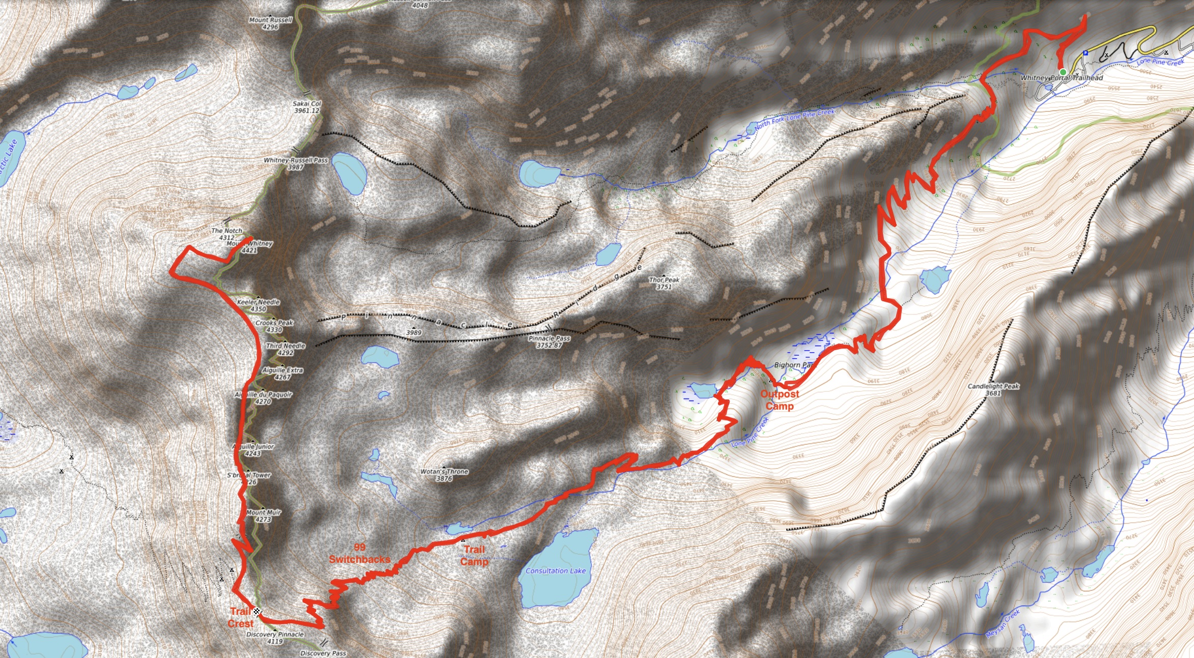
As I neared Trail Crest, the colours on the cliffs to my right kept changing.


Congratulations on your successful climb! You were lucky to get a permit and have excellent weather. I summited Whitney 3 times in days past, so it was a pleasure to see it again through your photos! 😁
LikeLike
Thanks for reading – glad you enjoyed the post!
LikeLike
Great summary Par – you always do a great job with your trip reports, info, and photos.
LikeLiked by 1 person
Thanks for the feedback and thanks for reading!
LikeLike
Congrats on the summit! This one is on my list too, so this was a helpful overview.
LikeLiked by 1 person
Thanks for reading! I could have put more in there about prep, but a lot of other resources have covered it in great detail. I think The Hiking Guy did it best: https://hikingguy.com/hiking-trails/hikes-around-mt-whitney/mt-whitney-hike/
LikeLiked by 1 person