September 21, 2024. A long, scenic ridge walk on the Autumnal Equinox.
- Region: Castle Wilderness. Traditional territory of the Ktunaxa, Tsuu T’ina, and Blackfoot First Nations
- Distance: 26.3 km loop
- Total Ascent: 1695 m (repeated gain and loss of elevation occurs during the ridge walk)
- Elevation of Objective: 2520 m
- Total Time: 11h 35m
- Safety and Disclaimer

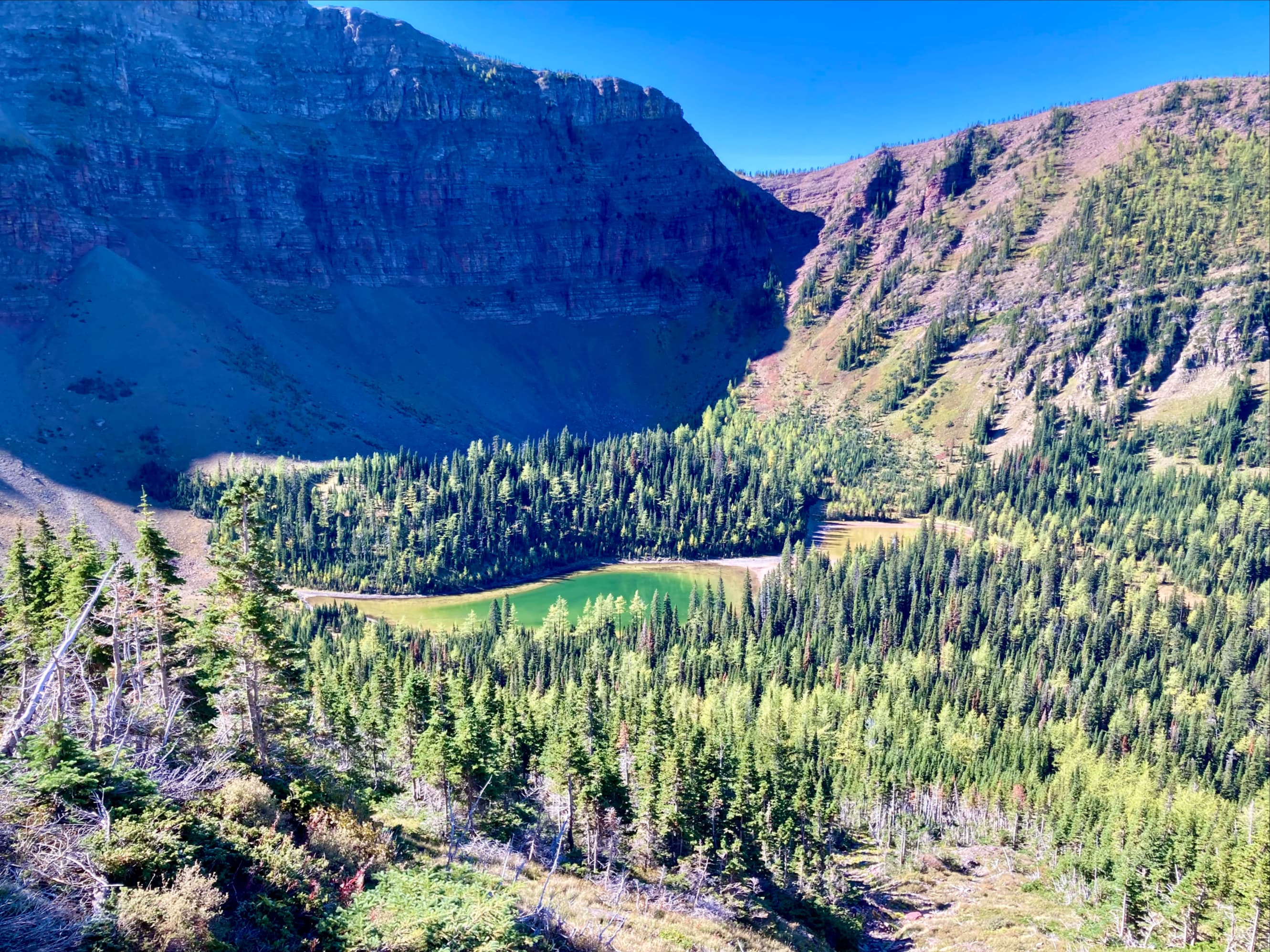
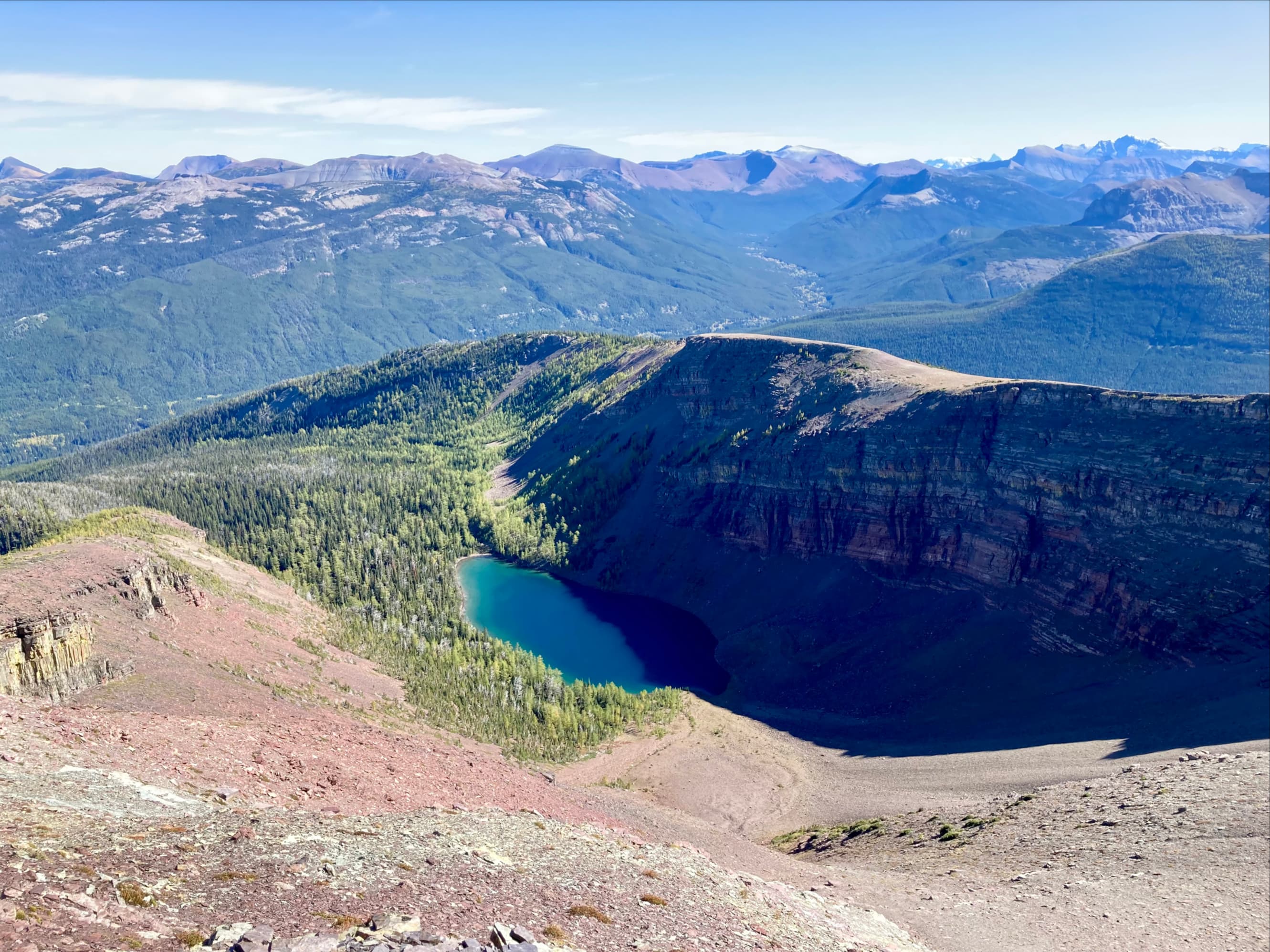
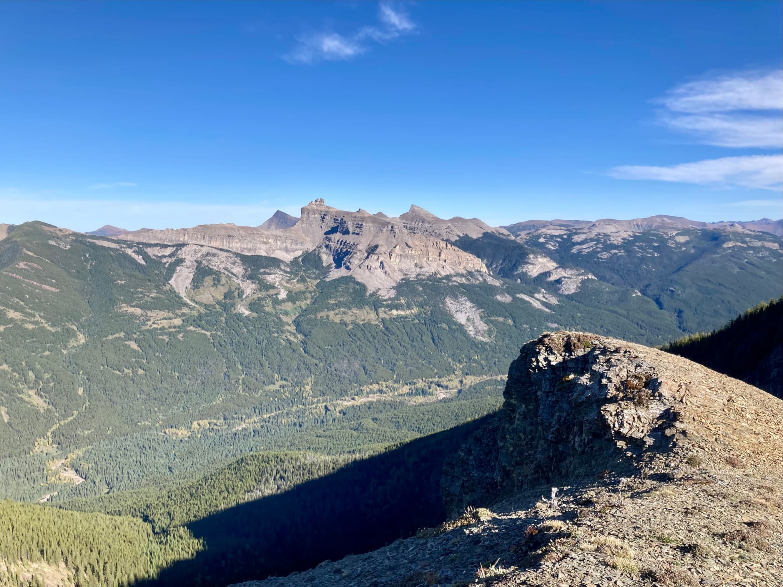
Lys Ridge is situated between 2 picturesque valleys in Castle Wildland Provincial Park. Grizzly Creek runs in the valley to the west of the ridge and the South Castle River runs in the valley to the east . The two converge around the northern tail of the ridge before picking up more tributaries and eventually becoming the Castle River. Grizzly Creek’s valley is blind-ending at its southern end where there are two remote and beautiful lakes: Grizzly Lake and Ruby Lake. Across the valley to the west is Barnaby Ridge and to the east are Castle Peak and Windsor Mountain. The whole area embodies the Castle’s iconic beauty.
Traversing the ridge is a fairly major undertaking in terms of distance, elevation gain, and access since there are no bridges over the South Castle River between the access road and the ridge. Doing this on a long summer day would be ideal, but I have held off on a June/July trip worrying that the river may be too high for a easy crossing. This year my August schedule was fully booked so this ended up being a September trip. This worked out fine since, with a brisk pace and reasonably early start, we were able to do the whole trip in daylight. We really didn’t want to be caught in darkness while making our descent or crossing the river. Interestingly, all of the trip reports I reviewed in preparation for this outing were from September and October (see list below).
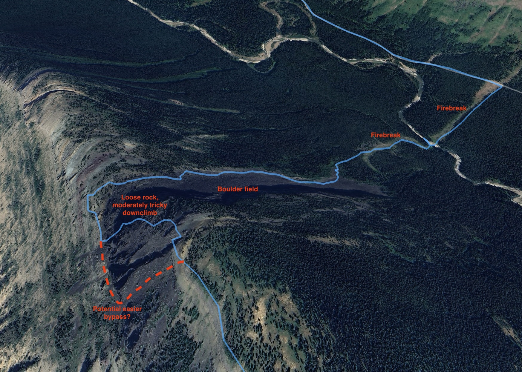
While an out-and back route is possible, a loop is ideal. This can be done clockwise or counterclockwise. Andrew Nugara describes both options in More Scrambles in the Canadian Rockies 3rd ed. We decided to go counterclockwise, following the Grizzly and Ruby Lakes Trail to (nearly) its end, ascending the slopes above Ruby Lake to reach the summit of Lys Ridge, then walking the ridge north. Making our way north we would tag the summit of West Castle before descending adjacent to the large boulder field on the eastern aspect of Lys Ridge near the northern tip. For a counterclockwise loop Nugara’s book describes a different descent – through the woods directly off the north end of the ridge – but we decided to avoid that.
Access is via the South Castle Road. From Pincher Creek take Hwy 507 west, then turn left onto Hwy 774 and pass through the town of Beaver Mines. There will be signs for the Beaver Mines Lake campground at about 14.7 km from the turn. Once on the gravel access road to the campground follow it for about 3.7 km and turn right (south) onto a gravel road. This road soon comes to a creek crossing. If the flow is low enough and you’re confident in your vehicle, it can be driven across. If not, there’s space here to park without blocking anyone else.
Beyond the creek crossing is roughly 5.5 km of variable-quality dirt and gravel road. Some stretches were smooth and dry, others were deeply rutted, or pocked with mud puddles of variable depth. A higher clearance vehicle is advisable. The vehicle-accessible portion of the road ends in a blockade of rocks and concrete barriers. Shortly before this there’s the remains of a fence part way across the road, and a Texas gate to drive over. At the blockade there is lots of parking space and a small kiosk and signs pointing the way to various trails. This arrangement was set up roughly 2019 or 2020, so all older books and trip reports will describe driving further and/or parking elsewhere.
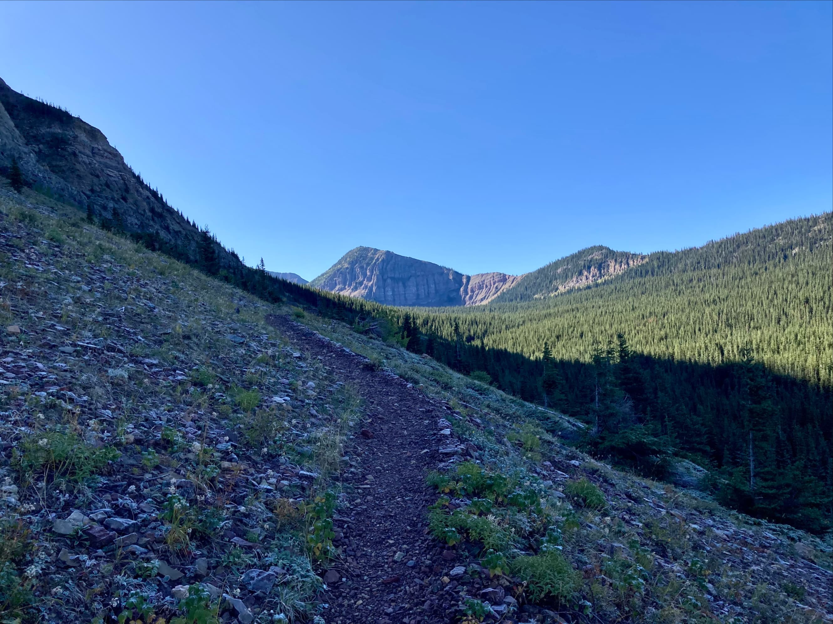
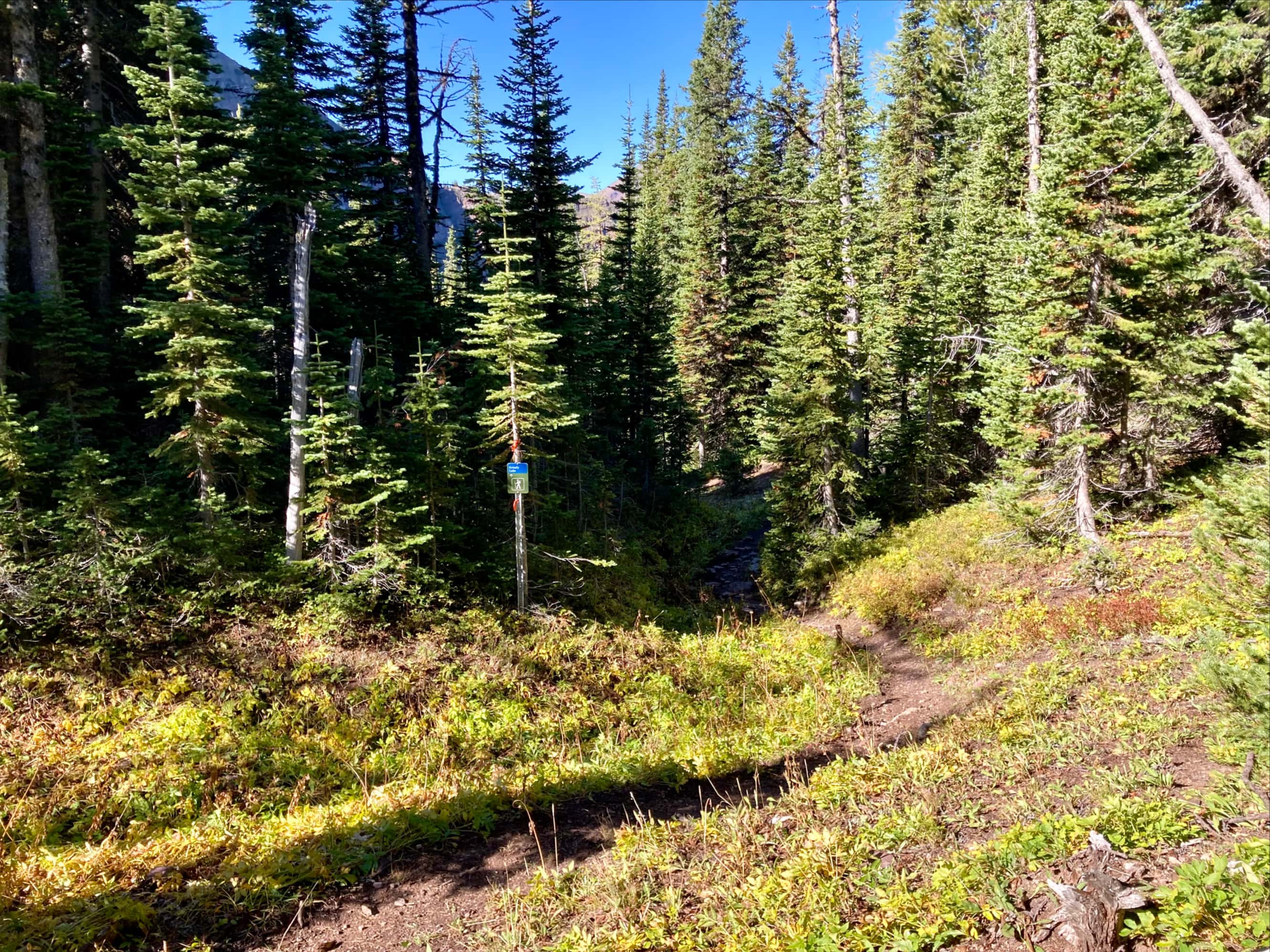
We geared up and followed the sign for the Grizzly and Ruby Lakes Trail. This quickly brought us to the South Castle River. A sign showing the continuation of the trail was visible at the edge of the trees on the opposite bank. The water was shin deep and we crossed without difficulty. We got back on the trail and enjoyed an easy, gently ascending hike for the next 11 km. The trail was quite well maintained. In the first few kilometres it passed over a some creek beds, some dry and some very low. Only one was bridged. Because we were in a hurry we didn’t take the side trail to Grizzly Lake or follow the main trail all the way down to Ruby Lake.
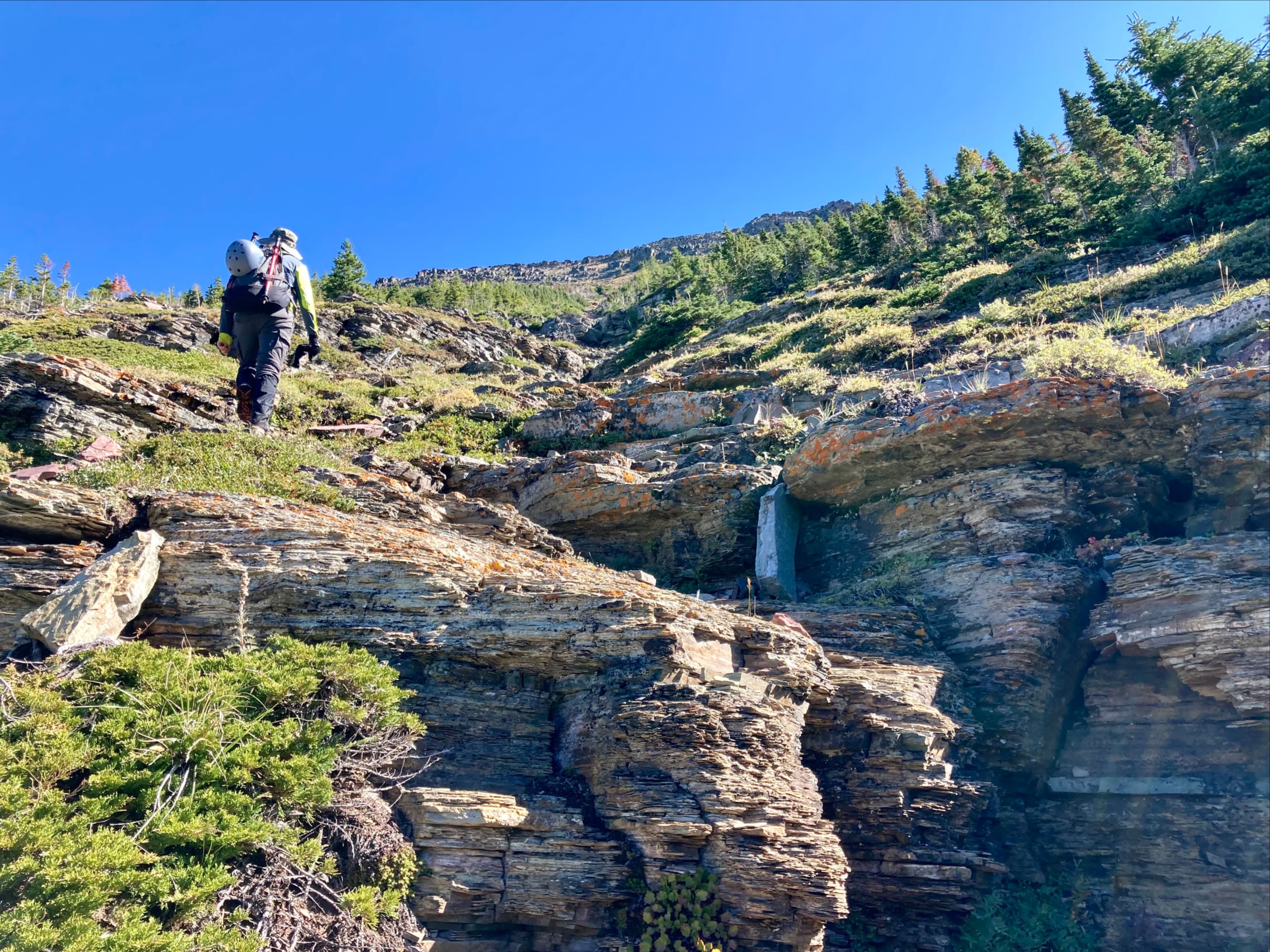
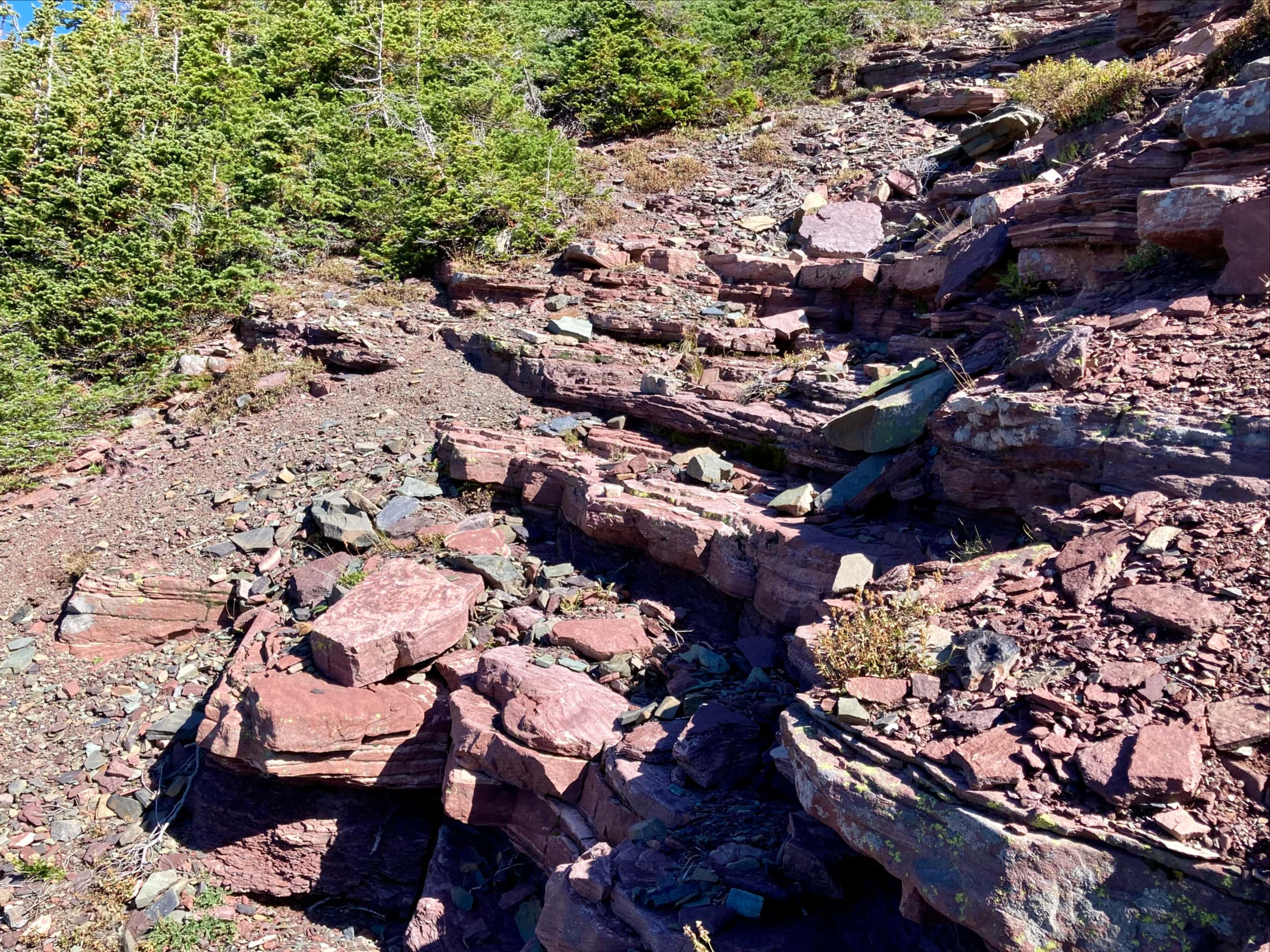
Where the trail turned west towards Ruby Lake we followed it a short distance to a clearing where we took a break. Looking at our maps and GPX tracks we decided to go back up to where the trail turned and follow a faint path that continued south. We did this, found our way through some trees by a slightly convoluted course (I think we could have just kept going straight) and intercepted what Nugara refers to as the RASC – the Red Argillite Staircase. This is a shallow gully of red argillite that has stable, step-like terrain which allows a rapid and enjoyable ascent most of the way to the top of Lys Ridge.
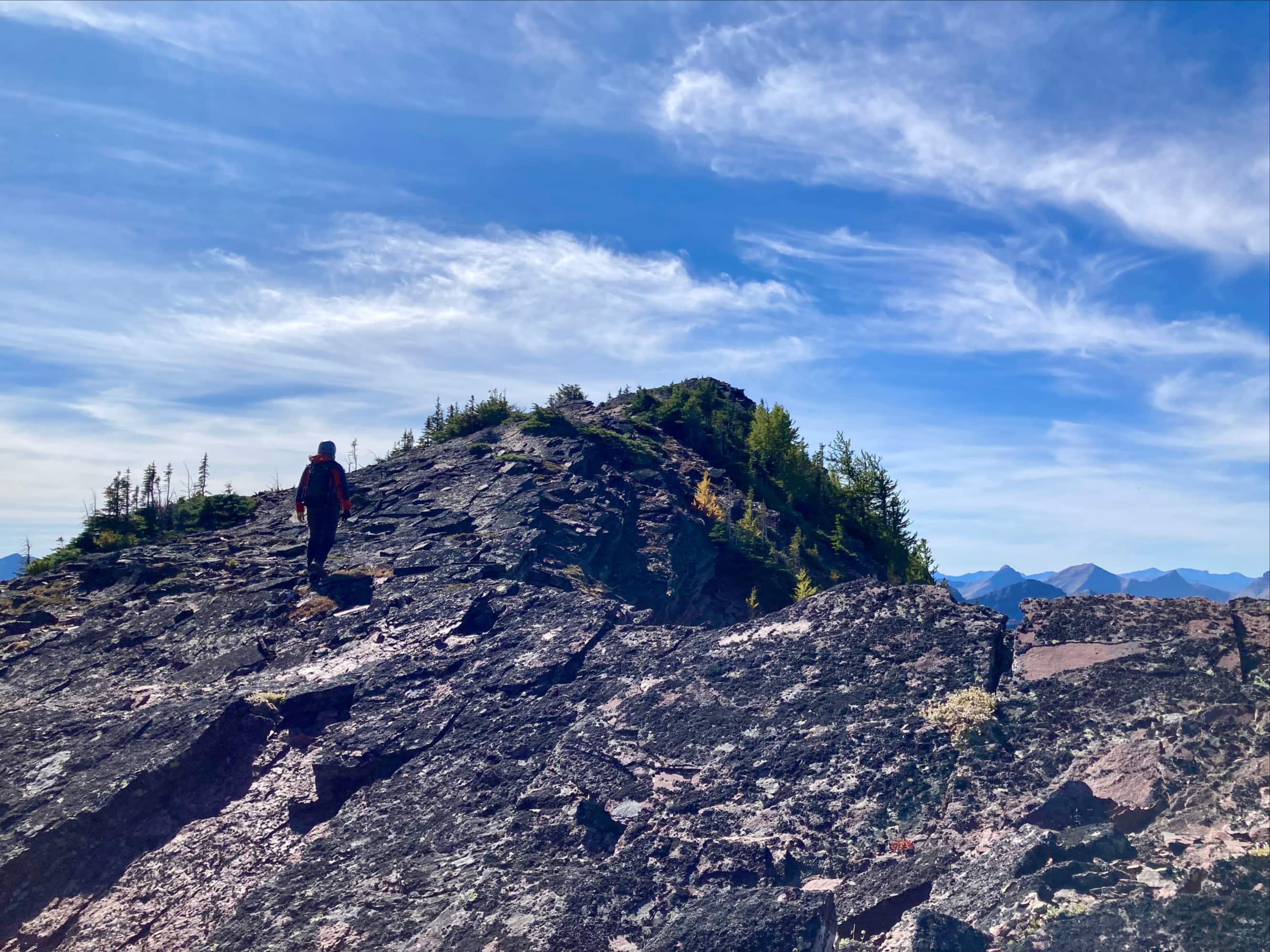
At the top of the RASC we navigated through some easy rock bands onto the broad, smooth terrain at the top of the ridge. As I ascended the last stretch, I saw the top of an antenna off to the right. I headed that way and found the repeater station which stands at the summit of Lys Ridge. Nearby was the official survey marker. The wind picked up a bit as we arrived at the repeater station – luckily, it functioned very well as a wind break. We found no register but there was a small geocache canister. Inside was a soaking wet piece of paper and a pencil. After a fairly long rest we set out to the north and began the ridge walk.
The ridge walk was very enjoyable and only involved a few difficulties. The terrain was varied – sometimes smooth and broad, sometimes rocky and narrow. A couple sections involved scrambling down rock bands and a bit of route finding was required. I think that ascending these sections on a clockwise route would be pretty straightforward. Roughly 3-4 km from Lys’ summit we encountered twin rocky outcrops, one grey and one striking red and yellow (which led me to think of it as “Spanish Peak”). We climbed to the col between them and saw that we had to descend a bit and slide-slope traverse under the red and yellow cliffs to find an easy rock band to scramble up to return to the crest of the ridge. We did that, then tagged the top of “outcrop”Spanish Peak” for a bit of fun.
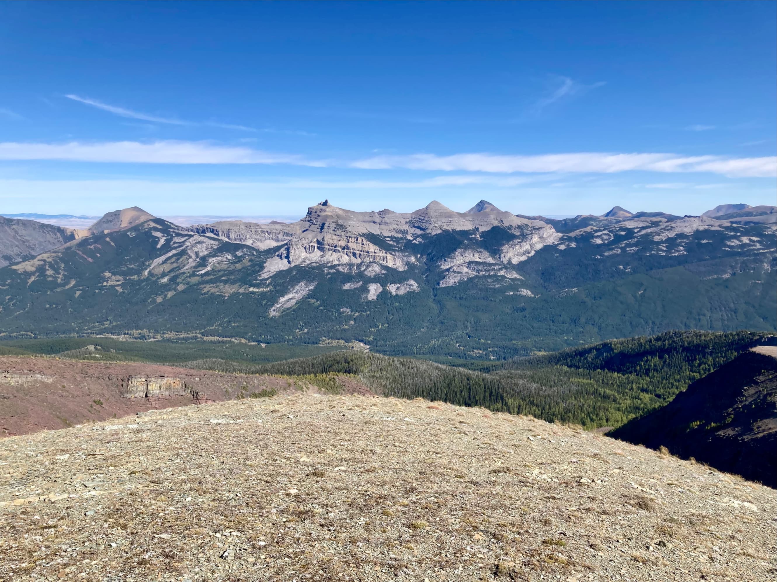
Carrying on from there the elevation of the ridge descended a little more rapidly and we began to encounter more trees on the ridge line. Some more down-climbing was required. Eventually we got to a high point overlooking a pair of peaks a little further along the ridge, one red and one grey-yellow. We knew that the yellow one, which is a little shorter than the red one, was West Castle – an official summit. Why it is that that particular high point is an official summit isn’t clear to me. In any event we were soon on the summit of West Castle, checking out its diminutive cairn.
We continued beyond West Castle, at one point crossing above a huge down-sloping slab, until we encountered black rock and what seemed to be a massive crack in the mountain. This was our cue that we were near the top of the boulder field that was to be our descent path. We bore to the right (east) to avoid a sharp drop of the ridge-top, but then had to head left and ascend, passing over the ridge and down rock bands on the other side until we reached terrain that allowed us to bypass the section. Another option would have been dropping off to the left sooner along the ridge top. Once past that section we left the ridge and started to descend along the left (north) edge of the massive boulder field. It wasn’t a carefree scree run, but there were areas of soft terrain that allowed for a bit of plunge-stepping. In other spots we found faint animal trails to follow. Once at the bottom of the slope we pressed through the woods for a short distance (finding a faint trail) northeast until we encountered an old firebreak which cleared trees right to the shore of the river. We were able to cross easily at this point then carry on following the firebreak straight to the South Castle Road. We turned left on the road and followed it northwest back to our vehicles just as the sun went down.
Aside from checking out Nugara’s description in More Scrambles in the Canadian Rockies 3rd ed. here are some other Lys Ridge resources to review:
- All Stone Adventures’ video report. He did this as a 2-day trip, camping at Ruby Lake but used basically the same route as us, ascending the RASC and descending adjacent to the boulder field.
- Dave McMurray’s September 2016 post. Great descriptions of what is encountered along the ridge top. He went clockwise and used different river crossings than we did.
- Vern Dewit’s October 2016 post. He followed McMurray’s route, but did it in snowy conditions. The scenery was amazing, but darkness closed in on them before making it back to the river, leading to a bit of a scary situation.


Oh wow! These views from the top are quite stunning!
LikeLiked by 1 person
Very good descripti
LikeLike