May 27, 2024. Hiking the most spectacular trail in Utah’s Zion National Park.
- Region: Zion National Park. Traditional territory of the Southern Paiute and Pueblo peoples
- Distance: 8 km round-trip
- Total Ascent: 454 m
- Elevation of Objective: 1760 m
- Total Time: 3h 18m
- Safety and Disclaimer


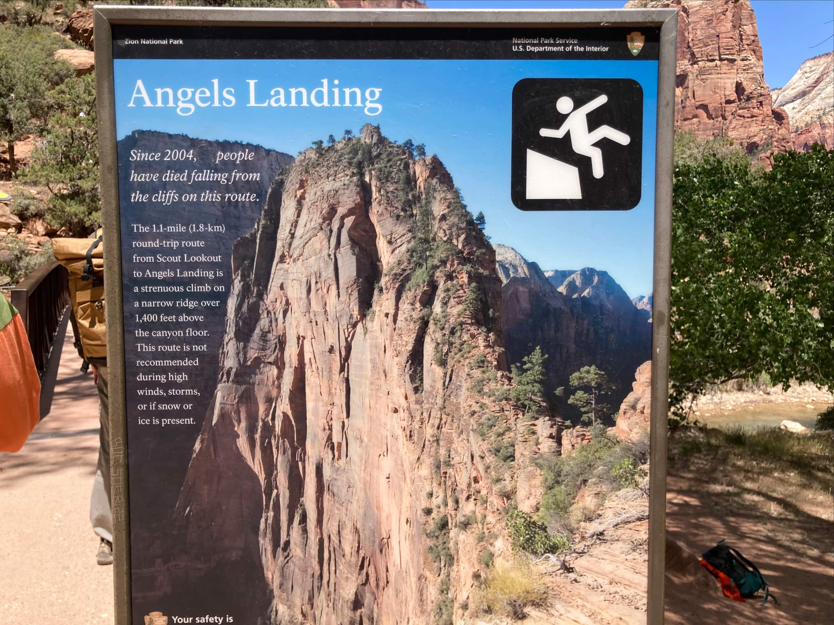
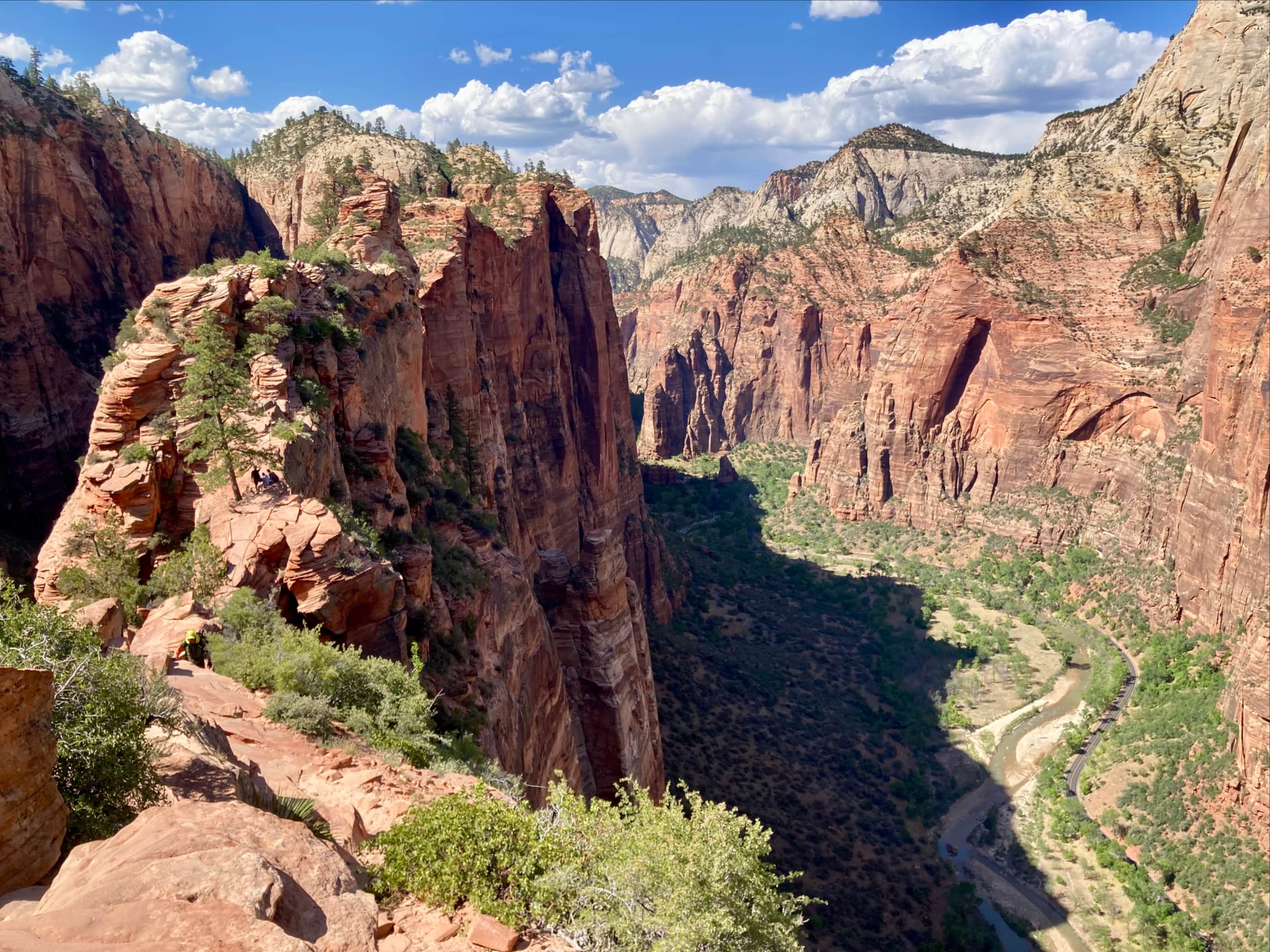
After 3 days of hiking in Grand Canyon, Bhaskar and I departed Arizona and drove north to Utah. On a very hot Memorial Day afternoon we arrived in a predictably crowded Zion National Park. Bhaskar had managed to win a lottery for a hiking permit on Zion’s famous Angels Landing trail (I double checked with official sources – there’s no apostrophe in the name). The summit of Angels Landing is surrounded on 3 sides by sheer drops to the floor of Zion Canyon. A trail clings to a narrow rock ridge which connects to the summit from the north. The views are spectacular and the ascent is exciting. This combination draws a lot of attention, and before the permit system was instituted in 2022 the trail was apparently dangerously/annoyingly crowded.
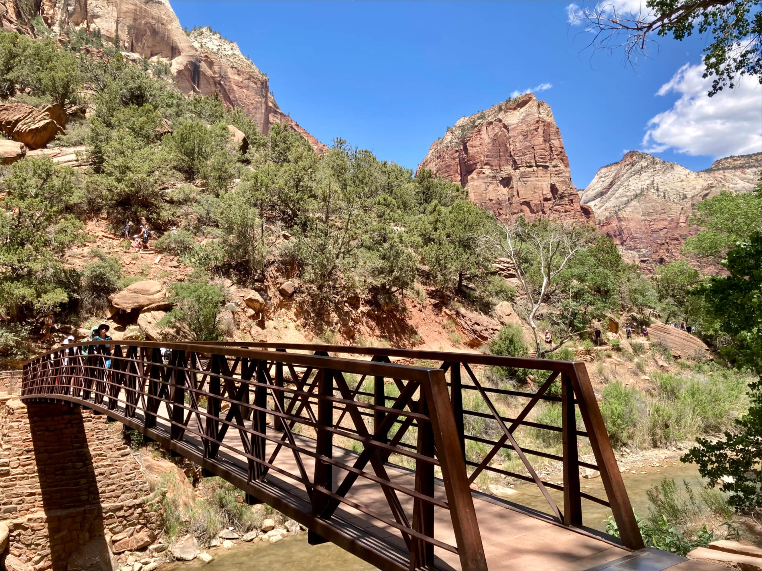
We took the free shuttle to the Grotto stop and crossed the road to the West Rim Trail trailhead. We did a “warmup” hike to the Emerald Pools. This was a pleasant hike, but not really worth writing too much about – if you have the time, definitely check out the pools. We then returned to the bridge at the West Rim Trail trailhead and I started the clock on our Angels Landing hike.


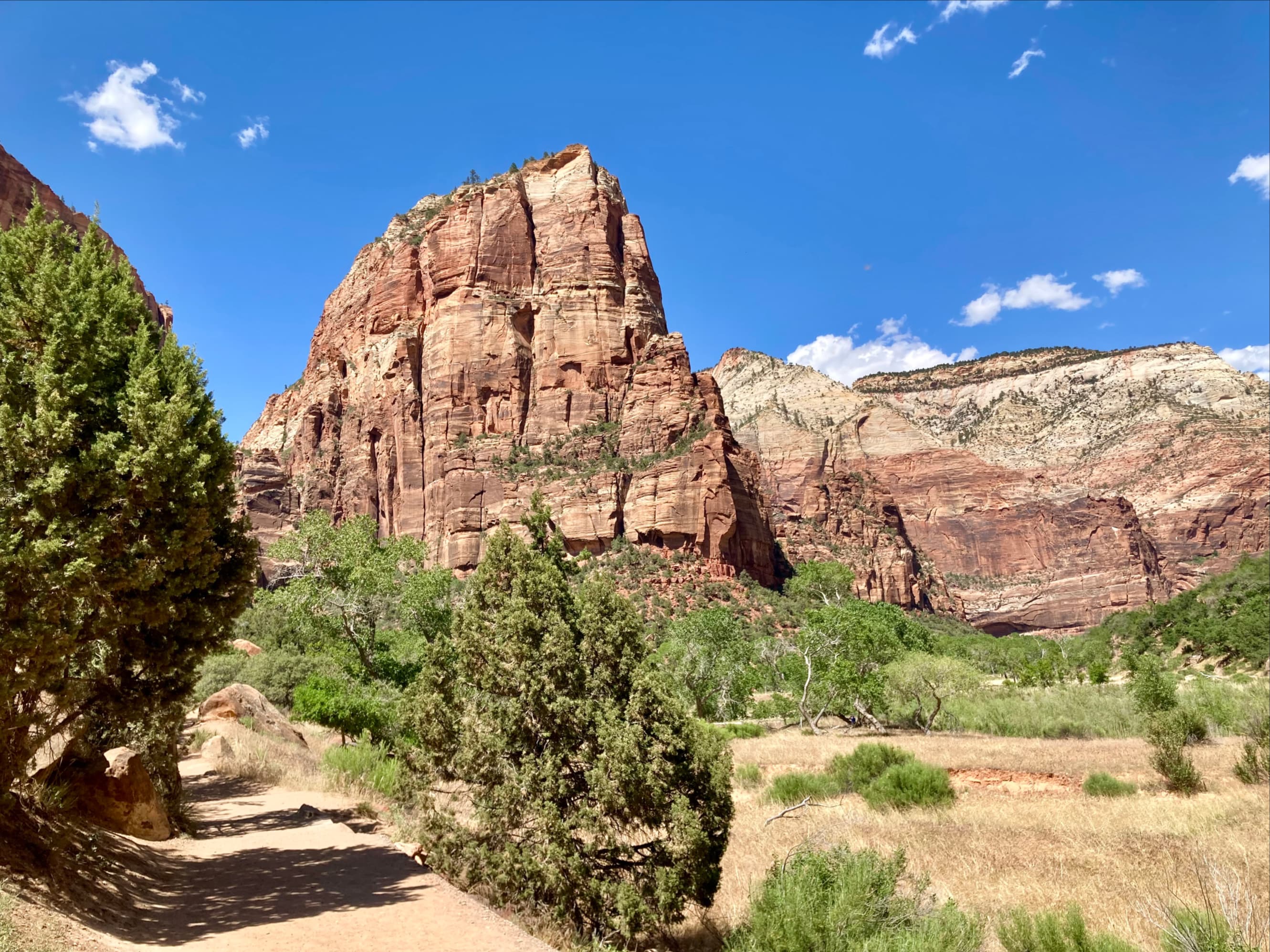
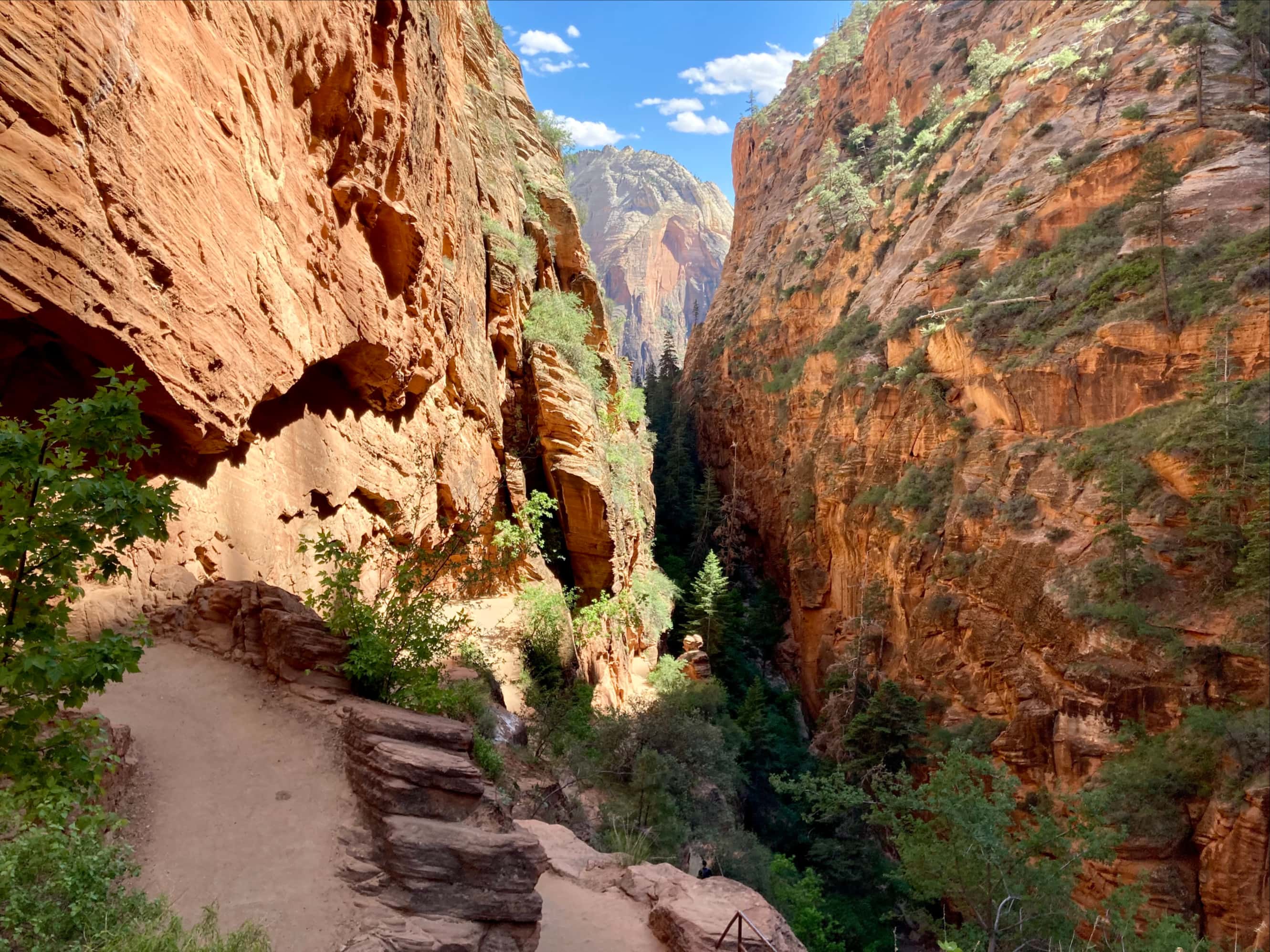
The initial leg of the hike is along the West Rim Trail, heading north directly towards the rocky spire of Angels Landing. The trail is initially sandy and quite level. It eventually transitions to a rough pavement then begins a steep, switchbacked ascent up a cliff west of Angels Landing. After a 100 m ascent the trail traverses east a short distance then enters narrow Refrigerator Canyon, which cuts between Angels Landing and its nameless western neighbour.


After 600 m of level going in Refrigerator Canyon the trail breaks right (east)up a pair of broad switchbacks which brings it to the base of a stack of tightly packed switchbacks ascending south. These are called Walter’s Wiggles – named after Zion National Park’s first Superintendent, Walter Ruesch, who oversaw their construction in 1926. At the top of the Wiggles a sign announces your arrival at Scout Lookout. Here the trail to Angels Landing branches off from the West Rim Trail.


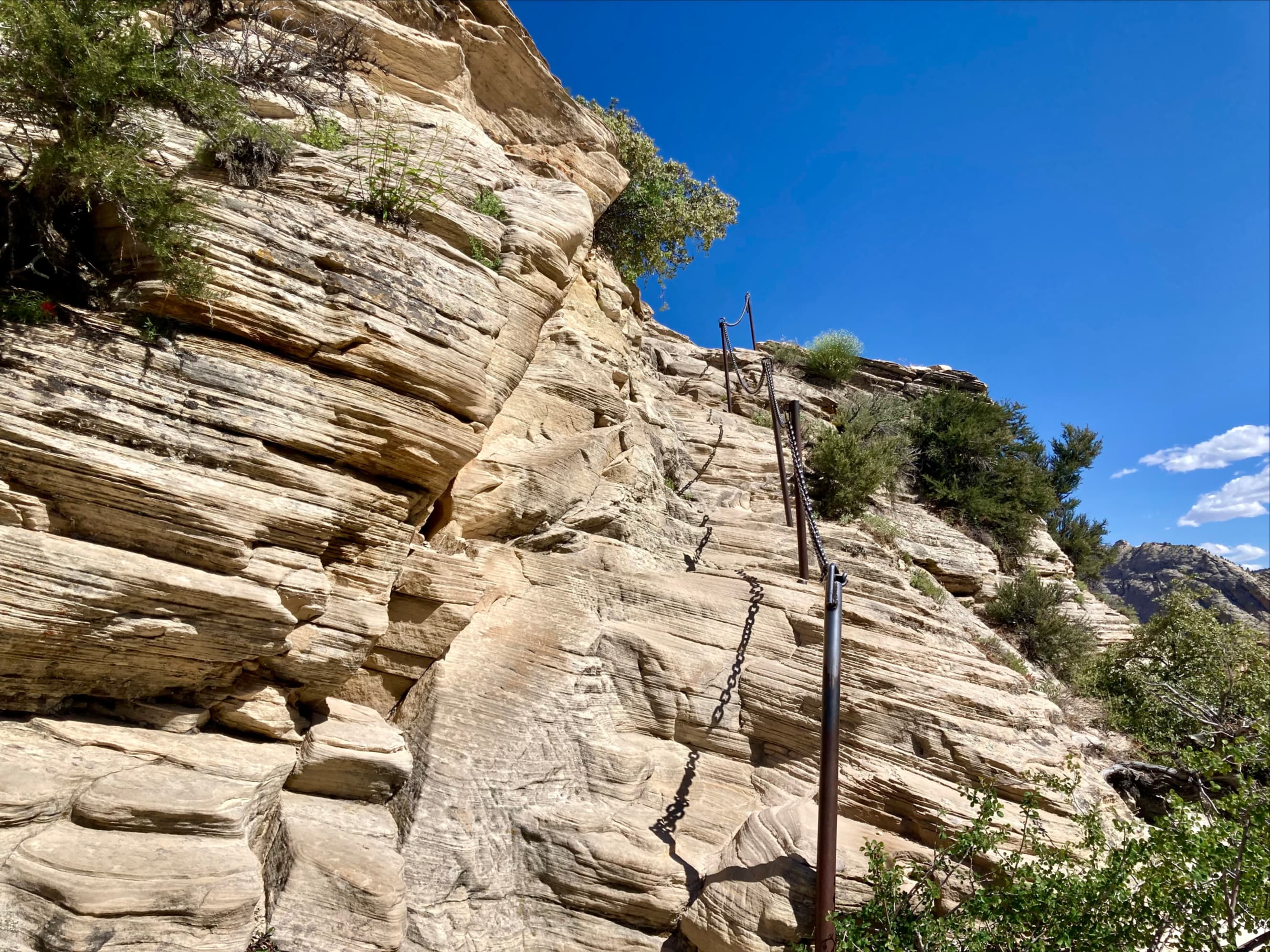
A sign at the start of the Angels Landing trail declared that permits were required but nobody from the park was there to check. We figured that this was because it was later in the afternoon and hiking traffic had died down. The ascent was steep but the rock was quite grippy. The trail is well-constructed and chains are present along most of its length to act as reassuring handholds. I can understand how someone not accustomed to scrambling could find it all a little nerve-wracking. However, if you’ve done some scrambling before and you are hiking in dry conditions I think you’ll find yourself feeling quite secure.
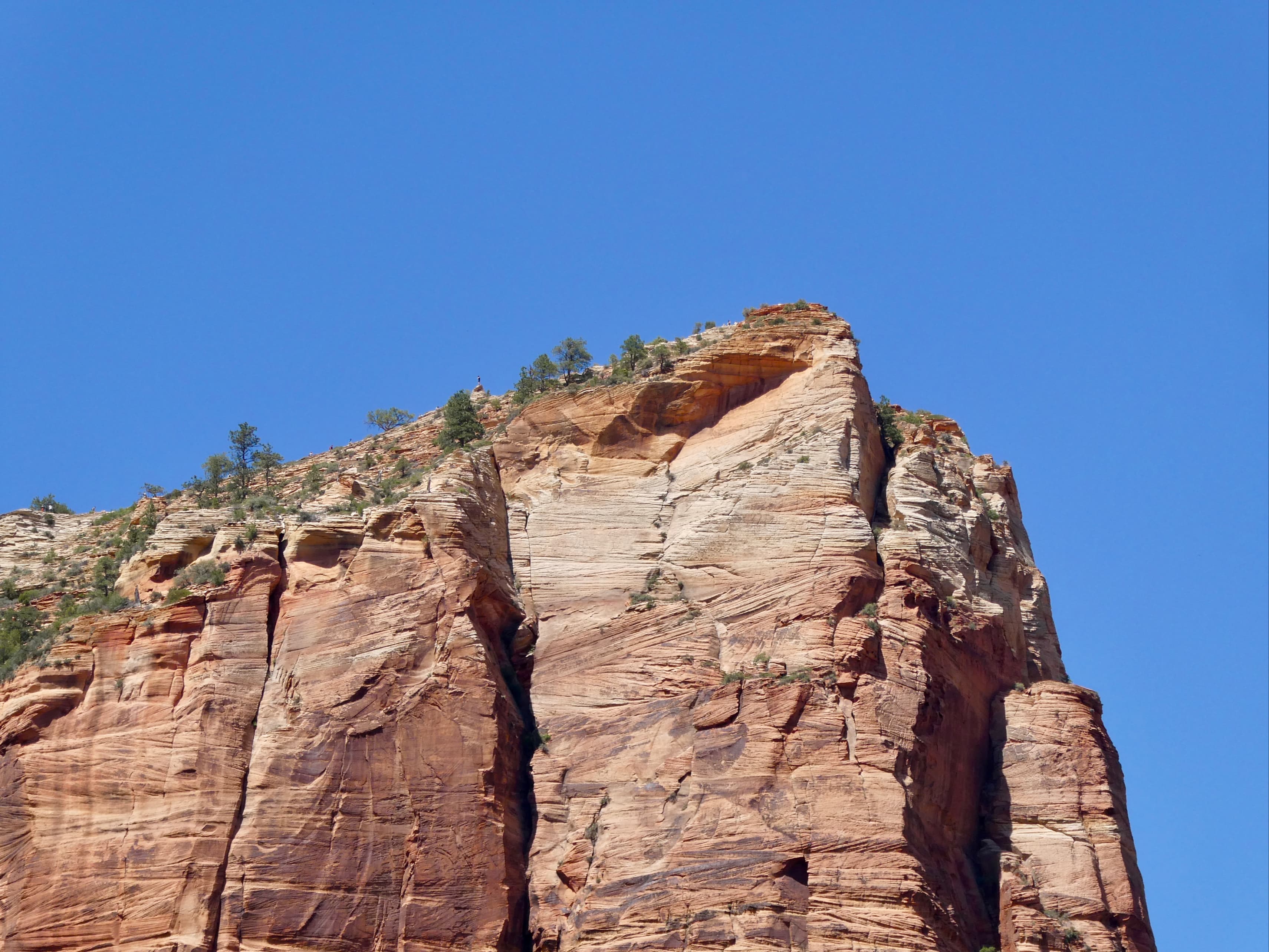
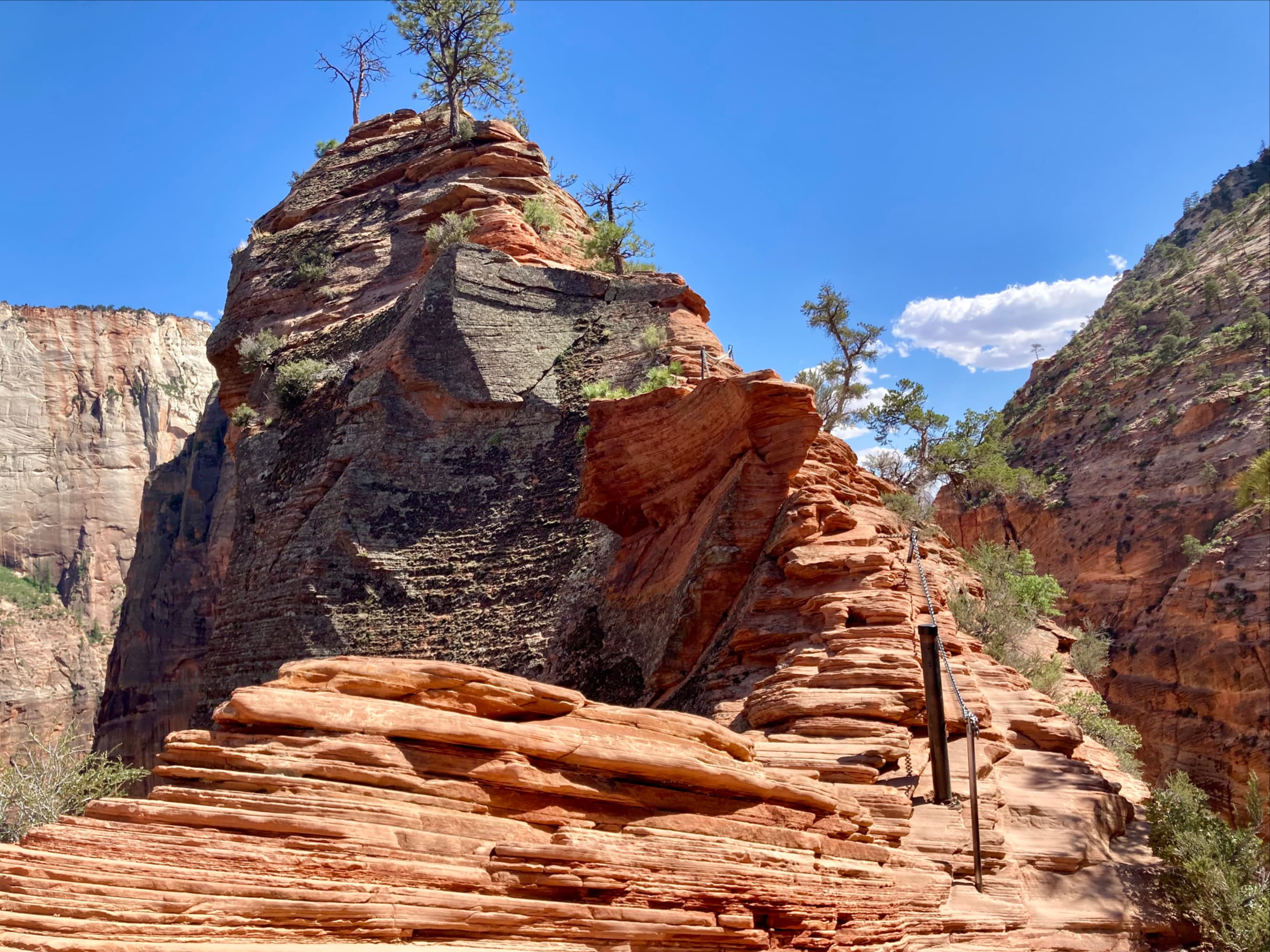
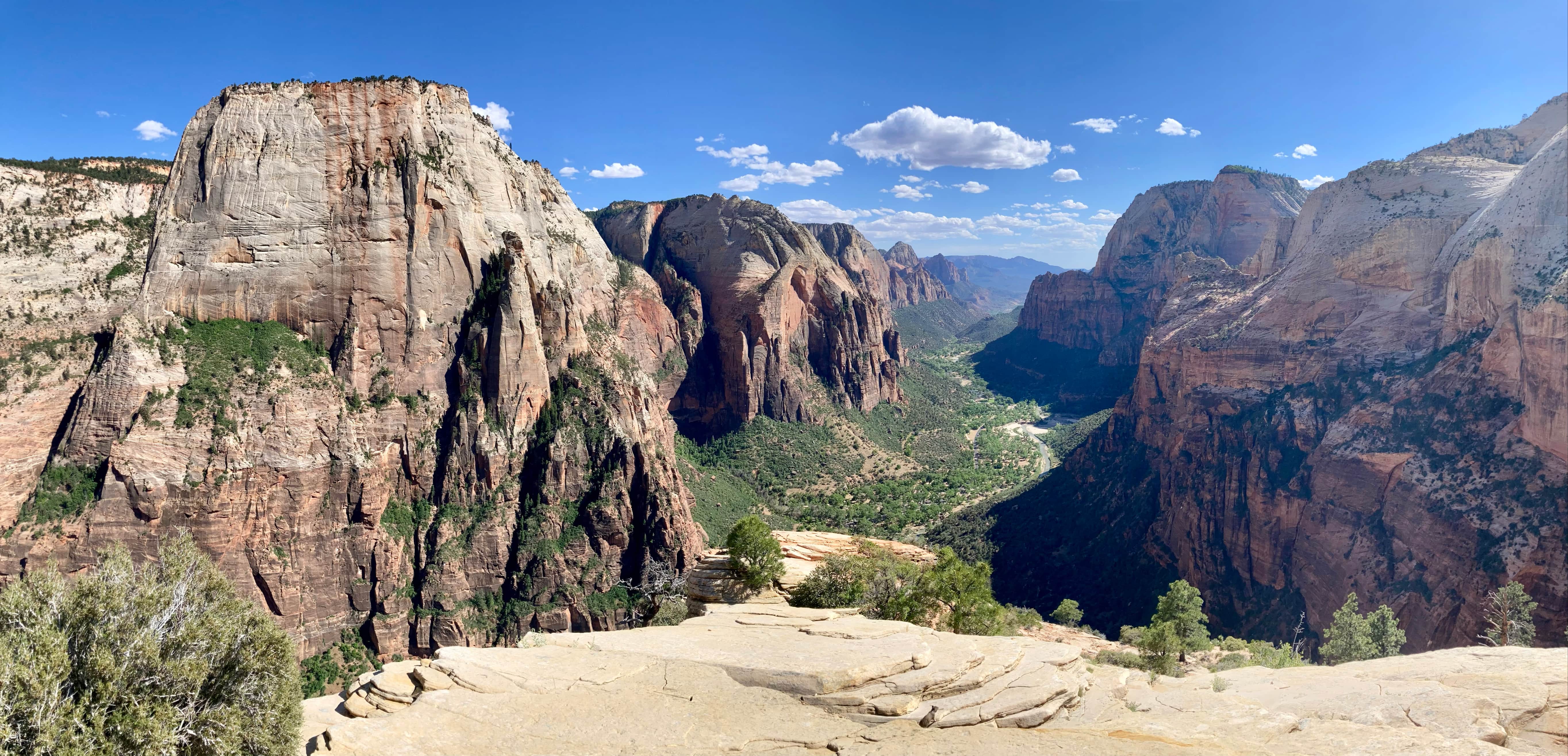
When the trail tops out it arrives at a long narrow walkway of white rock about 75 m long. Hikers mostly proceed to the very end of this ridge for their summit photographs, but the actual highpoint is a distinct protuberance of stratified rock a short distance before the end. It took about 2 hours to get to the top from the West Rim Trail trailhead. It was a hot day but the conditions at the summit were welcoming, so we took some time to relax and enjoy the view.


Our return was via the same route. We had spent the hottest part of the day hiking, and the elongating shadows cooling the canyon floor were quite welcome. This turned out to be the only day we spent in Zion – a planned trip through the Zion Narrows the next day was abandoned because of water conditions. Instead, we decided to check out Bryce Canyon National Park. That trip will be the subject of the next post.


really nice report and pictures that really gave great visual of the views and hike itself.
LikeLiked by 1 person
Thanks for the feedback – glad you found it useful 🙂
LikeLike