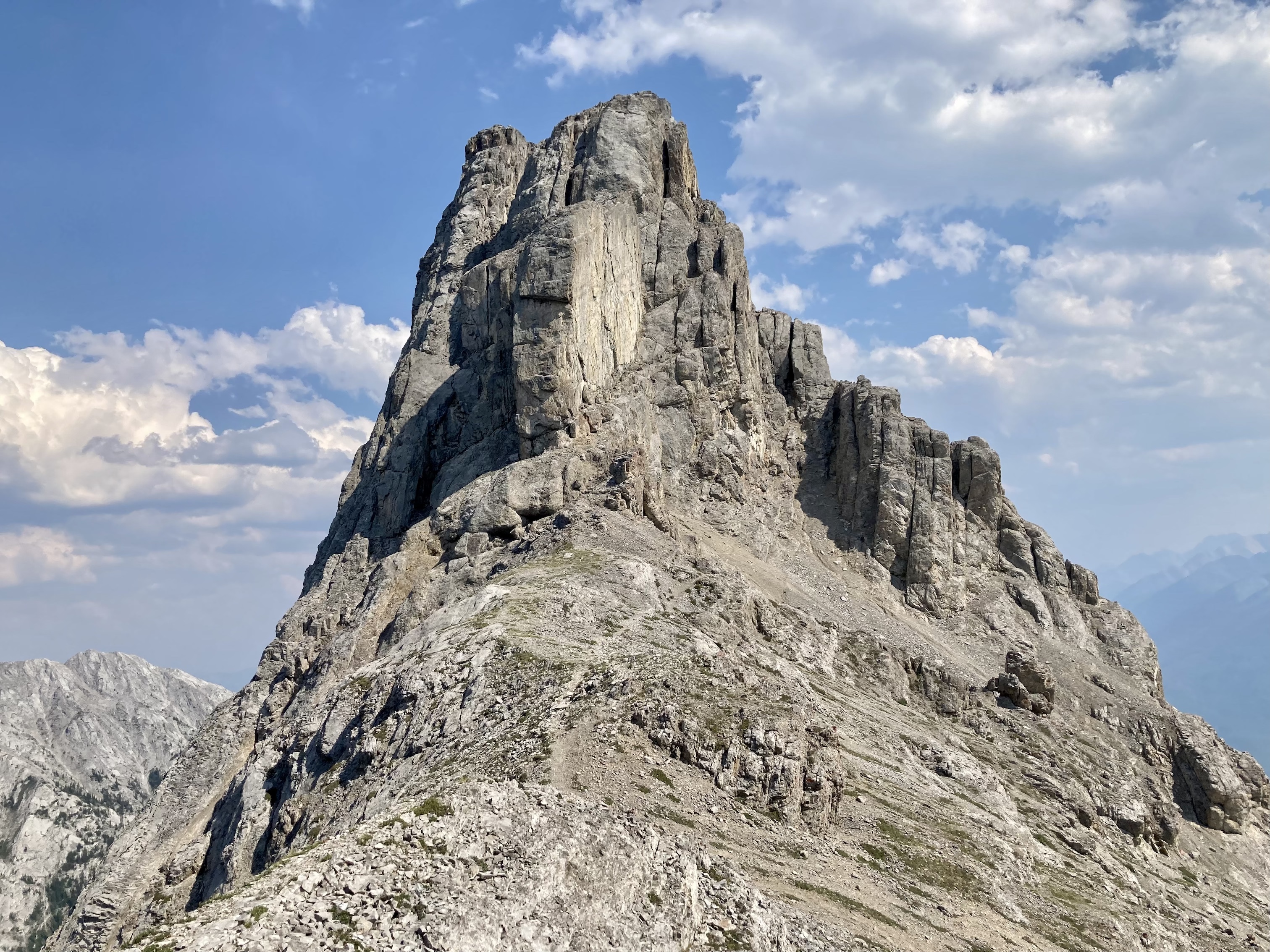
An opportunity arose for me to join a group of scramblers taking on Mount Edith – one of Kane’s “moderate to difficult” scrambles and one with a reputation for some thrilling terrain. Given that I’m usually solo, and therefore avoiding difficult trips, I was glad to join the group. Mount Edith has 3 distinct summits and each has its own personality. The third summit has a reputation for being difficult, but we found that most difficulties were avoided by paying attention to route-finding and supporting one another during down-climbs
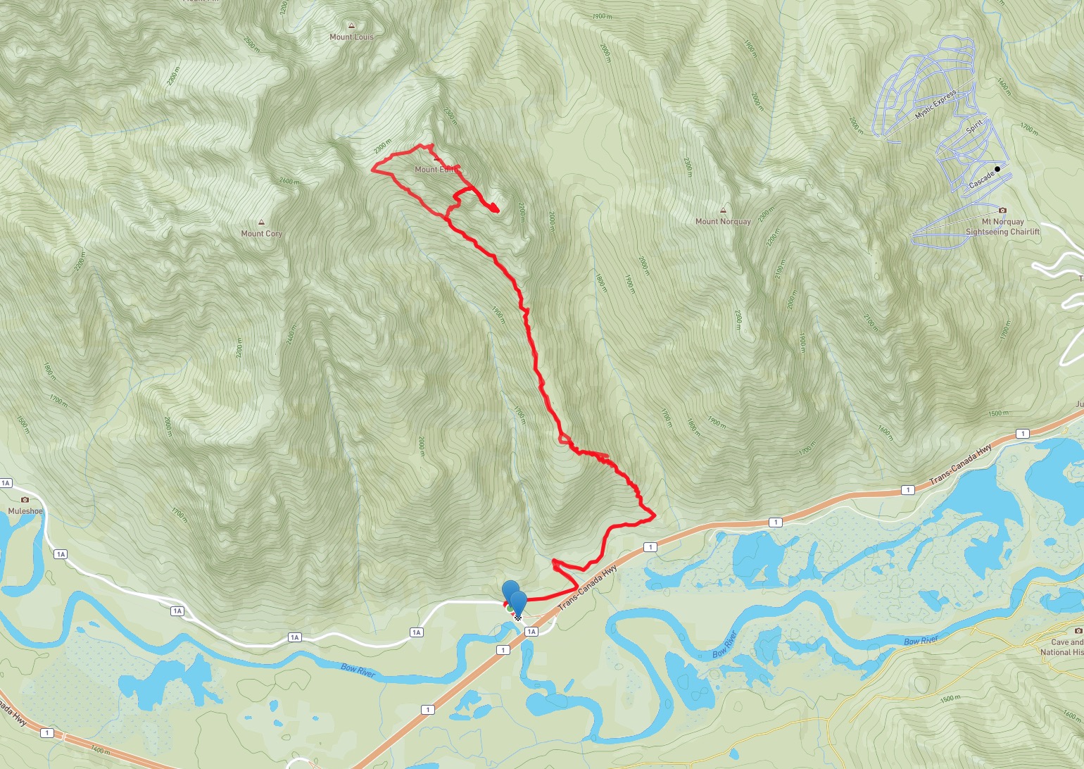
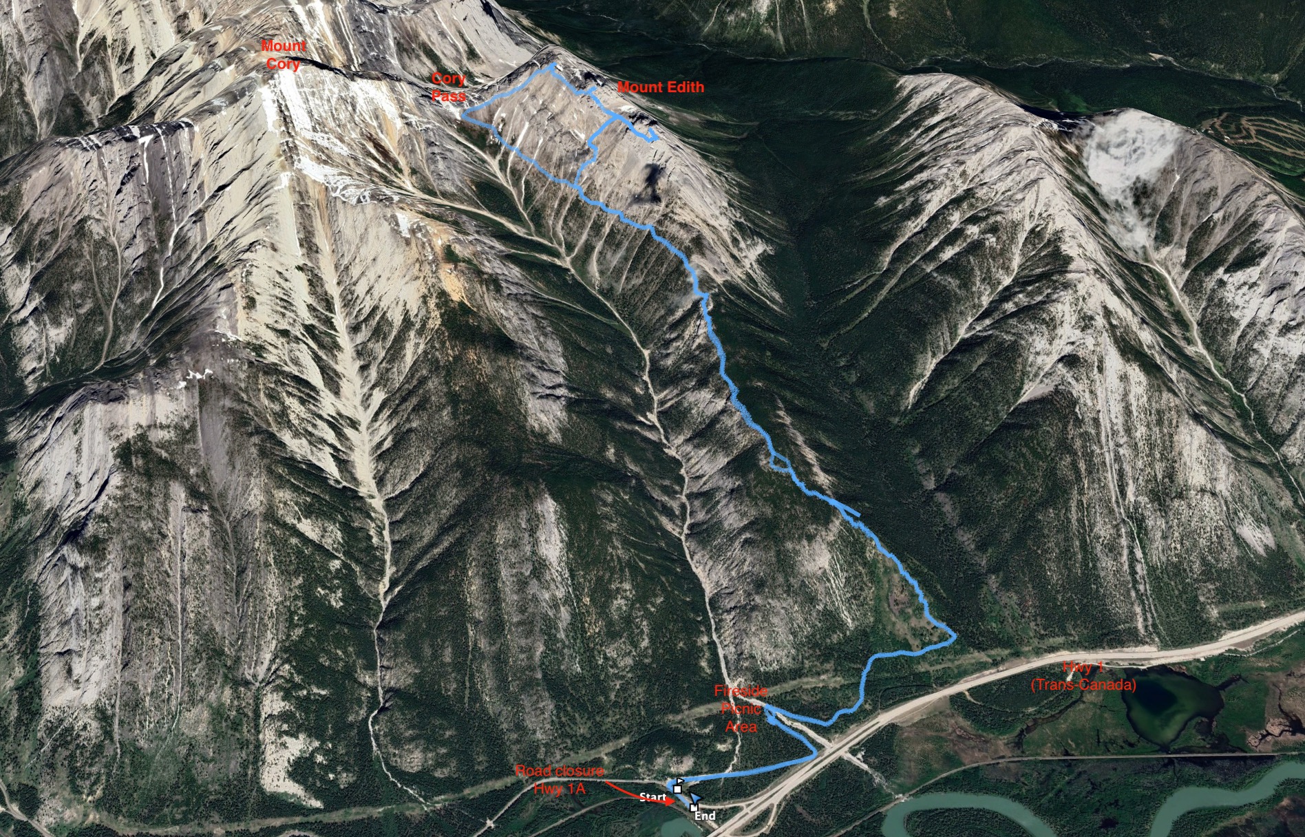
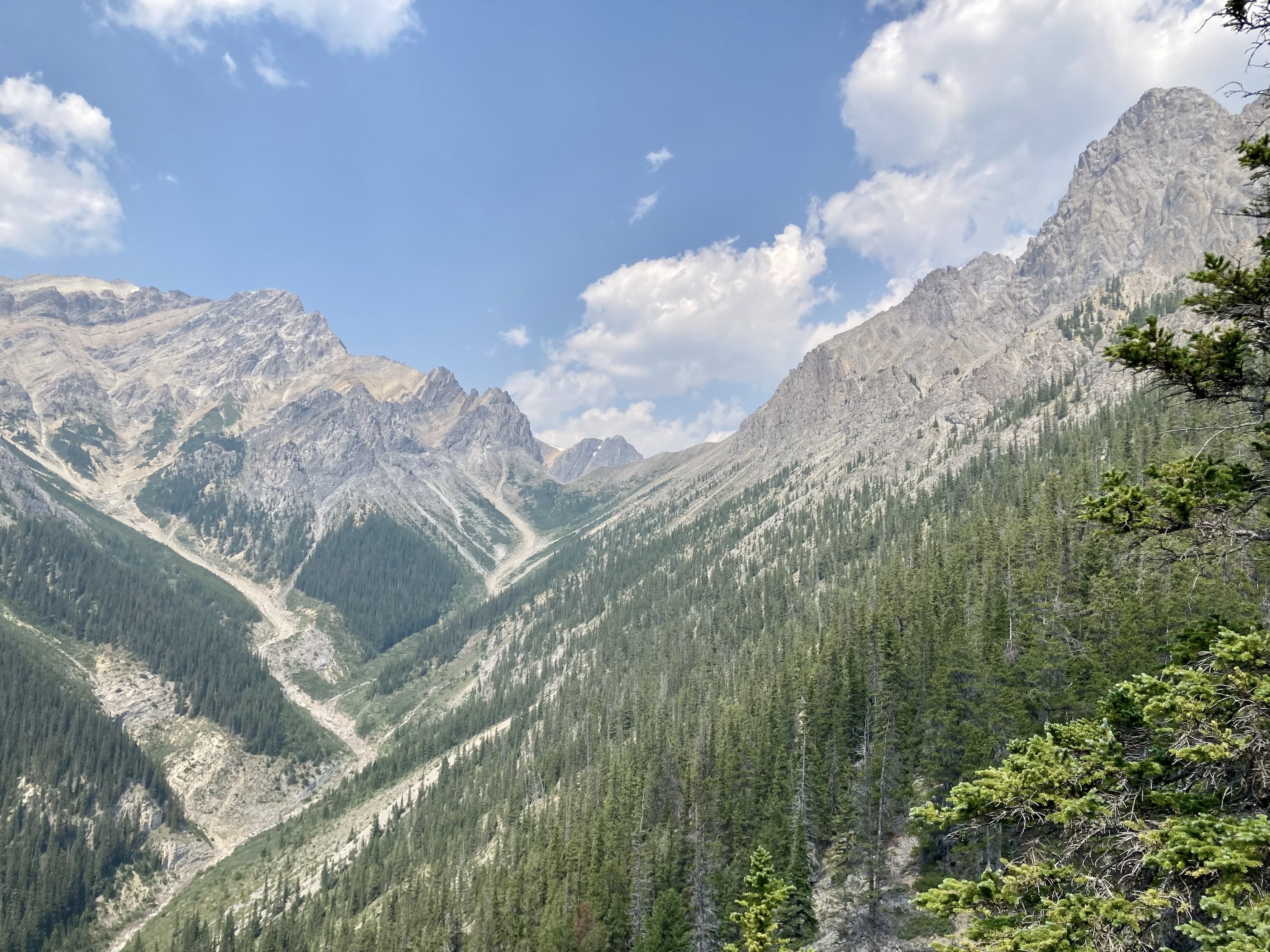
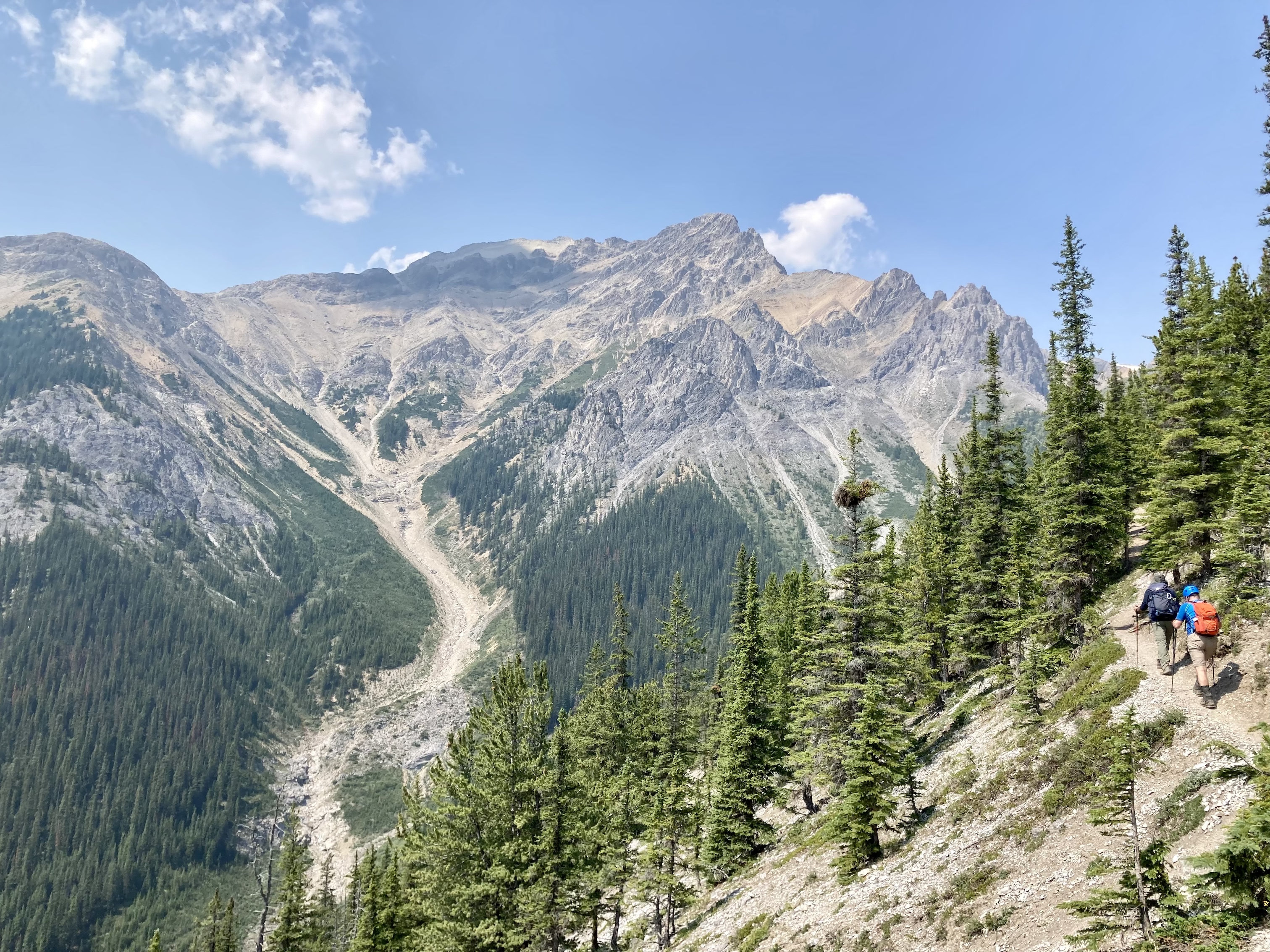
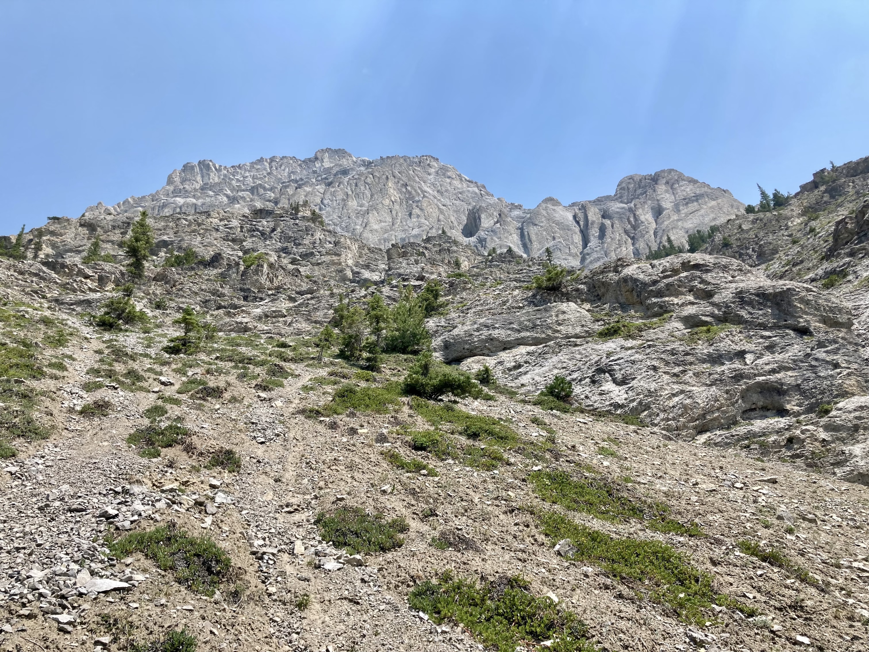
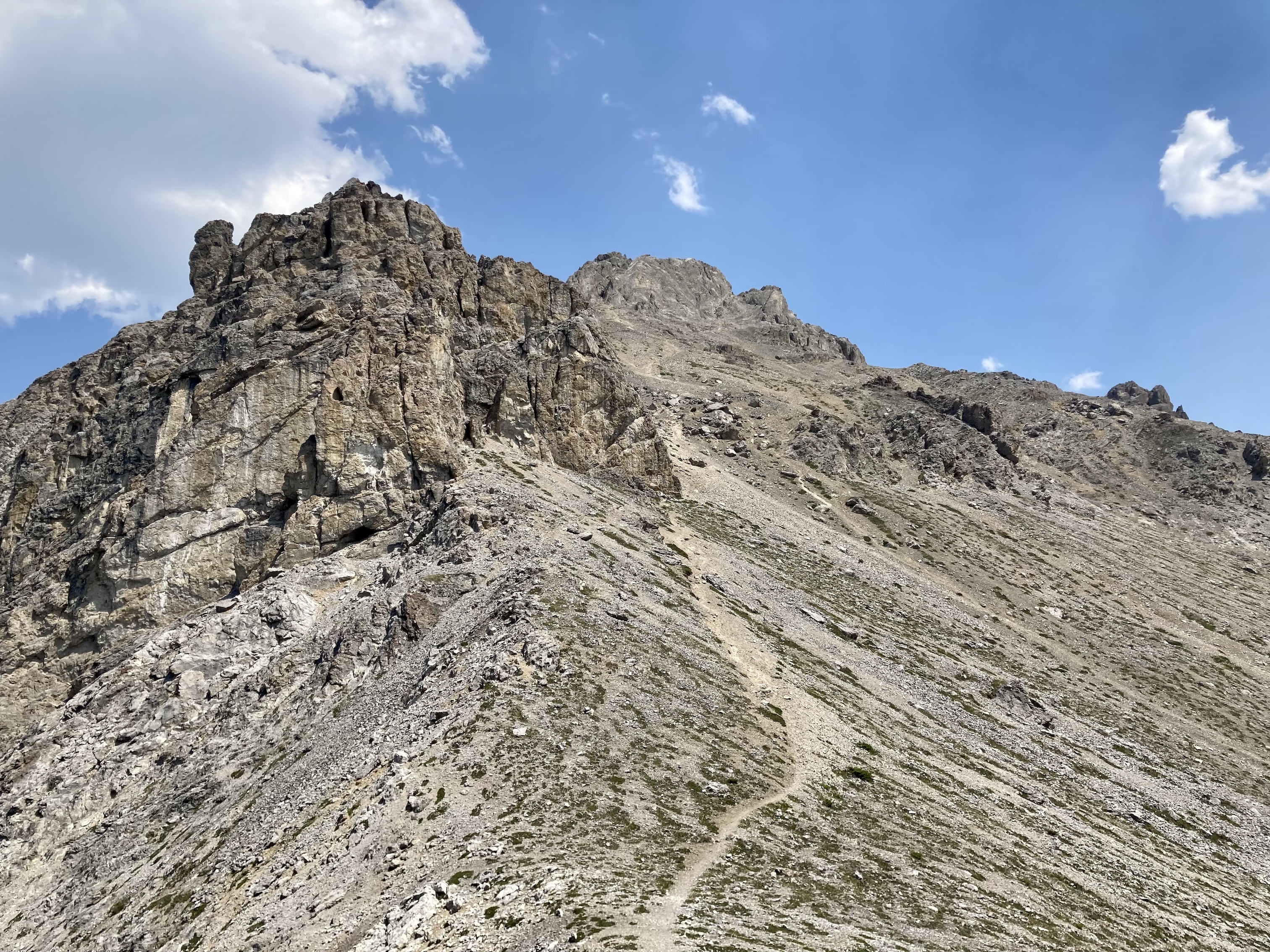
Access is via the Cory Pass Trail, which departs the Fireside picnic area in Banff National Park. Click here for the Google Map. Fireside is a short distance off Hwy 1A (Bow Valley Parkway) but It turned out that there was a seasonal closure of Hwy 1A to motorized traffic, so we parked next to the closed gate and walked to the trailhead. This added about 1 km to the start and end of the day. Following the Cory Pass Trail involved a sustained steep climb through forest up to a long north-south ridge extending from the main bulk of Mount Edith. The trail then climbs more gently in a long traverse going beneath all three summits of Mount Edith, eventually reaching Cory Pass a less than a kilometre west and 200 m below the northern summit.
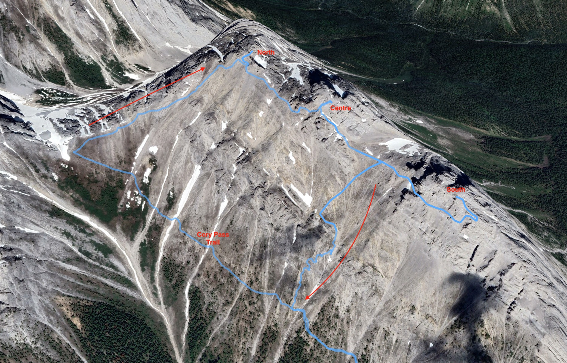
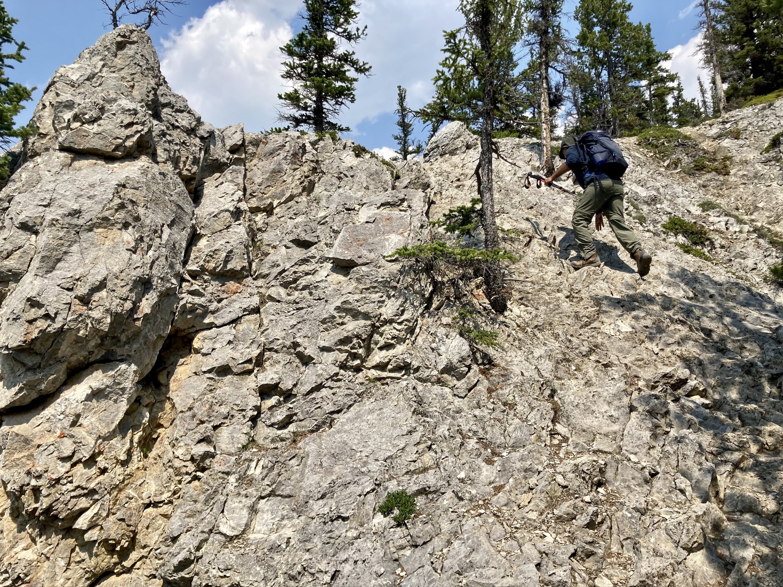
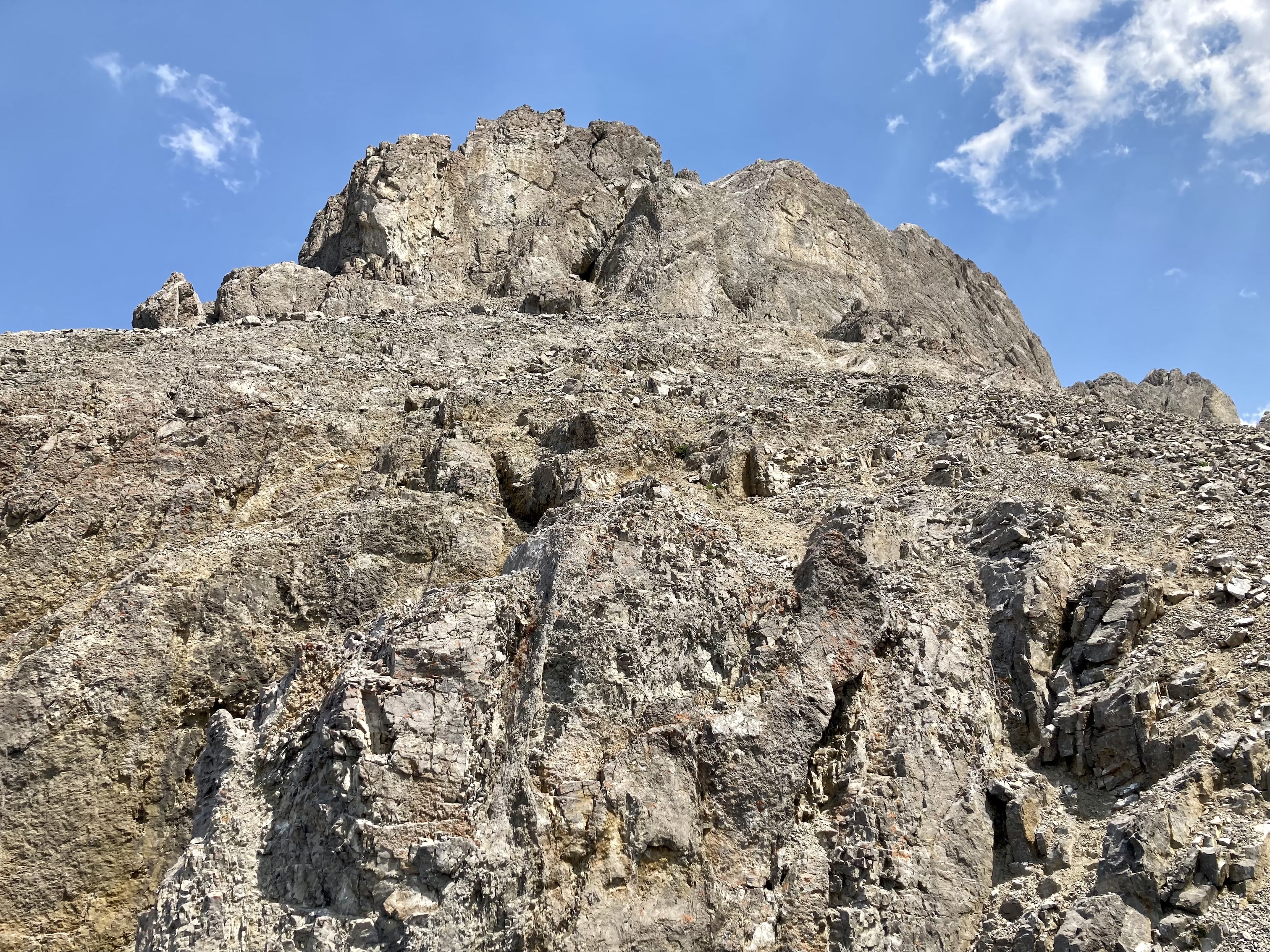
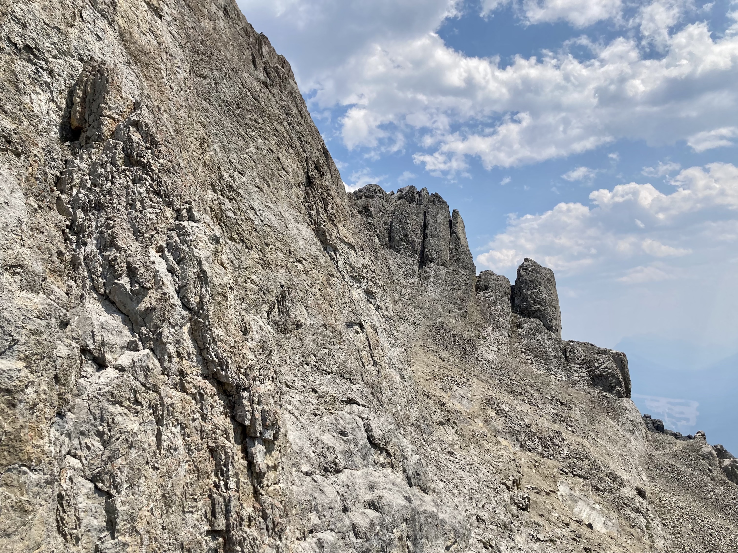
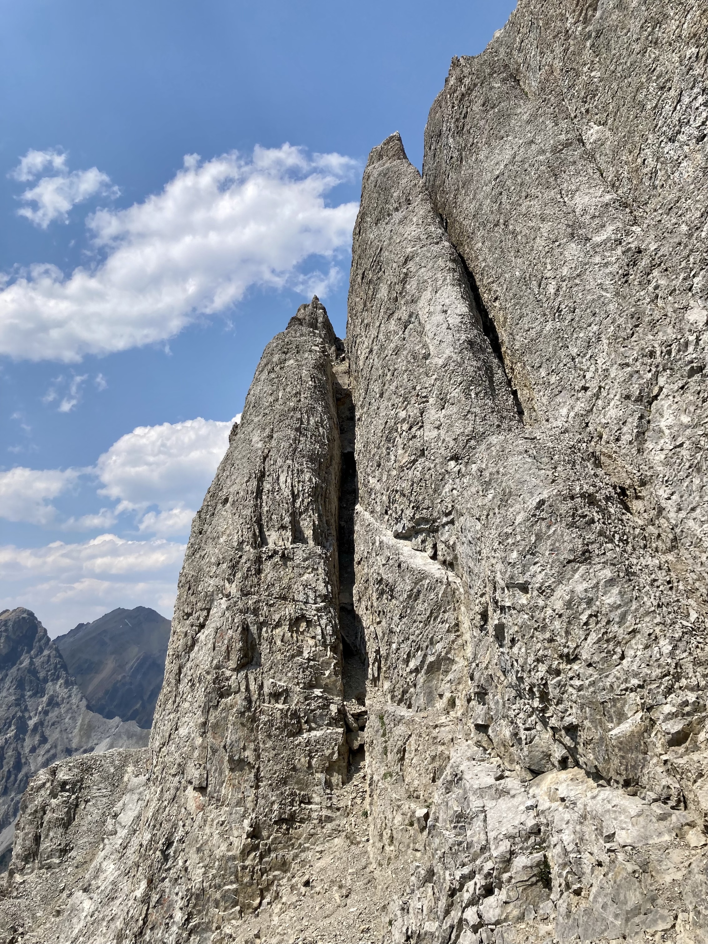
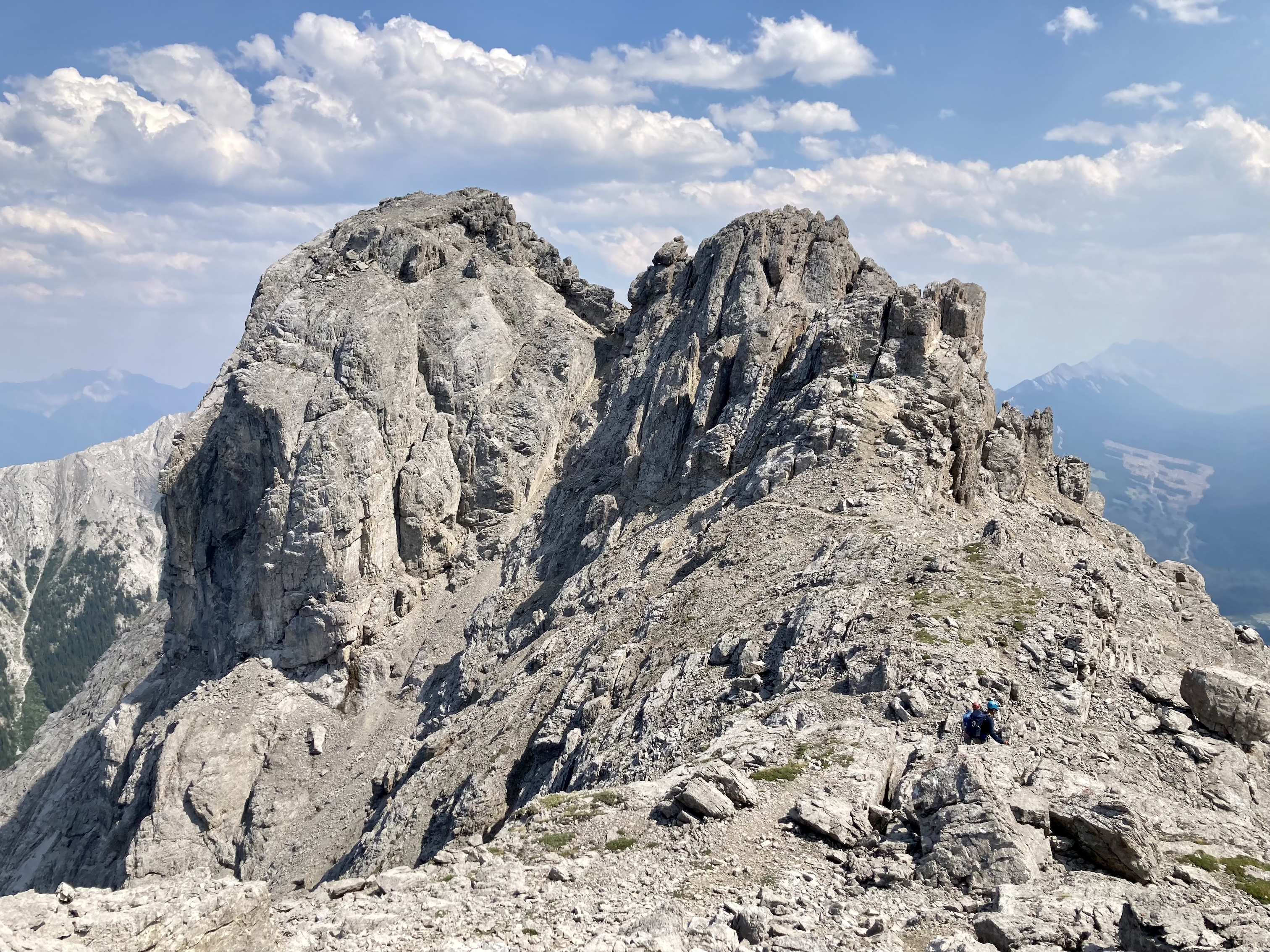
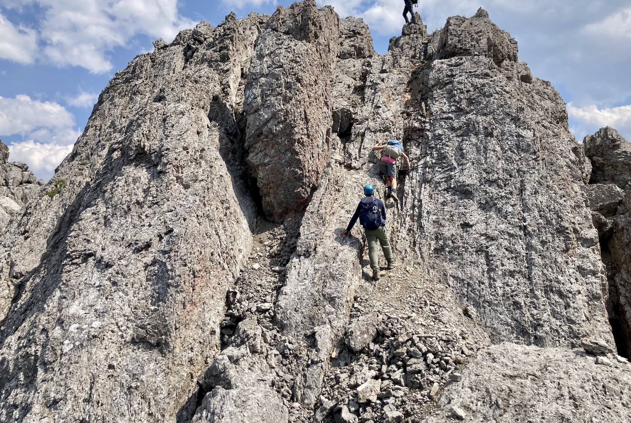
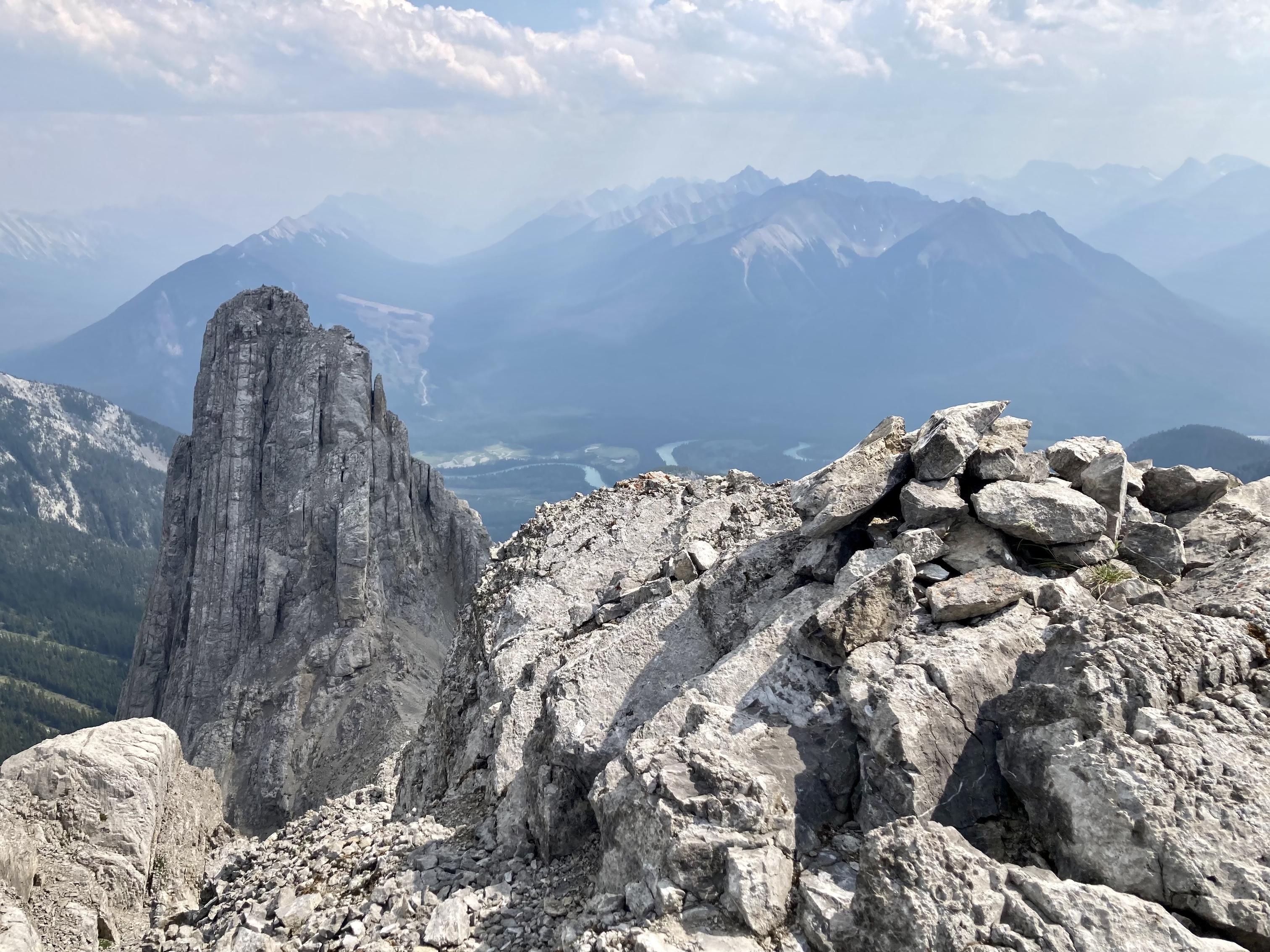
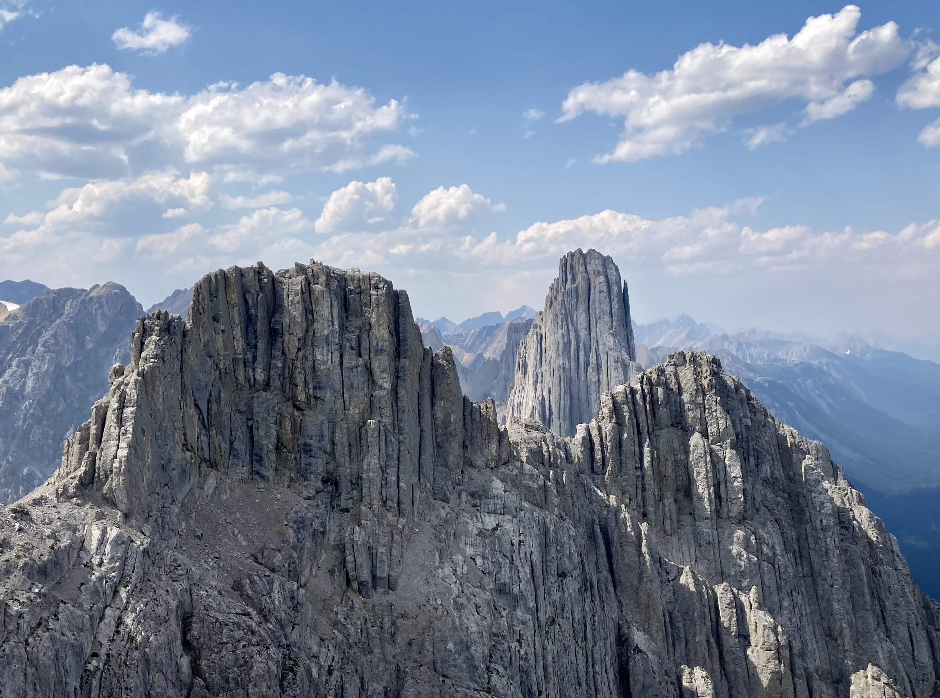
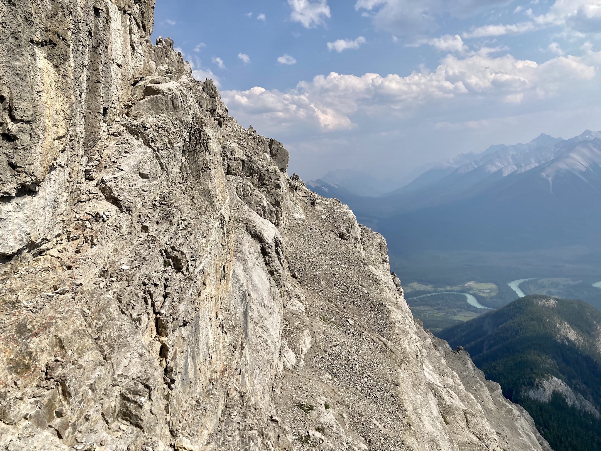
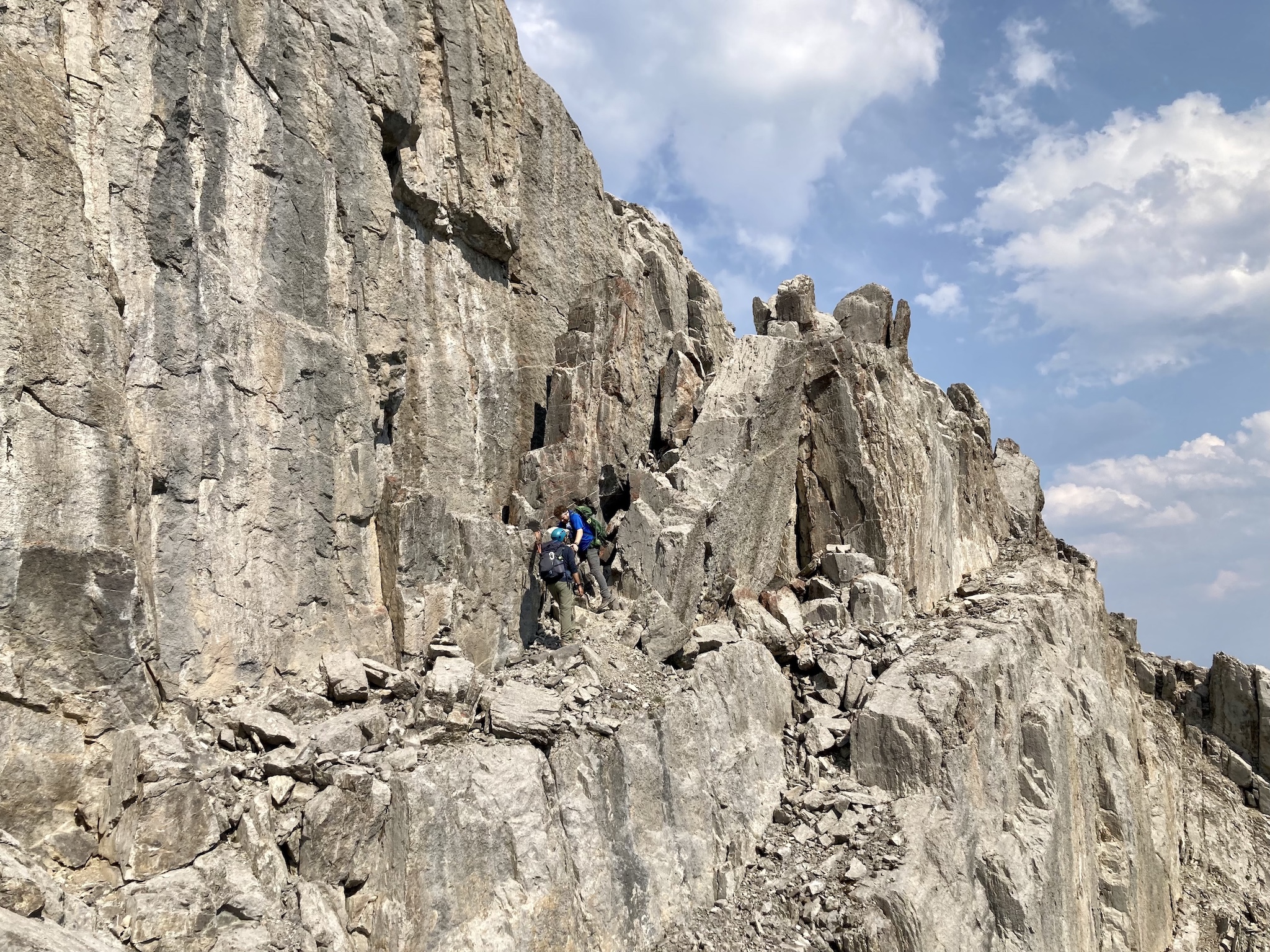
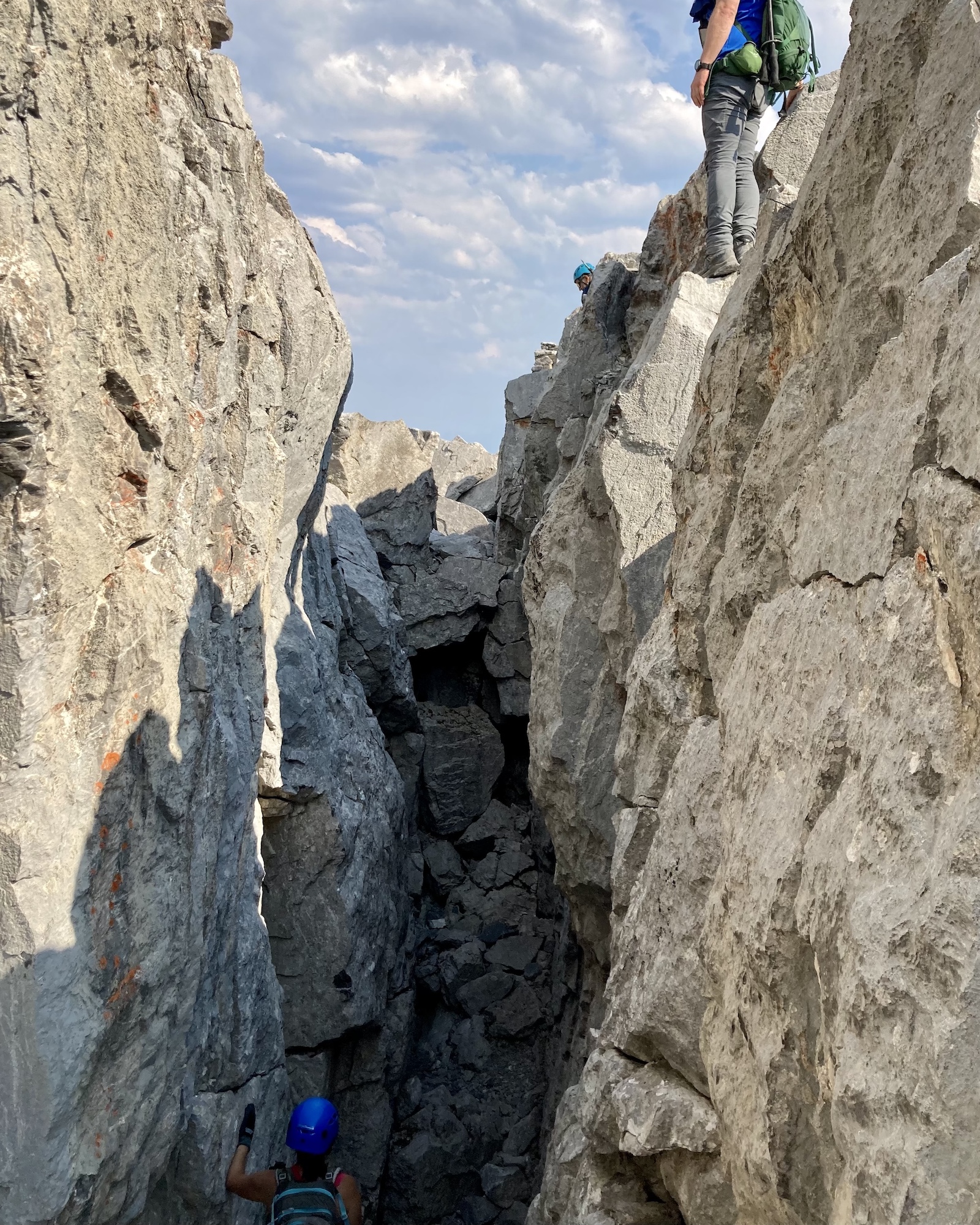
From there we started the scramble. We went directly up the ridge to the cliff bands below the north summit. Breaching the cliffs were rock chimneys on the northwest and southern aspects. I went to the south aspect where we found the twin chimneys that I’d seen on many trip reports. Since we’d be returning the same way I ditched my poles and pack here to make maneuvering through the narrow cracks easier. At the top of the chimney I turned right and scrambled some moderate terrain to the top. Here we found what Kane describes as a “notch” – a narrow rocky chasm that can be jumped over or circumvented. Jumping was quite popular among the group members. I could just imagine myself twisting an ankle or something so I just went around.
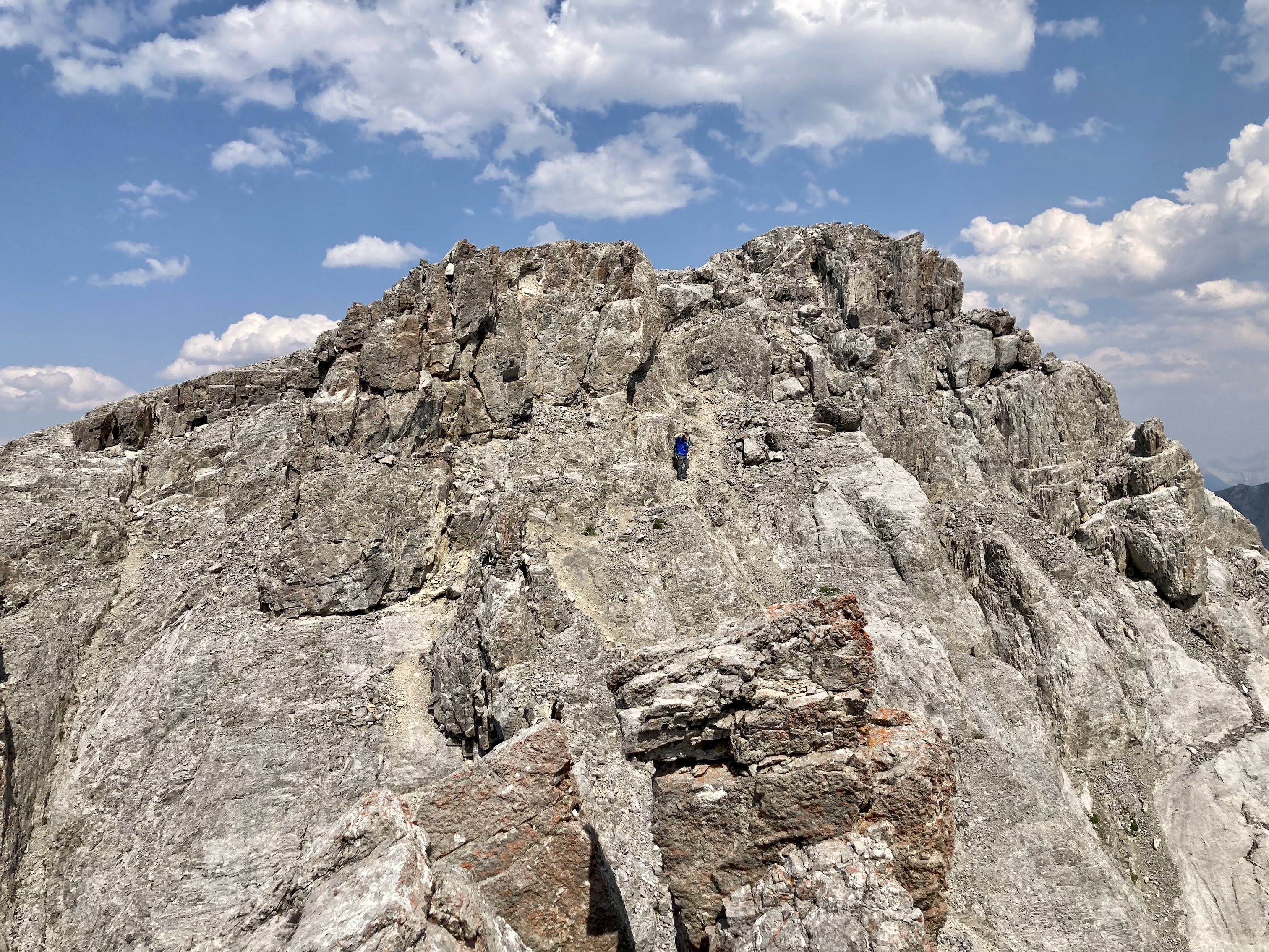
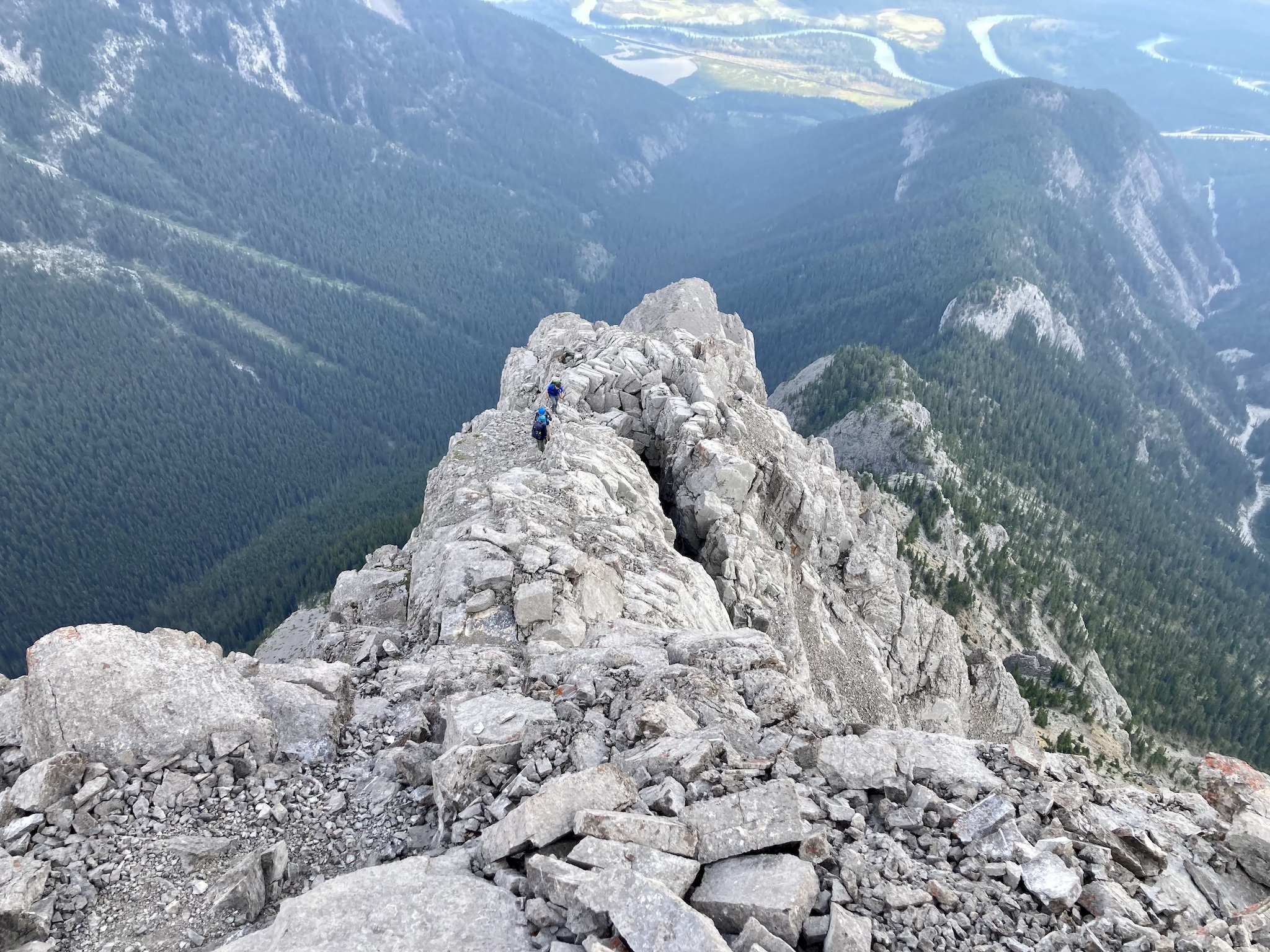
After time spent admiring the view, particularly of Mount Louis to the north, we descended back down the chimneys and traversed around western side of the northern summit to a connecting ridge heading towards the central summit. Some moderate scrambling took us up the first rocky pitch and eventually brought us to the top of a steep southeast facing gully pointing toward the south summit. We stayed left and ascended another bit of moderate rock to reach the central summit.
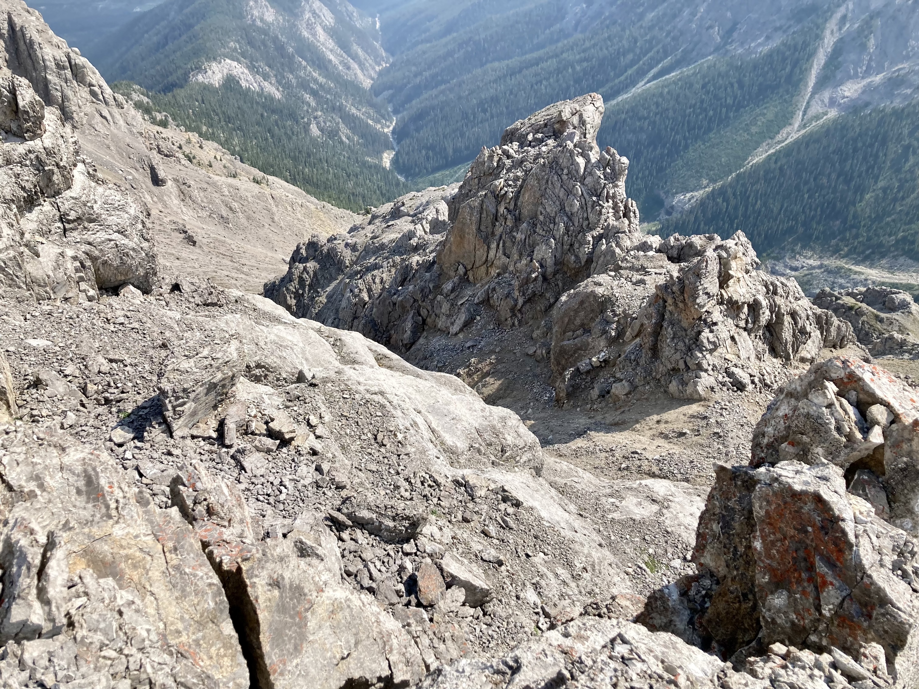
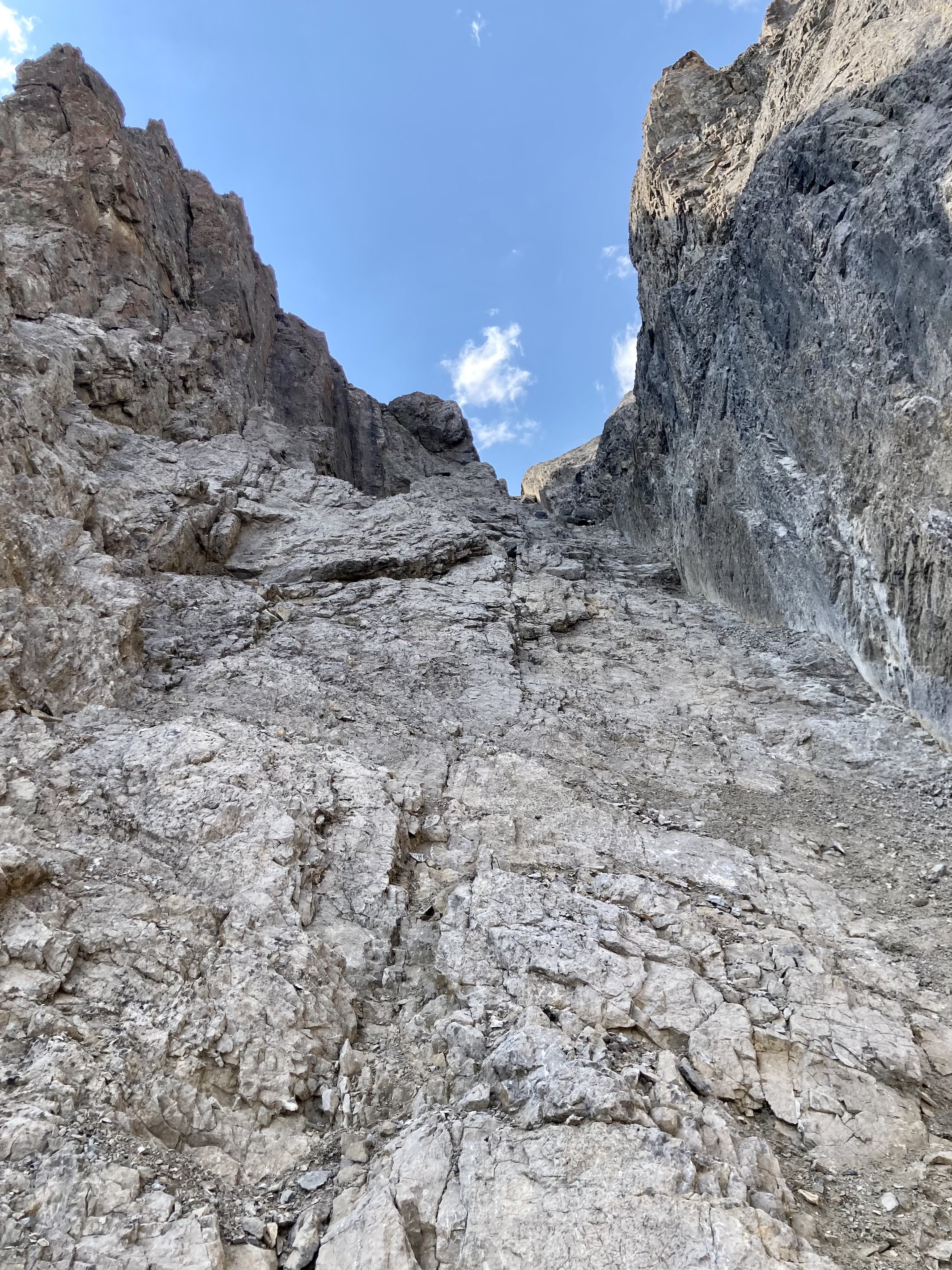
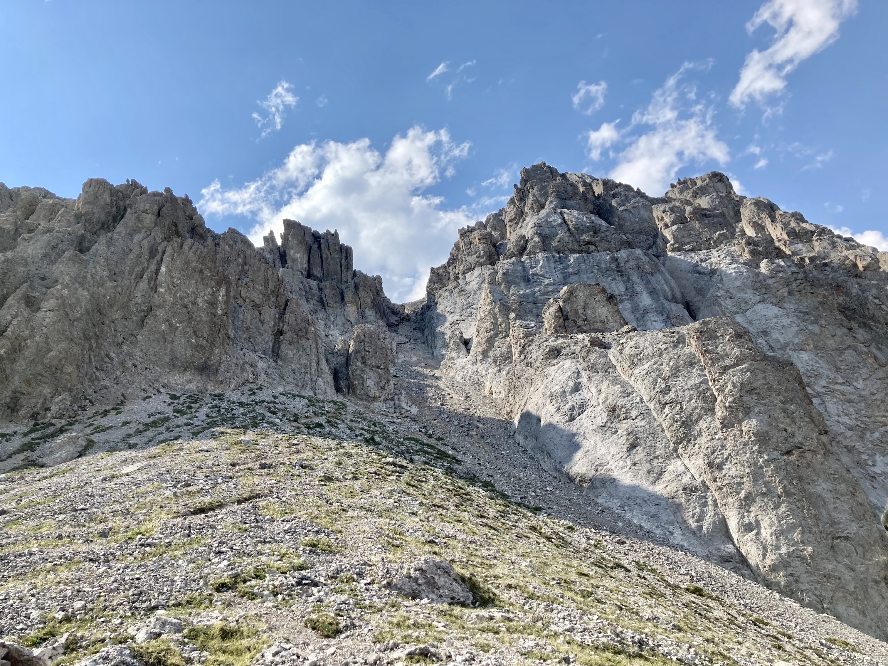
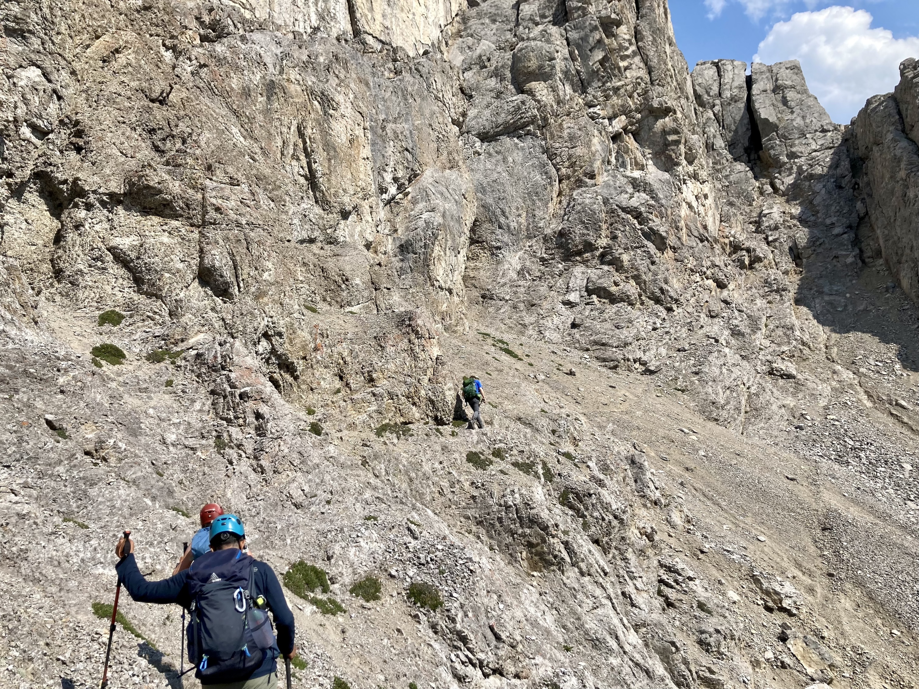
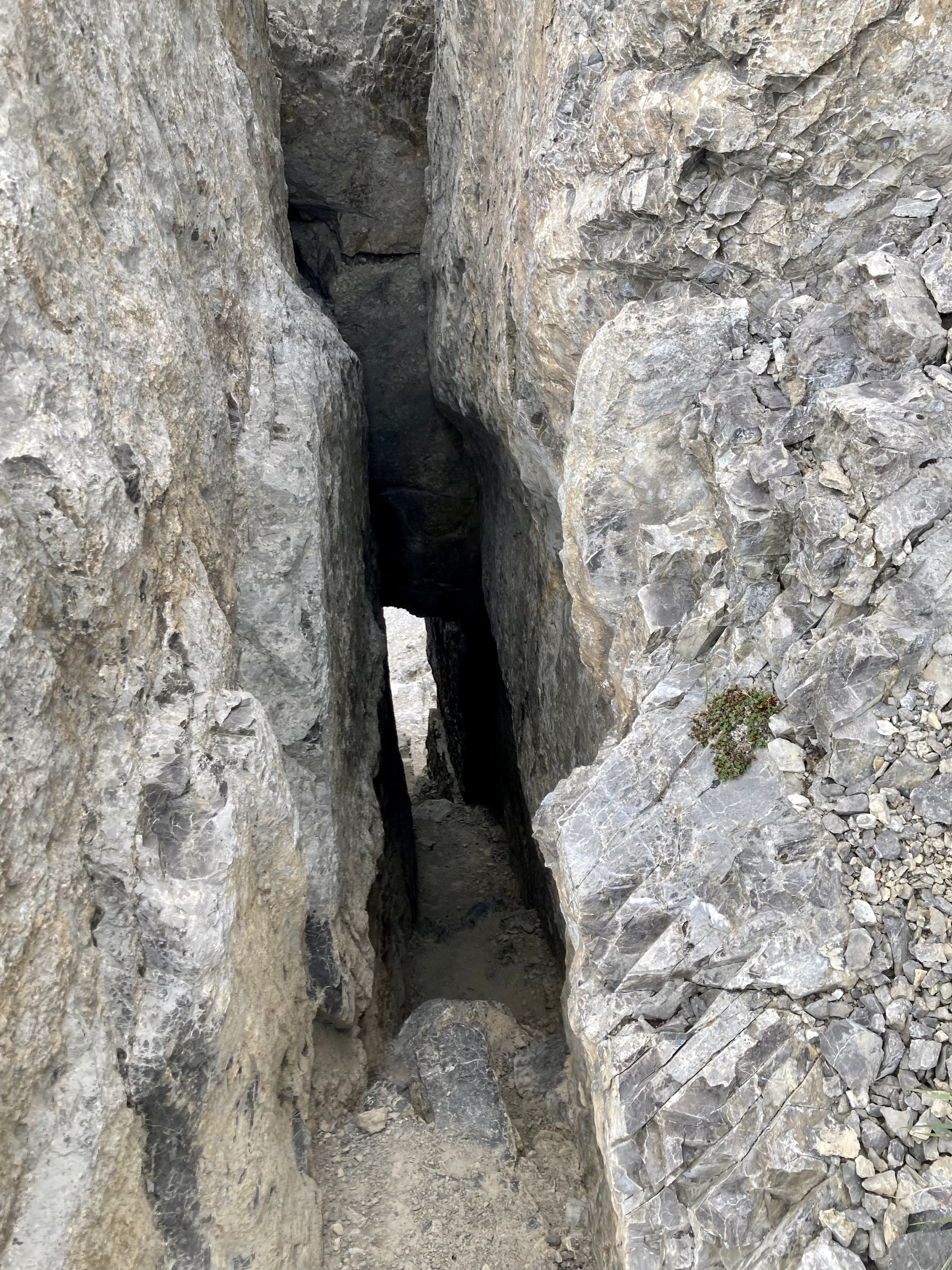
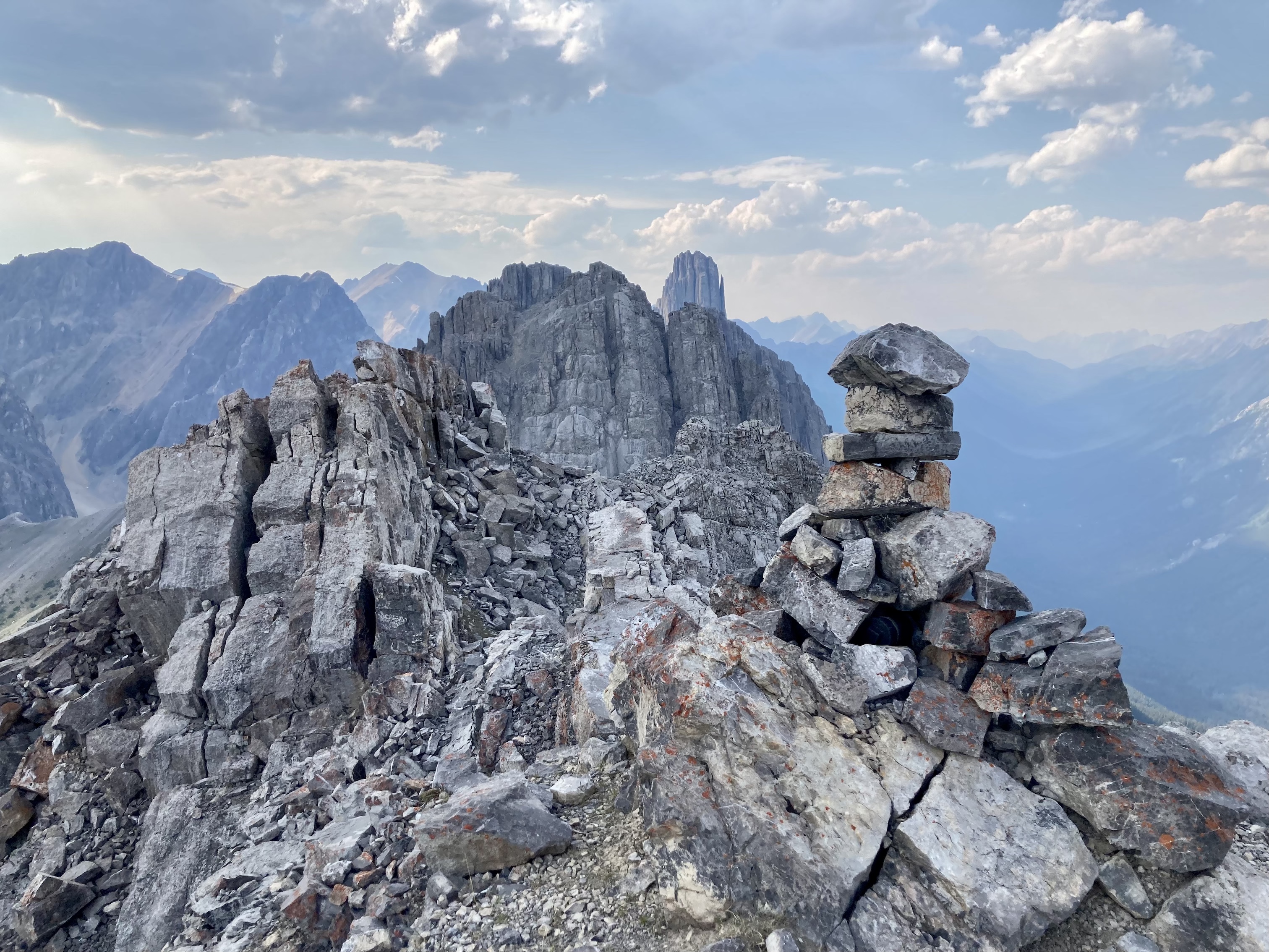
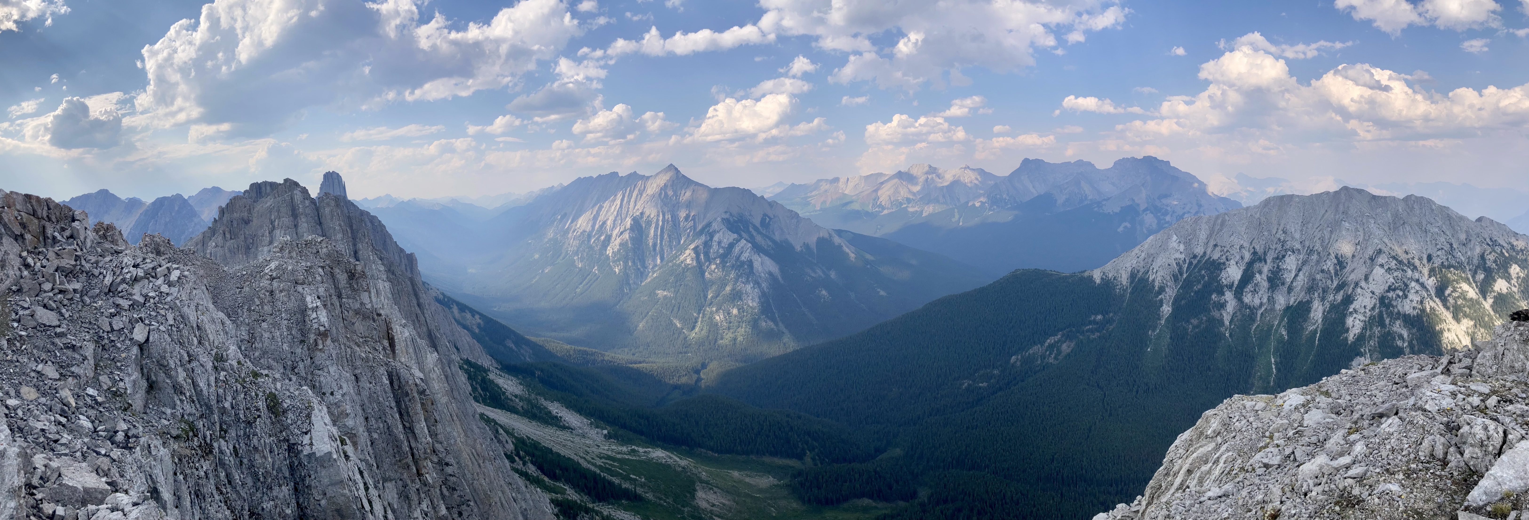
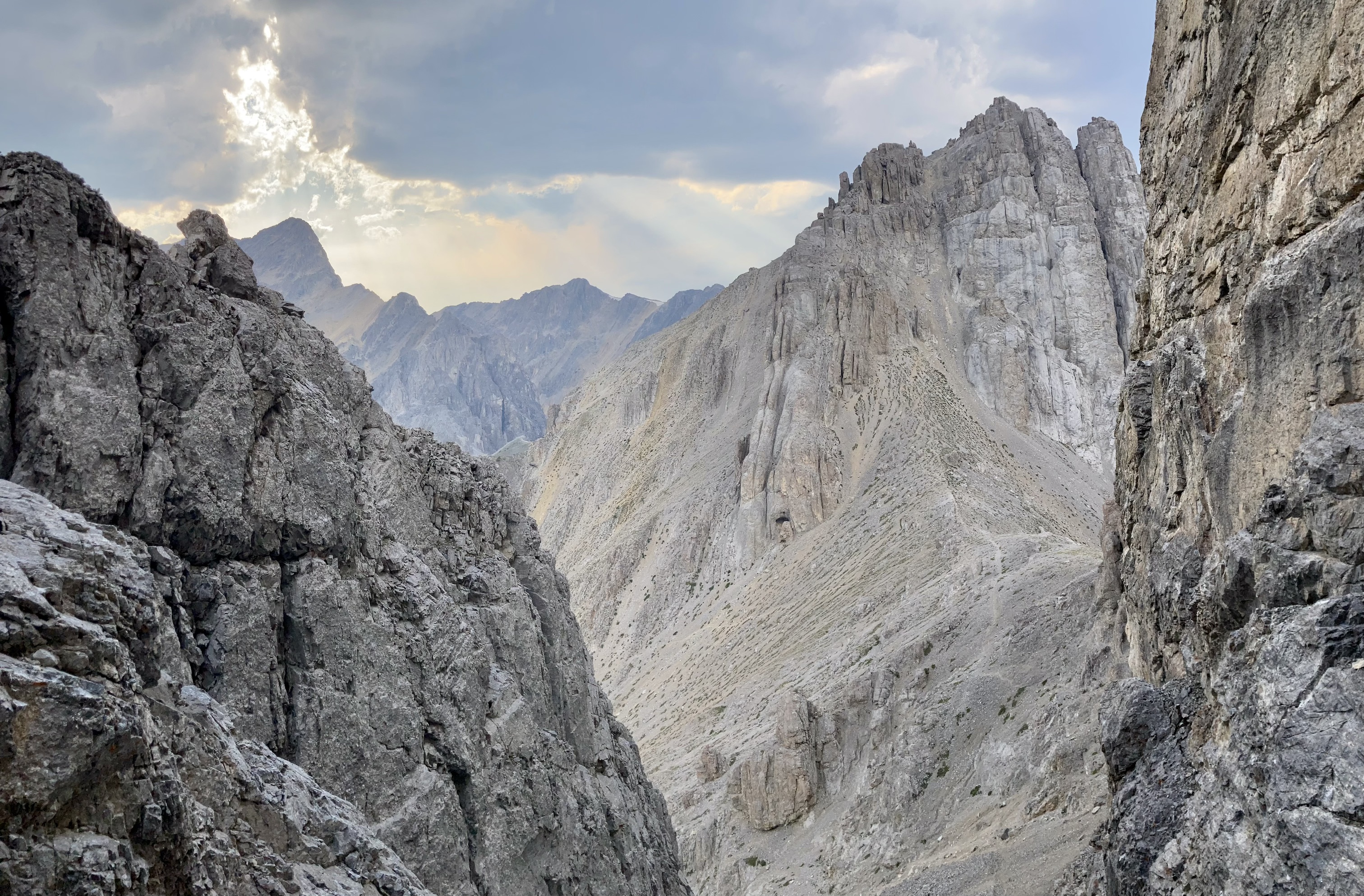
We then retraced our steps to the top of the gully and very carefully descended. This was potentially the most dangerous part of the trip because of the steep terrain and abundant loose rock. It was best to stay generally to the right. The bottom of the gully brought us out at the col connecting the central and southern summits. We ascended towards a broad gully below a tunnel or keyhole through the rock. Once through the tunnel, we were on the western aspect of the cliffs below the south summit. From here we proceeded south. Numerous cairns were present which helped guide us as we generally traversed and ascended. There’s clearly more than one way to go here, based on the scattered cairns. We then reached and ascended over rock “flakes” – giant flat slabs of strata tilting away from the main part of the mountain. The final obstacle beyond there was either a climb into and out of a small rocky fissure or an exposed walk along the top of the wall adjacent to the fissure. I went through the fissure, and there was a bit of tricky scrambling coming out the other end because of some overhanging rock. After that we were on the south ridge and we climbed to the summit. Smoke from BC wildfires made for hazy views, but the rocky terrain of the mountain itself and the chance too look back along the line of summits we had visited made for some great pictures.
To descend, we returned to the col between the centre and south summits and descended to the Cory Pass trail. There were visible trails to follow which first go right, then left around an outcrop. Below that level the route went straight down a gully before deviating right again to avoid some cliffs. A cairn marked the spot to begin deviating.
In getting ready for this trip, I found that Harlan Fox’s video on YouTube was especially helpful. It featured lots of useful information and no (for want of a better term) posing. Thanks, Harlan!
Click on the pictures in the gallery below to access full-resolution images.
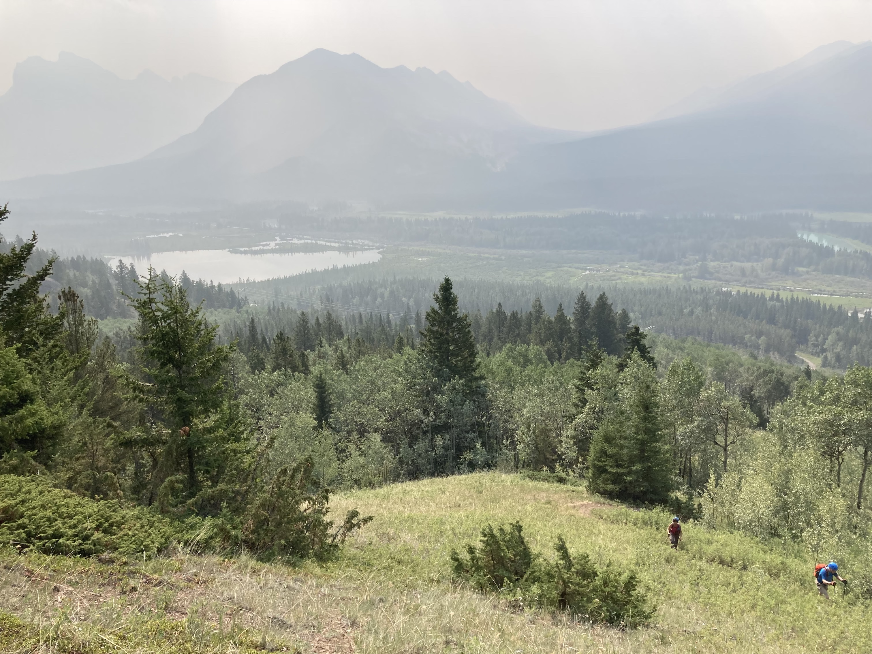
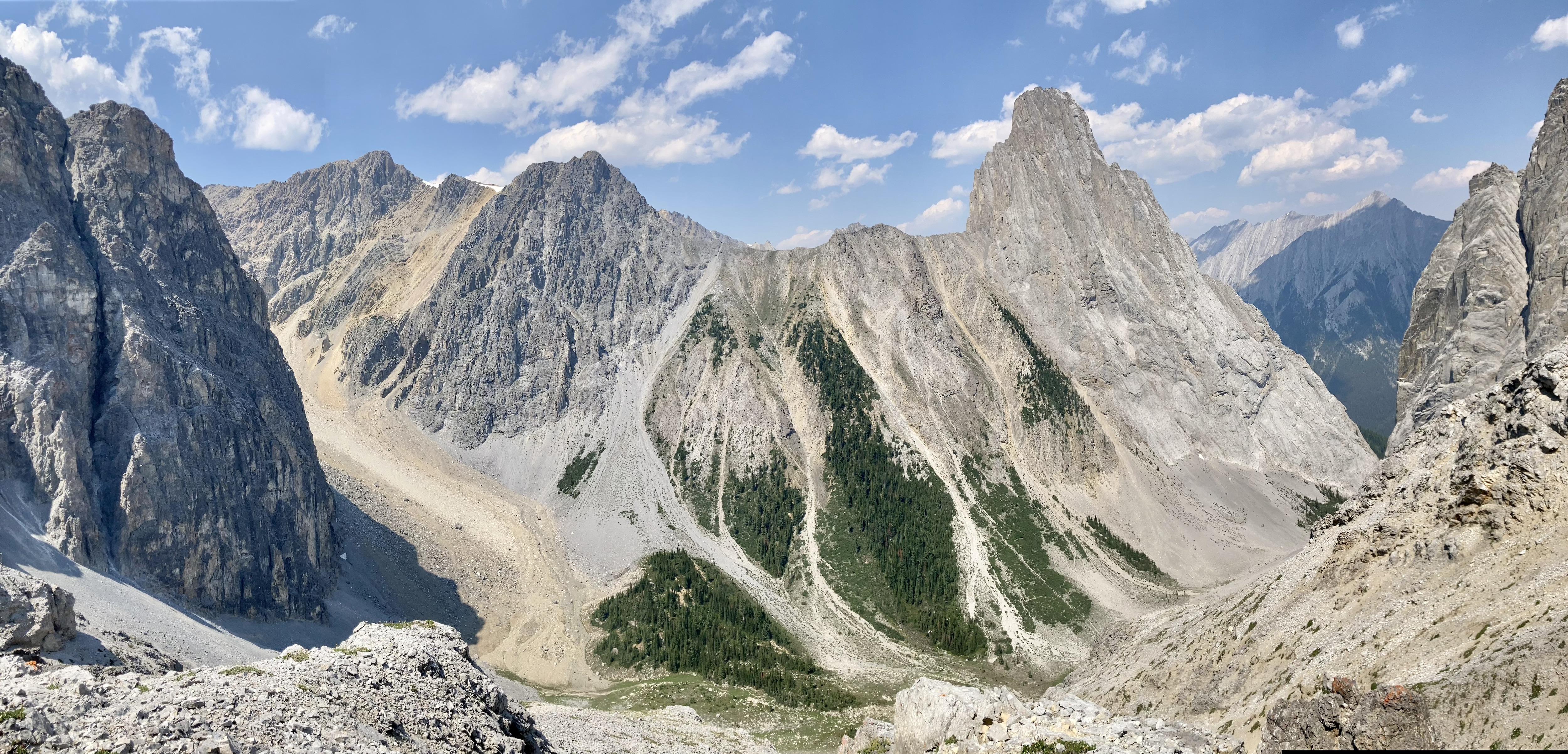
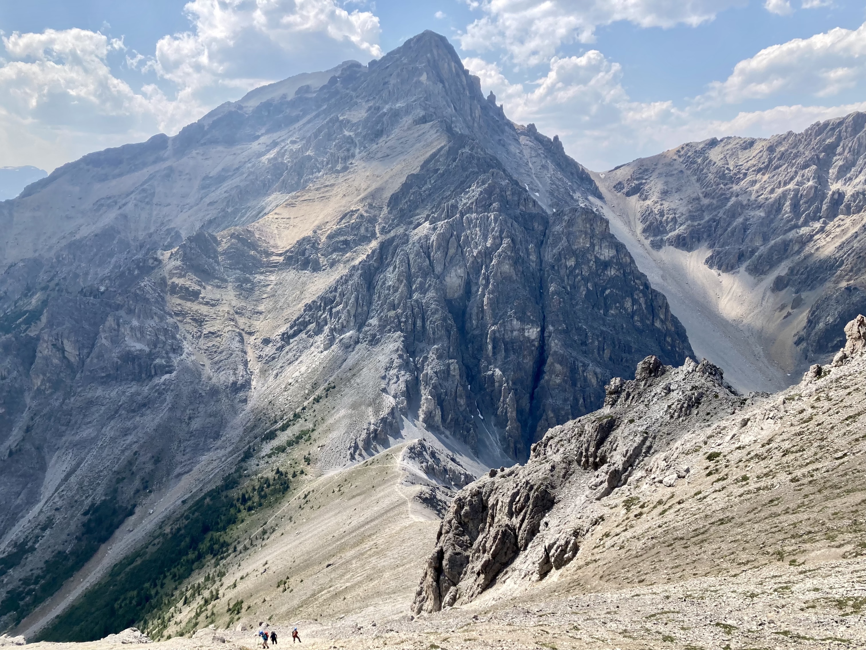
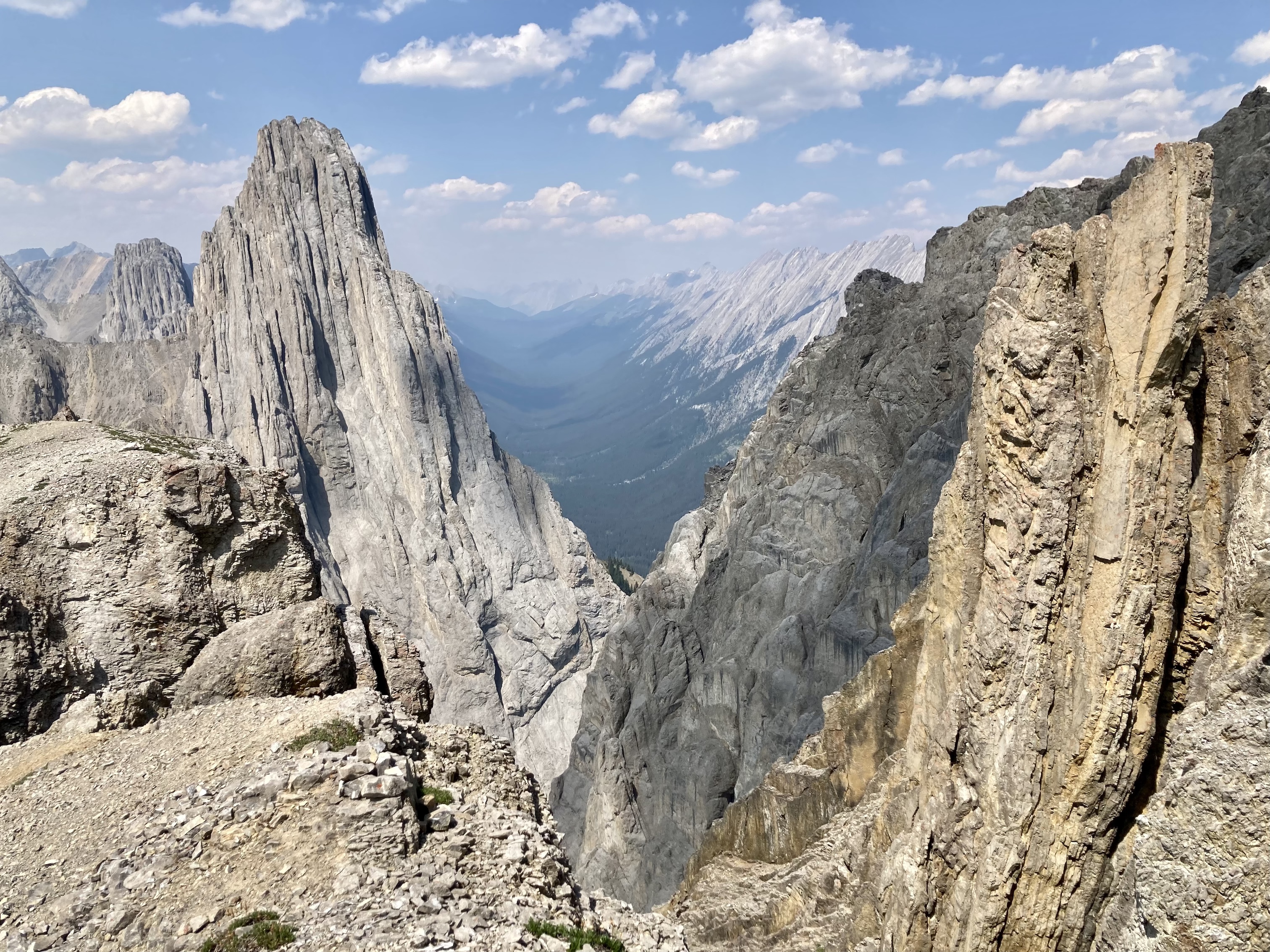
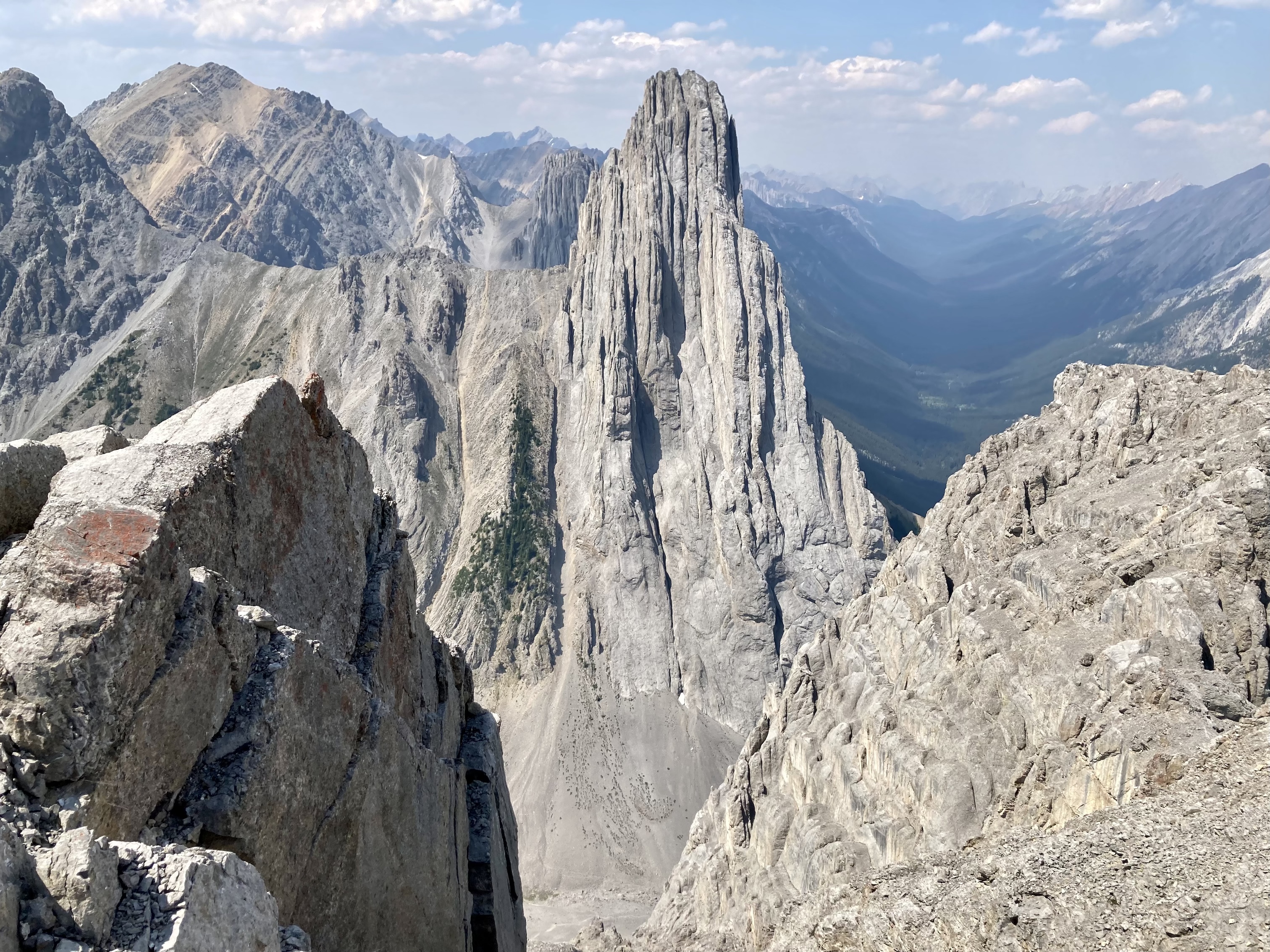
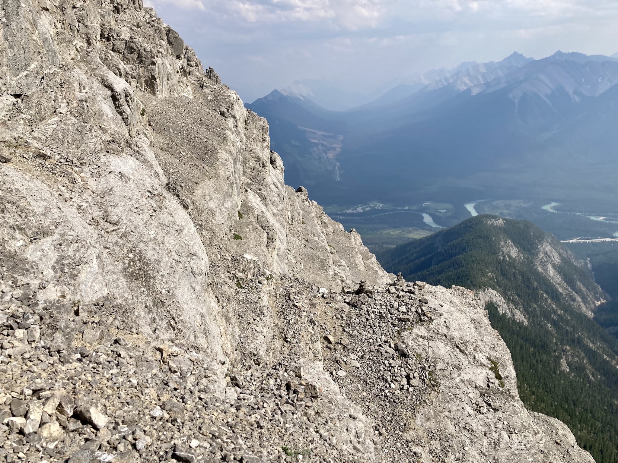
Route overview looking north.A closer look at the scrambling portion. Mount Edith’s 3 summits are labelled.Conditions were quite smoky through the day. This is the view after a bit of climbing along the Cory Pass trail. The initial ascent was a bit of a slog in smoke, heat, and mosquitoes.Once the trail reached the top of the long approach ridge we got a good look at Mount Edith.On the ridge top, the Cory Pass Trail actually features a section of exposed rock for some warm-up scrambling – upwards here with a down climb a short distance beyond.The first good look at Cory Pass. The trail can be seen traversing along through lightly treed slopes towards the pass.Mount CoryLooking up as we pass beneath Mount Edith’s south summit – this would the final one we ascended.Cory Pass. From here we turned right and ascended the ridge towards Mount Edith’s north summit.Mount Louis across the valley to the north.Looking up along the ridge to the northern summit. The way is well-travelled so there’s a very obvious trail.Looking back down at Cory Pass.Peeking over an abrupt drop-off to the north. Mount Louis in the background.Looking up at the cliffs below the first summit. The northwest facing chimney is up there near the top centre. I went around to the right to the twin south facing chimneys.Coming around the bend. The chimneys in front are not the ones we’re looking for -they’re just around the corner to the left. The trail carrying on to the centre summit is visible at the lower right.The south facing chimneys. I went up the one on the left and down the one on the right (it comes all the way down, it just isn’t apparent because of intervening rock). I left my poles and pack down here. Near the top there was a bit of exposure to the left but nothing crazy. Above the chimneys we headed right and to the summit.The “notch”. It really isn’t that wide. It’s mainly intimidating because you are not just jumping across, you’re also jumping down. It’s fairly easily bypassed by down climbing a bit and traversing to the left. I bypassed it because I was imagining how stupid it would be to twist an ankle or something jumping across this thing. Mine was the minority opinion, though. Most of the party very easily jumped across. Coming back across this you don’t jump, since you’re going upwards. It just involves an easy climbing move.The northern summit of Mount Edith.Mount Louis to the north.After descending the chimney and picking up our gear, we carried on and traversed around the west side of north summit. There was a brief descent on straightforward terrain then we carried on to the col. There appeared to be a path heading left from the ridge but we ignored that and climbed straight ahead.Looking back at the northern summit. The “notch” is visible from here as a V of blue sky interrupting the upper contour of the rock.The first part of the ascent to the centre summit.The second portion of the ascent to the centre summit. Our team leader was out ahead, snapping pictures of us.Looking down from partway up the second part of the ascent. We skirted past the top of the steep gully near the centre of the frame. We would return to it when we made our way to the col between the centre and south summits.Looking south and getting a good look at the south summit.Mount Edith’s centre summit cairn. You can actually barely make out the cairn on the south summit in this picture.Me on the centre summit, with a goofy look on my face and a goofy tilt to my helmet.Looking back at the north summit and Mount Louis.We climbed back down to the gully and descended. This was potentially the most dangerous part of the trip because of the steepness and potential for rockfall.Looking back up the gully. This was one of those moments where you ask yourself, “Did I really just climb down that?” The perspective actually makes it seem worse than it was. The terrain was not insanely steep, it was merely very steep.Looking back at the gully from the col. The last picture was taken from the bottom of the slabby terrain near the middle of the visible portion of the gully. The pitch eases and becomes a little friendlier below that.Looking at the southern summit from the col. The visible trail heads to the rectangular gully to the right of centre. The entrance to the tunnel is visible. Approaching it was best done by sticking to the left wall of the gully.In the gully below the tunnel.Looking up through the tunnel. It isn’t really a tunnel – some people describe it as a “keyhole”. It looks like a chimney with rock slabs laying over the top.Looking back down after climbing through the keyhole.Twin cairns sit nearby the exit to the keyhole. These are very useful in navigating back here. They also encourage you to not climb up immediately, but rather start traversing first. Kane makes a point of saying it’s best to work your way around to the right before gaining elevation.On the ledges, following the cairns.The rock flakes. It was pretty easy to just climb through the middle them.The final bit of difficulty before the final ascent was this area. One can either walk along the top of the “wall” to the right or climb through the fissure. There was more exposure than I was happy with on the top of the wall so I went through the fissure. There’s a bit of overhang in the rocks at the far side, which made scrambling up and down a bit tricky.Up and out of the fissure, looking back after ascending the south ridge part way to the summit.The last bit of climbing up the south ridge.The south summit of Mount Edith.Summit panorama looking north to east. The smoke was a little less dense in this direction. Mount Louis is in the distance to the left. Mount Brewster is just left of centre. Right of centre are Cascade Mountain and Mount Norquay.On the descent, emerging from the keyhole. We made our way back to the col then descended down the slopes to the left to re-join the Cory Pass trail.