May 25, 2024. A sunset hike to spectacular viewpoints on the South Kaibab Trail.
- Region: Grand Canyon National Park. Traditional territory of the Pueblo, Hopi, Navajo, Southern Paiute, Havasupai and Hualapai peoples.
- Distance: 5.5 km round-trip
- Total Ascent: 430 m
- Total Time: 1h 55m
- Safety and Disclaimer

The day after our successful rim-to-rim crossing of Grand Canyon we spent most of our day getting back to our car on the North Rim and driving it back to the South Rim. We left at 8AM on a shuttle for the 4 1/2 hour drive. The reason it takes so long to drive to the North Rim is because the nearest automobile bridge over the Colorado River is far to the northeast of Grand Canyon Village at Marble Canyon. Here, the famous Navajo Bridge spans the Colorado River at a place where the canyon is relatively narrow.


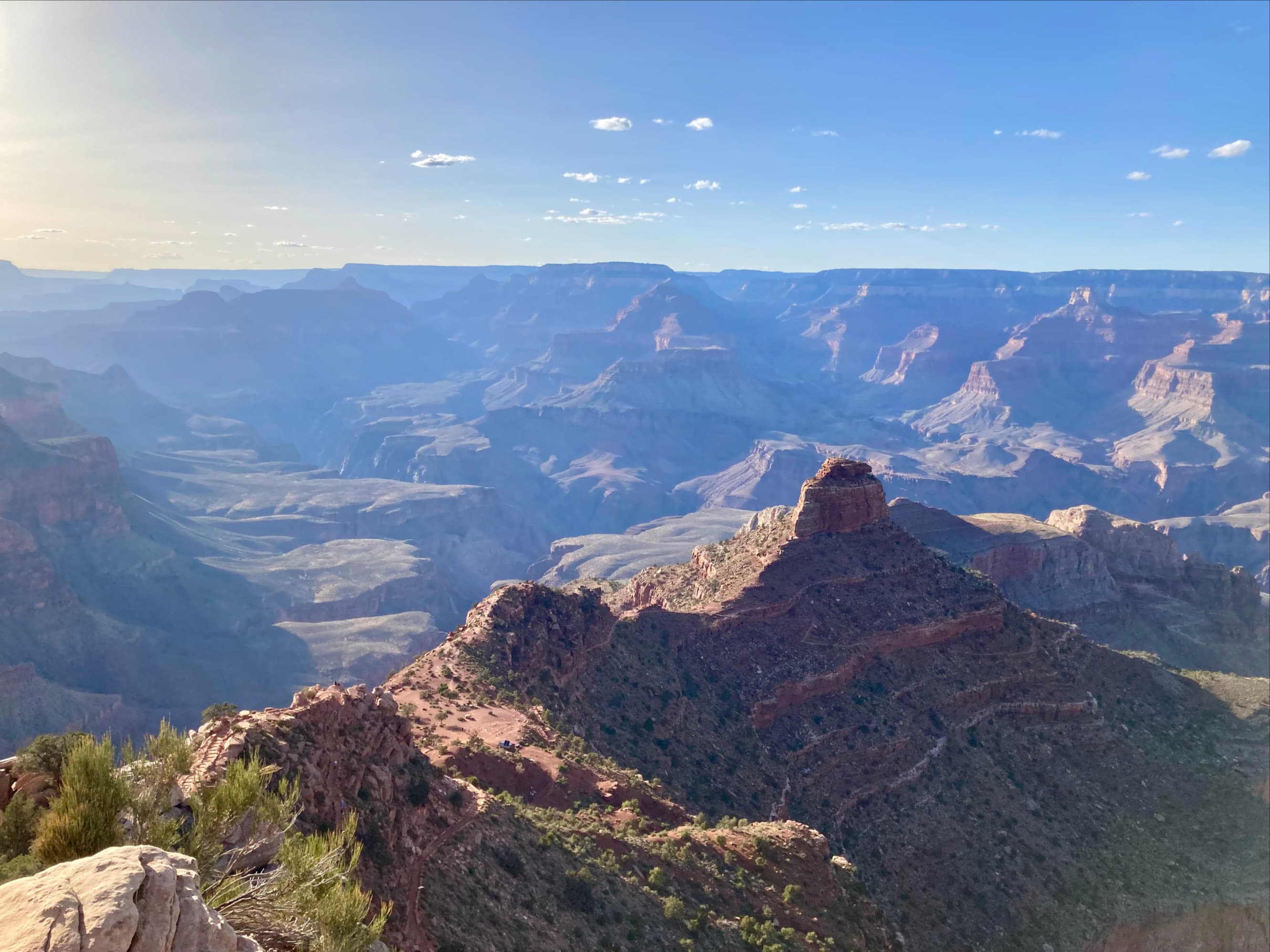
It was early evening by the time we got back to Grand Canyon Village on the South Rim, and the timing was perfect for a sunset hike down South Kaibab Trail. Like Bright Angel Trail, which we’d ascended the day before, South Kaibab goes all the way down to the Colorado River. It’s steeper than Bright Angel, though, and being a few kilometres east of Bright Angel it affords different views. As an objective for our sunset hike we were originally planning to go down to Skeleton Point which is roughly 7 km and 700 m descent along the trail. During the hike it became clear that we didn’t have enough time to make it to Skeleton Point and back, so we decided to hike down to distinctive O’Neill Butte instead. This is just past Cedar Ridge, an objective which the National Parks Service recommends for a short hike.
Access to the South Kaibab trailhead is via the free shuttle service that runs in Grand Canyon National Park. There’s a parking lot but I believe the only people allowed to use it are those with camping permits down in Bright Angel Campground.

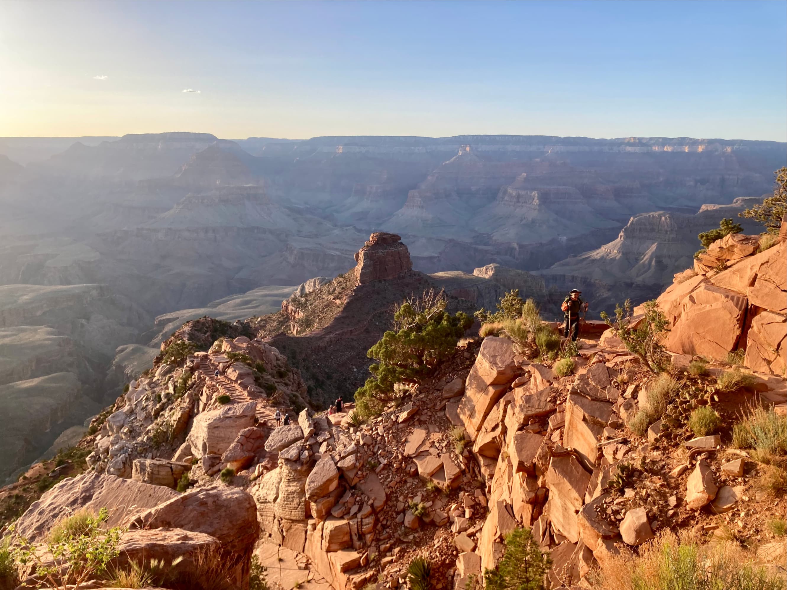
The trail has a steep pitch in places but is wide and very well built. It flings you into the midst of expansive views almost immediately. Just 1.5 km down the trail, after 230 m descent, we reached Ooh Aah Point. Yes, that’s its real name.


We departed Ooh Aah Point and continued our descent. The next milestone was Cedar Ridge. This is a flat clearing on the ridge line leading down towards O’Neill Butte. We found a hitching post for mules there and toilet facilities. Given how large and flat the area is it was clearly created at the time the trail was built.


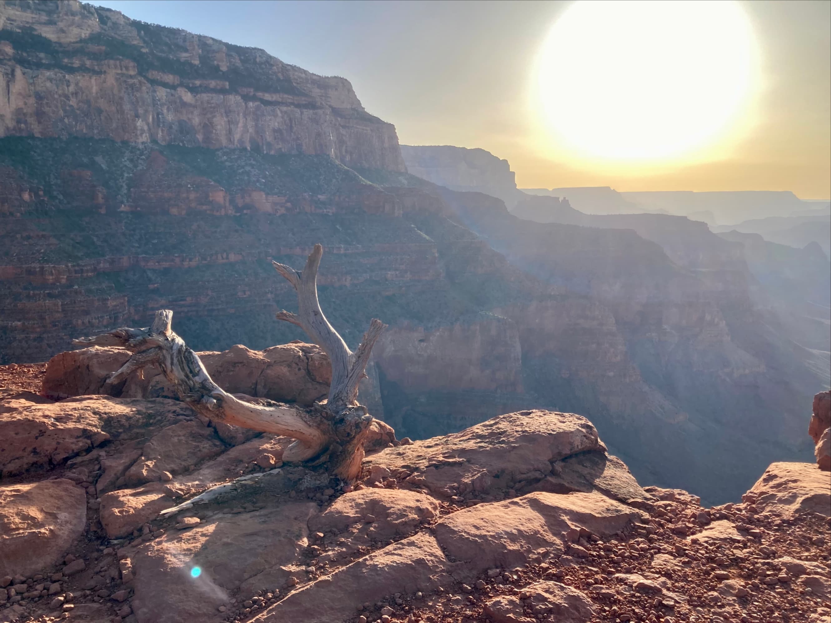
Around here is where we realized we’d have to modify our plans if we didn’t want to ascend in the dark and (more concerning) miss the last shuttle bus. Skeleton Point was actually visible beyond O’Neill Butte, giving the impression of a quick final leg to our hike – but stories abound about how Grand Canyon distorts perceptions of distance. We decided to descend a little further to check out O’Neill Butte then head back up.


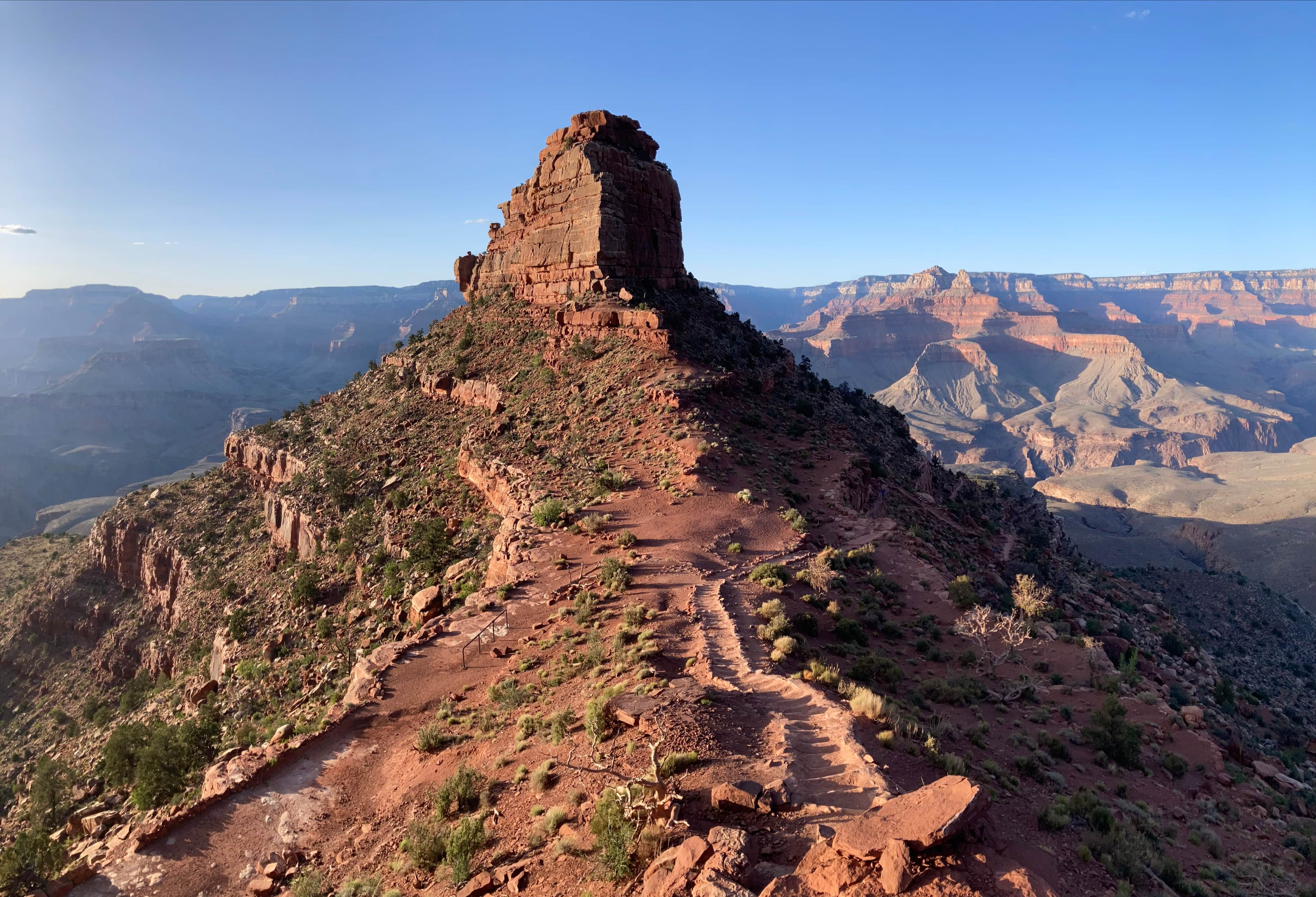


After enjoying the views for a while we decided to ascend. It was steep but the excellent trail made for relatively easy going.


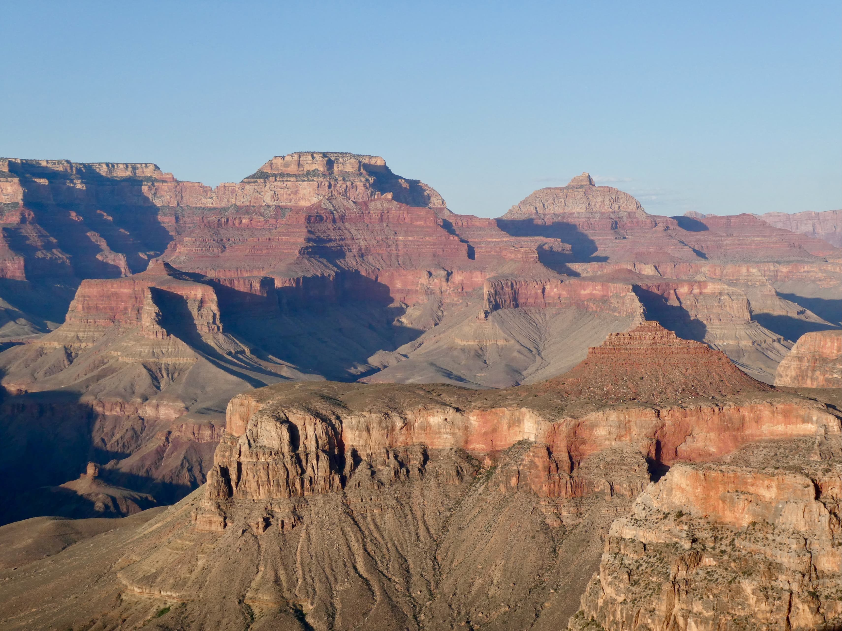
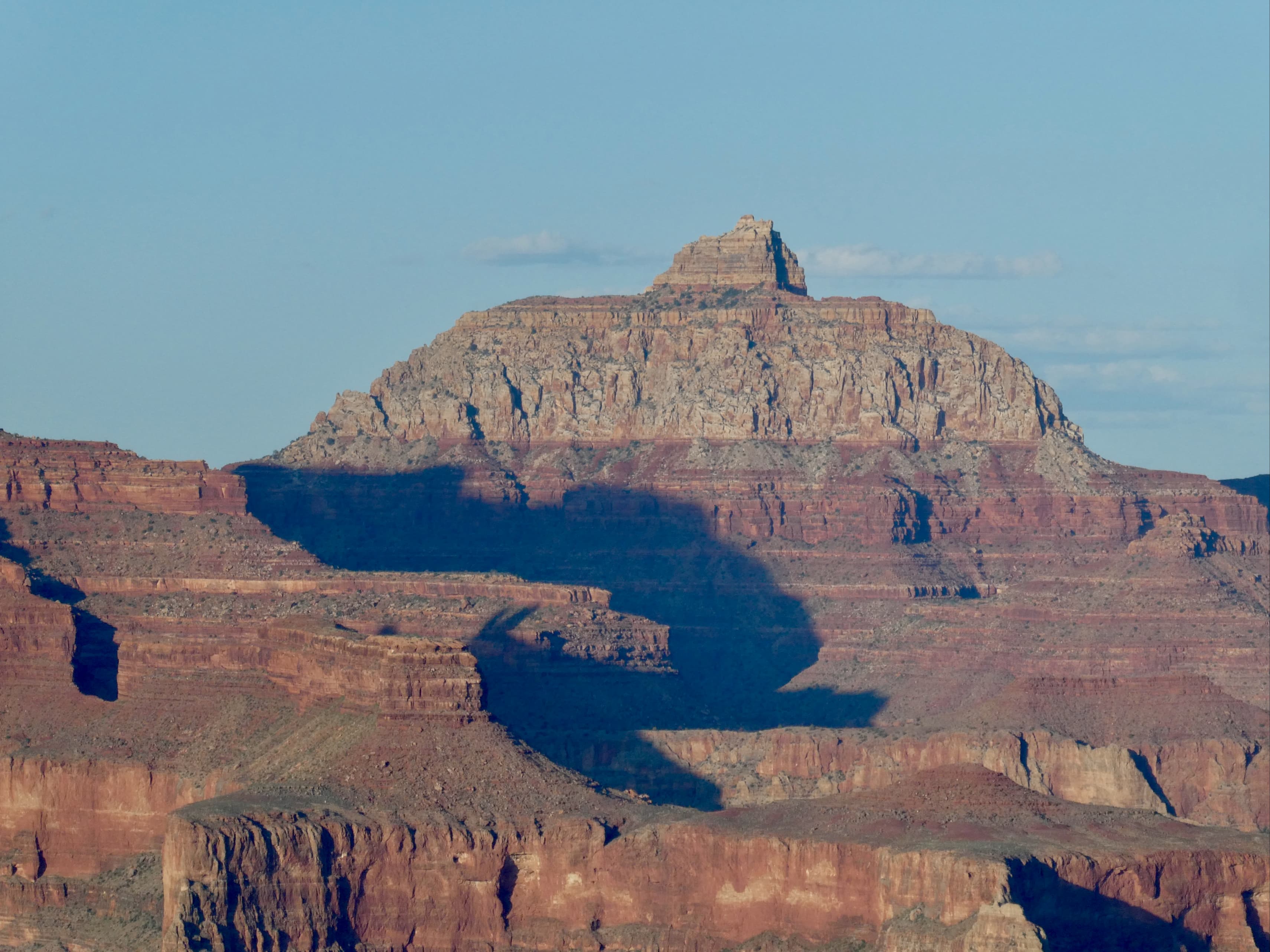
It turned out that our timing was nearly perfect. We got to the level of the rim just as the sun was reaching the horizon. Viewing the sunset across the vast expanse of Grand Canyon was unlike anything I’d experienced before. The usual shifts of light and colour on the horizon were accompanied by shifting shadows and silhouettes down in the canyon. It’s hard to imagine a better sunset hike.


I really like how you describe all the photos. We did this a few years ago but only rim to river to same rim.
LikeLike
Thanks, Lloyd!
LikeLike
I think I said the same thing about the name Ooh Aah Point back when I visited haha! Now I wish I’d hiked beyond that point. Beautiful sunset photo!
LikeLike
Yeah, feels like they needed to workshop that one some more :). Thanks for reading!
LikeLiked by 1 person