September 16, 2023. A beautiful day on Waterton’s most famous trail.
- Region: Waterton Lakes National Park. Traditional territory of the Tsuu T’ina, Ktunaxa, and Blackfoot First Nations
- Distance: 17.4 km return
- Elevation Gain: 675 m
- Elevation of Objective: 1946 m
- Total Time: 7h 5m
- Safety and Disclaimer

Sooner or later, this blog was going to have a Crypt Lake post. I’ve hiked the Crypt Lake trail twice in the past, most recently just before I started writing this blog. The hike is a true gem, though, and I was bound to return to it again. Yesterday my wife and I joined some friends and we made our return to Waterton’s most famous hiking trail.
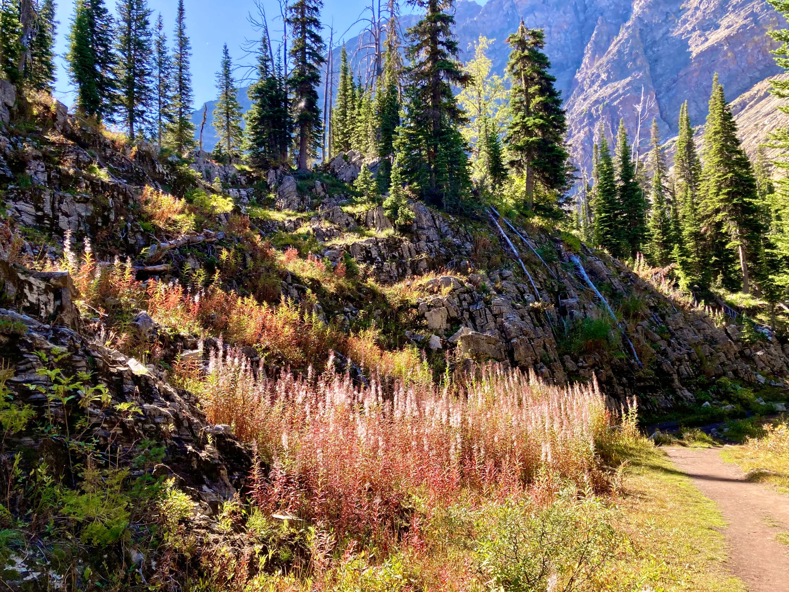
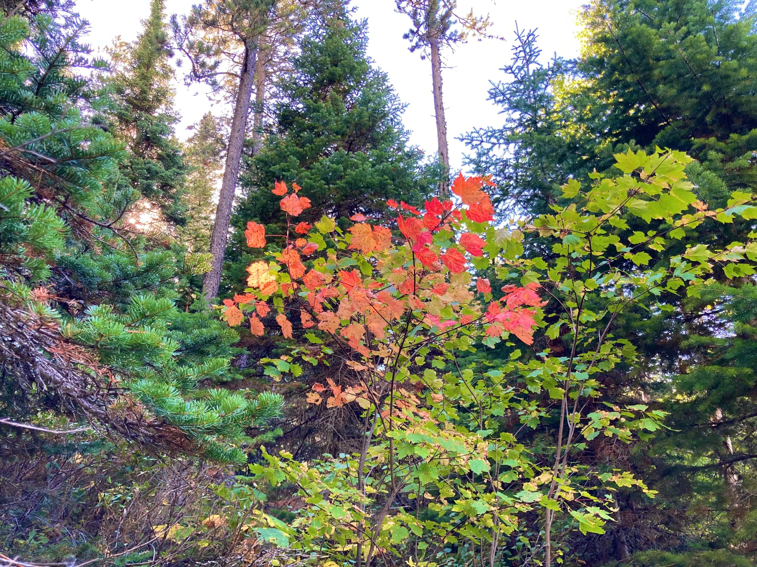
A journey to Crypt Lake involves following a very obvious and well-maintained hiking trail. It also involves sharing your day with many, many other hikers. The number of hikers could accurately be described as “boatloads”, since a boat trip is necessary in order to reach the trailhead (that’s not technically true – you could reach it by making a 14 km journey along the Wishbone trail – nobody does this). What attracts all of these hikers is a trail that ascends from the shores of Upper Waterton Lake, passes though forest that was untouched by the 2017 Kenow Fires, and travels up a long, secluded valley past waterfalls and a tarn before ascending to a narrow tunnel and a dramatic traverse above a 200 meter drop. The beautiful, hidden lake (hence the name “Crypt”) at the end is almost mundane compared to what comes before it.
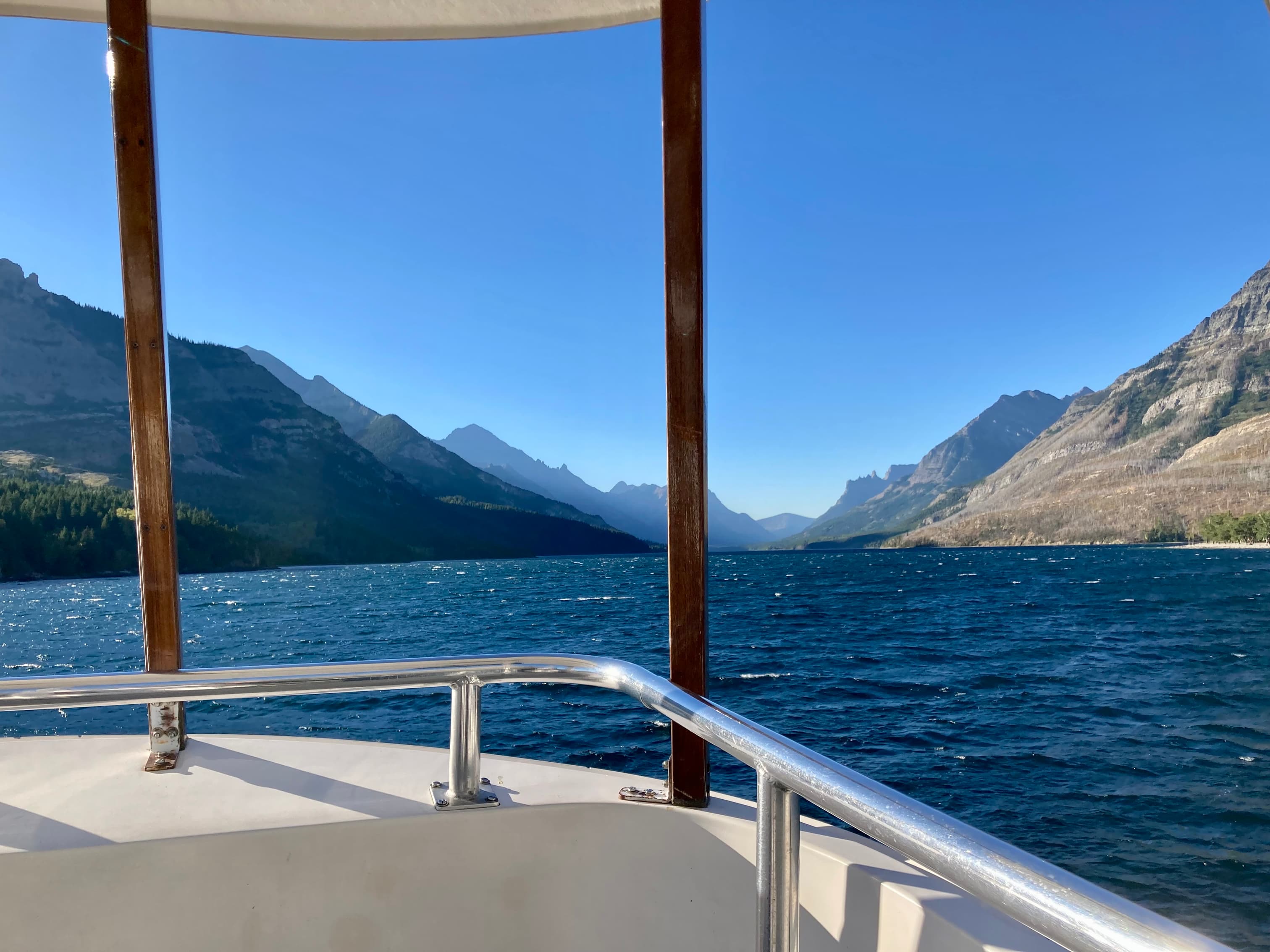
As mentioned, access to the trailhead is most often achieved by boat. Most hikers buy a ticket on the seasonal ferry that is run by the Waterton Shoreline Cruise Company. At the time of writing, online booking is not available, but they do post a schedule online. The lineup for tickets starts to form a half hour or so before the ticket office opens, so plan ahead for that. Also, if you don’t have a national park pass, you might find that there’s nobody manning the entry booths at the park entrance in the early morning, requiring you to wait until the park office in the middle of the townsite opens (at 8:30) so you can buy your day pass. Take this into account when planning your trip.
The ferry ride from the Waterton marina across the lake to the trailhead takes about 15 minutes. Once you’re off the boat, you join with your fellow passengers setting off on the trail. At first everyone is bunched together, but after a while various groups sort themselves by speed and things don’t feel too crowded. A few switchbacks bring you up into an elongated valley and from there the trail gently ascends along the north valley wall. A fork in the trail leads to Hell Roaring Canyon. This trail later re-joins the main trail. Most people who have the time and energy visit Hell Roaring Canyon on the return trip rather than at the start of the day. On this particular trip we didn’t go that way, but I’ve done it before and thought that it was worthwhile. A short distance beyond where the Hell Roaring trail re-joins, the main trail passes Twin Falls. These are more easily heard than seen, being obscured by trees. There is a little side-trail that goes to a viewpoint which allows a bit of a better view.
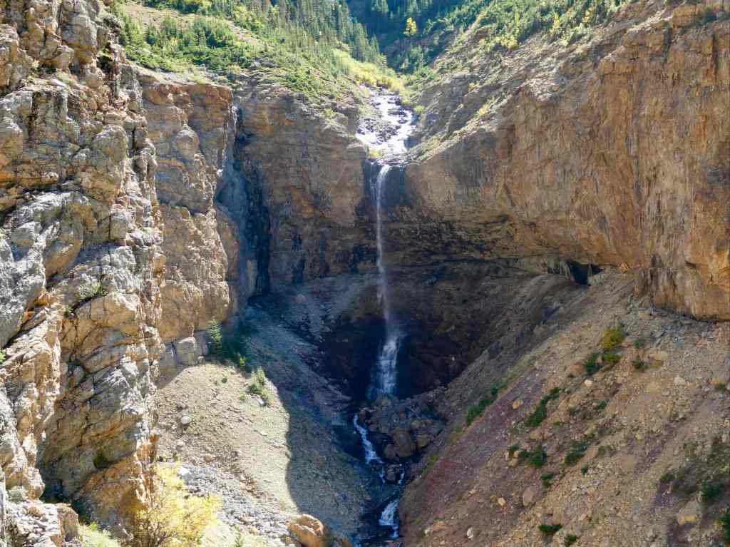
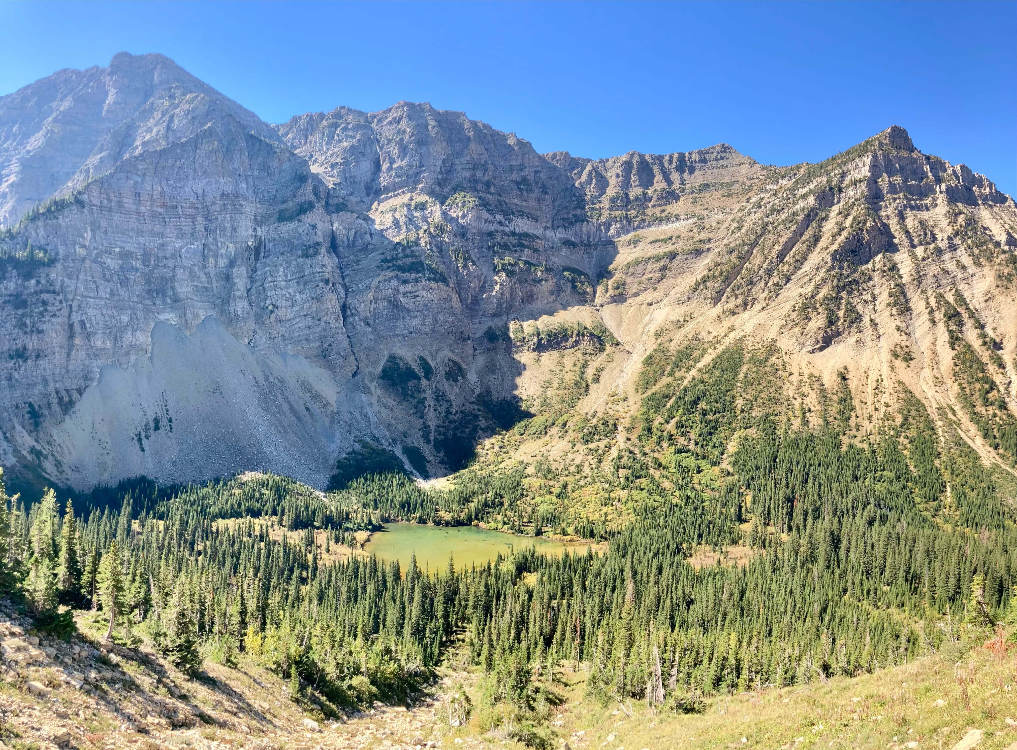
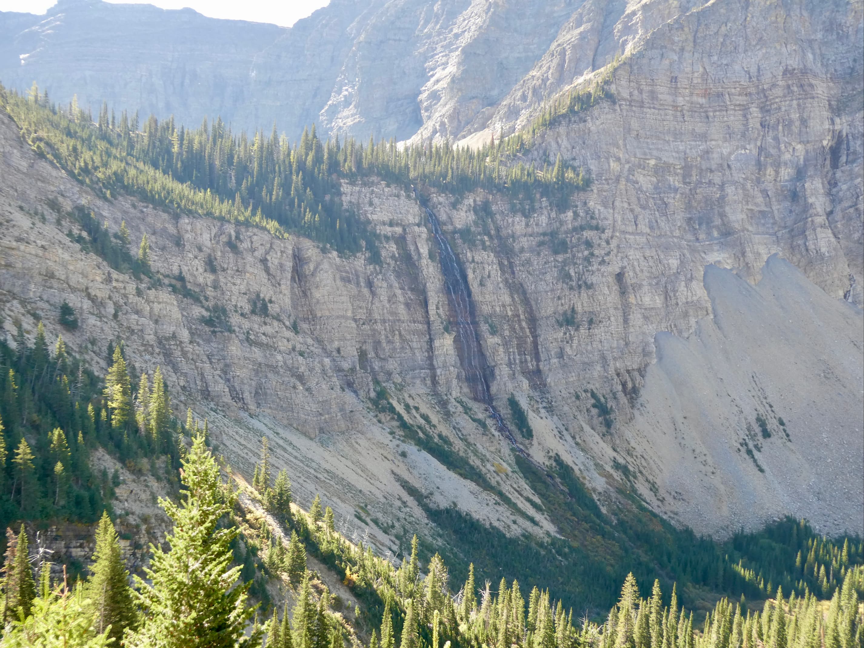
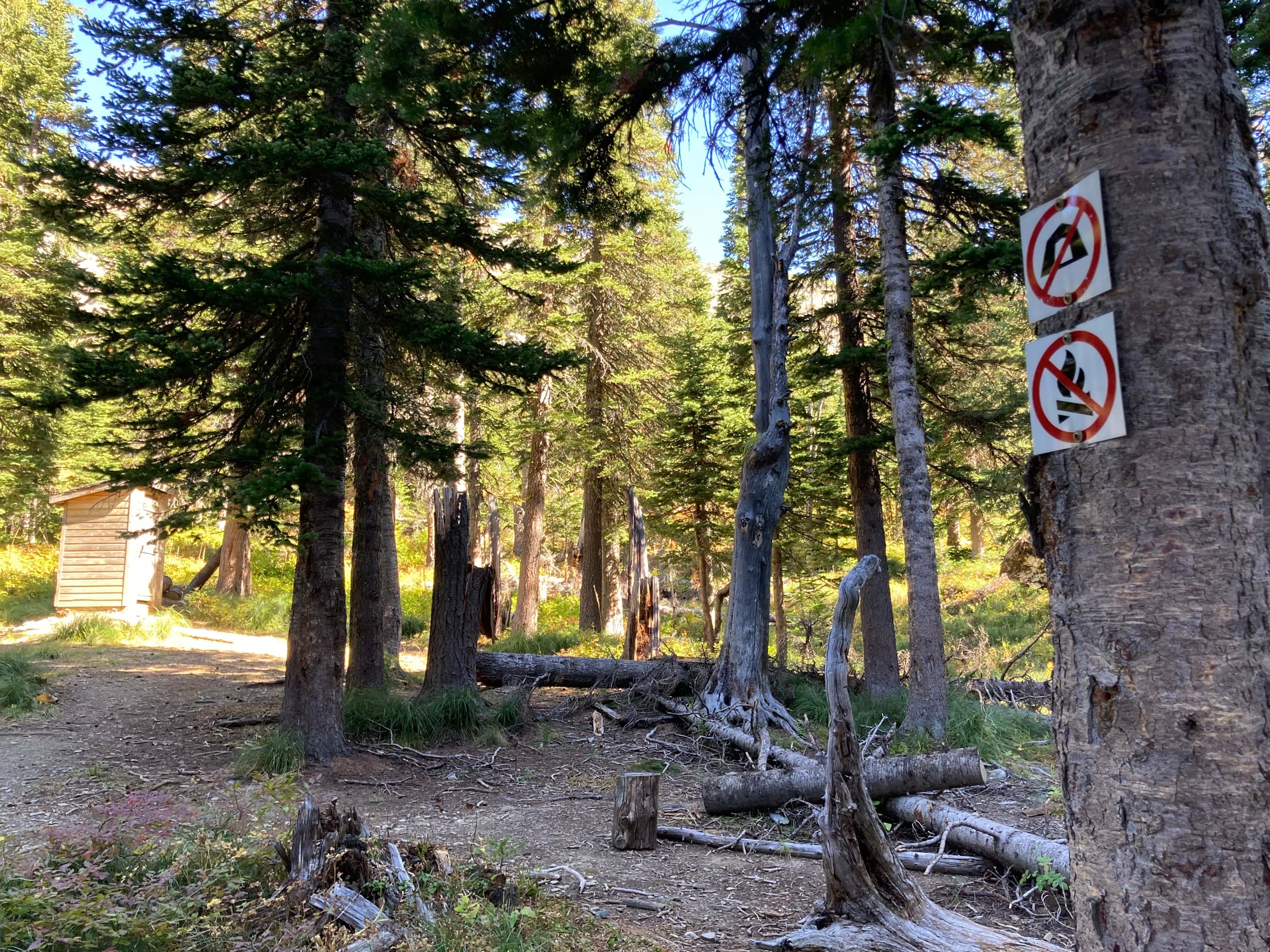
Eventually another waterfall comes into full view. This is called Swirling Mist Falls on topographic maps from the NRC and Garmin. However, guidebooks and Gem Trek Maps call this Burnt Rock Falls. The trail ascends above these falls then proceeds higher up the valley wall. An un-named tarn comes into view, and above that are the 200 meter tall Crypt Falls which crash down from Crypt Lake’s hanging valley. After a bit of an ascent, the trail passes through the site of the decommissioned Crypt Lake backcountry campground. I think this campground has been shut down since at least the 1990s due to the large amount of bear activity in the area. However, there is still a pit toilet up there that’s maintained by Park Canada.
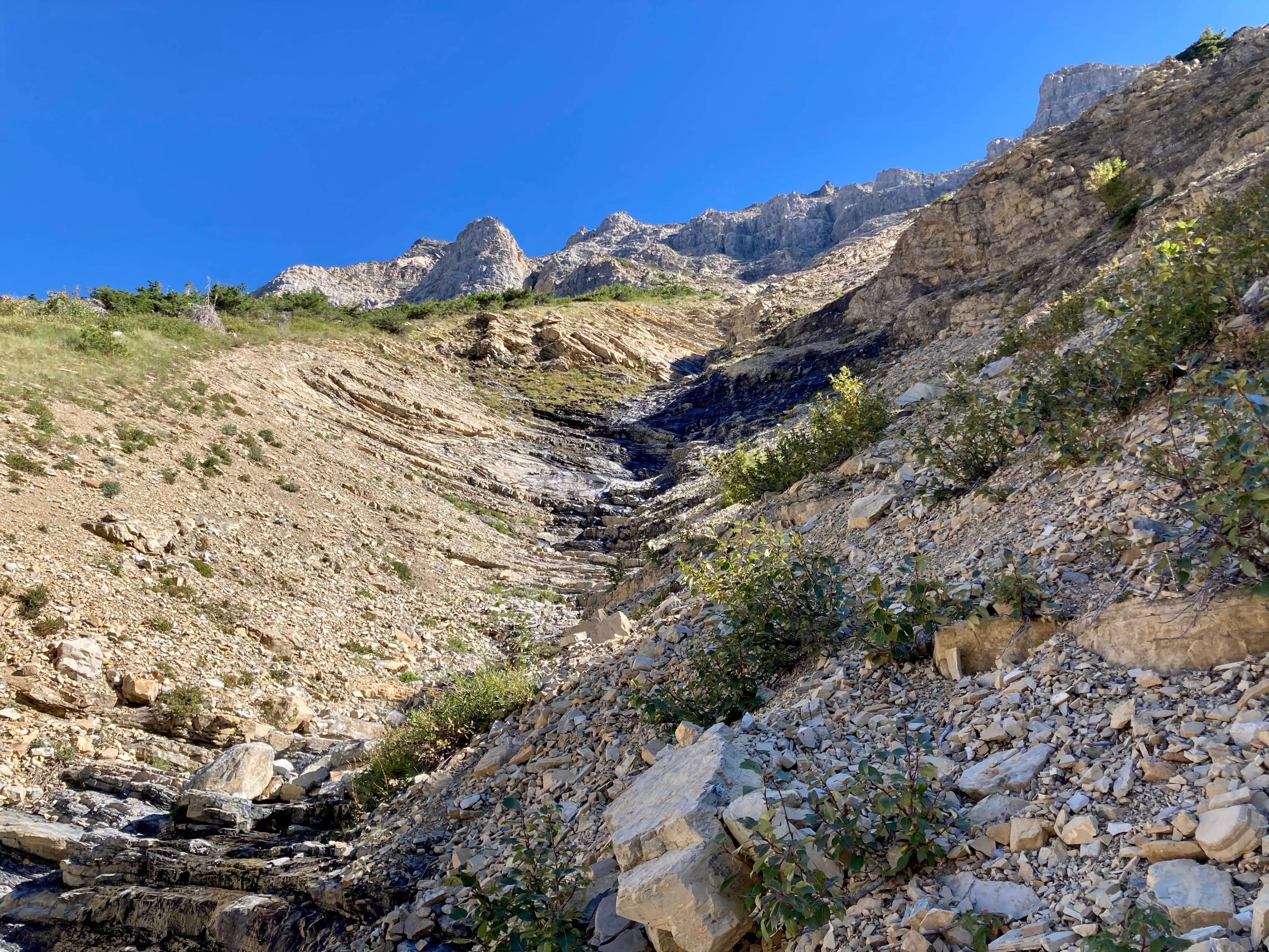
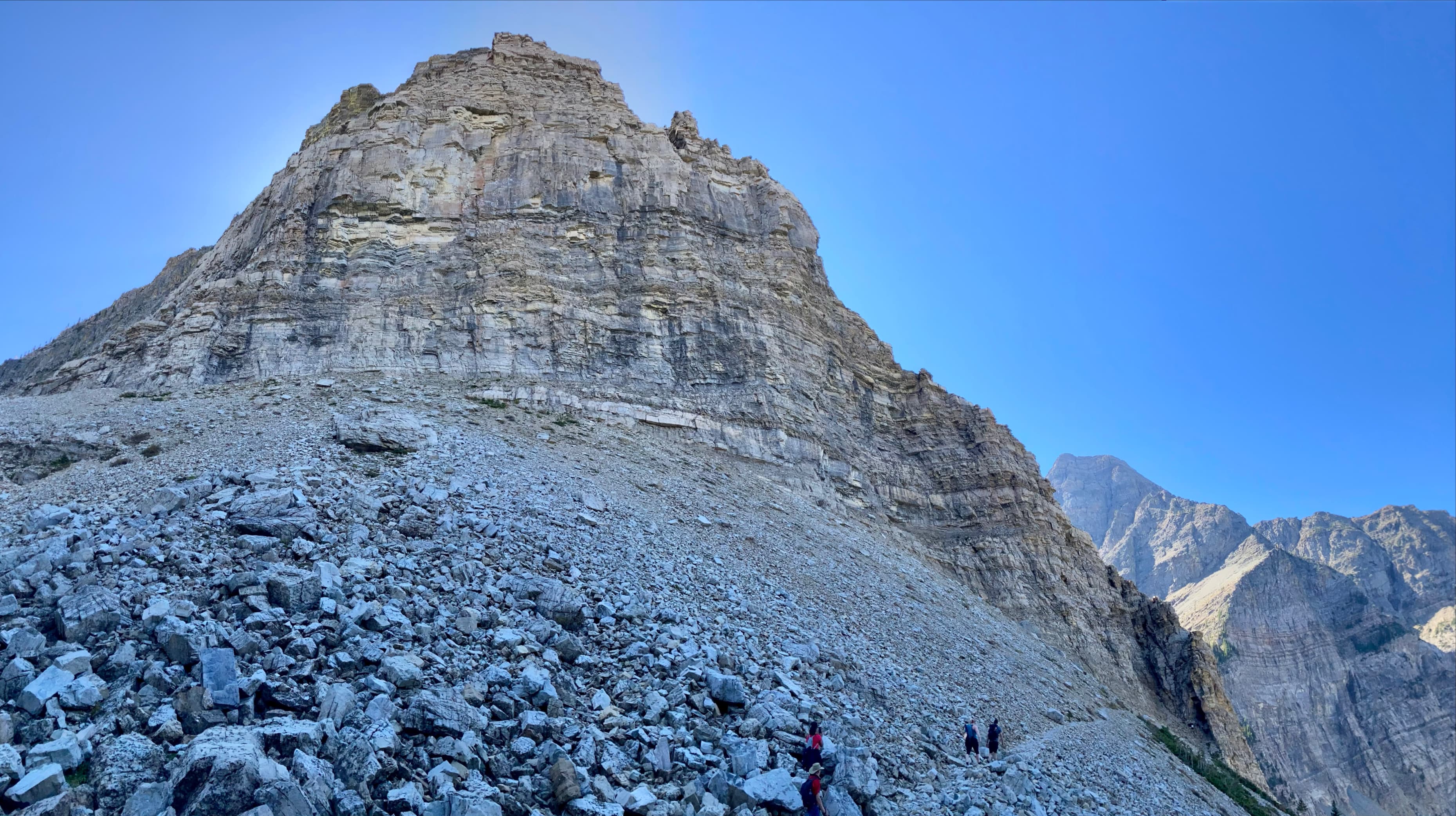
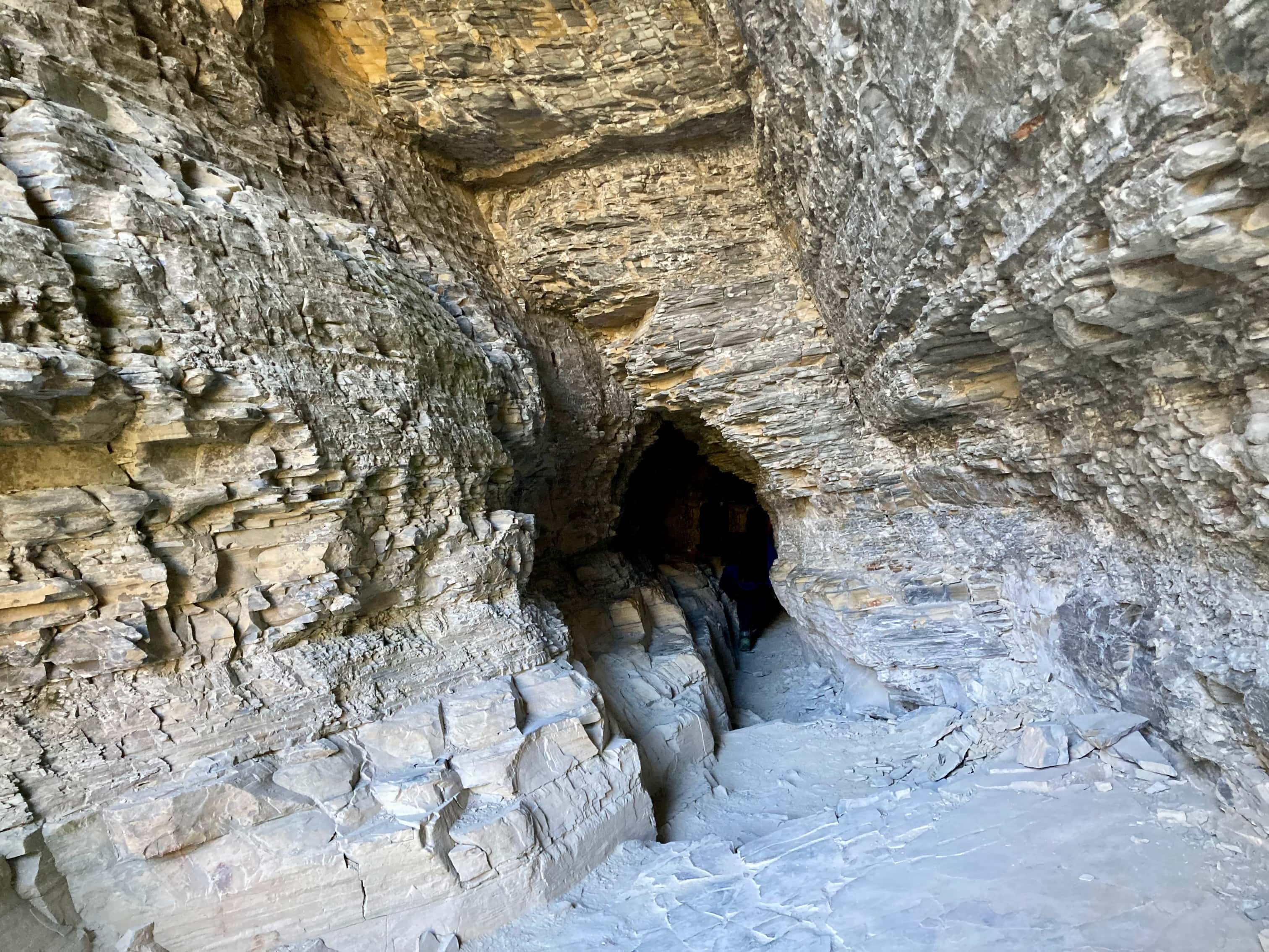
Beyond the old campground is where the excitement begins. The trail traverses along an airy ledge and approaches the mouth of a 20 meter long tunnel. A ladder leads up to the entrance. The tunnel is a little narrow and not tall enough to stand in. I have never found it particularly daunting but can imagine this being a mental obstacle for some people. Once through the tunnel, the trail ascends on (relatively) narrow ledges above a dramatic drop. A chain has been fixed along the rock wall by Parks Canada in this location (it was a cable up until this year when some maintenance was done). The chain isn’t absolutely necessary to make the traverse, but it’s reassuring and I have found it helpful on the descent. Beyond the traverse, it’s a short walk to Crypt Lake.
The lake itself is impressive: a crystal blue body of water below steep cliffs. Snow patches were still present on some of the north-facing slopes. Even though there were 2 ferry-loads of people around the shore, the lake is big enough that it didn’t feel crowded. There is a trail that goes around the lake, and the portion at the far (southern) end actually just barely enters the United States.
When you buy your ferry ticket, you’re given a return-trip ticket with your departure time marked. You really don’t want to miss the boat and be stuck at the far side of the Waterton Lake overnight. I’ve never found it too hard to stay on time, though, even while hiking in groups with variable hiking experience. On this trip, we actually only spent about a half hour at Crypt Lake before starting our descent. As we made our way down we made several long stops to admire the waterfalls or to enjoy the ambiance by a tiny creek.
Of the 3 times that I’ve hiked this trail, this was the only occasion that I didn’t encounter a bear. Even with the large amount of human activity in the area, bears encounters are common. Aside from a very dramatic episode back in the 1980s, though, I can’t bring to mind any stories of an actual bear attack on that trail. The usual advice around hiking in bear country applies to the Crypt Lake trail.
Click/tap on the pictures in the gallery below to access higher-resolution images.


We haven’t done the Crypt Lake hike in quite a few years. Your pictures remind me how beautiful it is so maybe it’s time for another trip to Waterton! Maggie
LikeLiked by 1 person