November 17, 2017. A snowshoe trip tagging a low summit in Beauvais Lake Provincial Park, Alberta.
- Region: Beauvais Lake Provincial Park, Traditional Territory of the Blackfoot, Tsuu T’ina, and Ktunaxa First Nations.
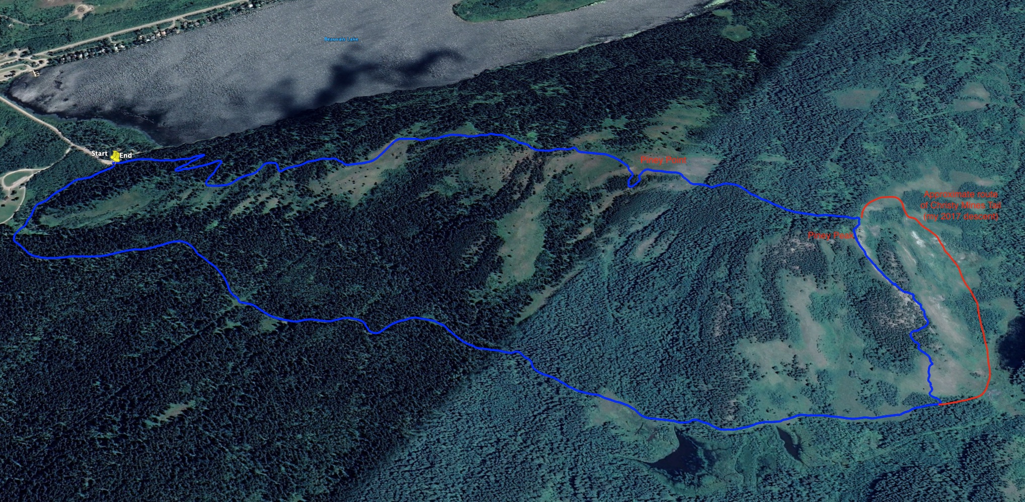
- Distance: 5.8 km loop
- Total Ascent: 237 m
- Elevation of Objective: Piney Point 1560 m, “Piney Peak” 1596 m
- Total Time: 1h 40m
February 17, 2021 update: I visited this trail again on another snowy, gloomy day. Signage in the park has been refreshed in the last few years, and I noticed that I’d gotten some details wrong in my original post. Most notably, the clearing just before the highest point in the loop is Piney Point, not the summit. On this occasion, I did actually climb to the top of the little summit which is skirted by the trail beyond Piney Point. As far as I know, it has no official name, so I’ll refer to it as Piney Peak.
Original Post: It’s been a long time since I got to do any hiking. The latter part of the summer saw our nearby mountains damaged by an significant forest fire. Waterton Lakes National Park instituted backcountry bans as the fire rolled in, and afterwards the destruction was so extensive that basically everything outside the townsite was off-limits. Then, there followed the usual autumn events that abruptly end a merry summer of hiking: kids return to school, extra-curricular activities start, work gets busier.
Shoulder season hiking beckoned, but with Waterton closed, the longer drives to areas like K-country or Banff kept me off the trails. But now, finally, the snow has fallen and it’s time to do some snowshoeing. What’s so great about snowshoeing? Well, it turns a trail that in the summer is a dull trudge under bug-swarmed trees into a compelling adventure, complete with deep drifts, icicles, and animal tracks writing stories in the snow.
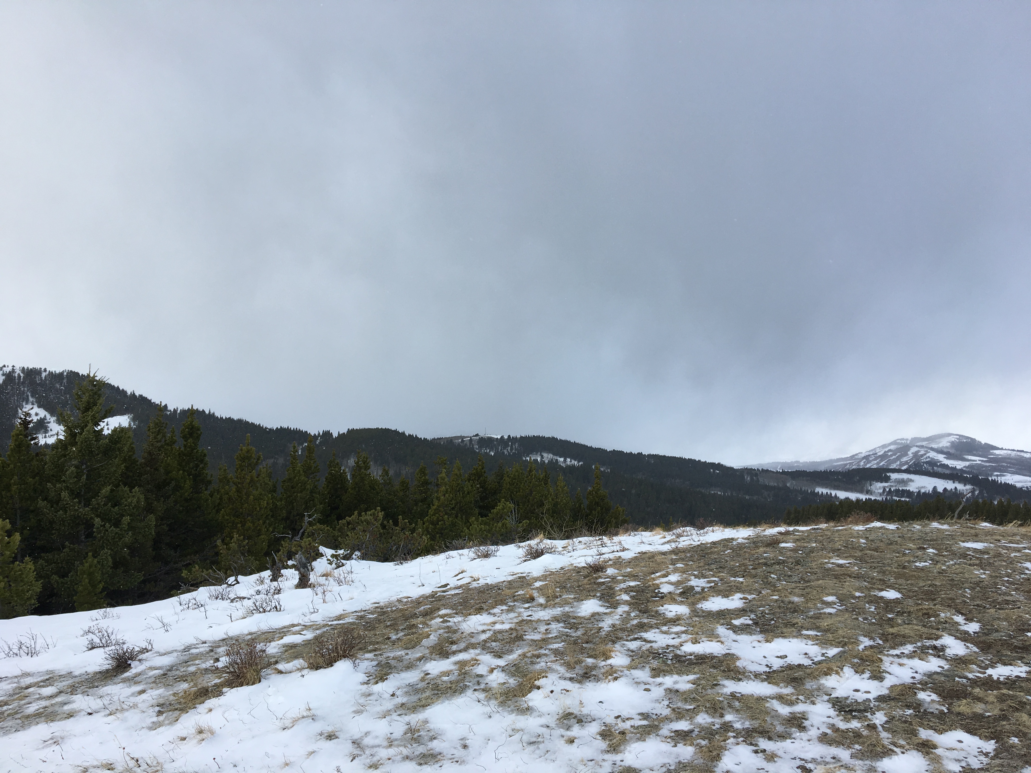
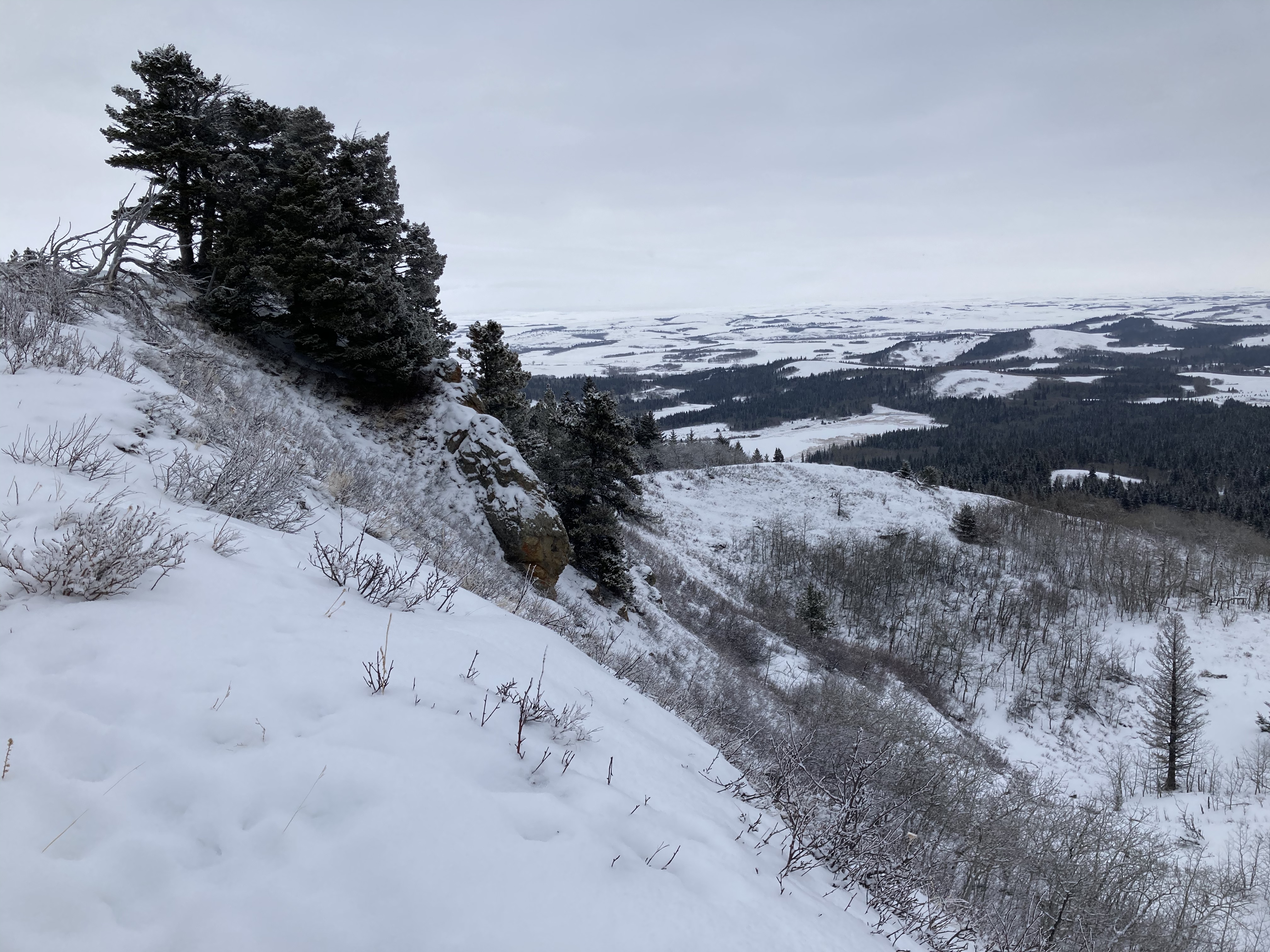
I had a half day of work scheduled in the Crowsnest Pass, and I decided to stop at Beauvais Lake Provincial Park on my way back to Lethbridge. There are numerous trails in the park suitable for snowshoeing, but I decided on a climb up to Piney Point and return via the Christy Mines Trail. This made a satisfying loop. The weather was not particularly cold: -2 degrees Celsius at the parking area. However, it was a little windy and periodically there was light snowfall. There were also dense clouds west of the park, which unfortunately obscured the views of the mountains of the Crowsnest Range.
Access is to the trail is straight-forward. The park is 15 minutes west of Pincher Creek. Just get on Highway 507 and follow the signs. I parked at the Beaver Creek Day use area, followed the easily visible trail sign, and got right onto the Piney Point trail. The snow on the roads in the park wasn’t too deep. I’ve been here before when the road into the park was plowed but the in-park roads were not, leading to a couple of anxious situations where my car almost got stuck. On that occasion I parked up on the main road and walked down to the day use area.
Southern Alberta had a major snow dump over the prior 2 weeks, but this was followed by warmer weather and frequent Chinook winds. I was wondering what the snow would be like. I even briefly considered setting out in just my winter hiking boots without snowshoes. I’m glad I had the snowshoes. Even where the snow was packed down and shallow, the crampons on the snowshoes gave me sure footing on the ascent and descent. As I got up higher and then descended via the valley on the opposite side of the ridge, I encountered deep windblown drifts with firm outer crusts and zones of deep, freshly-blown powdery snow.
The route was straightforward (here’s the park’s trail map), starting with switchbacks through the trees, which take you up to the ridge. The trail is joined there by another one, coming up from the area of the Lower Smith Homestead. From there the trail follows the ridge, passing 2 bald prominences heading up to Piney Point. There was steep climbing in 2 or 3 places, but nothing too challenging. The views were actually better at the lower bald prominences than at the summit because Piney Point is, well, piney. The trees obscure the view. The highest extent of the trail doesn’t actually go up to the summit. It tops out a few meters below the high point and is marked by a single tree with a fluorescent ribbon tied to it.
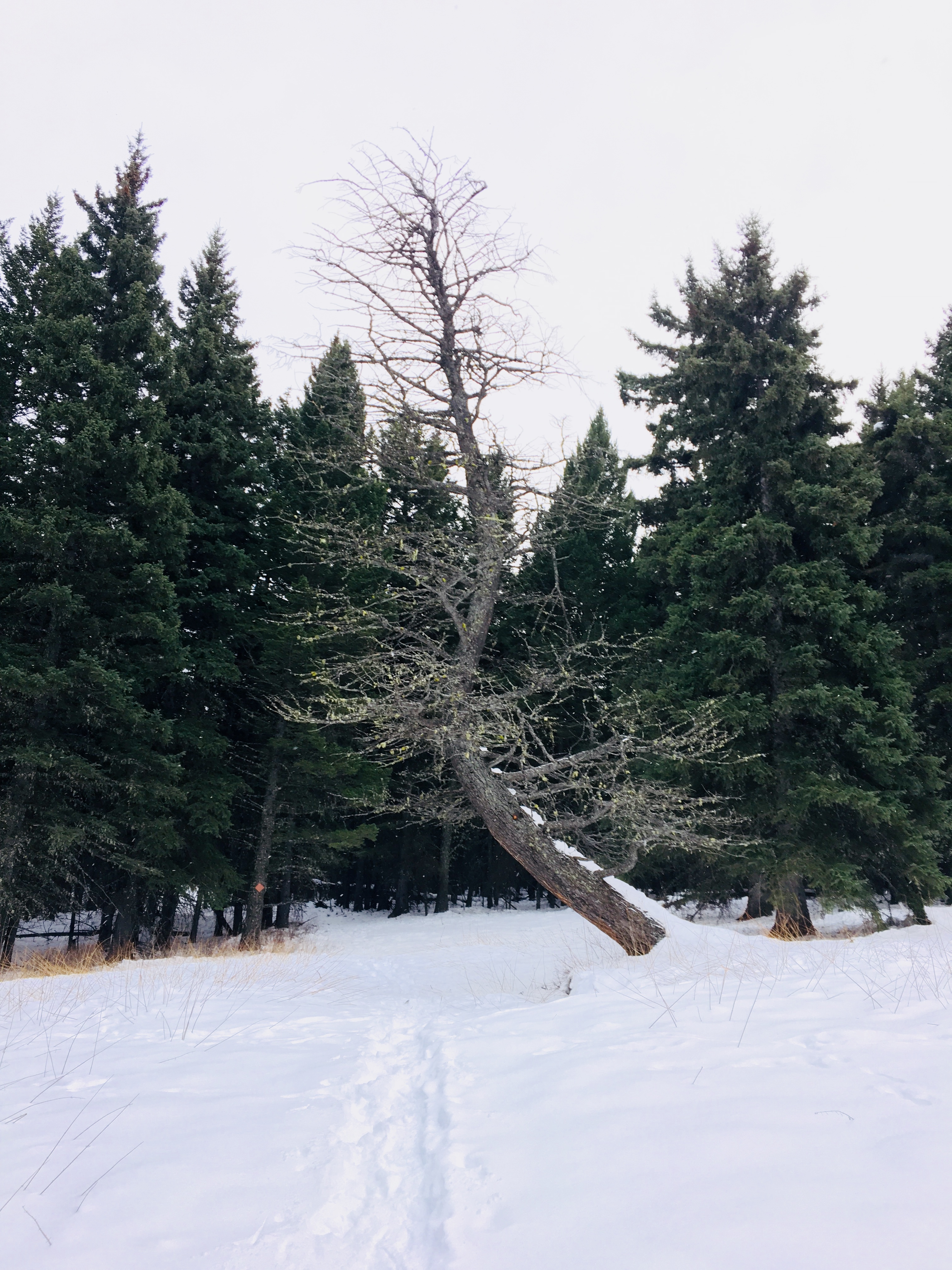
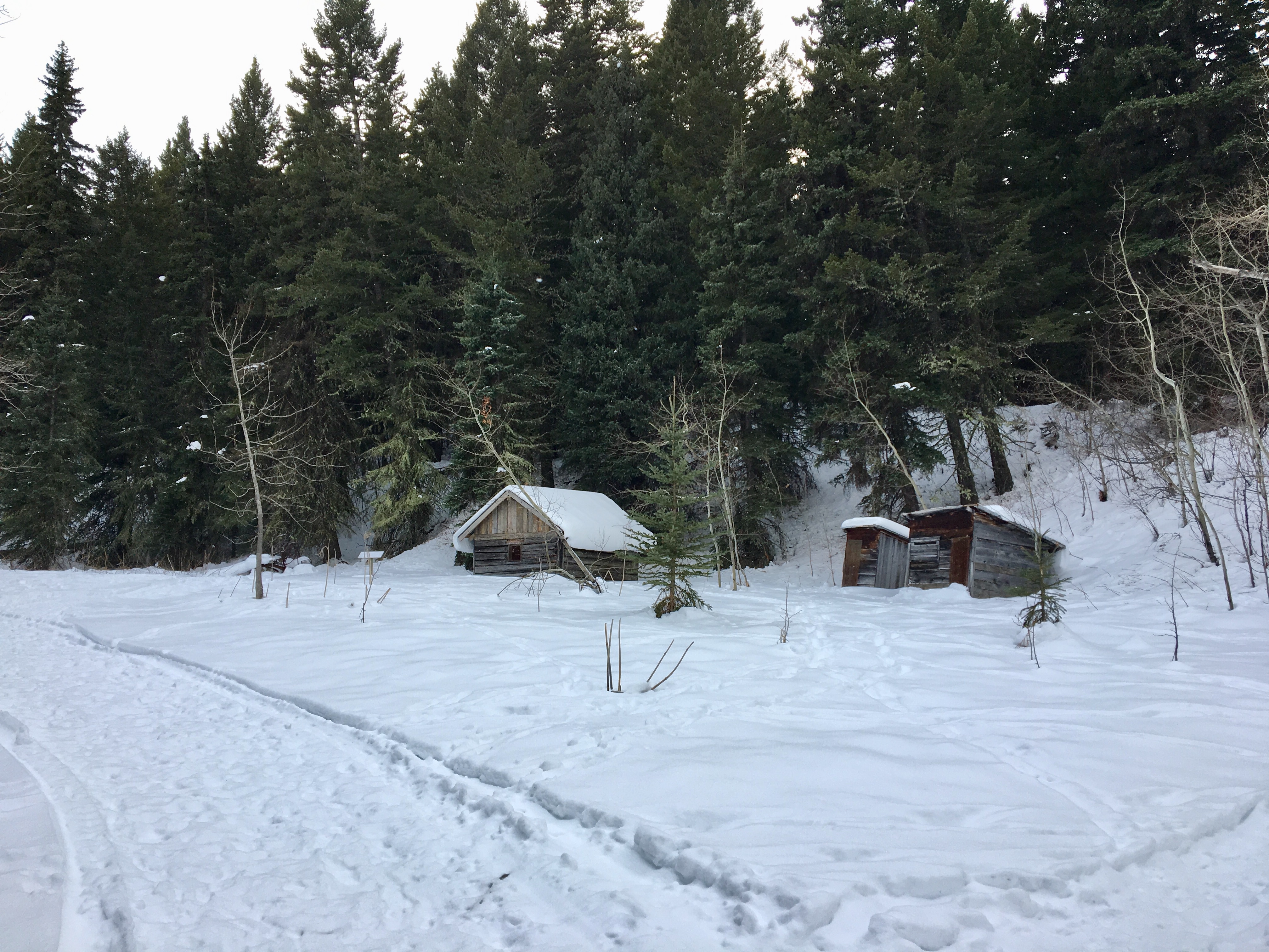
The trail wasn’t too hard to follow. There were footprints in the snow, and in those areas where the wind had obliterated them, there were periodic trail markers on the trees. These were very regularly placed on most of the route, but when I descended and began to head back via the valley many of the trail markers were missing. My GPS kept me on track and I walked by trees that had screws drilled into them, which must have once held trail markers. The trail passes 3 small lakes on the descent. I haven’t been able to find names for any of them. As the trail bottoms out, you arrive at the Lower Smith Homestead, where you find a cluster of abandoned buildings.
Even though the views were obscured and the weather was gloomy, this trip was worth it. It felt great to get back outside and hike. The trail isn’t one I’d consider doing in the summer, but with snow on the ground it becomes an interesting and moderately challenging endeavour.
Click on the pictures in the gallery below to access full-sized images.


One thought on “Piney Point Loop”