August 1, 2025. Scrambling to the summit of Yoho National Park’s eponymous peak.
- Region: Yoho National Park. Traditional territory of the Ktunaxa, Stoney, and Blackfoot First Nations
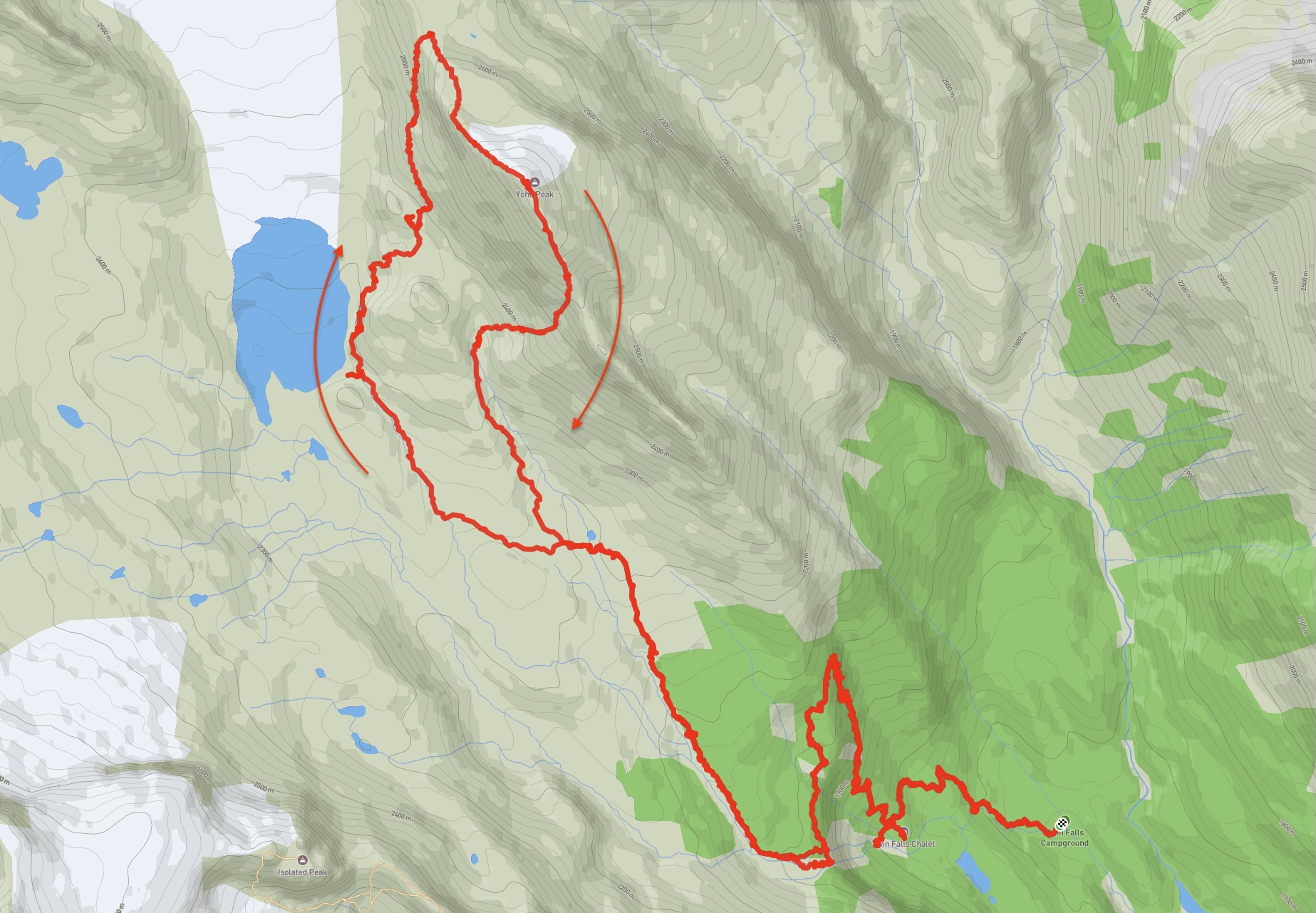
- Distance: 25.5 km round-trip from Twin Falls backcountry campground
- Total Ascent: 1280 m from Twin Falls backcountry campground
- Elevation of Objective: 2760 m
- Total Time: 9h 34m
- Safety and Disclaimer
I’ve had the chance to do some easy hikes in Yoho with my family, but time and distance have prevented me from doing anything more involved. Luckily, I got invited along on an already-arranged trip to Yoho by my Calgary hiking buddies after someone else had to cancel. The objective was to scramble two peaks on consecutive days: first Yoho Peak, then Isolated Peak. The weather forecast called for unsettled conditions, though, and in the end we only did Yoho Peak. It was nevertheless a great excursion with a strong group, as well as a chance to do some backcountry camping – the plan involved basing our trip out of the Twin Falls campground. Our route was based on the description provided in this post from Giant’s Gate.
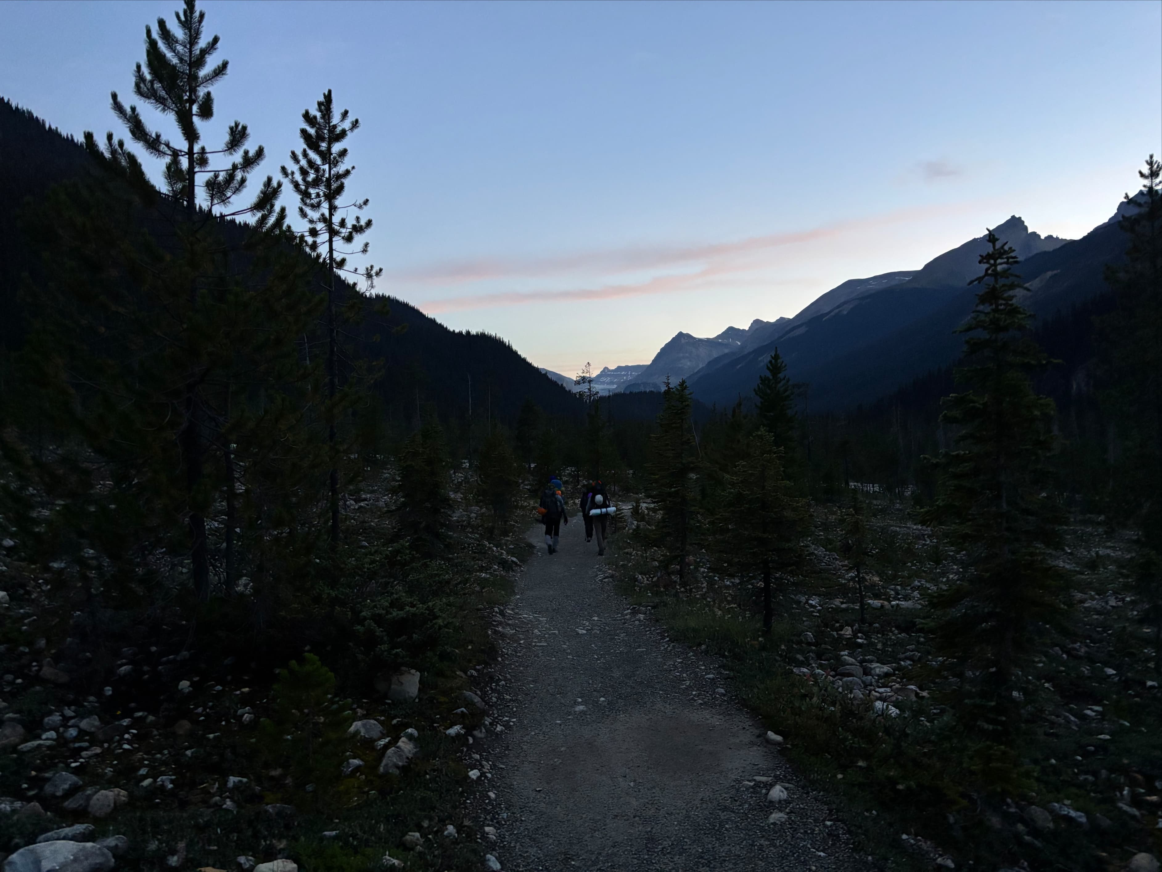
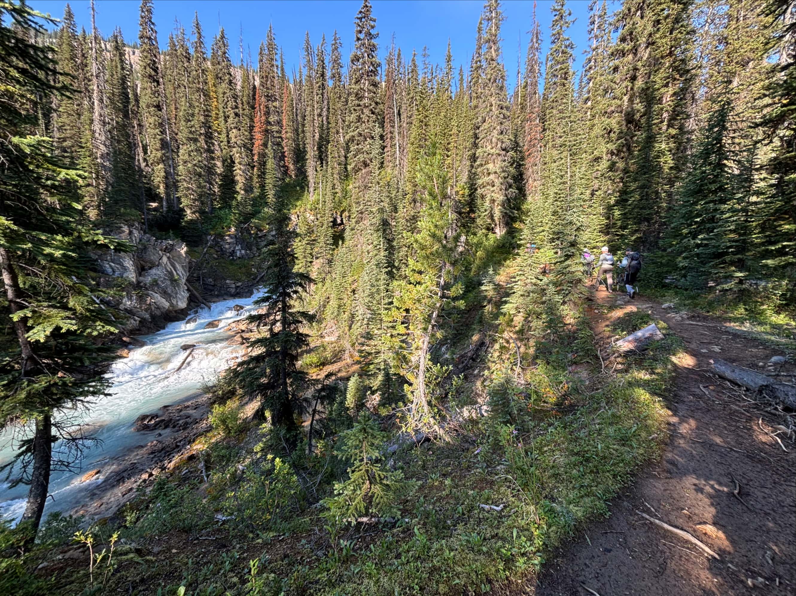
The Twin Falls campground is easily accessed from the Takakkaw Falls parking area. If approaching from the east, the turn-off to Takakkaw Falls is about 13 km from the Alberta/BC border. The road is closed October-June and is not suitable for trailers or very long vehicles due to an area of very tight switchbacks. Click here for the Google Map. We arrived at roughly 5AM, so there was lots of available parking. Later in the morning, especially on weekends and holidays, it can be an ordeal to find a parking spot. The Twin Falls campground is a straightforward 6.6 km hike from the parking lot.
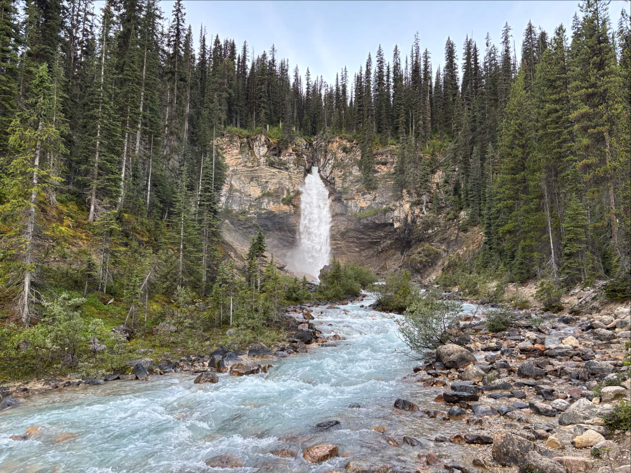
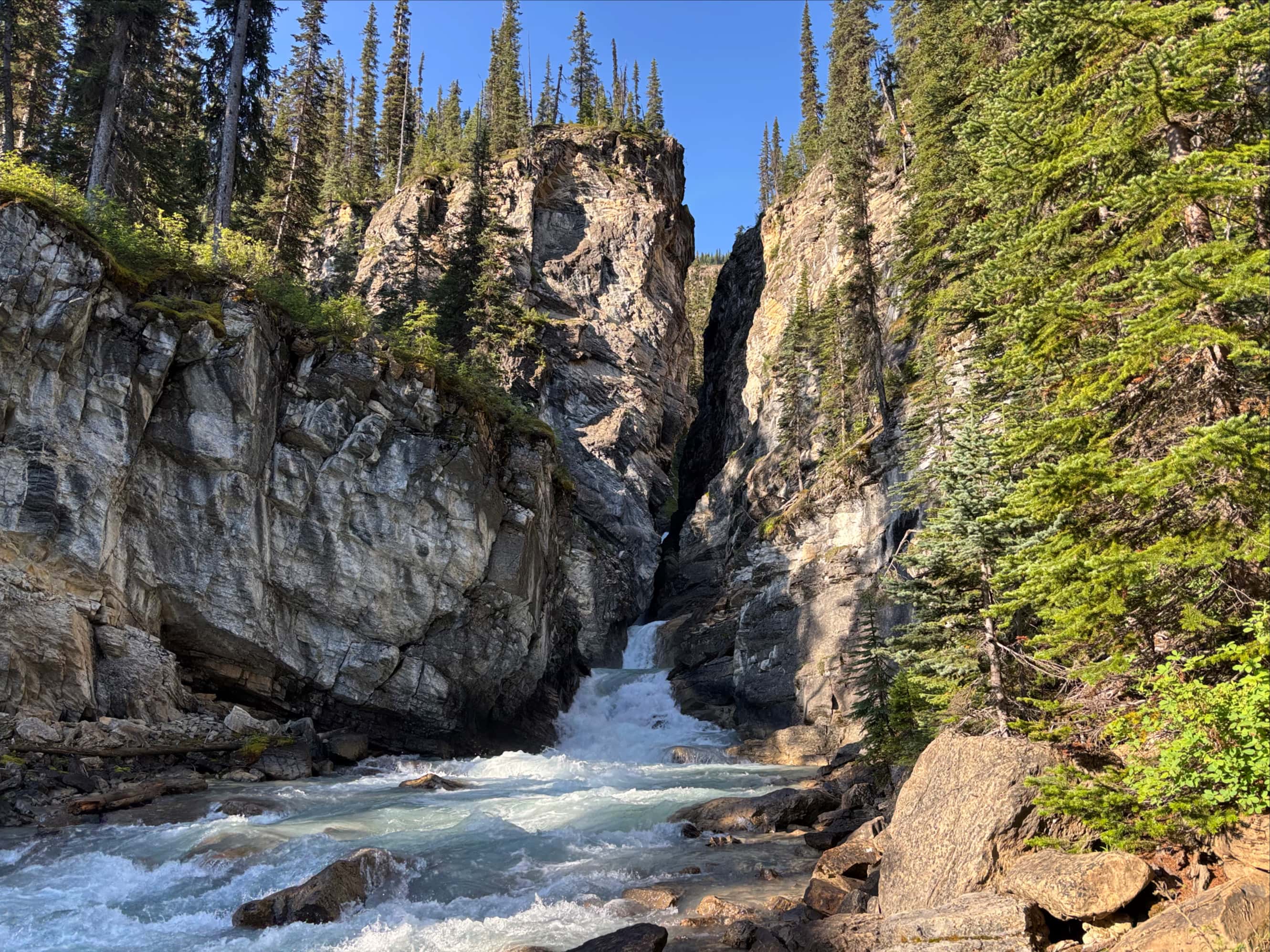
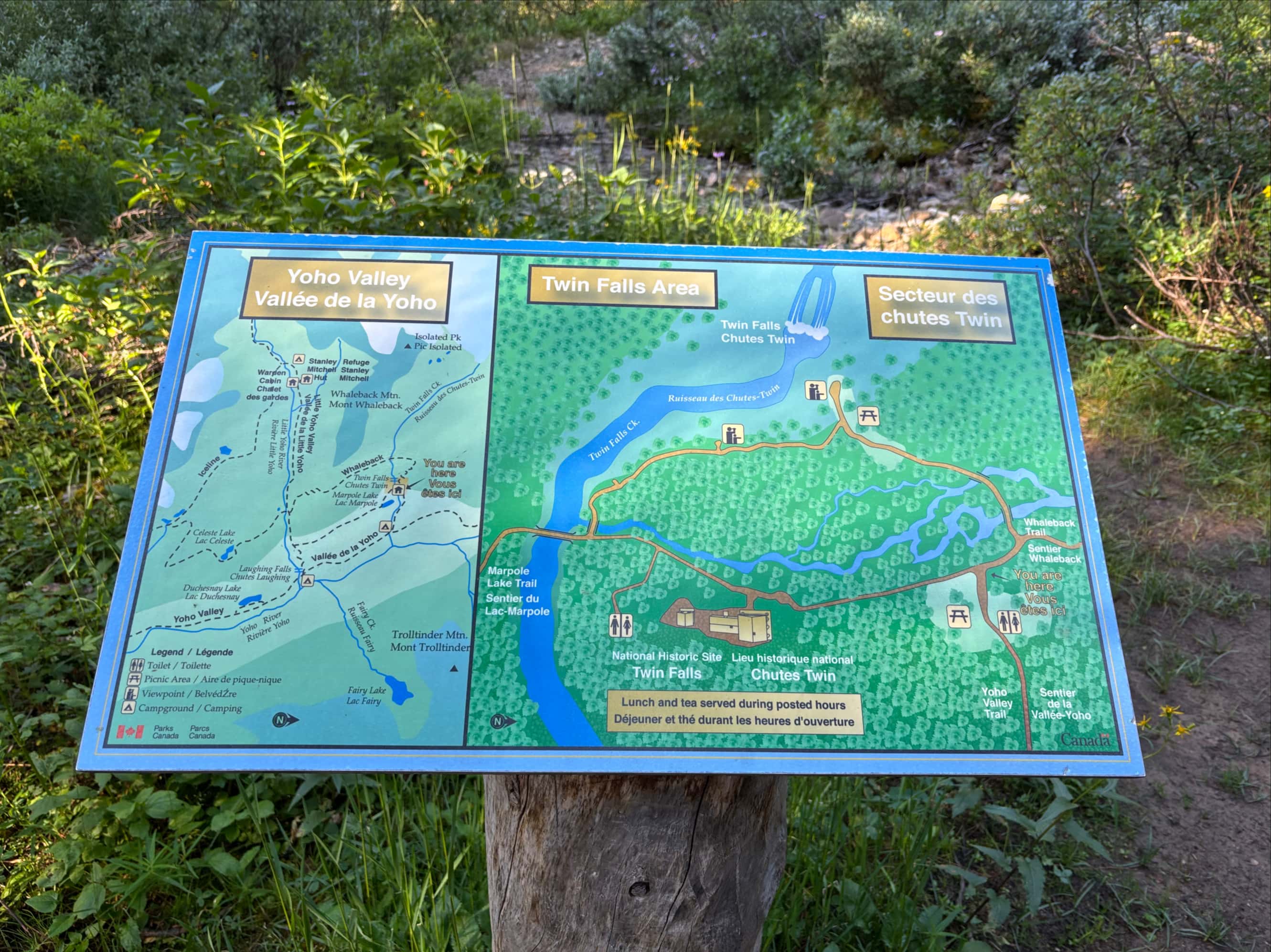
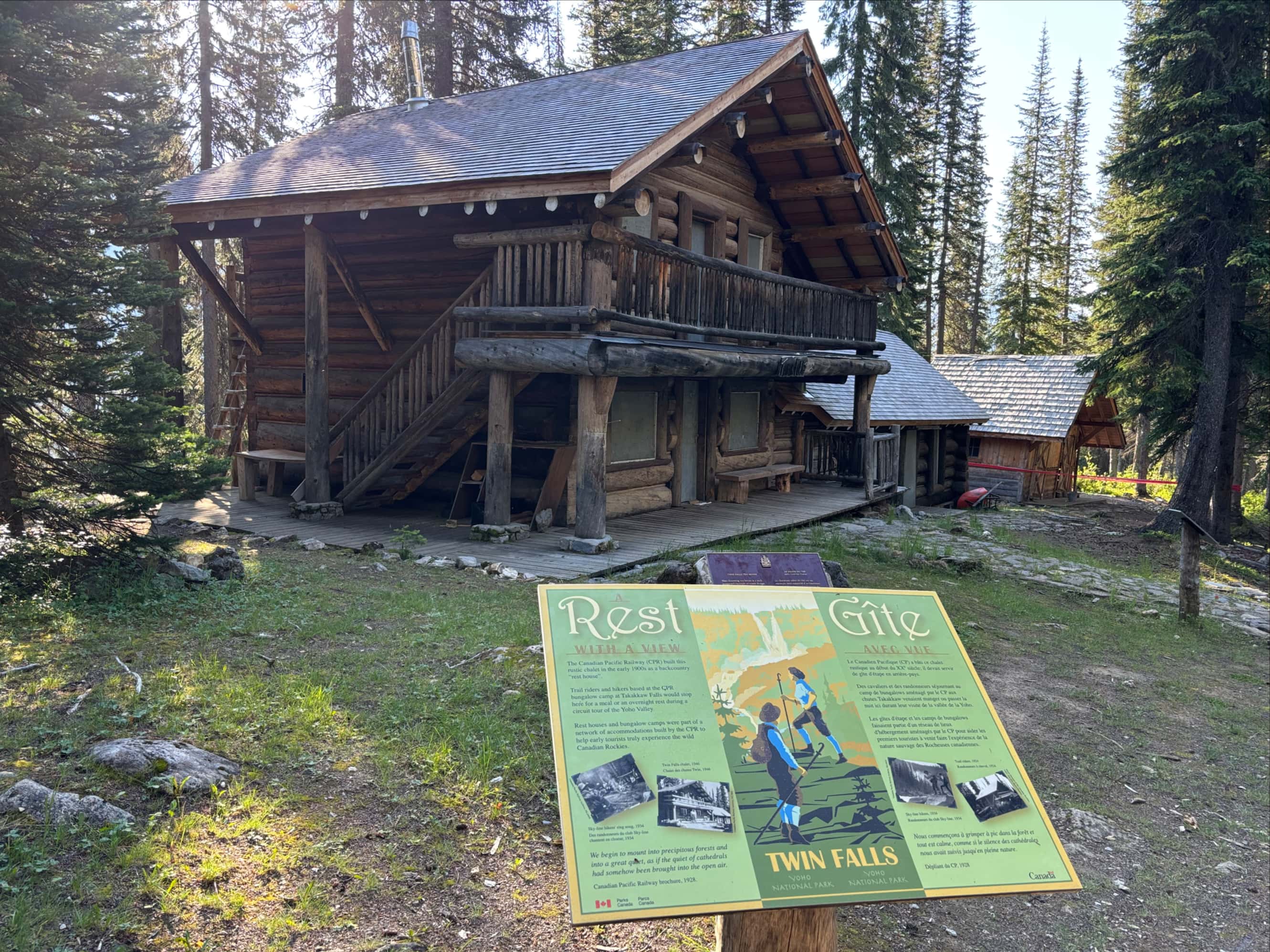
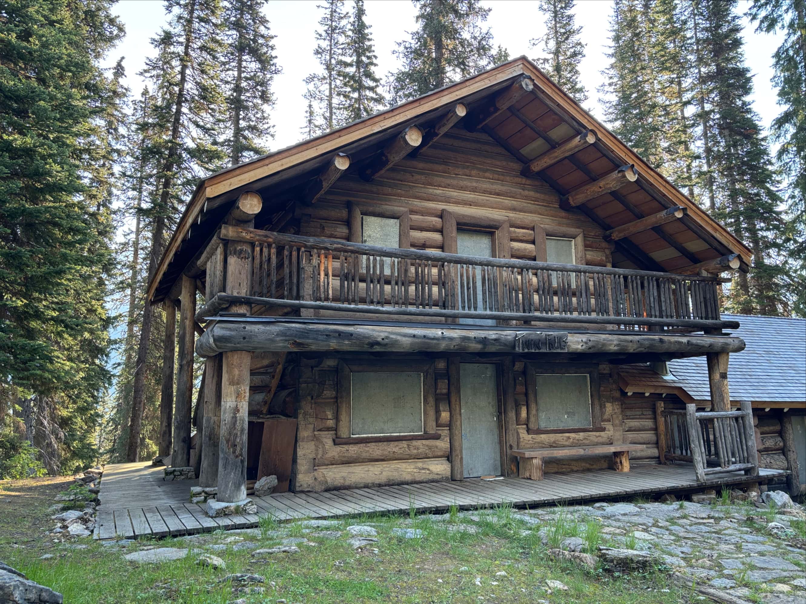
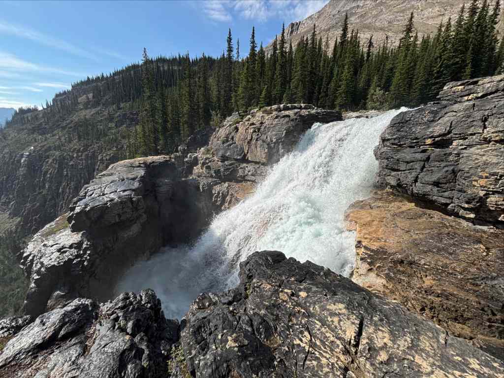
From Twin Falls campground (from which you cannot see the Twin Falls) we followed the official trail 1.5 km to the Twin Falls National Historic Site. Here we found a boarded-up tea house that was built by the Canadian Pacific Railway starting around 1908. Fran Drummond operated the teahouse for 57 years, until her lease ended and was not renewed by Parks Canada in 2019. This was the end of lunch and tea service at the site – the Alpine Club of Canada had planned to take over but announced in 2023 that they would not. The information sign where the trail arrives at the Twin Falls area still says “Lunch and tea served during posted hours”.
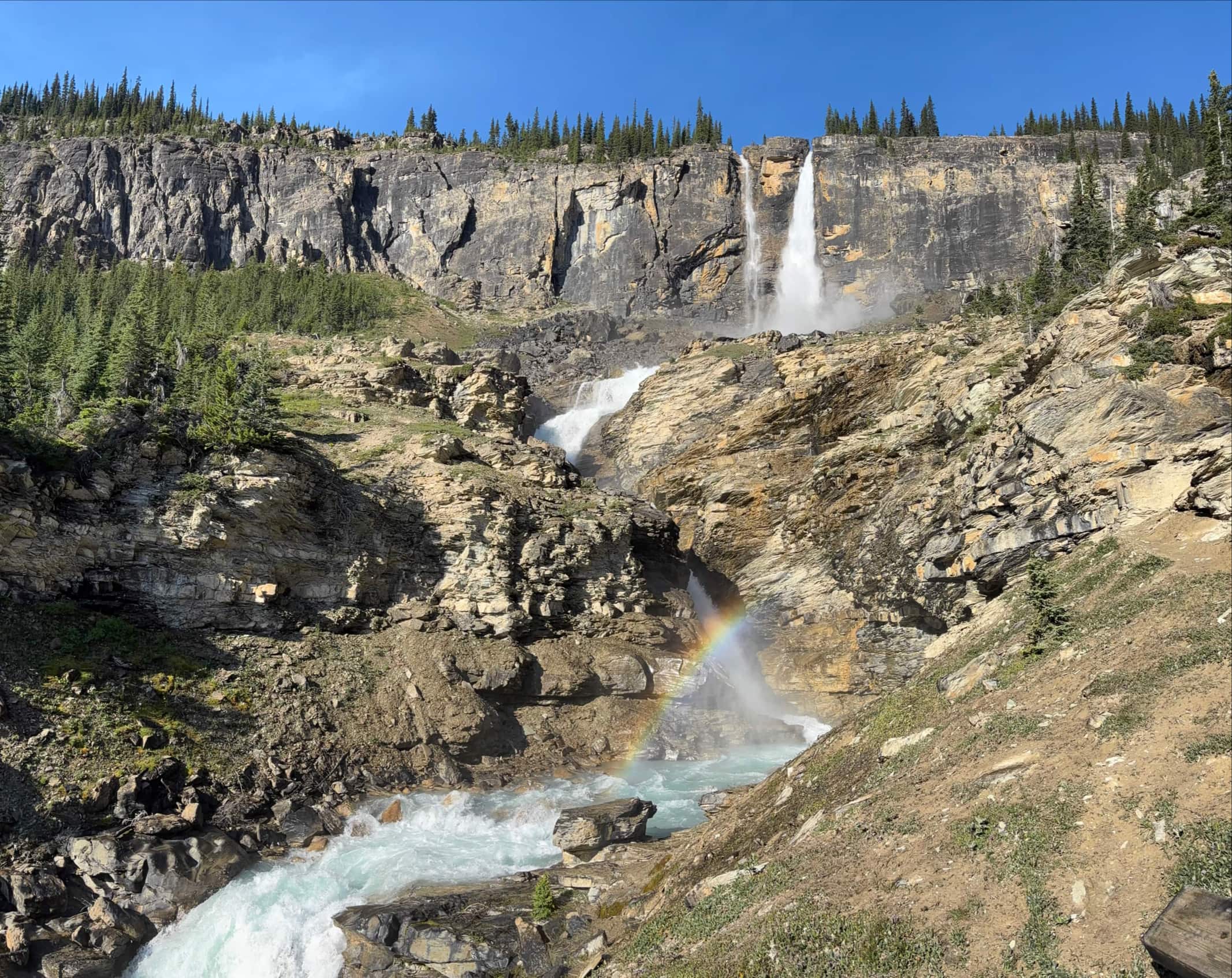
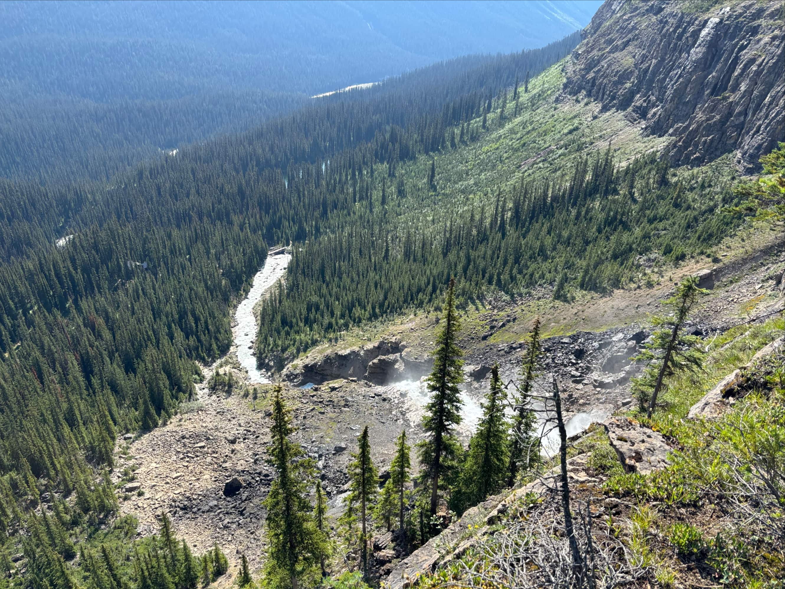
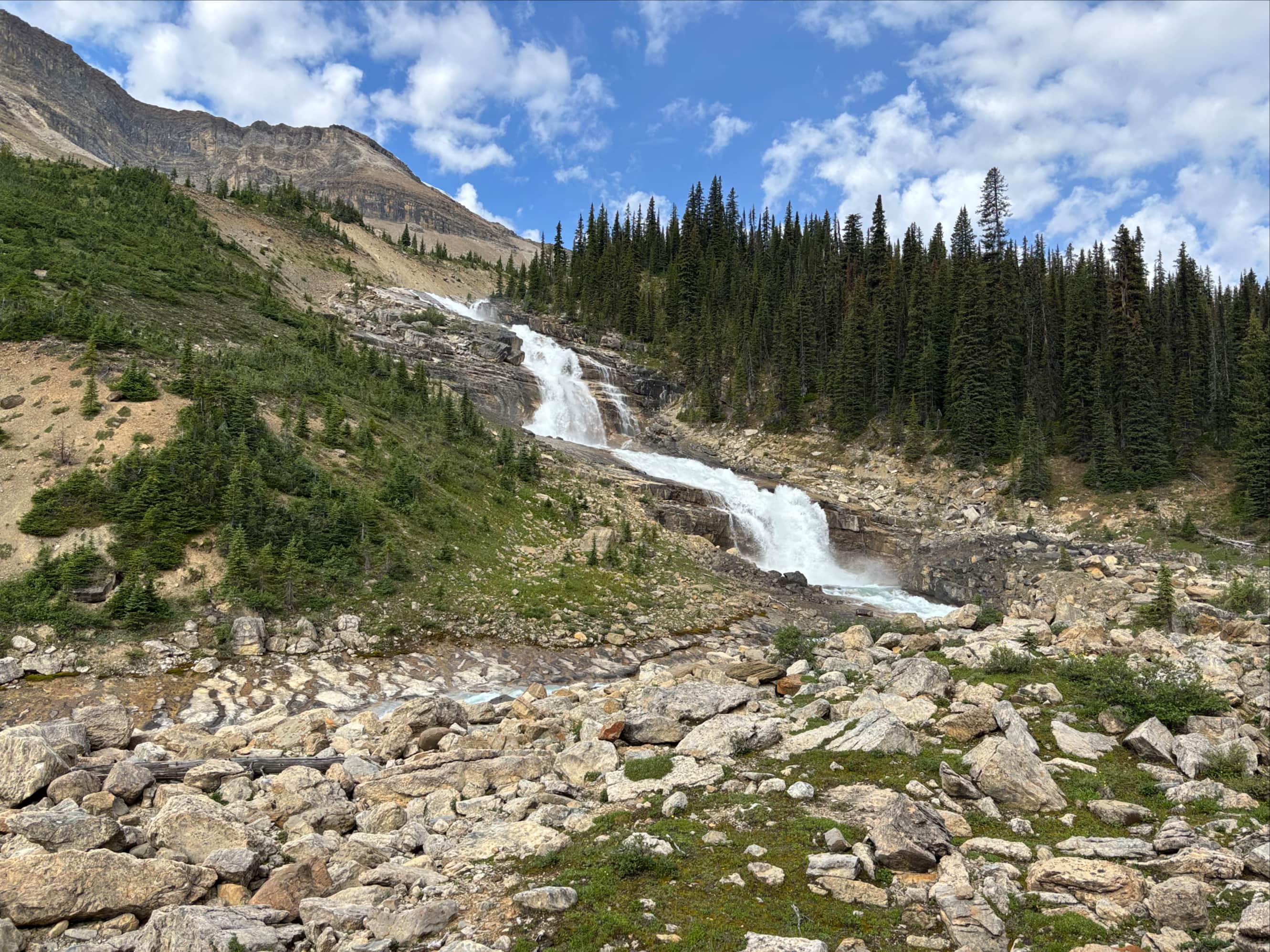
Historic tea house aside, this area is also where the best views of Twin Falls are. After taking it all in for a while we carried on, following the Whaleback Trail north up a series of small switchbacks then back south to the top of Twin Falls. A minor and obvious deviation from the official trail brought us to the rocky shelves at the top of the falls. From there we could watch the water above the falls take a short drop into a churning cauldron which then emptied into the precipitous 120 meter main drop of the waterfall.
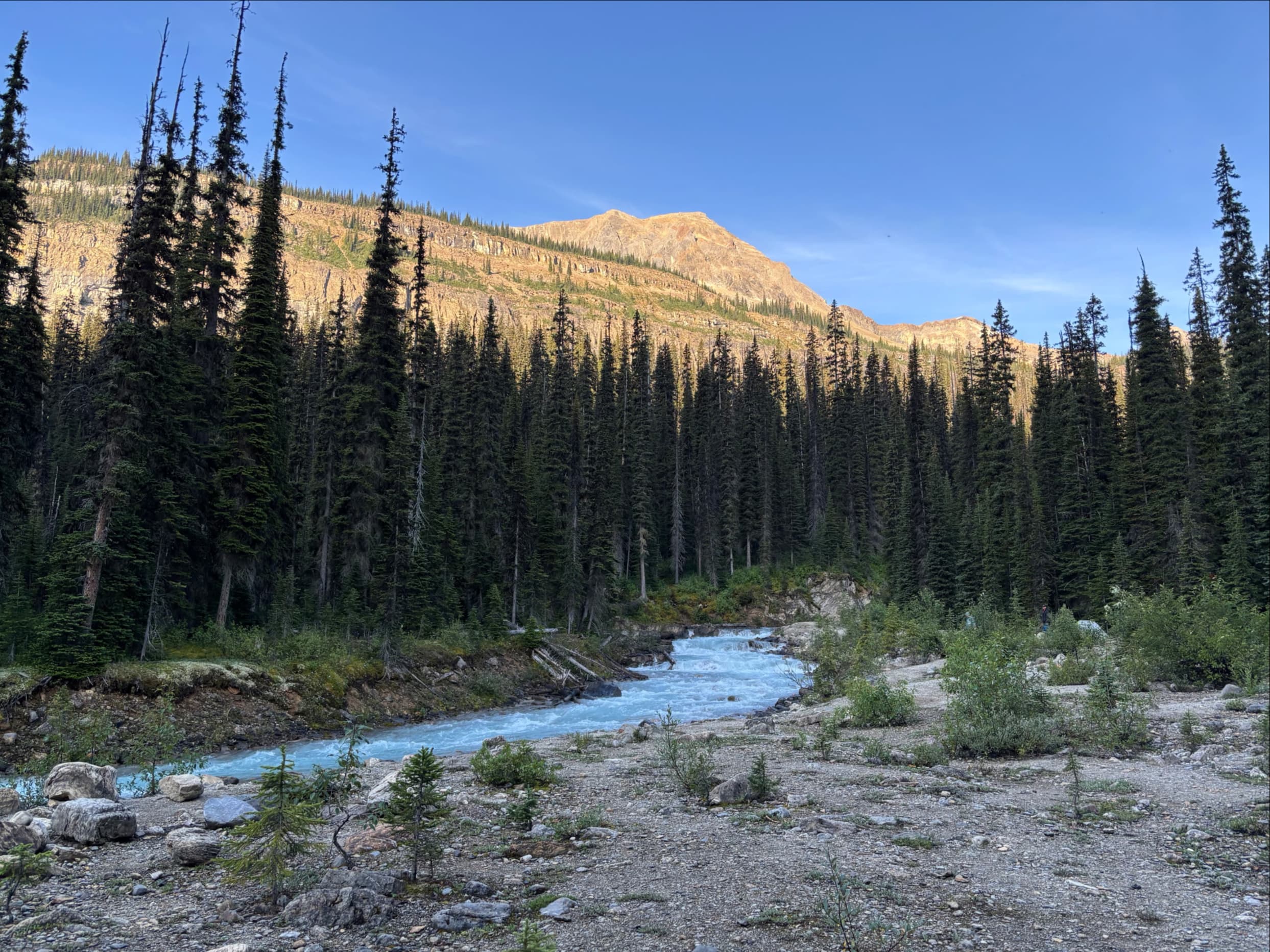
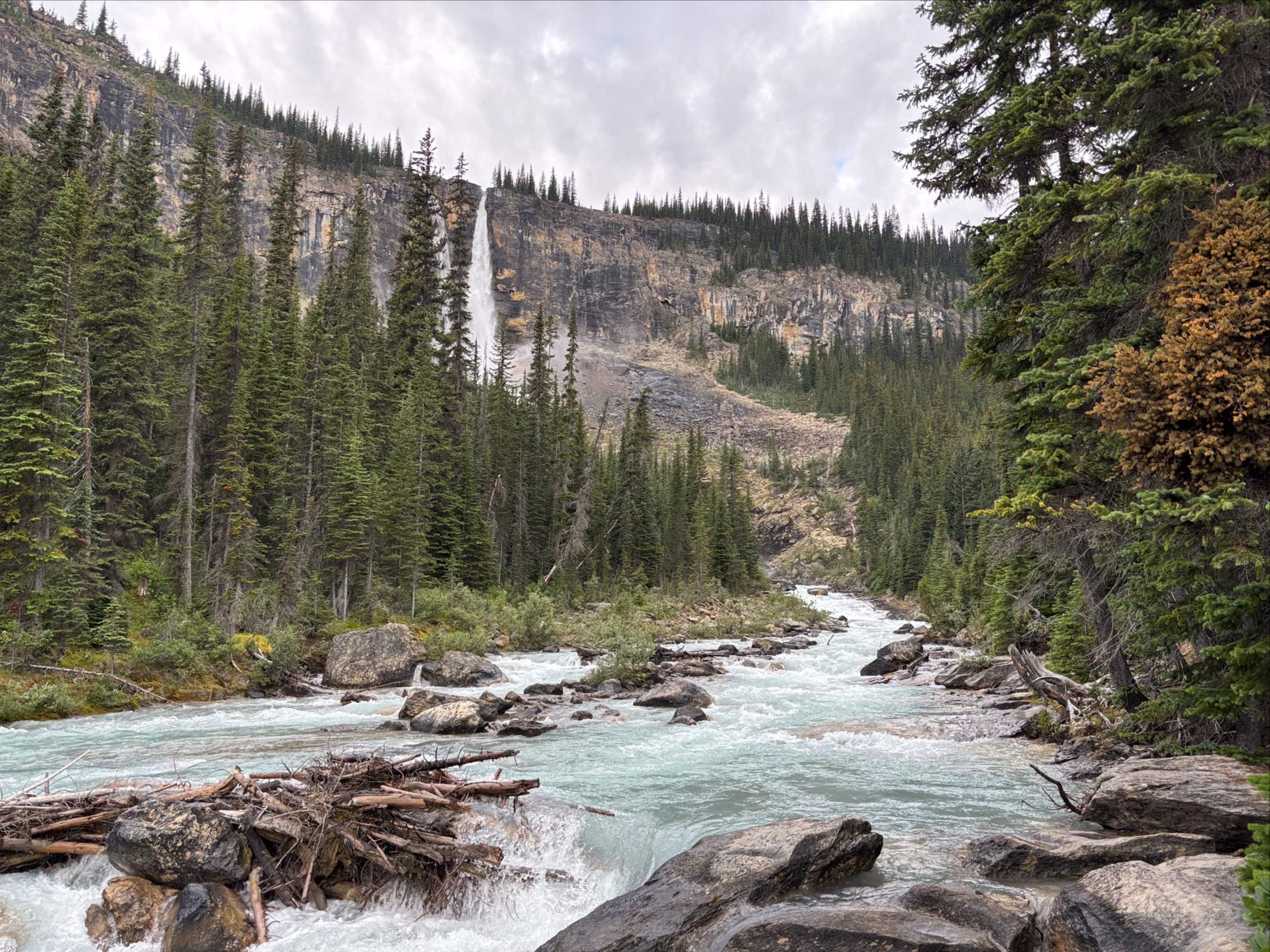
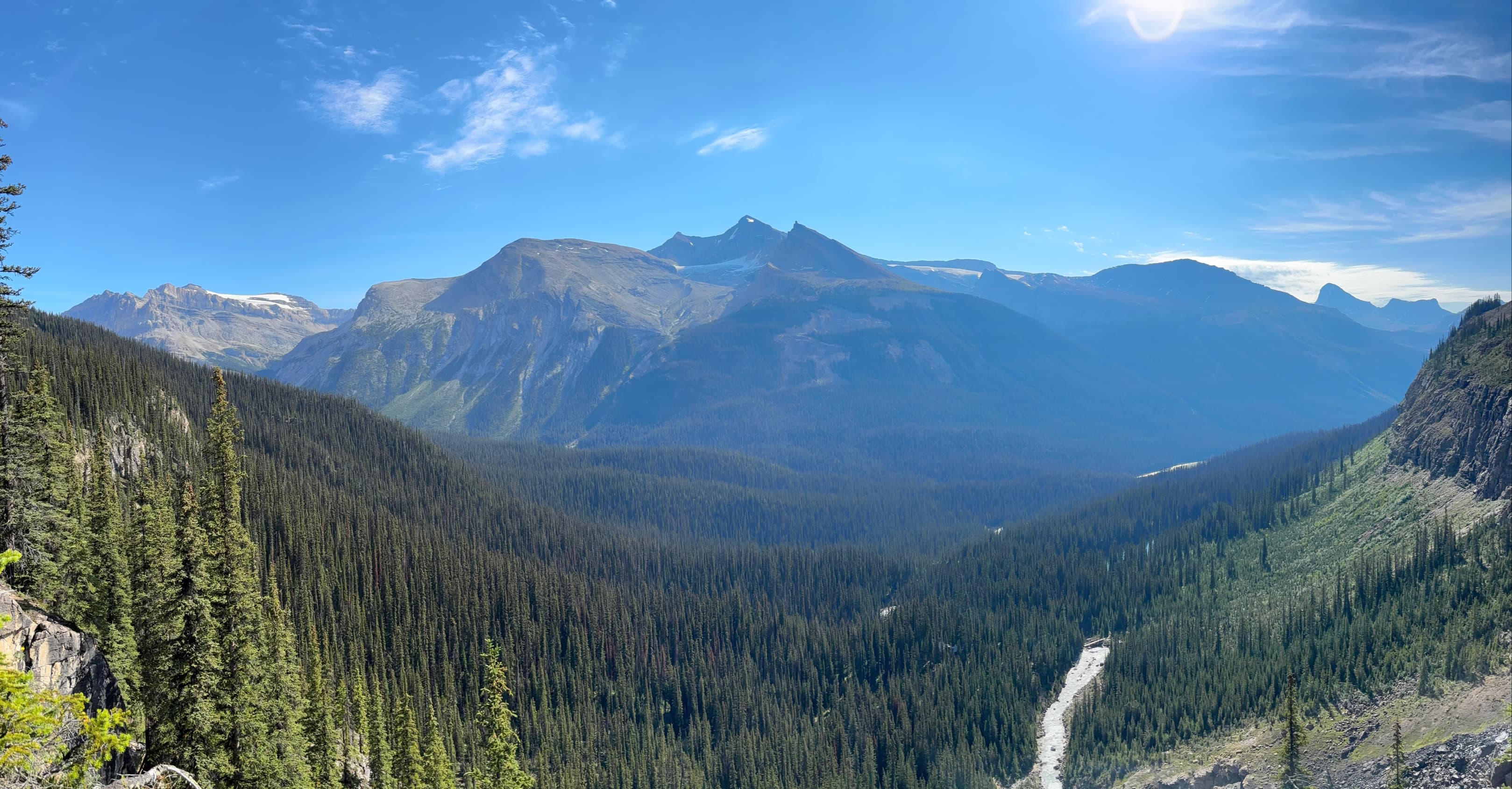
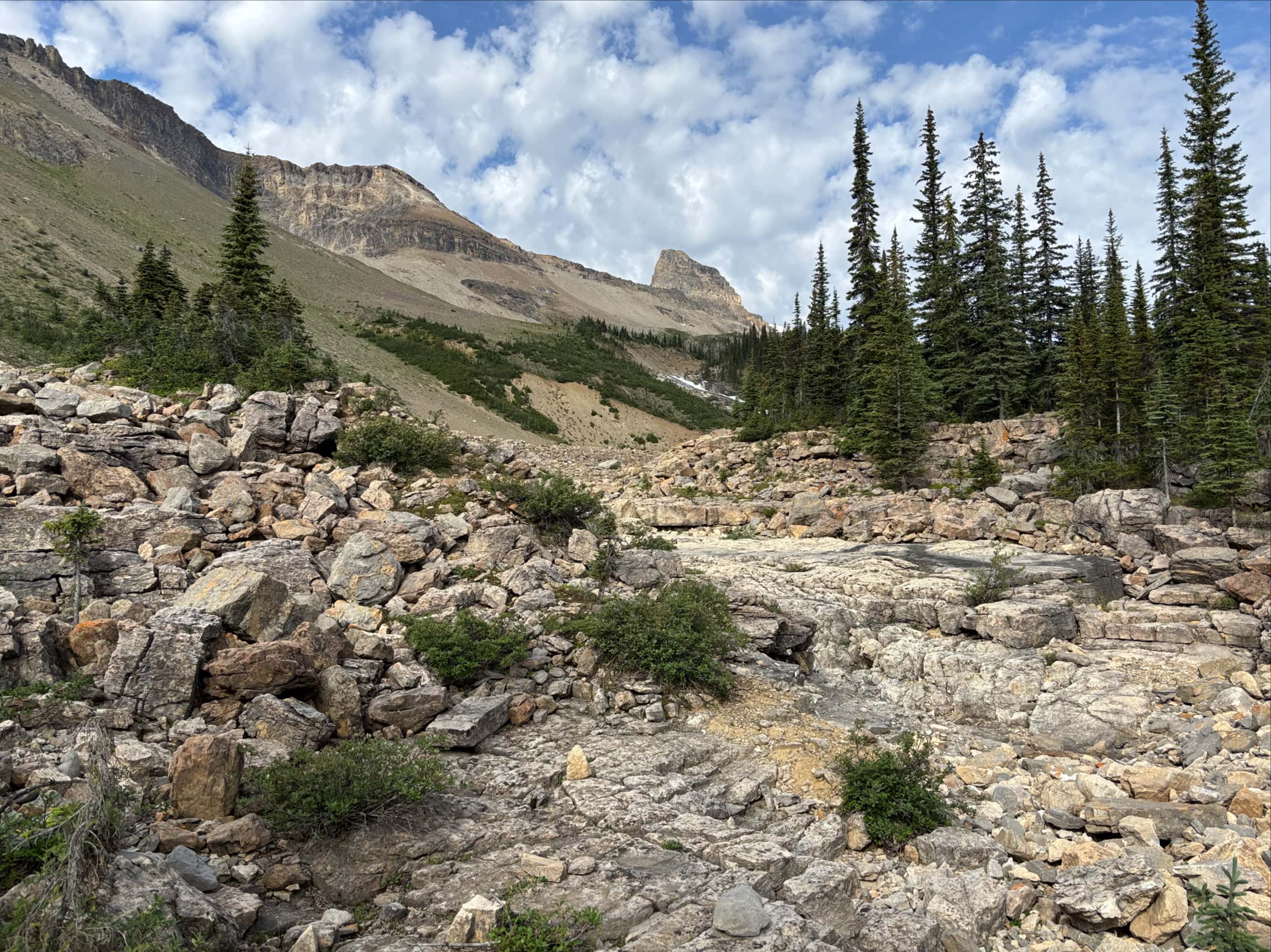
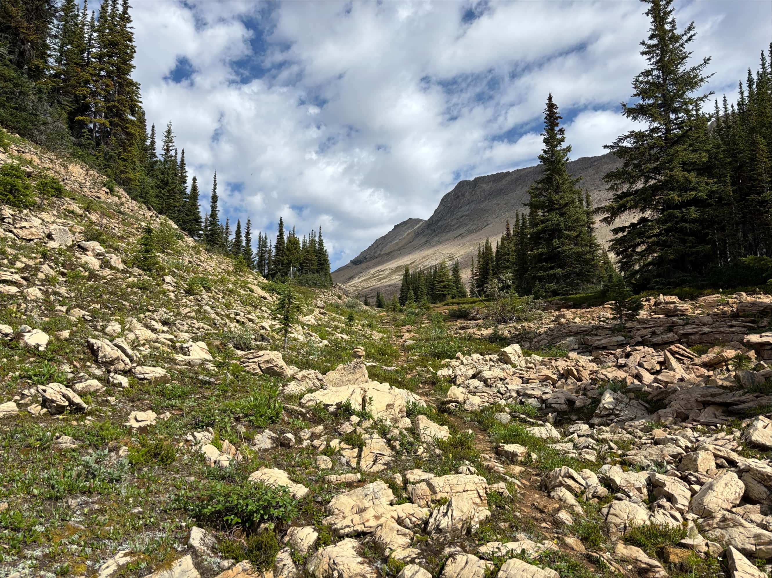
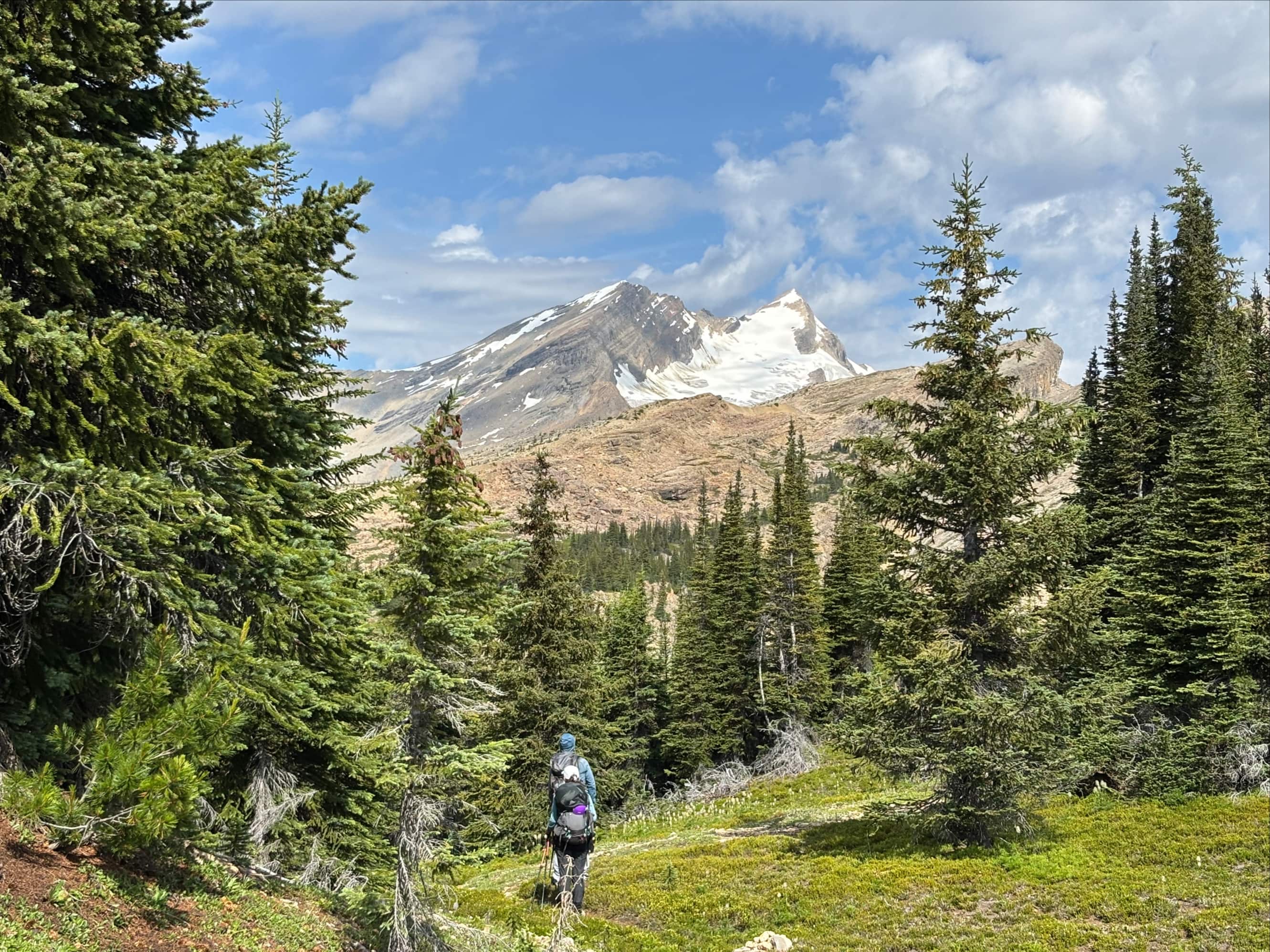
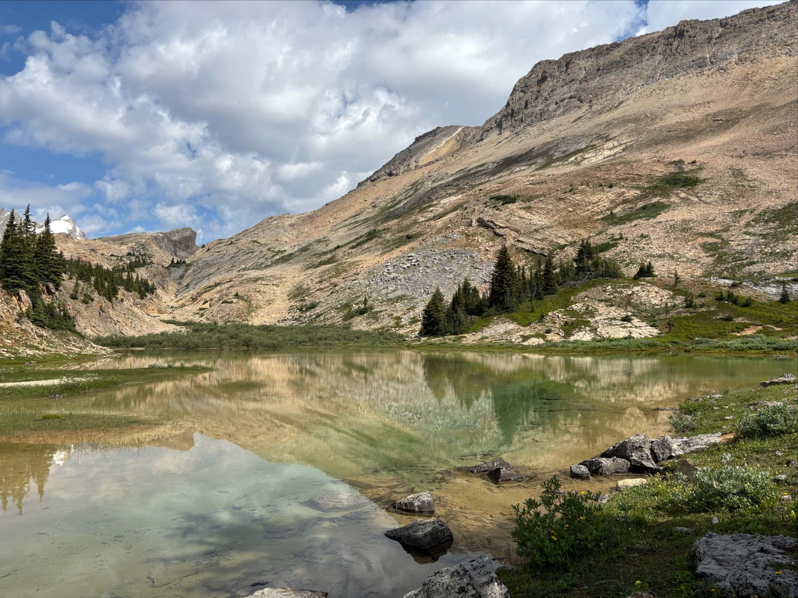
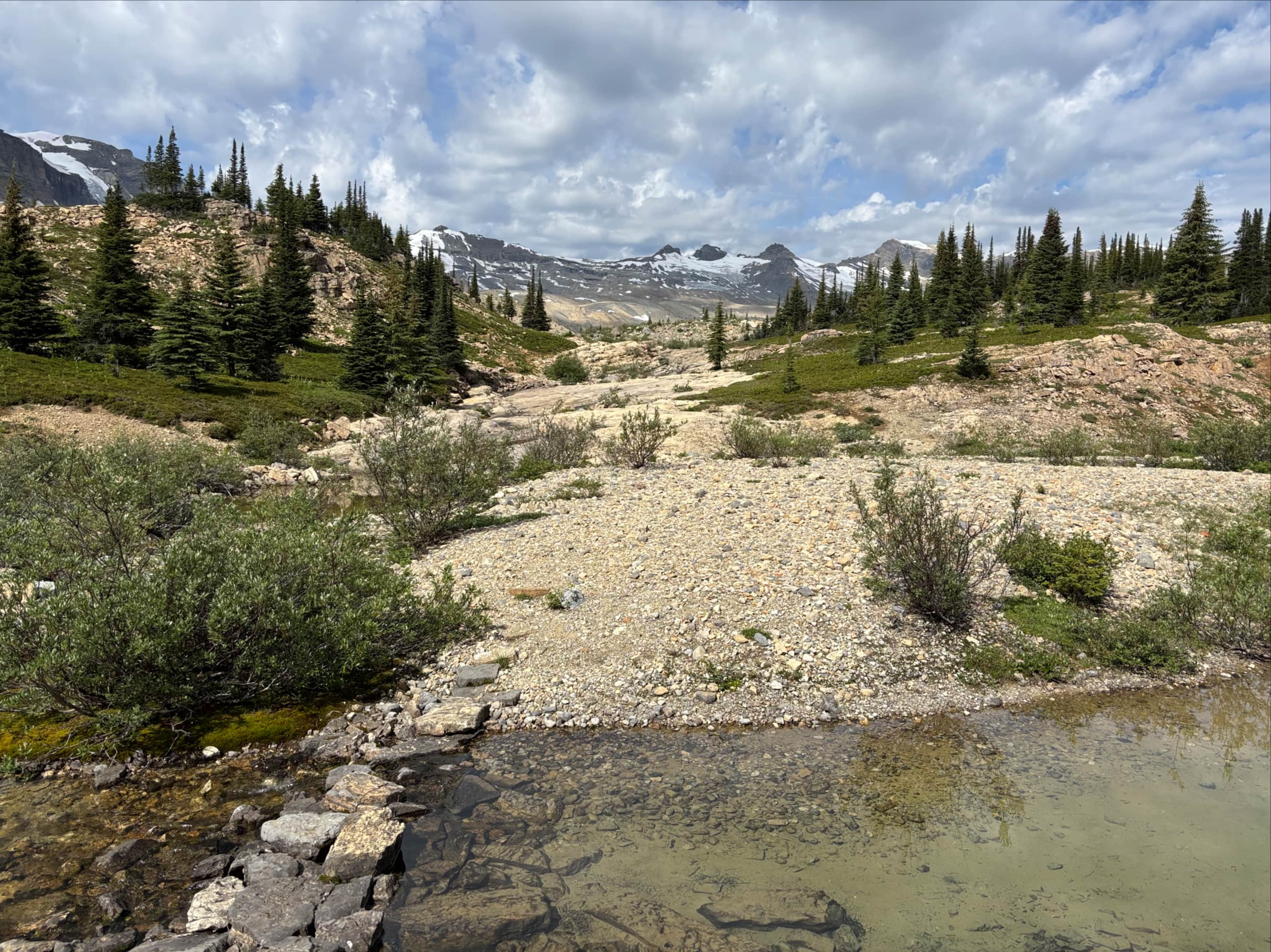
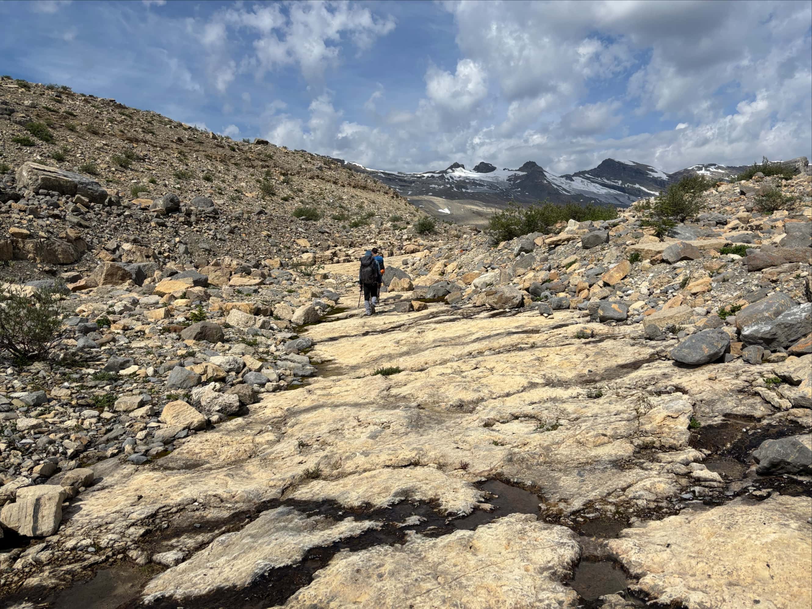
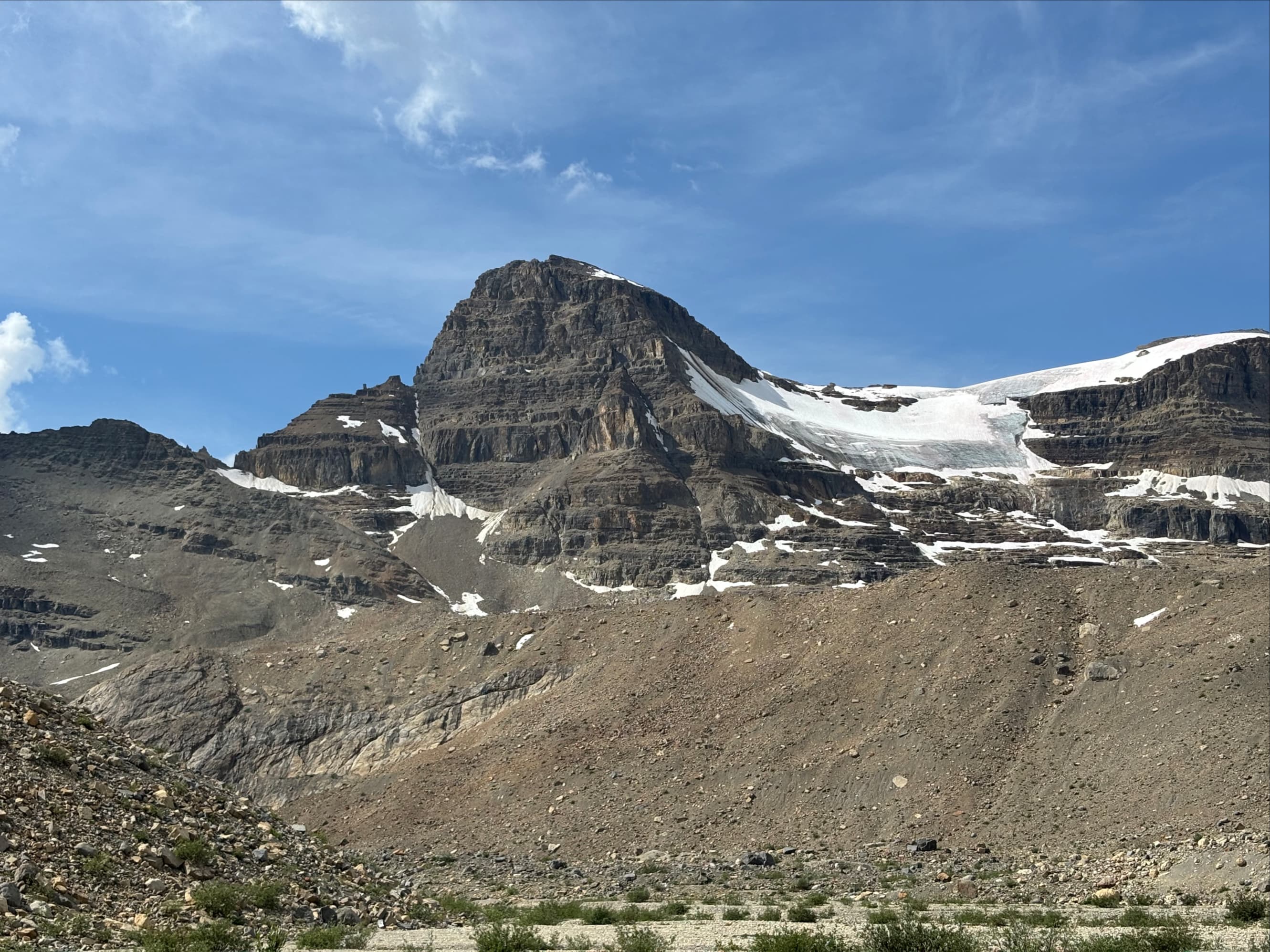
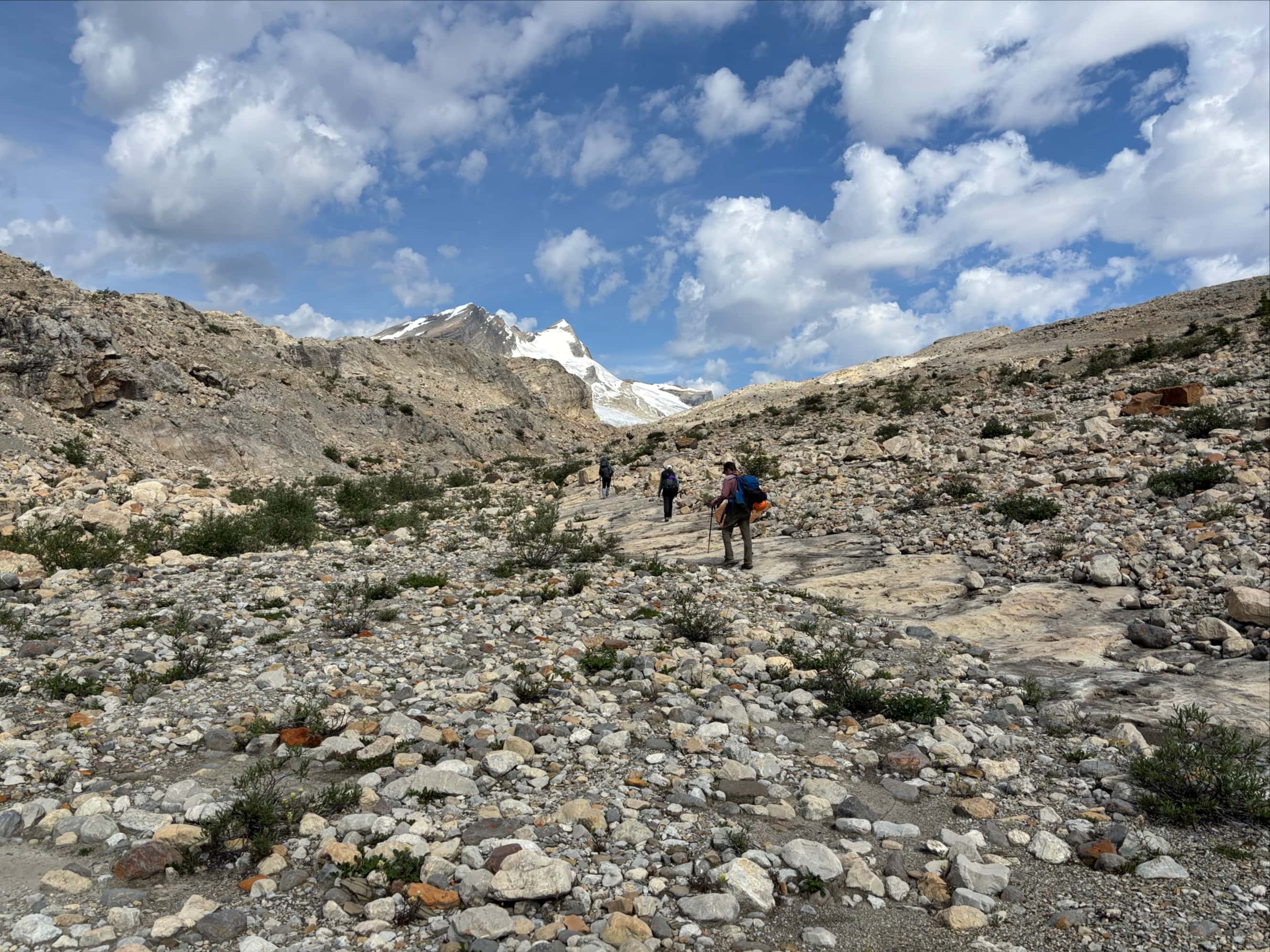
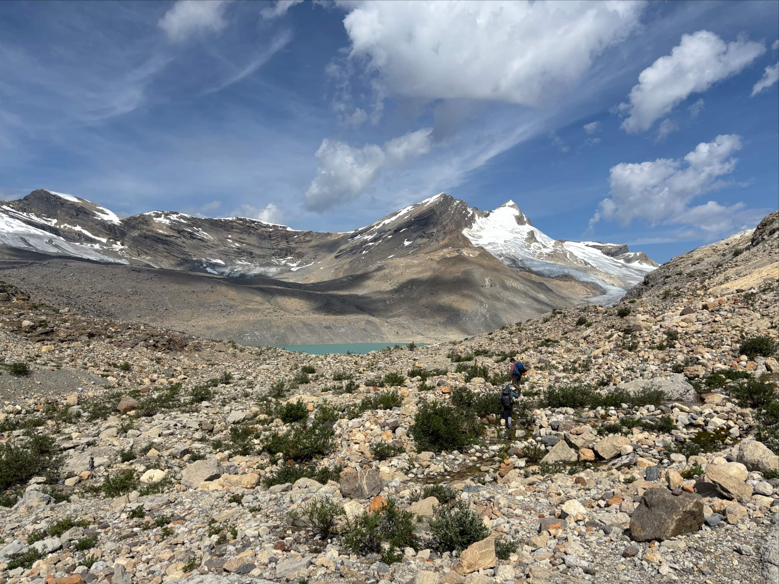
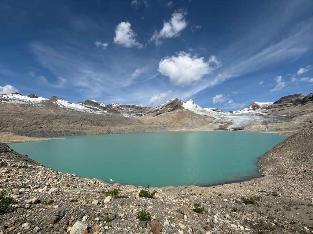
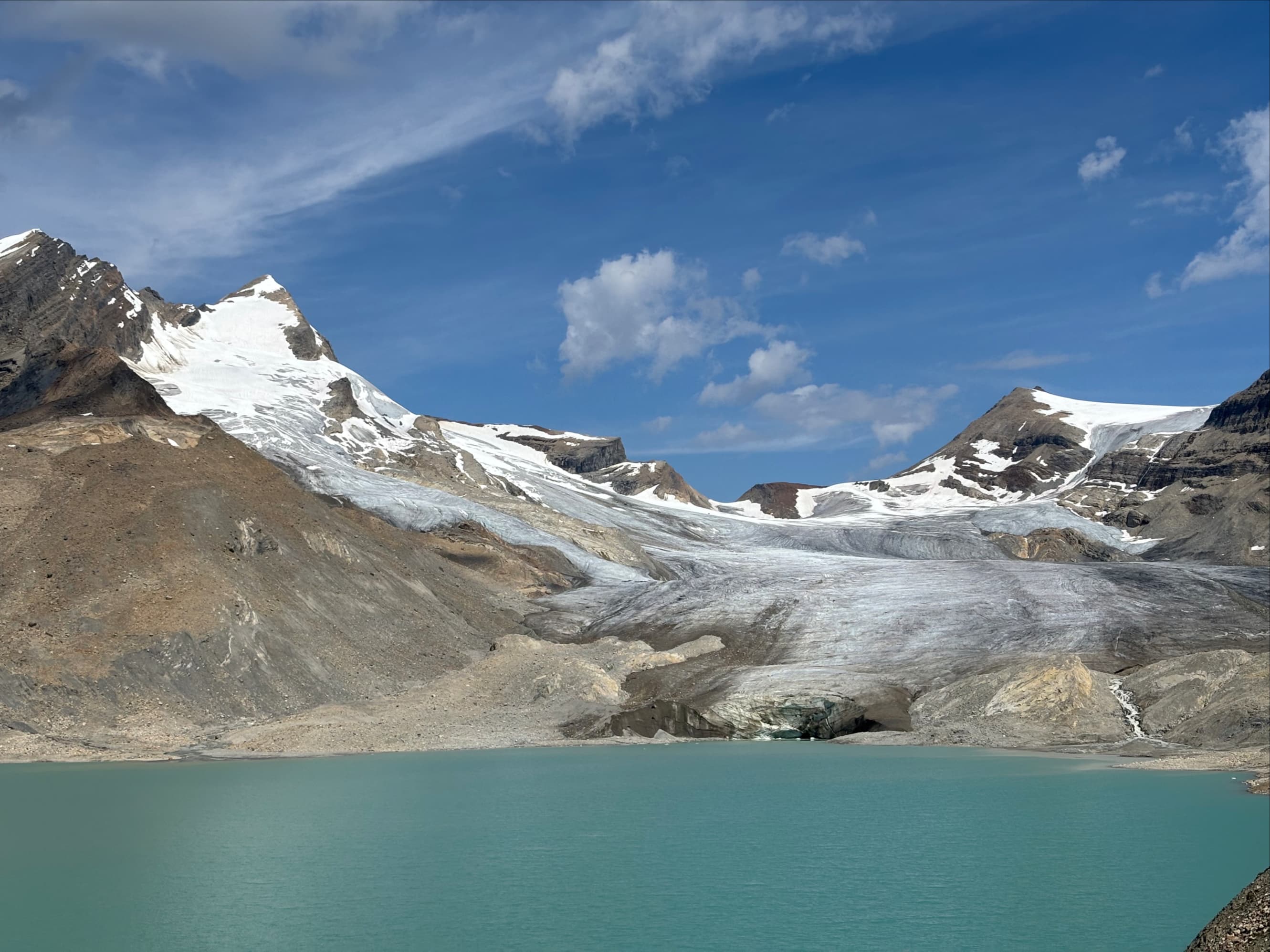
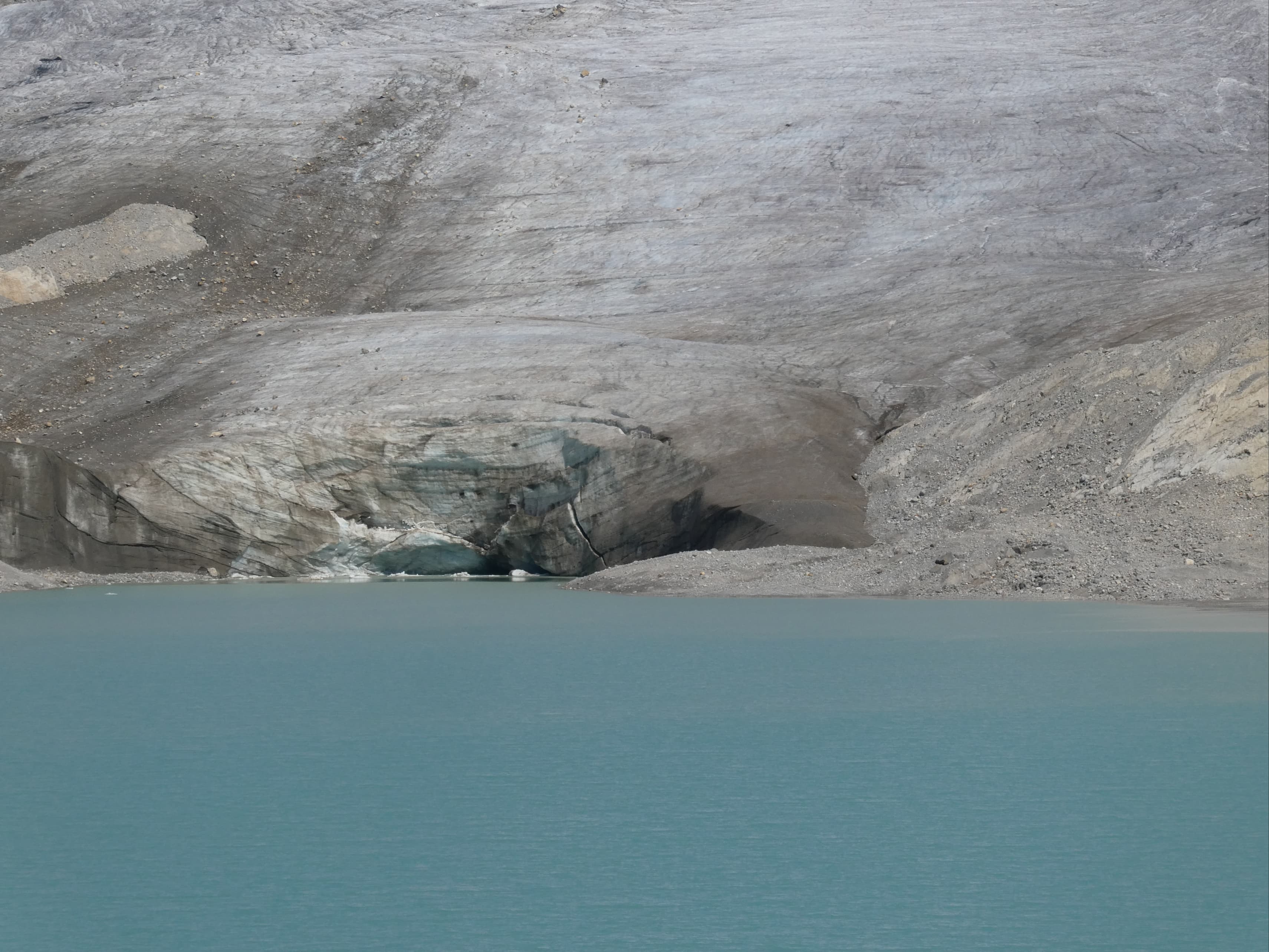
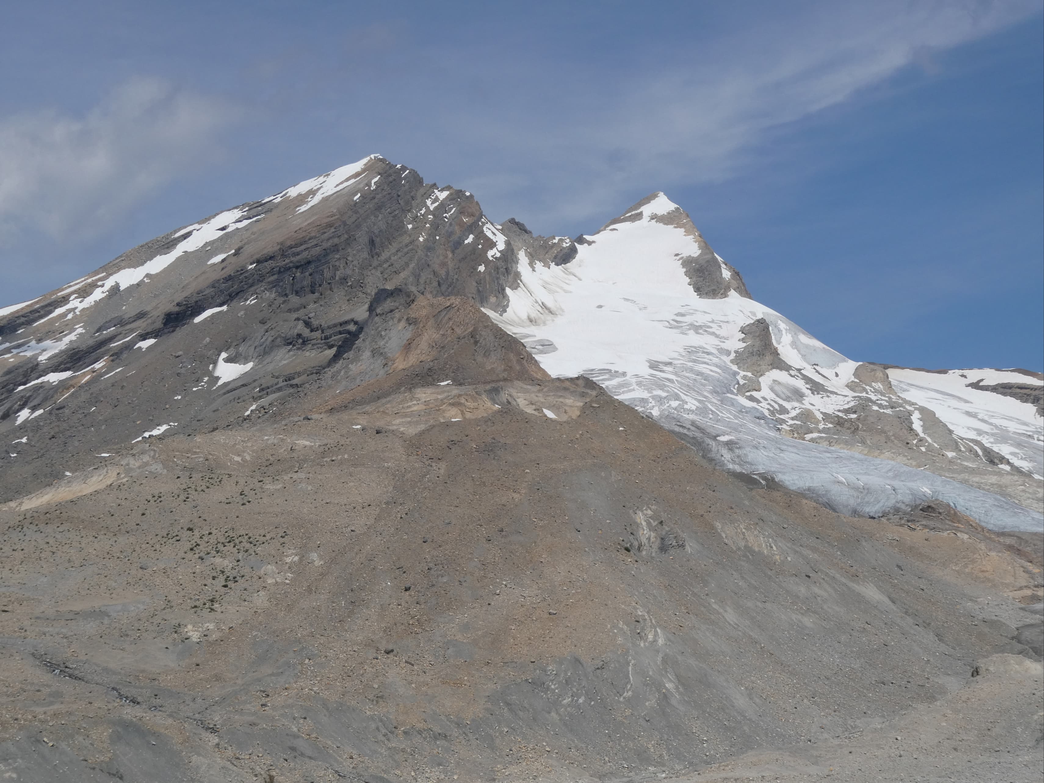
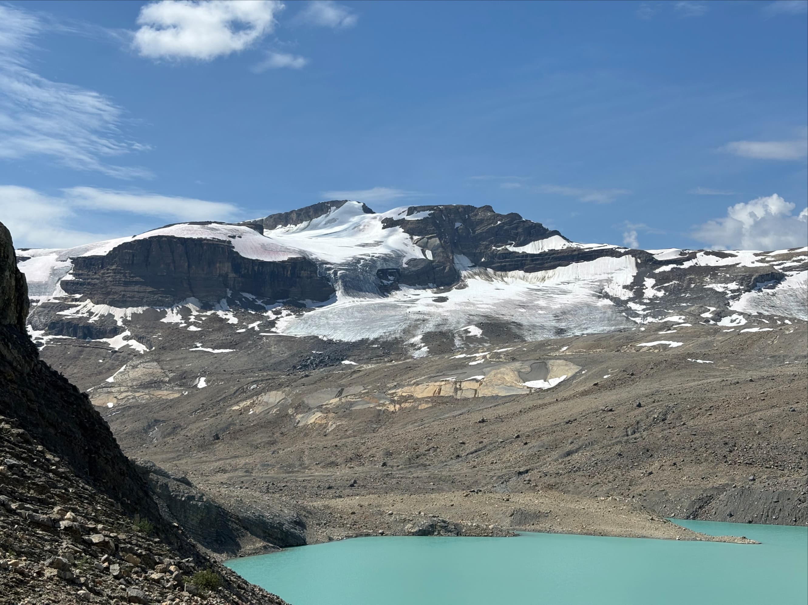
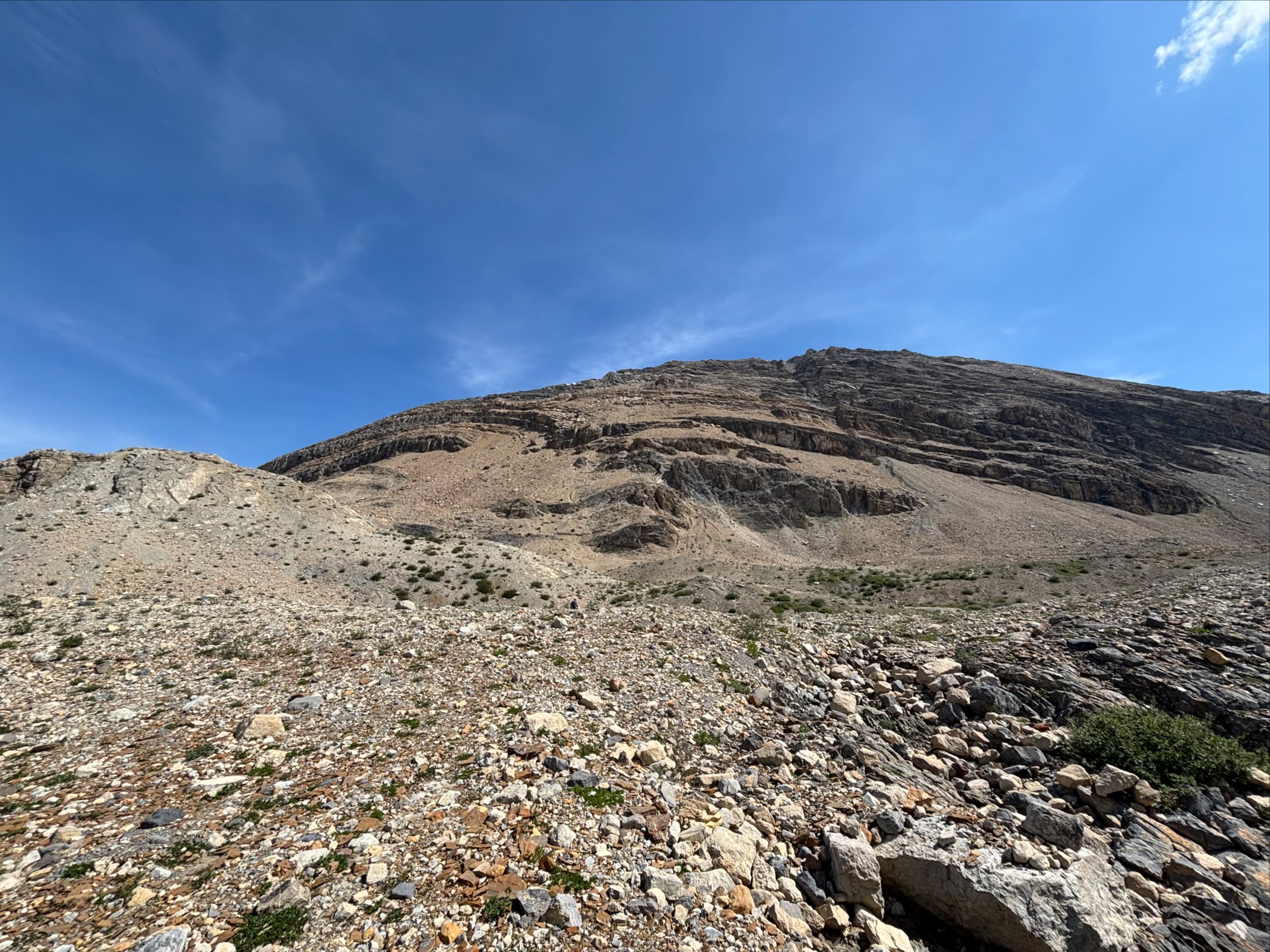
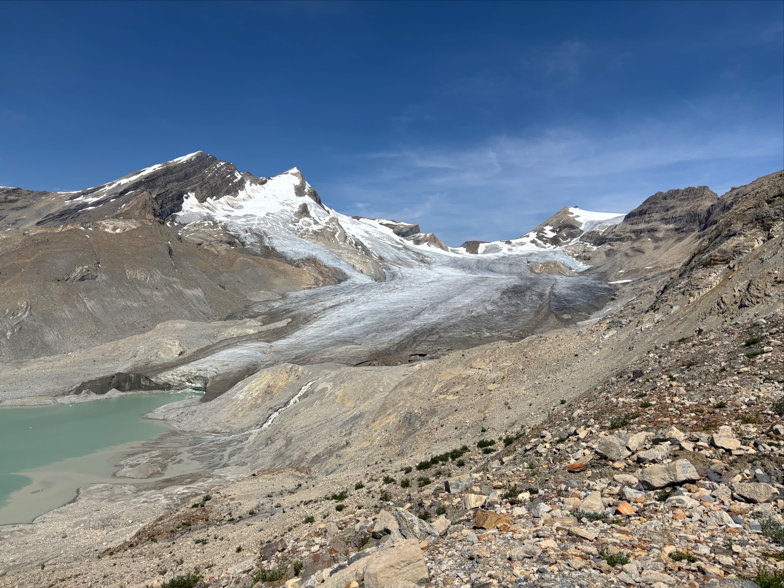
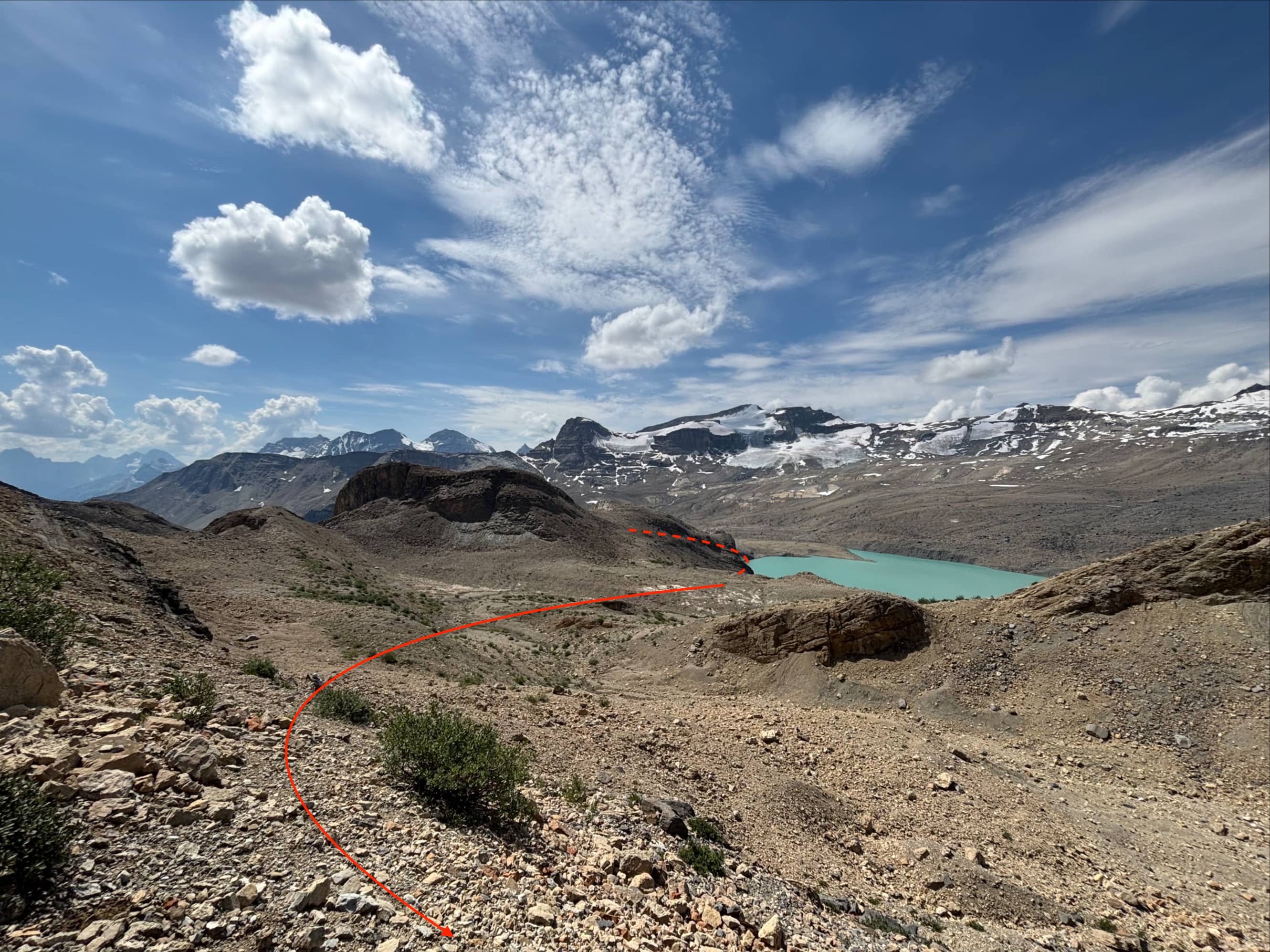
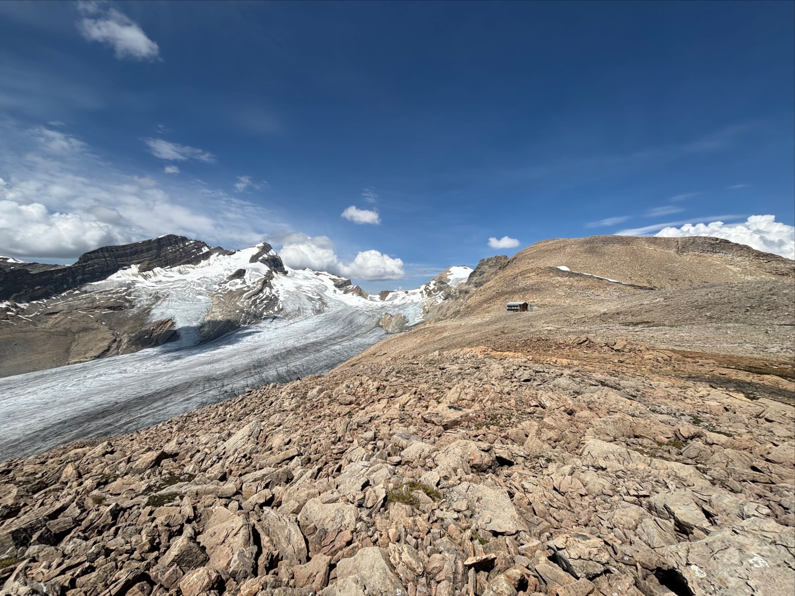
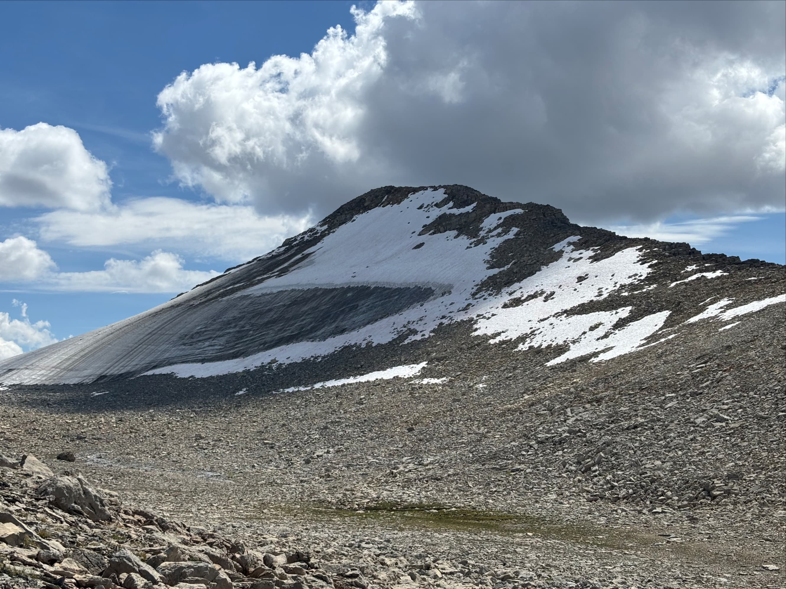
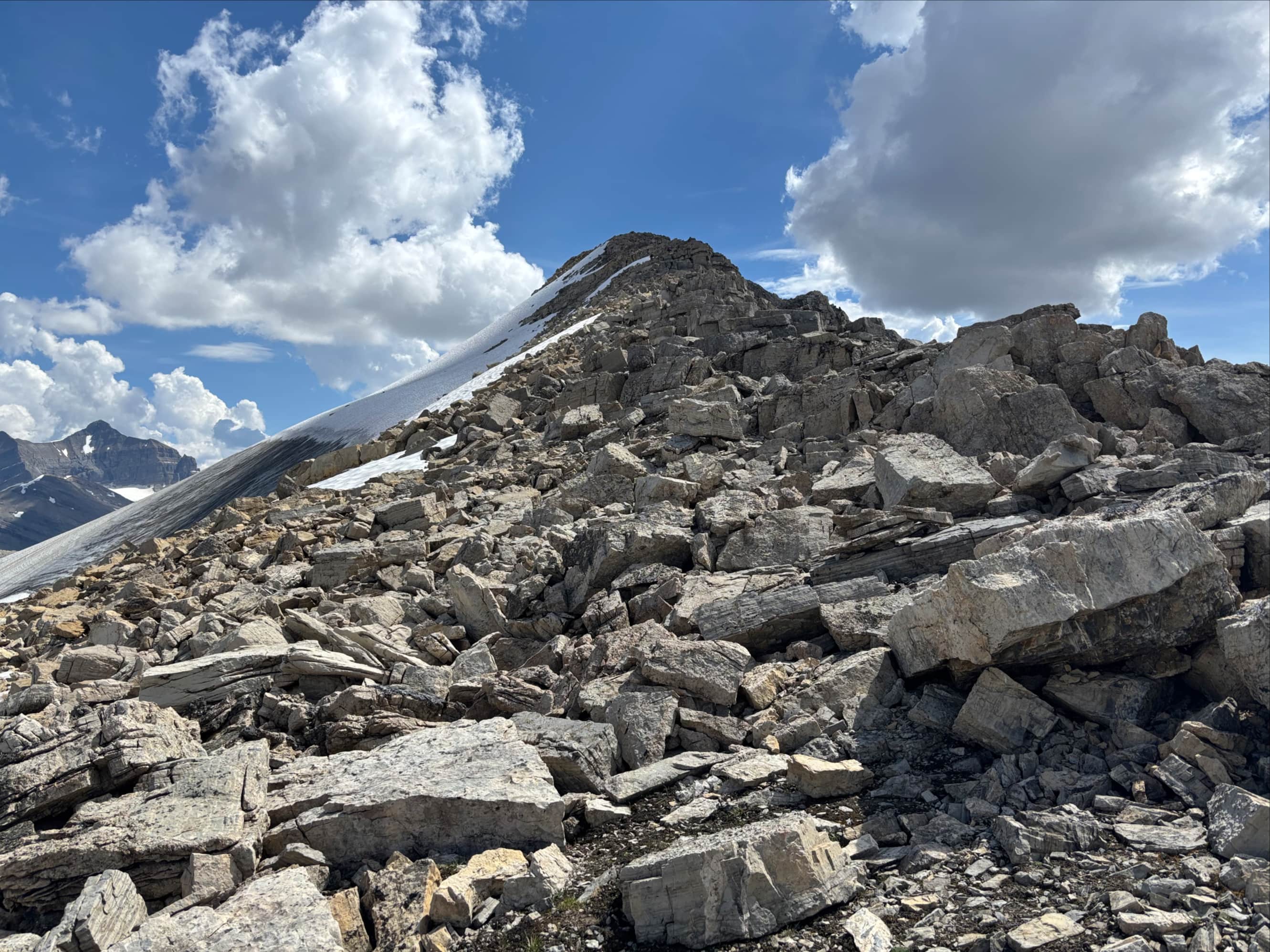
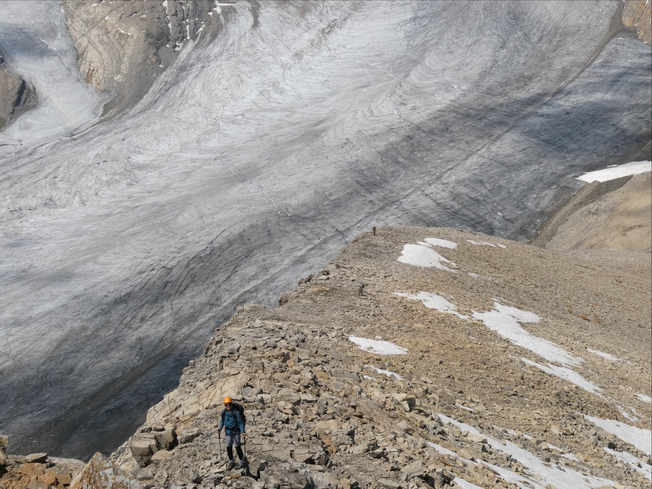
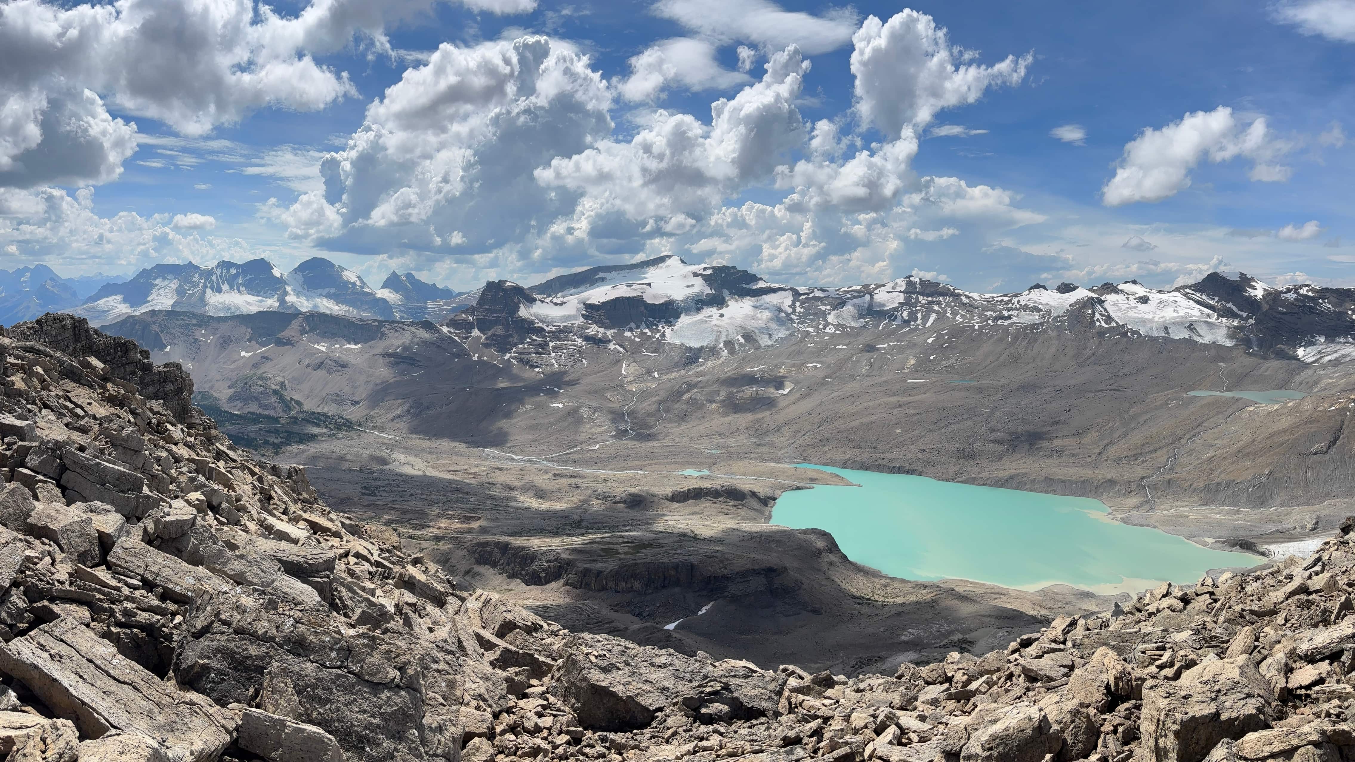
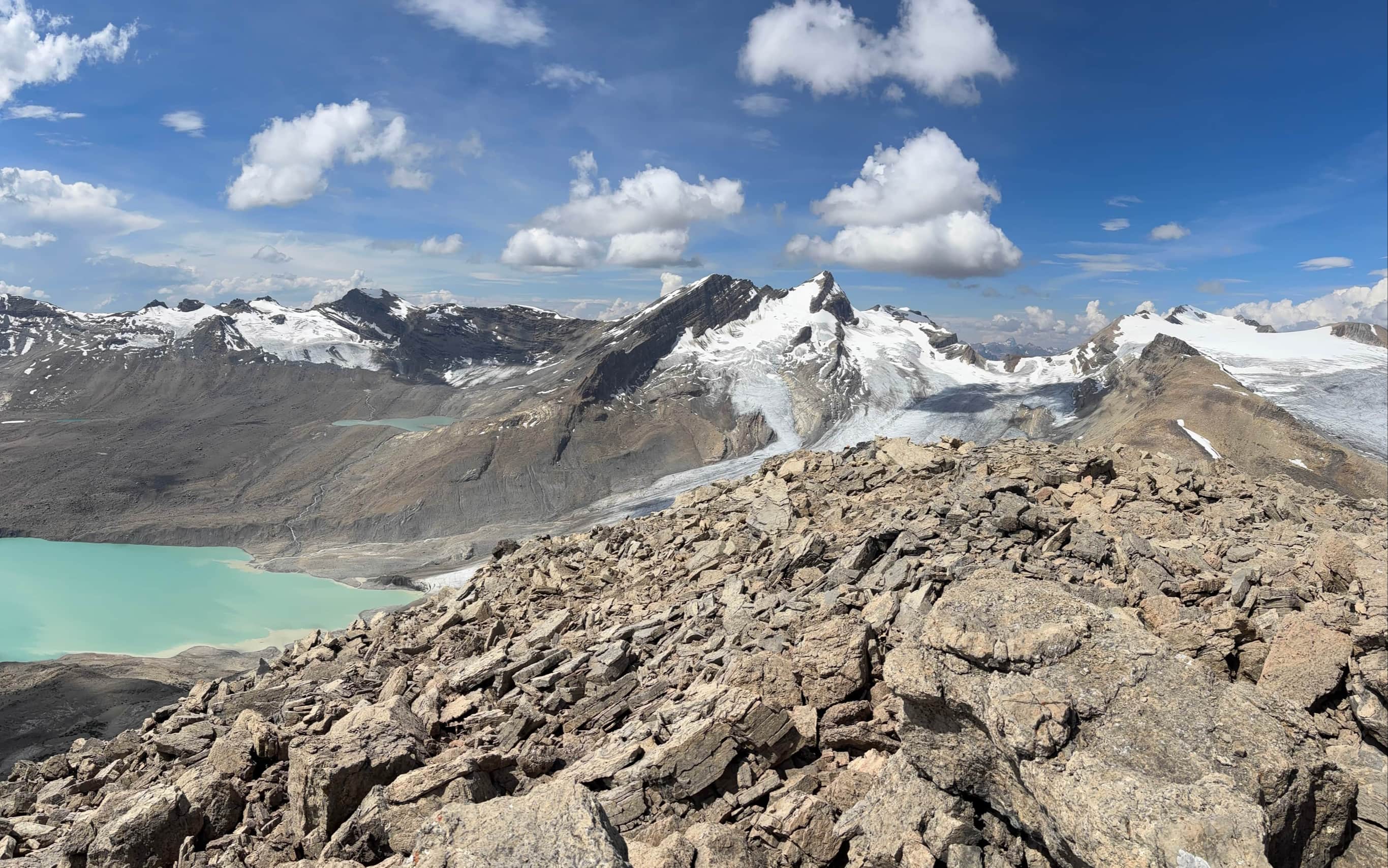
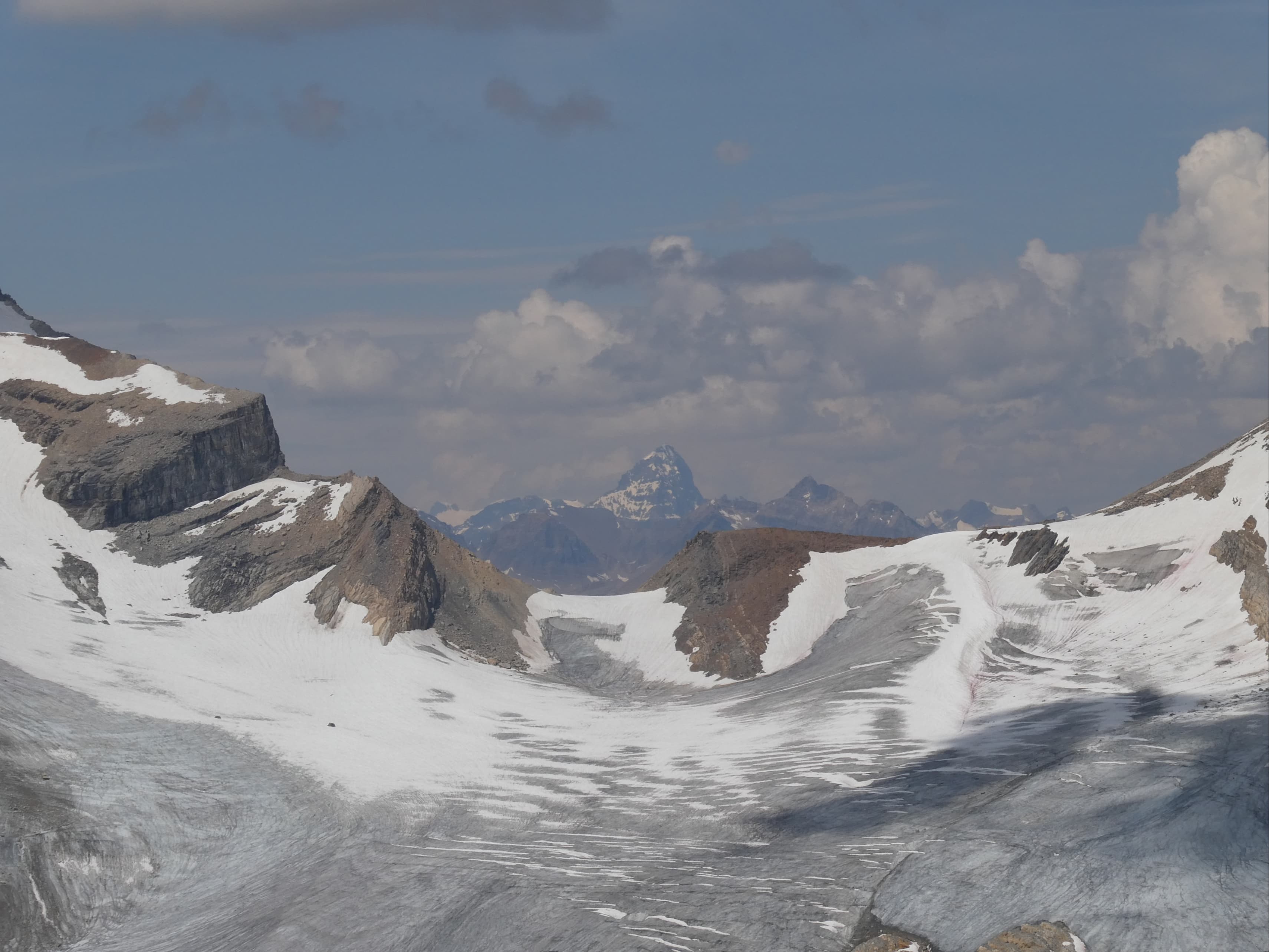
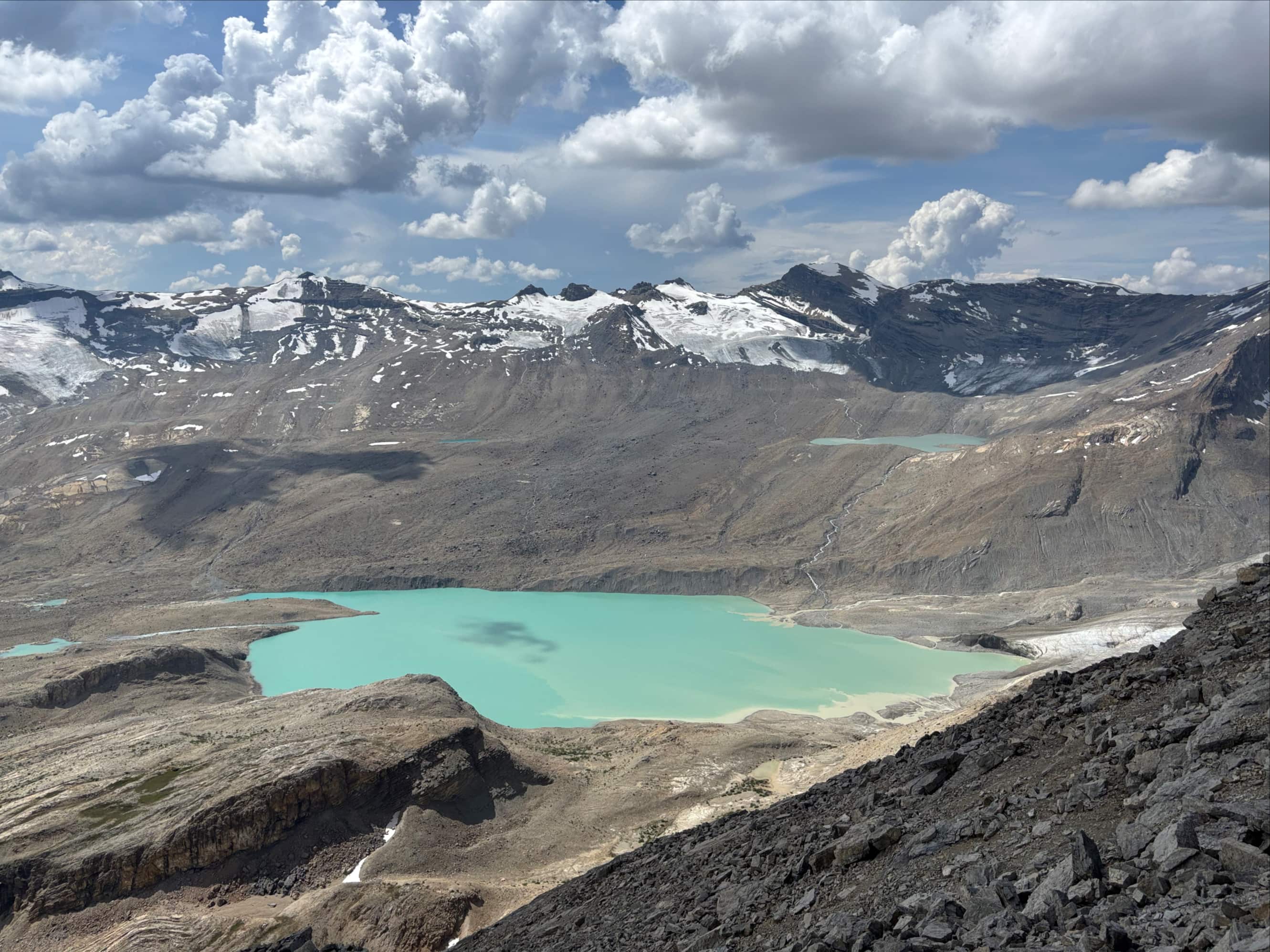
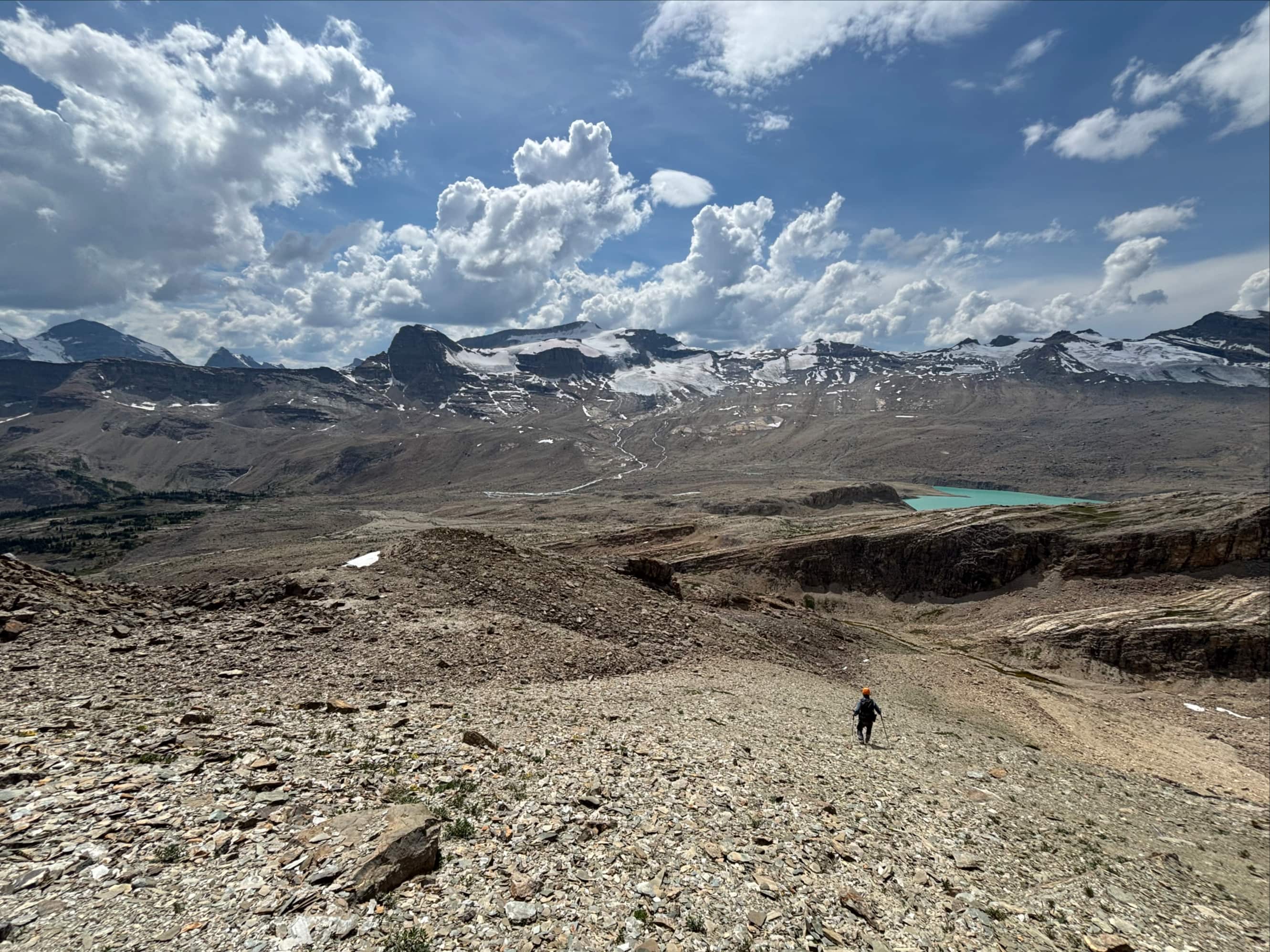
At this point we left the official Whaleback Trail and started walking west, first along dried slabs in the creek bed then along a very obvious trail just a few meters north of the creek bed. We passed an impressive but un-named waterfall then started steadily gaining altitude and eventually reached a tarn at the foot of Yoho Peak’s long southern ridge. We took what Mike at Giant’s Gate describes as the “scenic route” from there, heading west and crossing the exit stream of the tarn and entering a boulder field. We didn’t climb up the moraine directly ahead despite spying a couple of cairns up there. Instead we sought out the “Karst Highway” – an intermittently present smooth rocky surface. This, along with intermittent cairns, led us west, the northwest following a creek bed that brought us to the gap between two high points southwest of Yoho Peak. There we were greeted by an amazing view of the huge glacial lake associated with the glacier flowing down from Mont Des Poilus and Arete Peak. Neither the glacier nor the lake have a name that I can find.
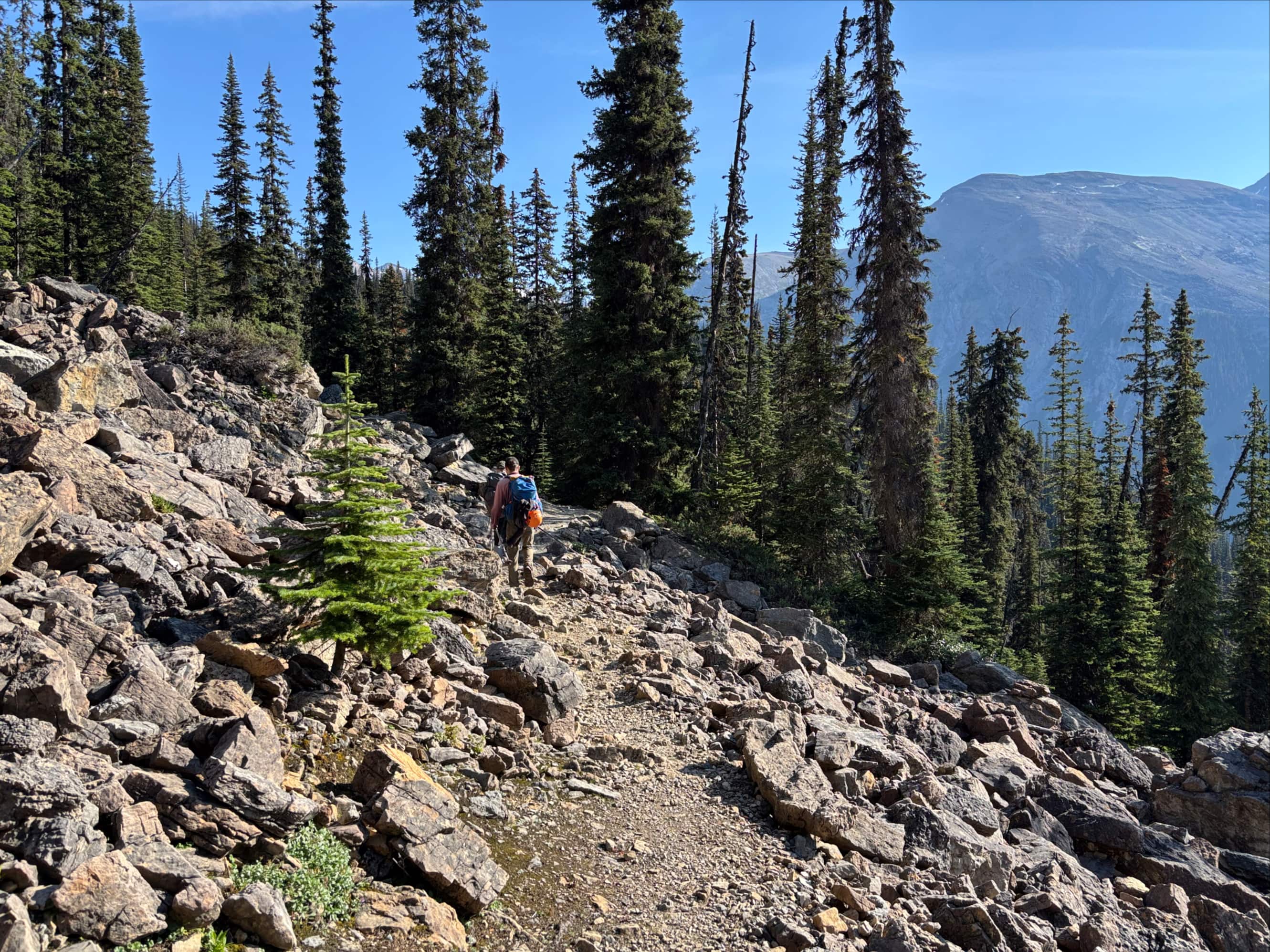
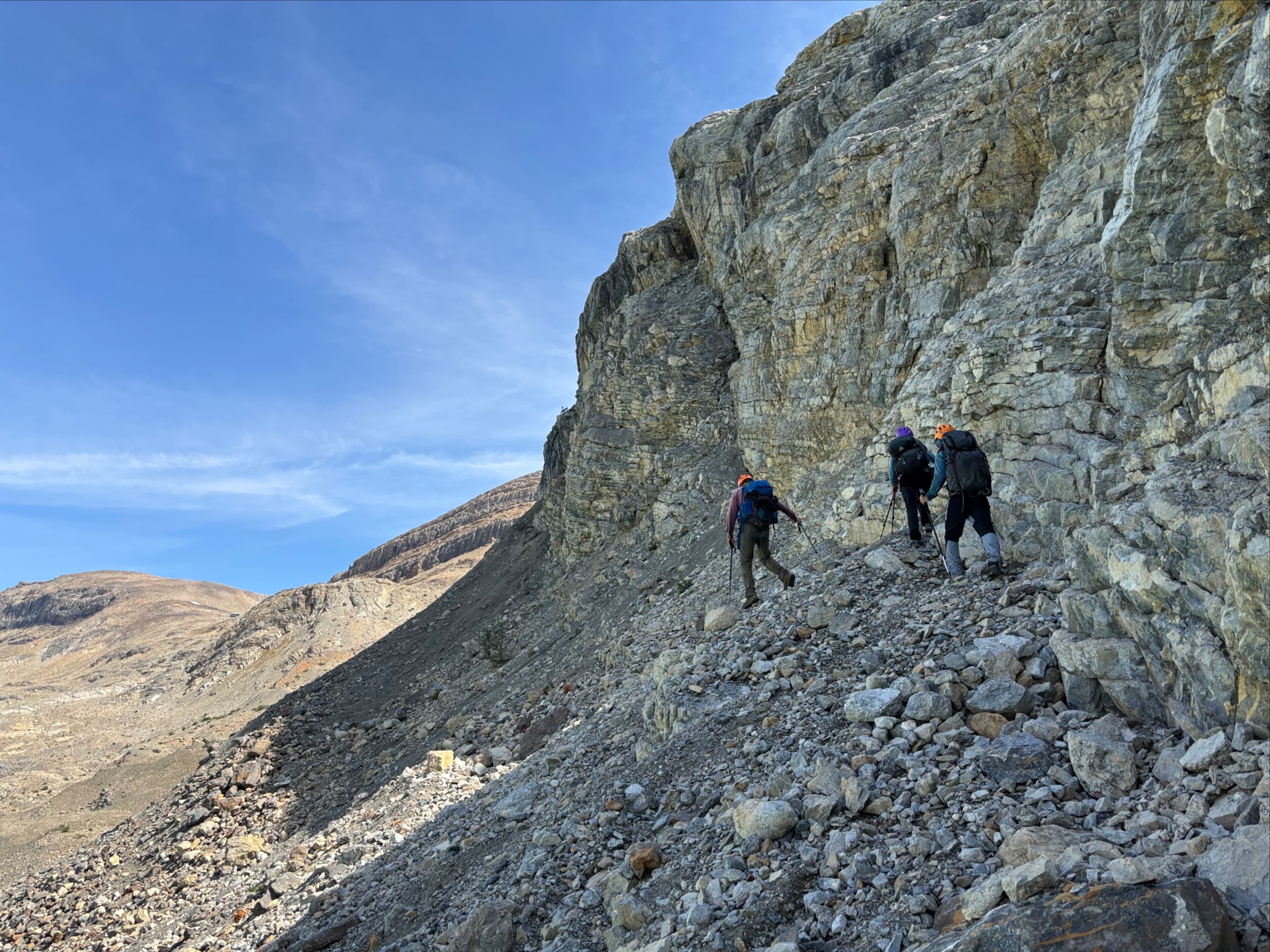
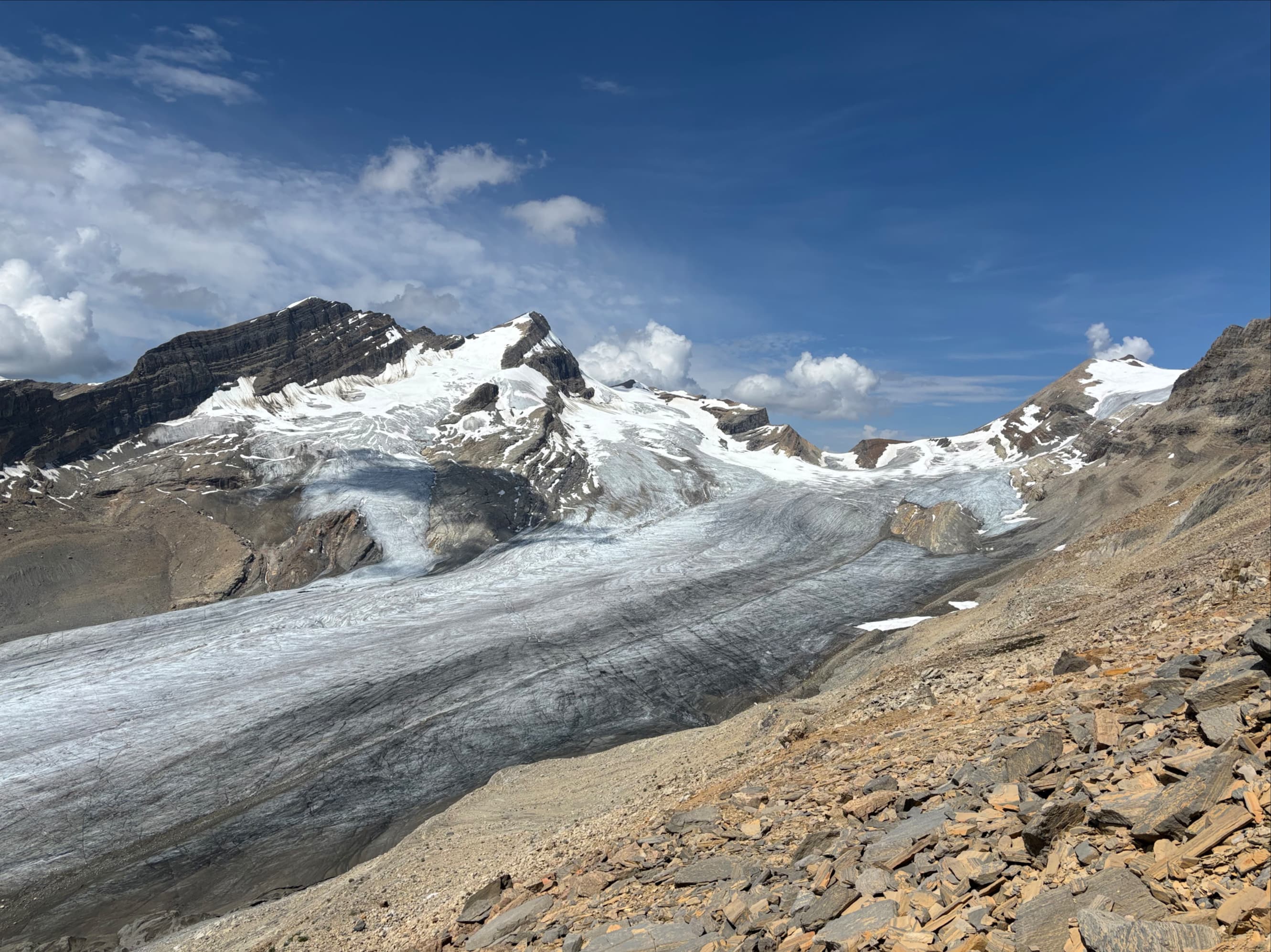
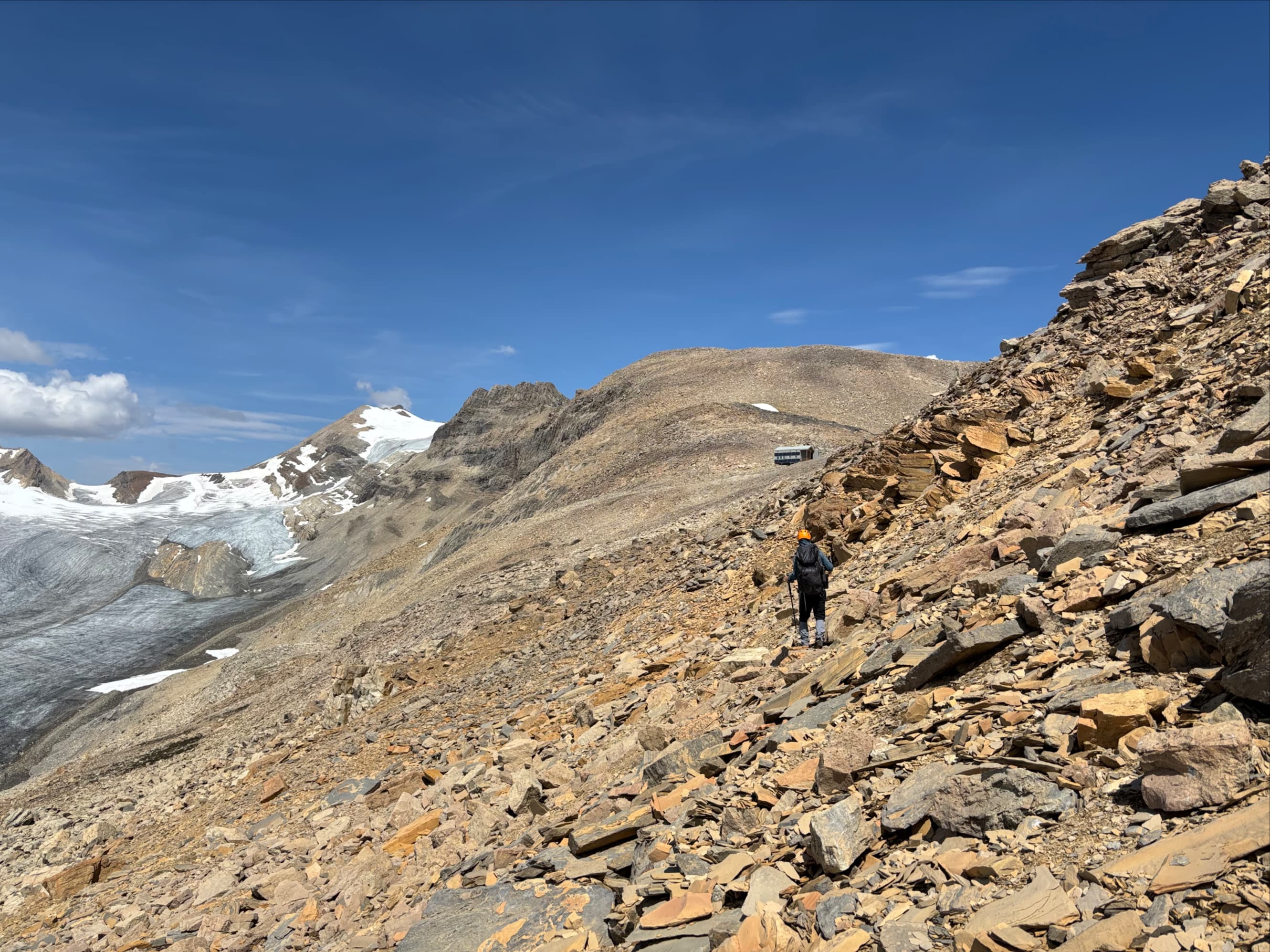
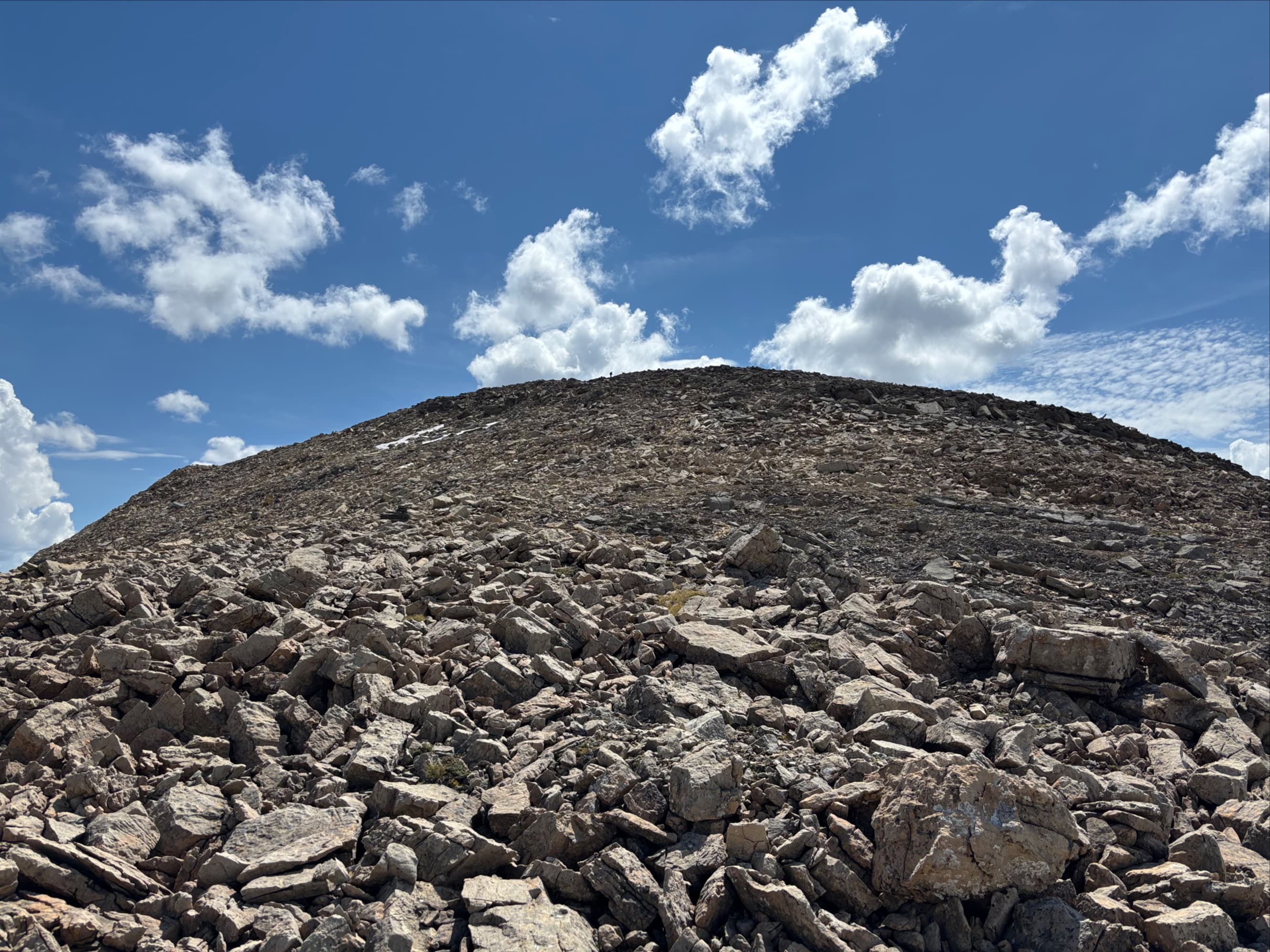
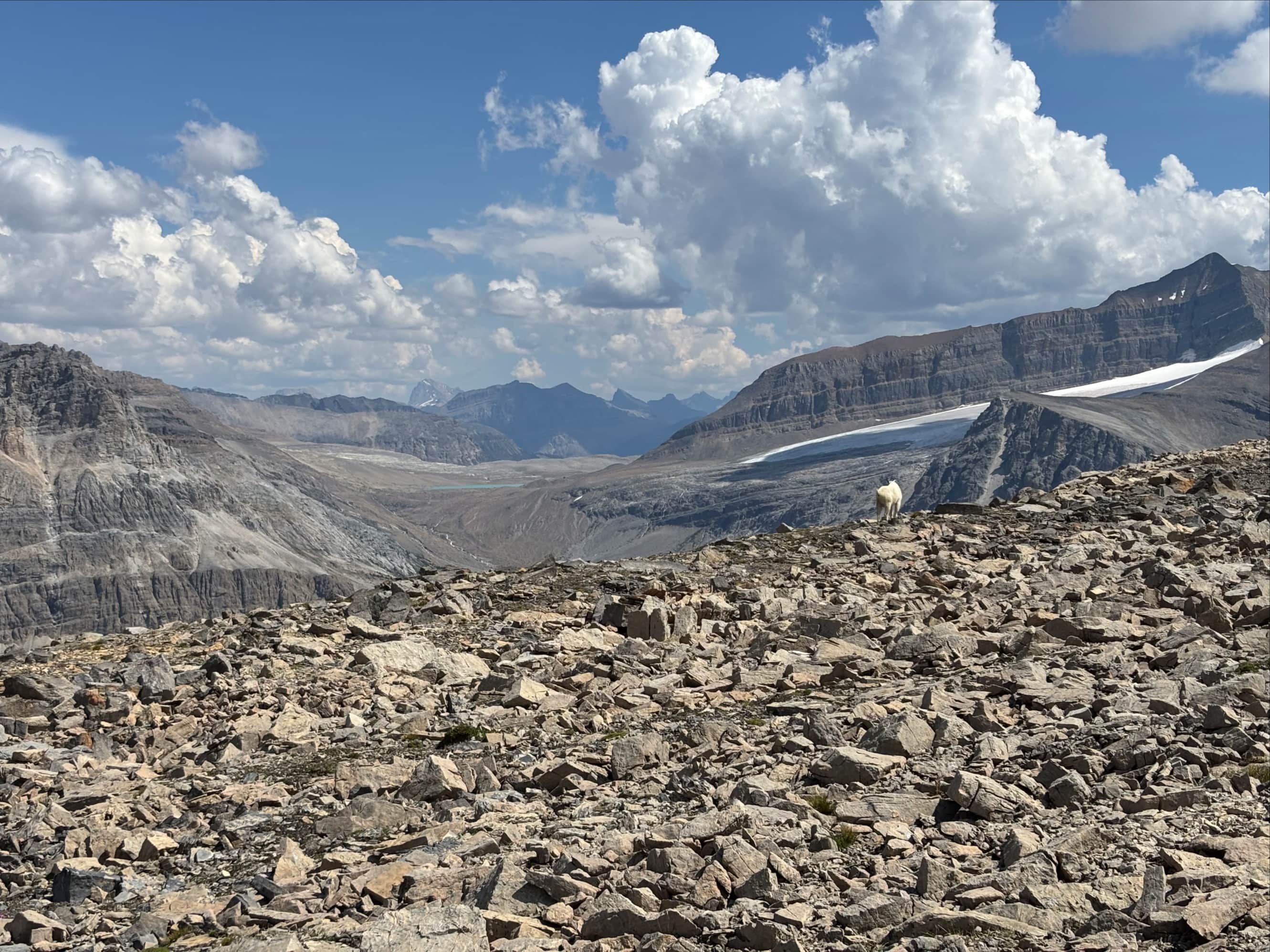
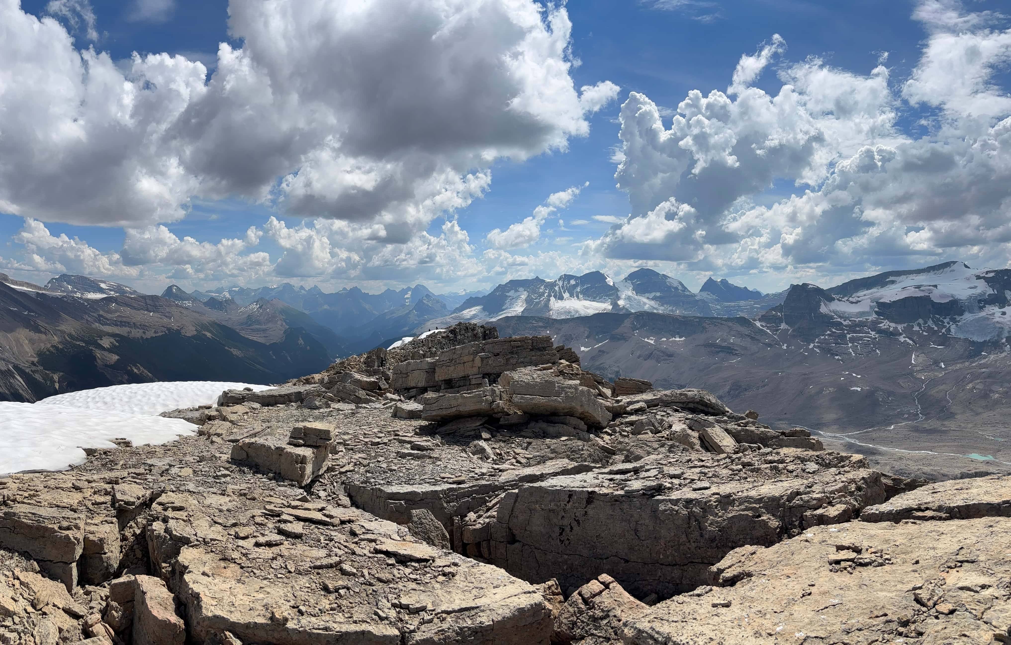
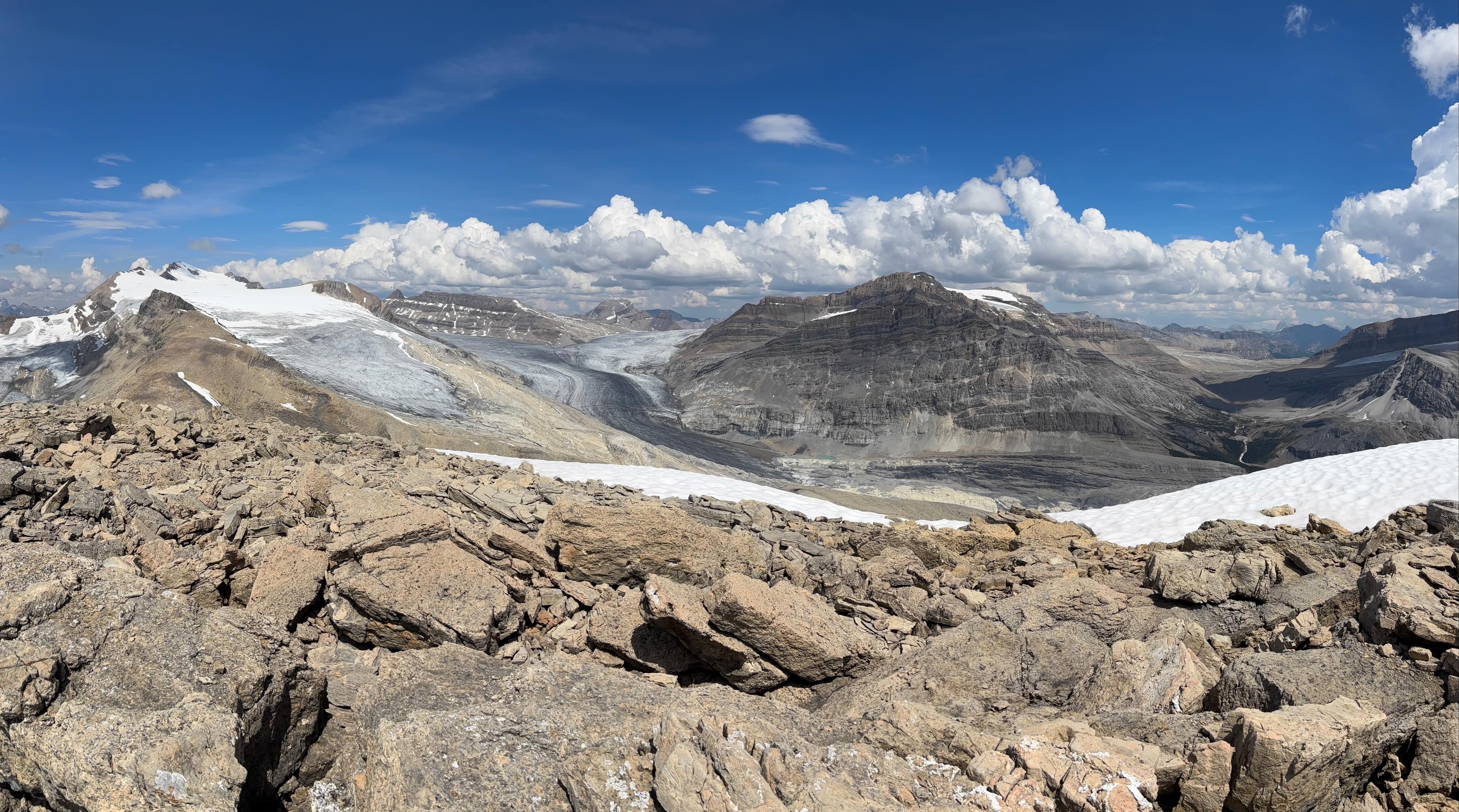
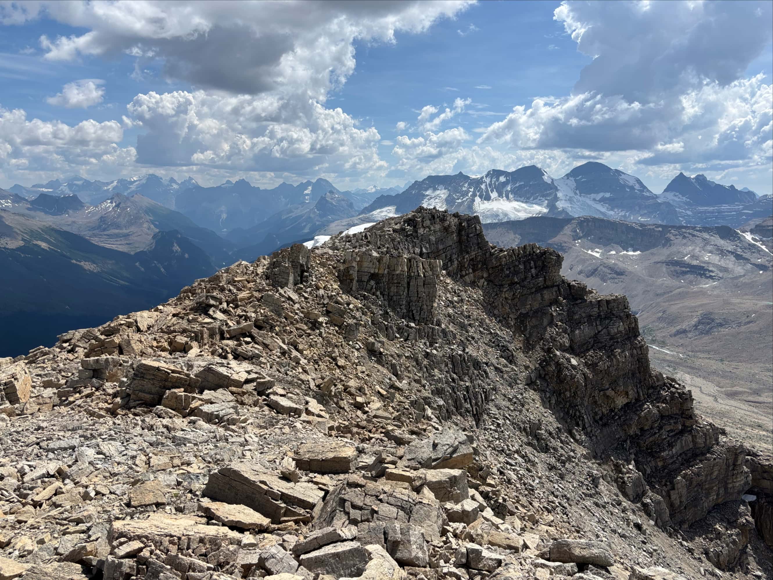
From there we started a time-consuming and sometimes sketchy traverse on what paths we could find, skirting above the glacial lake on the rubble-strewn slopes of the major high point to our right. Once around it we headed more or less straight north on the slopes below Yoho Peak, making our way to the col north of the summit. An ACC hut was visible and helped guide us, though we didn’t go all the way to it. Instead we hooked rightward onto Yoho’s northern ridge as soon as it was feasible. Then we turned south and followed the ridge to the summit. This was mostly steep hiking with areas of straightforward scrambling. Finally reaching the summit we took a fairly long rest, enjoying the views of high peaks and glaciers in all directions. There was only one other party on the mountain that day and luckily the weather remained fair despite some dramatic clouds in the sky.
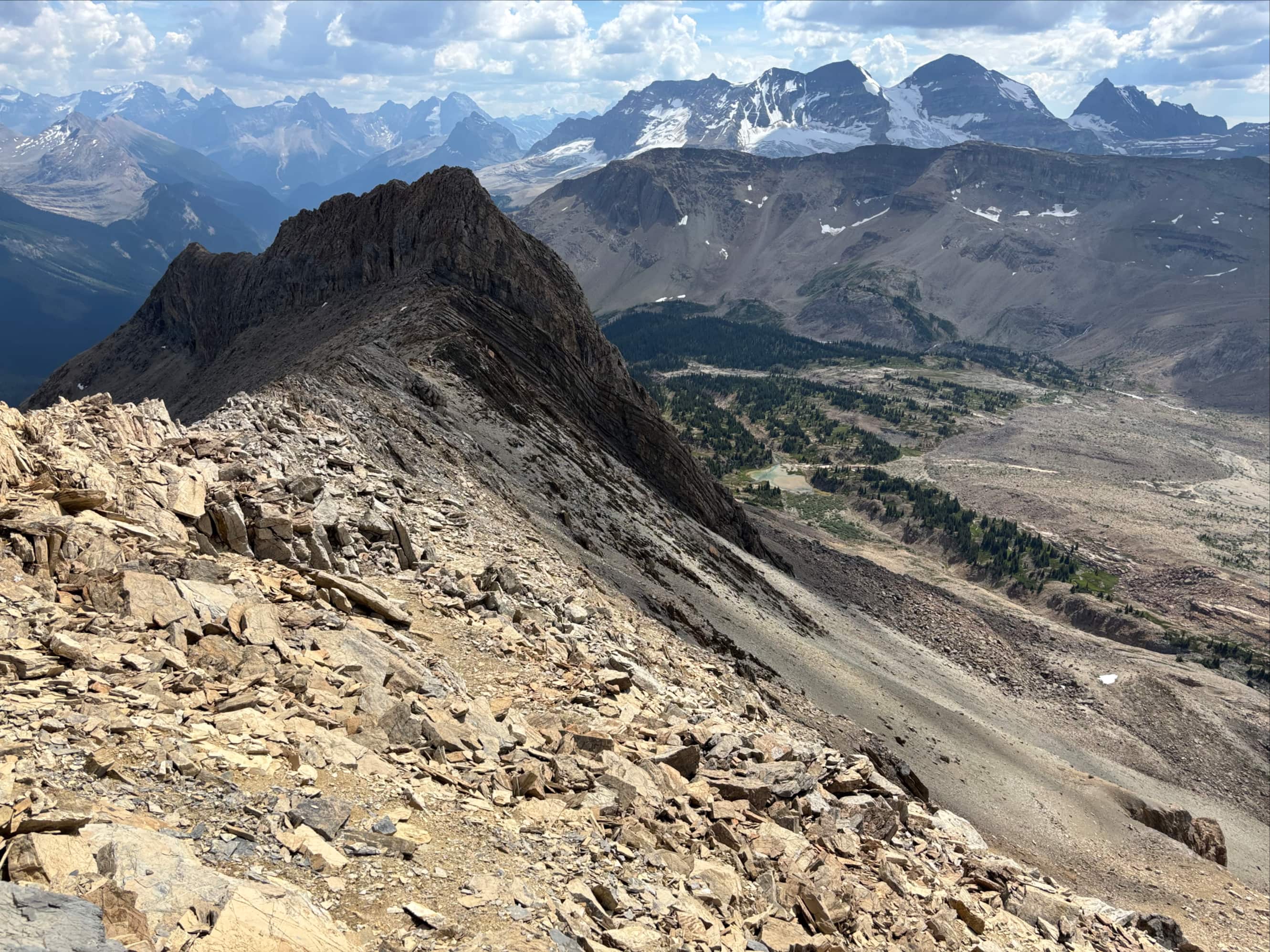
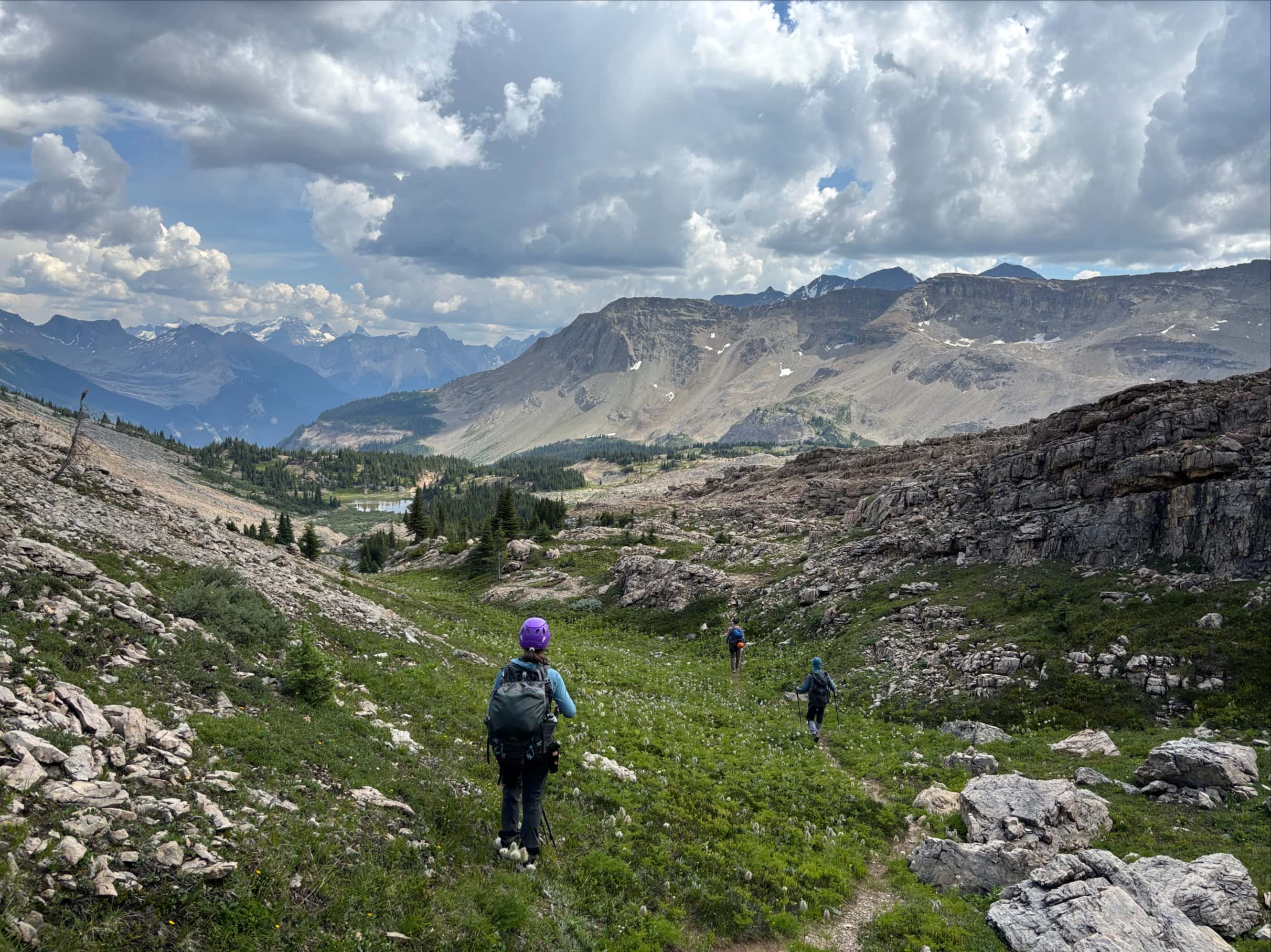
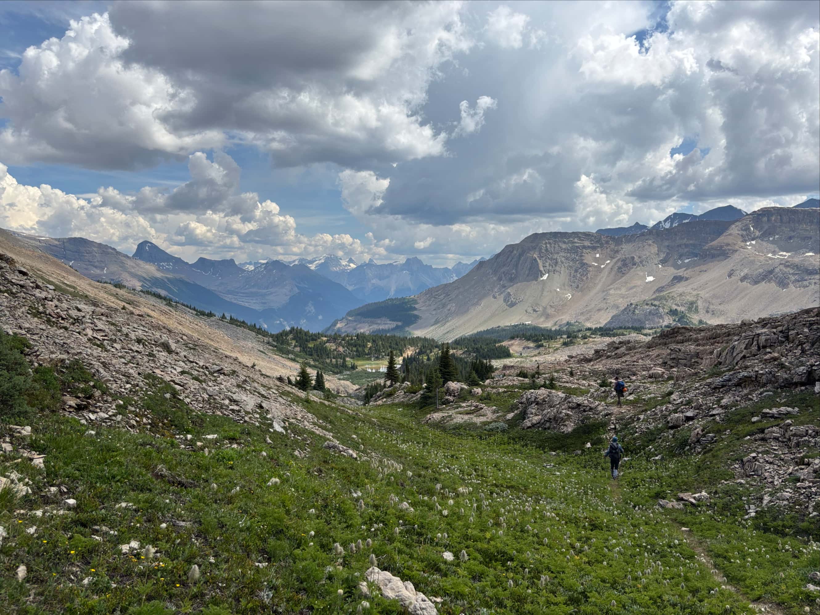
To descend, we didn’t exactly follow the Giant’s Gate route, which involved descending some steep slabs. Instead, we headed south along the ridge from the summit and carried on until we almost reached the col. We kept scanning the terrain below us looking for a good scree run, and managed to find one that was visible all the way to the valley bottom. A very quick descent brought us to a babbling creek where we refilled and filtered water and took another break. We then followed the creek back to the tarn below the south ridge. From there we retraced our steps all the way back to Twin Falls Campground.
It was a somewhat challenging day – the round trip from the campground was more than 25 km, and we had also hiked in the additional 6.6 km to the campground that morning. The day was hot and humid, but we were fortunate to avoid thunder storms. Our evening in camp passed peacefully and the next day, facing more unsettled weather, we decided to abandon our plans to climb Isolated Peak and instead hiked back out to our cars.


“Another gratuitous shot of the glacier” is a superb photo!
LikeLiked by 1 person
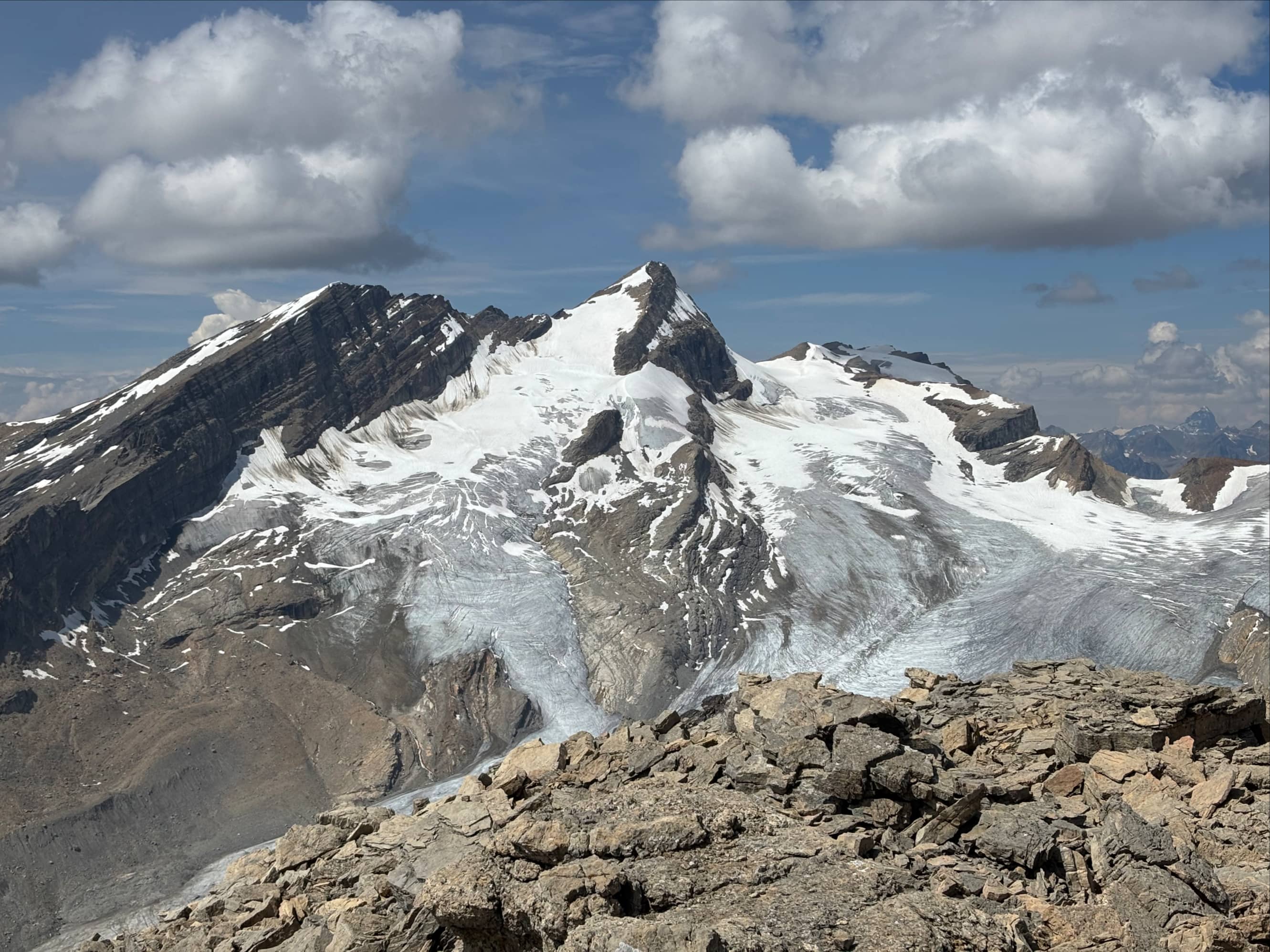
Thanks! In a valley full of mountains and glaciers Arete Peak and Mont des Poilus stole the show.
LikeLike
Wow, amazing views! Looks like an awesome hike!
LikeLiked by 1 person