July 25, 2024. A long day hike tagging two picturesque objectives in Glacier National Park.
- Region: Glacier National Park, Montana. Traditional Territory of the Kootenai, Blackfeet, Salish and Pend D’Oreille peoples.
- Distance: 24 km round-trip
- Total Ascent: 897 m
- Elevation of Objective:
- Ptarmigan Tunnel: 2259 m
- Iceberg Lake: 1855 m
- Total Time: 7h 9m
- Safety and Disclaimer
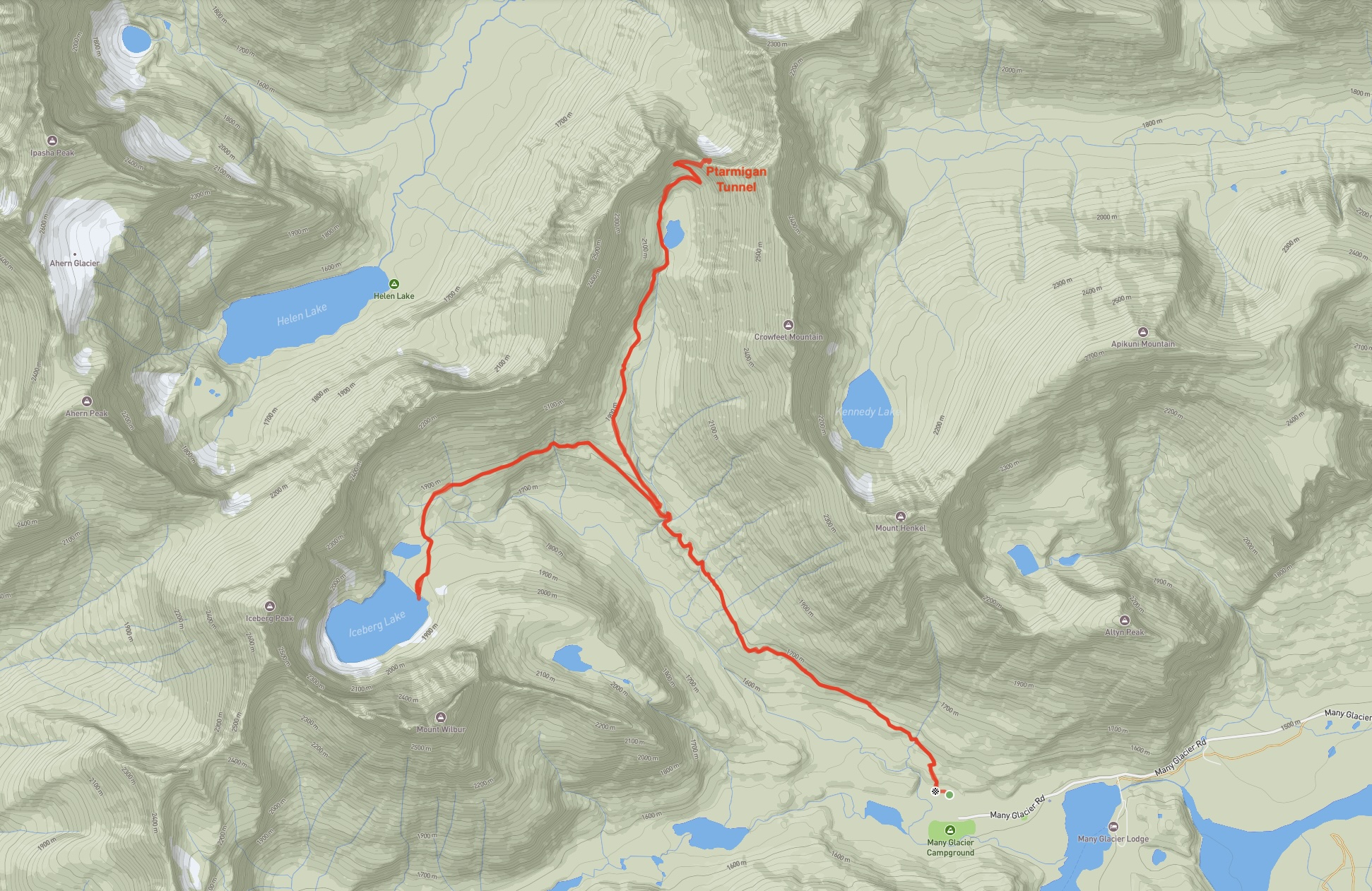
I joined up with a group from Calgary for a mid-summer excursion to Glacier National Park in Montana. My only prior hike in the park was scrambling up Ninastako (Chief Mountain) last year, so I was in the pleasant situation of knowing that no matter what objectives the group set I’d be experiencing something new. For our first day, we set out for Ptarmigan Tunnel and on the way down decided to tag Iceberg Lake to extend the hike.
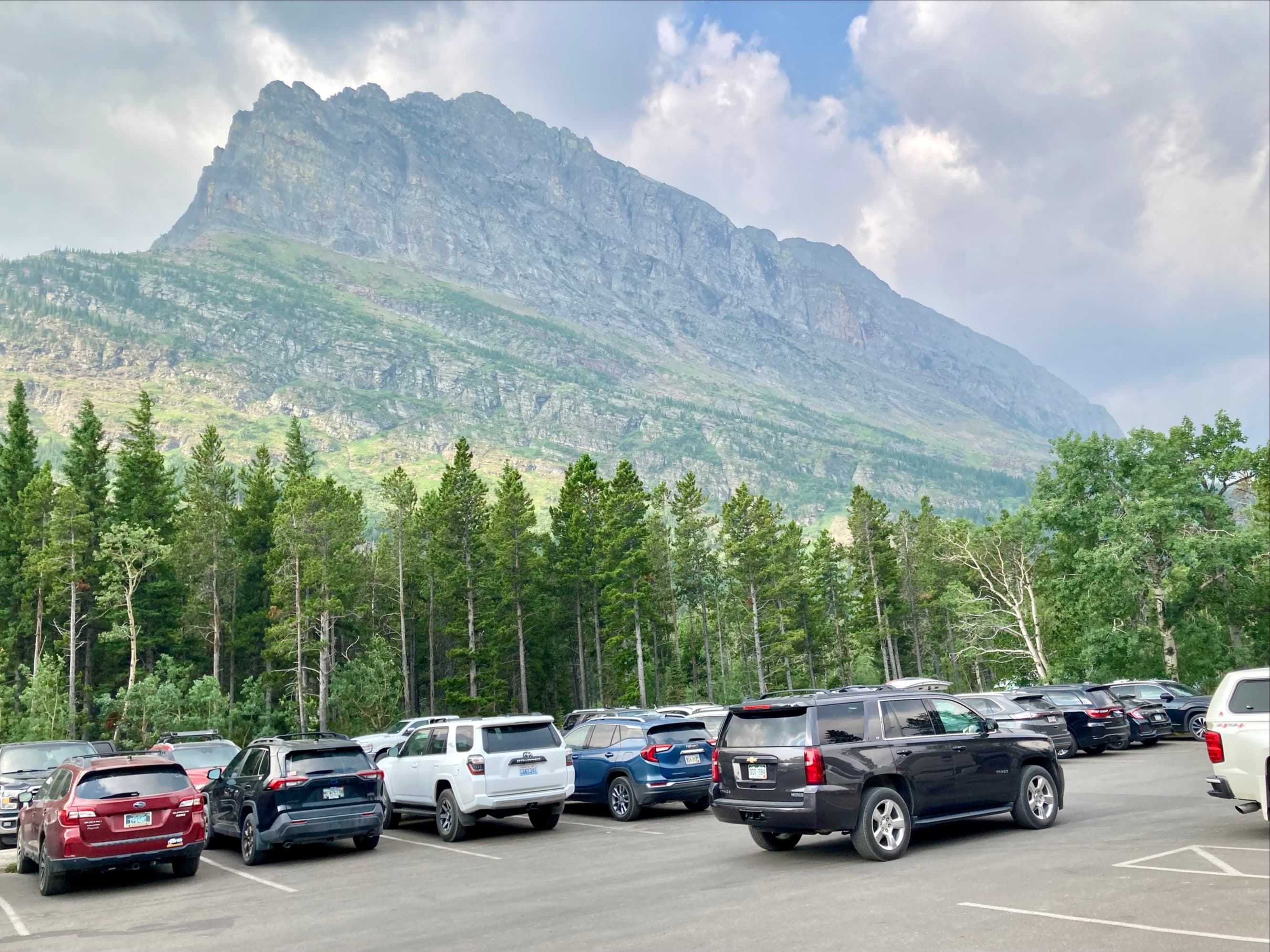
The trail to both objectives is accessed via the Many Glacier Road. A vehicle reservation was required to drive this road, and it had to be purchased online in advance of the visit. This reservation is in addition to the national park pass. In 2024 a vehicle reservation is required July 1 – September 8. It’s a good idea to check the official site well in advance to get the most up to date information on this. A portion of the passes are made available 4 months in advance on a daily rolling basis and the rest are next-day passes, made available at 7PM the day before their effective date. You have to log in and hope you can get one. Alternatively, if you have lodging, camping, or tour reservations with any outfit in the Many Glacier area, that will serve as your vehicle reservation.
Part 1 – Ptarmigan Tunnel
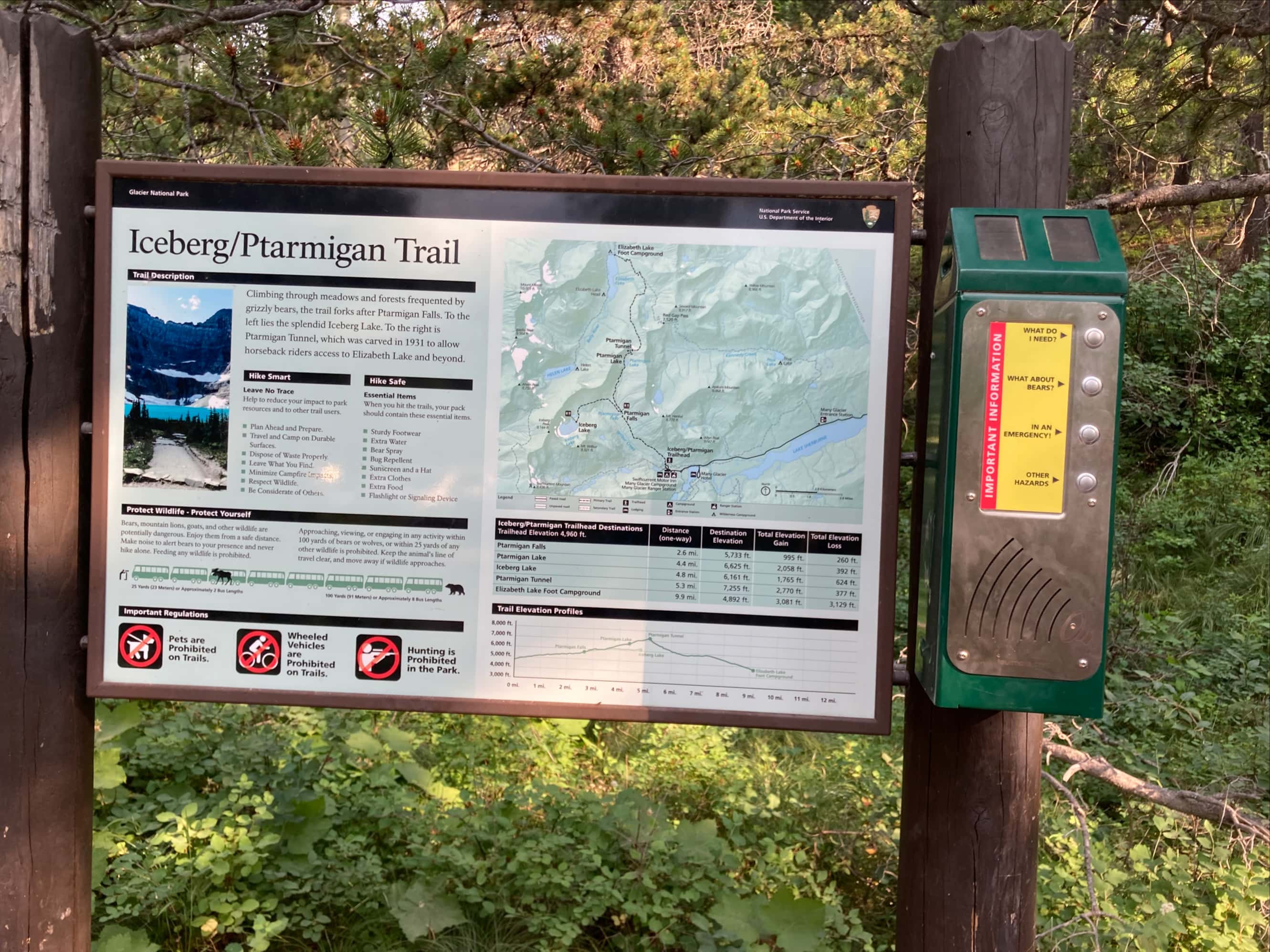
The trail starts behind the Swift Current Motor Inn, at the end of the Many Glacier Road. A sign next to the large Motor Inn parking area directed us to the trailhead. Setting off on the trail we soon encountered a signed intersection and turned left (northwest). We should have paid a bit more attention here – we walked right by the sign on the way down and ended up having to backtrack on a loop trail (omitted from my topo map route above). In our defence, the sign points to a ‘campground’ and we didn’t really think we were on our way back to a campground. However, right next to the big parking lot we left the car in is the Many Glacier Campground.
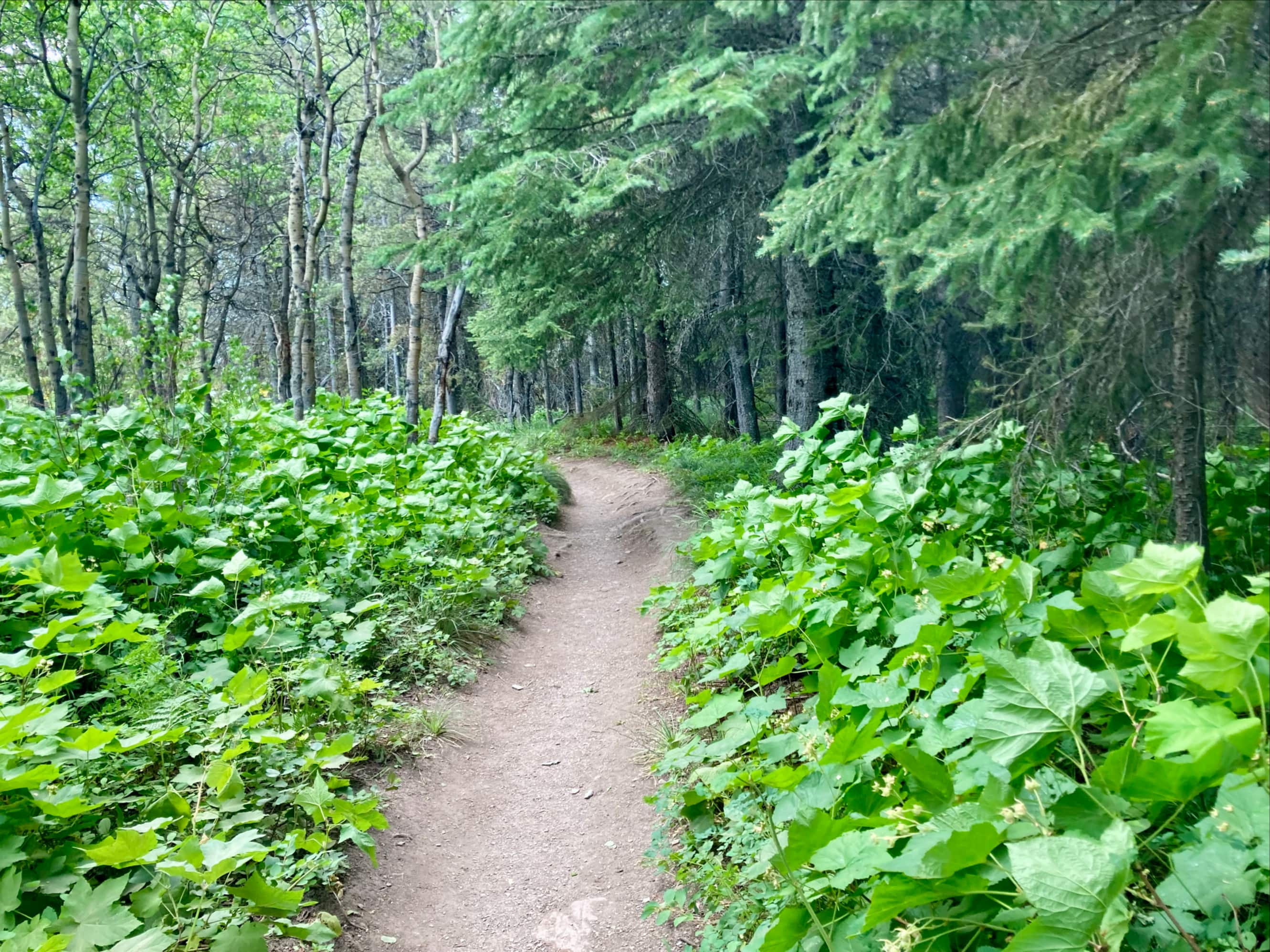
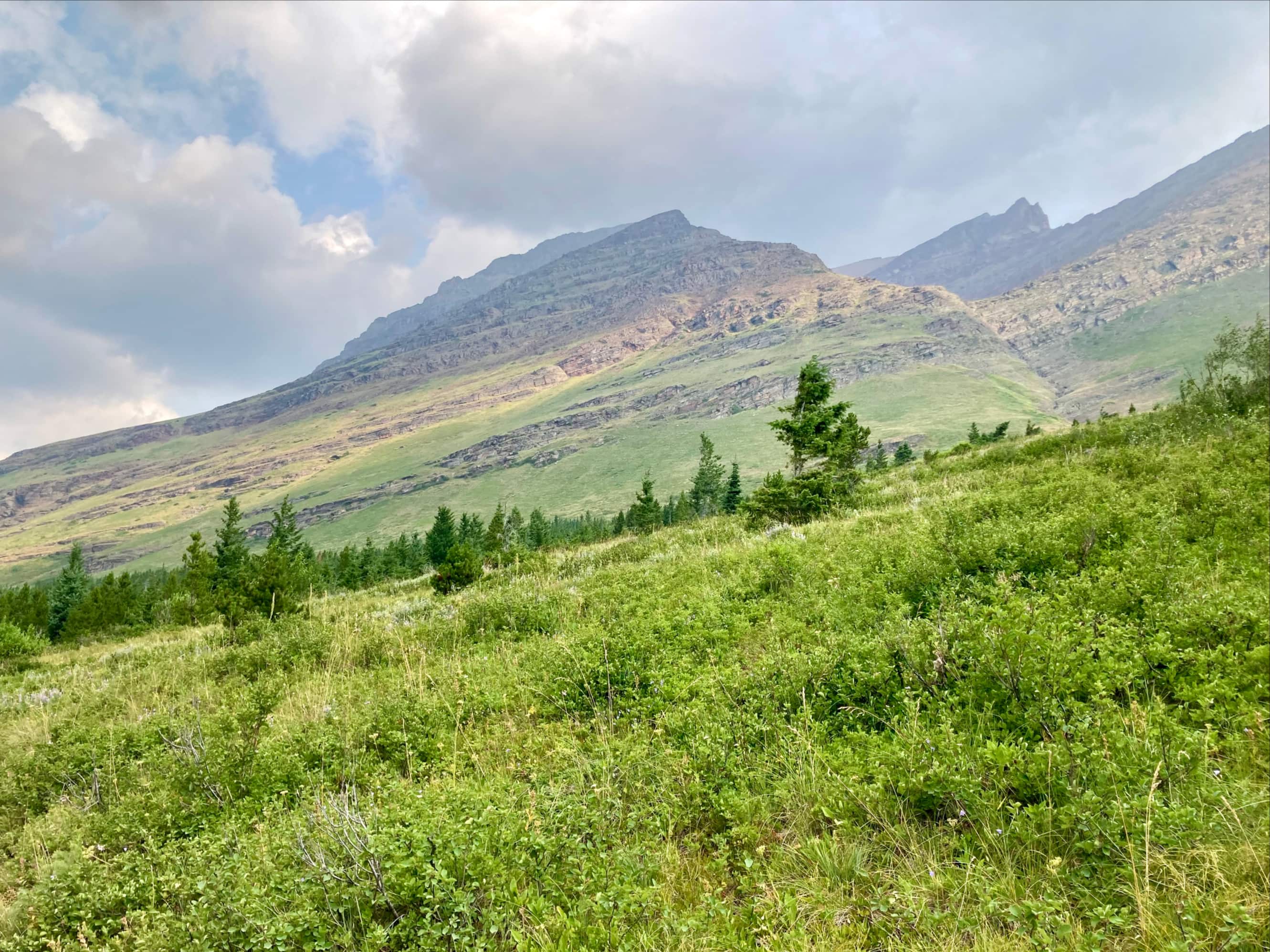
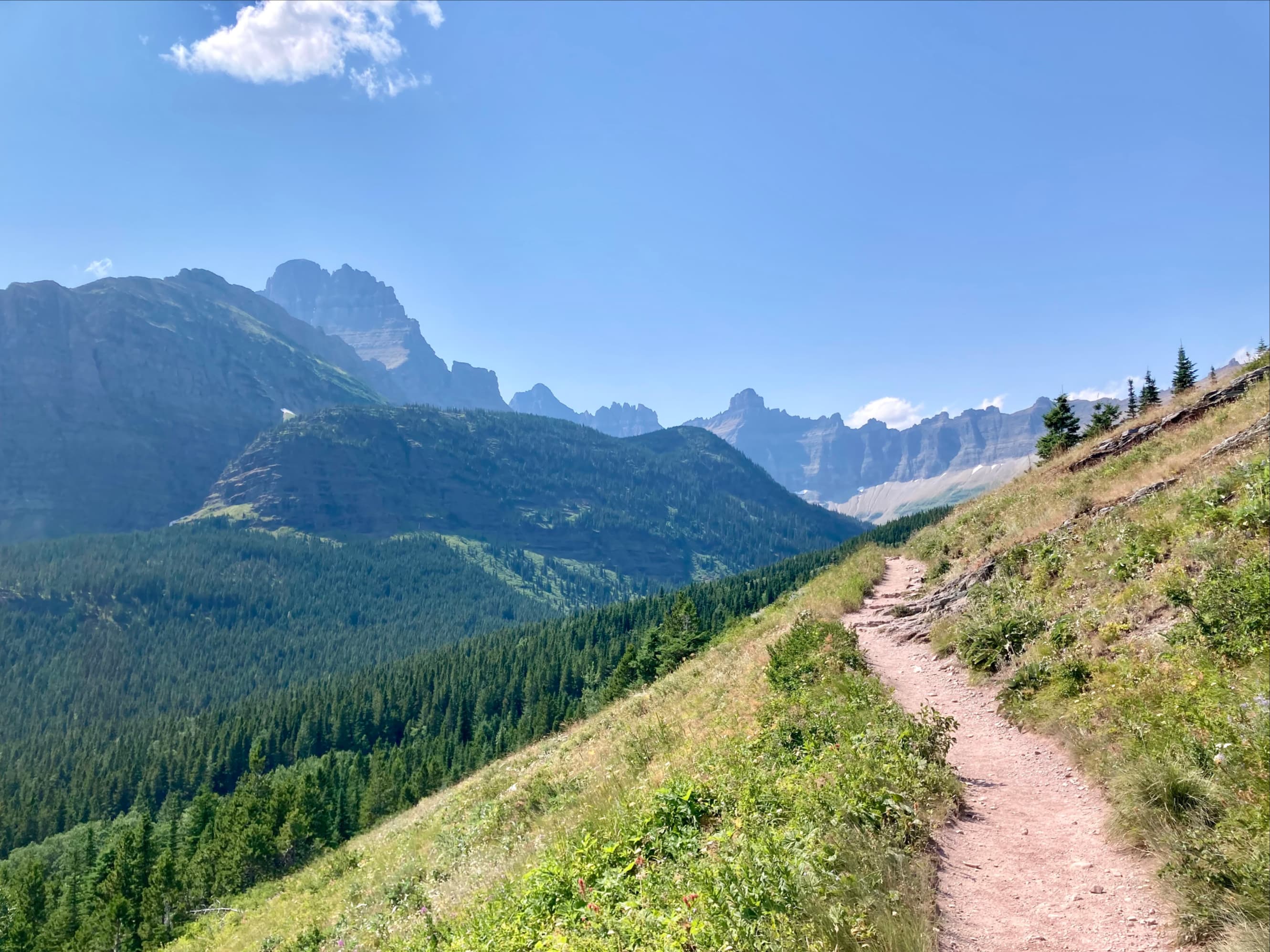
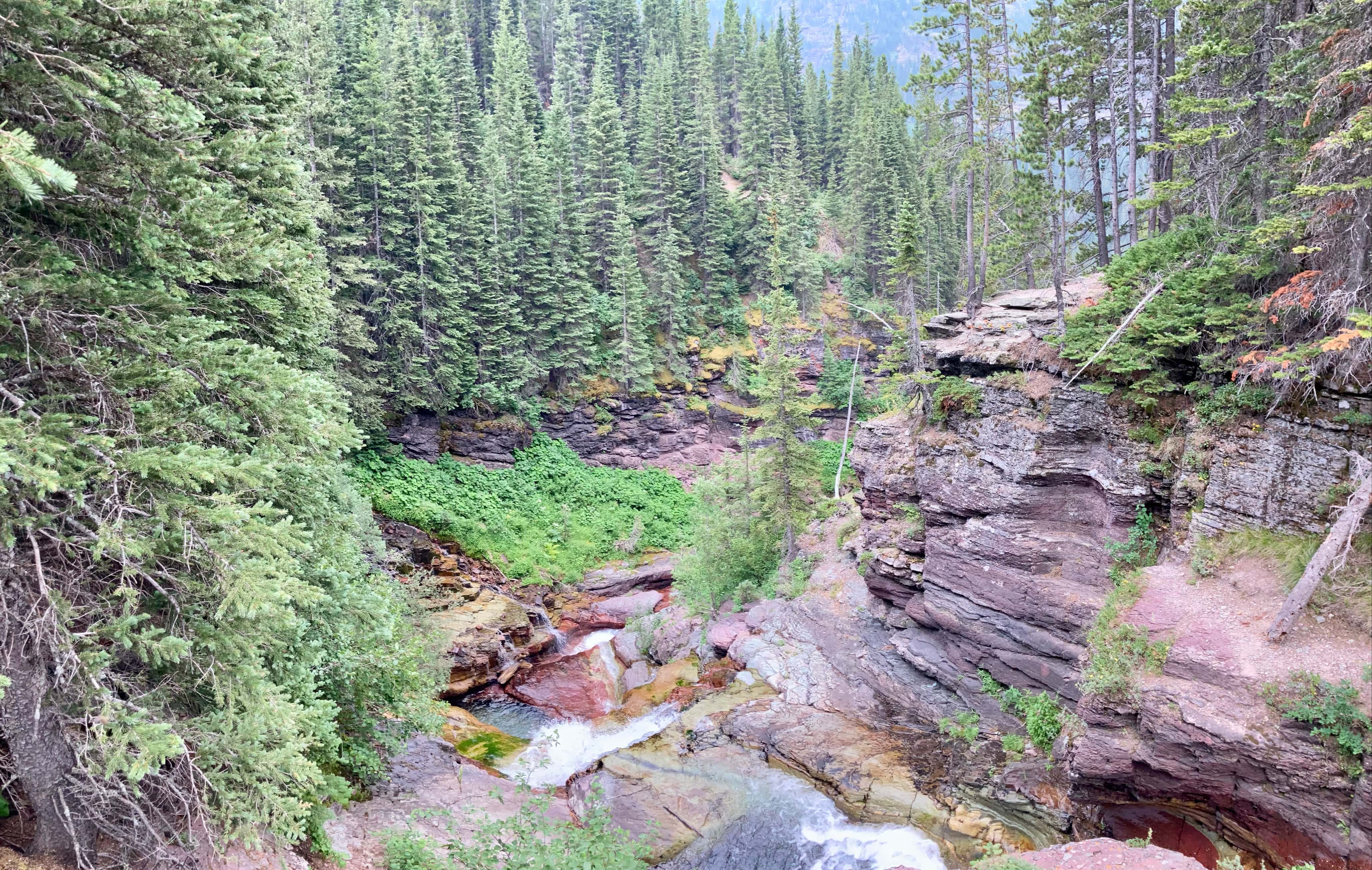
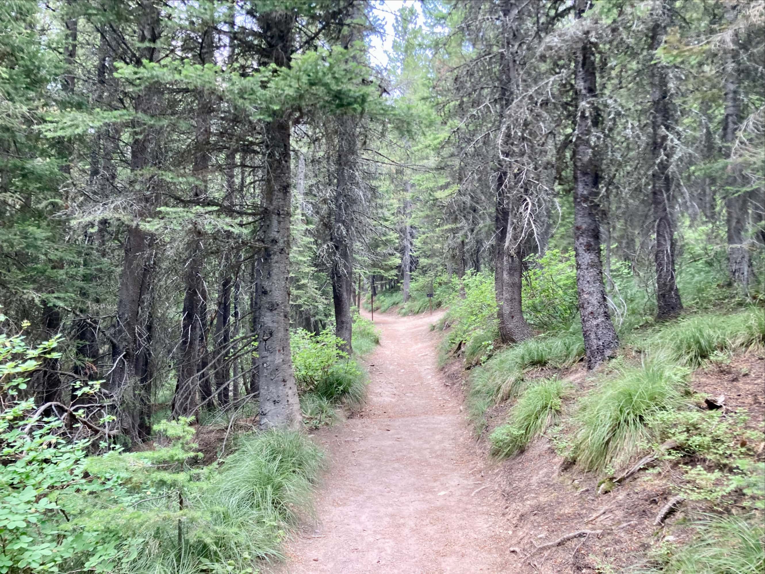
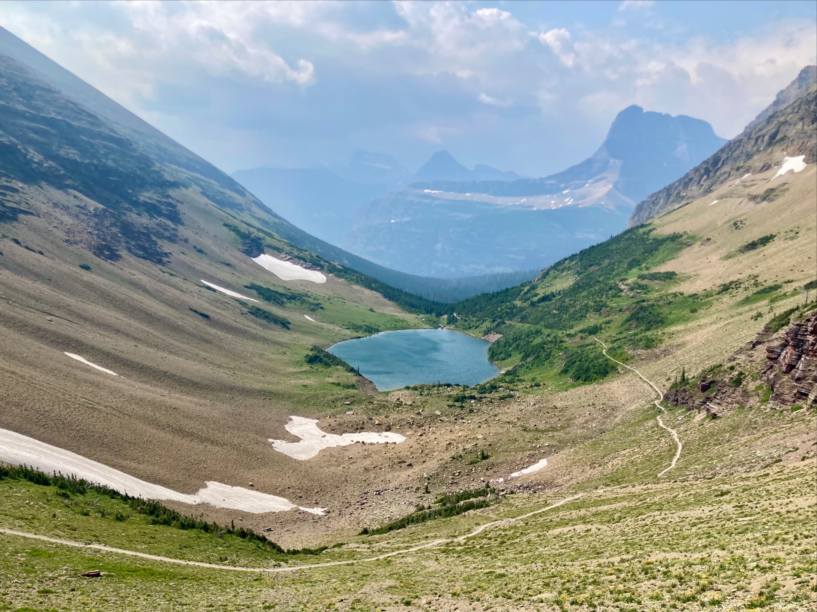
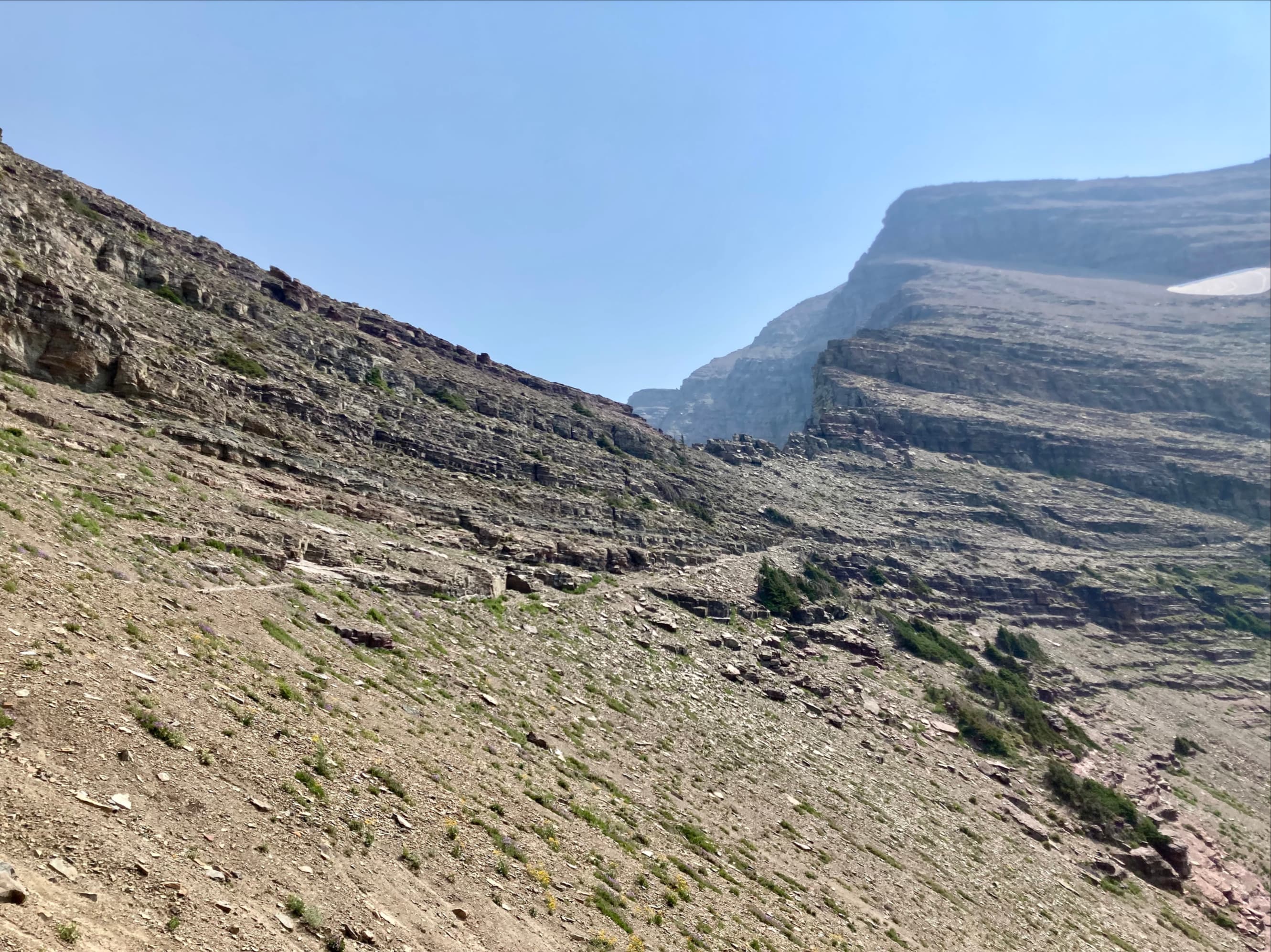
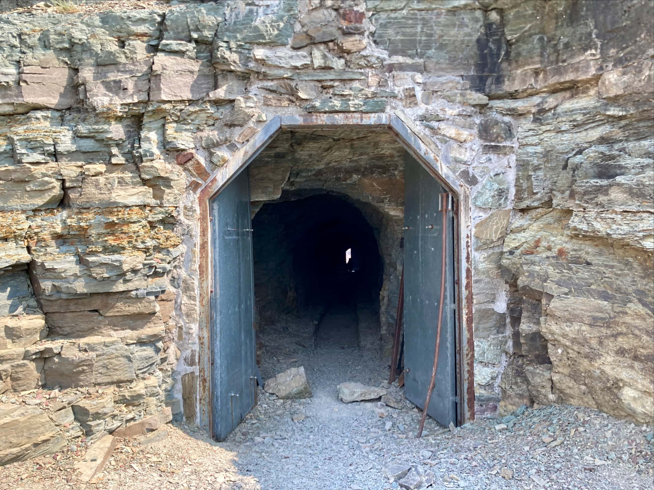
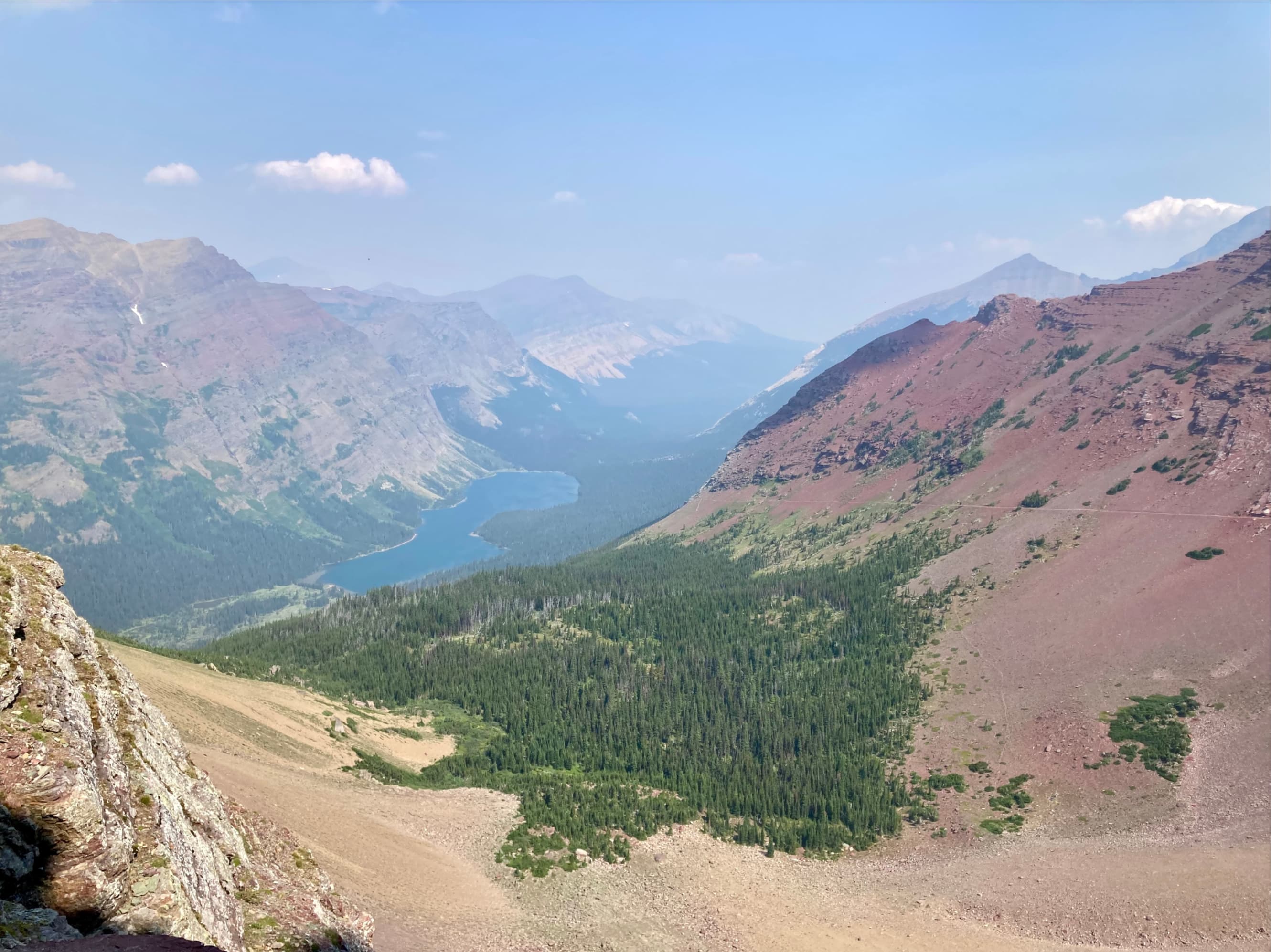
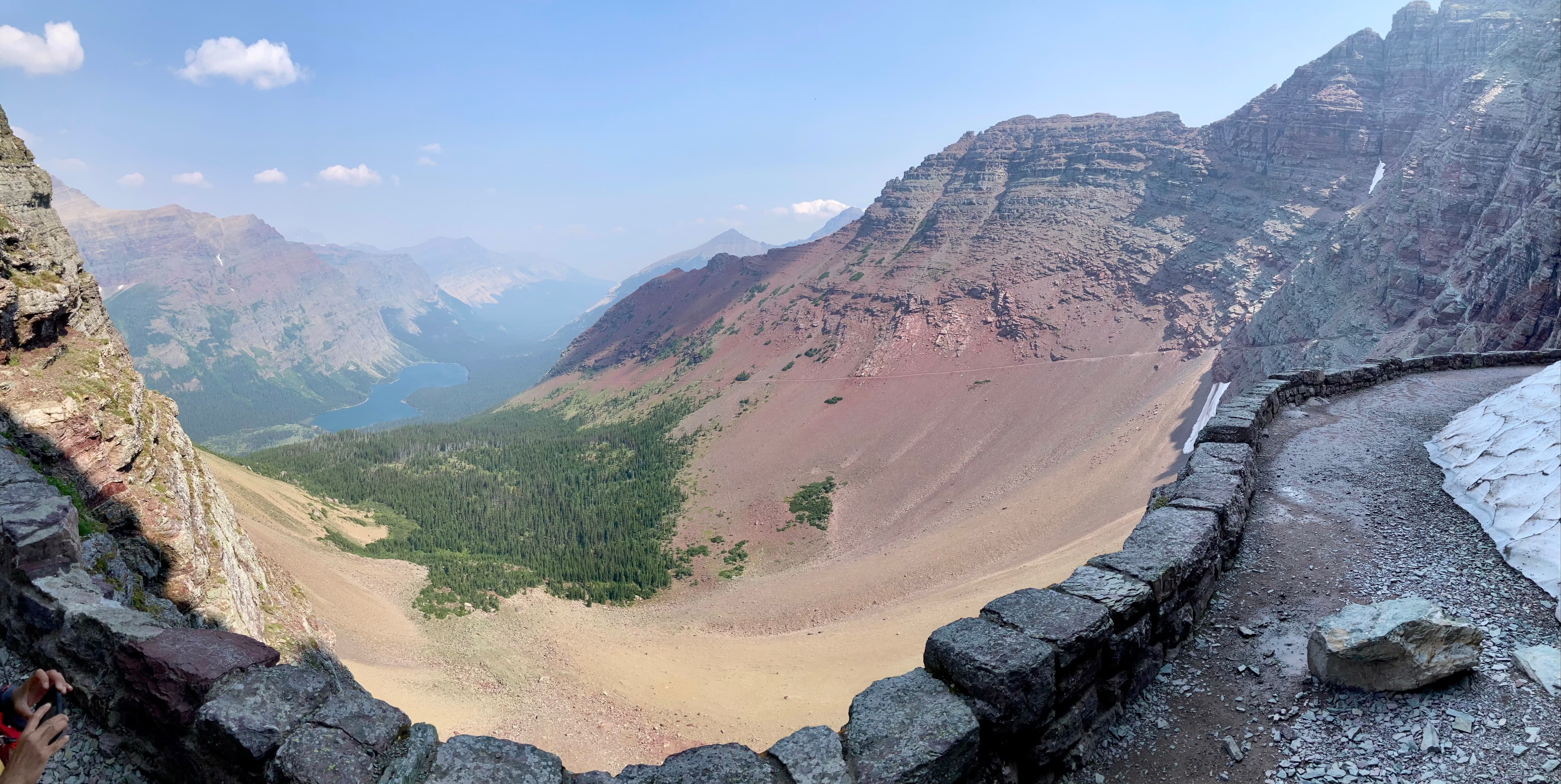
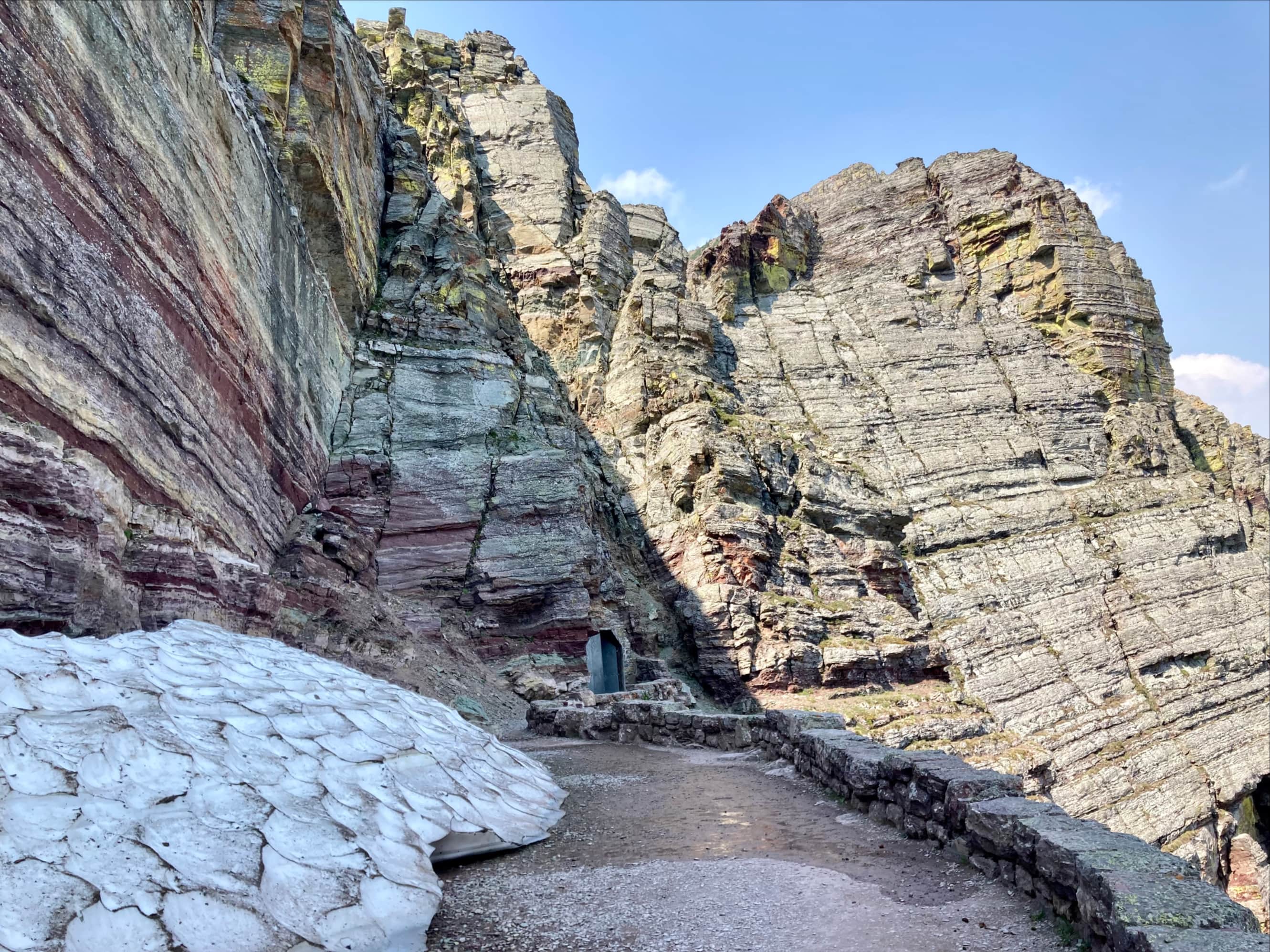
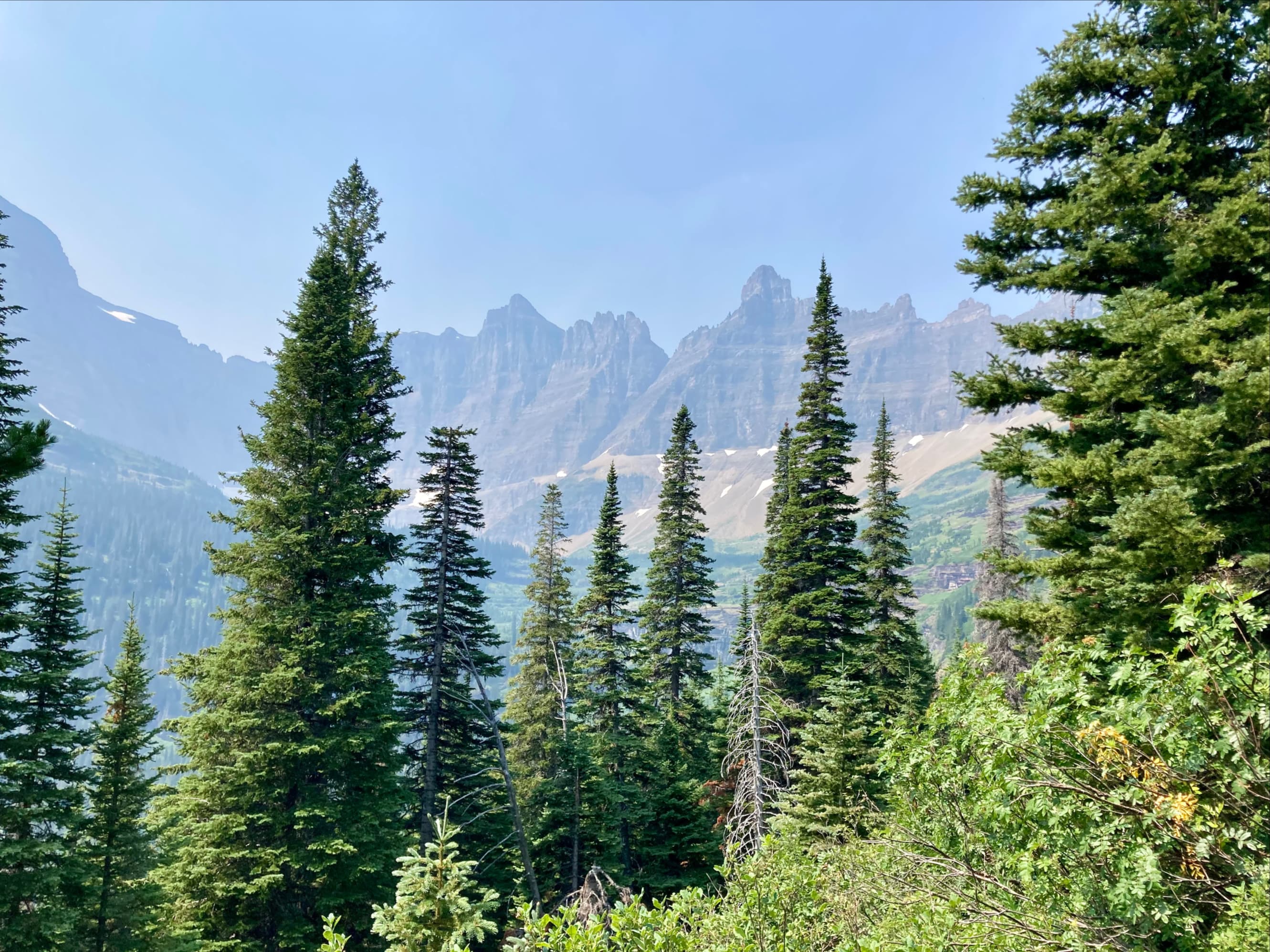
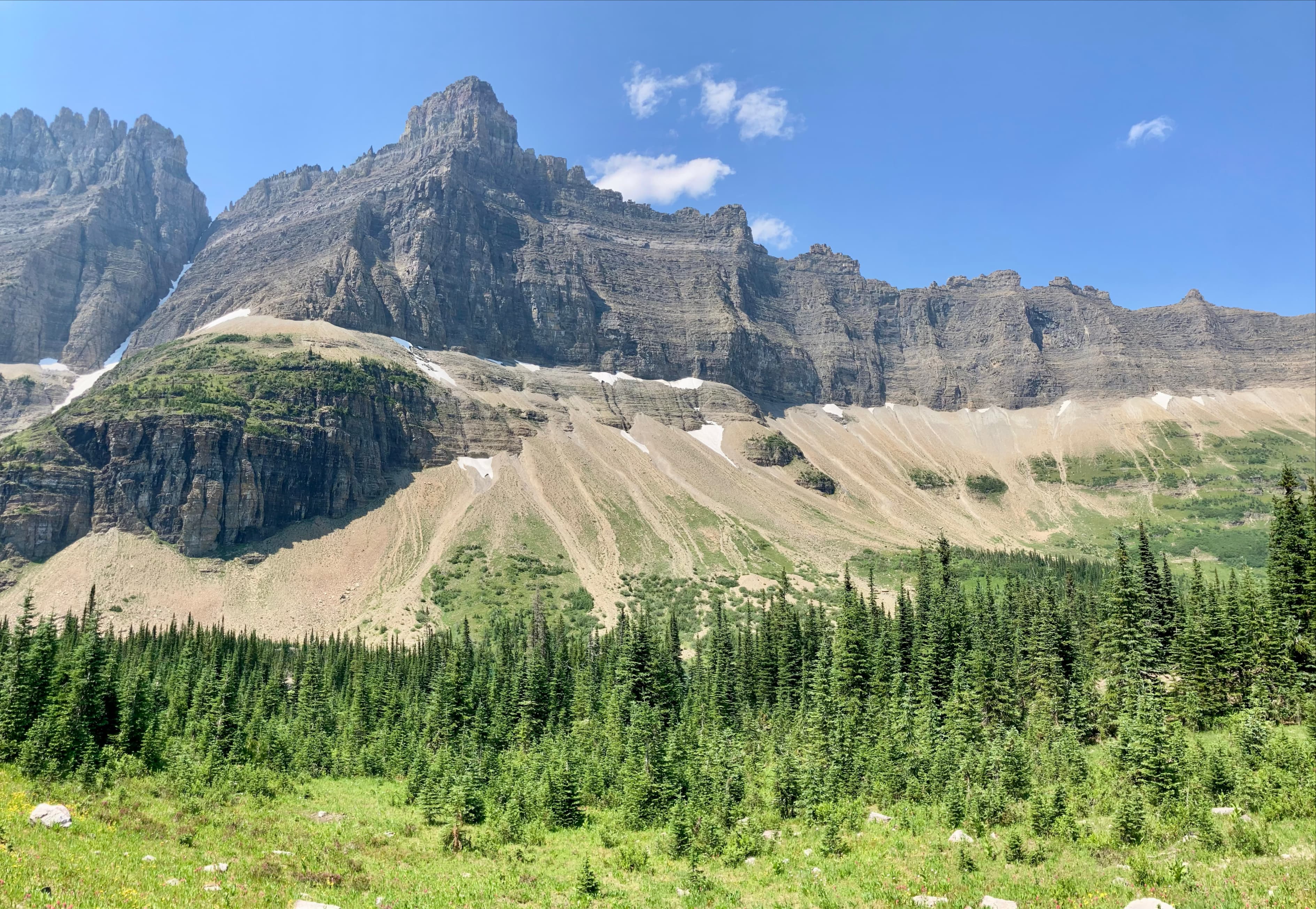
The entire hike follows a well-maintained trail, passing through a pleasant mixture of treed and open terrain. During the early part of the day there was a fair amount of forest fire smoke obscuring distant views. This cleared towards the end of the day. About 4.5 km up the trail, just past Ptarmigan Falls, there’s a fork in the trail. The left fork leads to Iceberg Lake and the right to Ptarmigan Tunnel. We went right first, eventually reaching Ptarmigan Lake sitting beneath a steep headwall. The trail then ascends the headwall via two broad switchbacks before reaching a broad landing in front of a large iron door and a tunnel piercing through the mountain. The doors are closed most of the year due to snow. According to the National Parks Service they’re usually open mid-July until late-September.
The tunnel is a little over 50 m long, and leads to an extensive view looking down on Elizabeth Lake. The trail carries on from there, descending to a backcountry campsite beside the lake. We didn’t go beyond the area of the tunnel mouth. After taking in the views for a while we went back through the tunnel.


Part 2 – Iceberg Lake
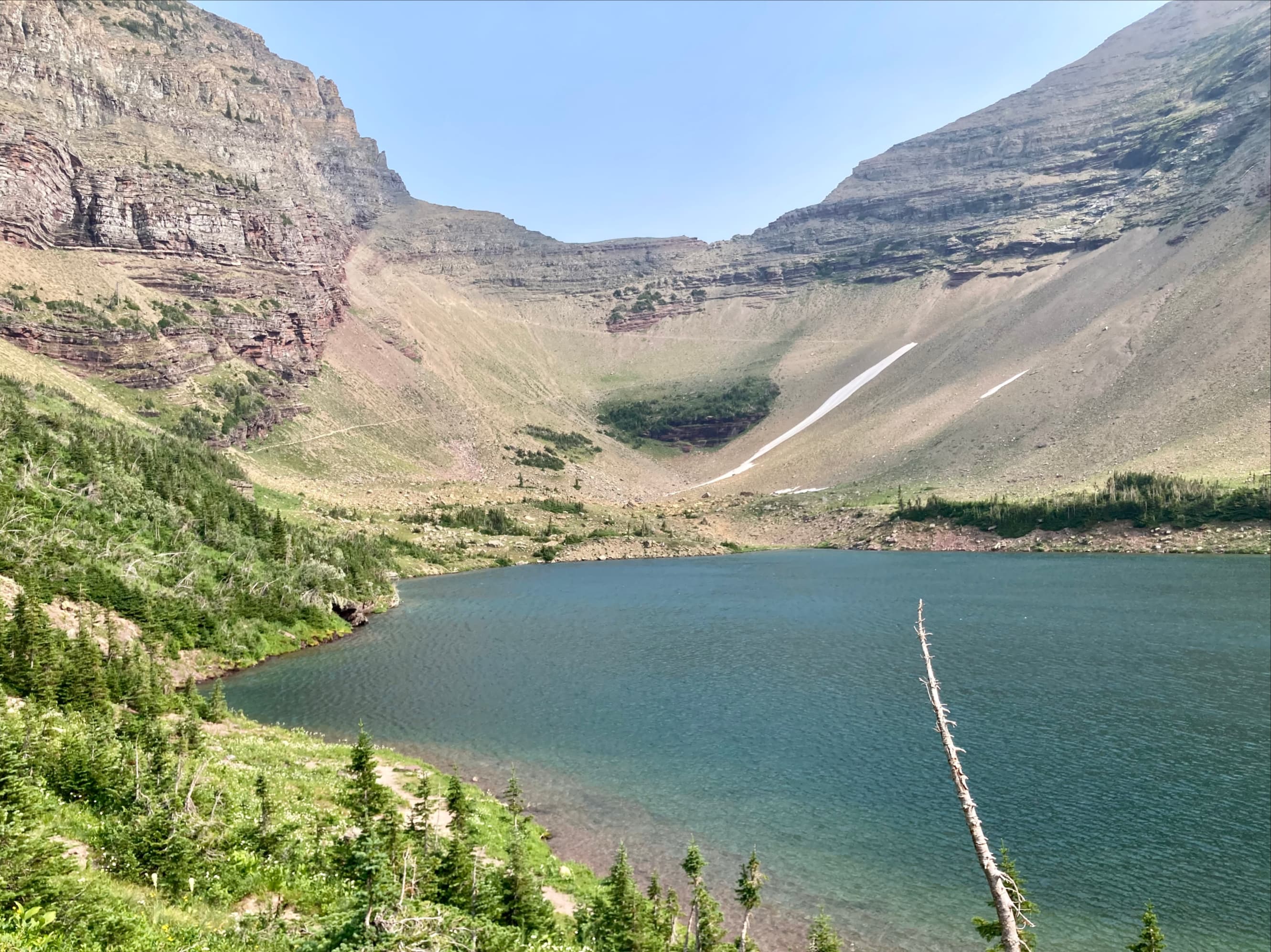
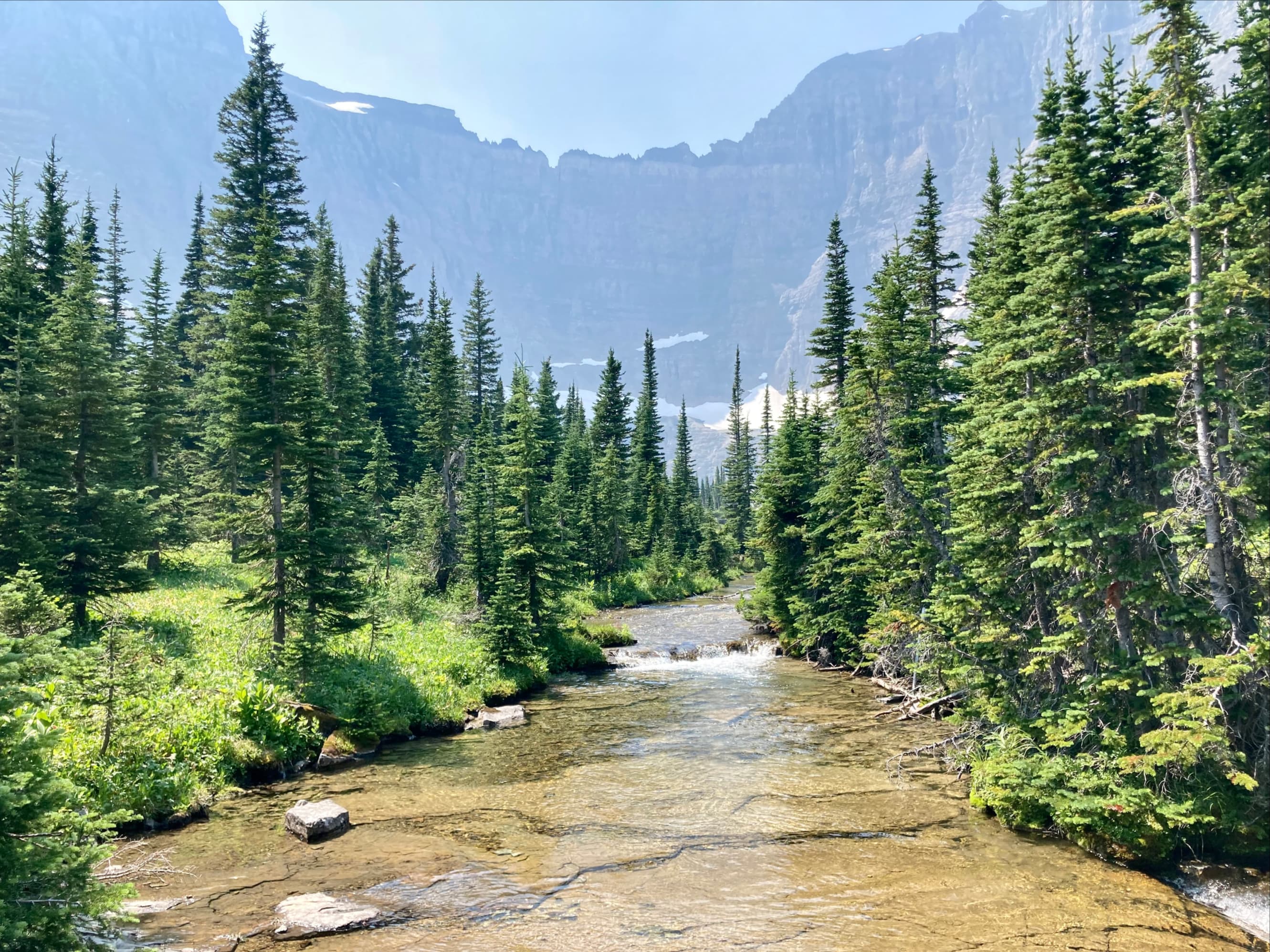
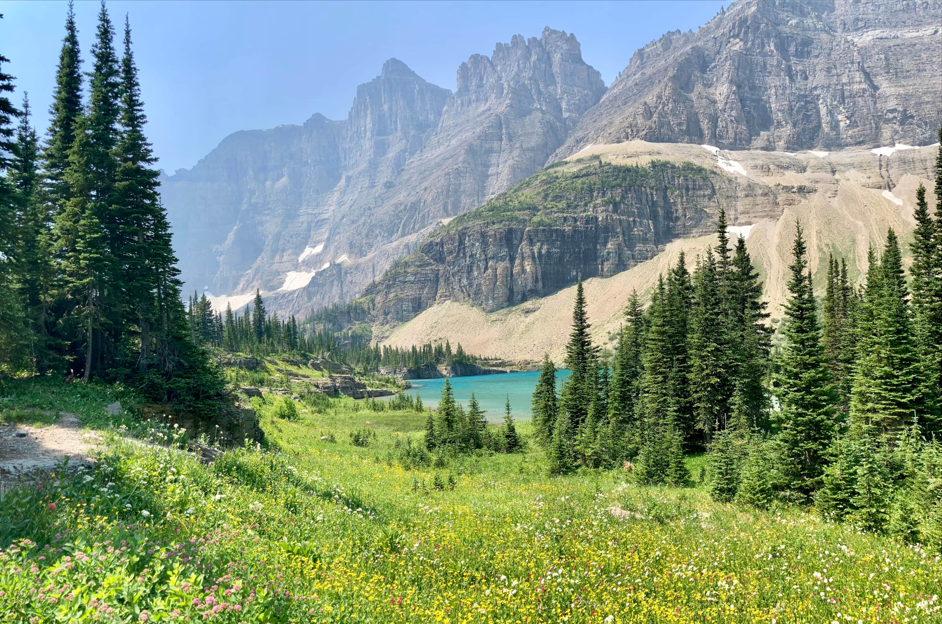
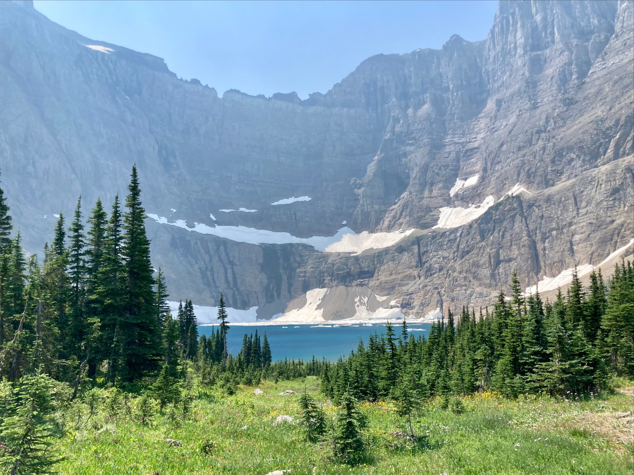
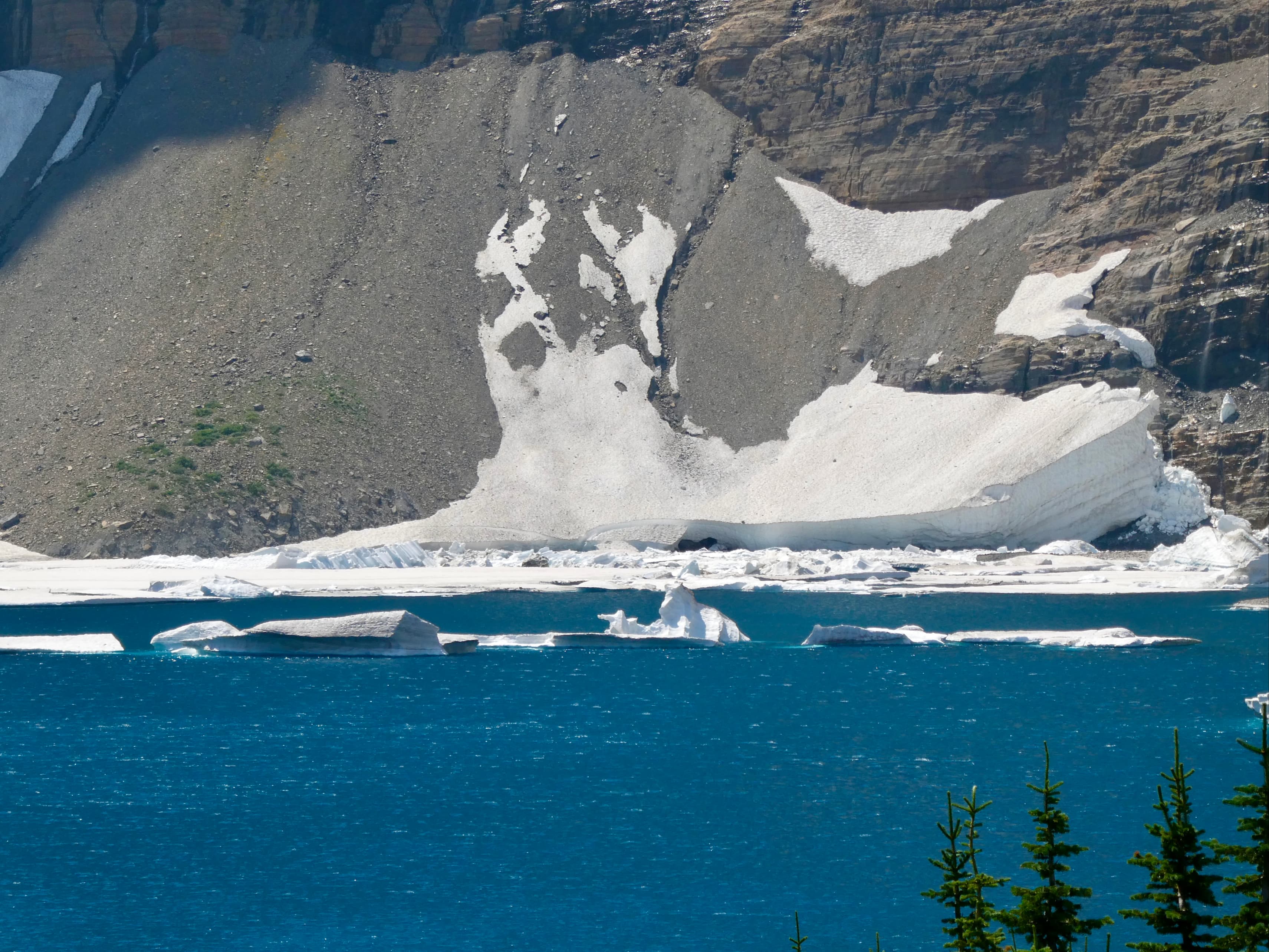
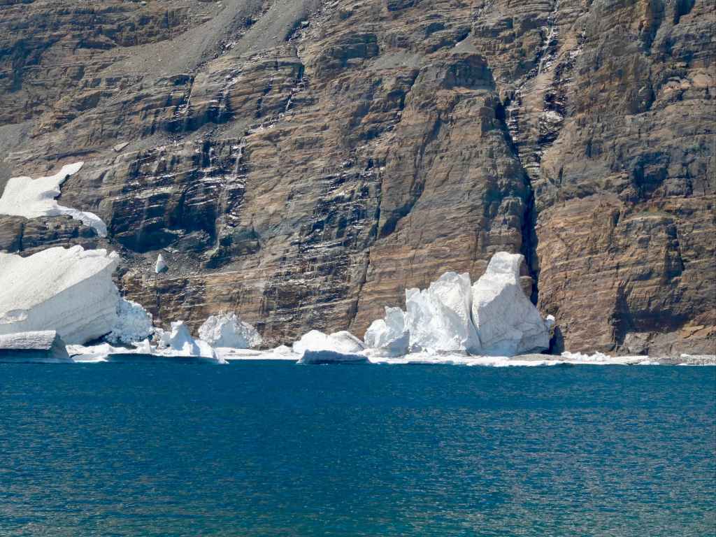
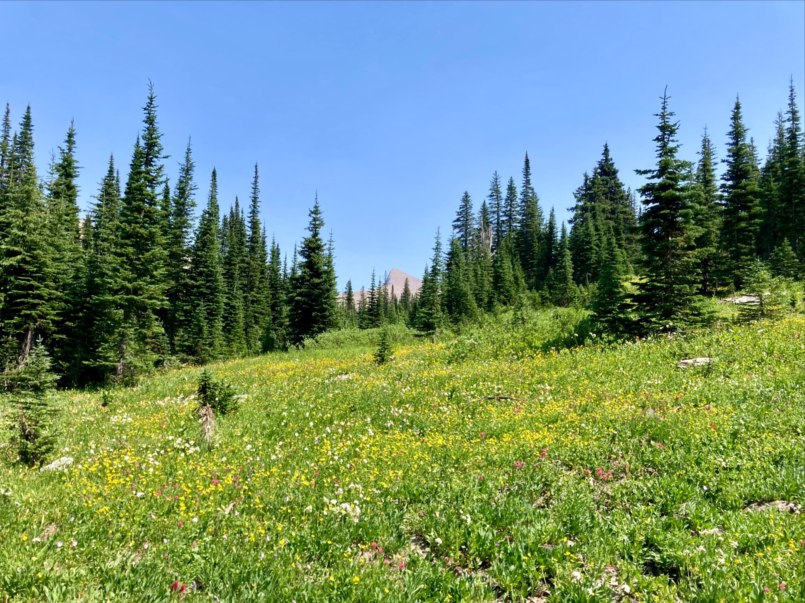
We retraced our steps to the fork in the trail and then took the left fork to Iceberg Lake. Hiking this trail we encountered only a mild and gradual ascent as we traversed along the northern wall of a broad valley. The views along the trail were impressive and when we reached the area of the outlet stream below Iceberg Lake we passed through one of the most colourful wildflower meadows I’ve ever seen. The lake itself proved to be quite stunning, sitting below sheer cliffs with snow ringing the far shore. The water was deep blue with small icebergs floating in it.
Iceberg Lake was a secondary objective in this trip, but if I had to pick between it and Ptarmigan Tunnel, I’d definitely choose Iceberg Lake. It’s hard to think of another high mountain lake that has such a remarkable visual impact. We took a long break there, wading in the icy water to soothe our feet before returning to the trailhead.


Very nice descripti
LikeLike
Lovely!
LikeLiked by 1 person