July 9, 2024. Straightforward but scenic scrambling to a summit overlooking the Carthew-Alderson trail.
- Region: Waterton Lakes National Park. Traditional territory of the Tsuu T’ina, Ktunaxa, and Blackfoot First Nations
- Distance: 21 km round-trip
- Total Ascent: 1210 m
- Elevation of Objective: 2692 m
- Total Time: 6h 23m
- Safety and Disclaimer
Mount Alderson is one of the Waterton scrambles described in Kane’s Scrambles in the Canadian Rockies. The ascent route is very obvious when hiking on the Carthew-Alderson trail from Cameron Lake down to the Waterton townsite. From the hiking trail the summit is visible at the top of a fairly easily navigable ridge line. A lot of strong hikers have probably crossed-over into scrambling after looking at Mount Alderson’s summit from the hiking trail and thinking, I could probably just hike up there.

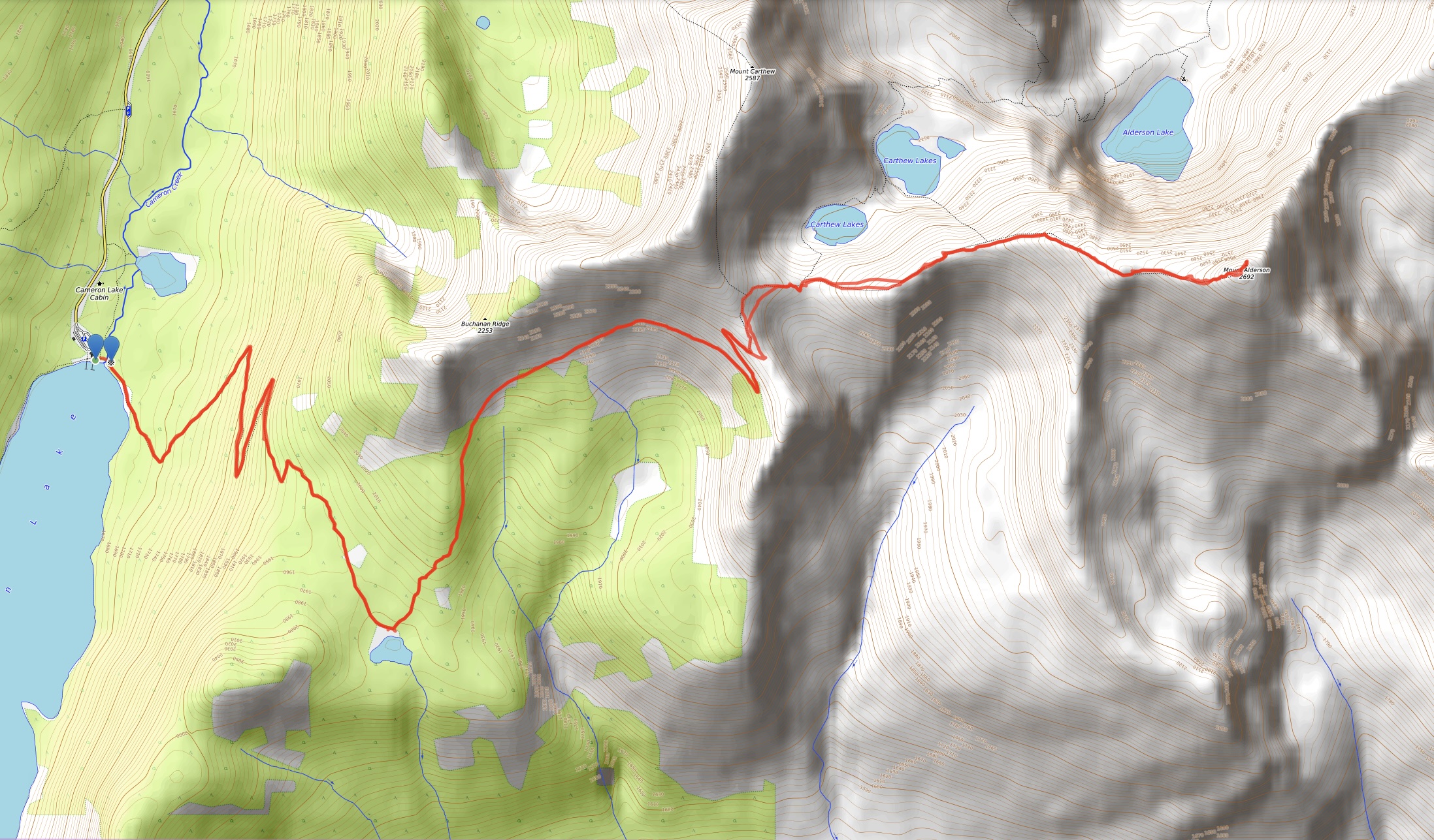
The peak is best approached starting from Cameron Lake. Access is via the Akamina Parkway in Waterton – Cameron Lake is at the very end of it. The road leads to a large parking lot at the north end of the lake. The trailhead is found by following the lakeside trail clockwise past the boat rental and over the outlet stream coming off the lake. I set off along the trail, following the shore of the lake for a short time before turning into the woods and up a steep hillside in broad switchbacks. Eventually the grade eased and the trees thinned out as the trail reached something of a plateau. Views to the south slowly opened up, and by the time I had followed the trail to Summit Lake I had a great views of Chapman Peak just across the international border in Glacier National Park.


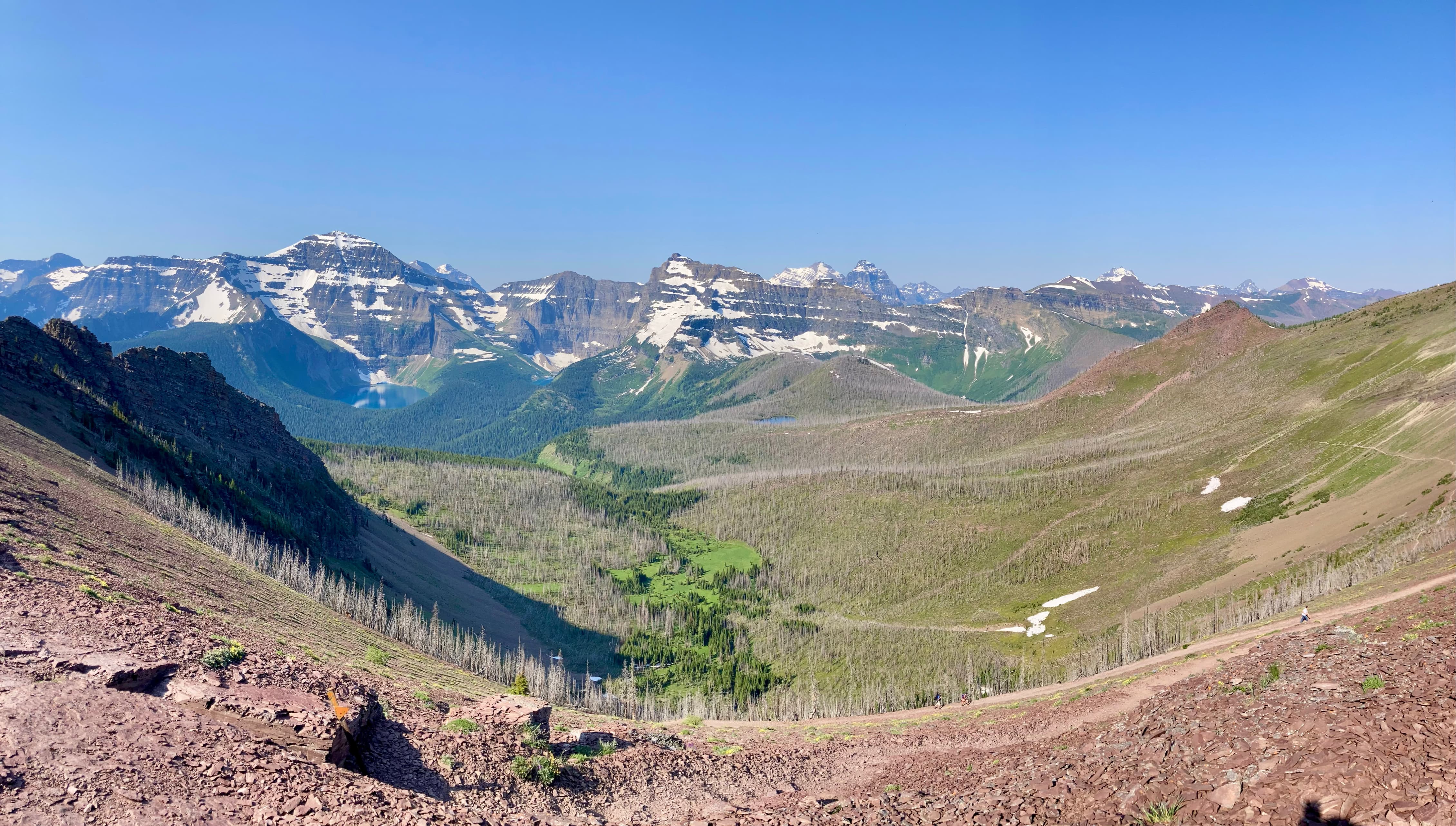
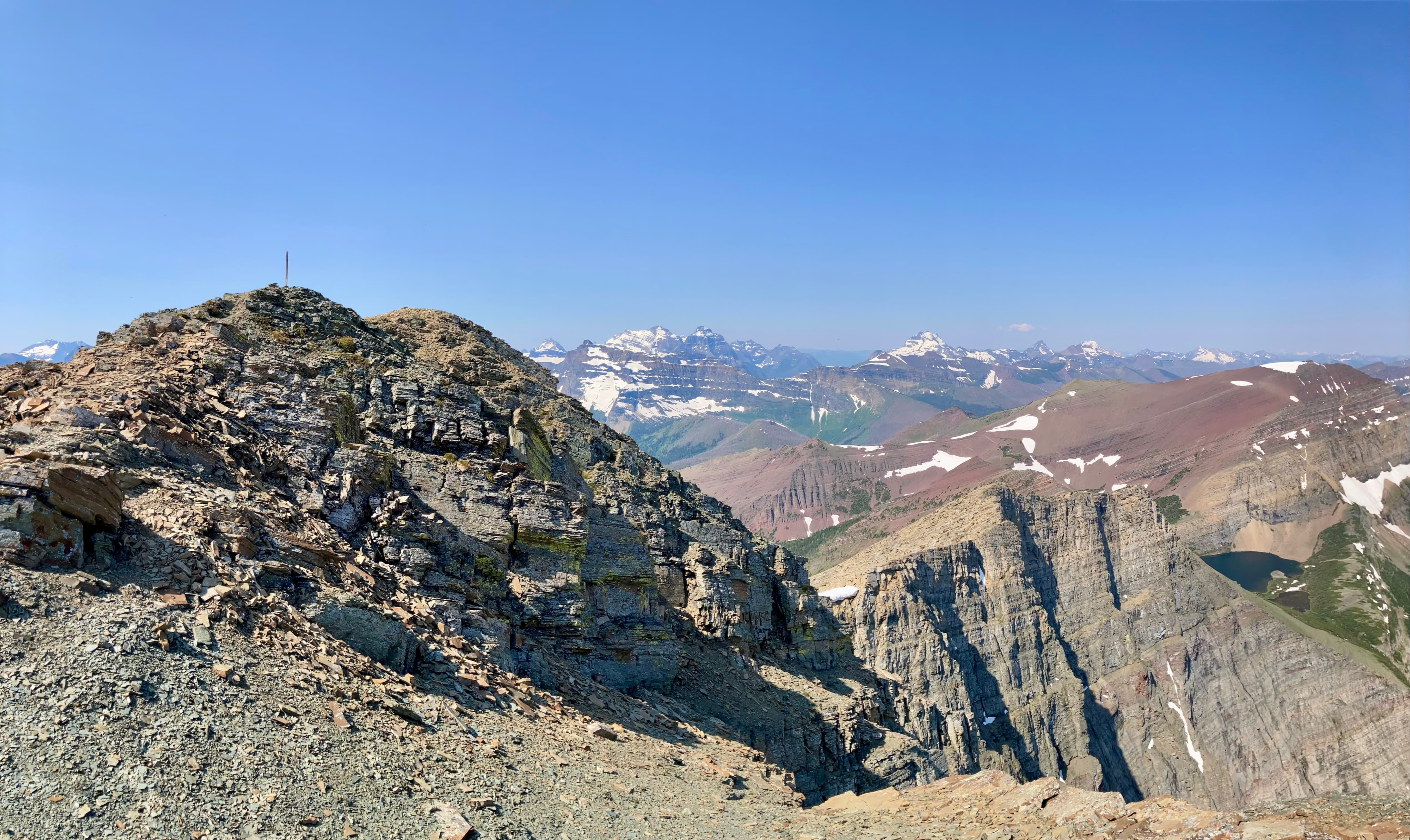
The thick insect swarms at Summit Lake helped prompt me to move along. I followed the signed trail departing from the shore heading northeast, eventually reaching a long, curving traverse leading to more switchbacks that finally brought the trail to its apex on a col between high points of Mount Carthew’s southern ridge. This high point is referred to as “Carthew Summit” on signs and maps. The views from this spot were excellent, and for the first time the summit of Mount Alderson came into full view.


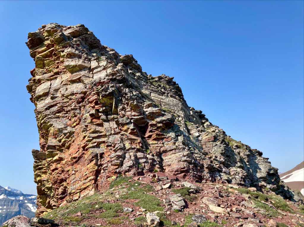
I lost some elevation as I followed the trail down from Carthew Summit to reach the base of Mount Alderson’s western ridge. From there, the ascent mostly just involved steep uphill hiking. Two areas of actual scrambling along the ascent involved down-climbs. The first was negotiated by finding friendly terrain to climber’s left, the second by trending a little bit right. A short climb beyond the 2nd scramble led to the summit.


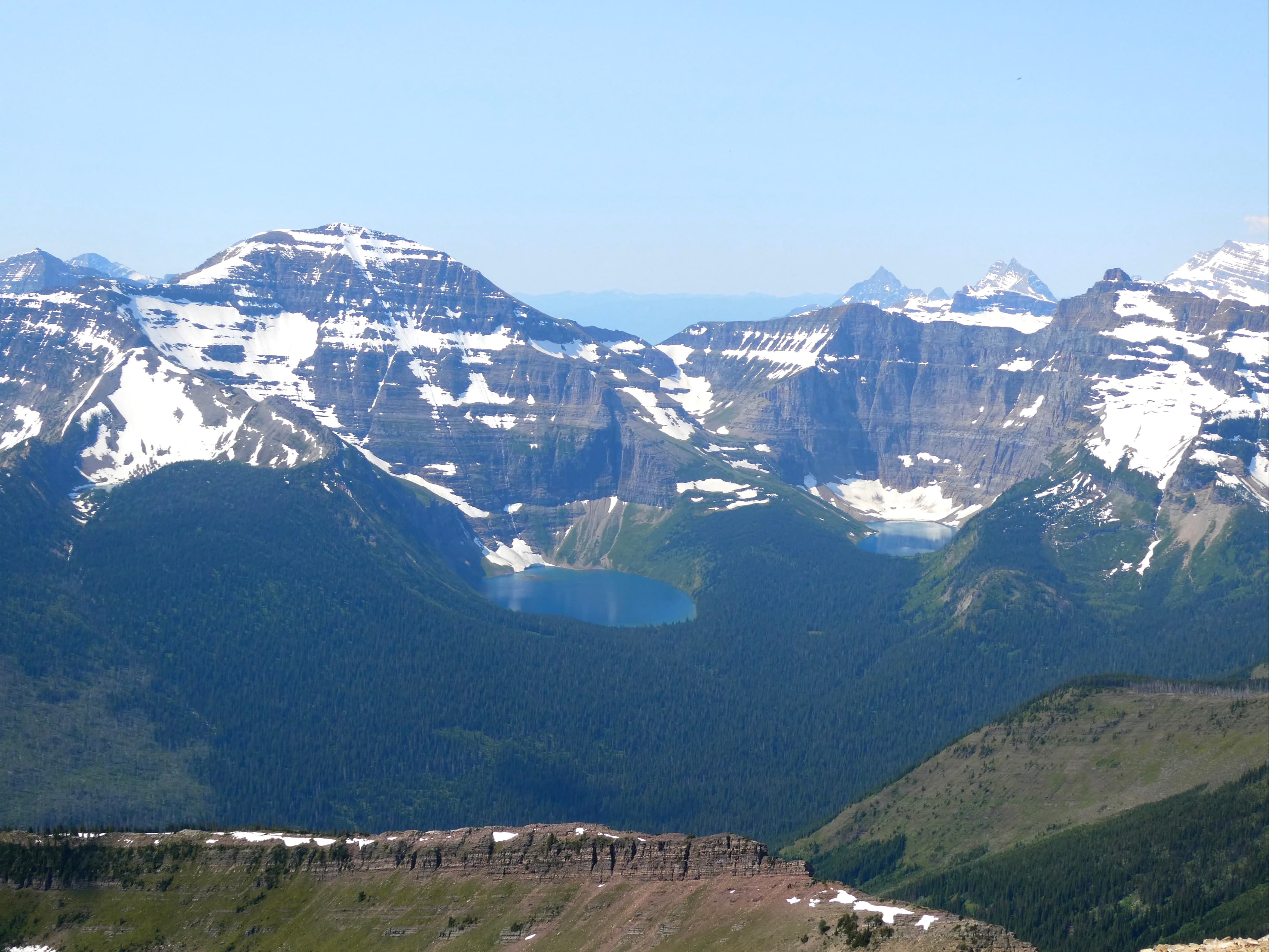
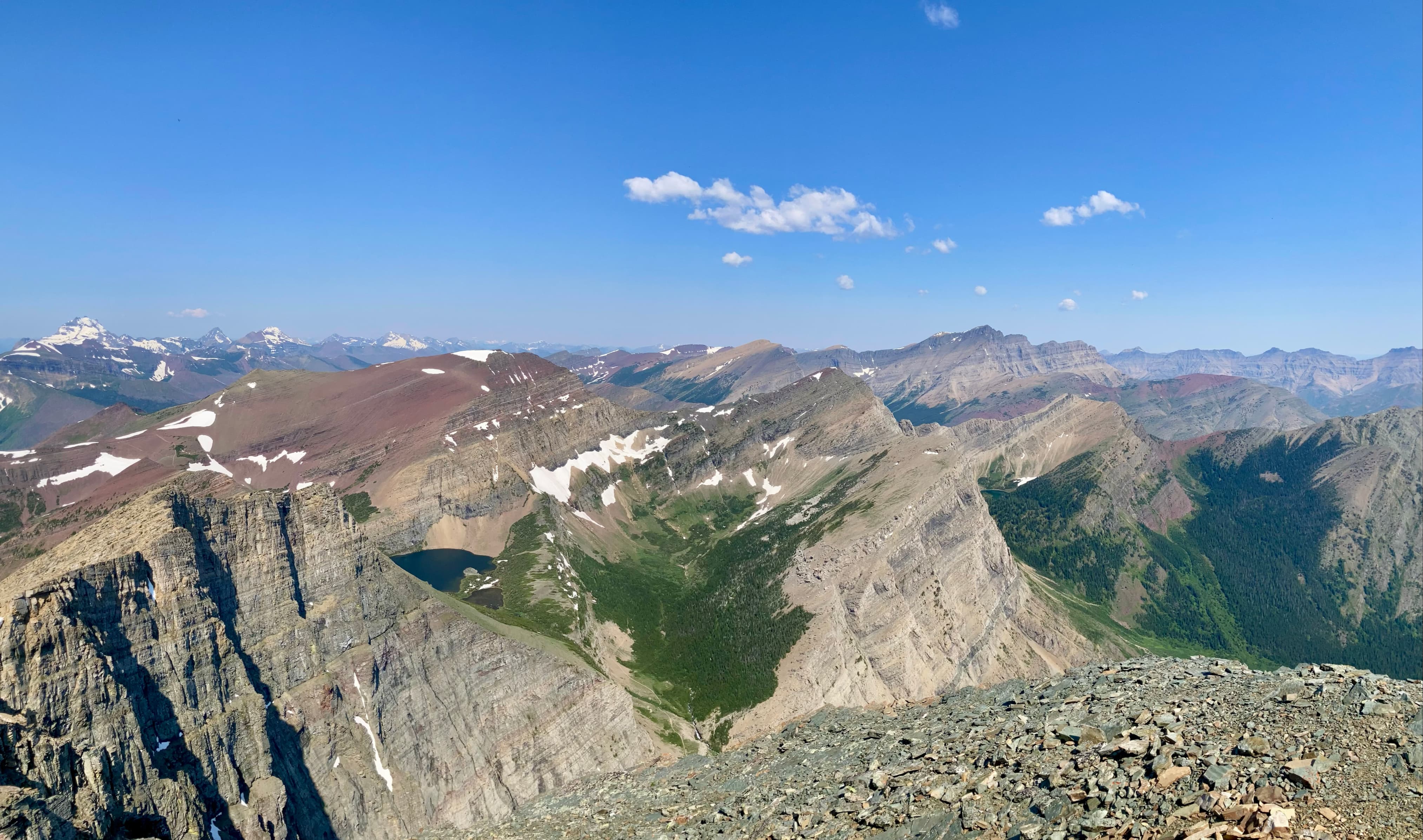
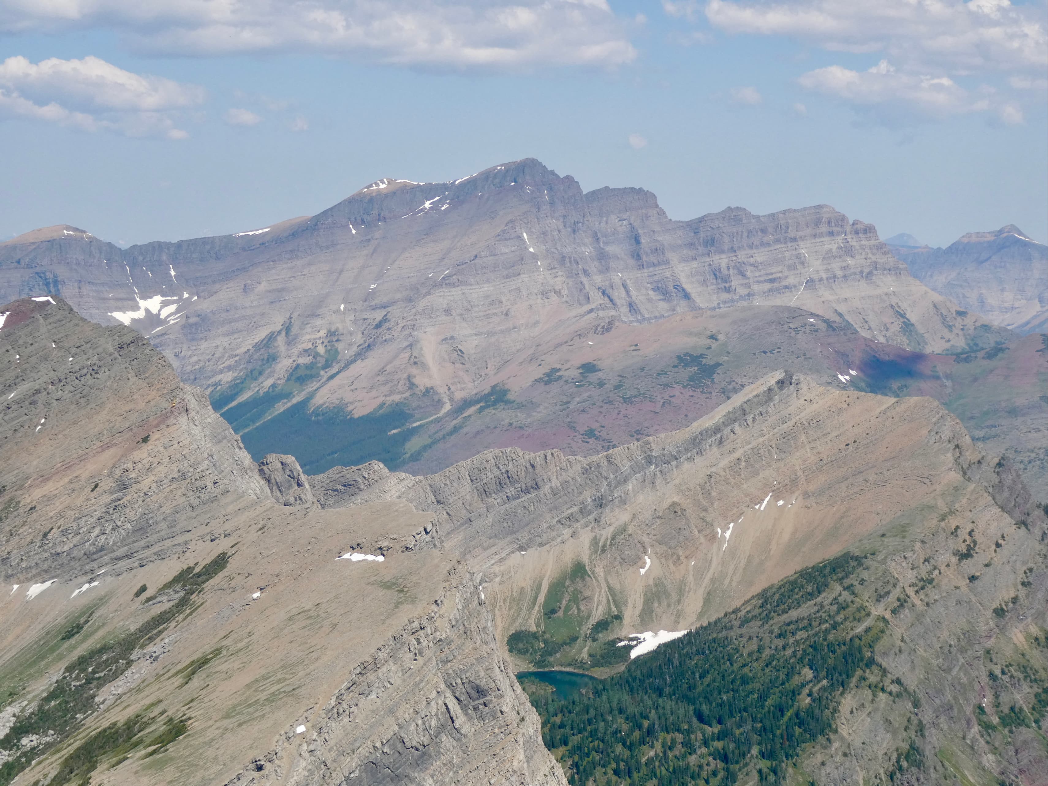
It was a fairly clear day, with only a bit of smoke in the air. Views were excellent in all directions. The summit itself was marked with a survey marker and there was a cairn on an adjacent, slightly lower spot. Shortly after my arrival at the summit I was joined by a gentleman from Montana who was escaping the crowds down in Glacier National Park. A few minutes later we were joined by a lady from Calgary, who was escaping the crowds back home due to the Calgary Stampede. It was calm and warm up there, so I enjoyed a fairly long stay at the top before returning along the same route. The light during my descent made for good photography conditions so I took plenty of pictures on the way down.


To reach Carthew Summit only, is there a scree section? If so, is it manageable for moderate hikers (someone who hikes a lot but doesn’t do actual scrambling)?
To reach Mount Carthew Summit, is there a scree section also? And again, how difficult is it for someone who hikes a great deal but doesnt do any hands on scrambling or the likes of that?
LikeLike
Carthew Summit is definitely manageable for a non-scrambler. It is all on-trail. I haven’t gone over the Mount Carthew’s summit yet, but provided you are on-route I don’t think there’s any scrambling involved.
LikeLike