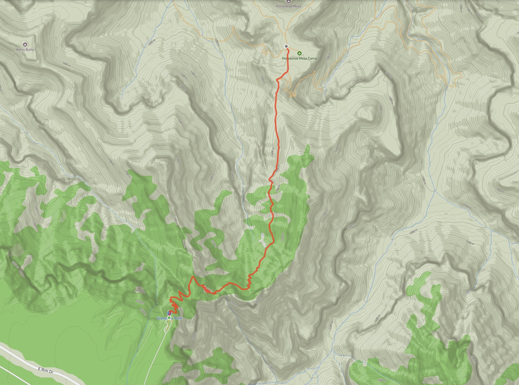
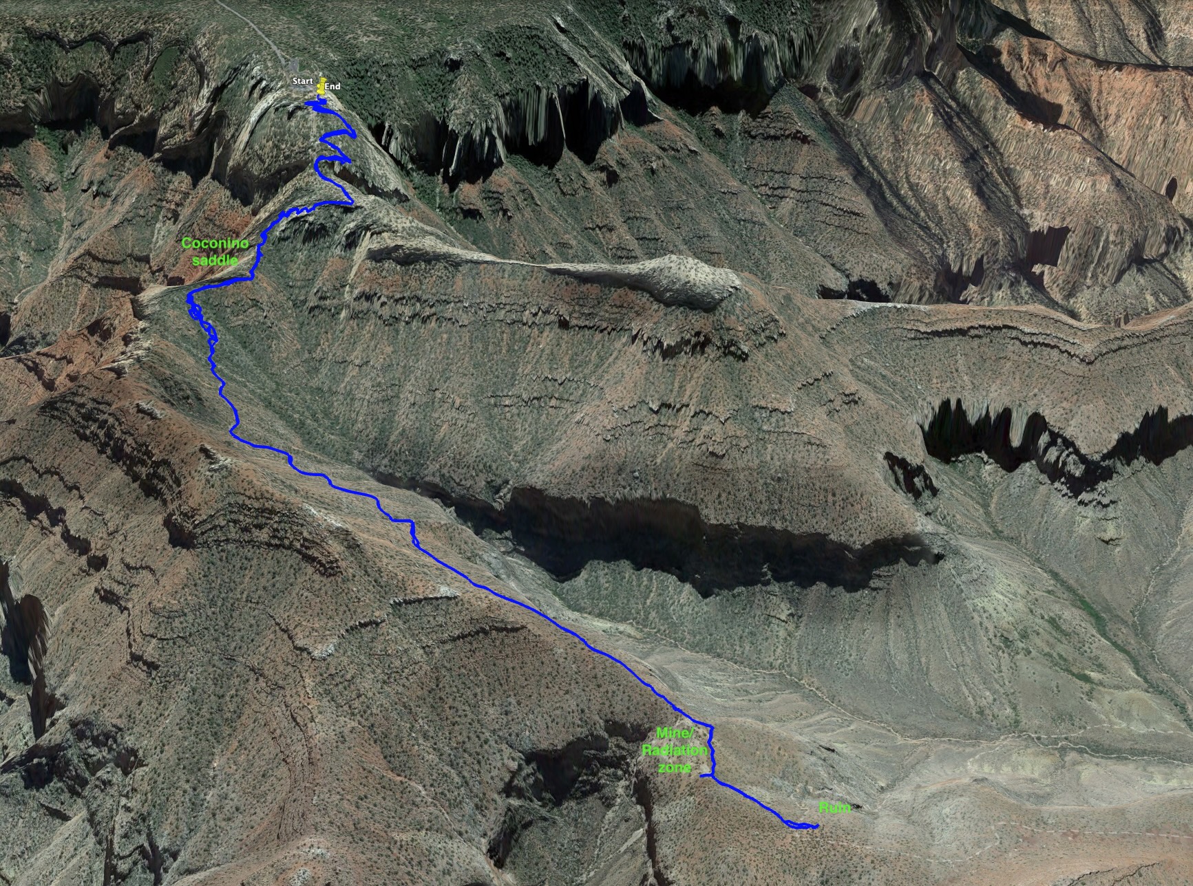
Click for a higher resolution, zoomable image.Route overview looking south.
To round out our first trip to Grand Canyon, we decided to visit Horseshoe Mesa via the Grandview Trail. In contrast to Bright Angel Trail and North/South Kaibab Trails, Grandview is rougher and narrower with a greater feeling of steepness and exposure. The National Parks Service does spend some time emphasizing that this isn’t an easy hike on their website. Our experience was that this is a fair description – it was a lot like hiking steep trails in the Rockies, with the added environmental element of significant heat. However, the rougher nature of the trail actually made it very enjoyable to hike and we had a great day in the Canyon.
The sign at the trailhead, warning the “Grandview Trail is not regularly maintained. It is steep and rugged.”
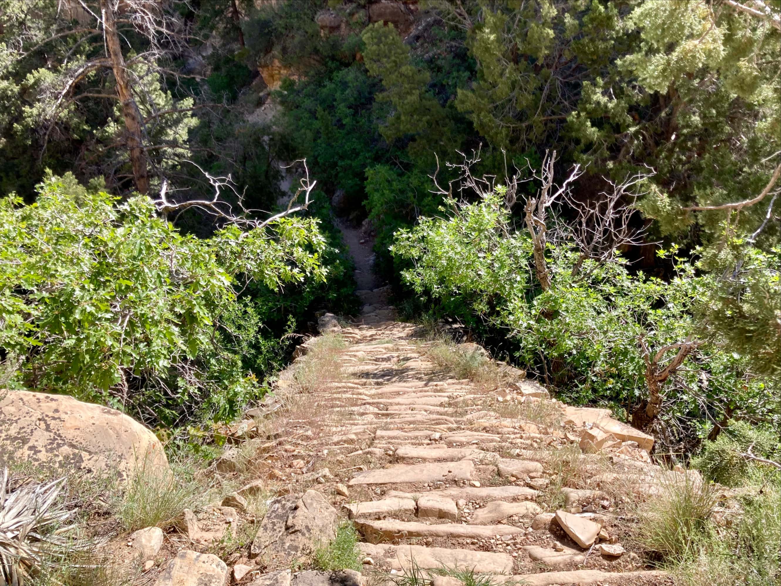
Access to this trail is via Grandview Point, a short distance to the southeast of Grand Canyon Village. A short road from the highway leads to a parking area with interpretive signs. The trail starts off sharply descending towards the north in a series of switchbacks, eventually changing directions to trend northeast and hook around an adjacent ridge. It then proceeds to southeast to another set of dense switchbacks which lead down to a col between two outcrops which is marked as Coconino Saddle on my National Geographic map. This unofficial name is also referred to on the National Parks Service website and suggested as an easier dayhike objective. However, there’s no sign on the trail marking the location.
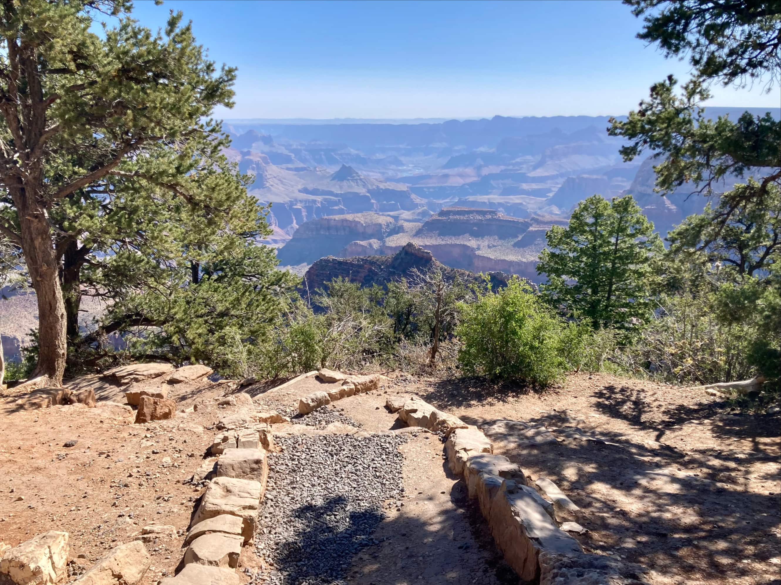
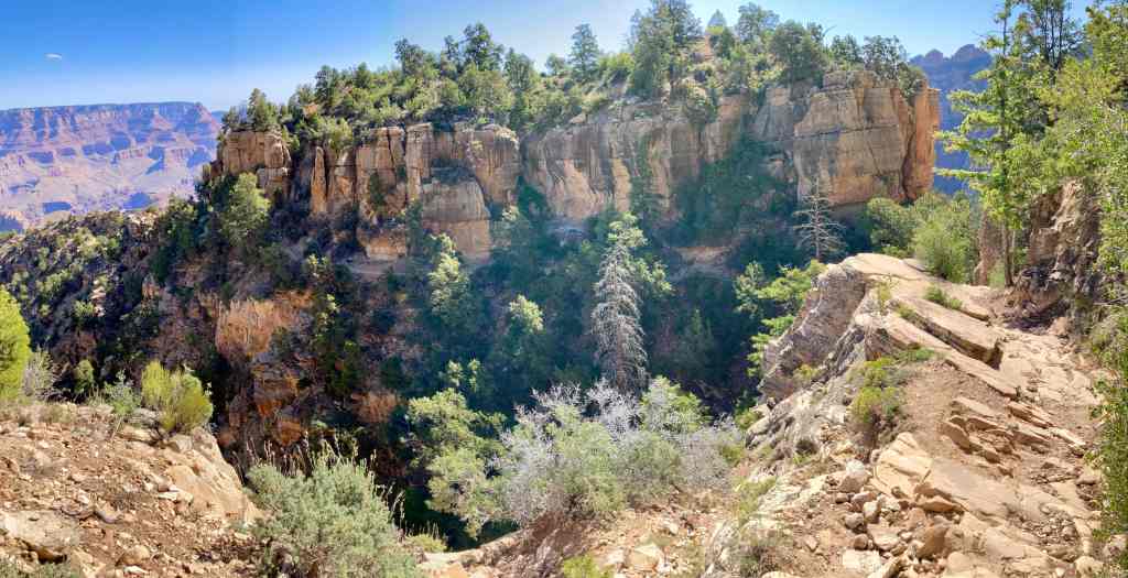
Setting out from the parking lot.The initial views were quite promising.Descending steep switchbacks.Bhaskar making his way down. I can’t say that things ever felt precarious on the trail, but some people might not like the exposure.A panorama looking north. Horseshoe Mesa is more or less dead-centre in this image. At the lower-left you can see part of the descending trail.The trail carries on to the right of this image then crosses a relatively narrow area to reach the adjacent ridge. You can see the trail traversing the ridge, under the vertical rock face across the gap.Turkey Vultures discussing their plans for the day.Descending to the adjacent ridge.The relatively trail is quite level as it traverses and then hooks around the northern end of the ridge.Descending to Coconino Saddle.Down on Coconino Saddle, looking north.
There’s a break from the steep descent for a short time after the Saddle. The trail gradually loses altitude traversing east before reaching another set of dense switchbacks descending northward. Thereafter, the trail heads directly north with a gentle descent over roughly 2.5 km until it reaches Horseshoe Mesa.
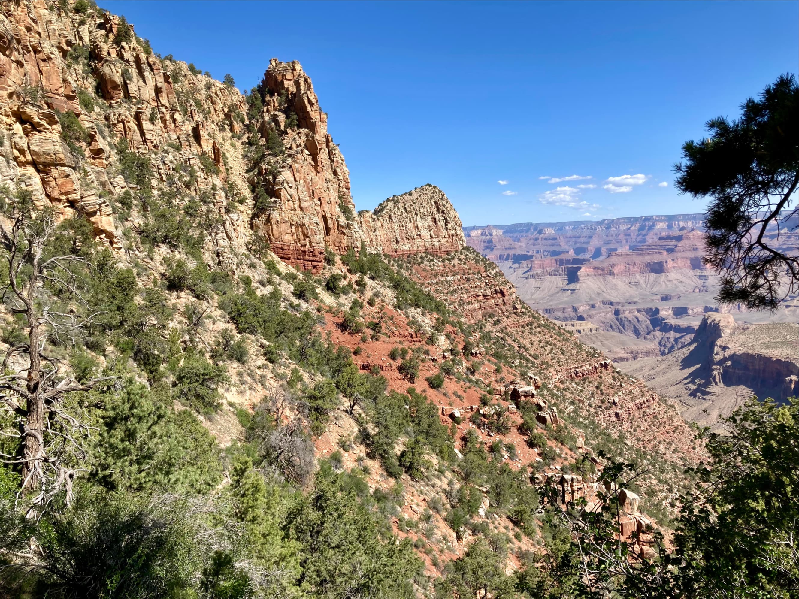
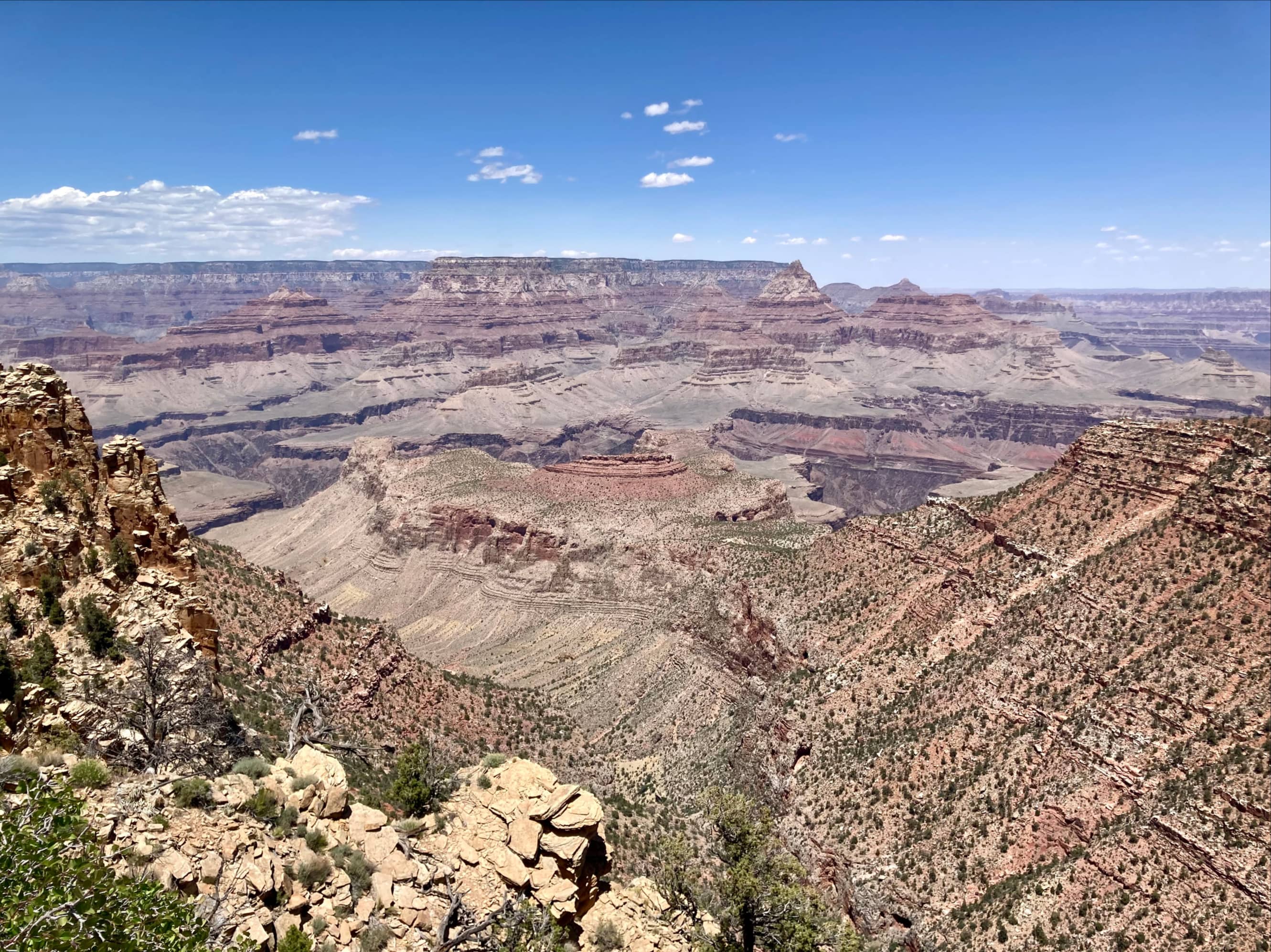
Beyond Coconino Saddle the rocks change from yellowish sandstone to red shale. Horseshoe Mesa visible once again beyond the ridge line ahead.Looking back at what the terrain we’d descended.A trailside agave plant.There were a couple of places along this section of trail where there were small boulders to navigate over and through.Another look back from further down. Coconino Saddle is the deep cleft at centre.After a long descent, finally almost down to the level of Horseshoe Mesa.
The ruins of a cookhouse stand near the Horseshoe Mesa campsite, and in this area we saw plenty of debris like rusted metal scraps and broken crockery. These are the remains of a mining camp for prospector Pete Berry’s Grandview Mine, also known as Last Chance Mine. The mine openings in the area have been sealed up. There is apparently also a high level of radiation in the area of the old mines, so warning signs have been posted to steer hikers clear of a small section.
I was a little surprised to see this sign, along with some rocks arranged to ward hikers away from a small side trail.A short distance along the trail and below the level of the first radiation warning there’s a trail intersection and another warning sign. Rocks were piled up here and higher up, presumably to seal off mine openings.Looking uphill from a little further down – a cave or mine opening was visible in the hillside.Here and there we saw distinctive light blue rocks. This is a mineral called Grandviewite and it is only found in Grand Canyon.Tin cans, metal belts, broken crockery. Trash + Time = Archaeology.I figured this was some sort of survey marker. Out of interest I put the number and location into Google and discovered a scan of the 1919 Field Notes of the Survey of the Mining Claim of Canyon Copper Company. It describes, “Cor. No. 4 Sur. No. 1358 A. Last Chance Lode consists of a sandstone showing 7x10x12 ins. above ground chiseled 4-1358A and hole at Cor. point. This is corner No. 3 as of record.” Cool.Me walking the last 100 metres to towards the cookhouse ruins. Photo courtesy of Bhaskar Bhowmik.Arrived at Horseshoe Mesa.Checking out the ruins of the cookhouse.Some material left behind in the fireplace.More artifacts scattered within the walls.The remains of a smaller building nearby.
We had a lunch consisting of submarine sandwiches purchased from the Grand Canyon Village Market while crouching in what little shade we could find. After exploring the area a little more we returned to the trailhead, taking in the south-facing views and stopping to check out some flora and fauna along the way.
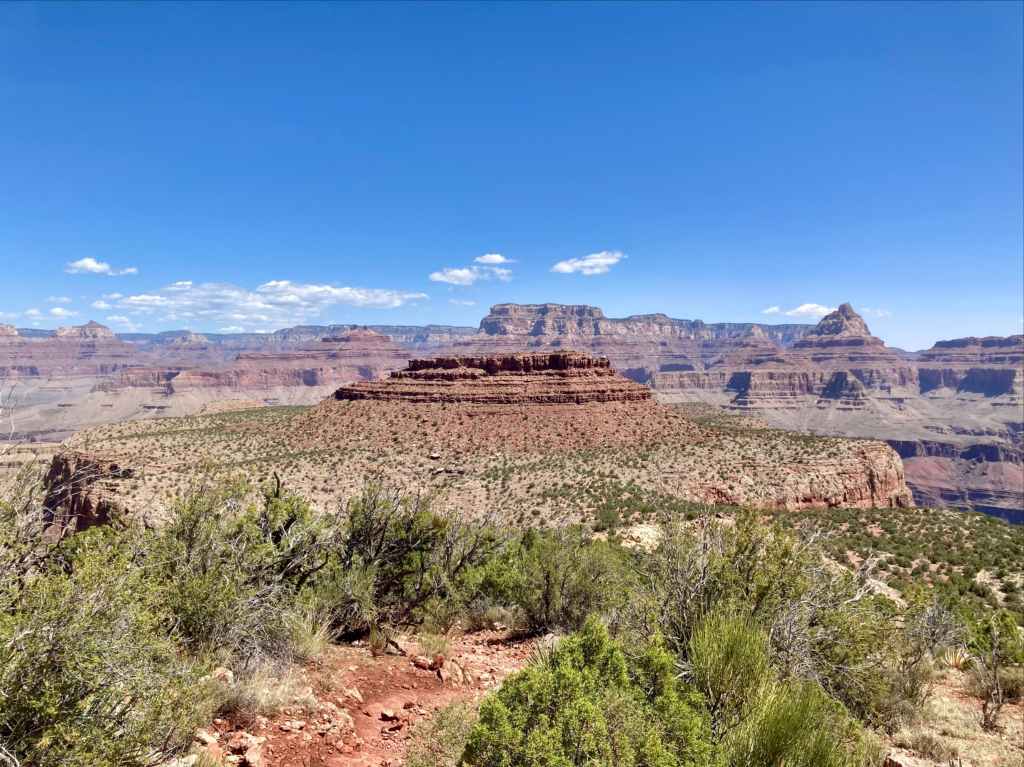
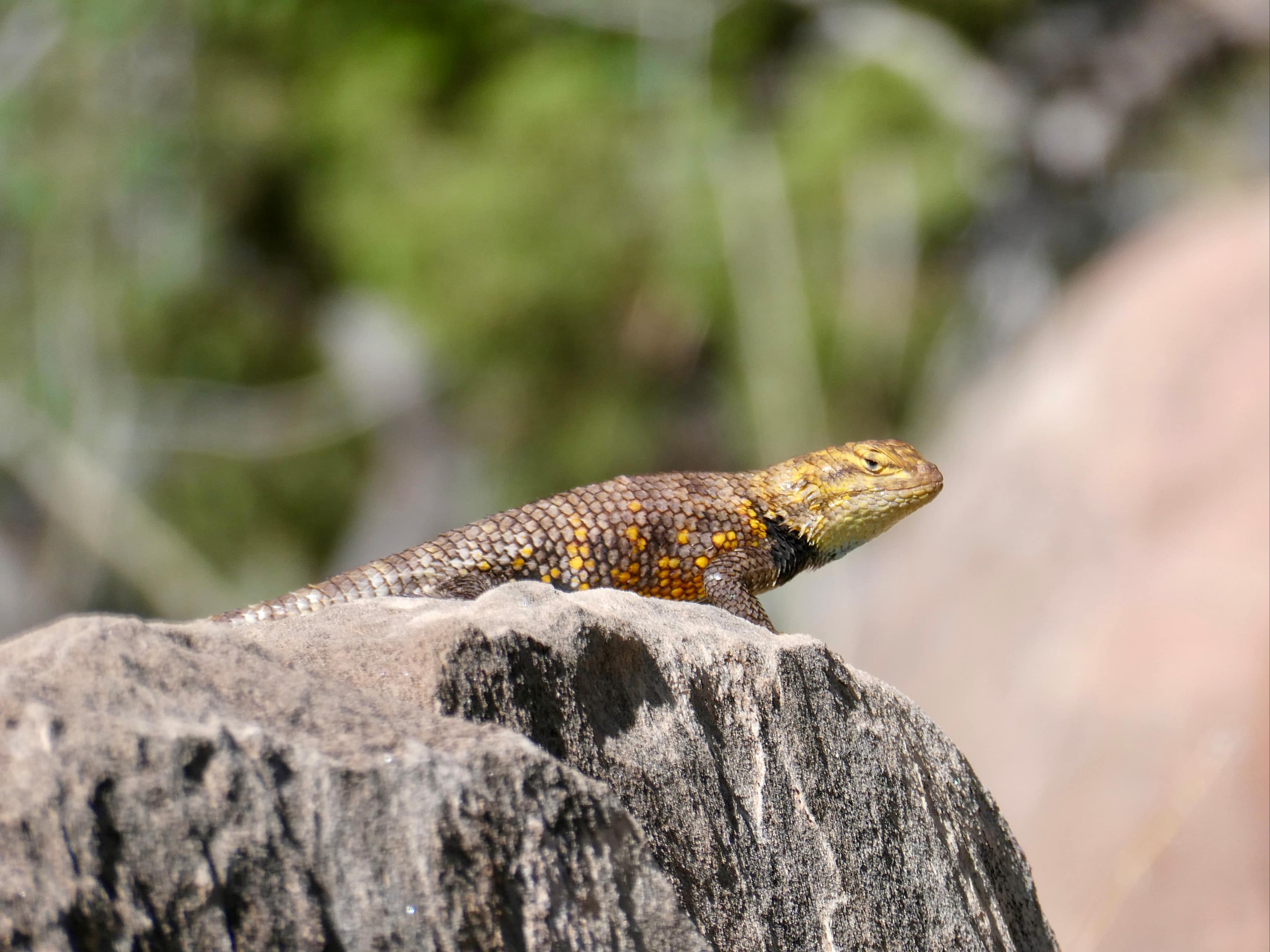
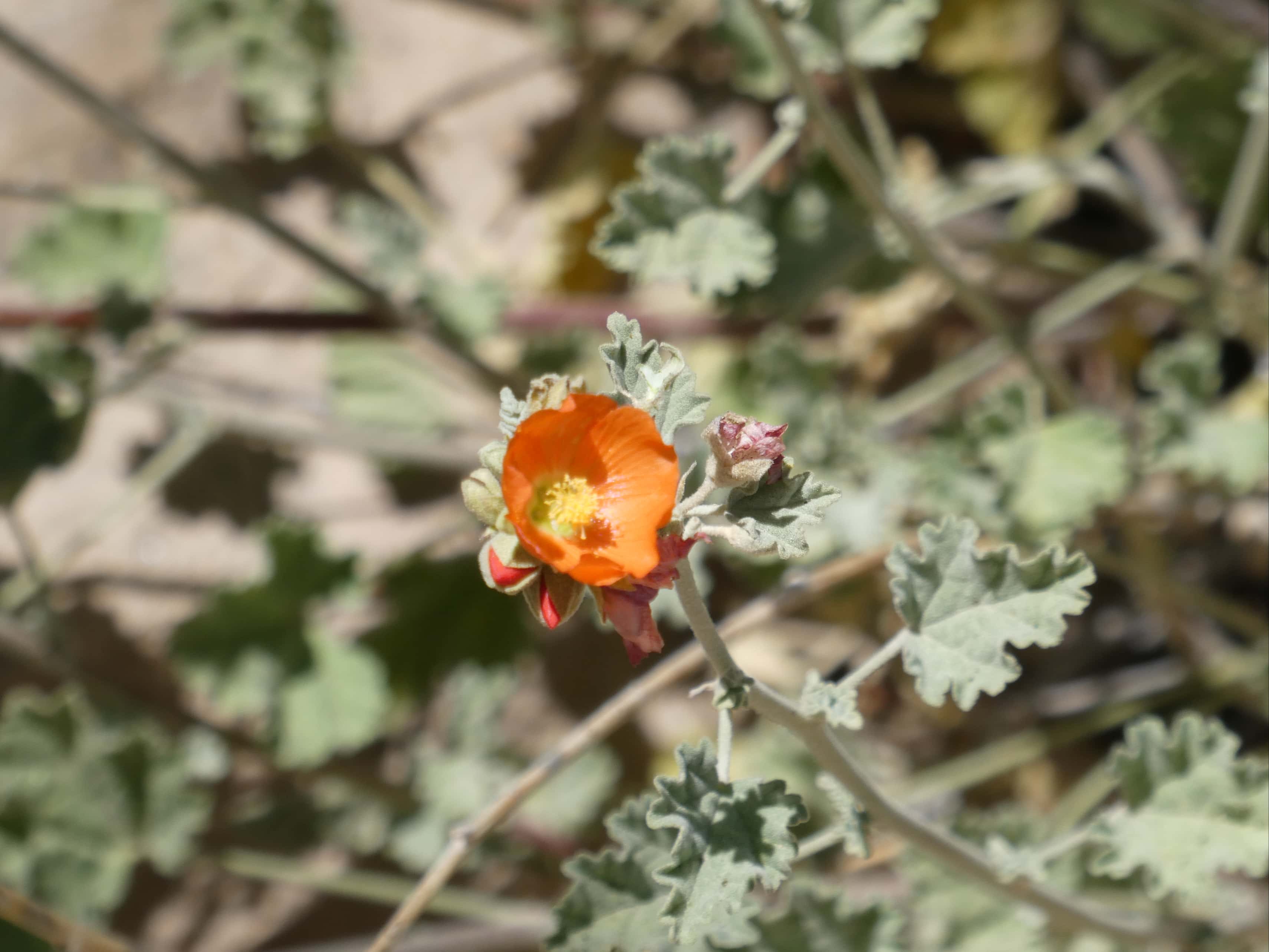
A southward view from Horseshoe Mesa, heading back the way we came.Looking down at a parched creekbed.A Yellow-backed Spiny LizardA yellow flower on a Brown-Spined Prickly Pear cactus.A pink flower on a Grizzly Bear Prickly Pear cactus.Lewis flaxTaking a break in the shade part way up, looking back at Horseshoe Mesa.White Mountain Flox, I think.Pink-petalled Mountain Flox.Desert PaintbrushA giant rocky fist punching its way to the surface.Another lizard, much smaller than the Spiny Lizard I saw. I’m not sure what kind it is.Gooseberry GlobemallowArizona SkyrocketA last look back at Horseshoe Mesa.Looking northeast. Grey-blue water of the Colorado River was barely visible.
This was actually the most enjoyable of the three hikes we did in Grand Canyon. Part of this was the greater solitude we experienced. Lots of people drive to the viewpoint, a handful hike a short distance down the trail, but we only ran into 2 or 3 other parties coming and going from Horseshoe Mesa. This is in stark contrast to the high-traffic Bright Angel and Kaibab trails. The rougher nature of the trail, as well as the terrain it wound its way through, also made for a more engaging experience. It’s well worth checking out for anyone with the time and ability.


Gre
LikeLike