July 29, 2023. Tagging 2 of the 3 peaks of a distinctive mountain in the Castle Wilderness.
- Region: Castle Wilderness. Traditional territory of the Blackfoot, Tsuu T’ina, and Ktunaxa First Nations
- Distance: Approximately 12km – my various apps varied wildly on this one
- Total Ascent: 1320 m due to elevation loss and gain between summits
- Elevation of Objective: 2412 m (first/true summit), 2450 m (second summit)
- Total Time: 7h 15m
- Safety and Disclaimer
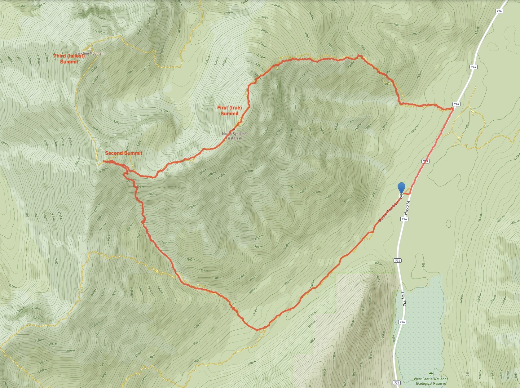
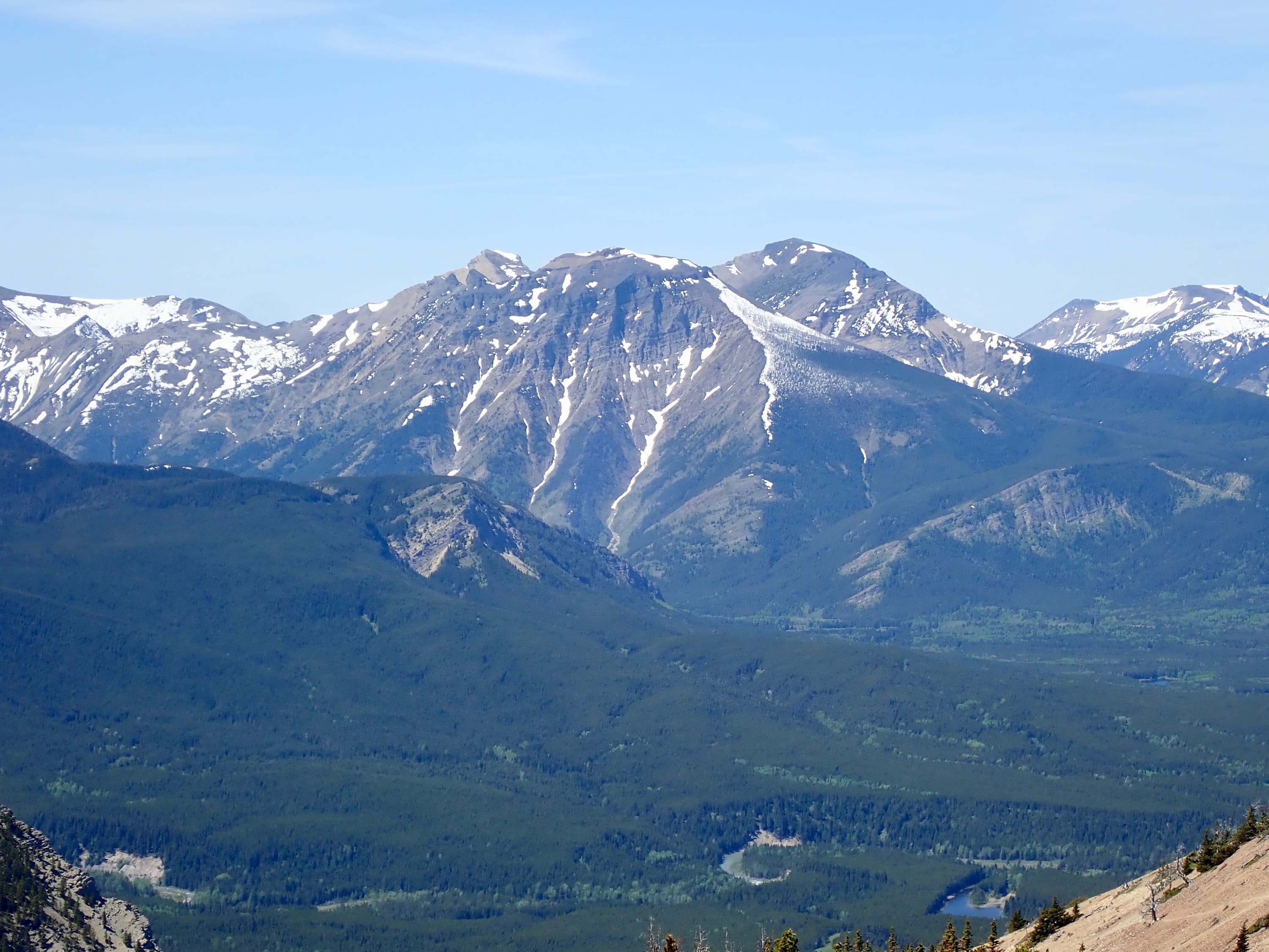
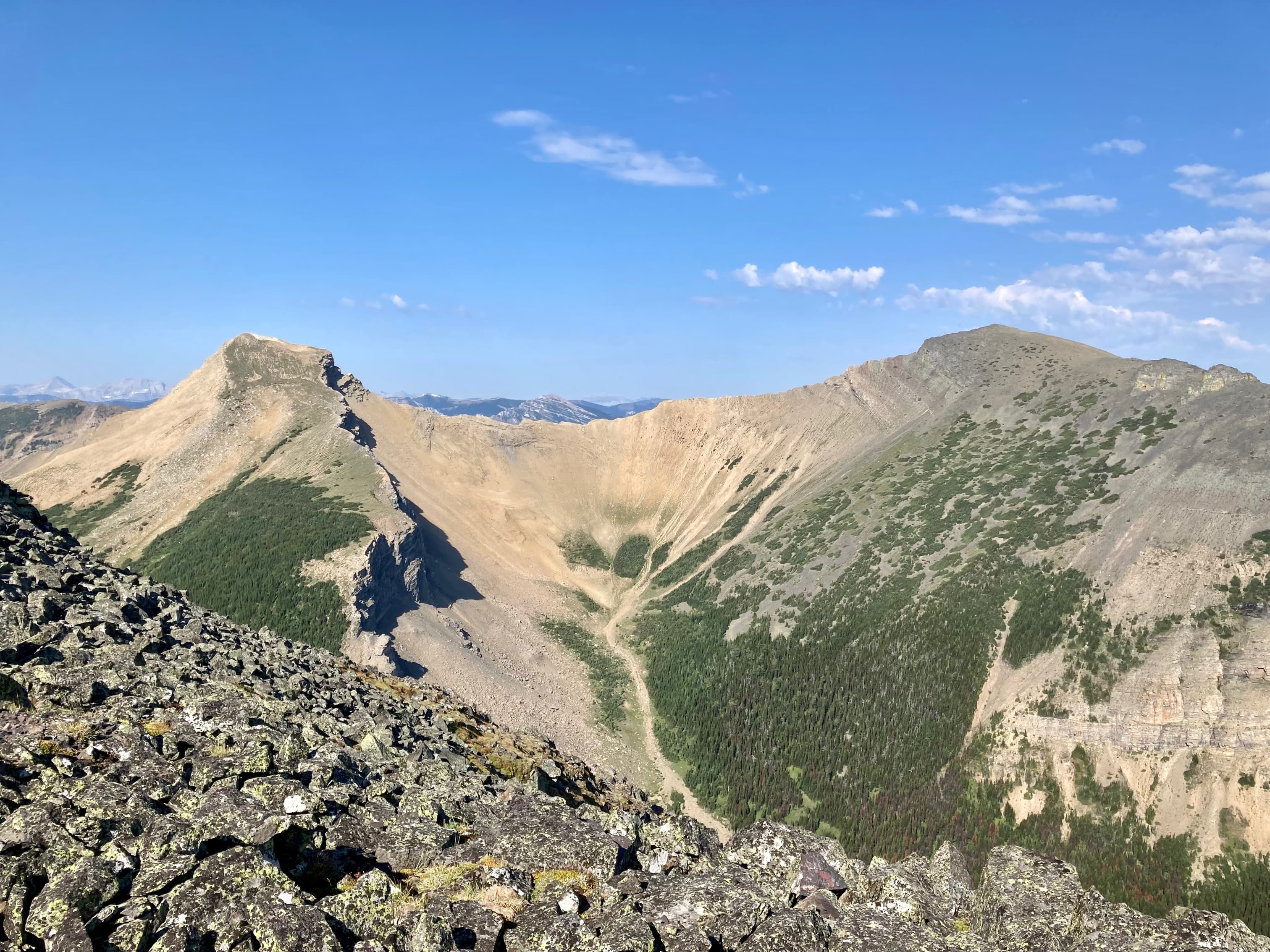
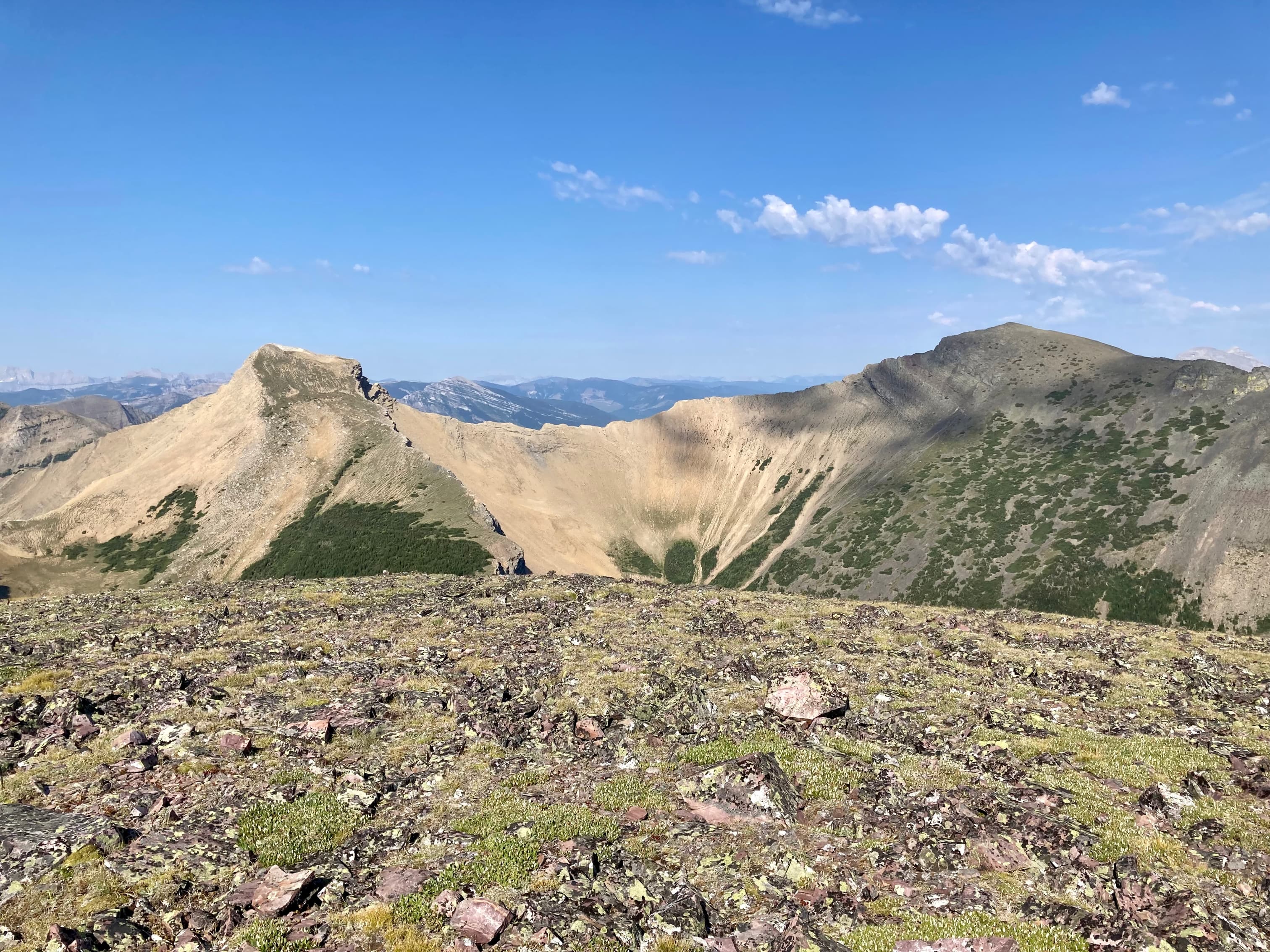
Nugara describes the route for Syncline Mountain in More Scrambles in the Canadian Rockies 3rd edition. The mountain has 3 summits, and the eastern-most is the true summit. It’s also the lowest of the three. I’m not sure how the lowest summit becomes the true summit, and Google hasn’t been helpful in this regard. Proceeding clockwise along the connecting ridges, one can go from the first to the second summit after bypassing some large intervening rocky outcrops. From there, the route involves areas of difficult but avoidable scrambling before reaching the third summit. I paid particular attention to Nugara’s suggested descent routes. If one was planning to go beyond the first/true summit, then simply retracing your steps was not ideal. If you made it all the way around to the third summit, one option was to descend into the valley south of that peak and follow the cheerfully named Suicide Creek to some ATV trails. Doing so, apparently, would involve some nasty bushwhacking. Another option was to return from the third summit to the col between the first and second summits, then drop into the valley south of the col and follow the drainage down to Syncline Brook Trail, which would easily lead back to the highway. Of course, this was also the best descent if one only made it as far as the second summit. This descent route seemed a much better option to me. I’d been down in that drainage and followed Syncline Brook Trail before when I climbed St. Eloi Mountain.
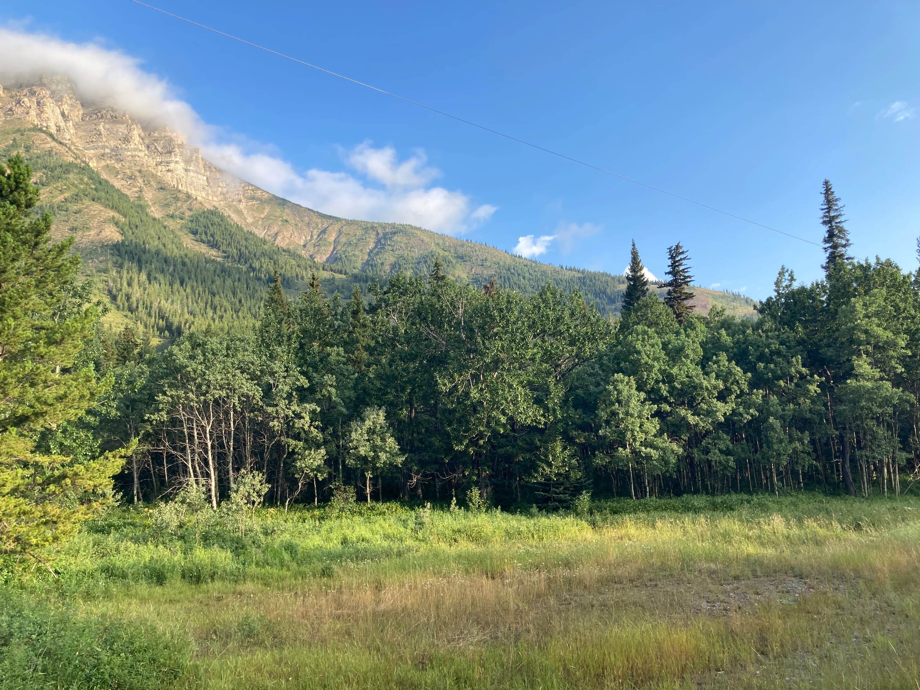
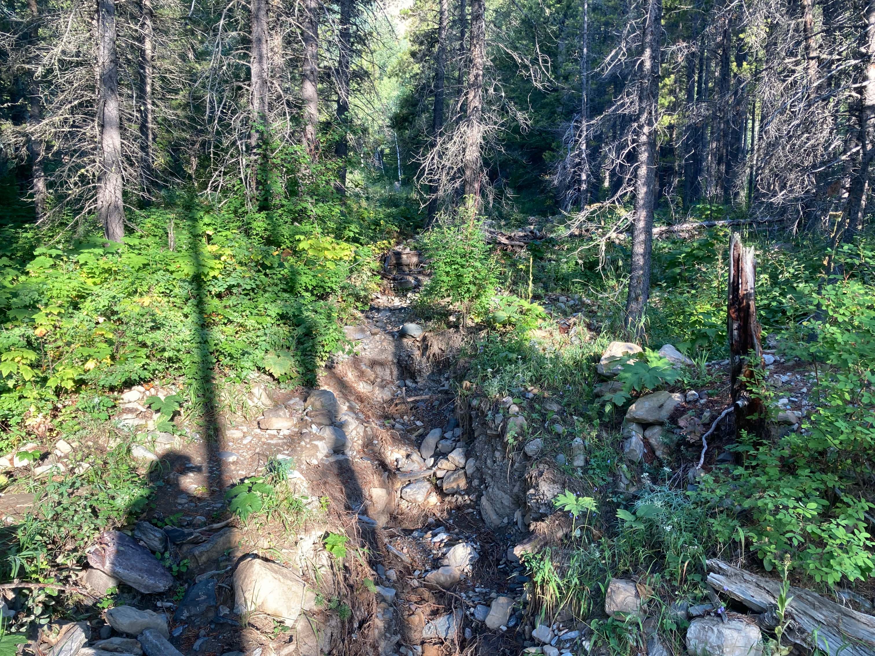
To get started, I drove towards the Castle Mountain Ski Resort and parked at the Syncline Barnaby Staging area. It’s a few years old now but still doesn’t appear if you search its name on Google Maps. Click here to see where it is. As of this writing the satellite picture shows the parking lot and Google Maps acknowledges that it is the new trailhead for the Southfork Lakes trail, but doesn’t have it referenced by name or show it as the trailhead for the Syncline Brook Trail. Once I’d parked, I walked back up the highway to the northeast for about 1 km, looking for the place to begin passing through the forest to get to the bottom of the ascent ridge of Syncline Mountain. A GPS track in Topomaps Canada was useful in this regard. There was a tiny bit of flagging on a branch where the GPS track indicated I should enter the forest. I also noticed that this spot was very close to the 2nd blue metal cage I encountered along the roadside which protected some bits of utility infrastructure.
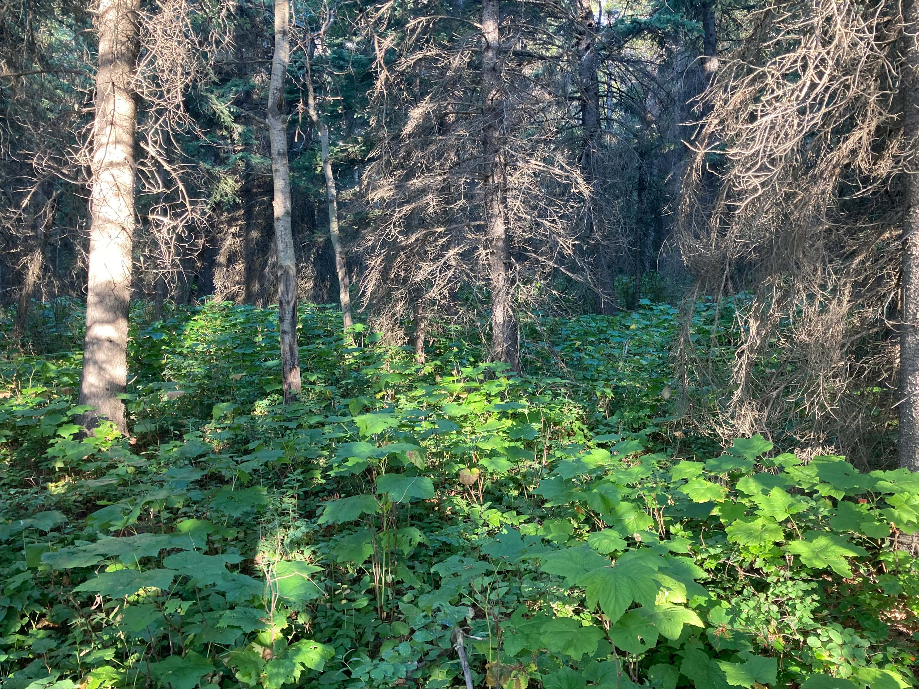
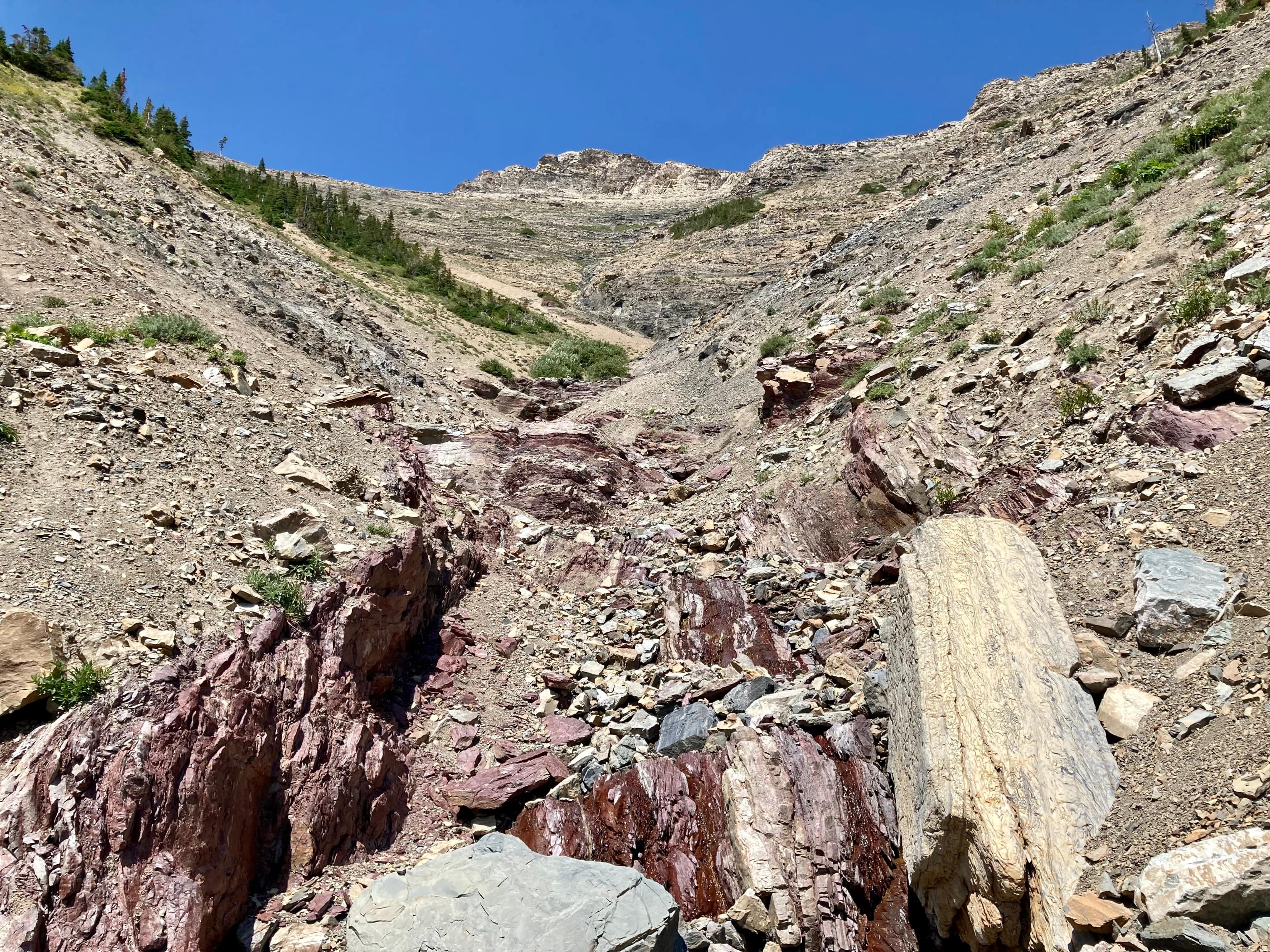
In the forest there was not the slightest hint of a trail, but I wasn’t expecting one. Other trip reports described a bushwhack at this point, and the mountain isn’t popular enough for a trail to have evolved. The bushwhacking was unpleasant and, because of the recent rain, I got soaked. My pants, boots, and socks got so wet I might as well have been wading up a river. I kept heading through the woods until I encountered a very narrow dried creek bed. I followed this west, either walking in it or alongside, until I could see that I’d reached the base of the ascent ridge. Then I cut over to the ridge and started to ascend.
More damp foliage awaited me and, for the first time that I can remember, I had to stop and change my socks during a scramble. I have a spare pair of socks that have been in my backpack for years without being needed. This was their time to shine. I wrung an alarming amount of water out of the pair that I was wearing and hung them on the back of my pack to dry. I put on the new socks and for a little while my feet were drier. But there were still lots of bushes to walk through as I ascended the ridge, and everything was soaked again in short order. I didn’t bother switching socks again until I reached the summit.
Getting to the first summit wasn’t complicated – it just involved steep hiking along the broad, sweeping ridge. Once the vegetation petered out, I headed between two rocky outcrops which defined a wide weakness in the cliffs below the summit. Bob Spirko referred to these outcrops as “the gates”. I’m a fan of The Hunt for Red October, so in my head I called them “Thor’s Twins”. The summit was a few minutes easy walking beyond the “Twins”.
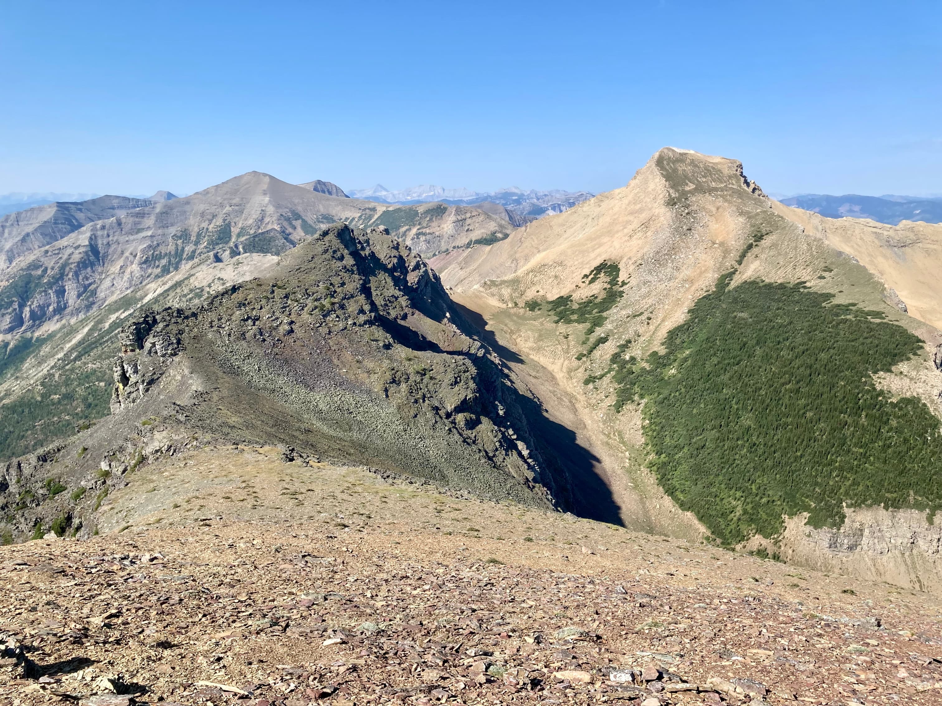
The trip to the second summit required following the connecting ridge to the southwest, then bypassing a large, multi-part rock outcrop to reach the low-point of the col on the far side. Bypassing the outcrop involved cutting across the middle of it, rather that going under it, following a path that’s a little hard to describe and required some hands-on down-climbing. From the col, it was just steep hiking to reach the second summit.
Looking at the third summit, I figured it would be reasonable to budget at least 1.5 hours to reach it, and almost that long for me to get back to the start of my descent. Unfortunately, clouds that had previously been very distant on the horizon looked a bit closer every time I glanced at them. I decided to call it a day at this point and start my descent.
Descending south from the col was not a carefree scree run. Slabs and low cliffs appeared here and there and it took a bit of thought to pick the best way down. Once down in the drainage there were a couple of areas that were tricky to descend, but nothing too difficult. There was some water flowing and as the grade eased and the terrain became more friendly I enjoyed walking out alongside the little stream. Where the drainage intercepted the Syncline Brook Trail I turned left and followed the trail out to the Syncline Barnaby parking lot. The thunder started to rumble as soon as I reached my car.
The scenery on this trip was pretty good, but the journey wasn’t particularly fun or interesting. Maybe I’m just grumpy about getting soaked, but I don’t think I’ll be returning to bag the third peak any time soon.
Click/tap on the pictures in the gallery below to access higher resolution images.


Looks like a very nice hike Par!
The photo of Mount Darah also captured my attention.
Have you ever hiked/climbed that peak?
LikeLike
I haven’t. Very few scramblers have climbed it and trip report are scarce. Here’s one from Sonny Bou: http://sonnybou.ca/ssbou2017/darrah.html
LikeLiked by 1 person
Thanks for the link Par. I will have a look cause it looks like a very interesting peak!
LikeLike
Many spectacular photos Par!
<
div>Many mounta
LikeLike
Great trip report! Any chance you can share the gpx file? Experienced scrambler here, but like to always have a reference other than book descriptions an photos/
LikeLike
Sure – where should I send it?
LikeLike