January 5, 2018. A snowshoe trip to an unnamed high point in the Highwood region of Kananaskis Country.
Southern Alberta is about one week out from its most recent major snow dump. I spent most of December 30, 2017 shovelling snow off various driveways. Actually, I can’t ever remember spending so much of a day shovelling snow. Along with the snowfall, we had record low temperatures. My car’s thermometer measured a daytime air temperature of -40 Celsius just outside Lethbridge — another thing I can’t ever remember happening before. However, everyone around here knows that you just need to give it a few days and the Chinook will return and eat away the snow.
Sure enough, the temperature began warming in the last 2 days, and today there were wind warnings in Lethbridge, Waterton, Pincher Creek and the Crowsnest Pass. This was all well and good, except I wanted to do some snowshoeing. A bit of wind doesn’t bother me too much, but wind warnings in the mountain regions around here are something to take seriously. Rather than miss a day outside, I decided to drive north and see if I could find a less windy area. After perusing the weather reports, I decided to head for the Highwood Region of Kananaskis. I’d never hiked or snowshoed in that area before, but I had a Gem Trek map of the area, and Andrew Nugara describes a few routes in his excellent A Beginner’s Guide to Snowshoeing in the Canadian Rockies 2nd edition (Rocky Mountain Books, 2016). I decided to make my way to Grass Pass, since it looked like a reasonably sheltered trail which had a variety of options for extensions once the pass was reached.
Access is via Highway 541 (which is the southern end of Highway 40). At this time of year Highway 40 is closed between Highwood Junction in the south and Kananaskis Lakes Trail in the north, so the only access is via Longview. Take Highway 22 to Longview, then get on Highway 541 and head west. At about 34 km outside town you’ll pass the sign notifying you that you’re entering Kananaskis Country. 3.6 km beyond that, on the north side of the road, you’ll see 2 orange diamond trail markers at the trailhead. Nugara mentions the Sentinel Day Use area, about 300 meters beyond the trailhead, as a good place to park (or rather a good place to park nearby since it used to be closed in the winter). It looks like that particular day use area was among the casualties of the major floods of 2013. It’s gone now, and in its place is a gravel access way to construction roads, likely for the massive reconstruction and flood mitigation efforts that have been ongoing since 2013. It’s still possible to park in that area, but the snow looked deep, so I just pulled far onto the shoulder and headed to the trail.
As of this writing, you can use Google Maps to see the area before and after the flood. Search for 50.3910592,-114.5829436, this takes the view to the Sentinel Day Use Area. The overhead imagery is up to date, but if you drag the little Street View guy onto the highway and look around, the imagery is from 2012, before the floods, and you can see the day use area as it once was.
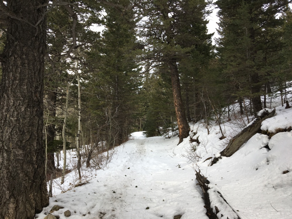
The trail was very easy to follow and it looked like at least 2 parties had been through there in the last few days. There were no fresh tracks, though, and I encounter nobody for my whole journey. The snow remained fairly deep despite the warming weather. It was soft and quite heavy so I was glad to have snowshoes on. The terrain under the snow was quite rocky, and occasionally sat exposed. By and large, though, there was a good base of snow covering the rocks and smoothing things out. I imagine there’d be tricky footing in light snow cover.
The trail proceeds up a valley and is among trees for the first 2 km. It was quite sheltered. The winds were lighter in the Highwood region than in the regions to the south, but still gusty. They were howling over the ridges above me, but among the trees I hardly felt a breeze. Beyond 2 km the trail moves onto open grassy slopes. Here there is a bit of a view opening up if you look back south, the way you came. Mount Burke is clearly visible, and the view of it slowly improves as you gain height. Looking ahead, the high point of the pass is clearly visible. The view that way is dull, but the climb eventually pays off handsomely.
After roughly 2.9 km horizontal distance and 420 m elevation gain, the route reaches the Grass Pass. I reached that point after an hour. The weather remained fair, so I looked at where to go next. The views straight ahead remained absent. The ridge to the west of the approach valley looked like it would be an easy enough objective, but Nugara suggests that the views are slightly inferior up there compared to those from the eastern ridge. The eastern ridge is marked as “Boundary Pine” ridge on the Gem Trek map. Getting there would involve a short south-east traverse to gain the ridge and then following the ridge southeast to a clearing. Along the way that route apparently passes the famous Boundary Pine. I don’t know why it’s famous, but I understand that it has something to do with the history of settlement in the area. This route is the route Nugara suggests to extend the trip.
However, looking at my map I could see that to the east and slightly north of the pass there was an unnamed high point. An unofficial route connecting Grass Pass to the summit of the Bull Creek Hills went over that high point. It was higher than the two ridges and I figured I’d get some good views from there. I started heading up the slope and noticed that human tracks were now absent (I’m guessing they went to see the Boundary Pine), but there were innumerable animal tracks, wallows and droppings. My best guess is that they were left by mountain sheep, but I’m hardly an expert at identifying tracks and scat.
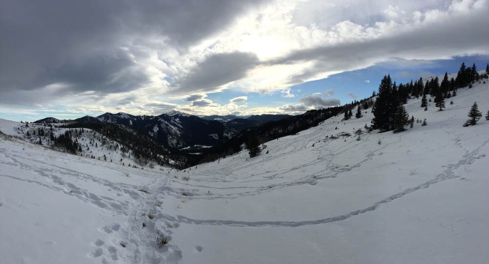
Immediately upon gaining a bit of height heading east the views to the west suddenly open up. Holy Cross Mountain and Mount Head spring into view in what has to be the most abrupt unveiling of a mountain view I’ve ever experienced. The view continues to improved as you gain height.
The route was obvious and after 800 m horizontal distance and about 115 m elevation gain I was on the high point, which I decided to call Sheep Summit because I’m not a very creative person. The wind was stronger up there, but nothing intolerable. I had great views south along Boundary Pine ridge, out across the valley to Mount Burke in the distance. The wind was blowing plumes of snow off the summit of Mount Burke, and I lamented that I didn’t bring and SLR camera and zoom lens. To the east I had a good look at the Bull Creek Hills. To the west and northwest the peaks of the Highwood Range stretched out to the horizon. A few of the big peaks of the continental divide could be glimpsed in the far distance to the west. After enjoying the view for some time I returned along the same route I’d ascended and headed back to my car.
Overall, this was a great day out. The route was trouble-free, and I only rate it as intermediate difficulty because of the elevation gain. Though I’ve driven through this area several times in the last few years, this is the first time I’ve stopped and explored, so it’s nice to have expanded my hiking world. I’ll definitely be back.
The route was 3.7 km to “Sheep Summit” with a 535 m elevation gain. Click on the pictures below to access full sized images (this is the best way to get a good look at the panoramas).


Very nice trail views and explanation of your hiking on snow shoes. I never had much time to hike the mountain trails.
Thanks for sharing your experience, Par.
LikeLiked by 1 person
Orange diamonds with a vehicle on them, identify trails “permitting” the use of that particular vehicle
LikeLike
There’s a picture of an ATV with a circle around it and a slash through it (you can click and then zoom in on the picture). Doesn’t that mean ATVS are prohibited?
LikeLike
Hi Par!
I stumbled onto your blog somehow(no idea how I got here) and am I ever glad I did!
Your site is nice, neat, informative and has some hikes that are just right for my kids(16, 12, 10) and I(pushing 50).
We did Grass Pass on Feb 13, and it was great. Your photos were super helpful. We did not go all the way to your “Sheep Summit” but did go as high as the odd metal cage thing.
For mid Feb, there was barely any snow left. Especially out of the tree cover. We hiked in our regular hiking boots without spikes and had no issue.
We are looking forward to adding your site to our list of resources for hiking this year.
Keep up the excellent Blogging.
Mike G and the Team
LikeLike
Thanks for the kind words, Mike. I’m glad you enjoyed the trip and that the blog was useful.
LikeLike