June 19, 2025. Engaging route-finding and scrambling in Waterton Lakes National Park.
- Region: Waterton Lakes National Park. Traditional territory of the Blackfoot, Tsuu T’ina, and Ktunaxa First Nations
- Distance: 21 km round-trip (this includes about 1 extra km hiked to avoid a bear)
- Total Ascent: 1196 m according to my GPS – others who have taken the same route have figures closer to 1400 m and it felt more like that
- Elevation of Objective: 2416 m
- Total Time: 8h 45m
- Safety and Disclaimer
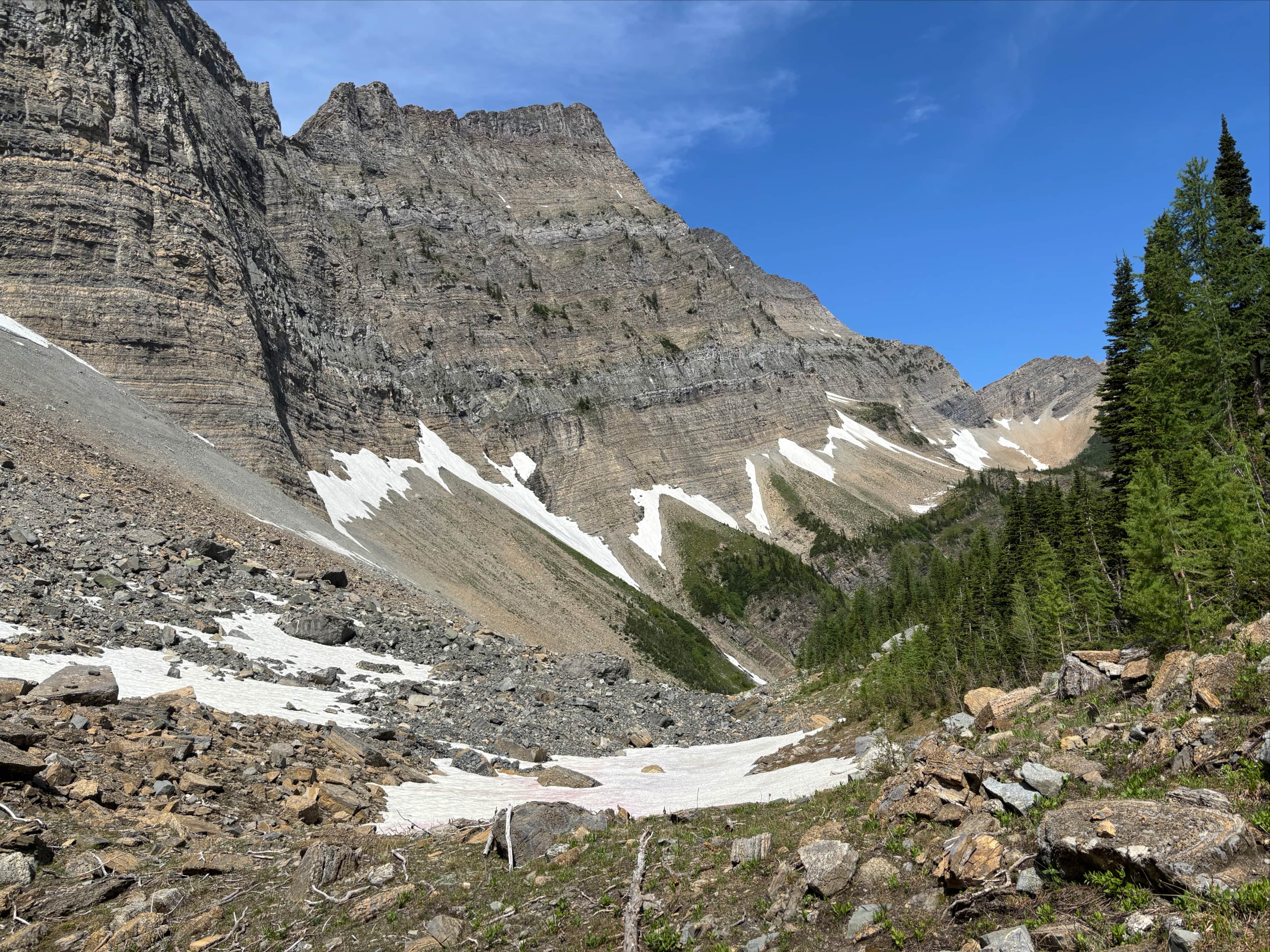
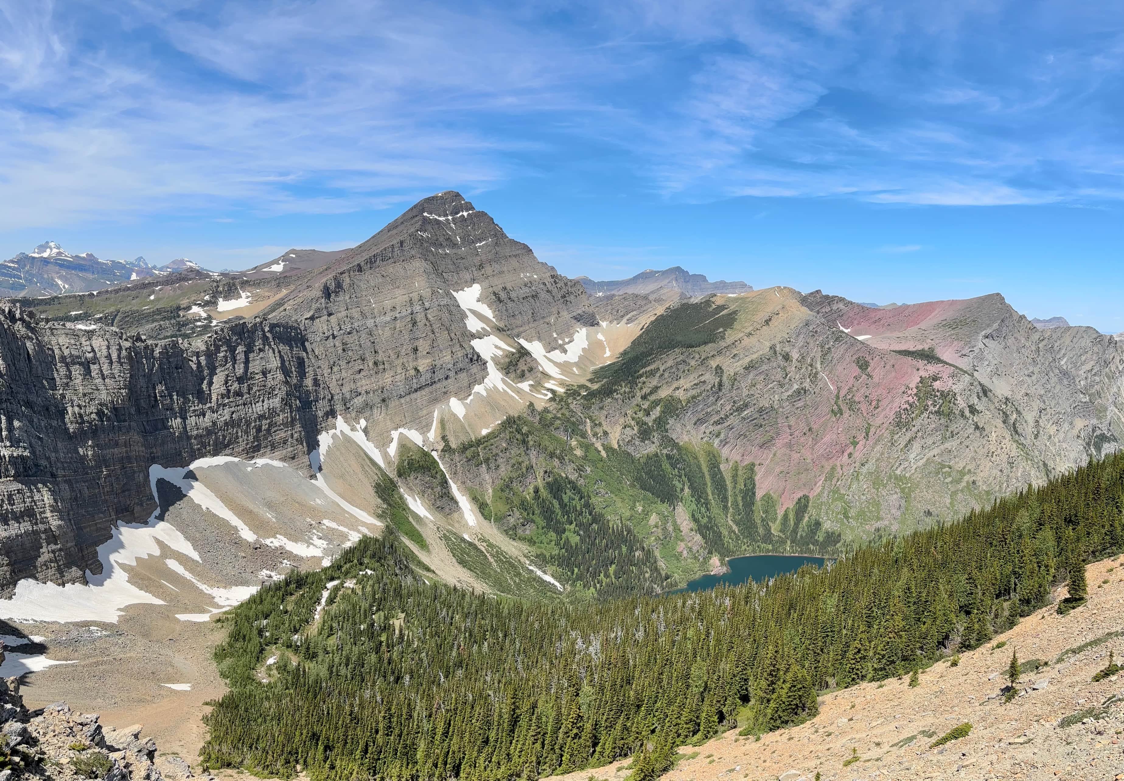
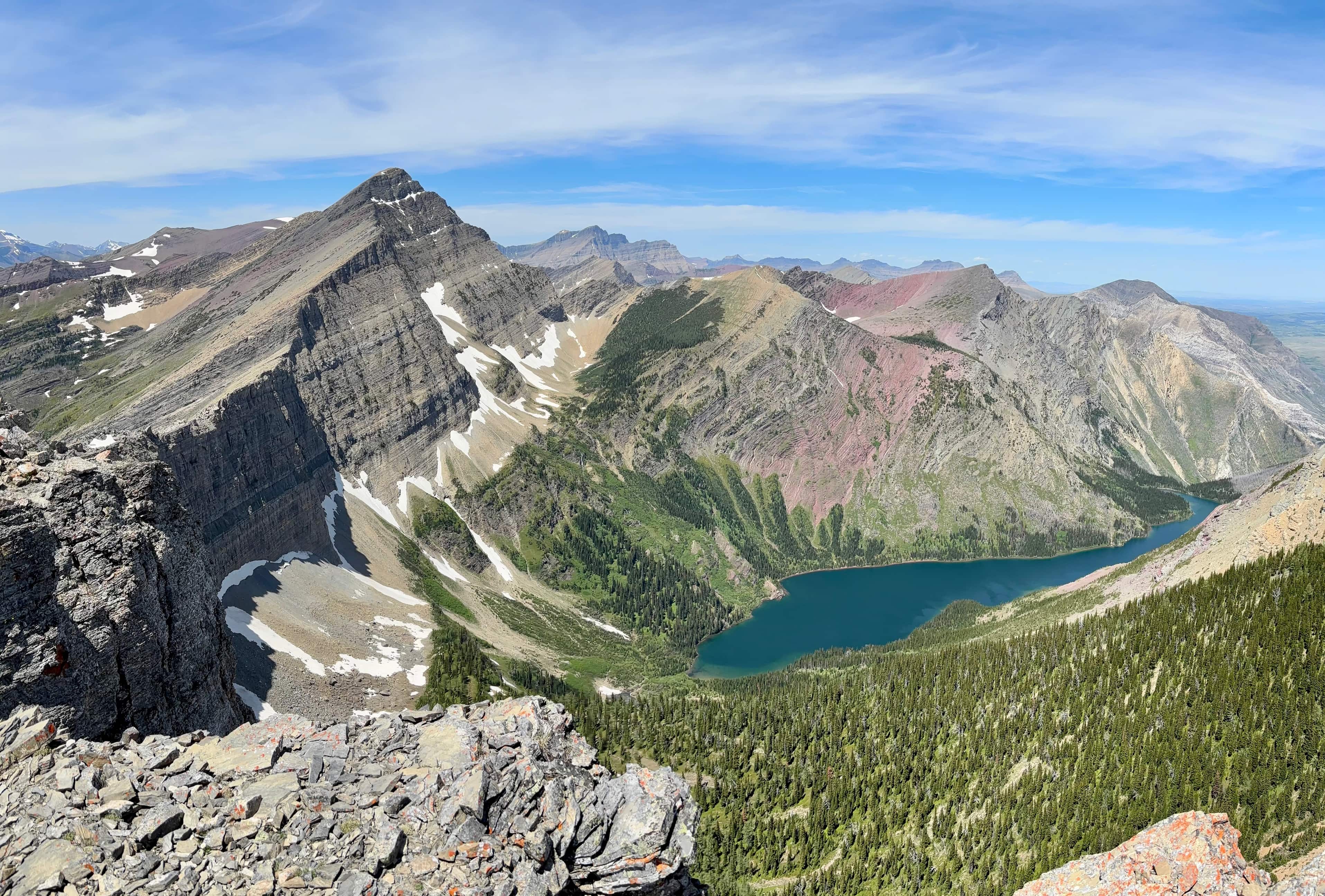
The defining view greeting hikers when they arrive at Bertha Lake is the imposing rock wall hemming in the far (southern) end of the valley. That wall is the connecting ridge between Mount Richards on the left and Mount Alderson on the right. Andrew Nugara describes two routes to reach the summit of Mount Richards in More Scrambles in the Canadian Rockies 3rd ed. One is the approach via the north ridge (a very difficult “climber’s scramble” which is beyond my capabilities) and the other is a “moderate” route via the north face and southeast ridge. I took a shot at climbing via the moderate route last September, but ended up turning back short of the summit – I wasn’t able to find Nugara’s route so I tagged the adjacent high point “Little Richards” then retreated. Now, with the 2025 scrambling season kicking off in earnest, I decided to use the exceptionally long day right before summer solstice to return and tag Mount Richards’ summit.

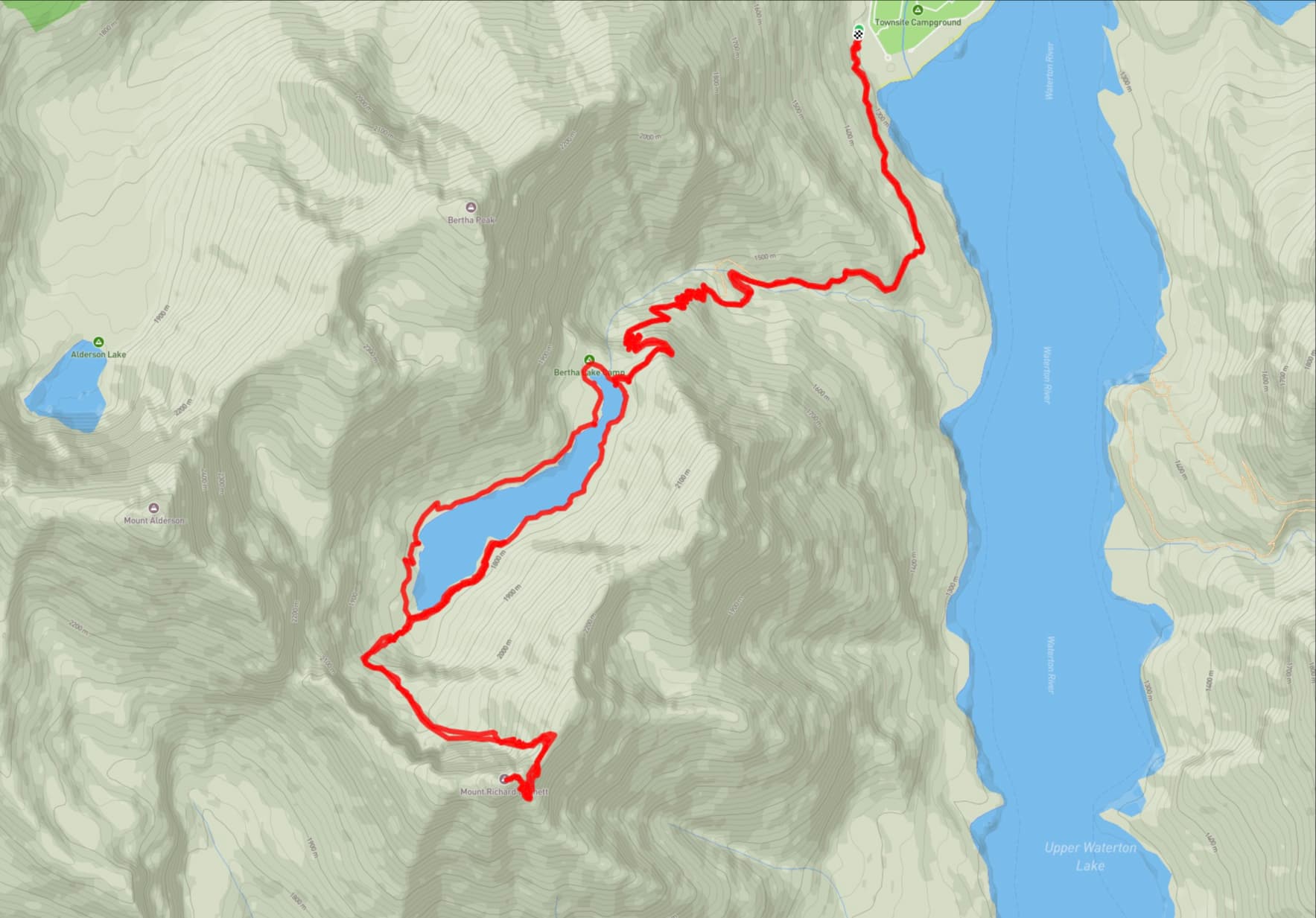
Access is via the Bertha Lake trail. Arriving at the Waterton townsite proceed straight through the 3-way stop. Continue following this road, Evergreen Avenue, as it reaches a Y intersection with Cameron Falls Drive. Go right and drive past Cameron Falls then continue along the road looking for the sign pointing to the Bertha trailhead on the right. There’s a small parking area which fills quickly, but lots of parking is available nearby.
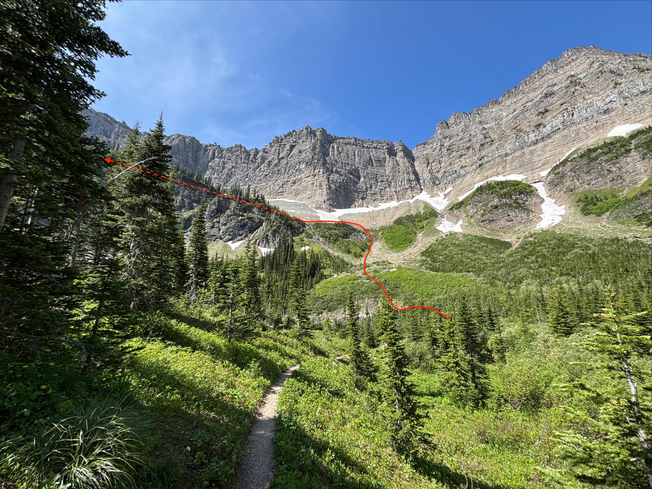
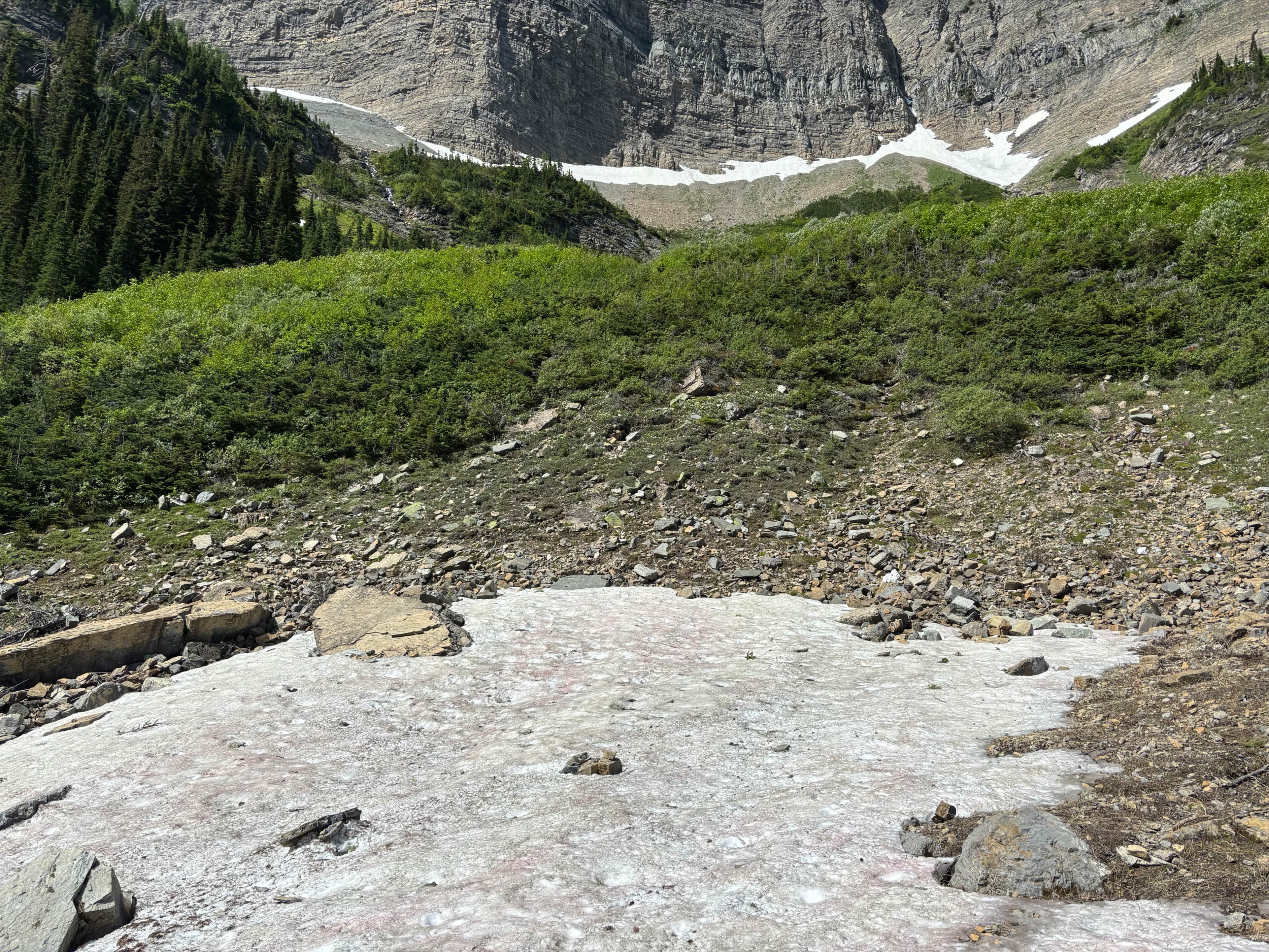
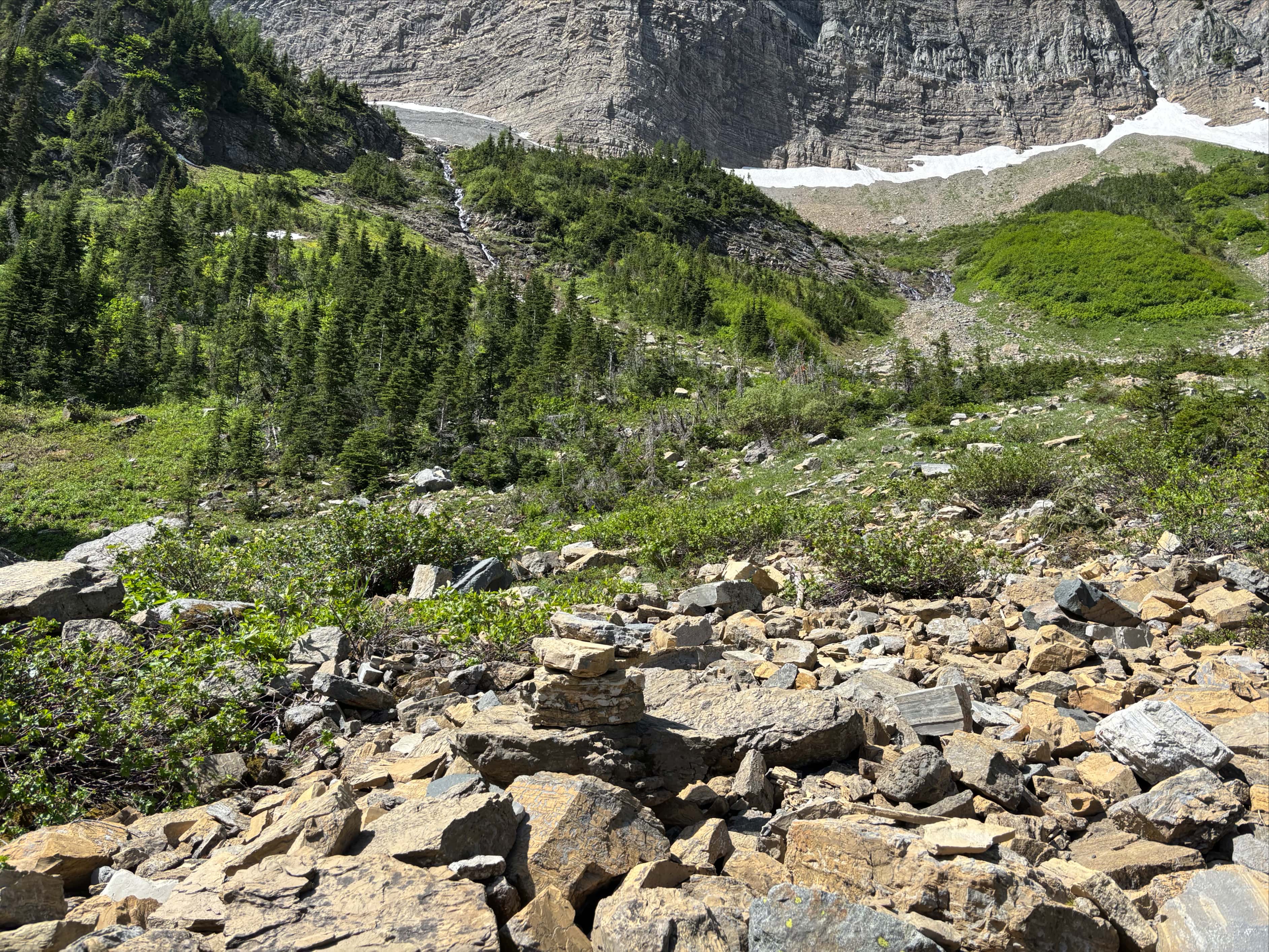
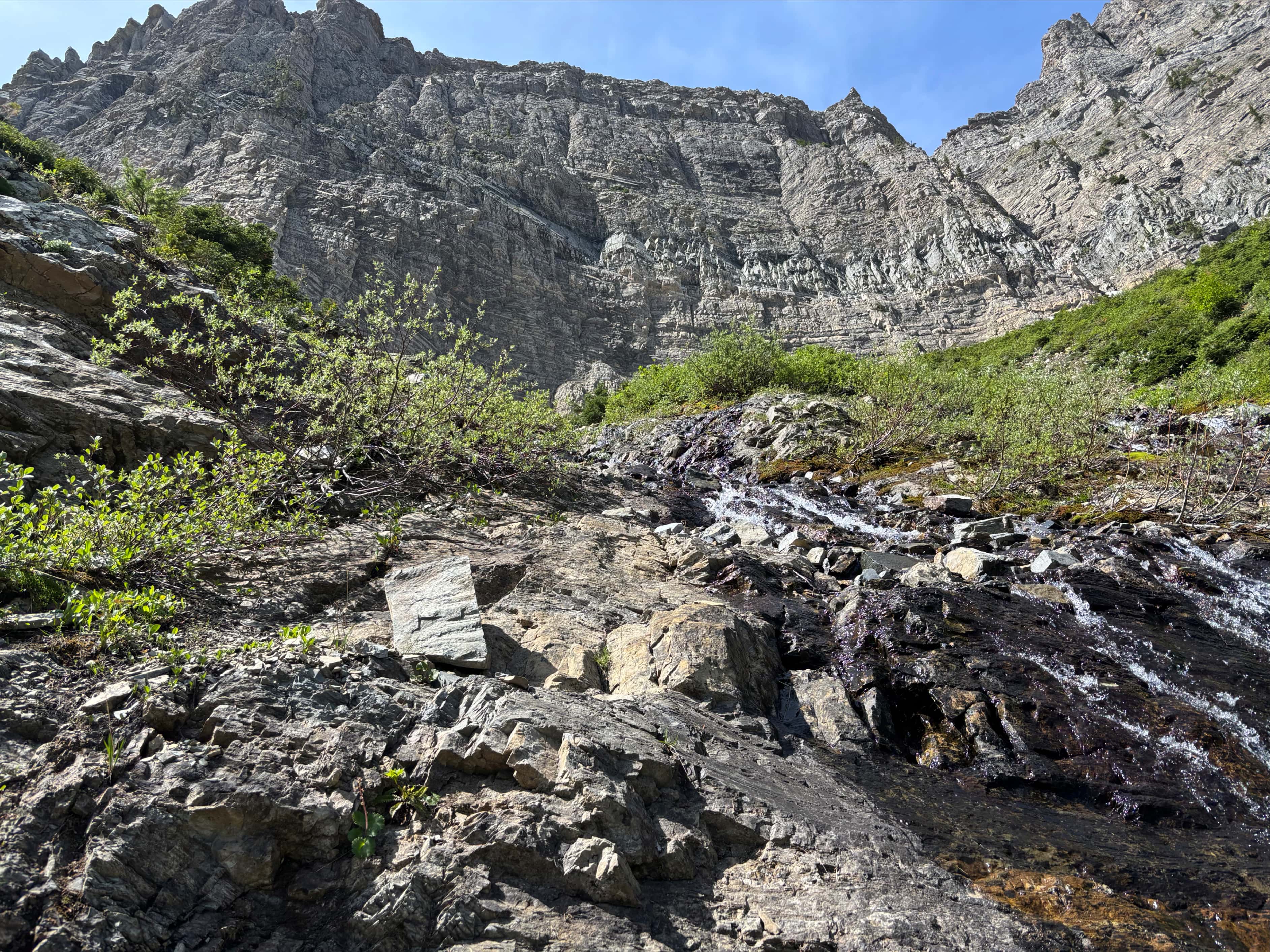
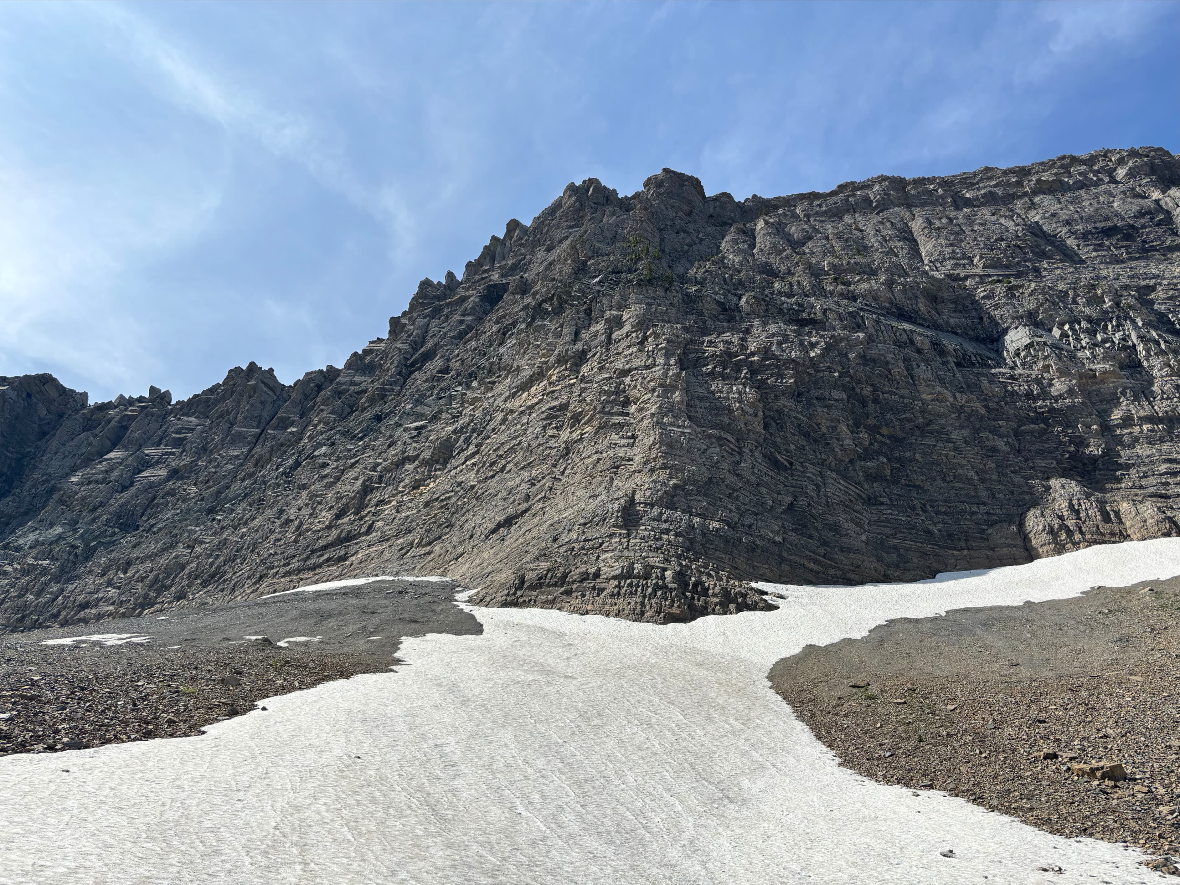
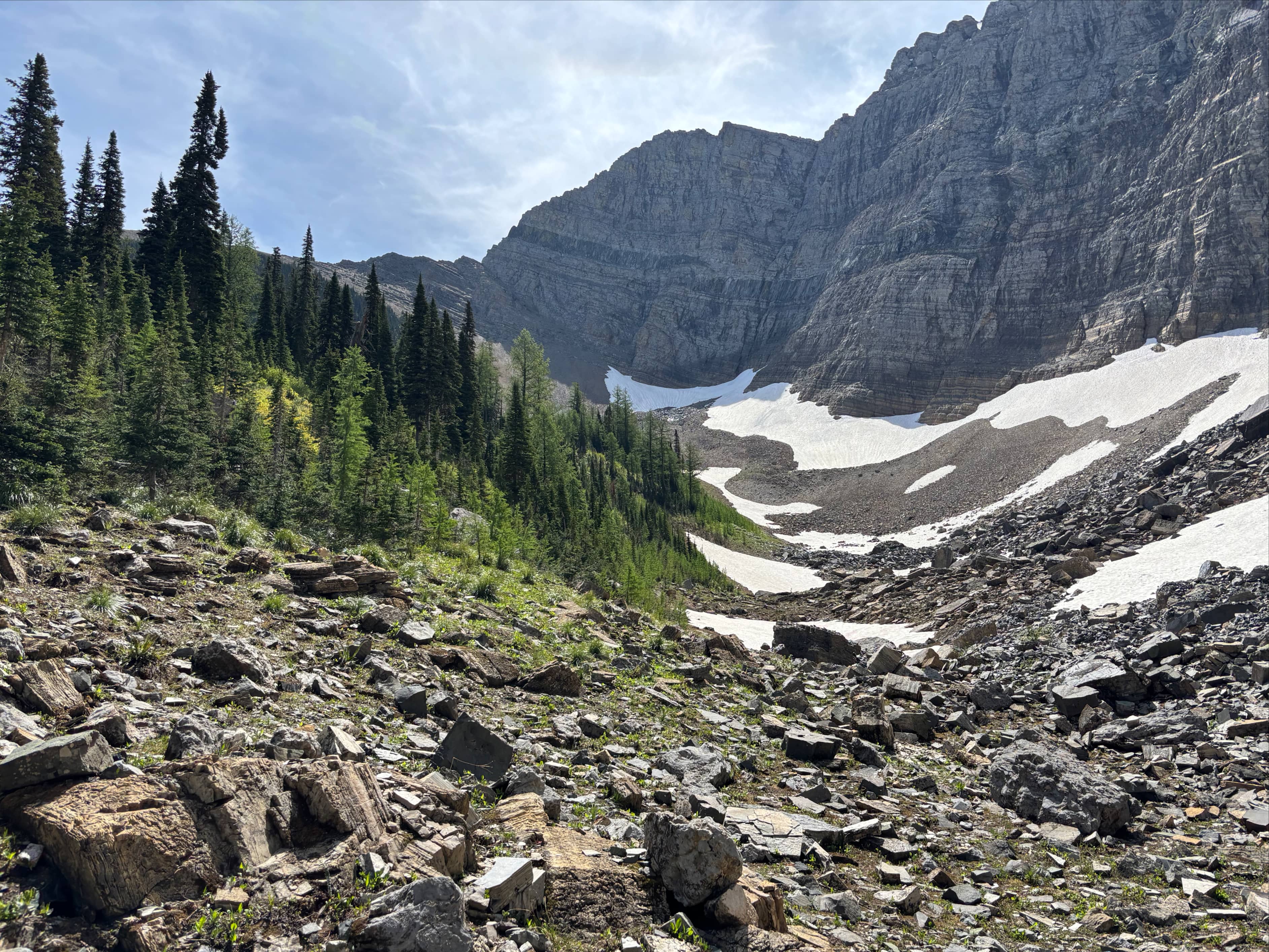
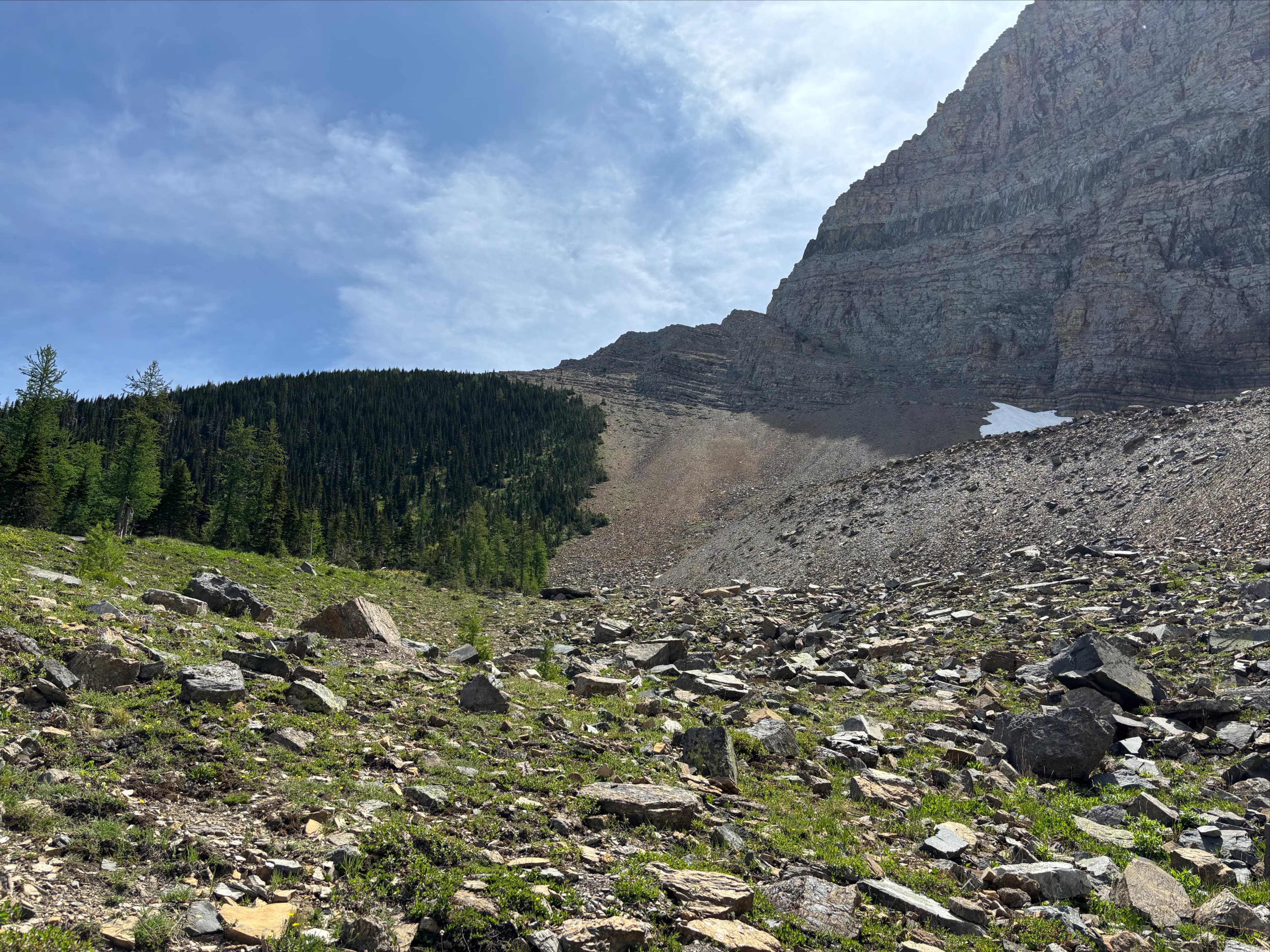
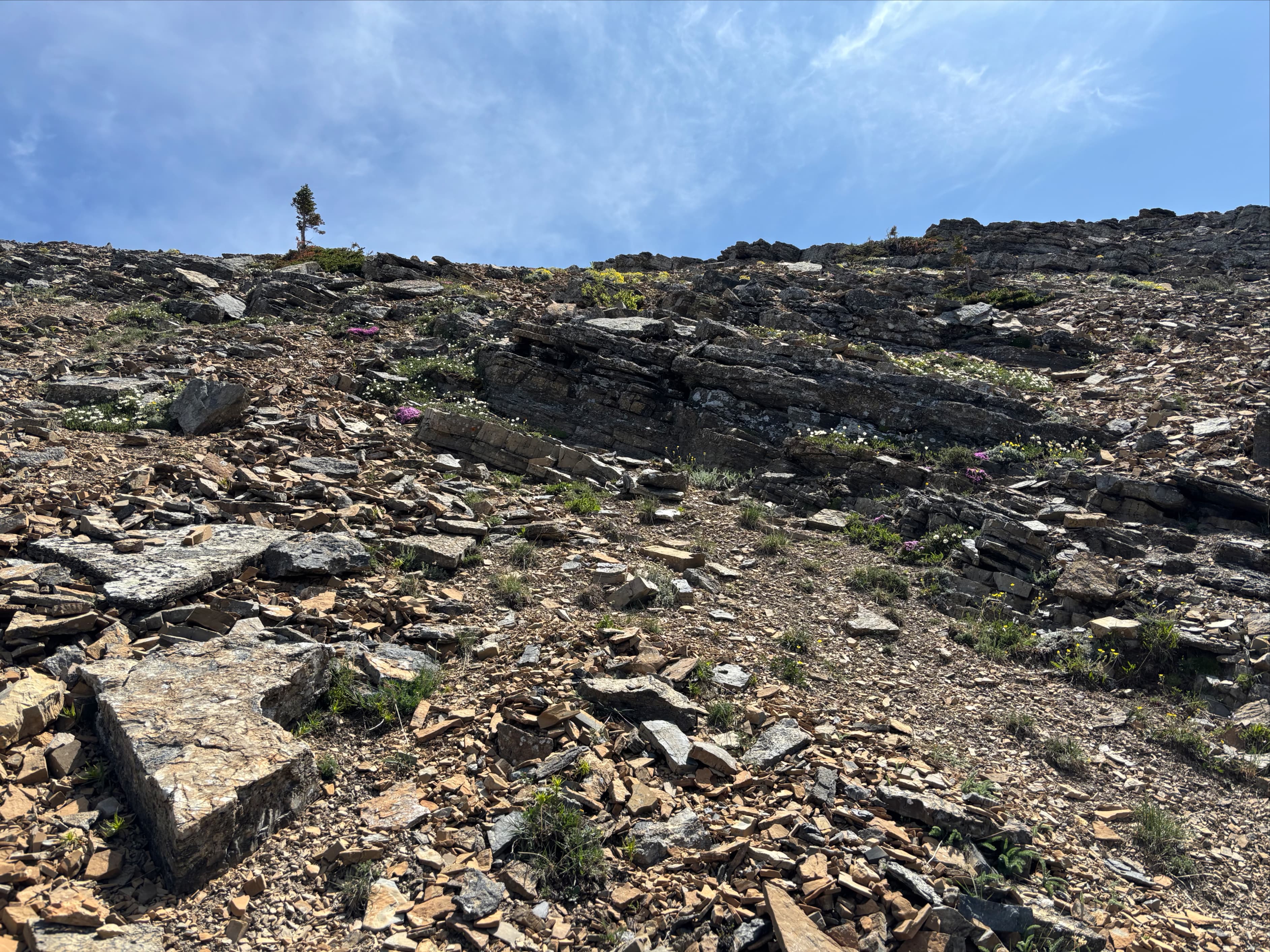
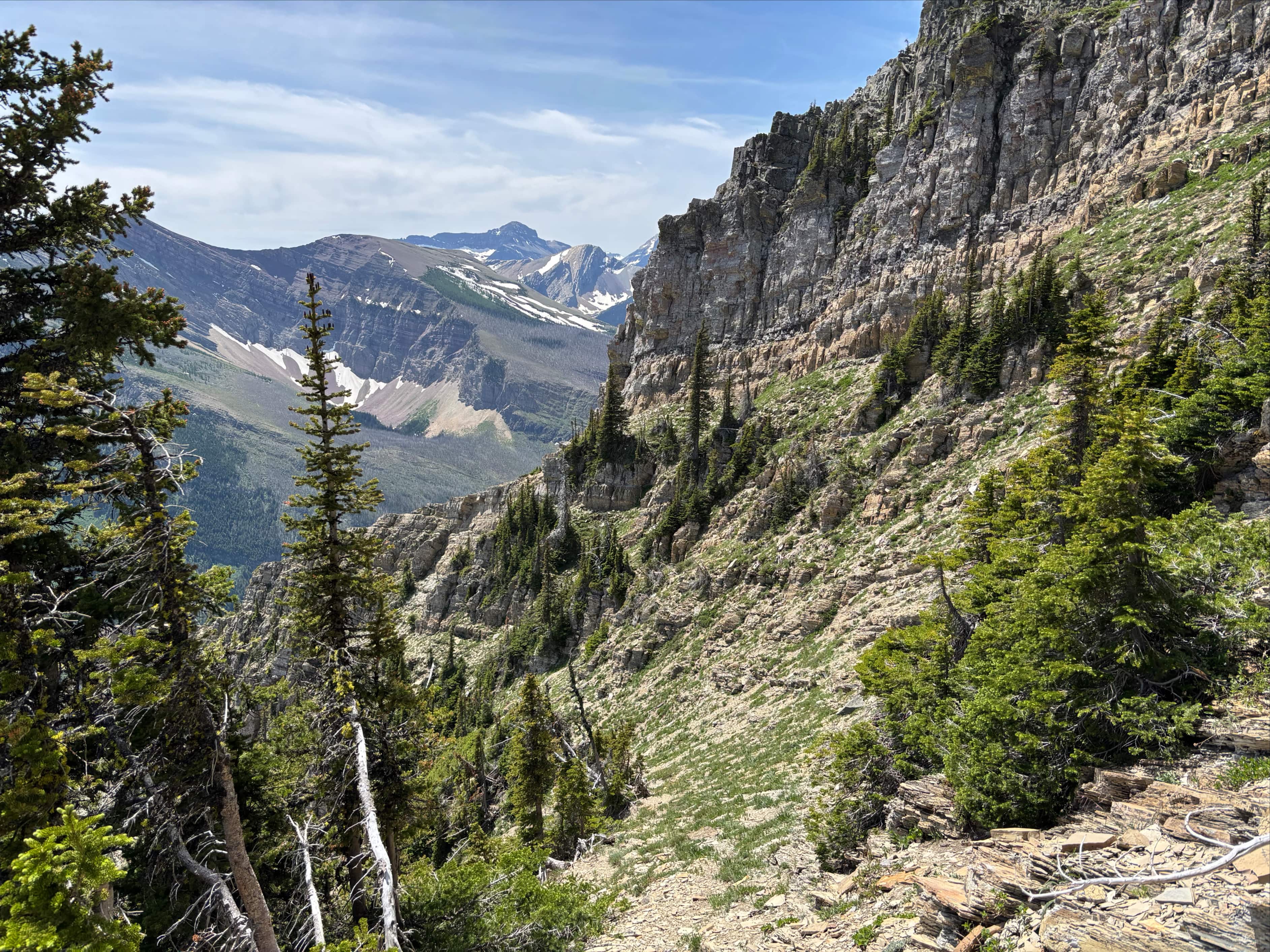
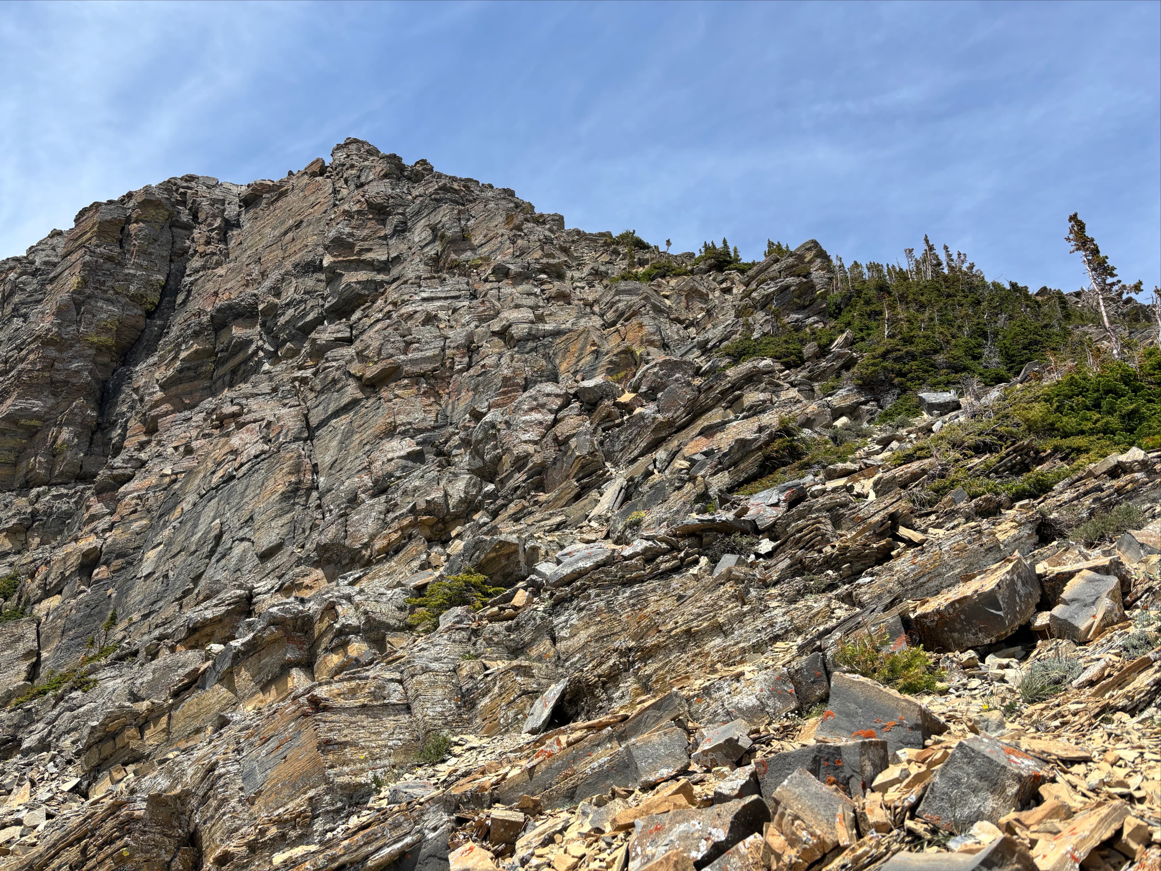
I set out and made very good time to Bertha Lake. I went clockwise around the lake all the way to the far side. There, just as the trail begins to curve right and head back around the lake, I found a clearly visible side-trail heading to the left. I followed that to the base of a short, densely vegetated, and fairly steep slope. Viewed from the base, there’s the suggestion of a trail visible cutting through the bushes. I climbed up that way and soon found a small rock-strewn clearing marked with a cairn. Ahead, beneath the massive cliffs, I could see cascades of melt water coming down from angled terrain rising towards the left (what Nugara calls the “shelf”). A taller single cascade was on the left and shorter twin cascades were on the right. I bore to the right and climbed up alongside the shorter twin cascades and entered the boulder, talus, and scree field on the shelf. Turning left and ascending, I endured the prolonged slog up progressively steeper terrain to gain the col between Mount Richards and “Little Richards”.
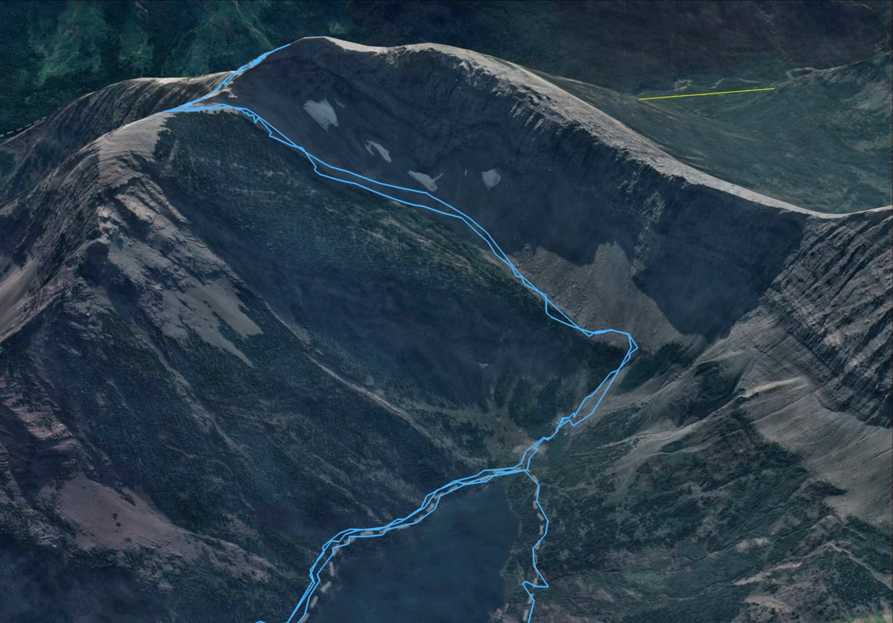
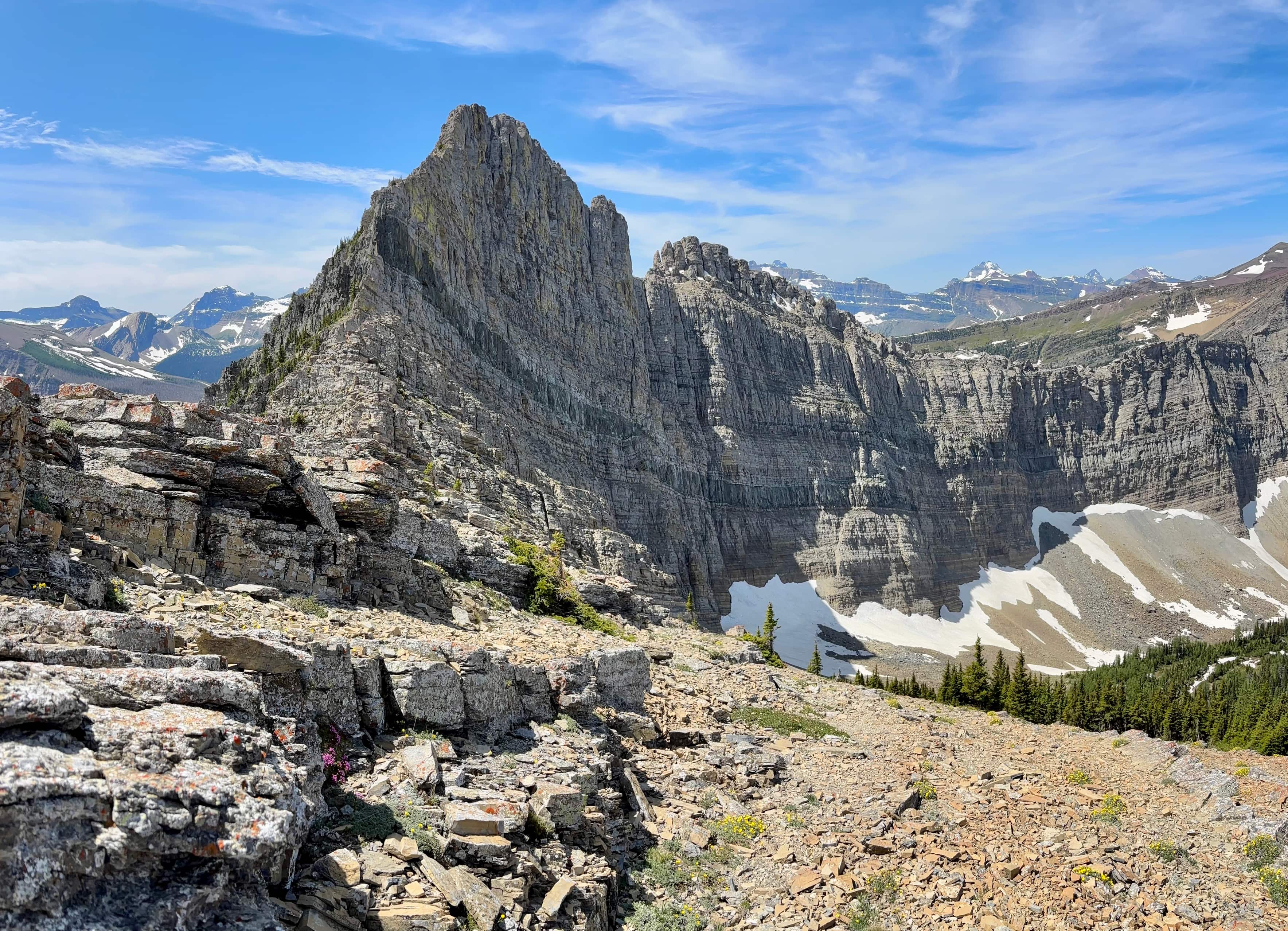
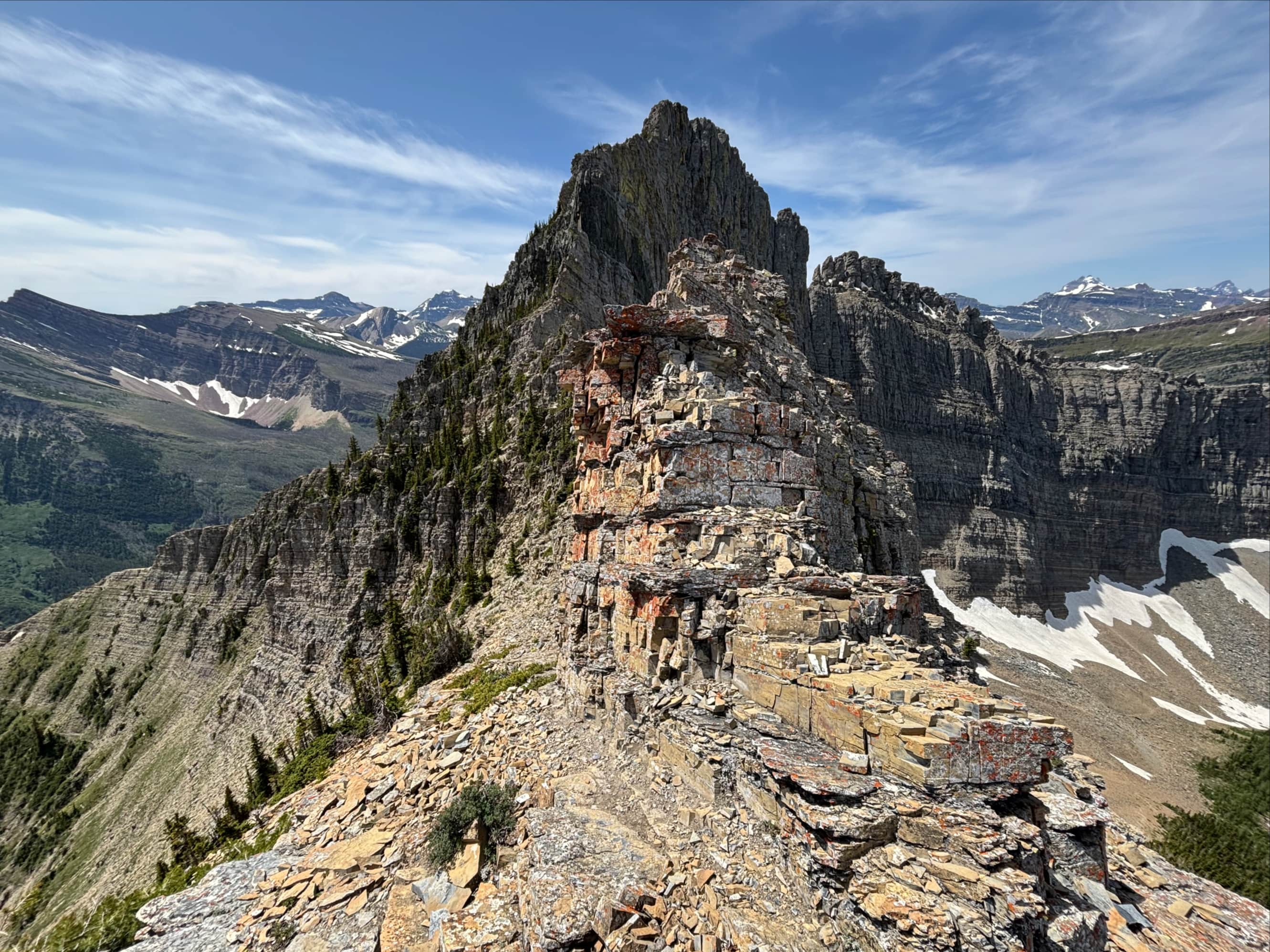
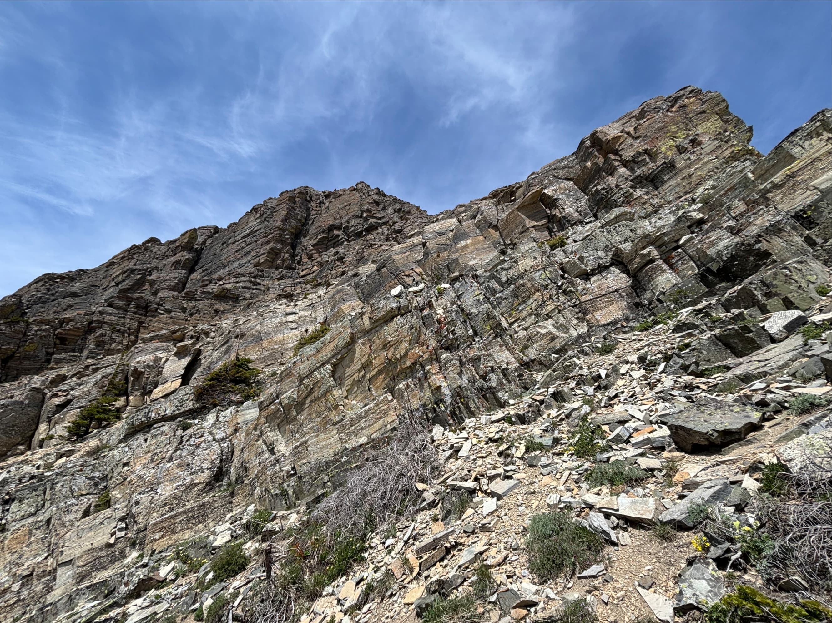
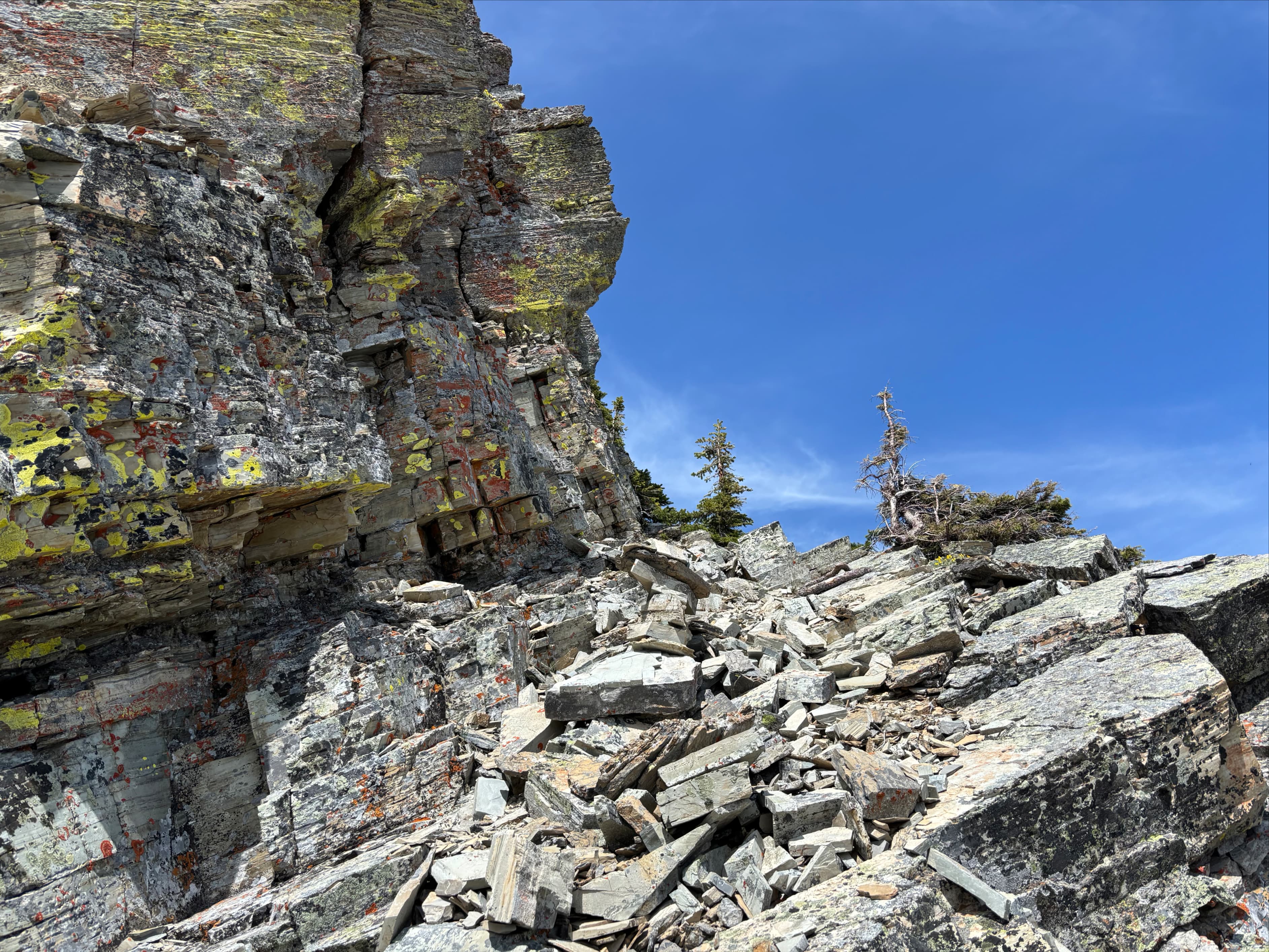
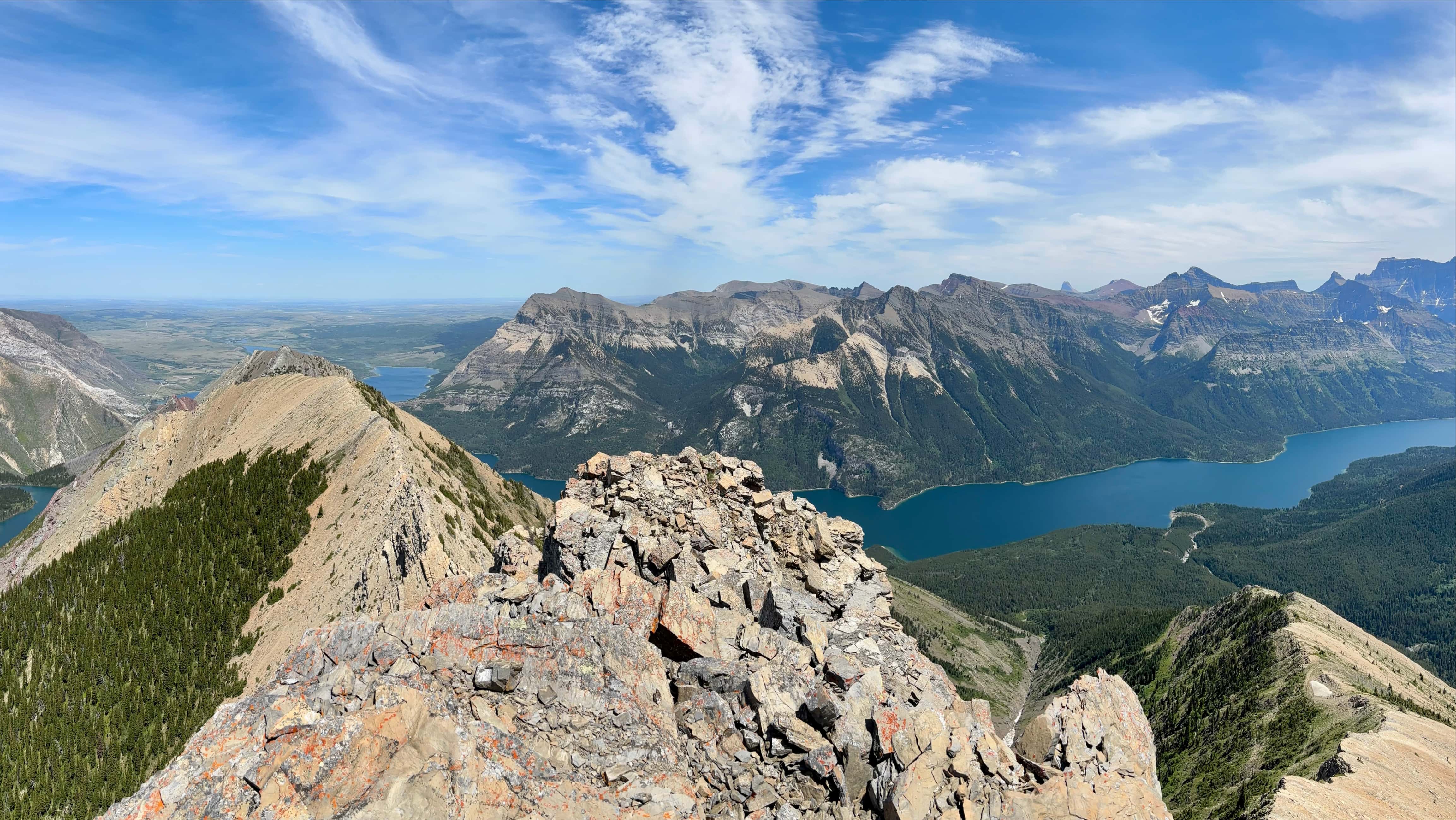
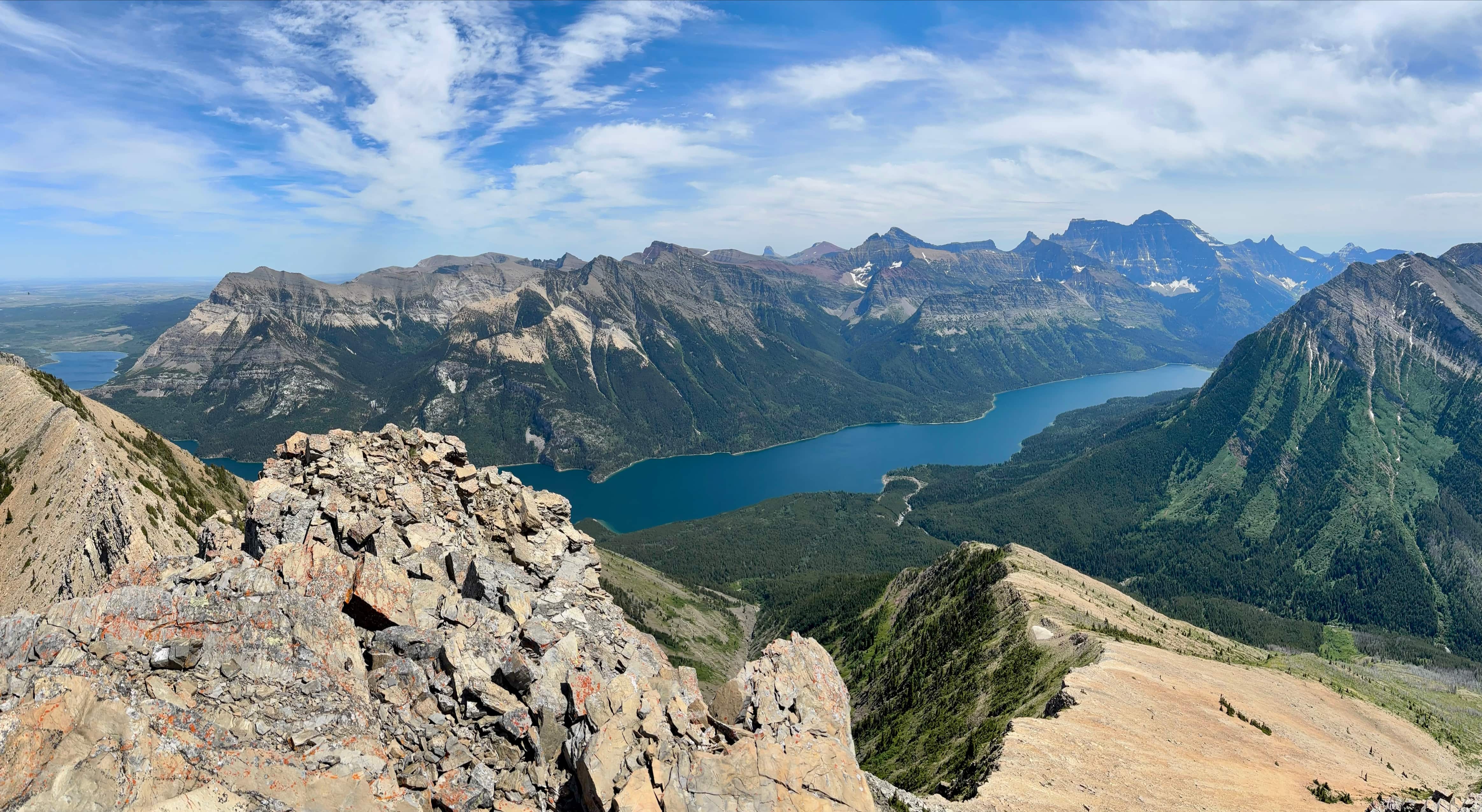
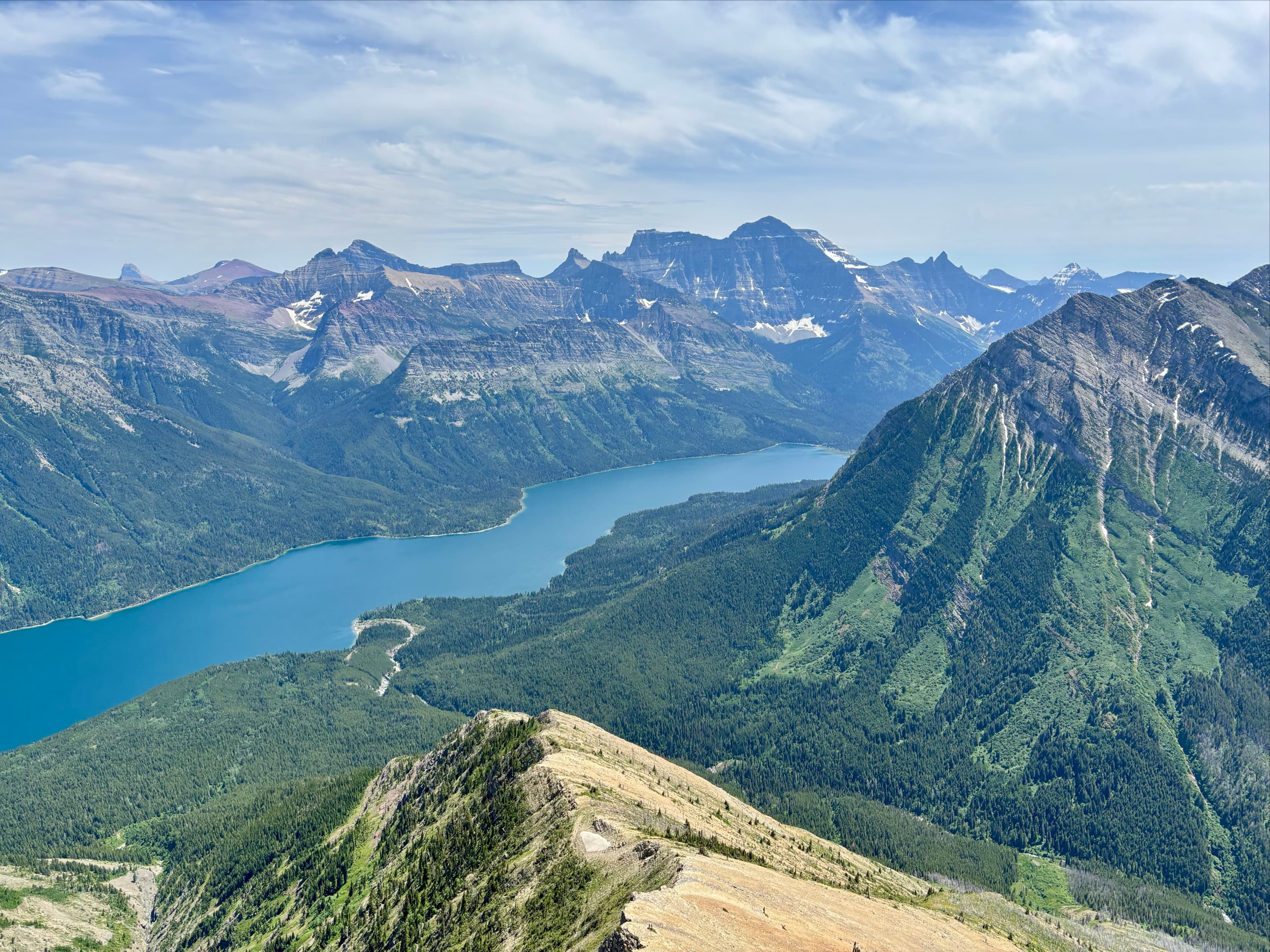
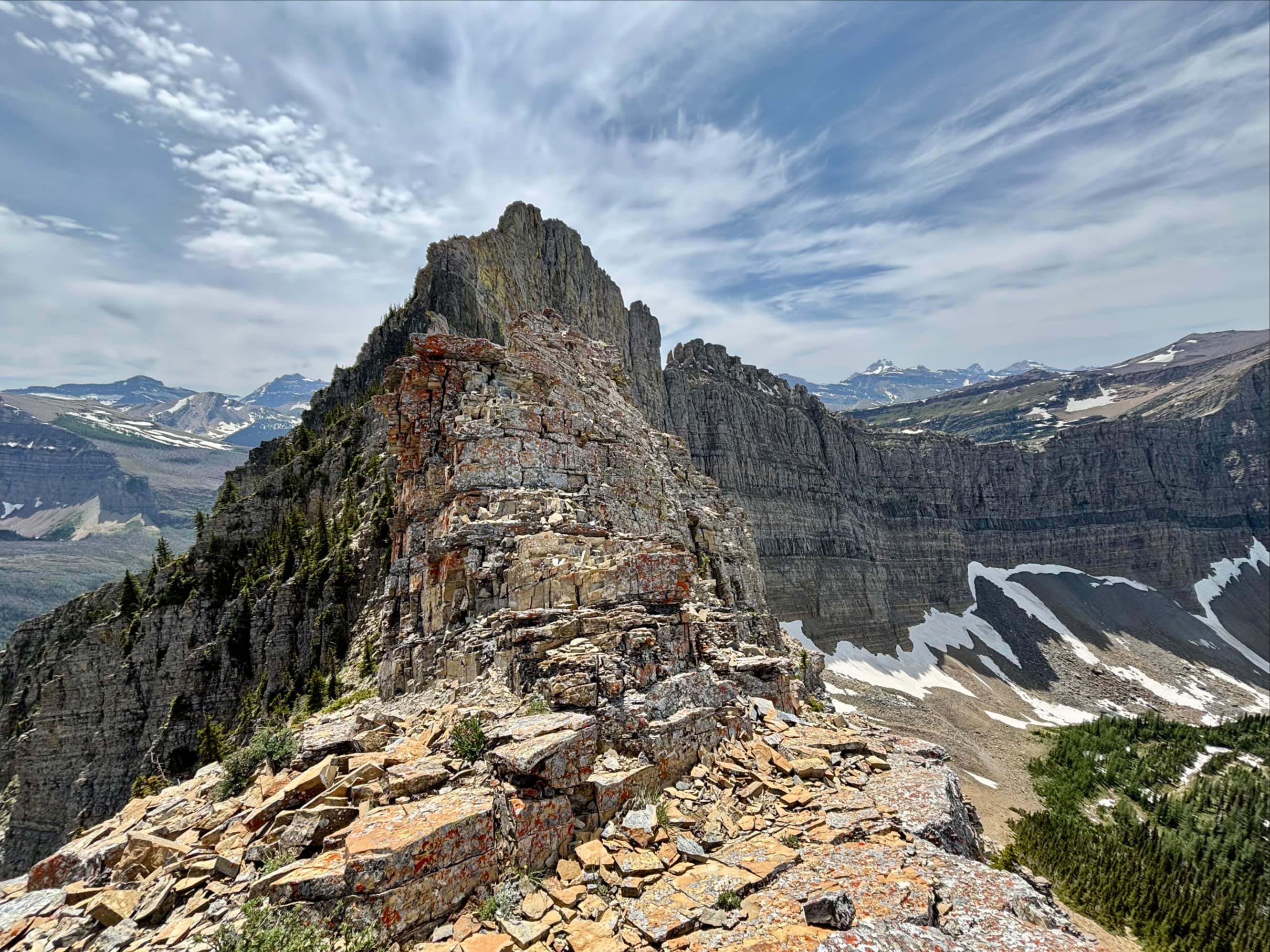
Once on the col, I was greeted by the sight of Upper Waterton Lake far below me and the surrounding peaks. “Little Richards” was a short distance to my left, but since I had already tagged that last fall I didn’t bother with it on this occasion. I turned right and considered the intimidating ridge below the summit of Mount Richards. I had spent some time leading up to this trip studying Dave McMurray’s excellent pictures from his 2021 ascent. He clearly showed where to leave the ridge and begin traversing left on a downward sloping ledge. This the key to the ascent that I’d been unable to locate last fall. This time, I scrambled up the ridge until I encountered a distinctive section of grey-yellow rock with orange lichen. To the left of this was an easily navigable descending ledge. I followed this downward, trying to see a cairn on a higher ledge which is supposedly from that point. I didn’t see it, but eventually got to a spot that matched Dave’s pictures and climbed up to another ledge.
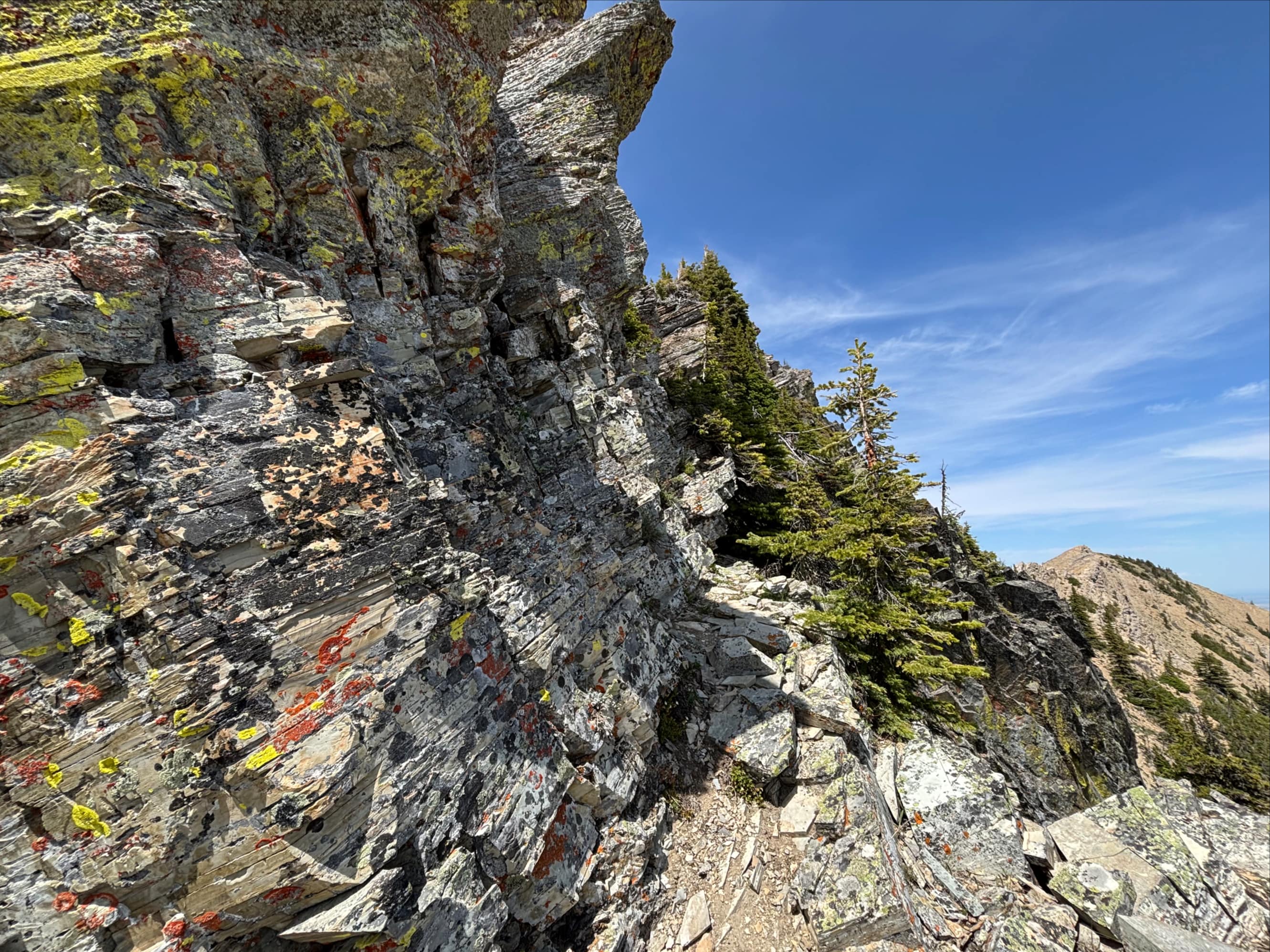
At the top of that climb I encountered the toppled-down cairn. I built it up again. During my return trip, after I down climbed here and ascended the ledge back to the ridge, I looked back a few times and confirmed that the cairn was, indeed, visible the whole way. You just have to know exactly what you’re looking for because it blends in so well with the surrounding narrowly stratified rock.
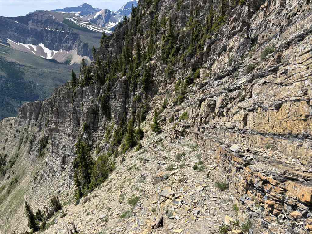
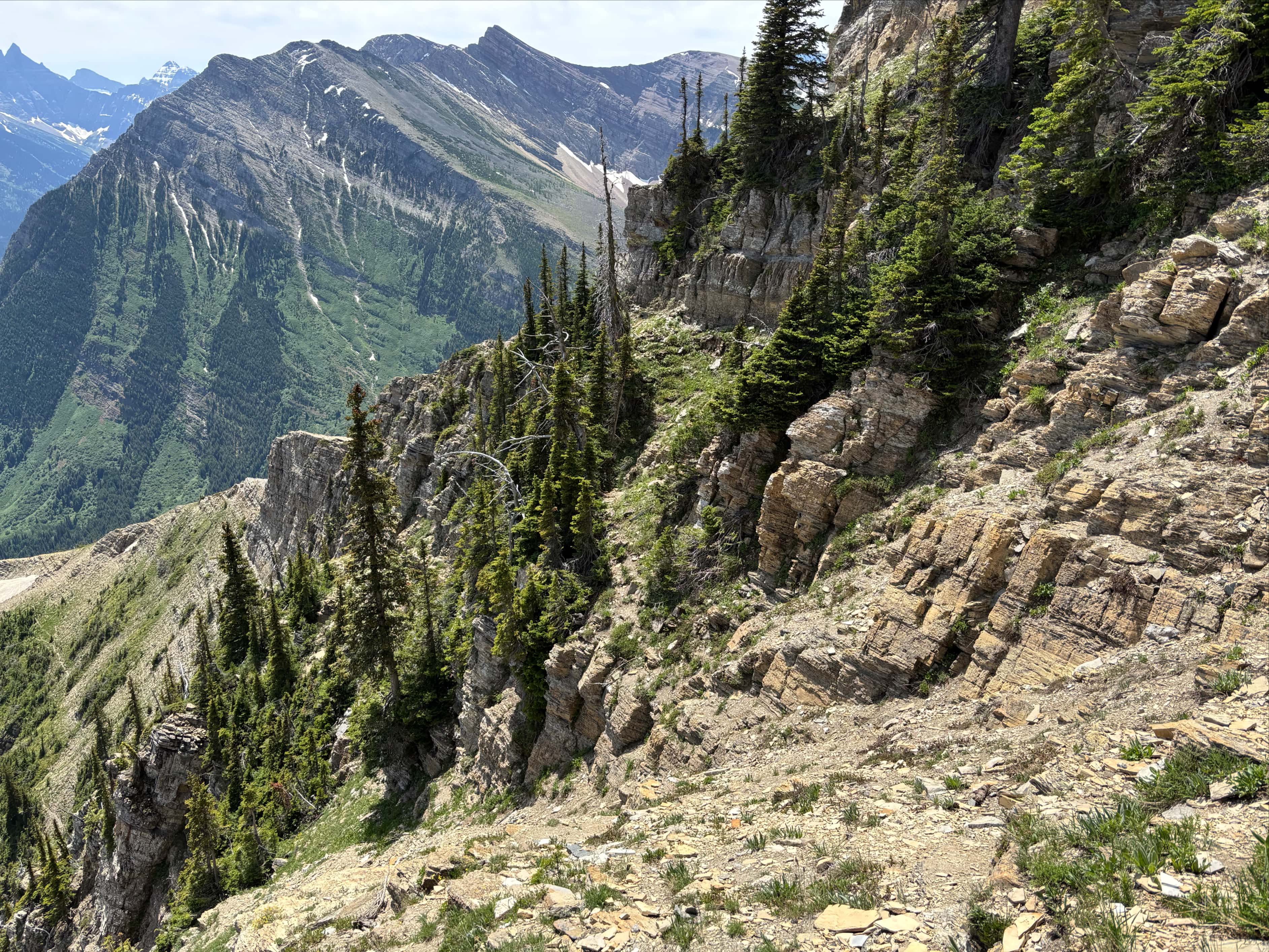
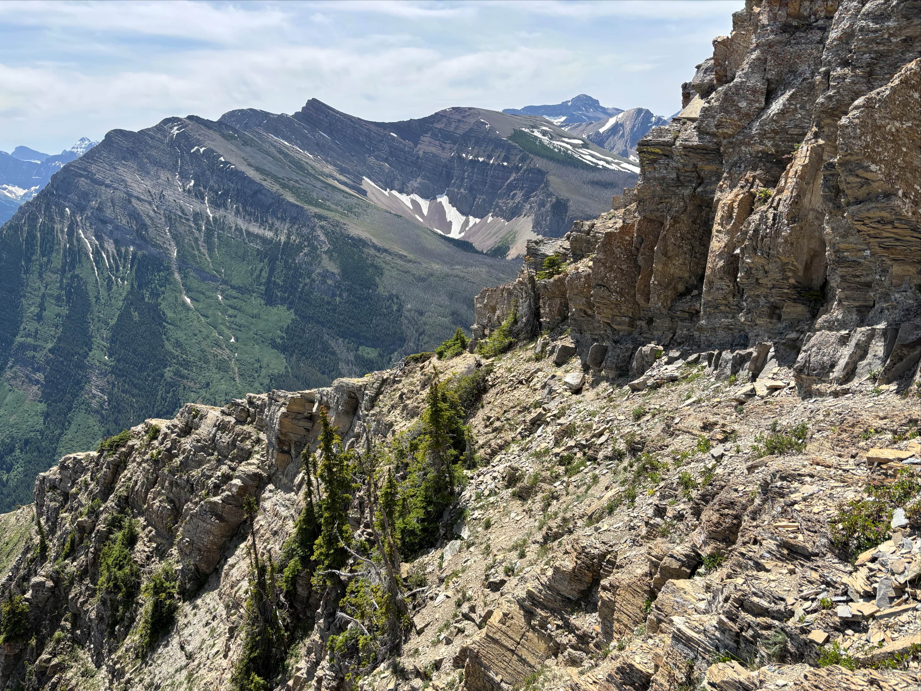
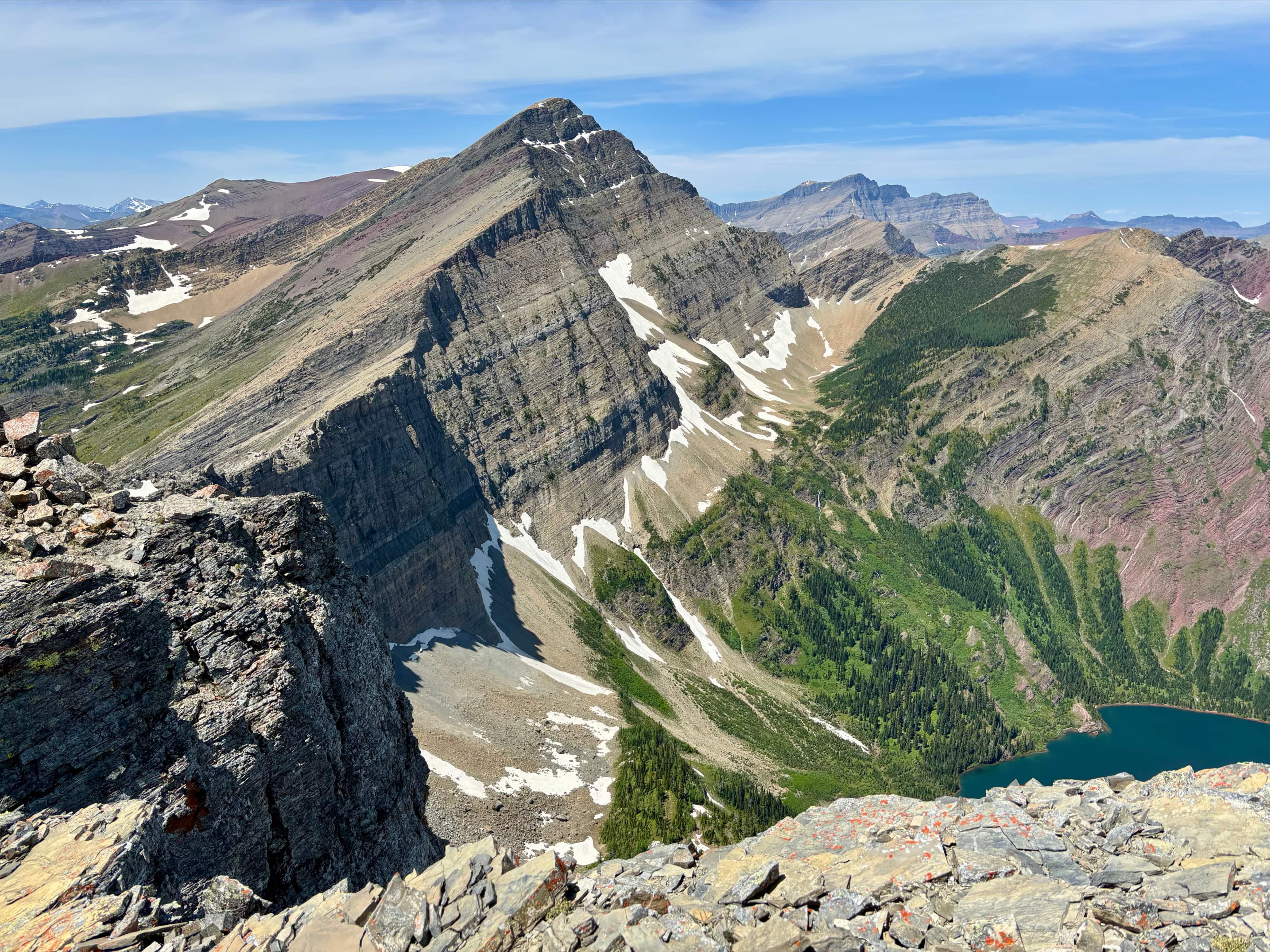
After rebuilding the cairn I followed a bit of a trail on this higher ledge, passing along a narrow route between sparse trees and the cliff above me. The trail seemed to lead to a drop off, but it actually lead around a corner to the eastern aspect of the peak. Ahead I could see the southeast ridge. Above me to my right, the large cliffs guarding the summit continued all the way to the ridge. I aimed for where the two came together, picking a path a some distance below the cliffs at first but eventually realizing that it would be easiest to climb up and traverse just below the cliffs. On my return trip I stayed right below the cliffs (which made for easy hiking) but then had to figure out how to descend to the right place to find the cairn again.
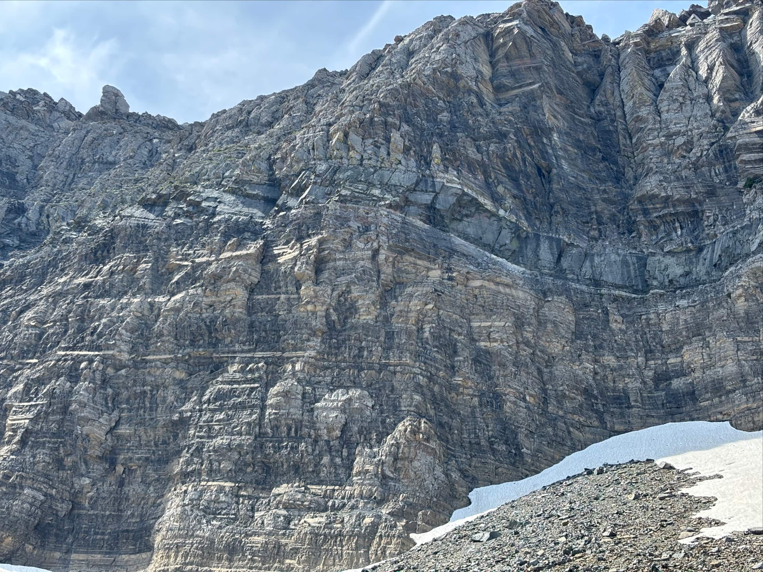
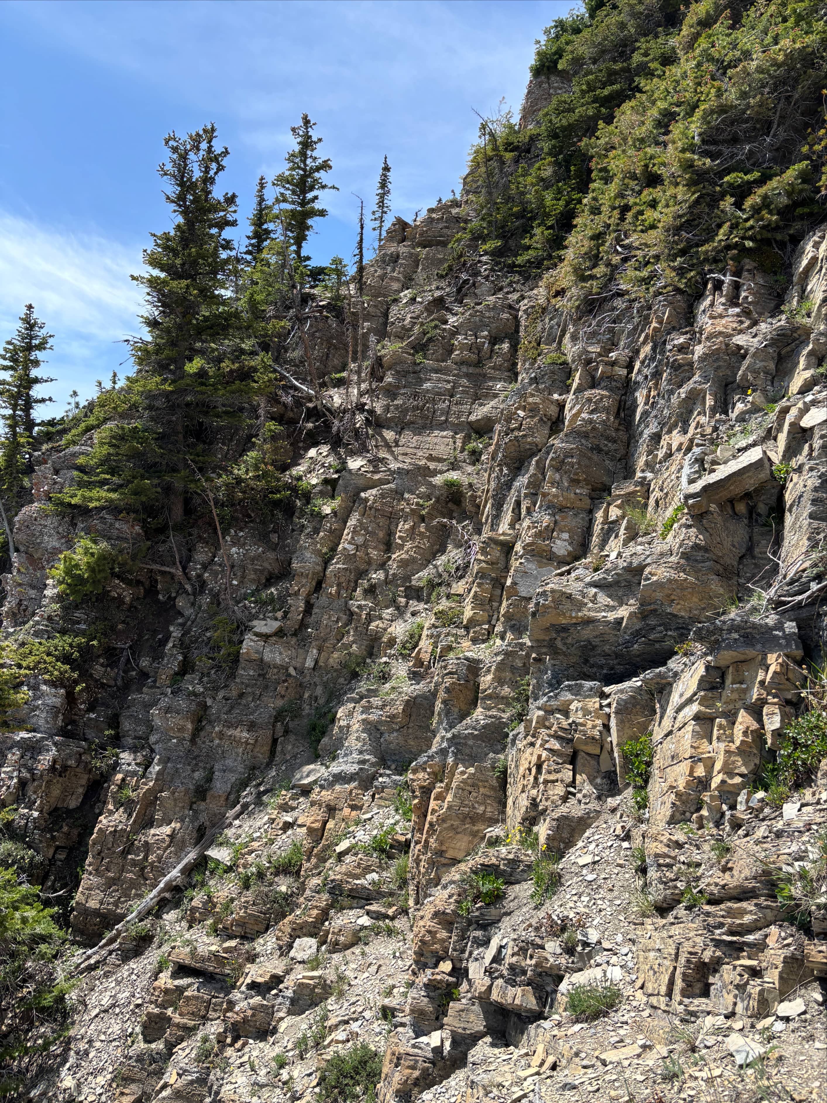
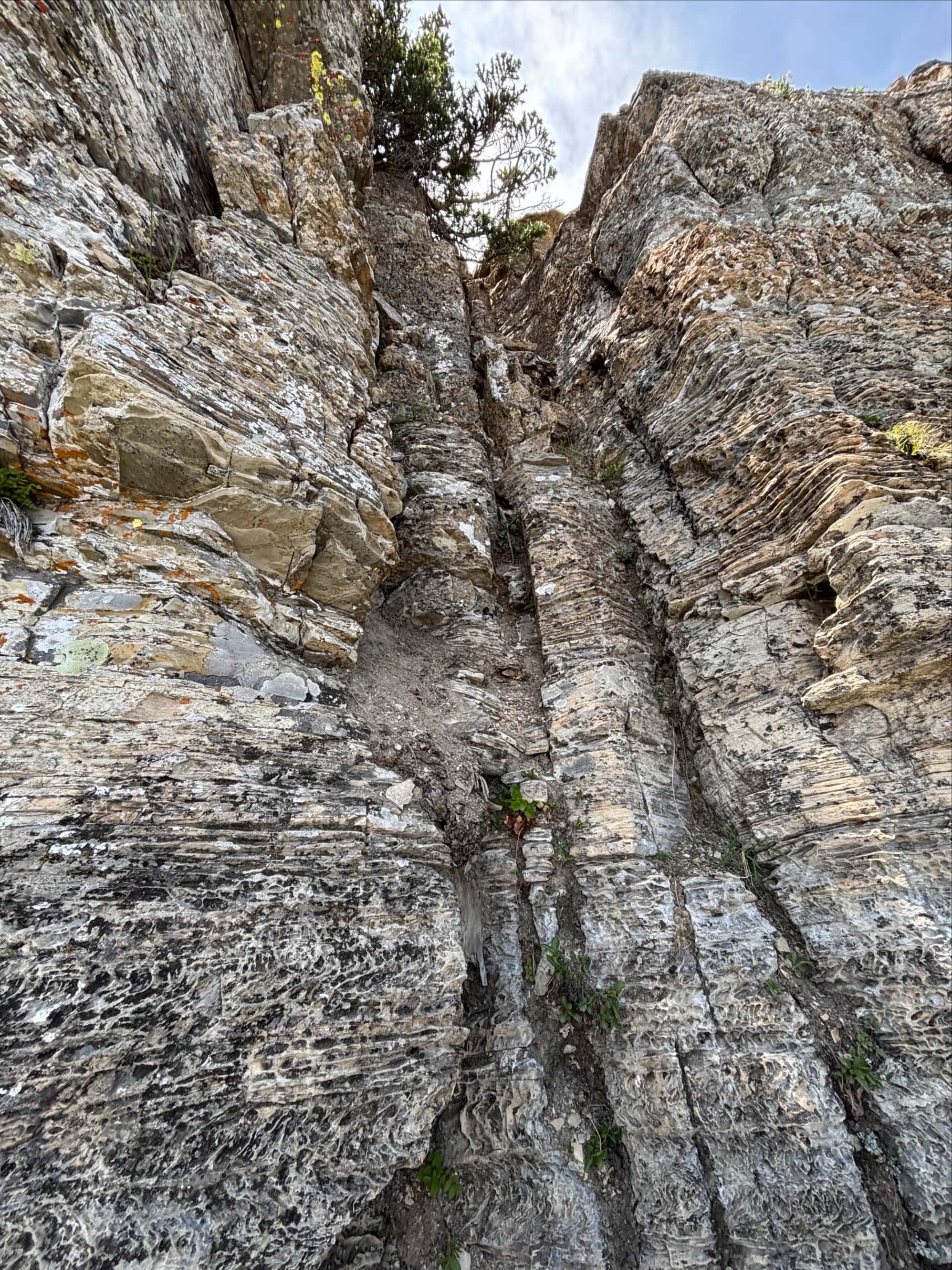
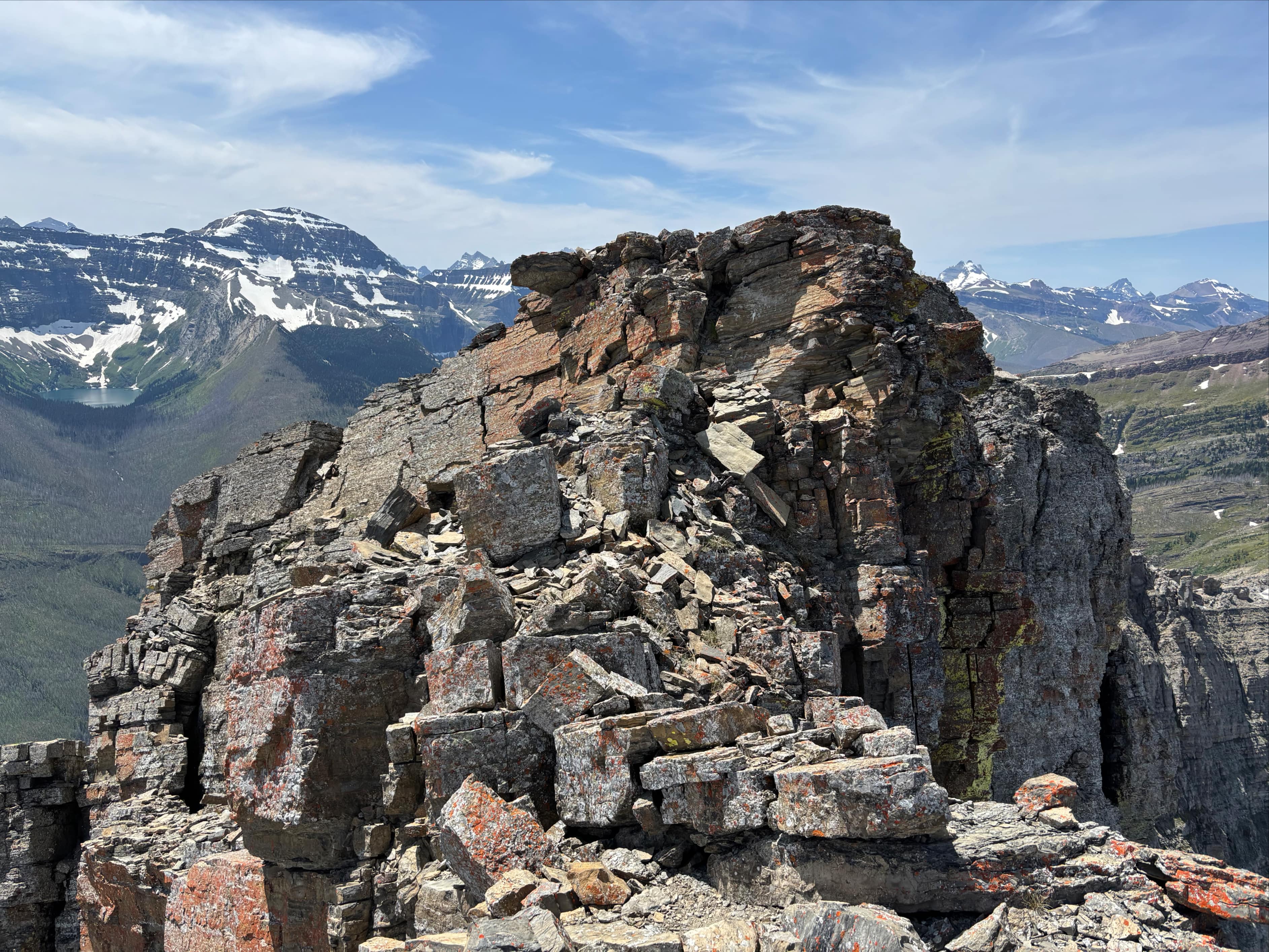
I reached with southeast ridge without any misadventure and looked upward at the final section. It is apparently possible to traverse left and find a gully to ascend but I ended up doing the same as McMurray and mostly stayed right, closer to the ridge. This involved a lot of route finding and sometimes tricky scrambling. Most of the challenge involved ascending through the layers of the Purcell Sill – the distinct white/black/white band visible on many of the mountains in Waterton and Glacier National Parks. The black rock is a magma intrusion and the white on either side is metamorphic marble created by the heat of the magma changing the surrounding sedimentary rock.
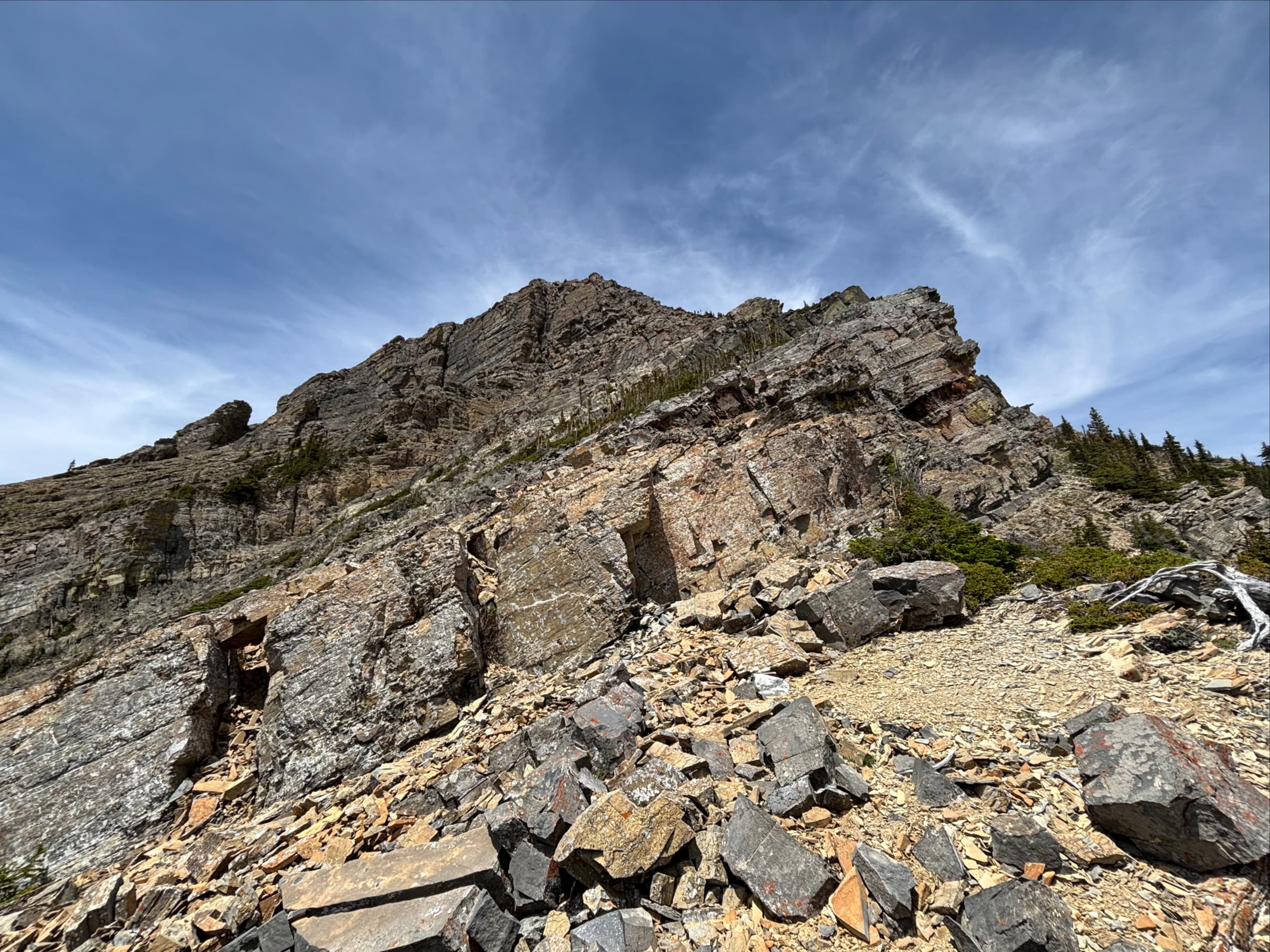
Getting above the initial white band was fairly straightforward. The black band and the upper white band were more challenging for me. I can’t explain the route I took through the black band, you’ll have to rely on your route-finding skills. I initially thought the upper white band would stop me. However, exploring to the extreme right I hooked around the corner and saw a chimney leading up. Someone had built a cairn nearby marking this. The chimney was not too tough to climb even though there was a small tree crowding the top. The terrain below the chimney was a fairly narrow ledge so it felt a little exposed. When I got to the top of this section I found another toppled-down cairn. I rebuilt that since I definitely wanted to be able to find this place again on the way down (though, if I were smart, I would have found the gully McMurray and Nugara described for descent).
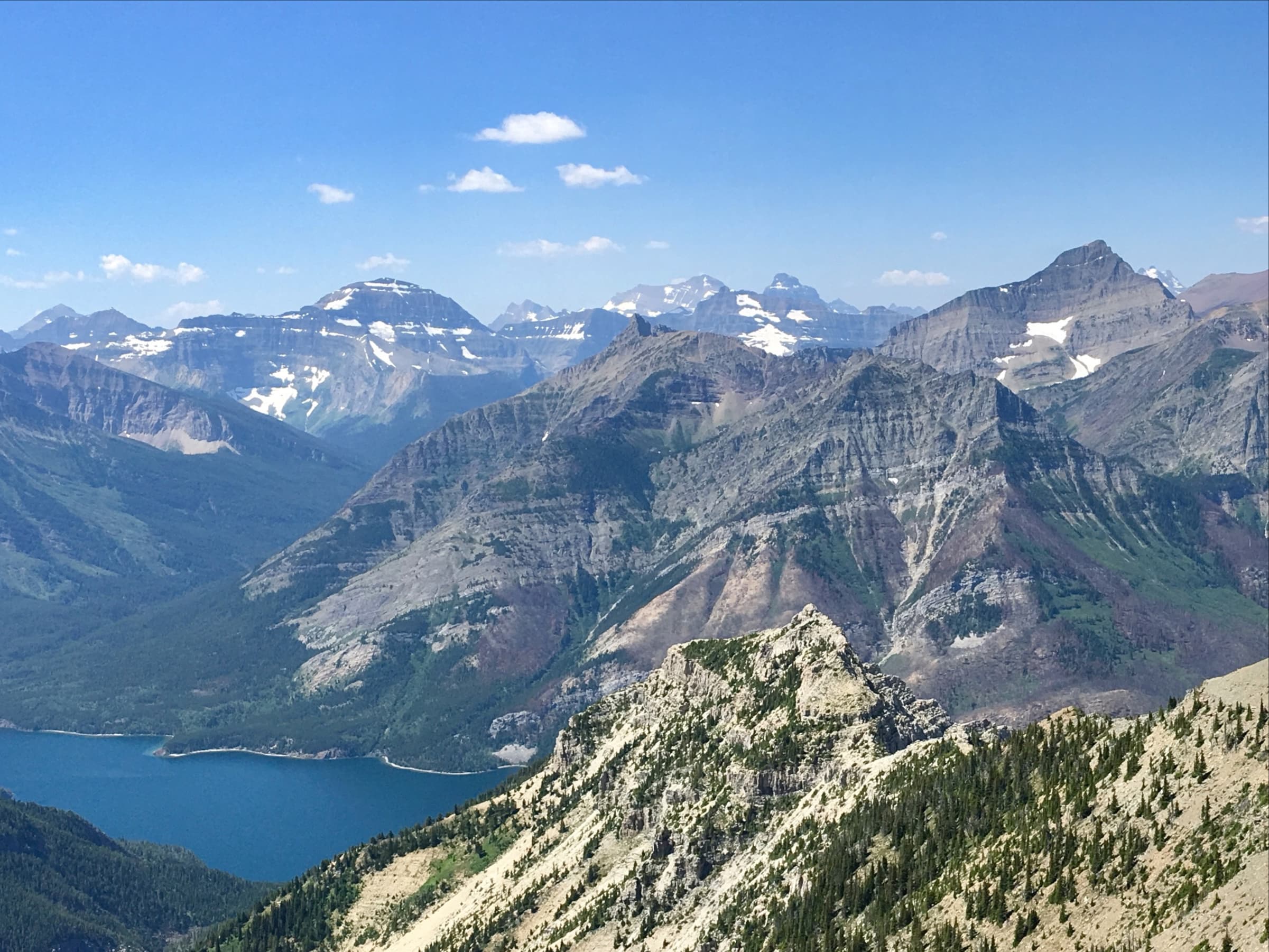
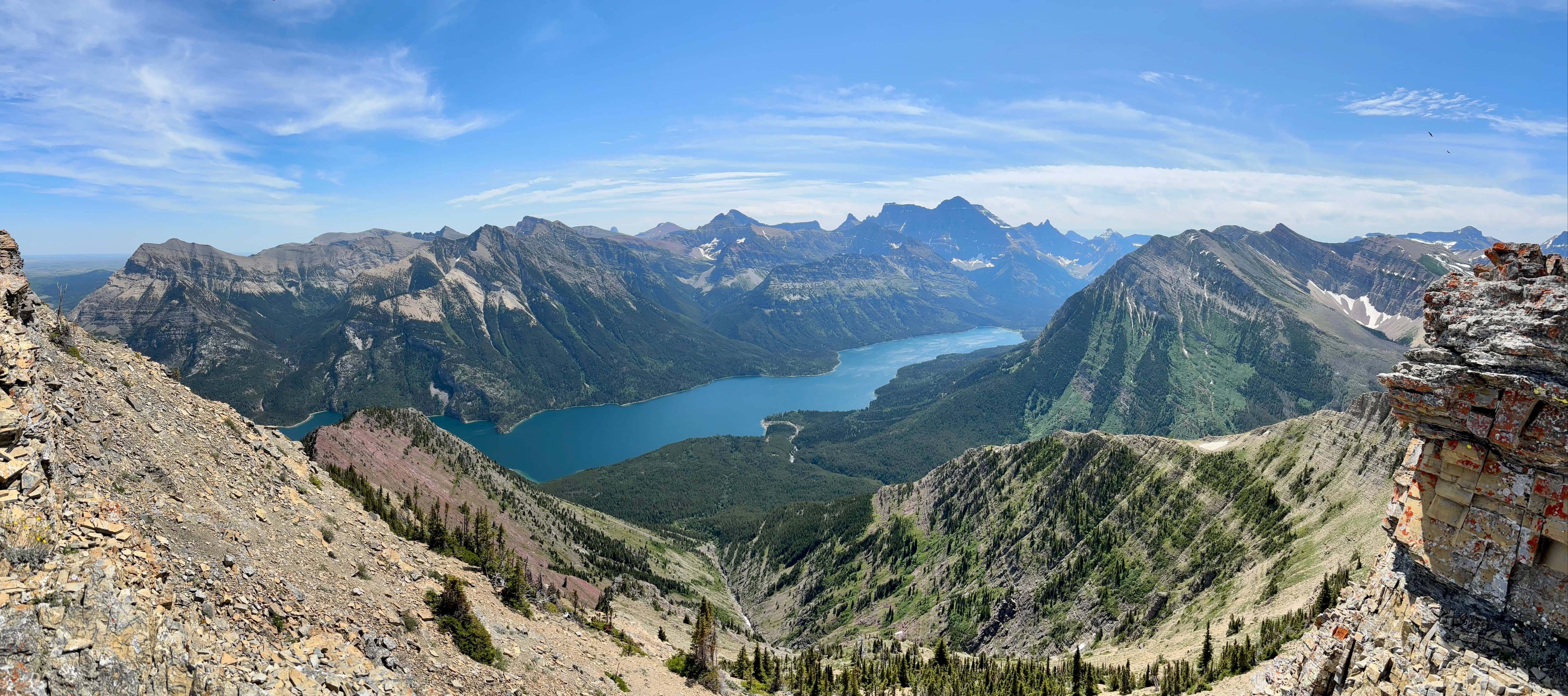
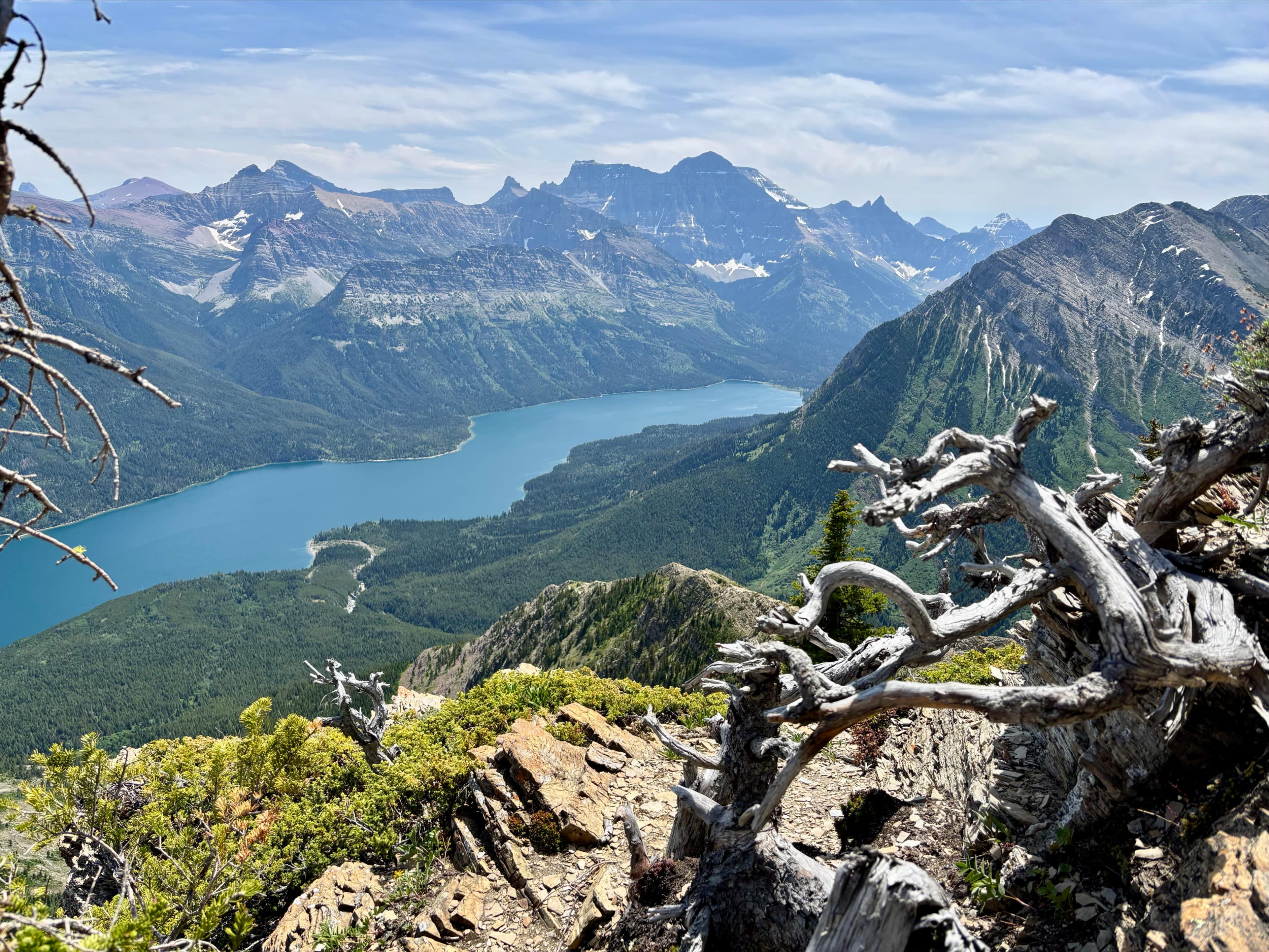
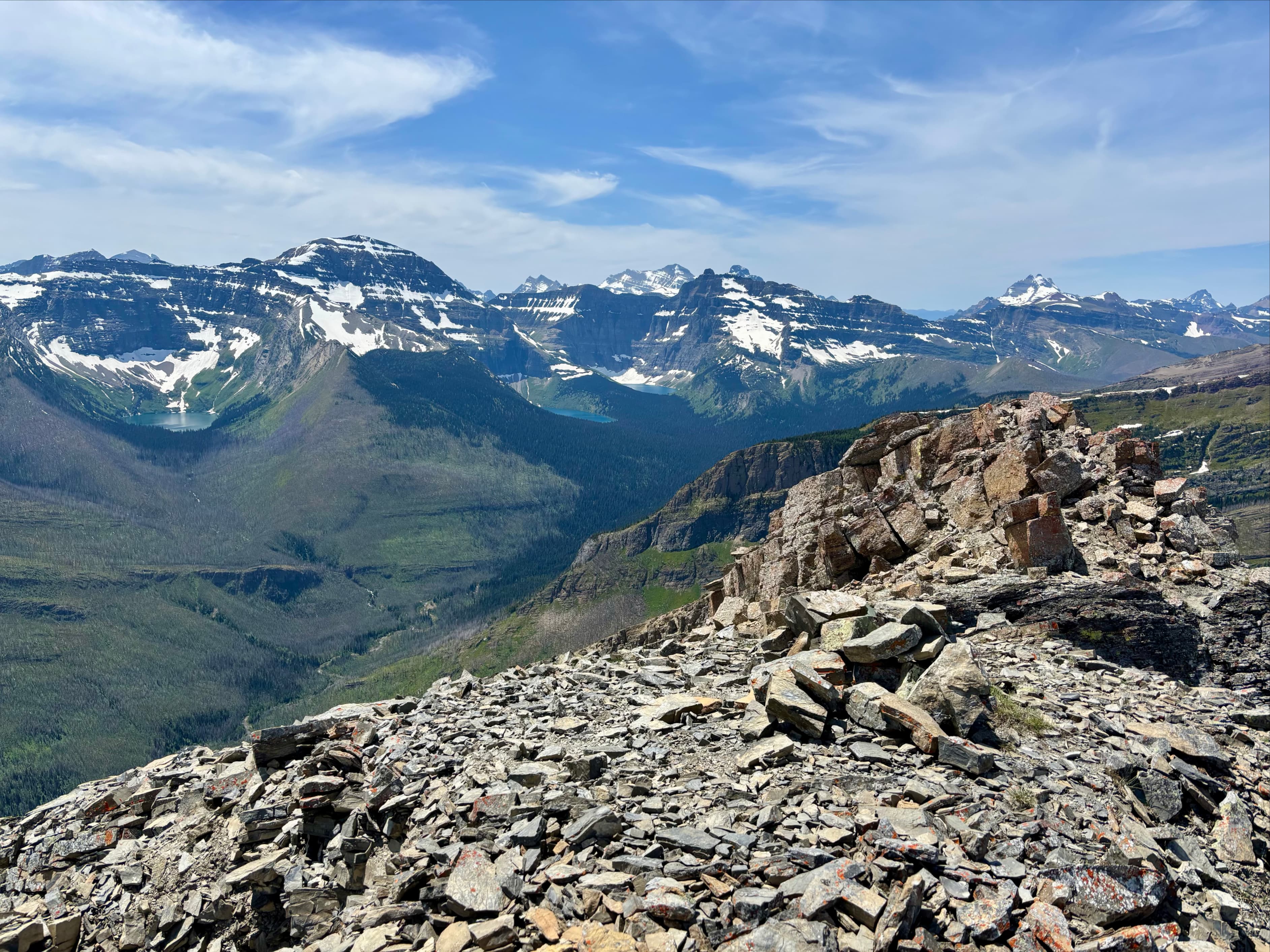
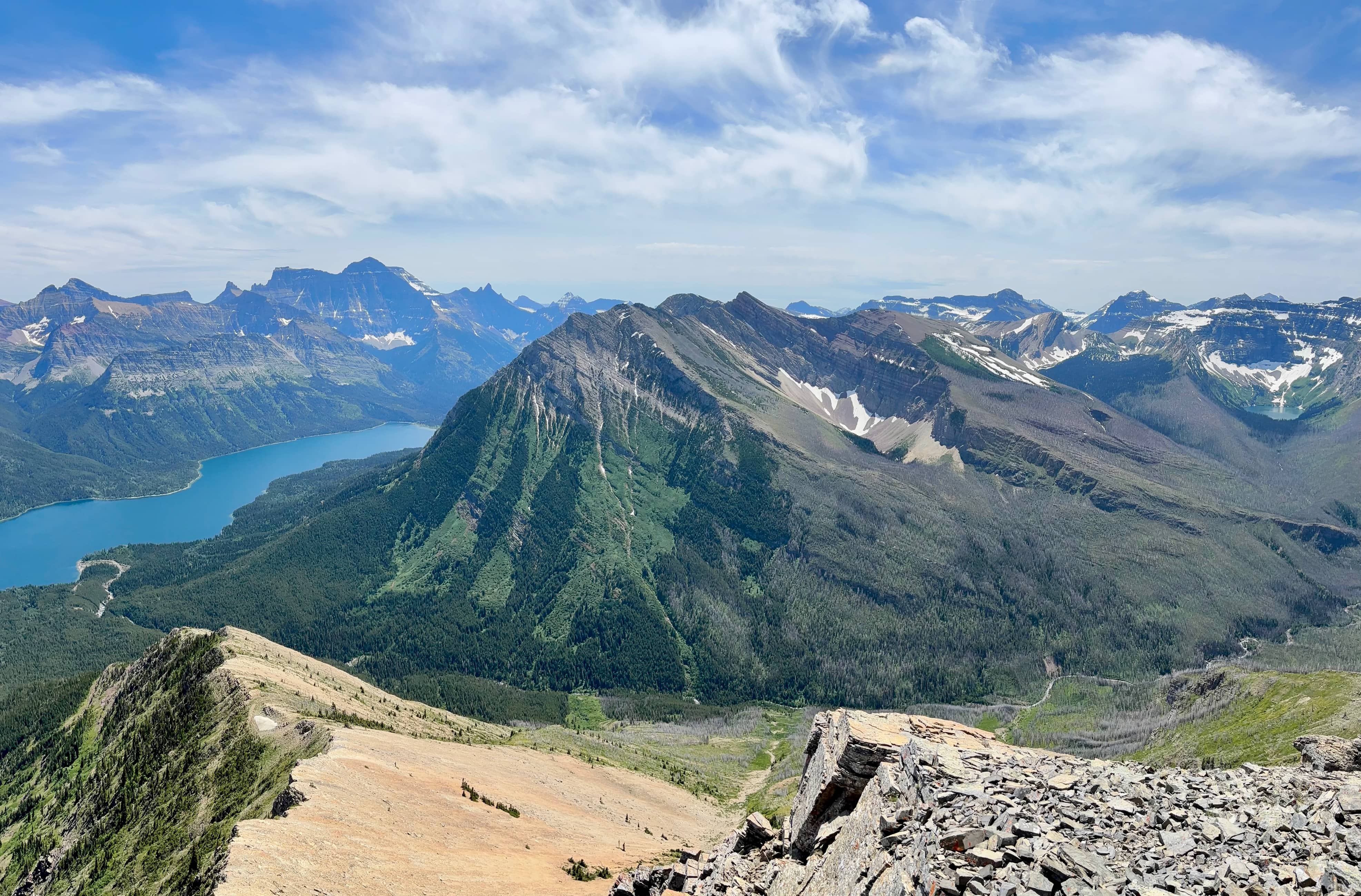
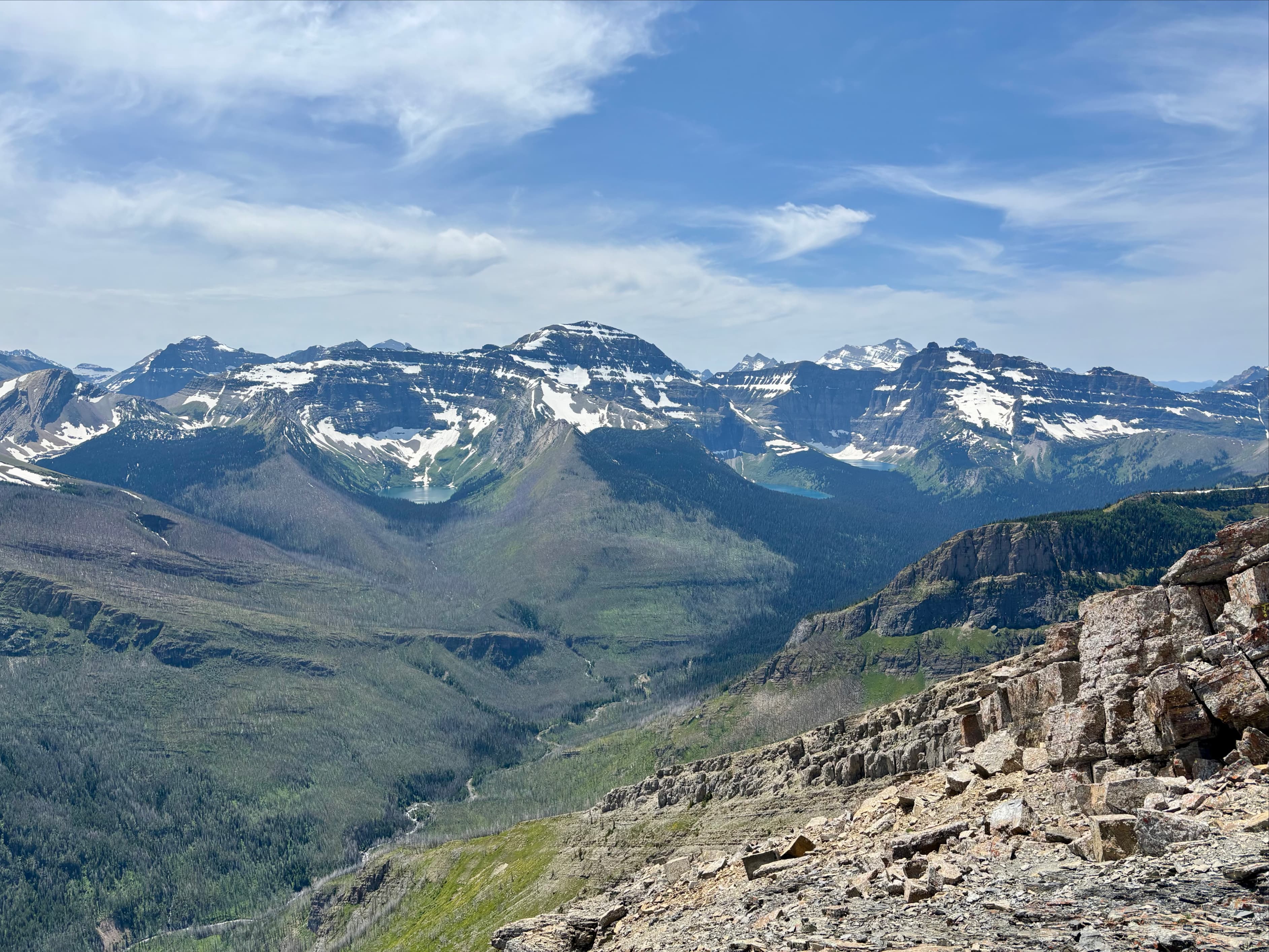
Once through that last major obstacle there was only a short section of fairly straightforward scrambling up the increasingly narrow ridge to the summit. A low cairn housed a green ammo box with a summit register and materials for smudging. It took roughly 4h 30m to reach this point. I was lucky enough to have calm conditions and only slightly hazy skies. The view has to be one of the best, if not the best, in Waterton. Clear views of the peaks in Glacier to the south, Upper Waterton Lake and surrounding mountains to the east, Bertha Lake and Peak to the north, and Mount Alderson immediately to the west (with Long Knife Peak and Mount Blakiston in the distance). After enjoying the view and eating my lunch I descended.
I intended to return along the same lake shore I’d used on the approach (southeast). However, about 650m along the way I encountered a grizzly bear. I had been yelling episodically as I walked along and I the bear actually looked like it had started walking away from me when I stumbled up on it. It was 20 meters or less away and I had just come around a corner when I saw him. I stopped right away and made some reassuring human noises while I pulled out my bear spray. It looked back over its shoulder as I crept slowly back around the corner. I didn’t hear anything big running towards me so I backed away a little more swiftly until I had a long section of visible path ahead of me. I considered my options – I didn’t know if the bear intended to hang out in the area or if it would eventually decide to come back around the corner. I decided to go back to the southern end of the lake and go the other way around to get back to the access trail at the north end. When I was almost back to the north end I looked across to the opposite shore of the lake…and there was the bear again, ambling slowly along, seemingly heading to the exact same place I was. I picked up my pace and made it to the access trail and started down without running into him again.
This was a very engaging but challenging scramble for me and the route finding was a major part of the challenge. Via the route I took this felt like moderate-to-difficult scrambling. Opinions will obviously vary based on personal capabilities, but this trip is undeniably in a different category than its near neighbours Mount Alderson and Bertha Peak. If you want similar views but a little less hazard, either of those is a good choice.


Great job Par
It took me two trips as well last Fall.
First trip – decided to turn around before ridge/Little Richard as the slope was covered with ice/snow. Very tedious and slippery
Second trip was successful. Definitely not a walk-up though
You always do a great job on your photos and descriptions.
Have you done Buchanan Ridge from Akamina Parkway?
Thank you,
Paul
LikeLike
Thanks for the kind words 🙂 I haven’t done Buchanan Ridge from Akamina yet.
LikeLike
I always enjoy your posts about your climbs – detailed and easy to follow with great photos. I particularly enjoyed the ones you did last year about your climbs in California’s High Sierra – they brought back good memories. 😁
LikeLiked by 1 person
Thanks for reading – glad you enjoy the posts!
LikeLiked by 1 person
Amazing views! Adding this one to my Waterton list.
LikeLiked by 1 person