July 4, 2024. Summertime hiking in springtime conditions in Kokanee Glacier Park.
- Region: Kokanee Glacier Park. Traditional territory of the Sinixt, Syilx, and Ktunaxa First Nations
- Distance:
- Kokanee Glacier Cabin to Sapphire Lakes: 3.5 km one-way
- Enterprise Pass to Tanal Lake: 1.5 km one-way
- Total Ascent:
- Kokanee Glacier Cabin to Sapphire Lakes: 300 m
- Enterprise Pass to Tanal Lake: -220 m
- Elevation of Objective:
- Sapphire Lakes: 2250 m
- Tanal Lake: 1800 m
- Safety and Disclaimer

Following our first night at the Kokanee Glacier Cabin we set out bright and early for Sapphire Lakes. A well-established trail leads to the pair of lakes which sit between Lemon Pass and Glory Basin. The reputed beauty of the area was reason enough for us to visit, but with the added challenge of significant remaining snow on the ground we found the journey as engaging as the destination. To fill out our day we headed to Tanal Lake afterwards.
From the shores of Kaslo Lake we followed a signed trail from the Cabin northwest for about 500 m to Enterprise Pass. We found a sign there that was knocked over, “Enterprise Pass” written on one board and “Tanal Lake” written on another board with an arrow. After puzzling through how to orient the sign we propped it up again with a rock pile. We also spied a “Sapphire Lakes” sign pointing to a trail heading uphill and to the southwest. We ascended and enjoyed some great morning views of Kaslo Lake from above.


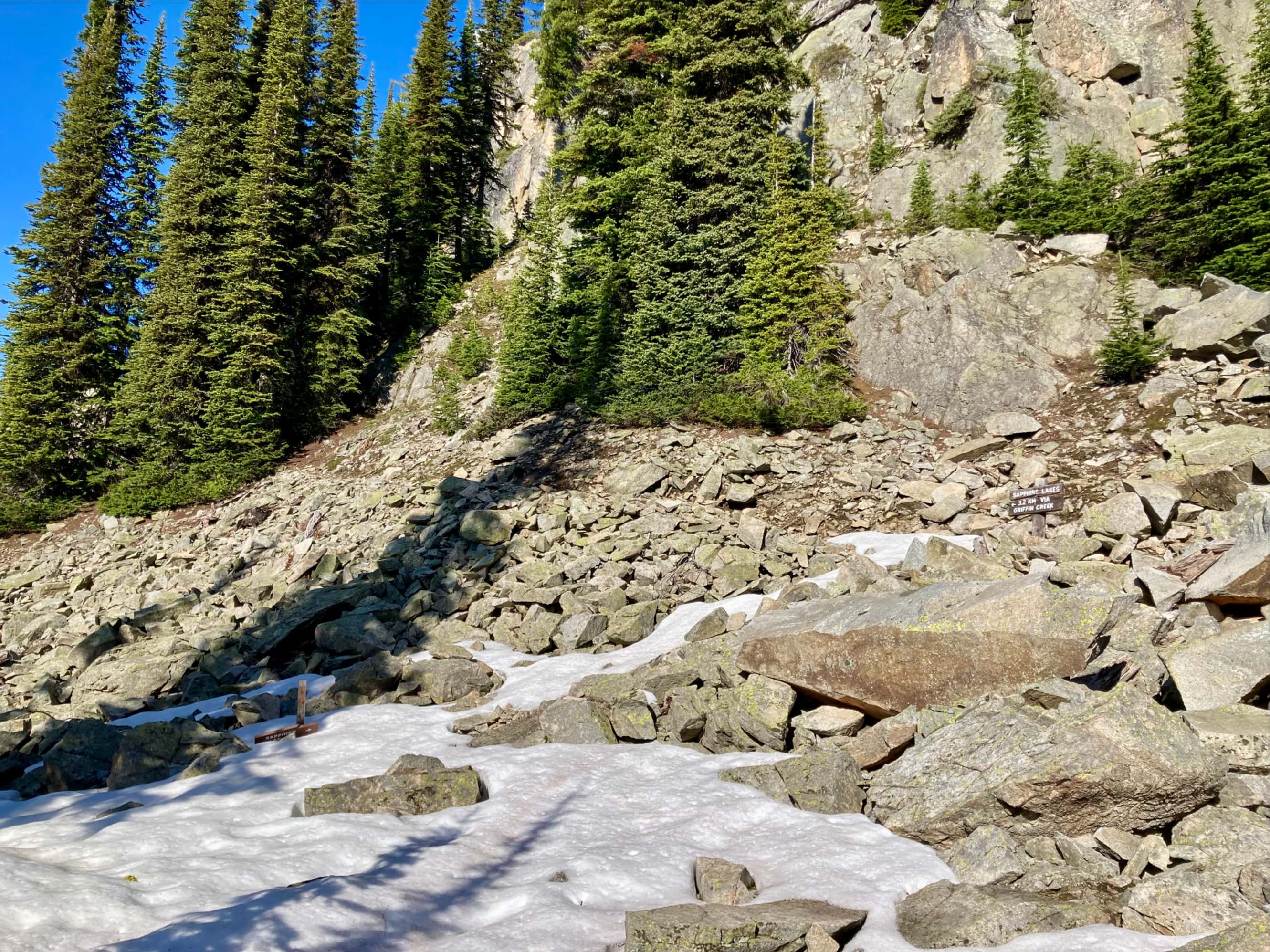


Snow completely obscured the trail after a while as we continued upwards. We eventually came alongside Griffin Creek. We had to cross from the north to the south side of this creek, and using previously downloaded GPS tracks we could identify the usual site for crossing. However, high flow volume and overhanging snow on the far bank convinced us not to cross at that spot. Instead, we followed the creek upstream looking for a better spot to get across. A few hundred meters upstream we found a safe spot to hop across and carried on towards the cirque below Lemon Pass.


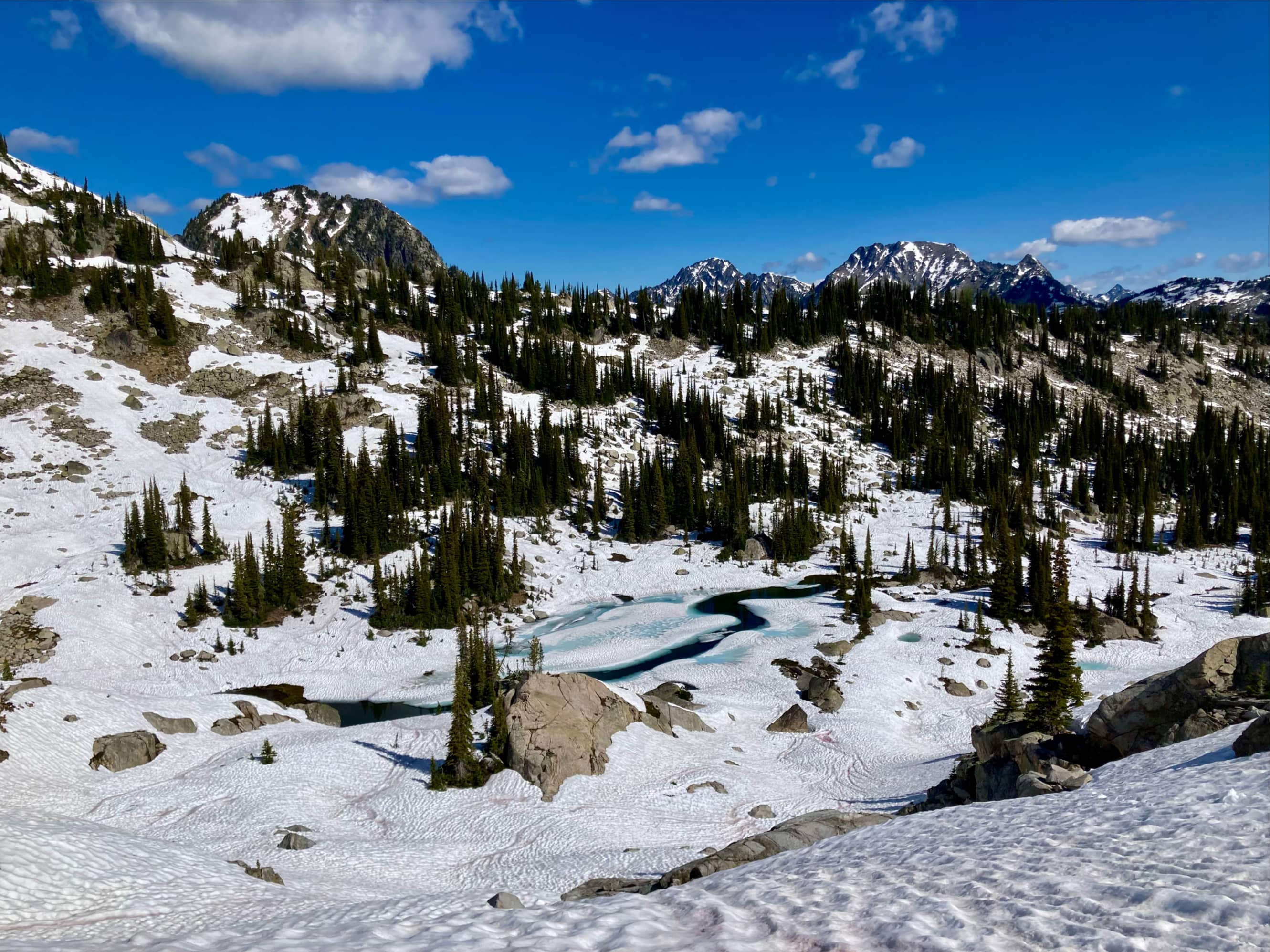
Once at the cirque, we traversed below cliffs on the eastern wall of the valley, angling south to Lemon Pass. We reached the pass with no major difficulty and had a look south through Lemon Pass towards Mount John Carter and Sunset Mountain. Another 400 m walking to the south and we reached the snow-covered Sapphire Lakes.


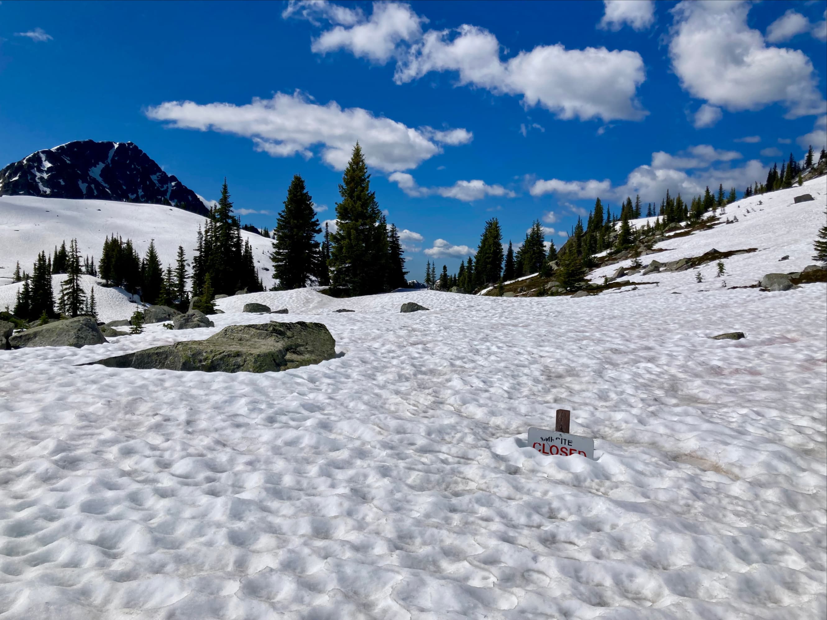

The conditions limited our ability to explore around the more easterly lake and up into Glory Basin. Instead we clambered up some rocks on a slope above the westerly lake and took a long break, enjoying the unique view of turquoise water laying atop snow.


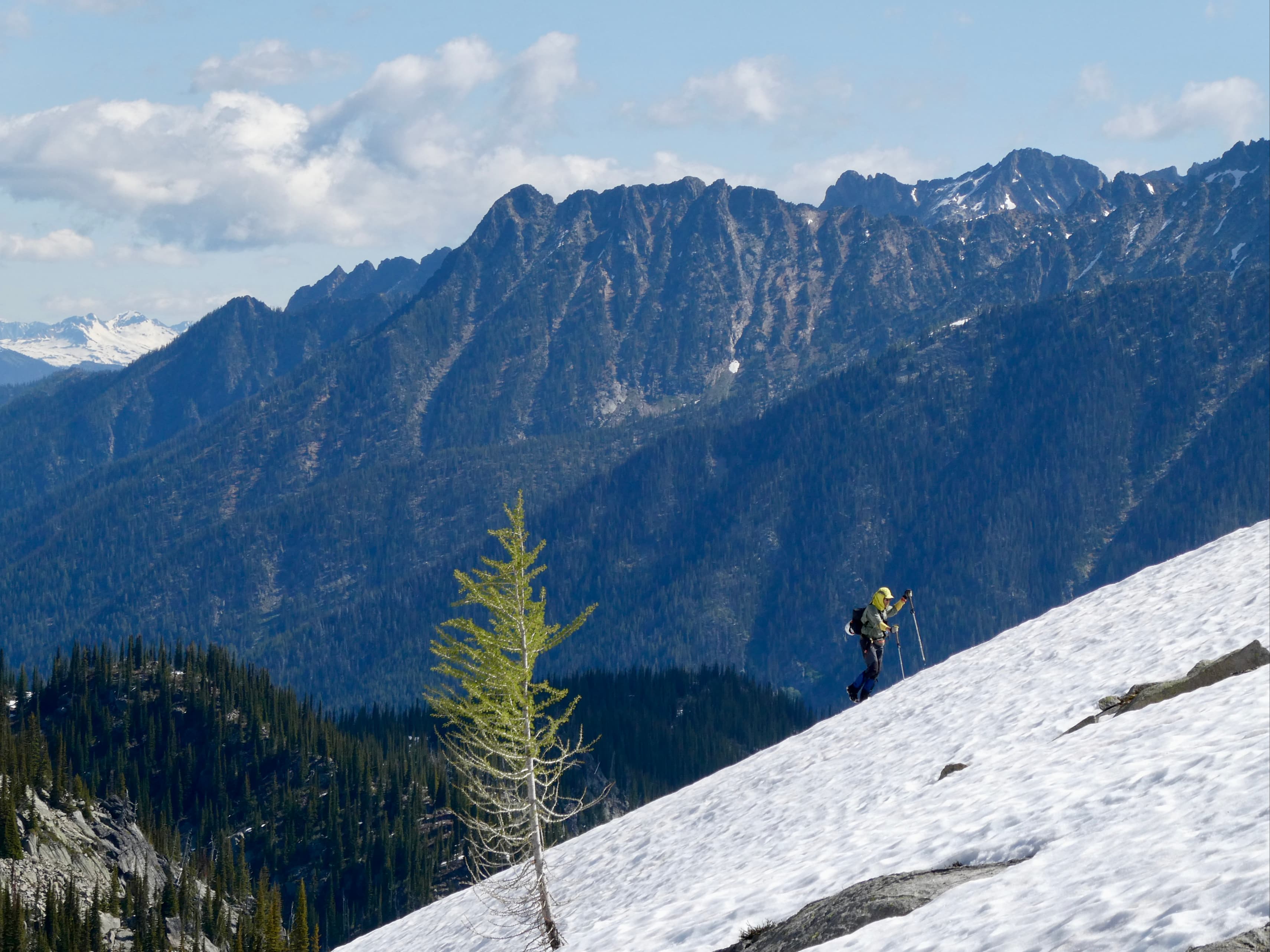
We debated whether to try walking up the snowy slopes to the summit of Mount Giegerich. Eventually we decided against it and slowly made our way all the way back down to Enterprise Pass.


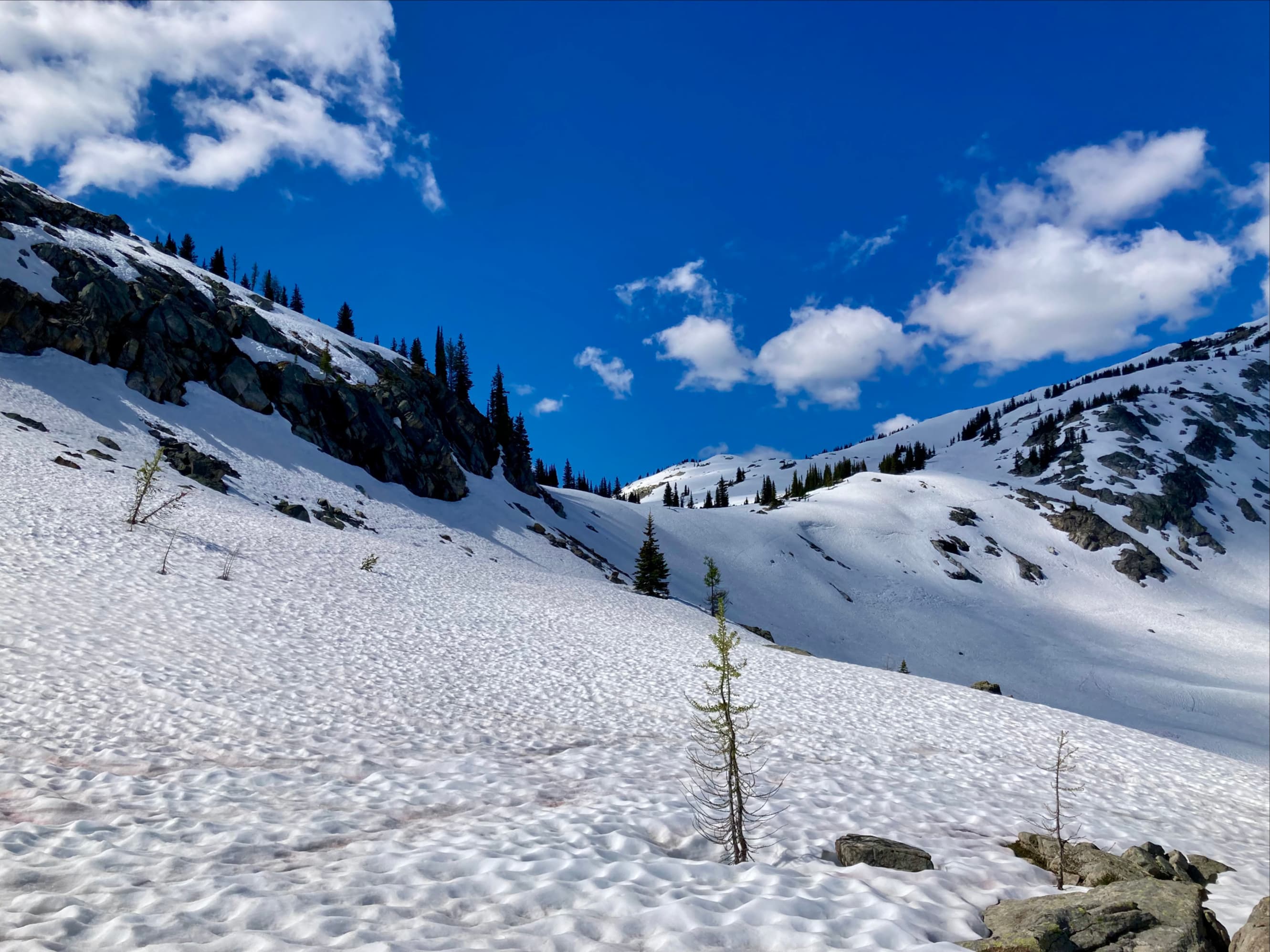
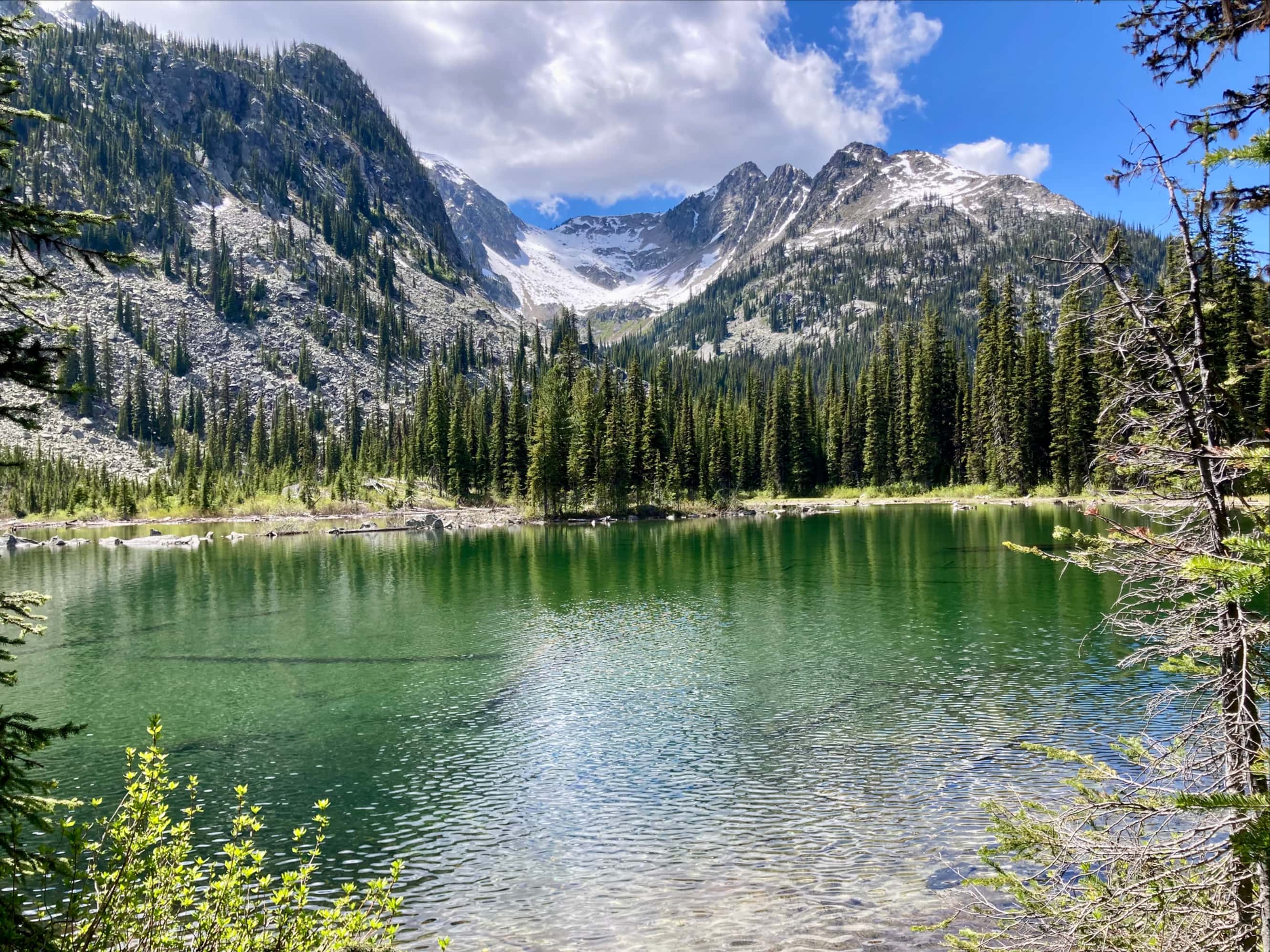
Since we had a couple of hours yet before suppertime we decided to check out Tanal Lake. Following the directions on the sign that we’d propped back up that morning, we set out north from Enterprise Pass. About 100 m from the sign the route cut across snow-covered rubble in a narrow gully then began to descend roughly 220m over 1.5 km to the lake. In stark contrast to the other side of the pass, there was no snow in Tanal Lake’s valley. Early on in the descent we were treated to the best views of the lake, surrounded by trees beneath the slopes of Mount Robert Smith, Boomerang Mountain, and Tanal Peak. When we reached the shore we lounged for a while in the shade, had a snack, then made our way back to the comforts of the Kokanee Glacier Cabin.


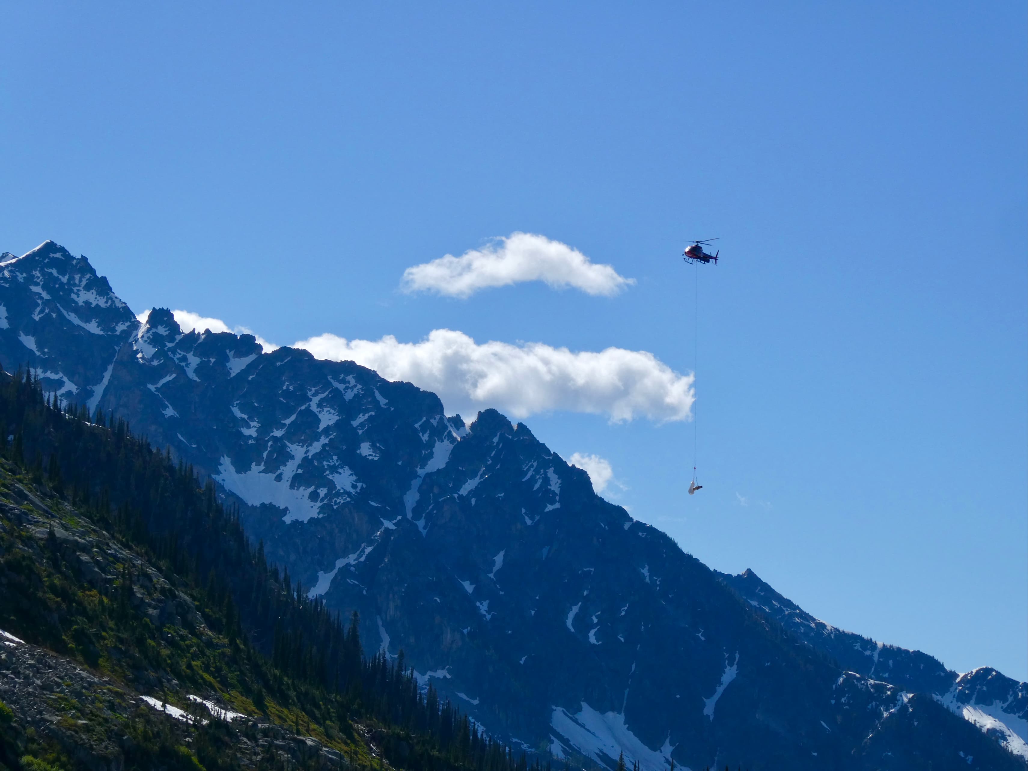
The next day we walked out of the backcountry. As we walked, a helicopter zipped back and forth several times – some maintenance work was going on back at the cabin. It was the first day of a heatwave in western Canada. The skies were clear and it was interesting watching the helicopter ferry material in and out on a long line. We reflected that although our more ambitious hiking plans had been scuttled it was still a very enjoyable trip. We agreed that we would eventually have to return and explore further.


One thought on “Sapphire Lakes & Tanal Lake”