The flat mountaintop could be seen from many locations, and it became one of the main landmarks Jerry Potts used to confirm his bearings as he travelled the prairie. He, like many Blood warriors, had climbed the slopes and rested his head on a buffalo skull, questing for visions and dreams that would help guide him in his daily life.
From “Bear Child”, by Rodger D. Touchie
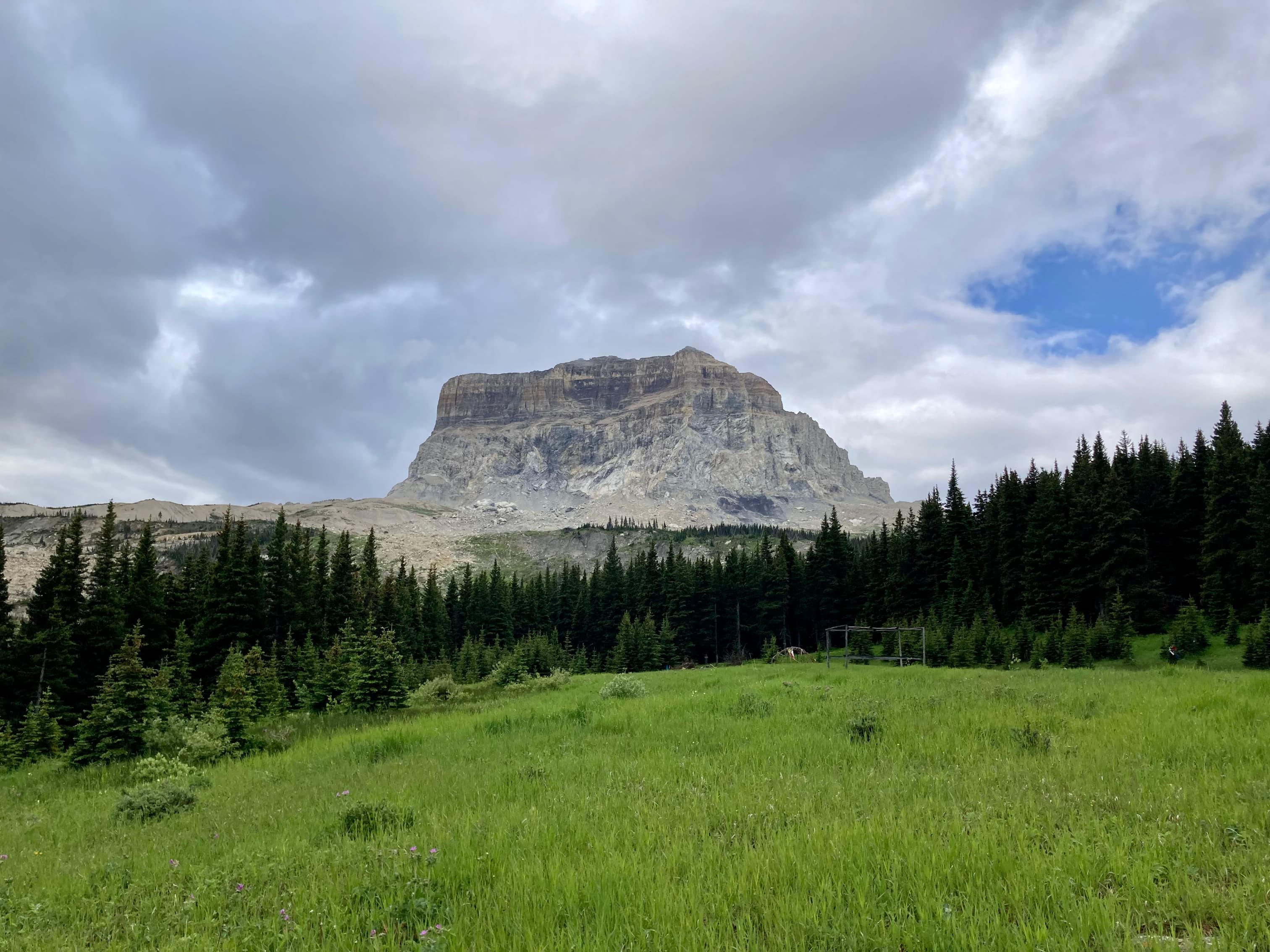
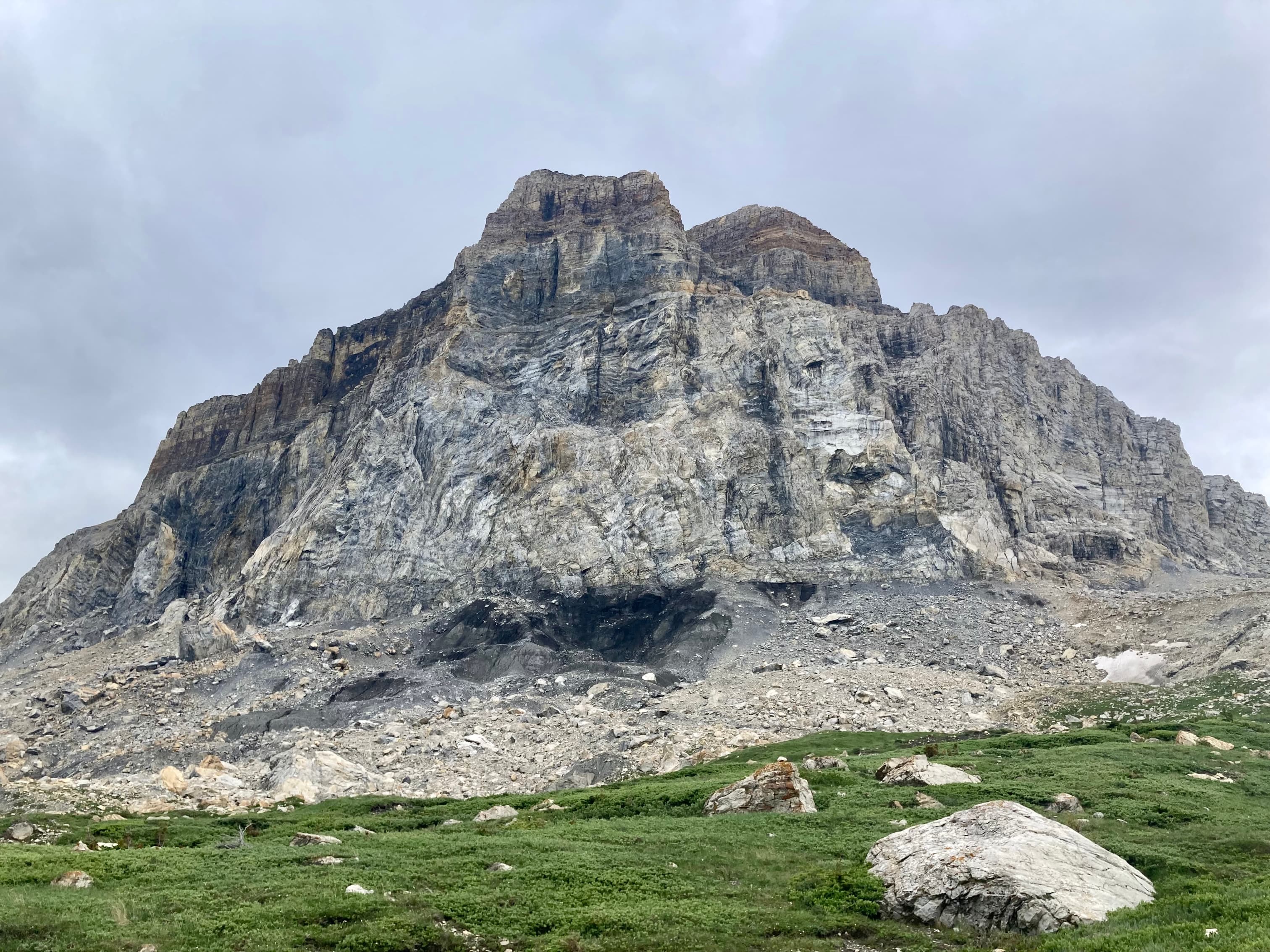
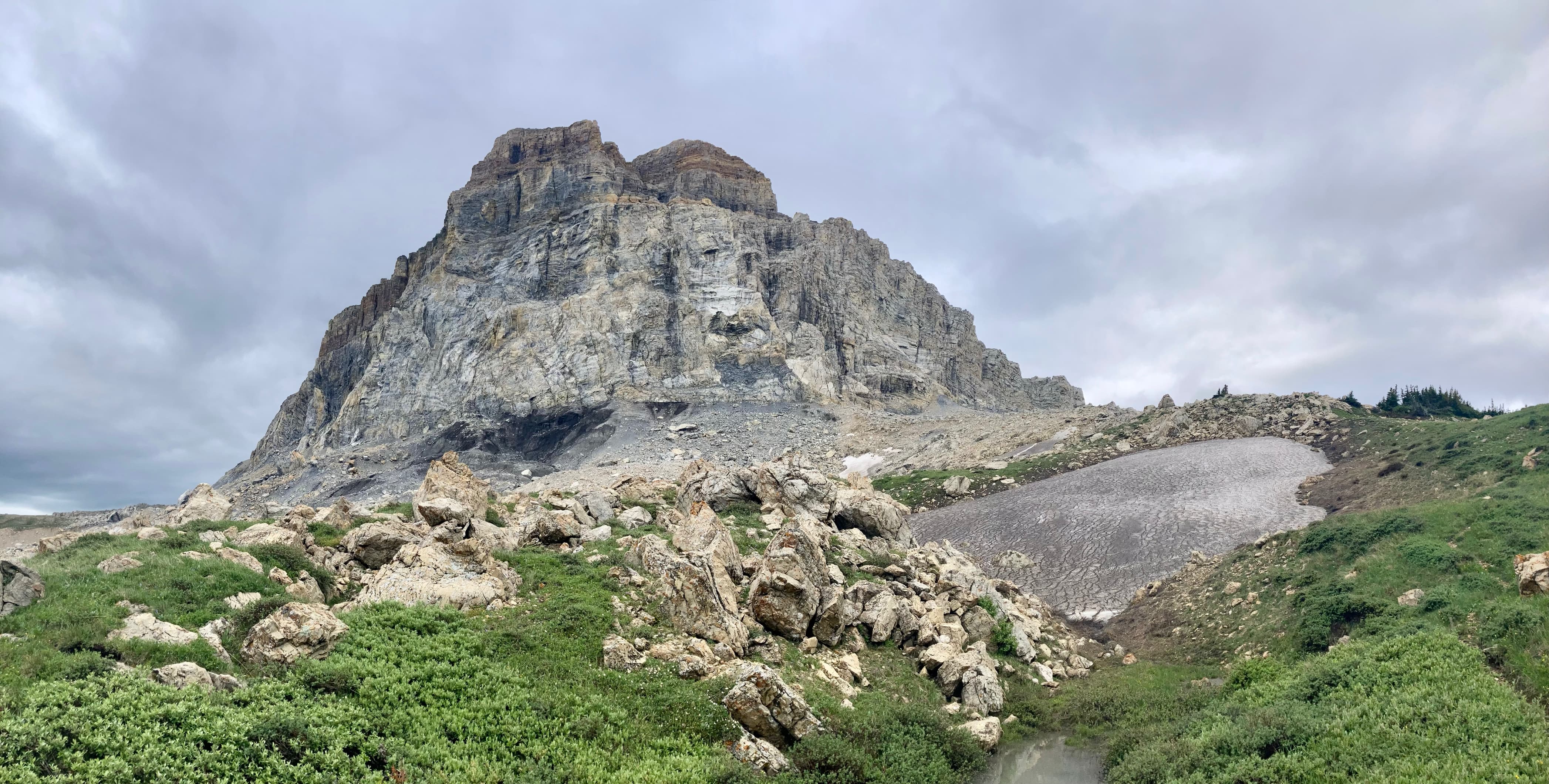
All Southern Albertans are familiar with the striking silhouette of Ninastako. Its distinctive rectangular shape is visible to the southwest on clear days, standing apart from the peaks of the main ranges of the Rockies. I can remember staring at it as a child, pondering the unique form. These days, when I’m on a summit in Waterton, the Castle, or the Crowsnest Pass, I look into the distance to see if I can get a glimpse of it. If I can see Ninastako on the horizon, I know I’m close to home.
The Blackfoot (or Blackfeet, in Montana) have a special reverence for the mountain. To be in sight of it is to know you are in Blackfoot territory. Many important stories in Blackfoot culture relate to the mountain.
Ninastako, also called Chief Mountain, is the home of Thunder. When he stole the wife of a Blackfoot man, he took her to his home inside this mountain. Raven came from his home at Crowsnest Mountain and fought with Thunder on the slopes of Ninastako.
From “The Story of the Blackfoot People: Niitsitapiisinni”, by The Blackfoot Gallery Committee of the Glenbow Museum
The mountain and the area around it are sacred, and any visit to the peak should be treated as a privilege.
The mountain sits astride the Blackfeet Reservation and Montana’s Glacier National Park. There is an approach that only traverses National Park territory, but the preferred approach is from the reserve. Each member of your party needs to purchase a conservation pass through the Blackfeet Nation Fish and Wildlife website. Since our route on foot would take us into Glacier National Park, one group park pass was also purchased. For crossing into the USA from Canada, either the Chief Mountain or Carway border crossing can be used. As we discovered, the opening and closing times for these may be different depending on which way you’re crossing. Check the American websites for what time you can cross into the USA and check the Canadian websites to find out when you need to make it back by. Just because the port is open in one direction doesn’t mean it’s open in the other.
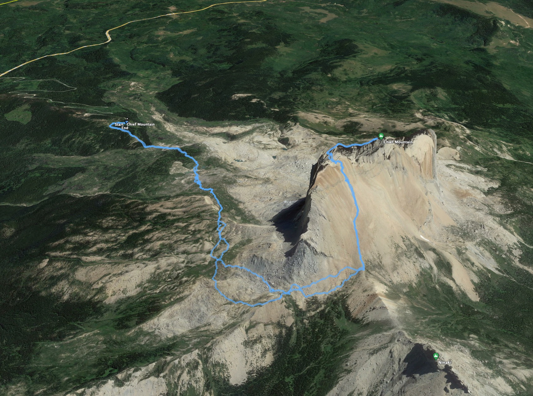
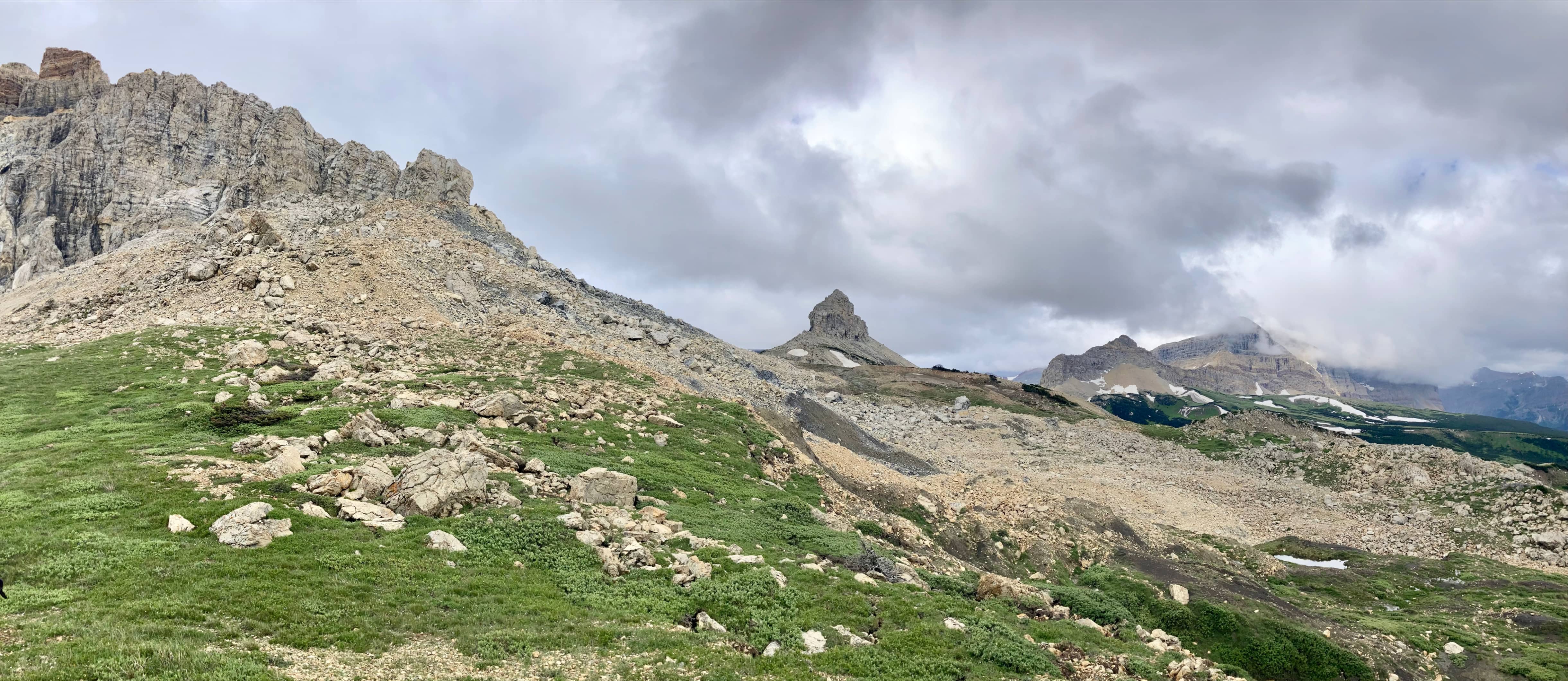
Access to Ninastako is via a rough dirt road that departs Chief Mountain Highway (Hwy 17 in Montana) about 6.7 km south from the Chief Mountain Border Crossing. Click here to see where it is. We were able to travel this road in a high clearance vehicle with good tires. The major challenges were a fallen tree, which we were able to maneuver around, and a few muddy and rutted sections. The road zig-zags uphill through forest and then arrives at a large clearing where Ninastako is clearly in view.
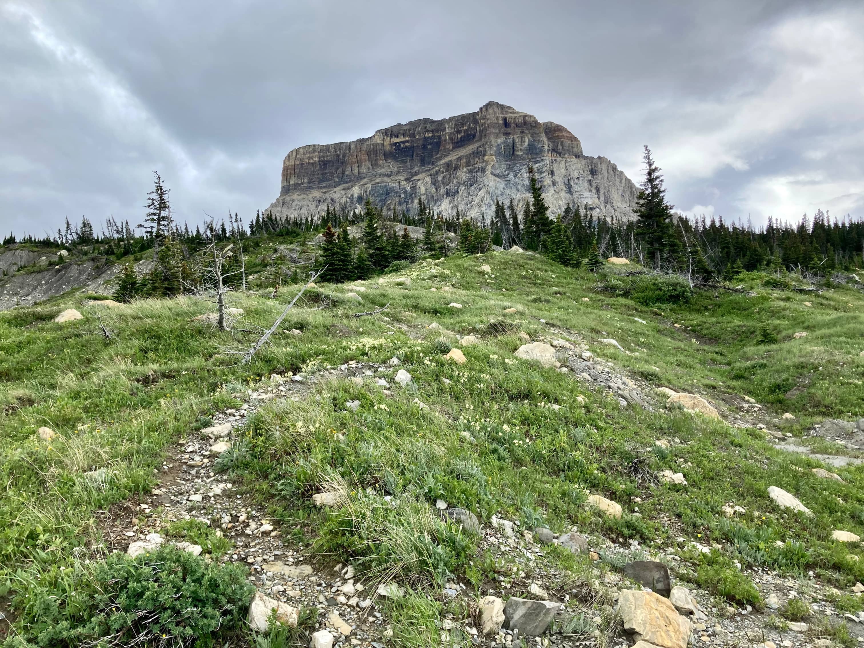
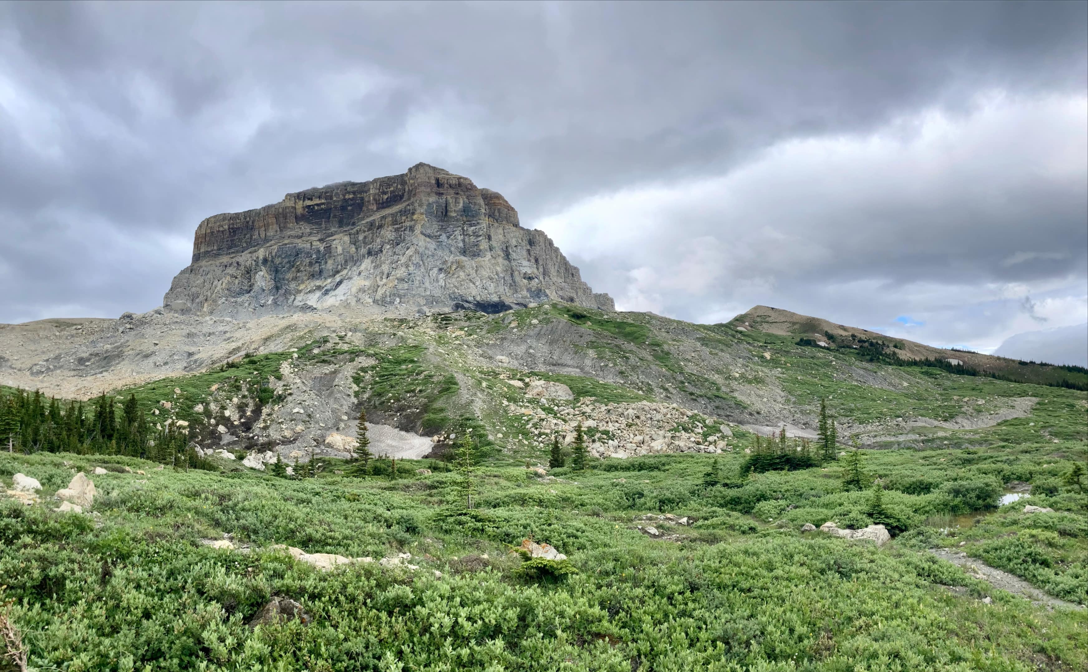
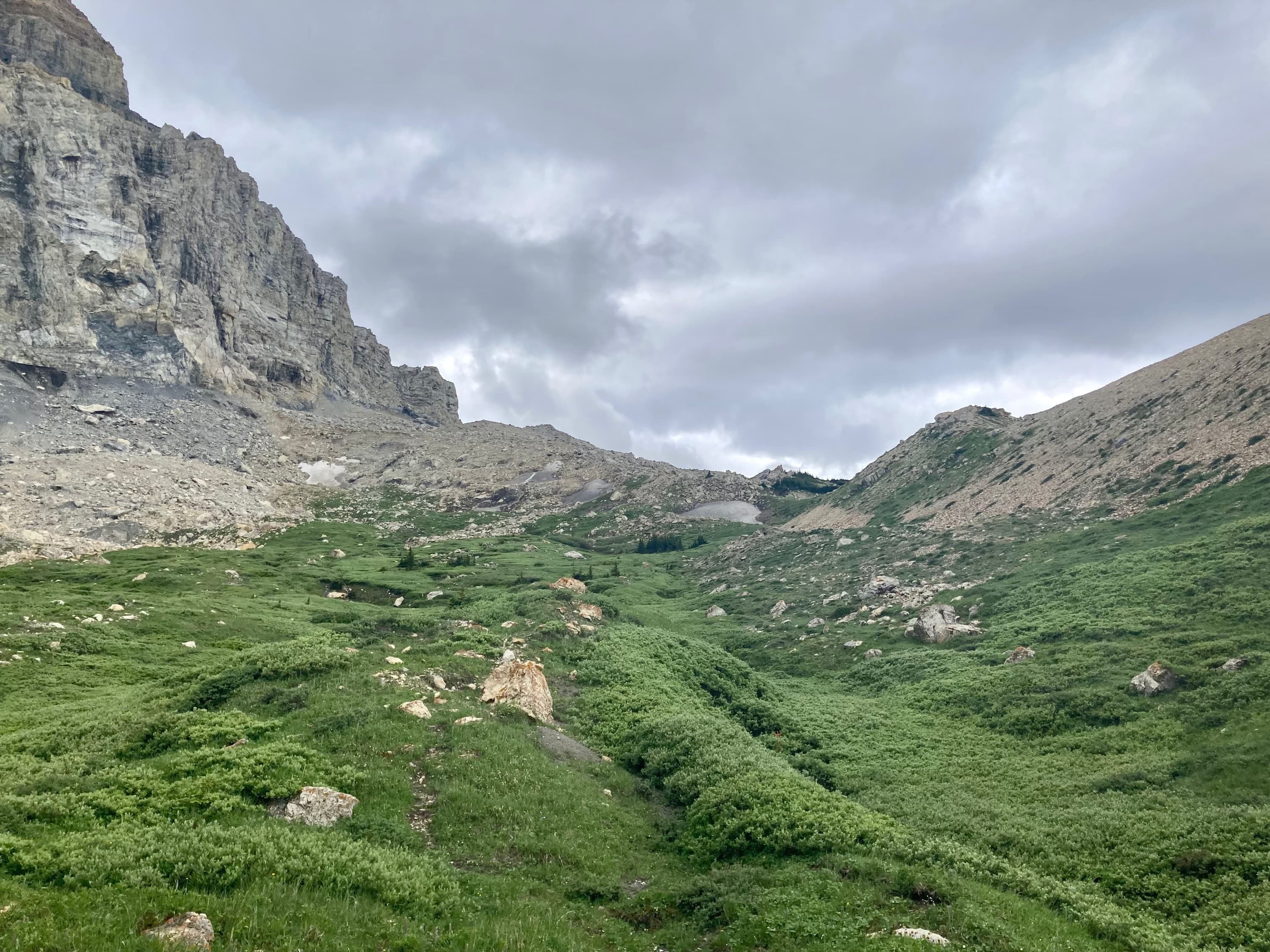
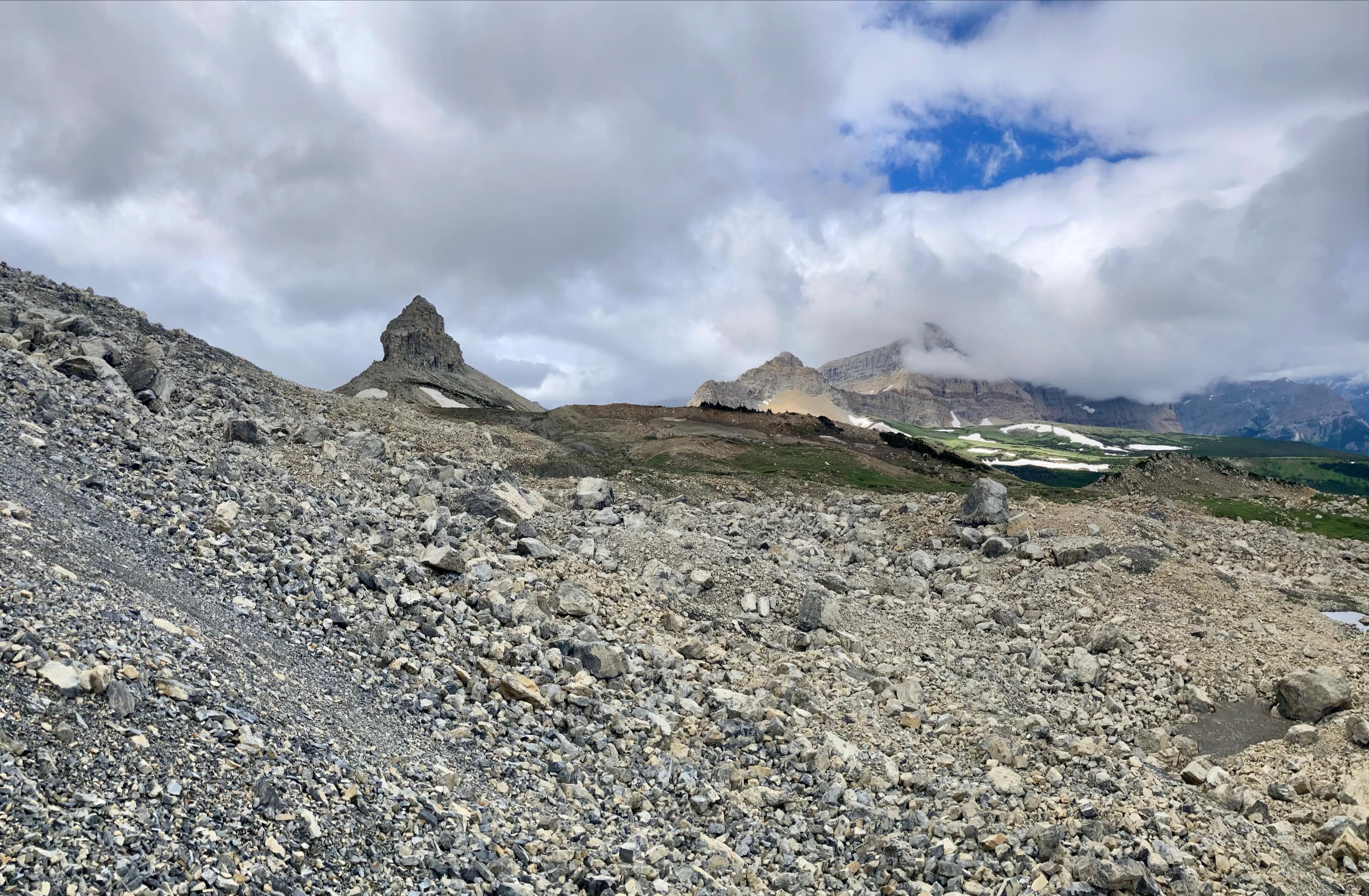
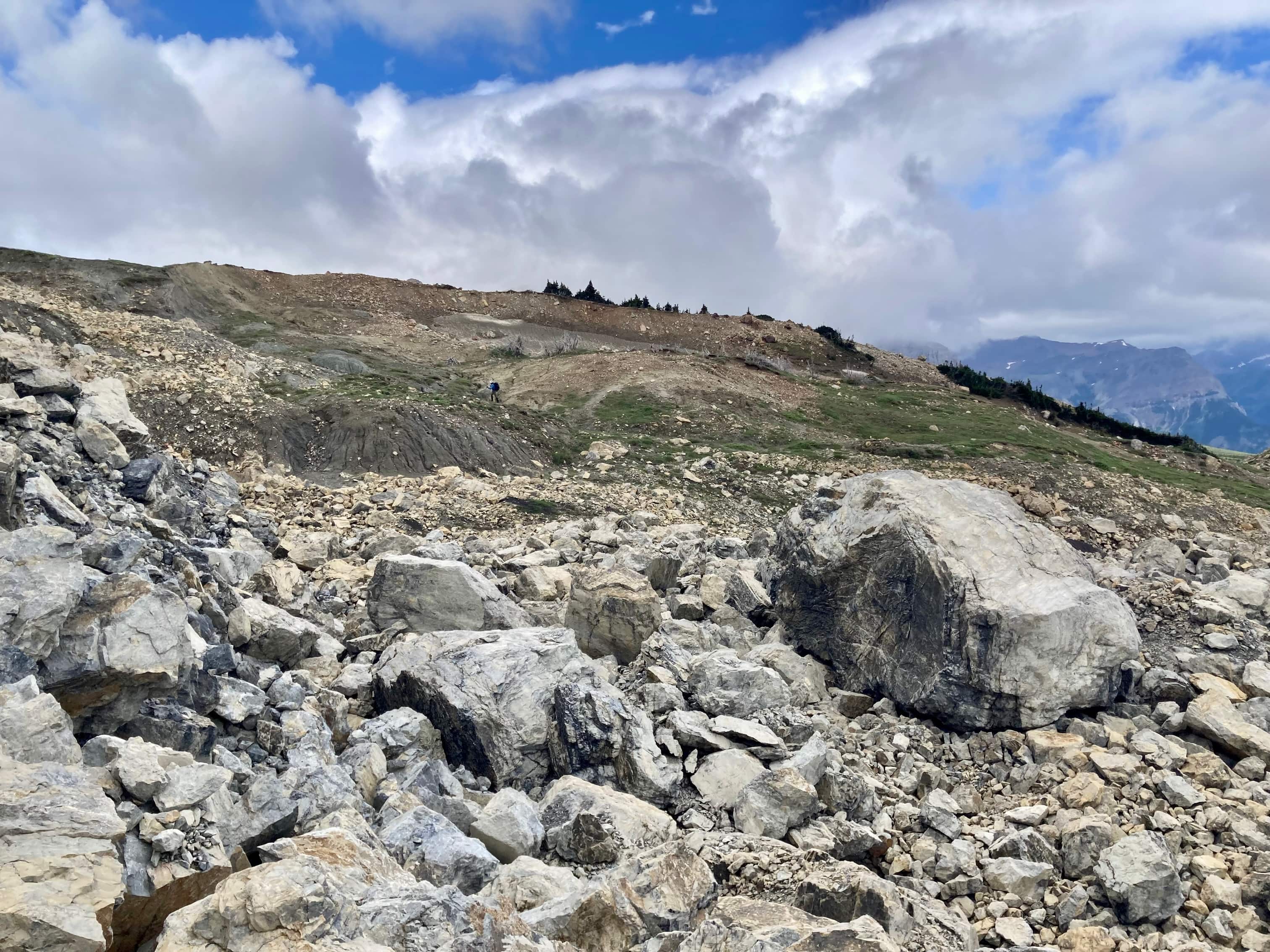
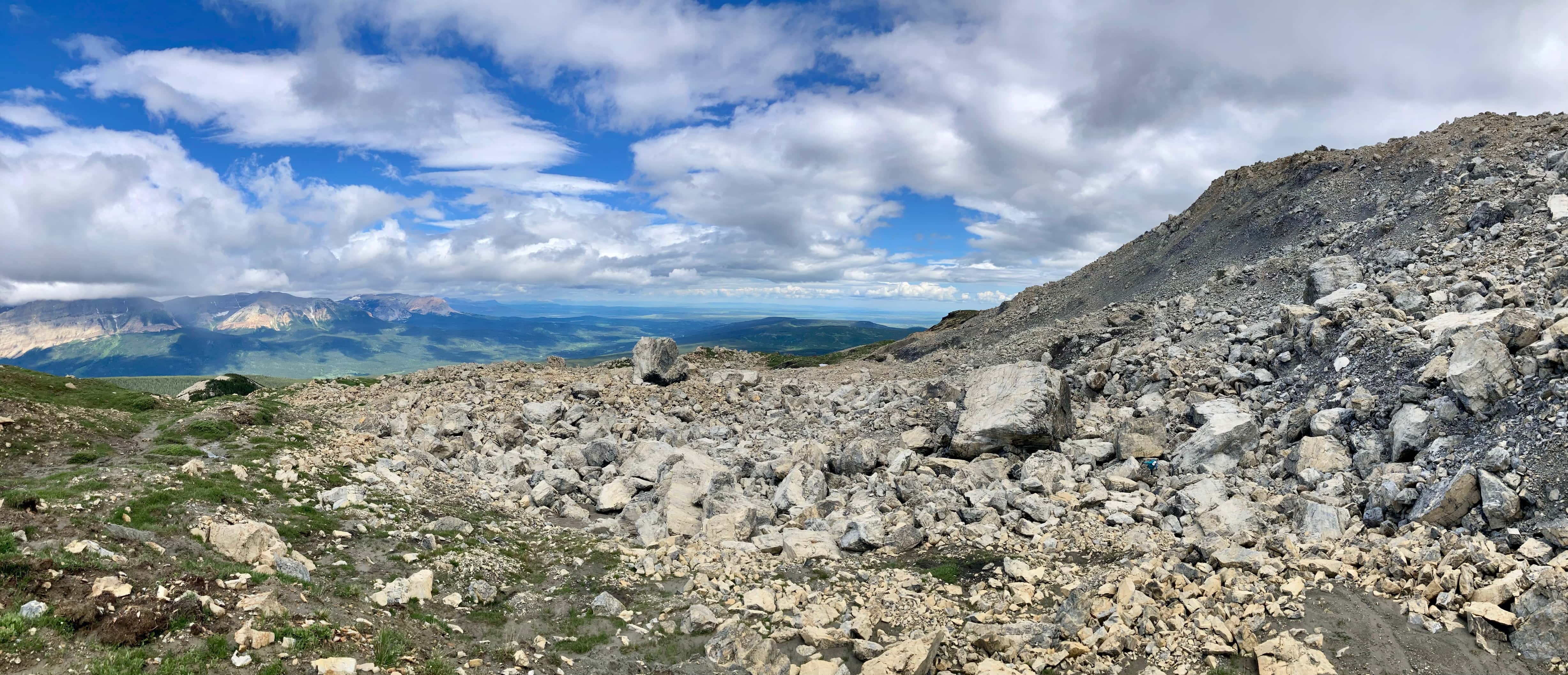
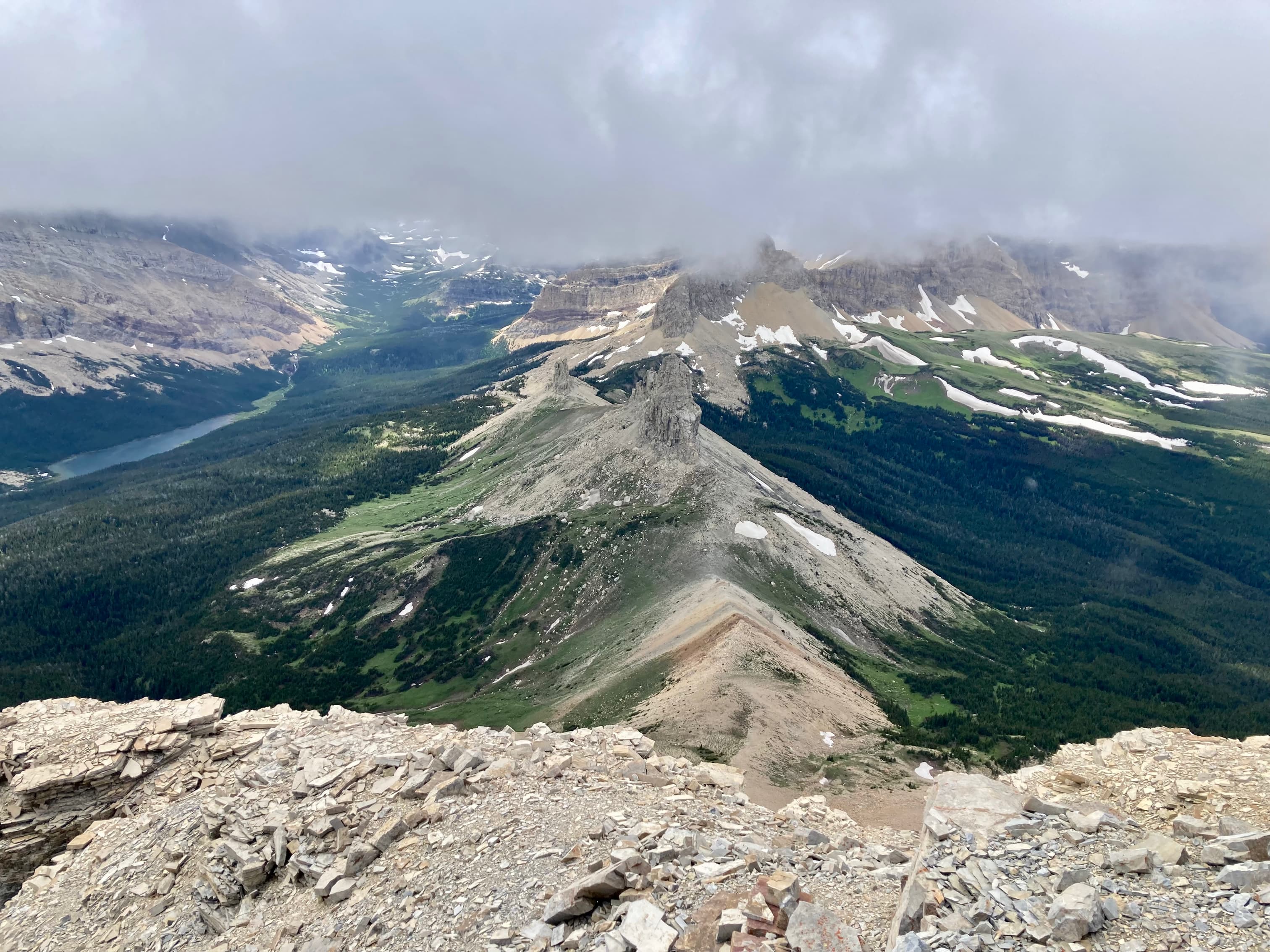
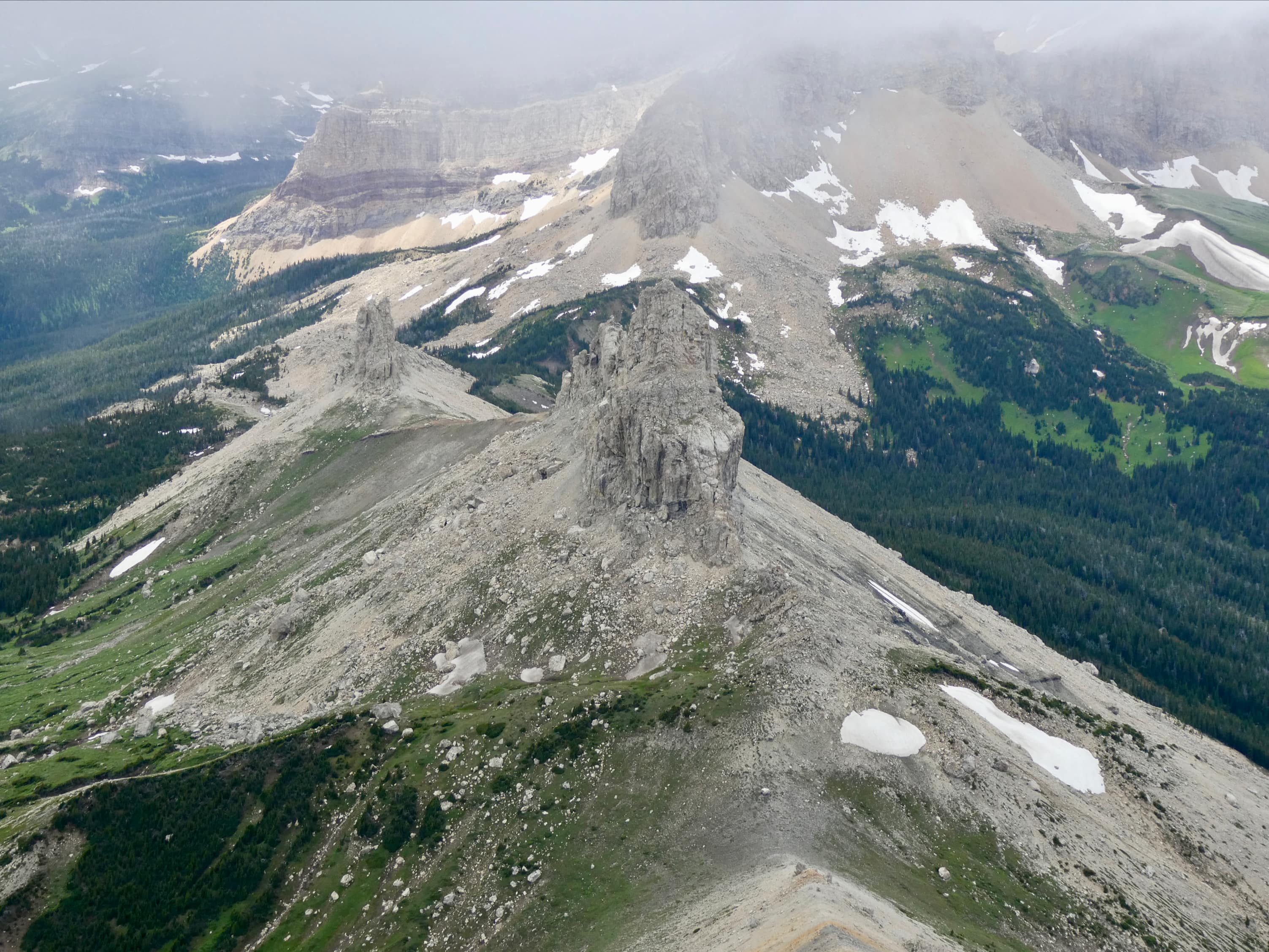
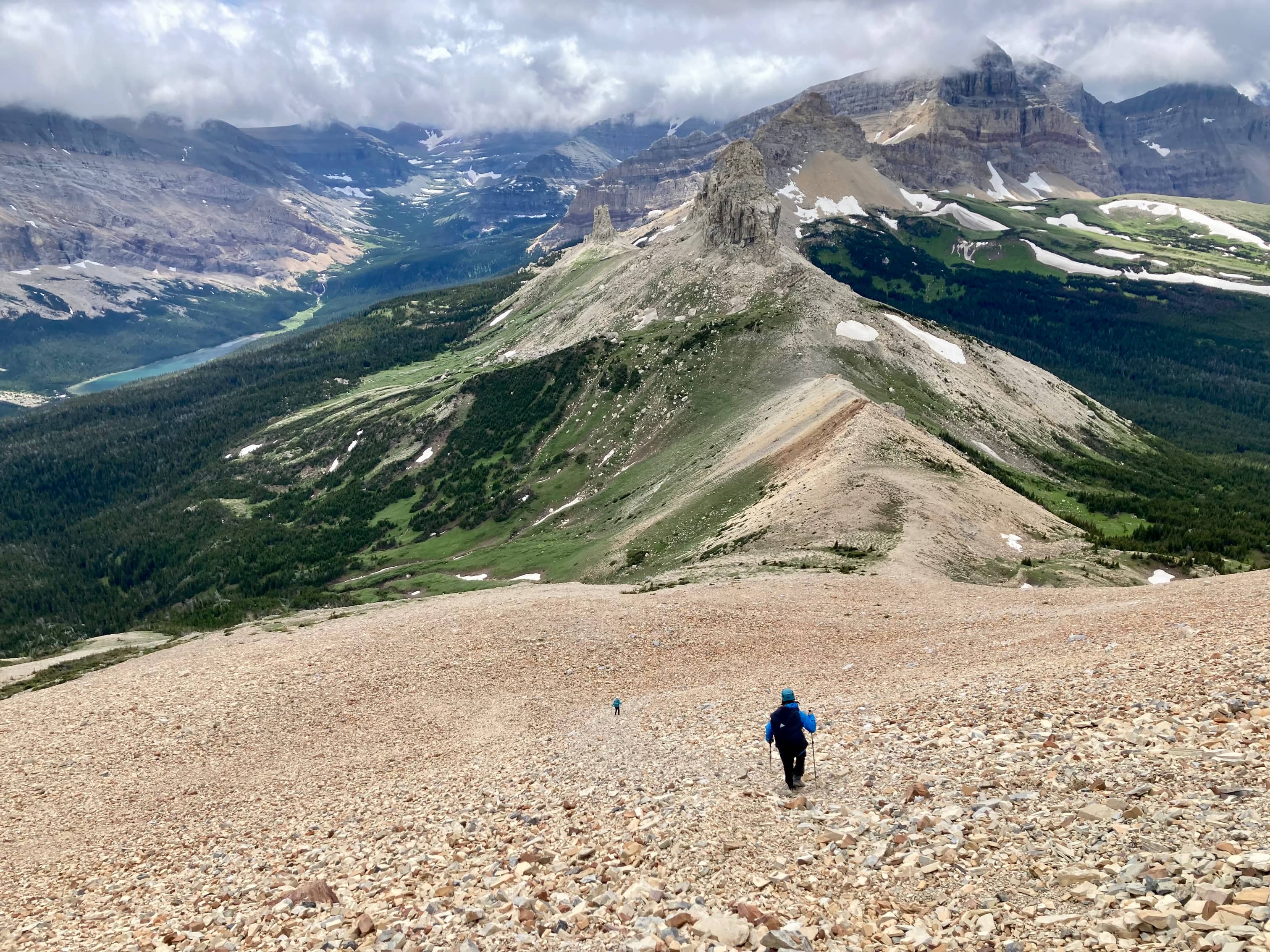
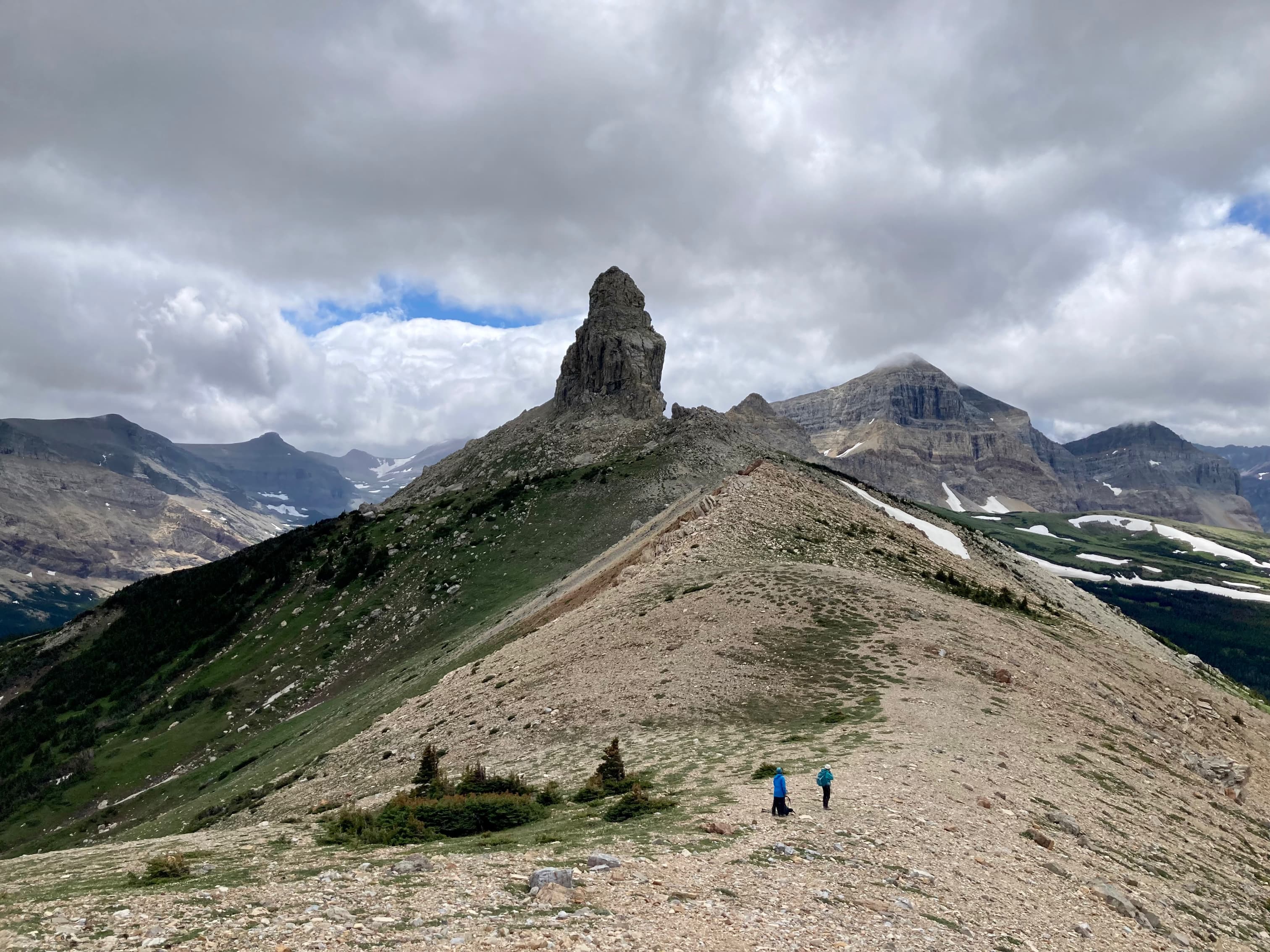
Once on foot, we followed another short road northwest from the clearing, into the forest. This road soon ends and a clearly defined foot path bends south and heads towards the mountain. The trail is generally easy to follow, passing through trees and clearings, eventually reaching small ponds and angling southwest to skirt around a bolder field beneath the mountain’s northern face. From there the route continues southwest and then south. We encountered another boulder field and most of the group made their way across it. One of our party, Bhaskar, chose a much faster route that skirted around this boulder field, too. We all went this way on the return trip. Our paths converged at the bottom of Ninastako’s western ridge. From there we hooked around to the southeast and made our way to the col between Ninastako and Ninaki – a smaller peak to Ninastako’s southwest.
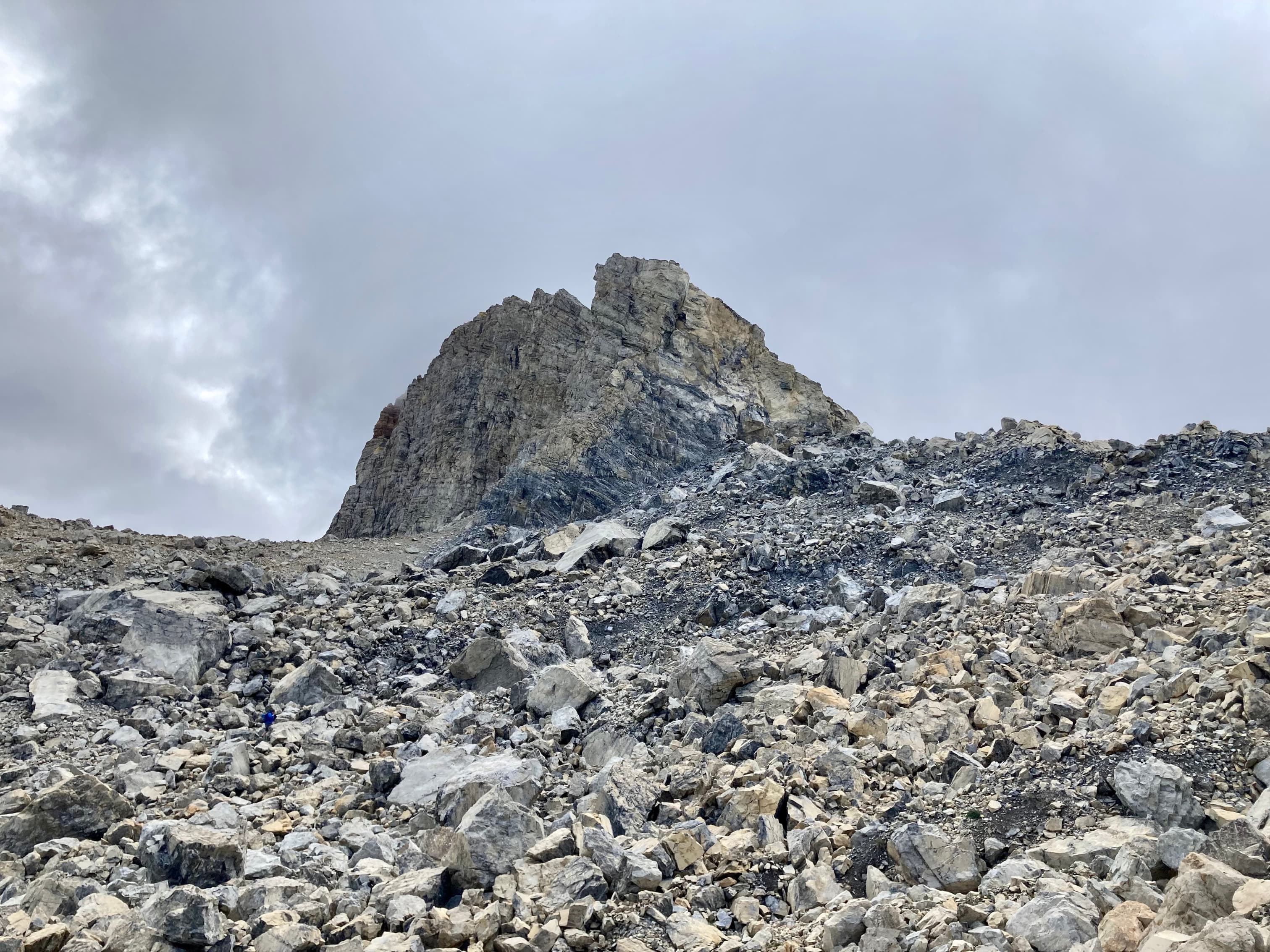
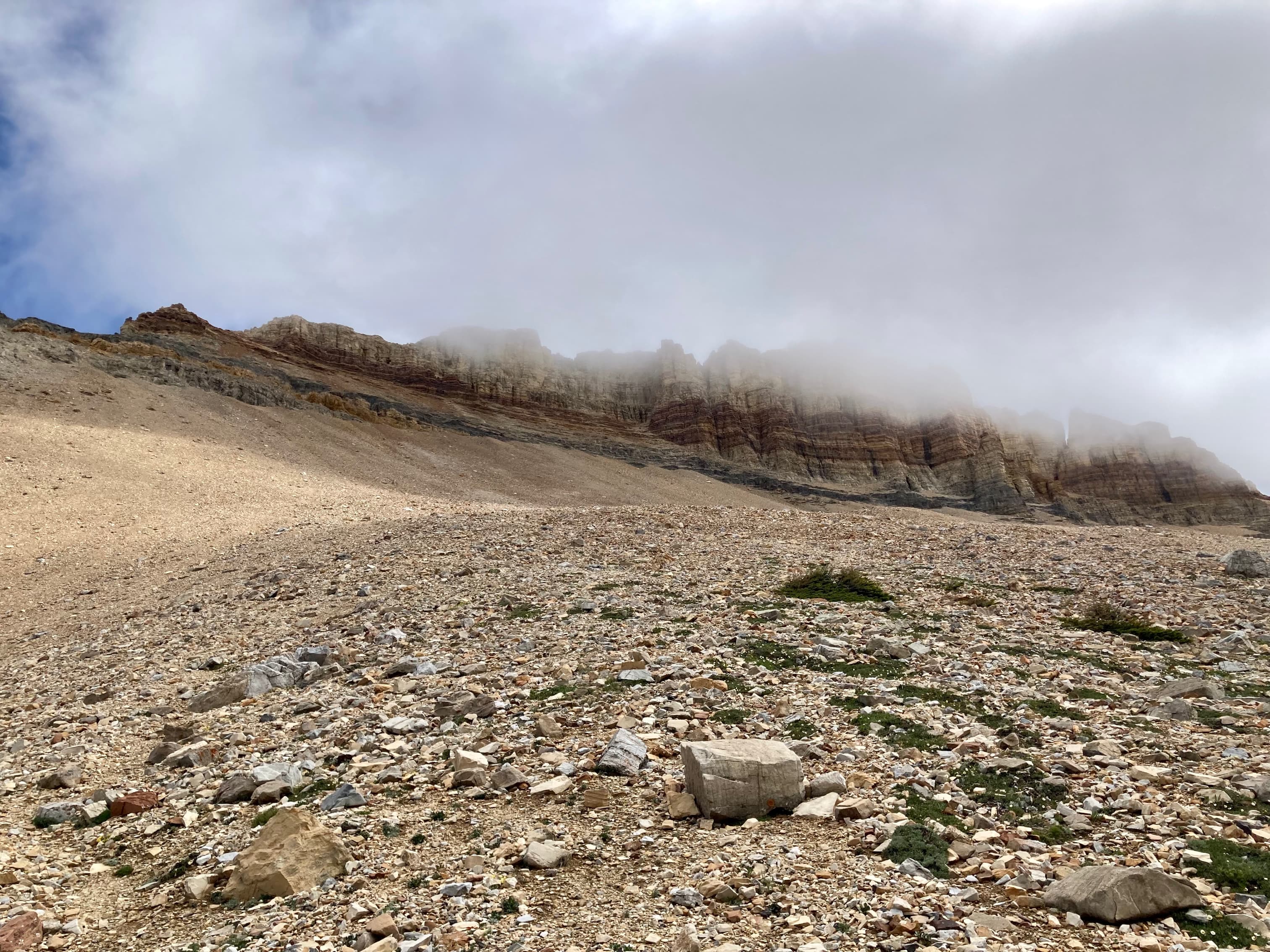
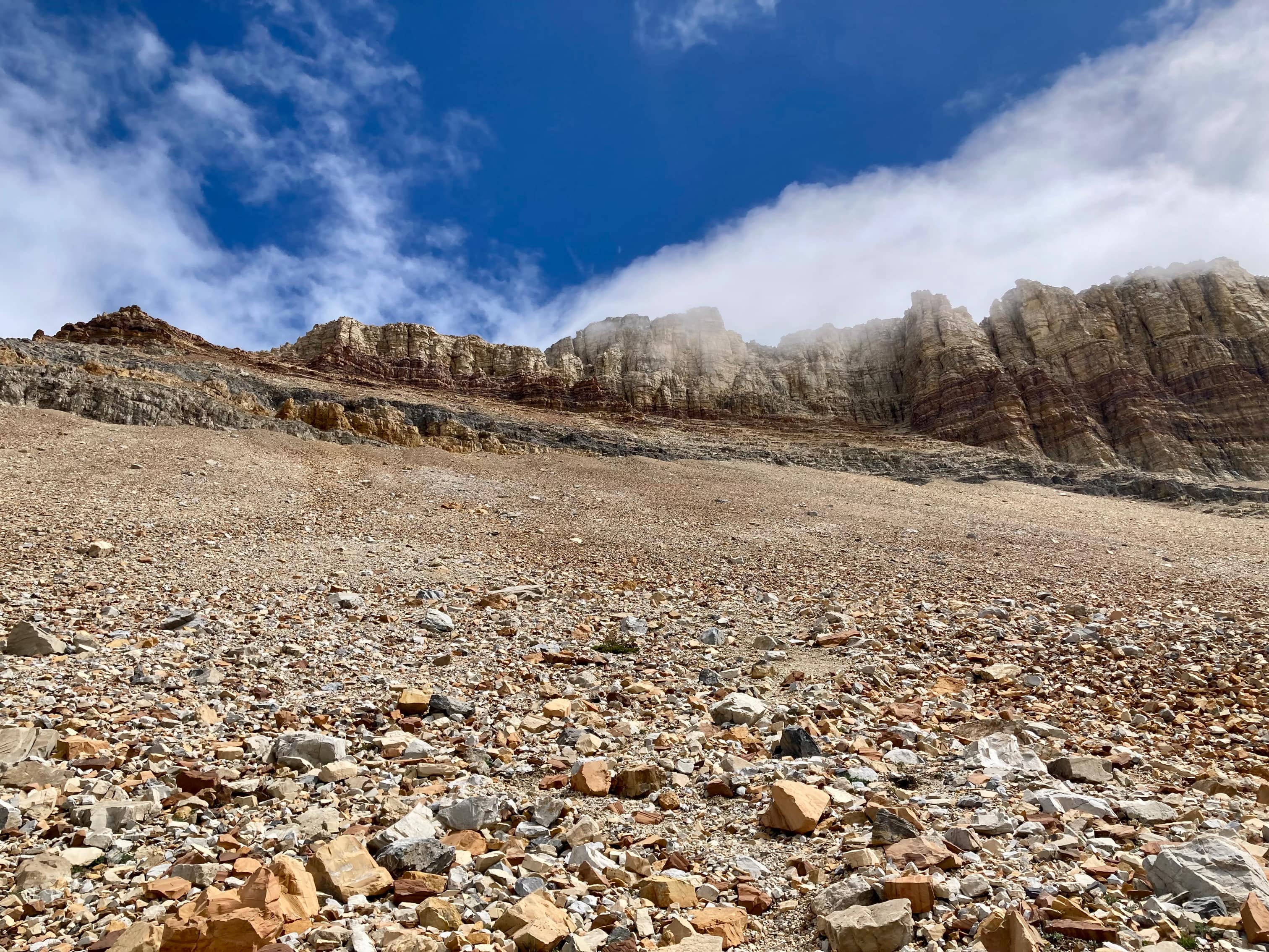
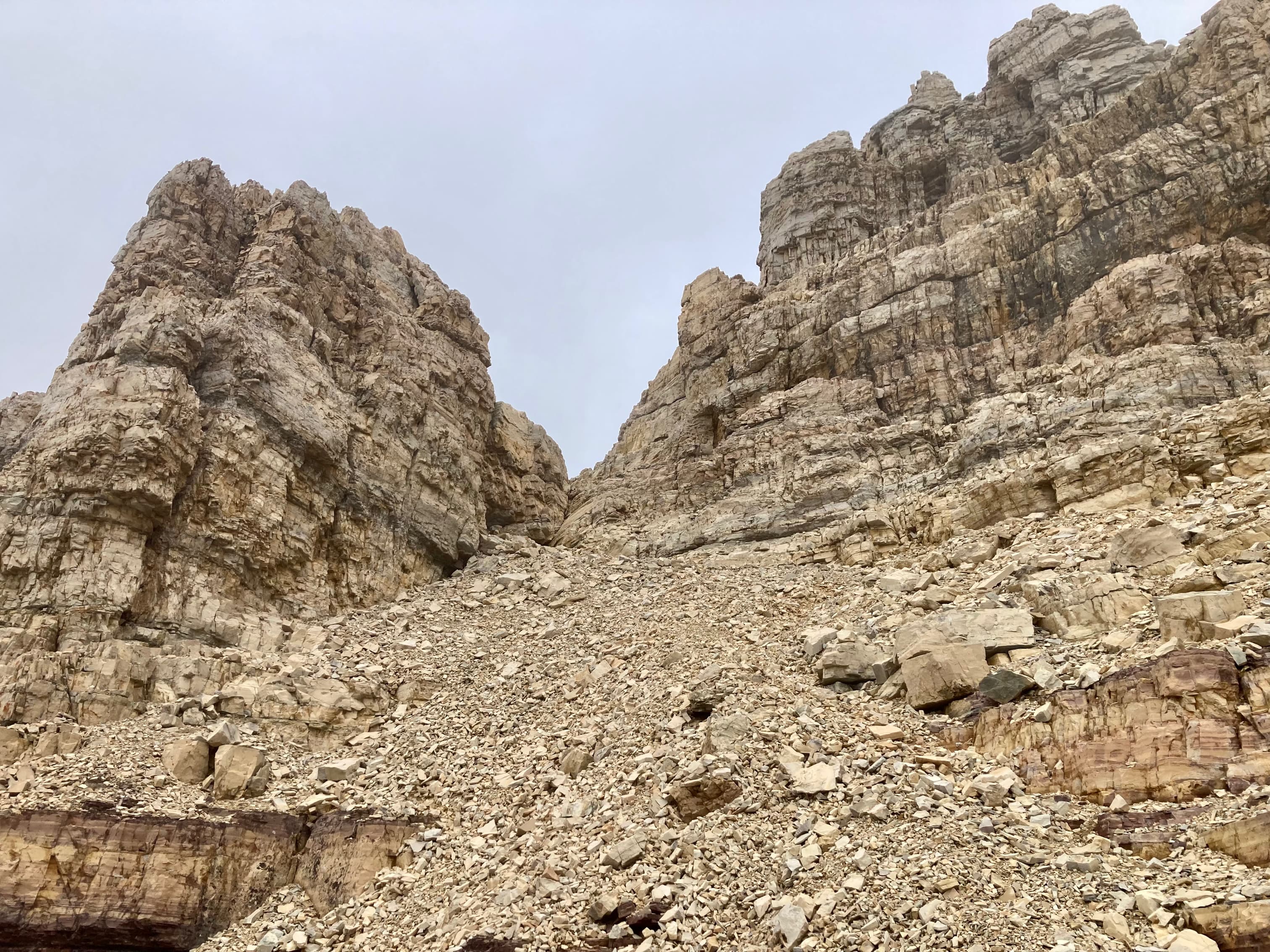
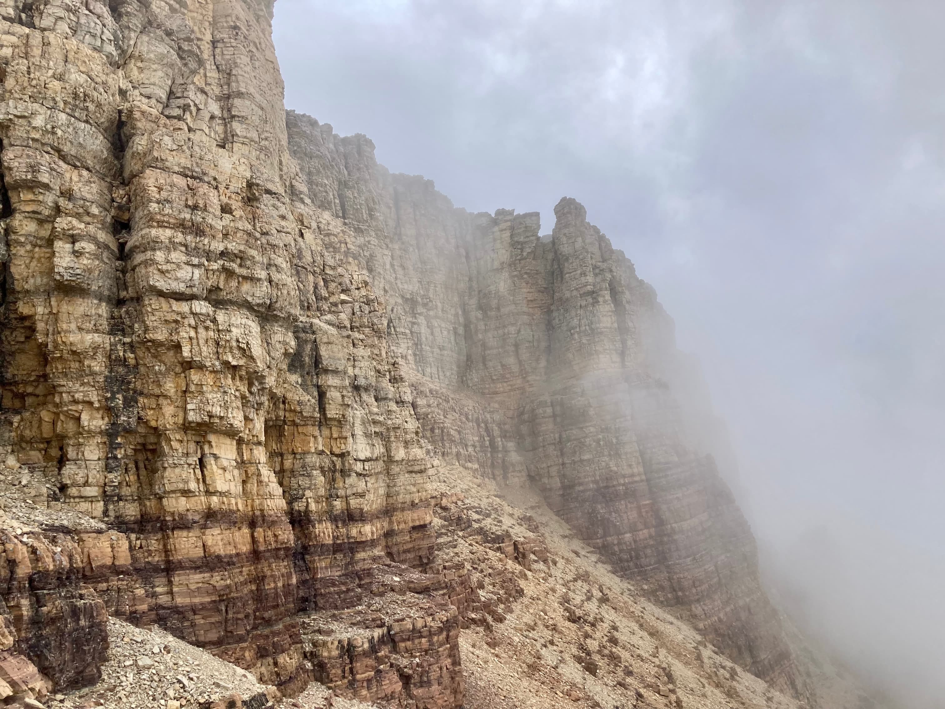
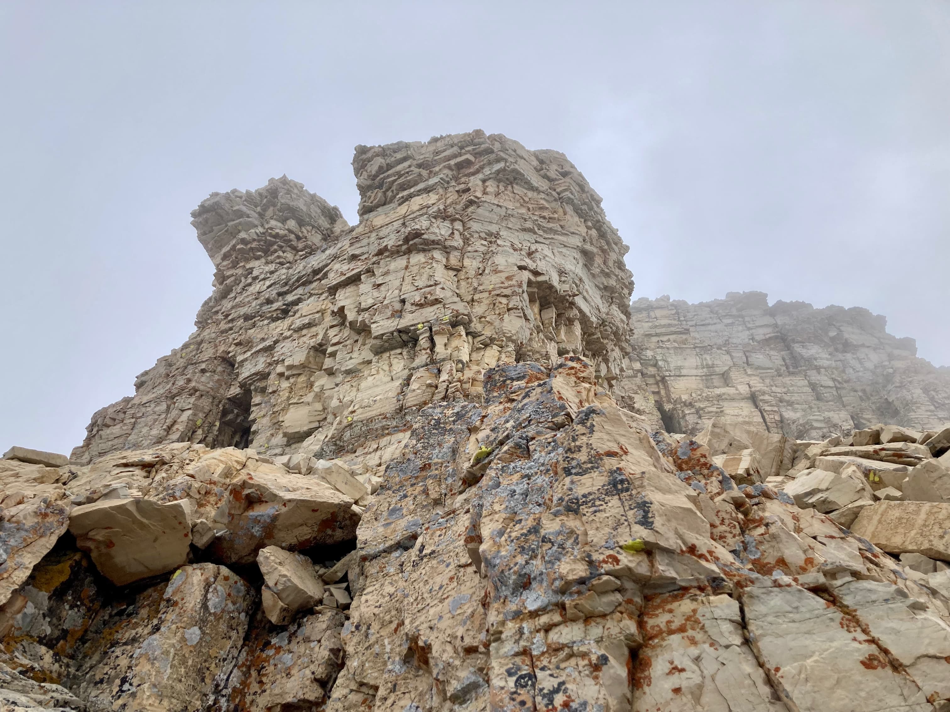
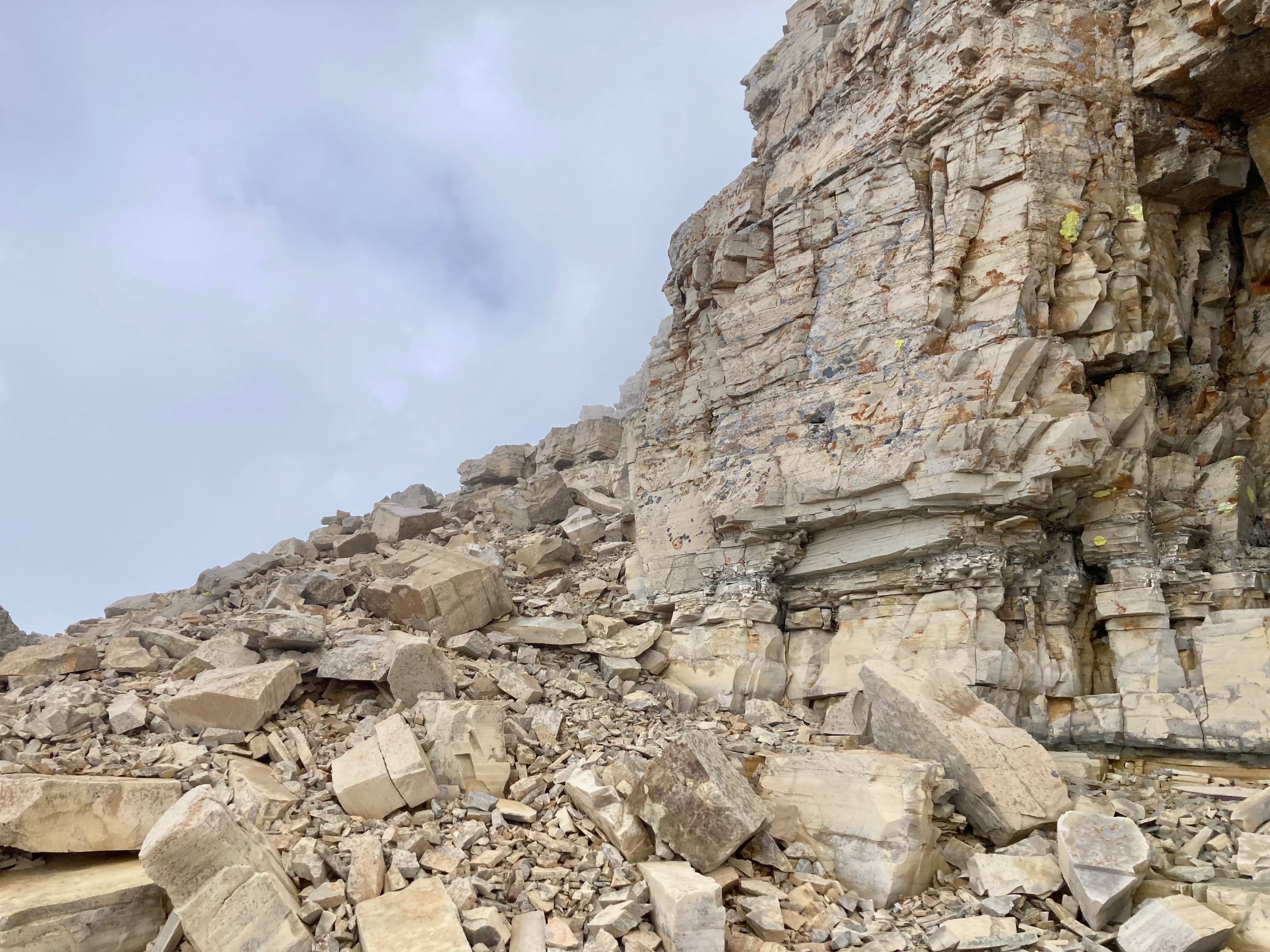
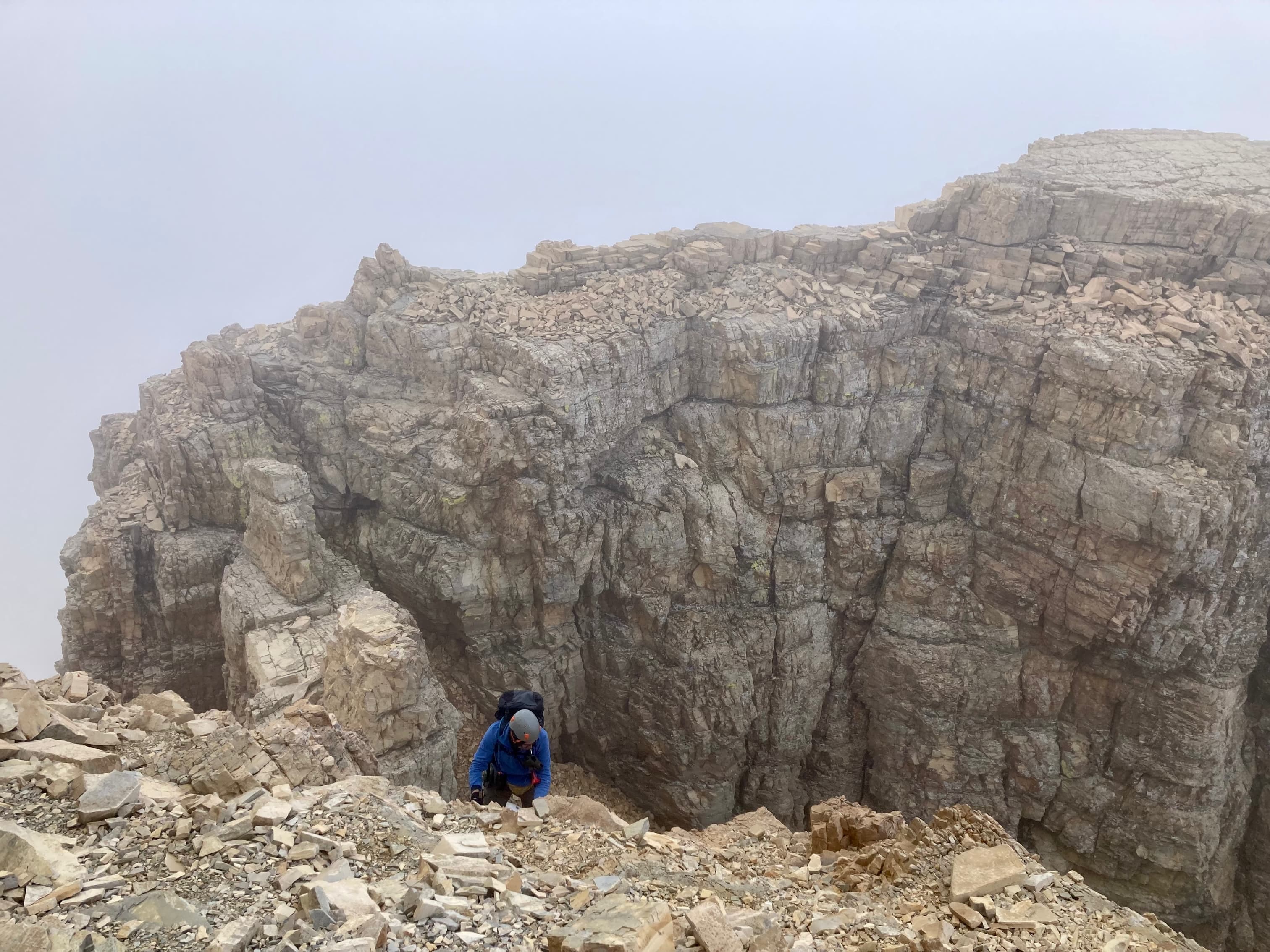
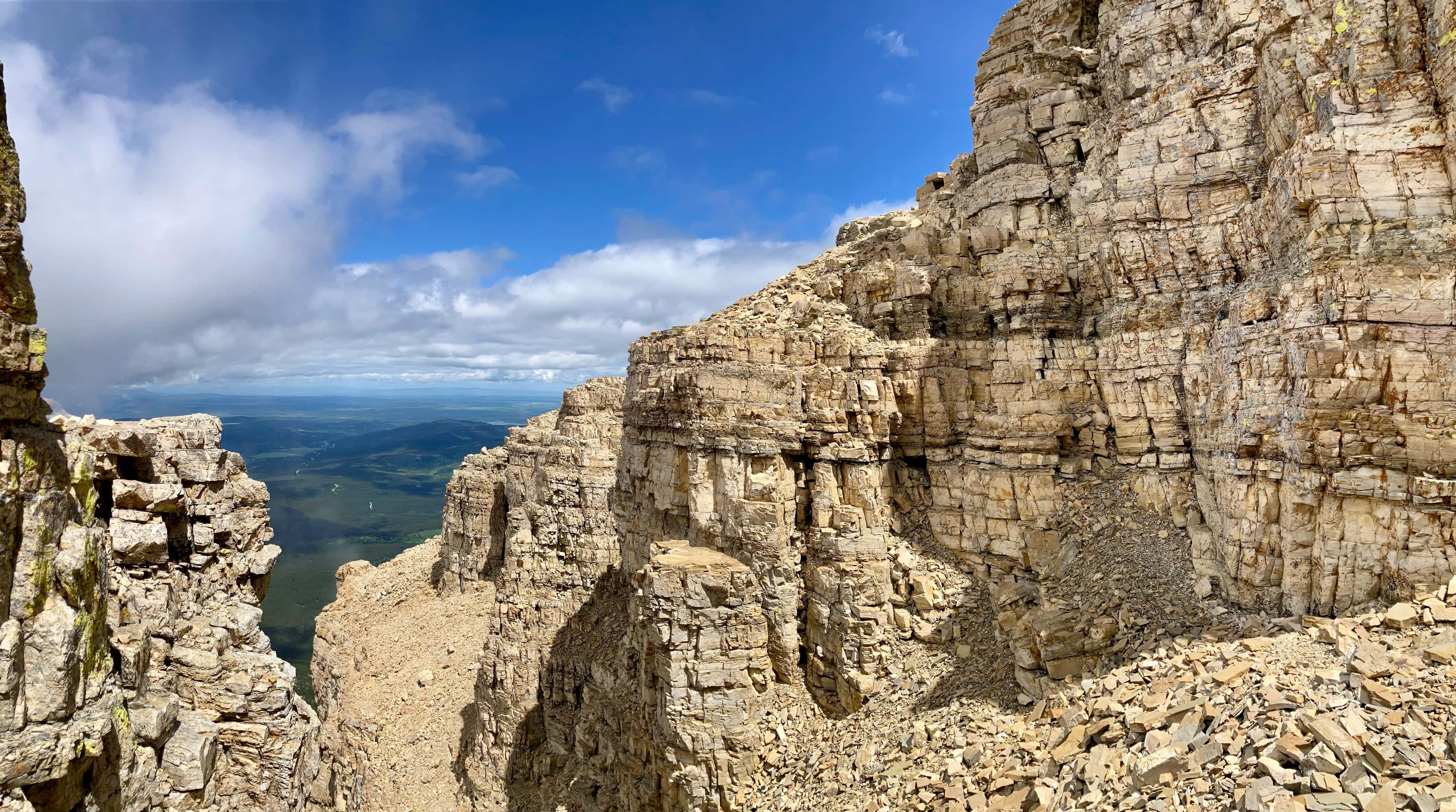
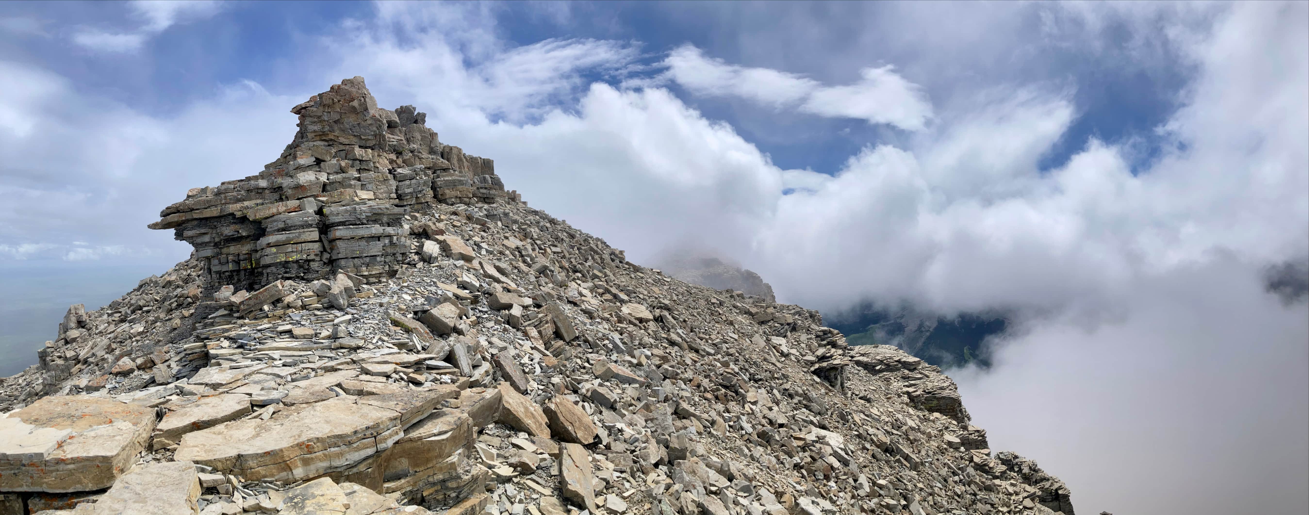
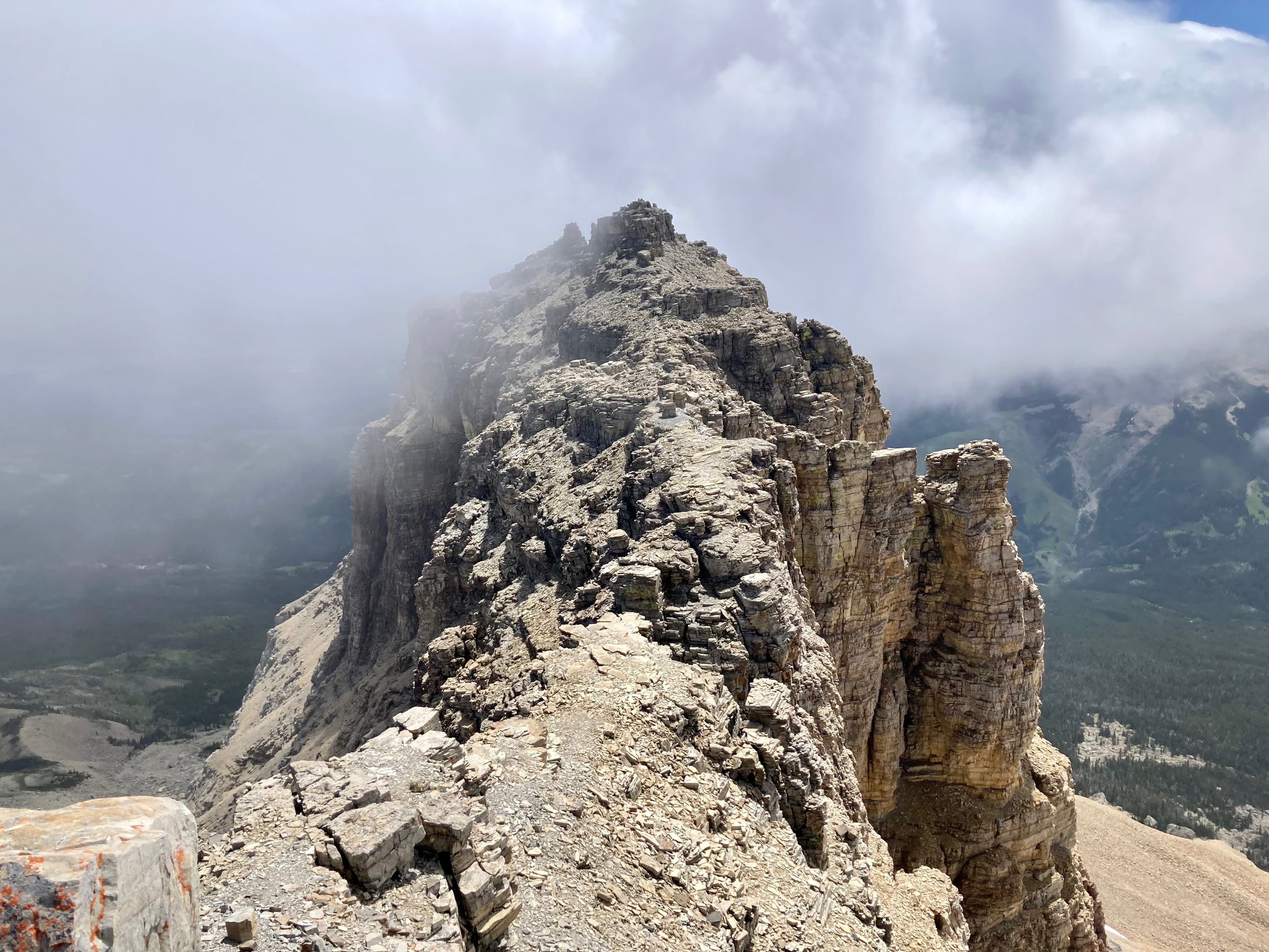
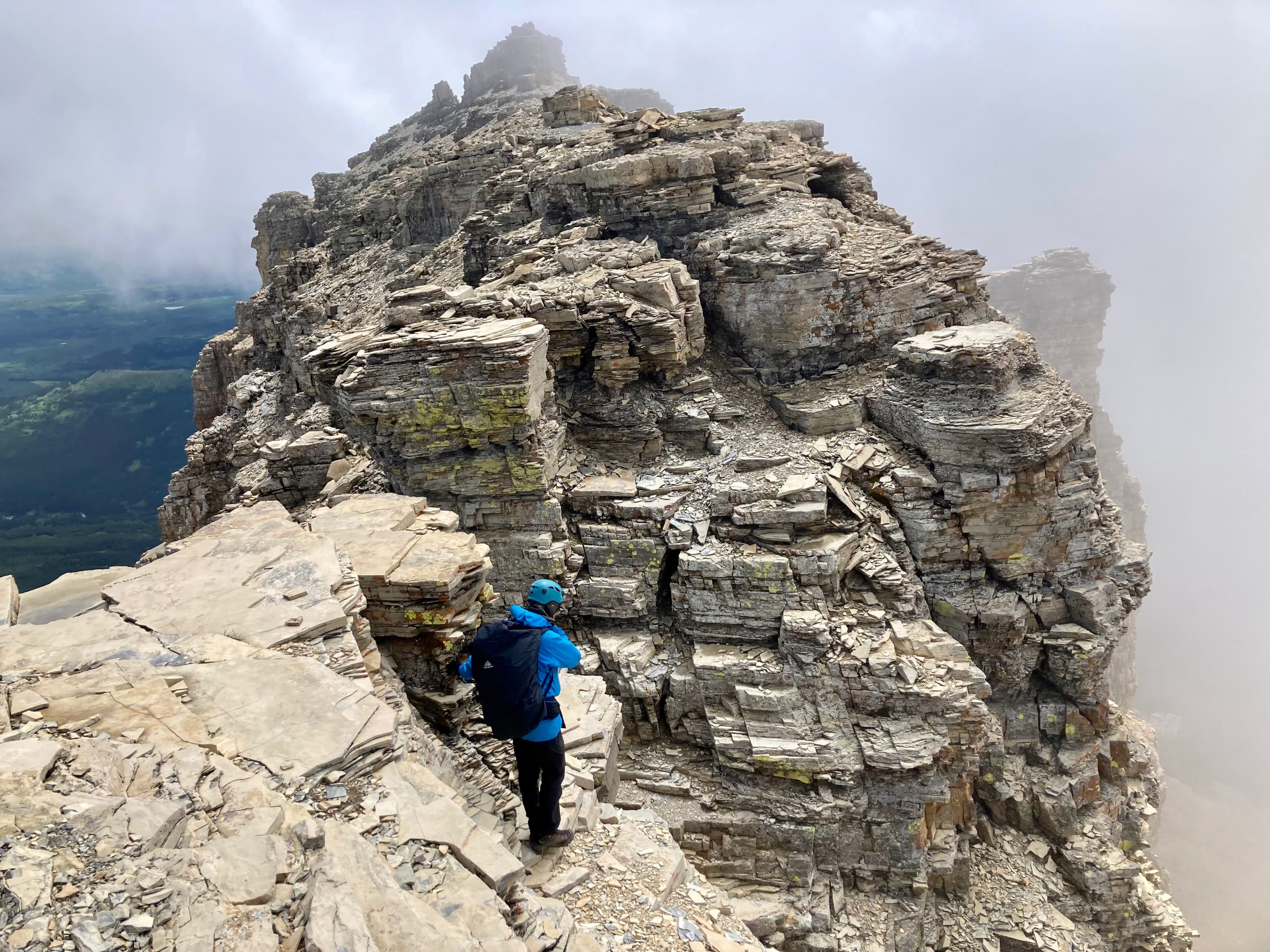
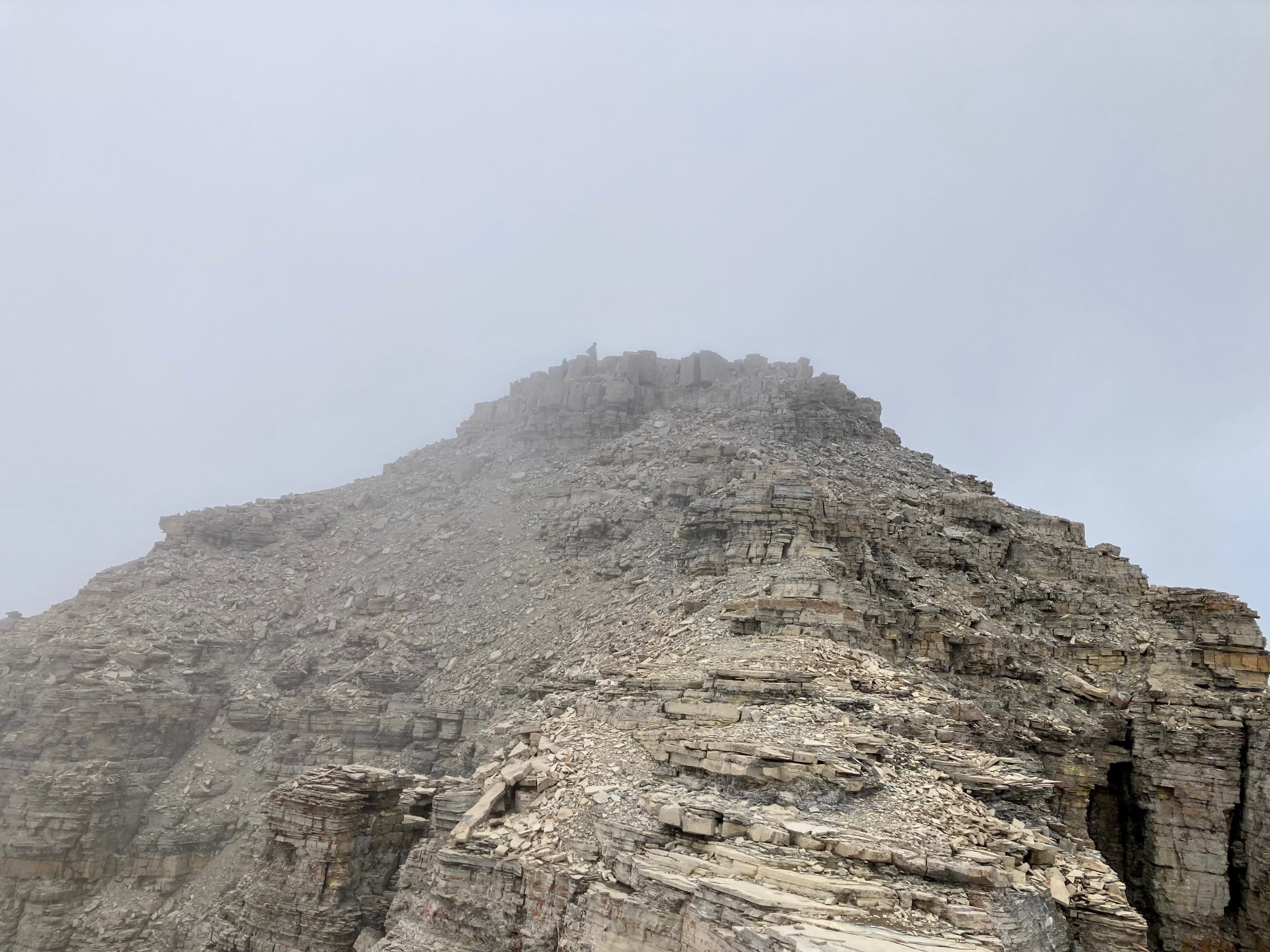
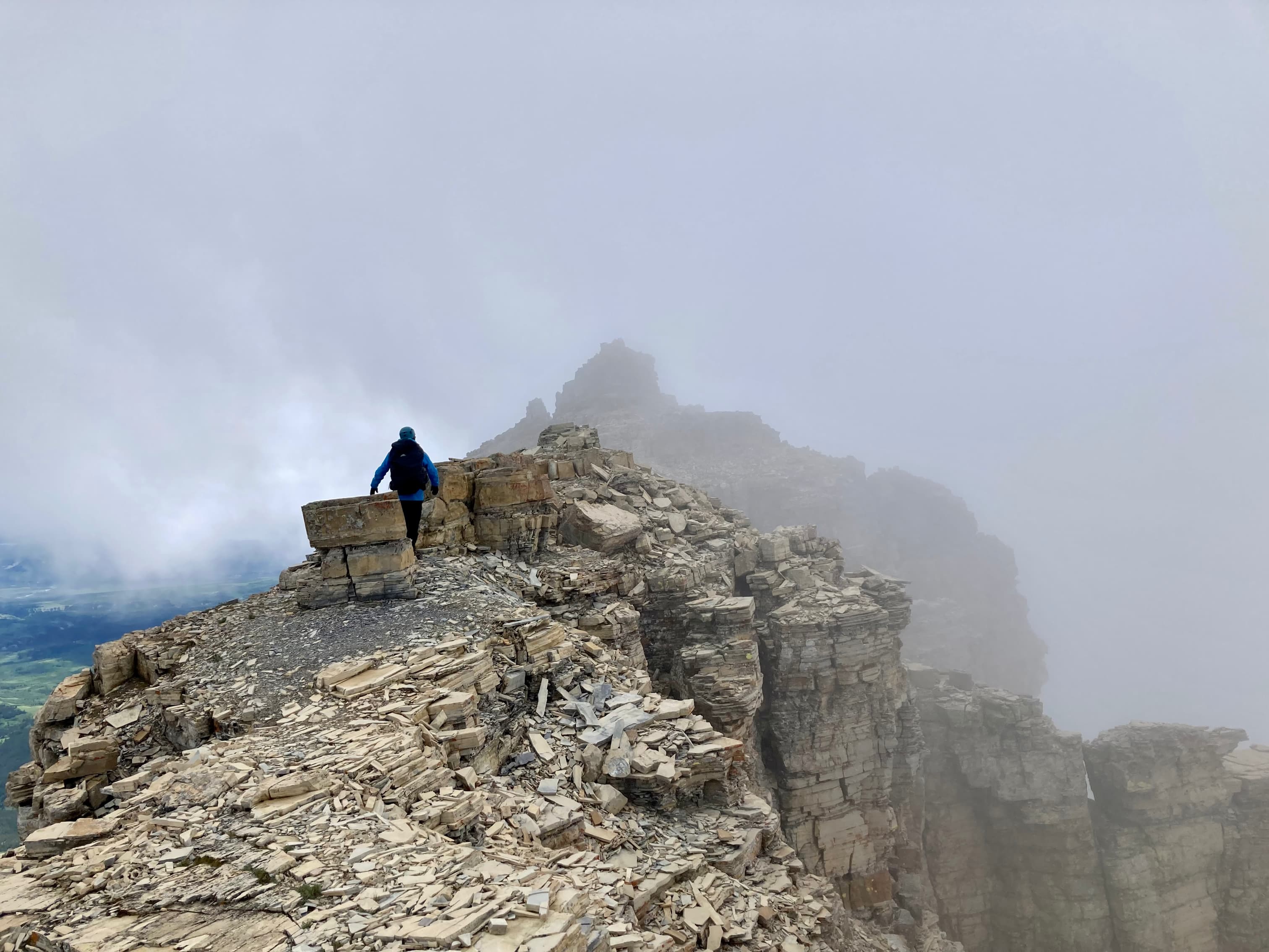
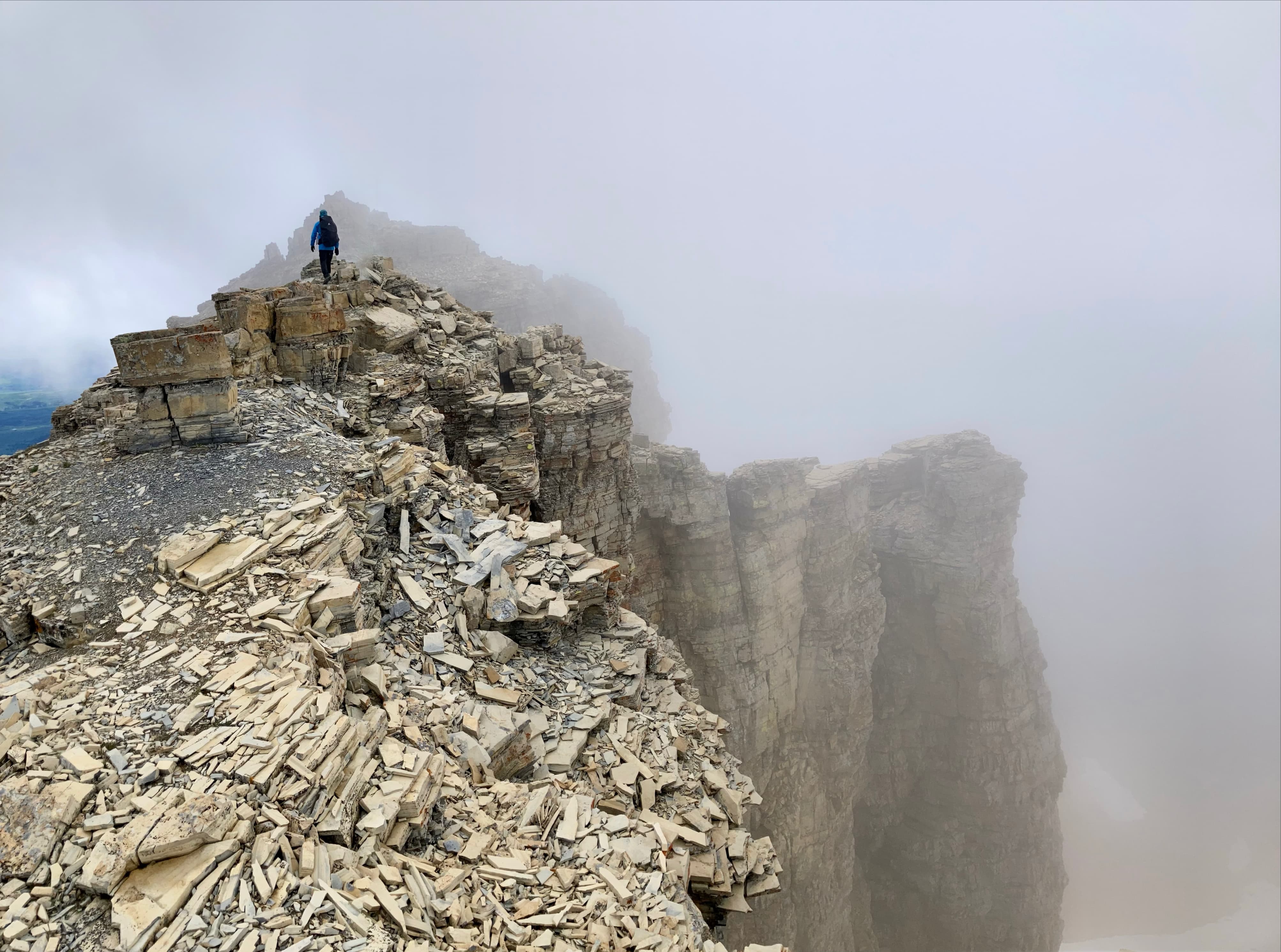
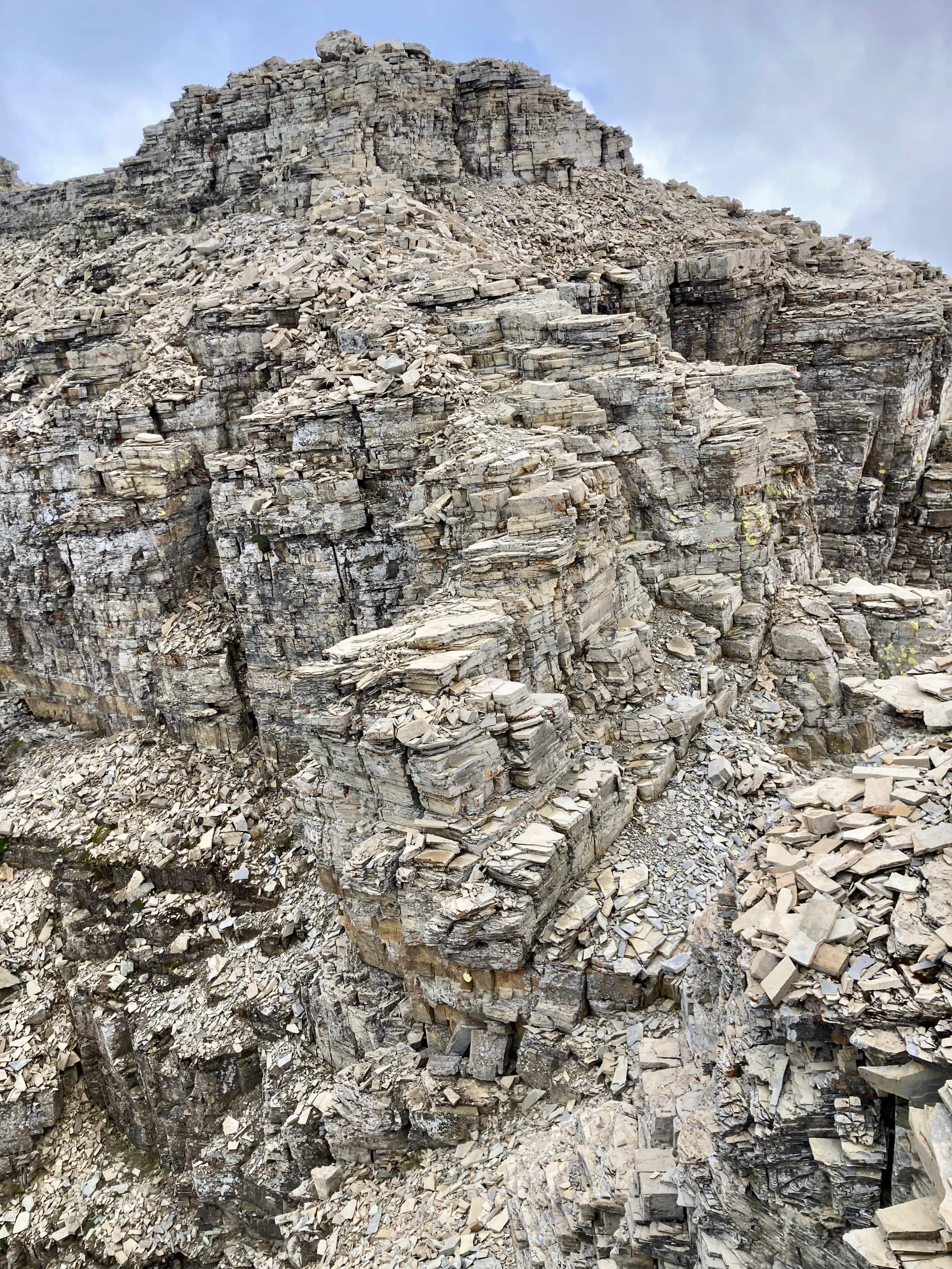
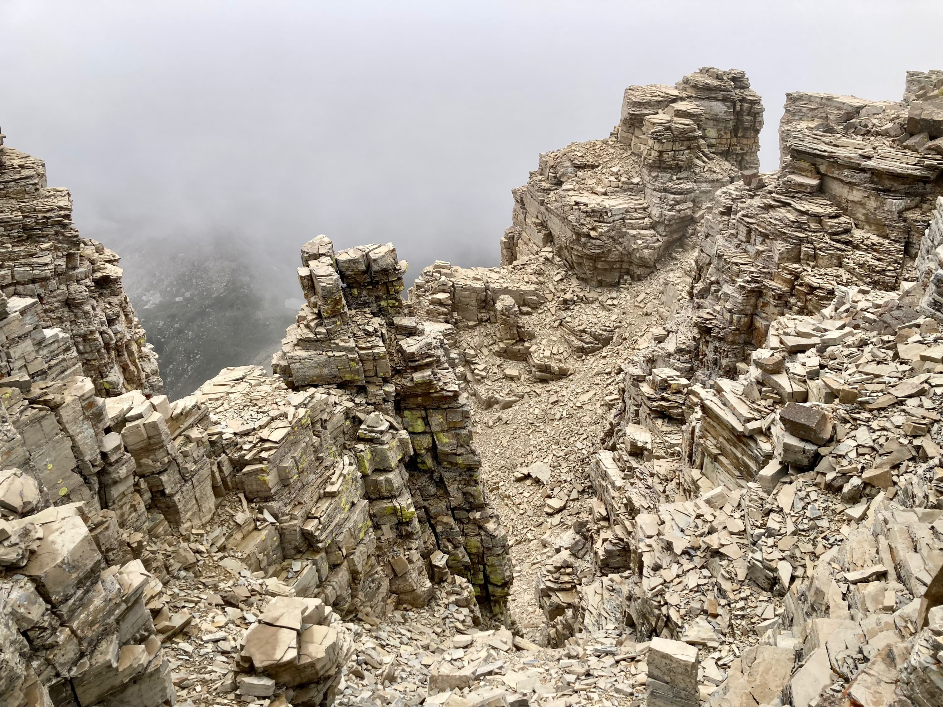
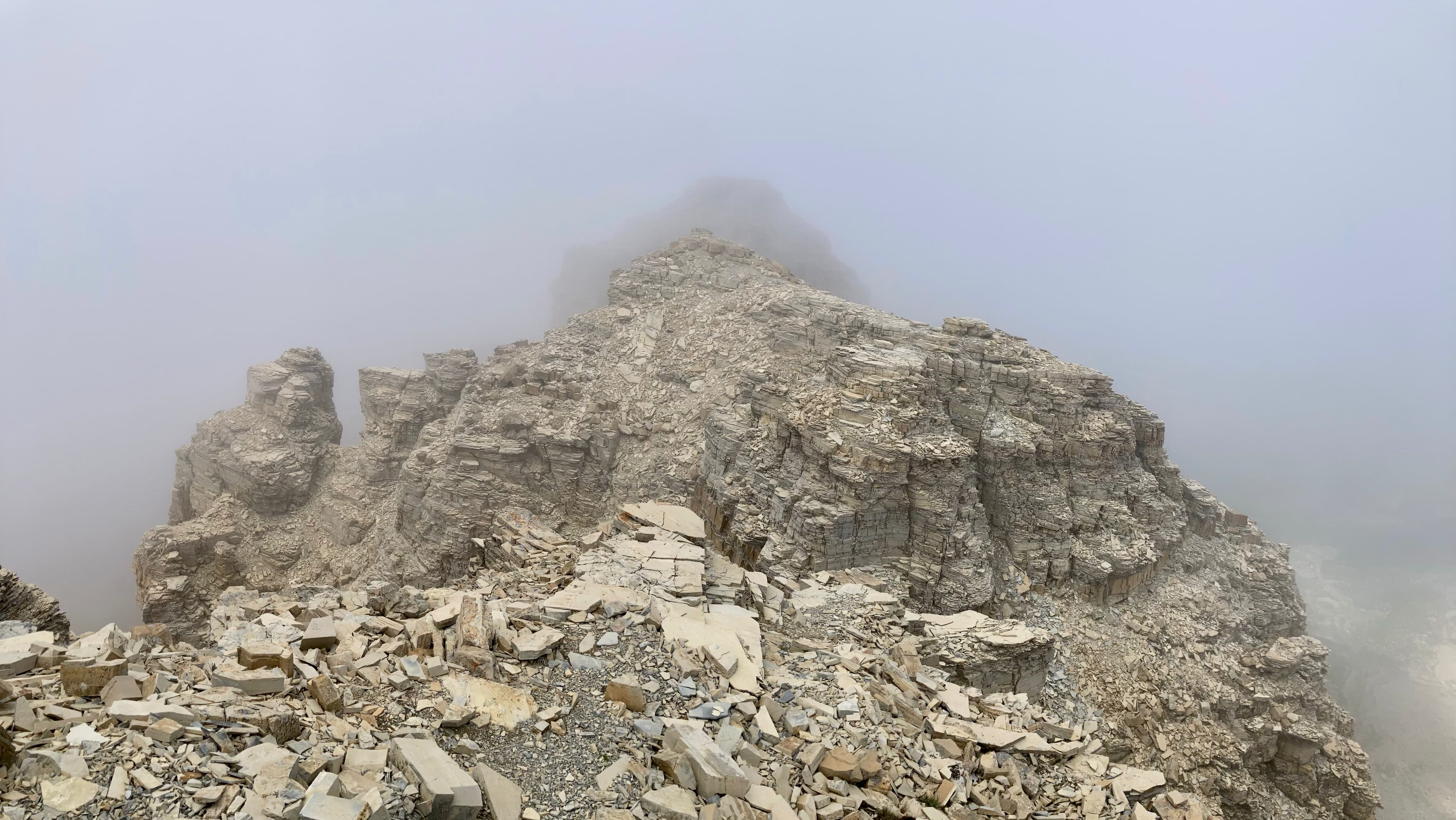
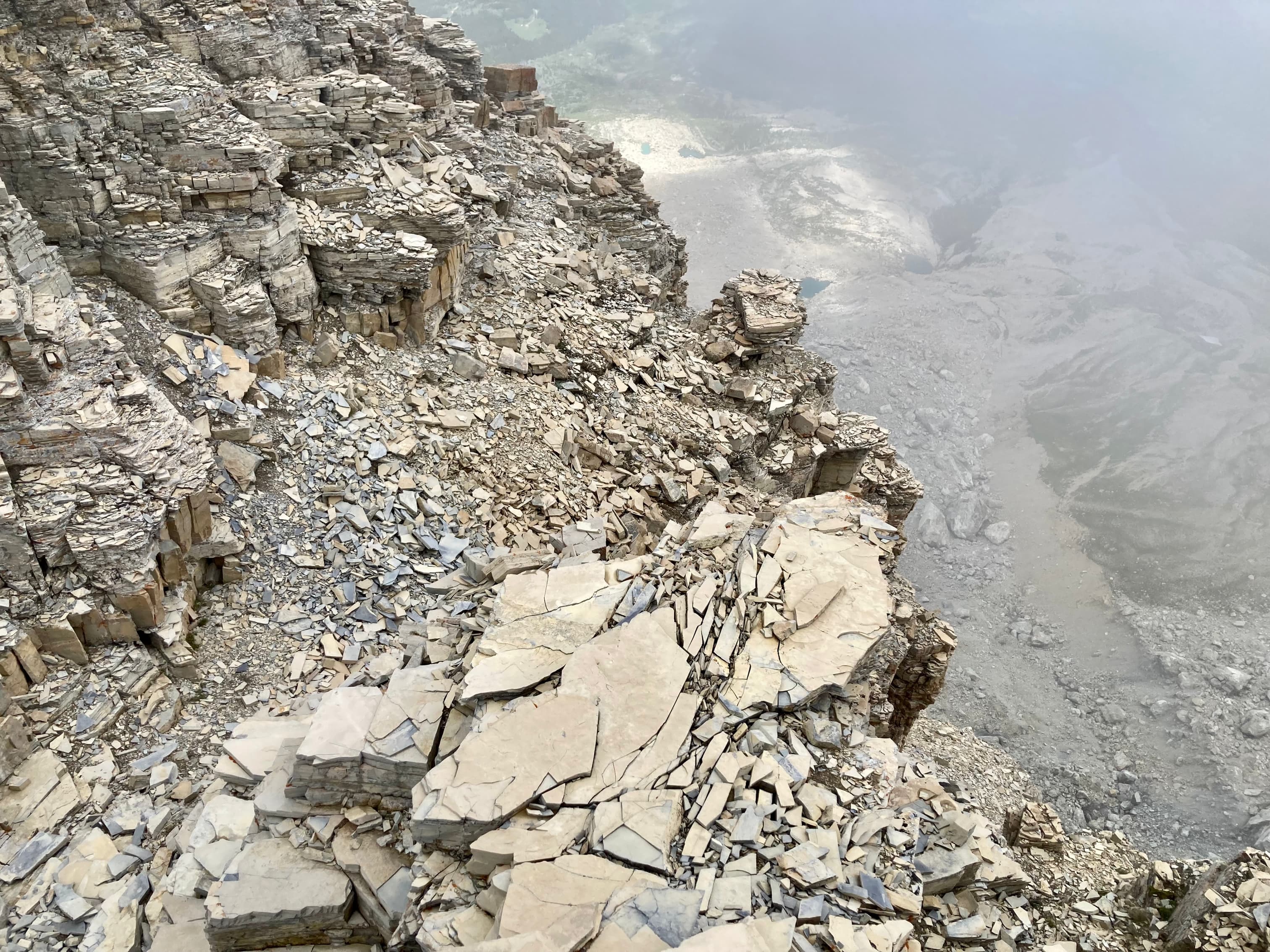
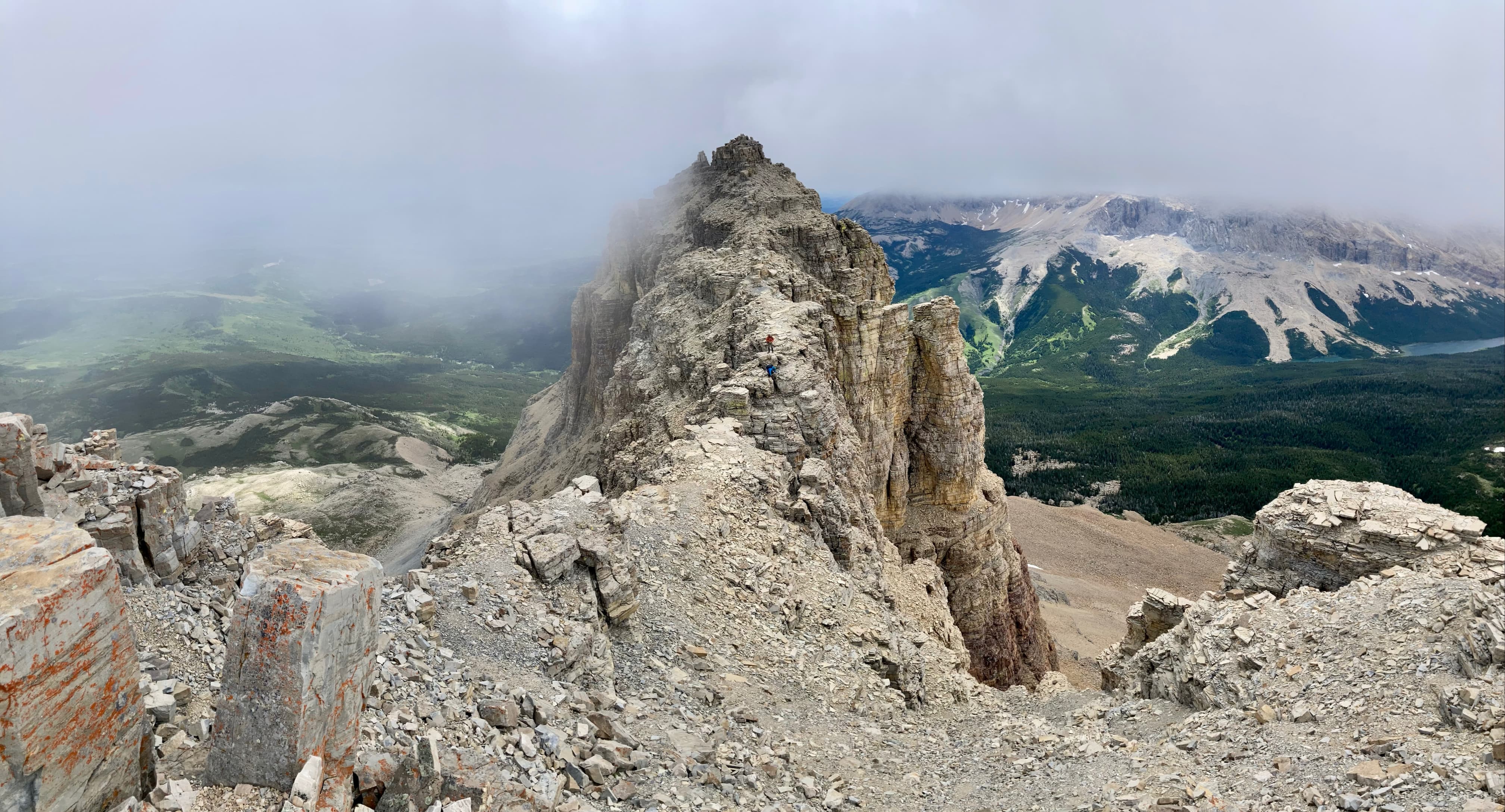
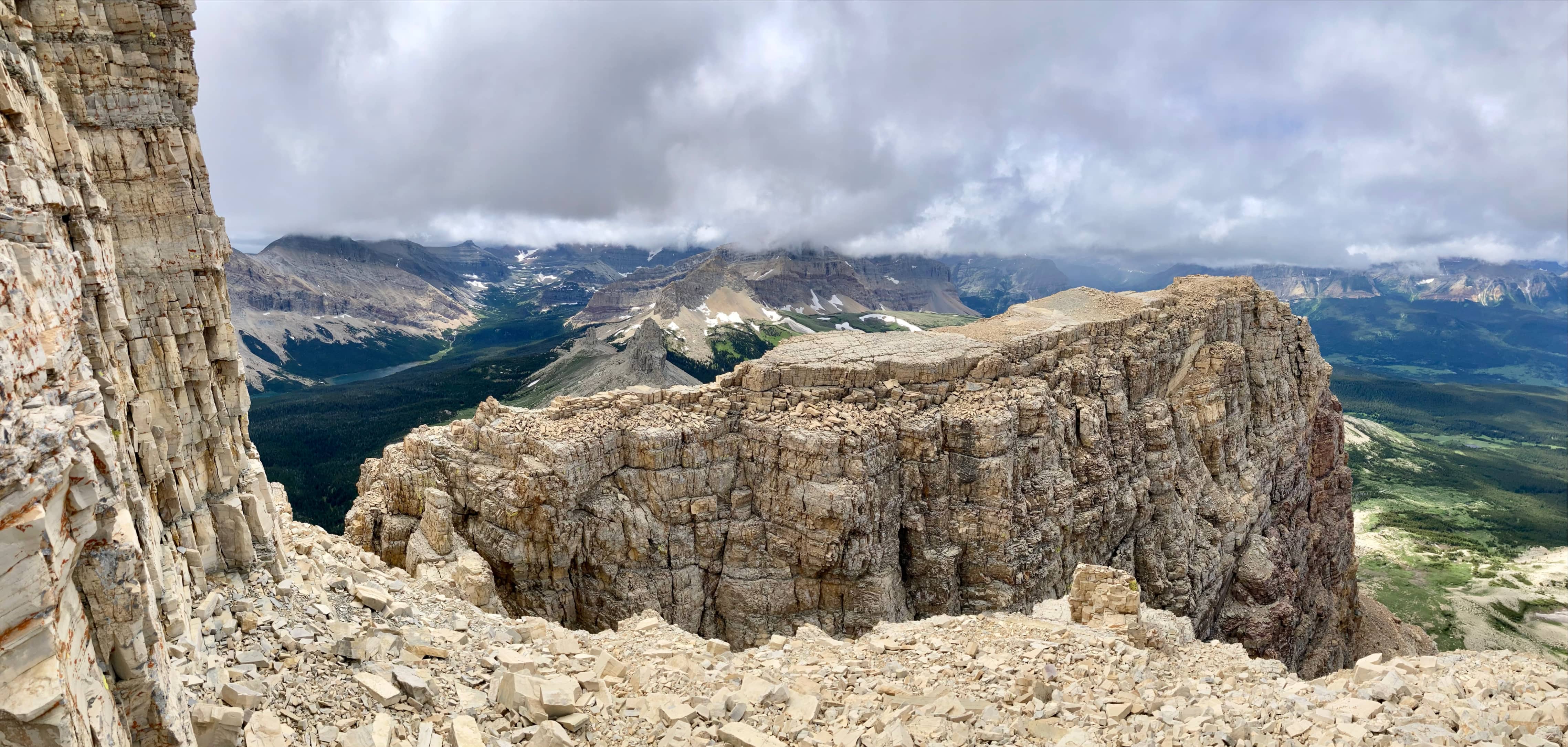
From the col, Ninastako’s southern aspect was in full view. Whereas the northern aspect is sheer cliffs, the south is a steep scree slope with cliffs at the top. Not visible from the col, there is a “notch” in the cliffs which allows access to the summit ridge. We made our way up and through the notch. Beyond the notch we ascended on pretty straightforward scrambling terrain until reaching a cleft through the summit ridge, with views and drop-offs to the north and south. We bore left here (north) and ascended a more scrambling terrain that brought us up out of the cleft and onto the summit ridge. The lower, west summit was easily reached and gave a clear view of the true summit a few hundred meters southeast.
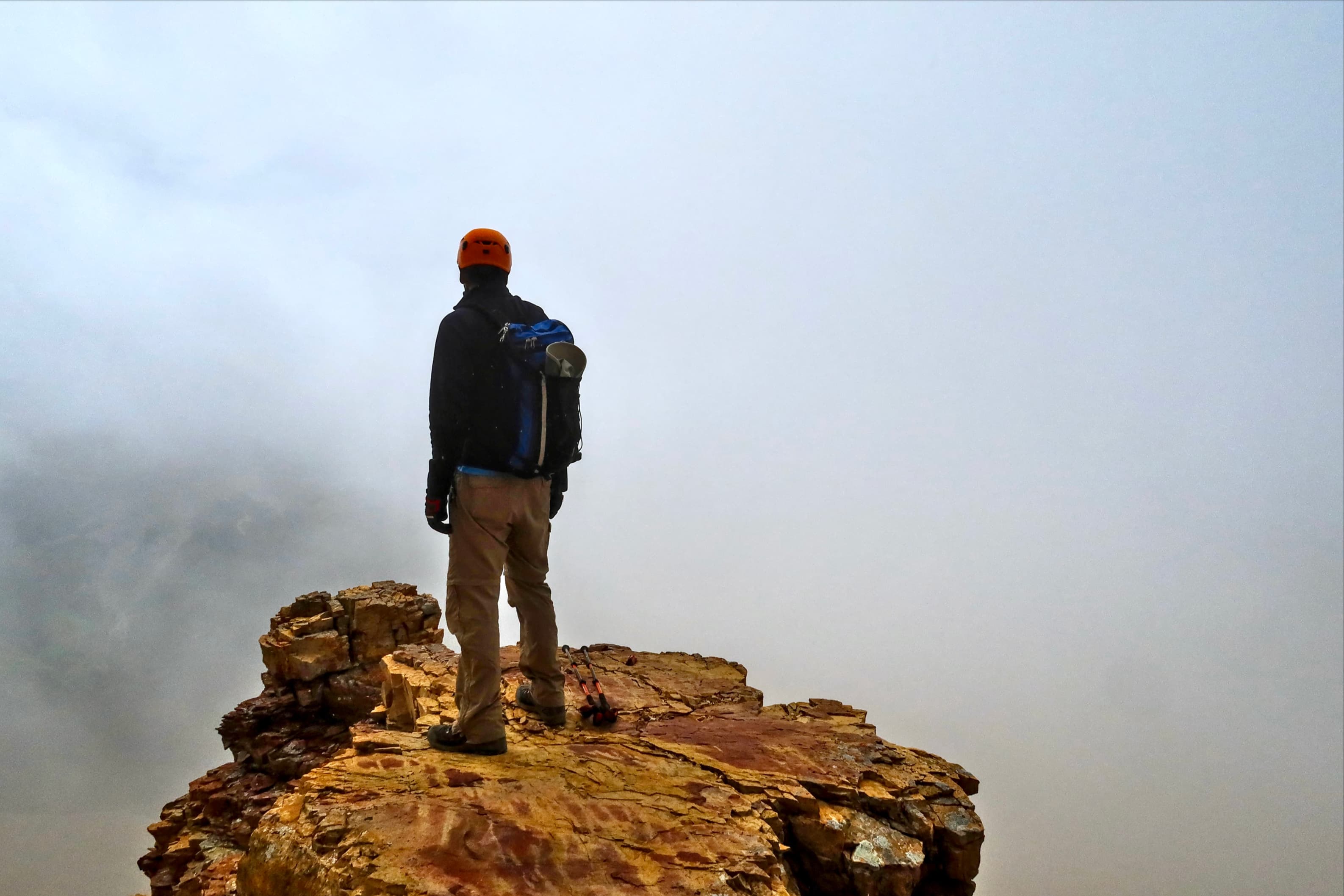
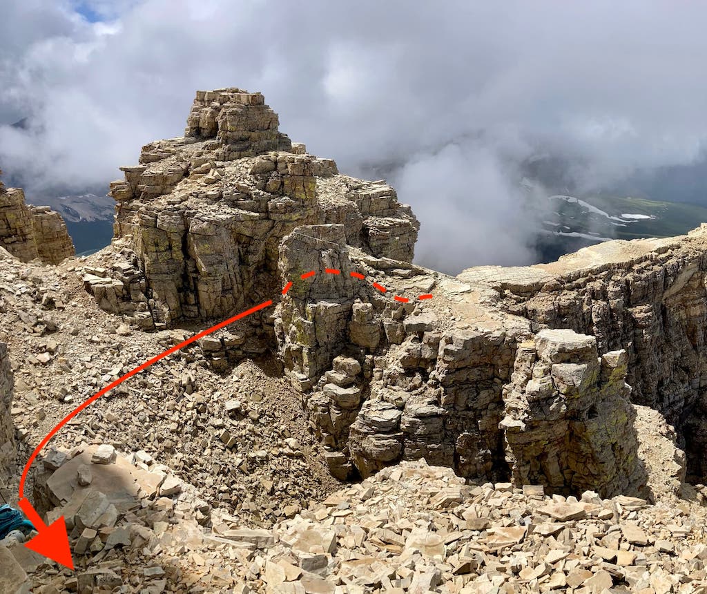
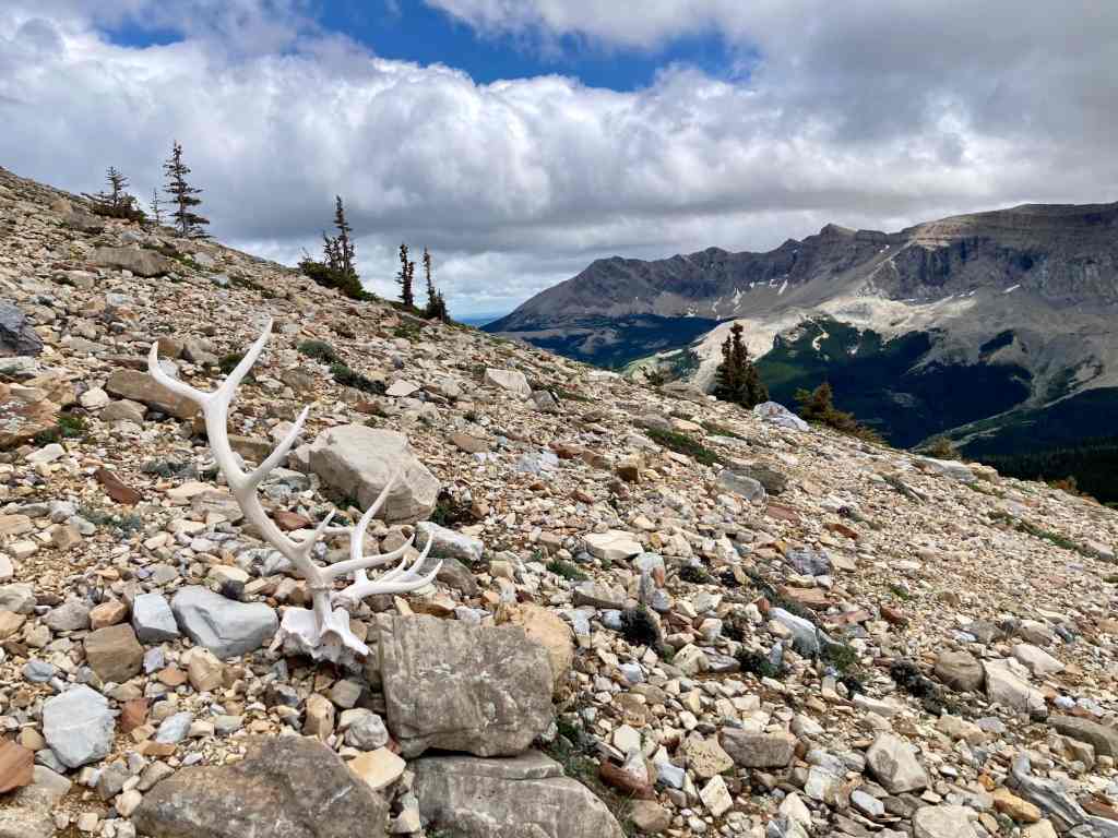
Making it to the true summit from the west summit involved two down-climbs, the first of which initially seemed quite daunting. However, a route became apparent after a bit of scouting revealed solid footholds just out of the initial field of view. The second down-climb was straightforward and we soon made our way to the summit block. I went around it to the left and found a place to climb up that required a bit of tricky scrambling, but no exposure. Bhaskar went around to the right and found a much easier way up. On the summit we discovered animal skulls and antlers, an eagle feather, and a horseshoe. Clearly, it is a sacred place and any items found should be left undisturbed.
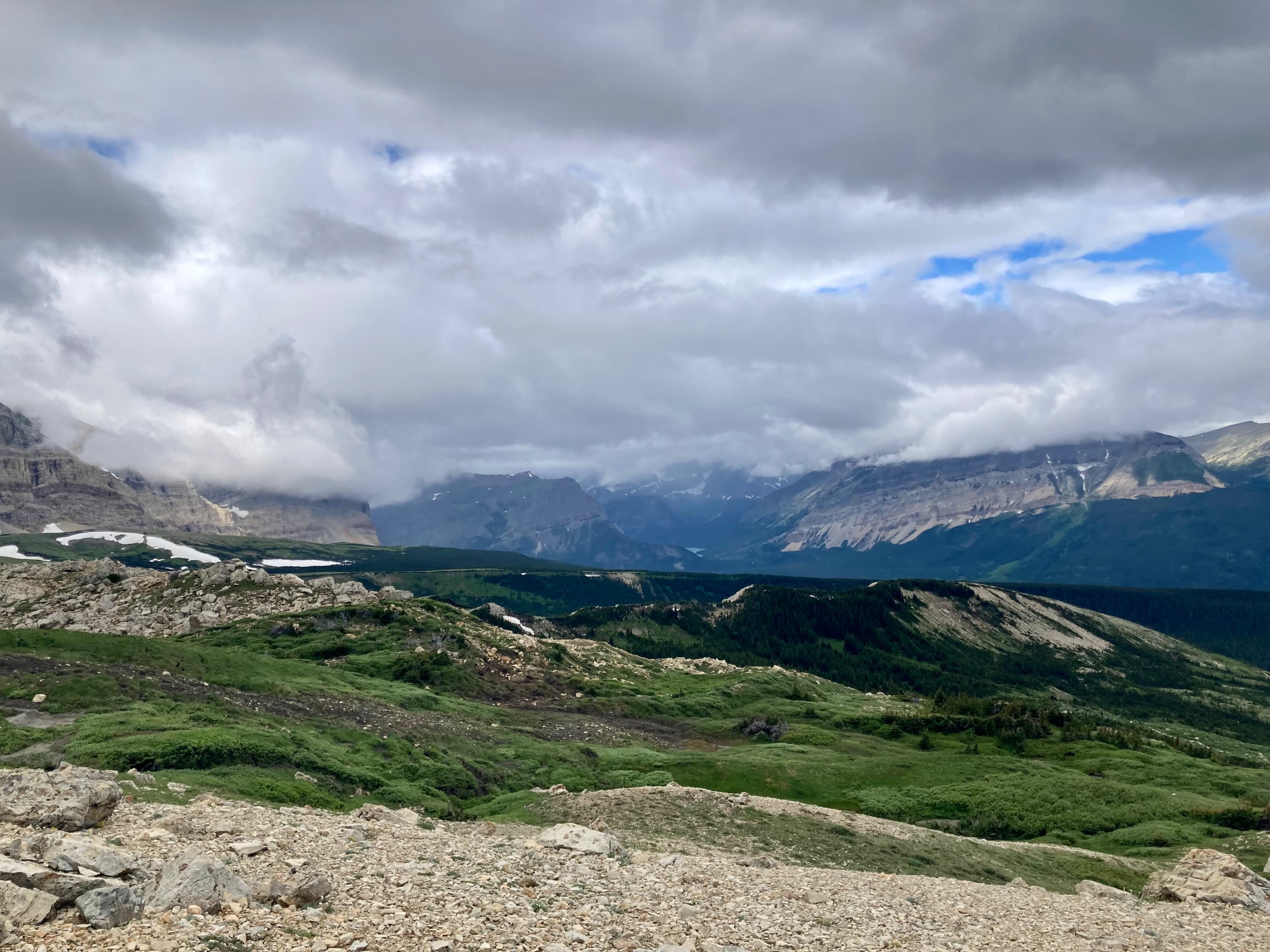
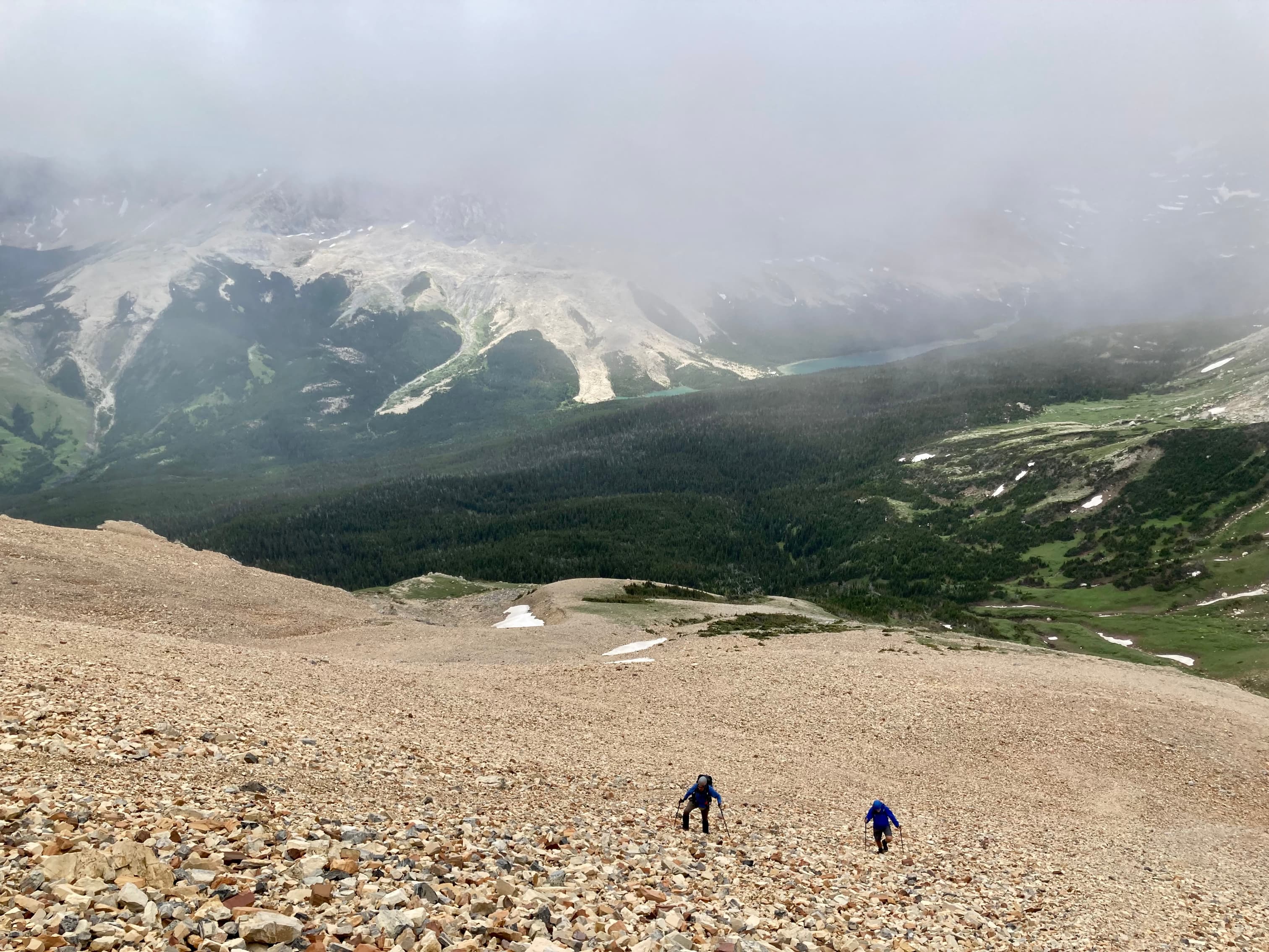
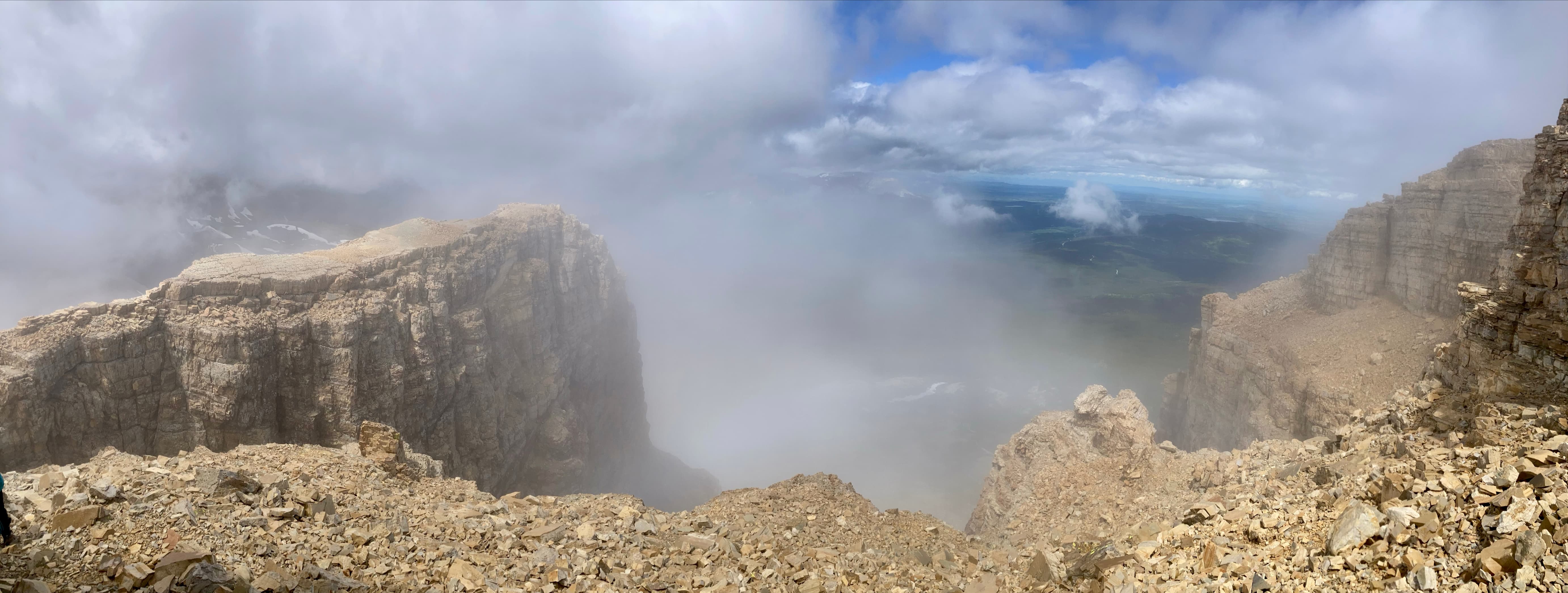
The weather had been unsettled throughout the day. Steady rain ended in the morning just before we set out, and through the rest of the day low clouds were moving through the area. Ninastako’s summit ridge was in the clouds most of the time we were on it. This meant that distant views were obstructed. However, the weather added to the numinous atmosphere on the the mountain itself. It certainly felt like we were somewhere sacred, the home of the Thunder Maker. After a short time at the top we returned along the same route.
Whenever the Thunder Maker smoked his pipe, he blew two whiffs upwards toward the sky, and then two whiffs towards the earth. After each whiff the thunder crashed. Finally the Thunder-bird spoke to my father, saying, ‘I am the Thunder Maker and my name is Many Drums. You have witnessed my great power and can now go in safety.’
From “The Old North Trail: Life, Legends & Religion of the Blackfeet Indians”, by Walter McClintock
Click on the pictures in the gallery below to access higher resolution images.
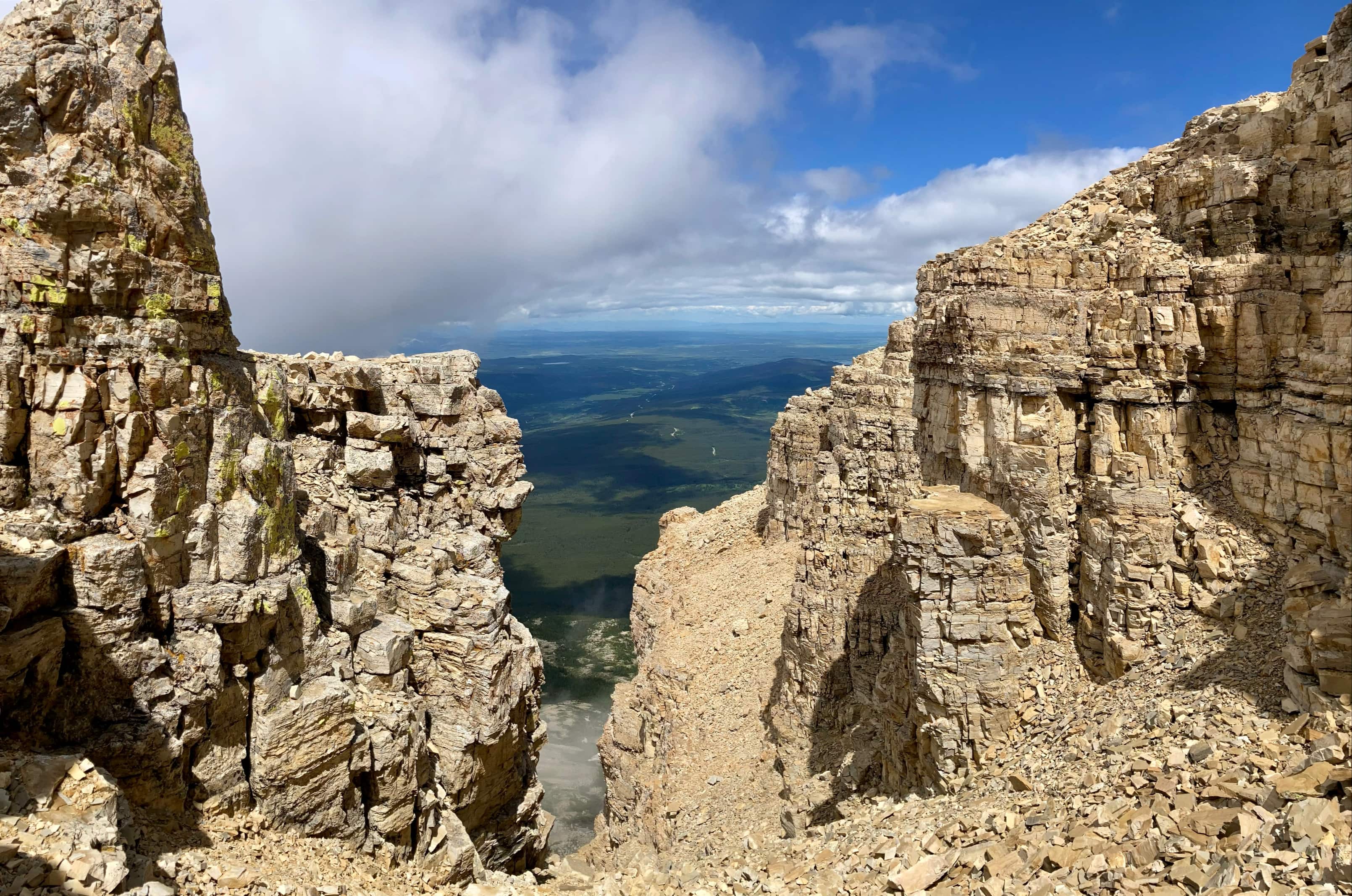
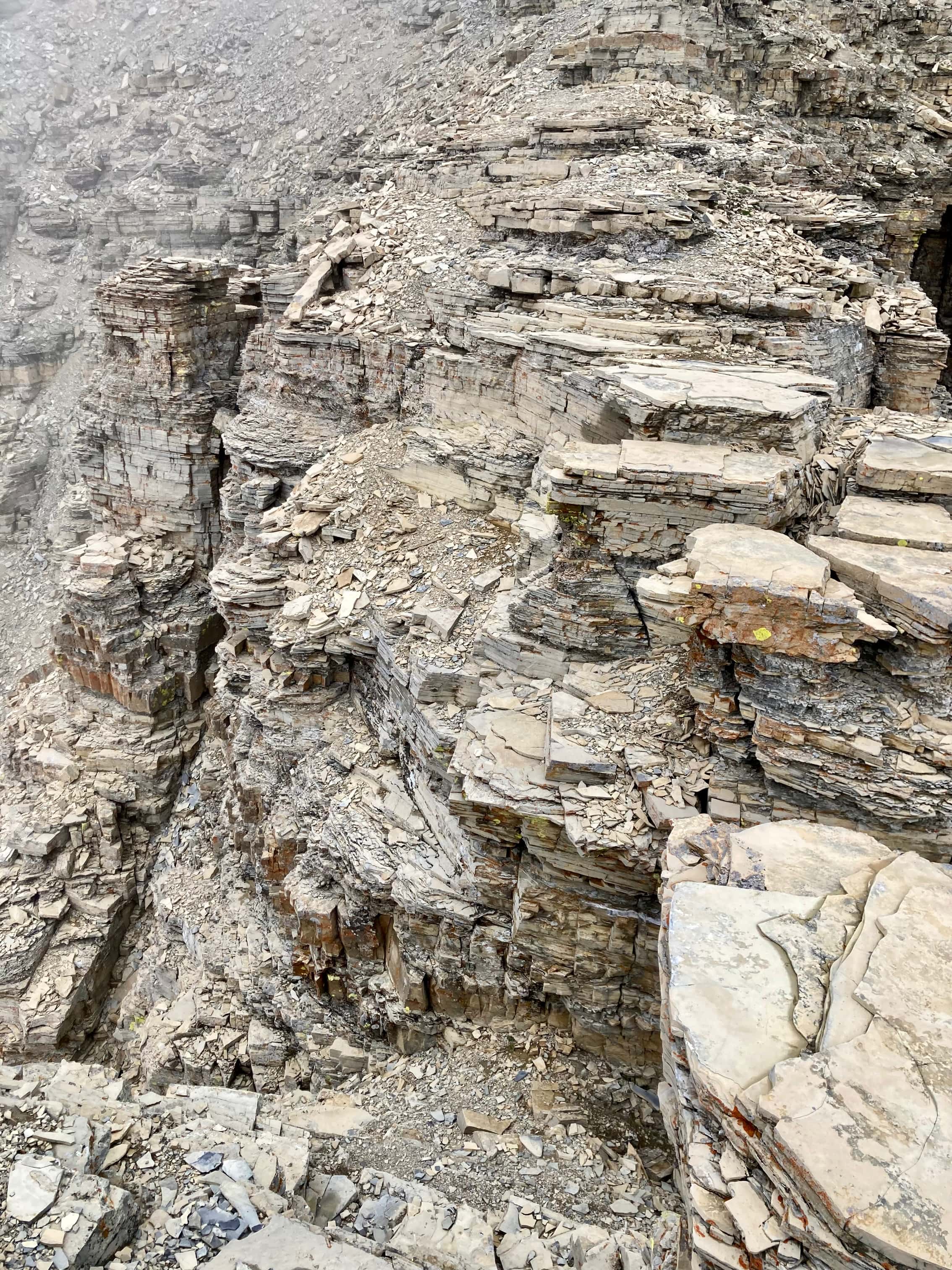
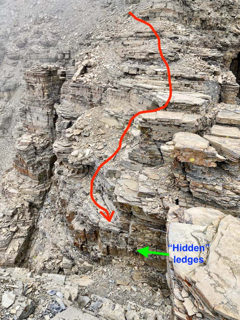
Route overview looking south, showing the initial hike from the parking area to the boulder field.Route overview looking north, showing the scree ascent from the col and the scramble onto the summit ridge.The initial view of Ninastako from the parking area.After following the short road out of the clearing to the northwest, we got on the obvious trail as it headed south towards the mountain.The trail entered an area of low shrubs with a couple of very narrow streams cutting through it, draining and feeding some ponds.Looking back at the area of the ponds.The rain had stopped earlier in the morning, but clouds continued to move through the area, their bottoms at roughly the level of the summit.The trail began to climb as we skirted the boulders and headed towards the mountain’s western aspect. A few patches of snow were still hanging on.As we made our way around the mountain, the rectangular character of the north-to-south profile became less apparent.A wider view from a little further along the trail. The trail continued to rise onto a bit of a shoulder.Looking north from the shoulder. Sofa Mountain is in the background near centre. Peaks in the Castle area are in the distance. Prairie Bluff is clearly visible.The low clouds obscured many of the peaks in Glacier.Following the trail beyond the shoulder, we got our first good view of Ninaki (centre) and the boulder field we’d end up crossing. From here, you can see that a fairly easy way to skirt around the boulder field would be to head right and follow the green patches where the boulders are sparse. On the ascent, though, I crossed straight through the boulders (and really enjoyed it). On the return I skirted around.Heading towards some of the bigger boulders.When I was navigating through the larger boulders I looked right and saw Bhaskar easily making his way around.As we got nearer the base of the western ridge, the mountain’s profile got noticeably more narrow. Note the hiker in the bottom-left quadrant of this pic to get an idea of the scale of the rocks.Looking back after crossing the boulders.At the foot of the western ridge. The south scree slopes were coming into view. We made our way to the col, basically straight ahead. The easiest route was to head right at it.Looking over at Ninaki and Gable Mountain.Nearing the col, getting a better look at the scree slopes and the cliffs above them.The party reaches the col.Beginning to ascend the scree. There was a bit of a trail visible. The notch which allows access to the summit ridge isn’t visible at first.As we ascended, we made our way towards the red cliffs near the centre of this picture. In particular, we focused on the red cliff that is diagonally down-sloping to the right. We headed to the bottom of that down-sloping wall.Taking a look back down towards the col.As we got higher and angled towards the bottom of the diagonal red rock wall, the notch came into view.Finally at the top of the scree and nearing the bottom of the diagonal red rock wall.Looking back from the top of the scree.Hooking around the base of the red rock wall and ascending step-like terrain.Not the best footing, but there’s no exposure. The top of the red rocks to the left formed a nice wide platform which was a good place to rest.Me, up on the red rock platform. Photo courtesy of Bhaskar Bhowmik.Another pic from Bhaskar. A good hiking buddy takes pictures that make you look cooler than you actually are.Moving on to the notch.More clouds coming up against the cliffs to the right.Ascending through the notch.Once through the notch we followed the rock face, heading right, then ascended some more.Looking back down towards the notchAbove the notch, but not yet on the summit ridge. We were now on the northern aspect of the mountain.Continuing on, we went through this area and ahead could see a rocky gully. This is a north-south cleft through the mountain adjacent to the summit ridge.In the cleft looking south. Don’t go that way.In the cleft looking north. There’s plenty of set-back from the fall at the bottom of the gully. From here, we ascended the rocks at the right of this frame. It looks tricker than it actually is.A wider view. We went directly across the gully to the rock face at the right of this frame, then followed it left and scrambled up.A pic from the end of the day when we were climbing down that part, showing the path we took.Looking back from the top of the scramble with the path sketched out.A wider, higher res view showing the north and south ends of the cleft. A faint rainbow is in the lower right corner.Making our way to the summit ridge, we were at the top of the north-facing cliffs. Another rainbow was in view (left of frame). The ponds we passed between on our approach or the grey-ish pools to the left of the boulder fields. This was our first good look at the brilliant blue tarns within the boulder fields.Now on the summit ridge, approaching the west summit.The very inviting west summit, with plenty of flat terrain to take a break on. Half our party made this their final objective and enjoyed a rest while 3 of us continued on to the true summit.Looking towards the true summit as it emerged from the clouds. We followed the ridge and had to deal with two down-climbs. The first one was kind of tricky, the second one was not.At the first down-climb. This was tricky because the angle of your view as you descend makes it hard to see what is at the bottom of this depression, and whether there are any good places to put your feet. You end up having to descend and then lean outward, allowing you to see that you’re not over a yawning abyss, and that there are some small but solid ledges that can be your footholds allowing you to descend.The view from the other side of the down-climb. Note that there are drop-offs to either side of the bottom of the descent.A sketch illustrating the way down. At the end of the arrow, you need to lean outward to see the ledges and the bottom of the gully.Looking back at the western summit from beyond the first down-climb.The expert scrambler known as Jagermeister leads us onward.We soon reached the 2nd down-climb. It was very straightforward to descend.Looking back from beyond the 2nd down-climb.Some rocky scenery south of the summit ridge.Carrying on, I approached the summit block and went around to the left (north). This shot is from next to the summit block, looking beyond it to an adjacent rocky pinnacle. I turned right and ascended here.I climbed up here. It was a little tricky, but not exposed. Bhaskar went around to the other side of the summit block and found a much easier spot to ascent.The summit of Ninastako. It wasn’t a day for sprawling summit panoramas, but I think the weather enhanced my experience. It was only fitting that Thunder-bird’s domain was wrapped in clouds.The western summit was only barely visible as clouds continued to envelop the top of the mountain.Making my way back to the western summit.A very dramatic drop to the right as I returned.Ninastako’s north face. Dramatic cliffs I’d been staring at from afar for most of my life.Back at the 1st down-climb.Back at the west summit, looking at Ninaki.A closer look at Ninaki.Looking back at the summit.Heading back down. The clouds were breaking up.Back through the notch.Descending the scree back to the col. On the col. The clouds were breaking up. Conditions were lovely as we walked out.“We call the thunder Isis-a-kummi – Thunder-bird. We believe that it is a supernatural person. When he leaves his lodge to go through the heavens with the storm-clouds, he takes the form of a great bird with many colours, like the rainbow, and with long green claws. The lightning is the trail of the Thunder-bird.” From The Old North Trail:Life, Legends & Religion of the Blackfeet Indians by Walter McClintock.


That was a really great post! Also, the view from west summit towards Ninaki is really nice!
Thanks for sharing.
LikeLiked by 1 person
Thanks for reading, Olympus!
LikeLiked by 1 person
Great post Par.
LikeLiked by 1 person