May 3, 2021. A visit to Turtle Mountain’s less popular neighbour.
- Region: Crowsnest Pass. Traditional territory of the Blackfoot, Tsuu T’ina and Ktunaxa First Nations
- Distance: 6 km round-trip
- Total Ascent: 690 m
- Elevation of Objective: 2164 m
- Total Time: 3h 19m
- Safety and Disclaimer

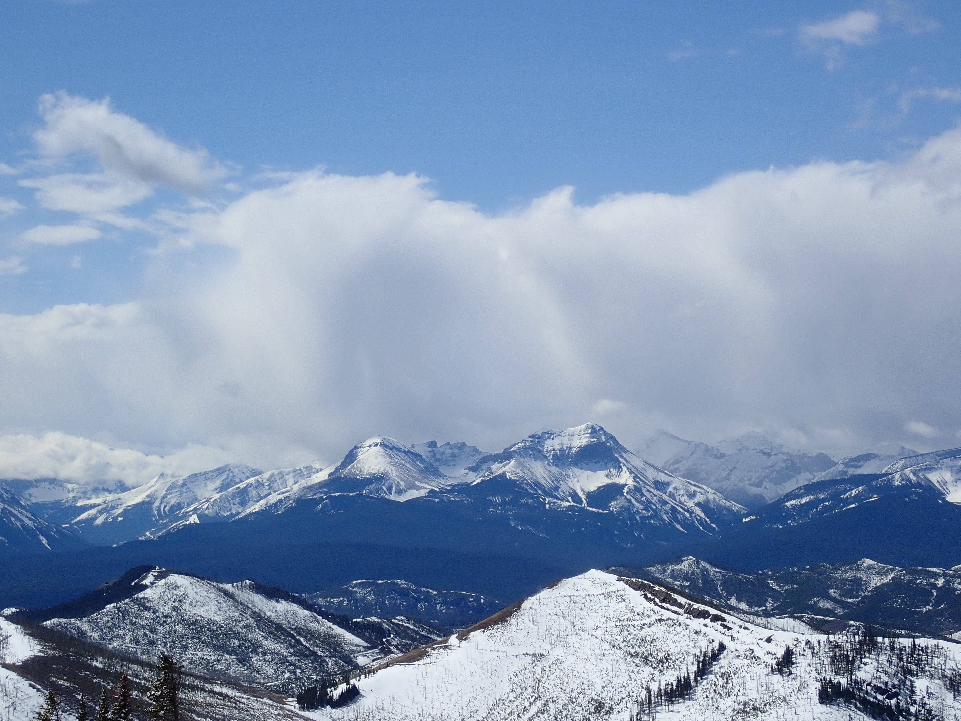
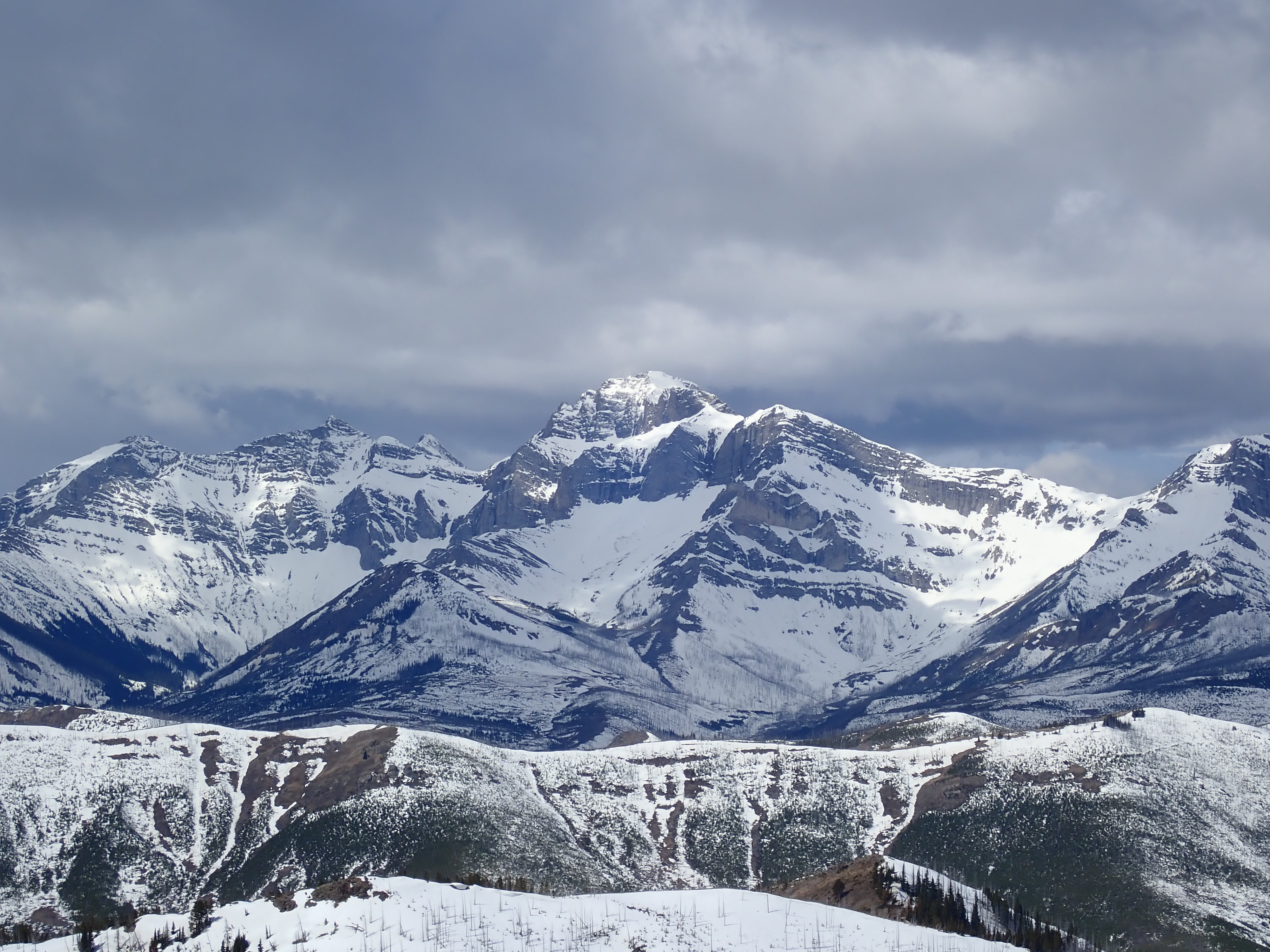
Hillcrest Mountain is featured in Nugara’s More Scrambles in the Canadian Rockies, as well as in his new (2021) Popular Day Hikes: The Castle and Crowsnest. It’s a trip that is mostly a steep hike to a short ridge walk, but it qualifies as a scramble since it’s almost all off-trail movement to reach a summit, and because there’s a short section of hands-on scrambling just before the summit ridge. I decided to climb it on a reasonably calm morning when there was unsettled weather incoming. This made for sky conditions that were almost as interesting as the mountains. The initial ascent through deadfall and brush was uninspiring, but once I was above that area I had an enjoyable day.
Access is via Adanac Road. East of Bellevue on Hwy 3, there’s a marked turn-off to East Hillcrest. Turn here and follow East Hillcrest Drive southwest, across the river, and follow the bend as it turns northwest. Beyond the bend, about 500-600 meters, there’s a sharp left onto Adanac Road. Follow this gravel road 5.4 km and look for a clearing to the right where you can park. Ask Google Maps to drop a pin at 49.523472, -114.393277. Or click here.
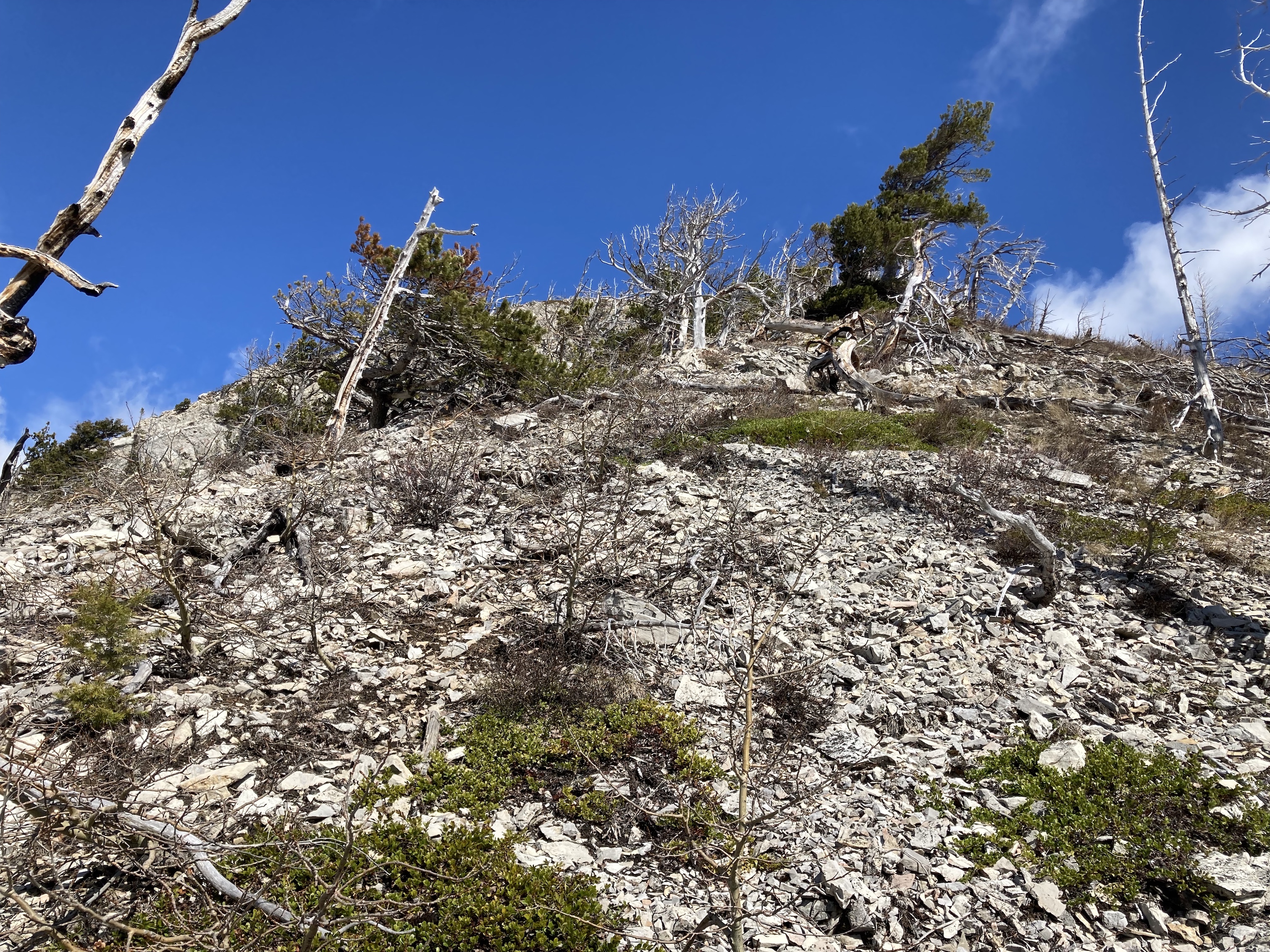
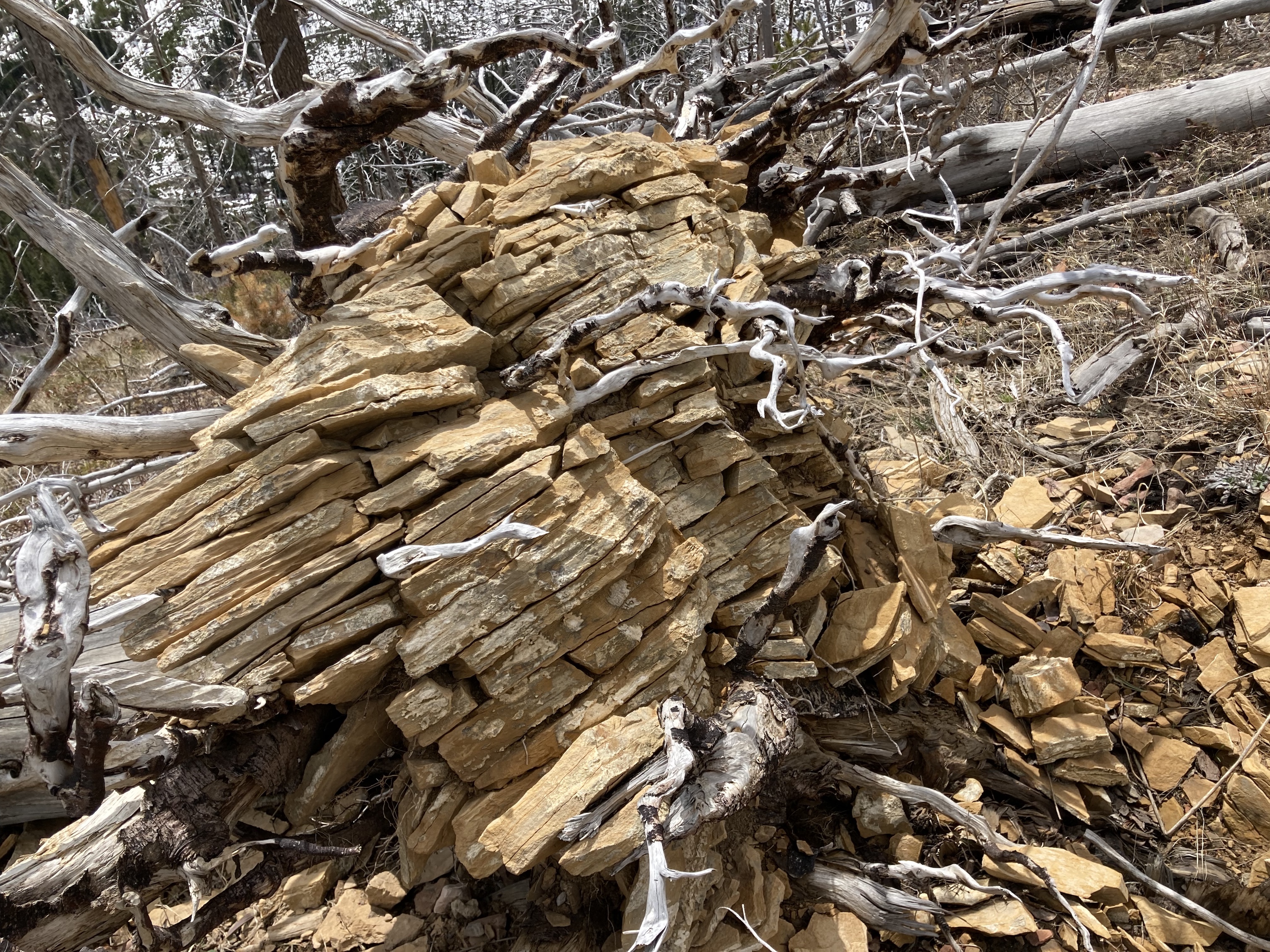
Beyond the parking area, there’s a big obvious dirt and gravel road that zig-zags a short way northwest into the woods and joins a marked ATV trail. I followed this trail northwest towards the base of Hillcrest Mountain. At about 1 km the trail reaches the base of the mountain’s rounded southern ridge. I left the trail at this point, climbing up onto the southern slopes. Down low the ground is choked with deadfall – what remains of the trees engulfed in the 2003 forest fire which swept through this area. Navigating over and around all this while on a steep slope (especially when coming down) was the main difficulty of this trip.
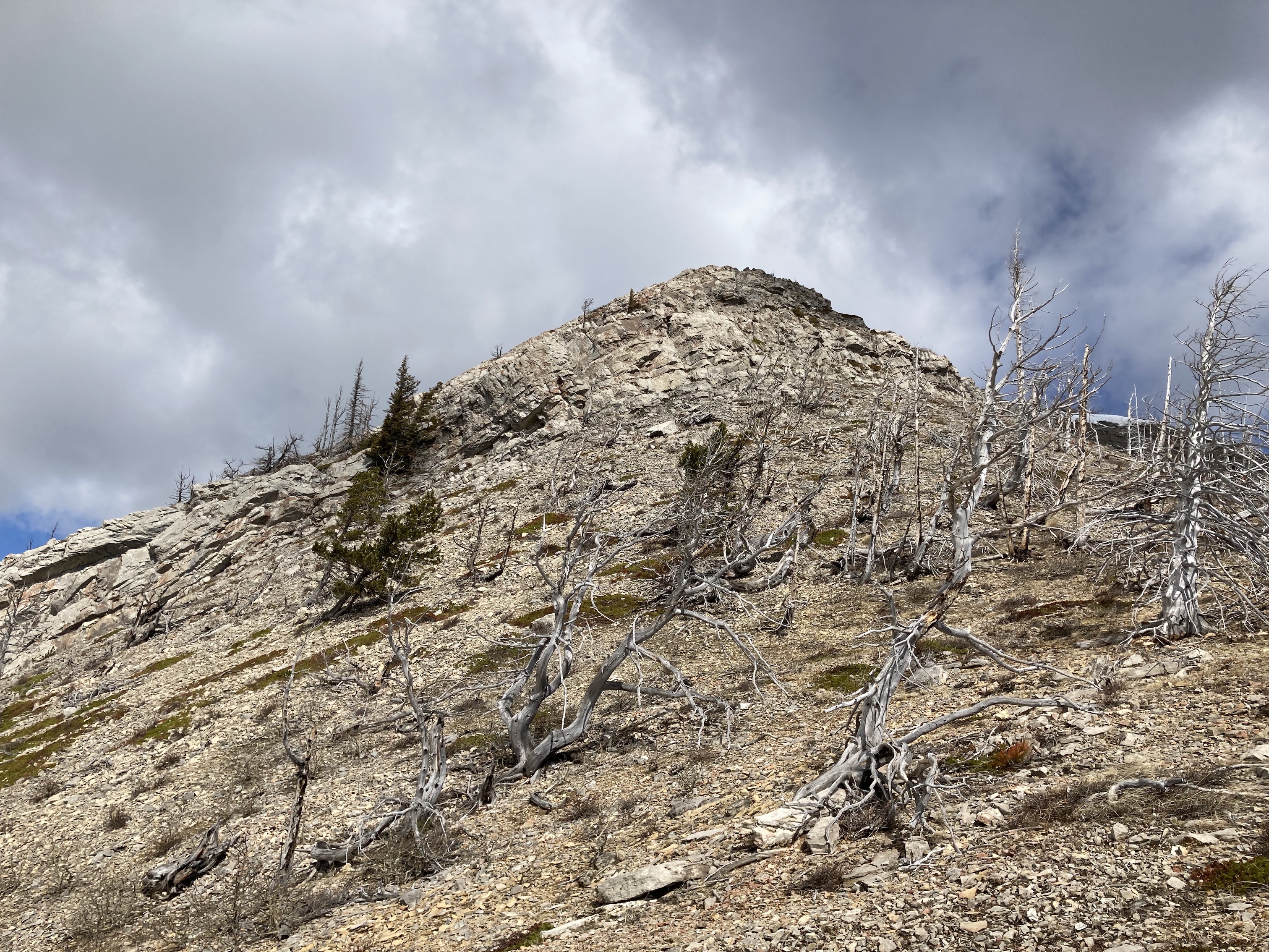
Luckily the unpleasantness doesn’t last. I made my way up, aiming to go to the left of the first area of exposed rock. Above there the terrain got a little more open and rocky. Continuing upward I eventually reached a rock band. This allowed for some enjoyable but short lived hands-on scrambling. Above the rock band, I followed the open ridge to the summit cairn. The ascent took me about 1h 36m moving at a steady pace.
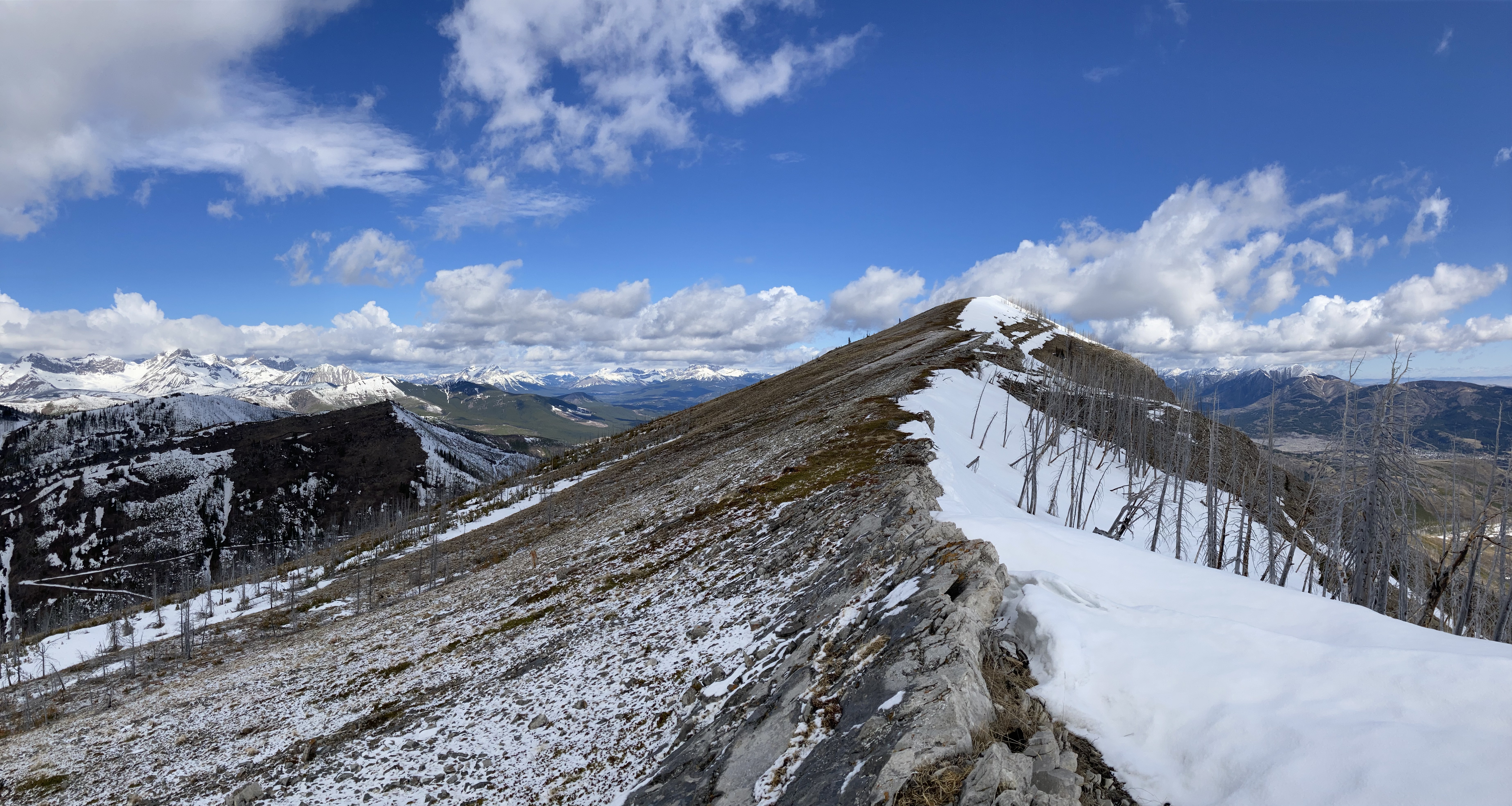
The views were quite satisfying. I started getting glimpses of the Flathead Range shortly before reaching the rock band, and once above that point there were expansive views of mountains stretching across the entire western horizon. Crowsnest Mountain, Turtle Mountain, and the Livingstone Range were visible to the north.
This was a worthwhile outing, though it’s probably one to do only if you’ve already gone up Turtle Mountain a couple of times and want something different. It’s also suitable for shoulder-season trips.
Bob Spirko’s trip report is from 2007, and it’s worth checking out to see how different the burned forest looked back then as opposed to now. Over time more trees are falling over and accumulating at the bottom of the slope. Find it here.
Click on the pictures in the gallery below to access full-sized images.


Very nice, Par.
>
LikeLiked by 1 person
Well done and great writing and photos.
Ptolemy SE5 looks Very interesting and I’m curious about the name of this peak and I’ll search where it comes from.
LikeLike
Thanks, Olympus! Peakfinder has an explanation of the name: http://peakfinder.com/peaks/1123
LikeLike
Ah, that’s great and thanks for letting me know!
The photo of the “Mummy Mountain” and basically the profile of a human face is very nice.
With regards the name, I thought it was about the ancient Greek Ptolemy, that also lived in Egypt. Actually, the name Ptolemeus (Ptolemy), means a kind of “epic form of war”.
Again, thank you for replying to my question and I look forward to your next posts.
LikeLiked by 1 person
Thank you for your wonderful insight and pictures. I am never sure what to hike so live to hike what you hike. Your tips are so very helpful.
LikeLiked by 1 person
Thanks for the feedback! I’m glad the blog is helpful.
LikeLike