July 26, 2024. A full-day hike on a popular trail high above Going-to-the-Sun Road with a short, sharp climb to a spectacular viewpoint above Grinnell Glacier.
- Region: Glacier National Park, Montana. Traditional Territory of the Kootenai, Blackfeet, Salish and Pend D’Oreille peoples
- Distance: 21.5 km point-to-point
- Total Elevation Gain and Loss: 749 m gain, 1424 m loss
- Elevation of Objective: 2300 m (Grinnell Overlook)
- Total Time: 6h 29m
- Safety and Disclaimer

For the second day of our late-July trip to Glacier National Park, the group decided to head for Logan Pass and hike the Highline Trail. Something I didn’t realize (and I’m not sure if others in the group knew it, either) was that there is a short side-trail along the Highline which leads to a ridge overlooking Grinnell Glacier in the adjacent valley. When we discovered this fact along the way we made a very worthwhile detour onto the side-trail. With the exception of the final few kilometres, the entire day was spent above the tree line surrounded by amazing views.
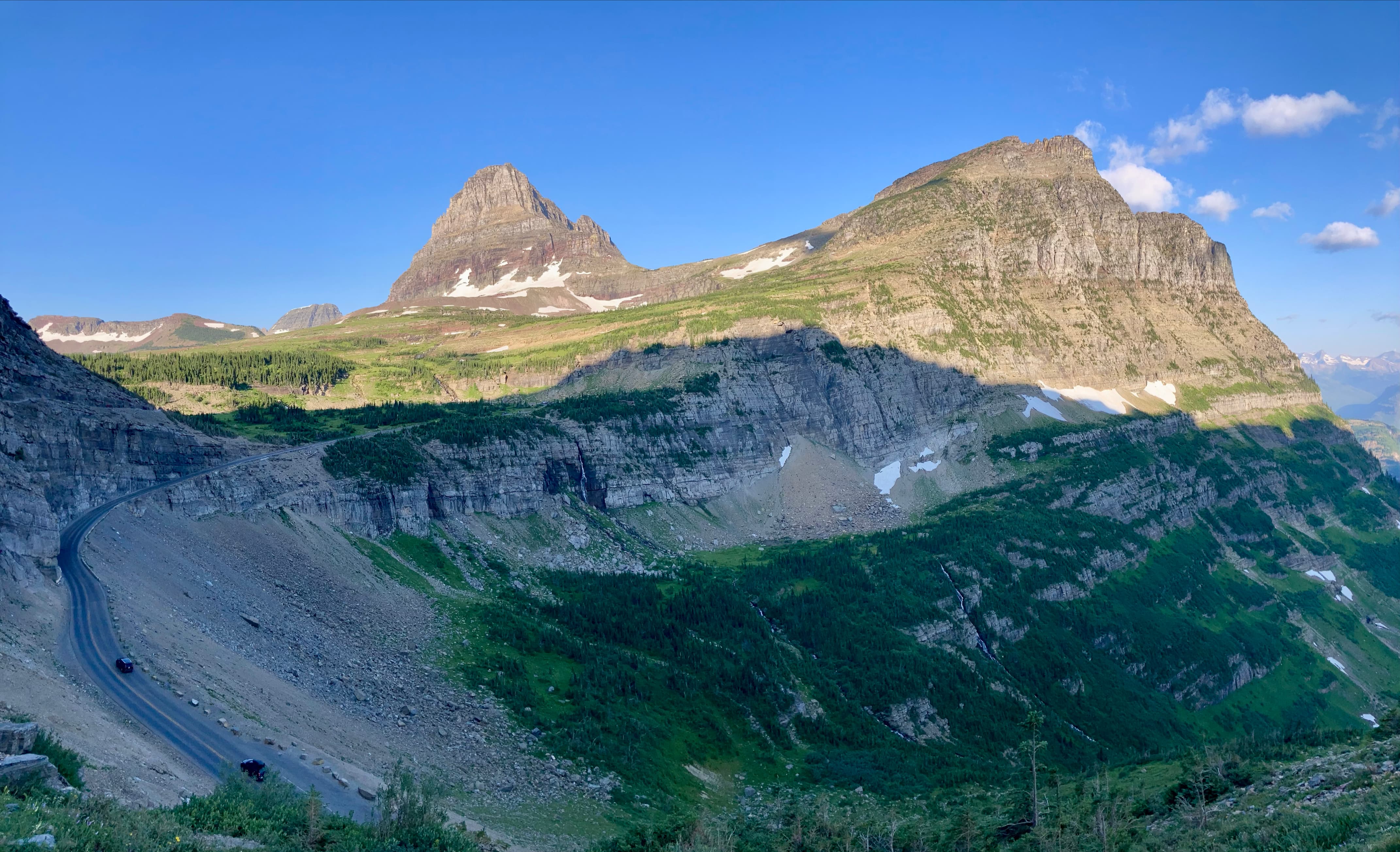
This is a point-to-point trail that can either be hiked south-to-north beginning at Logan Pass, or north-to-south beginning at The Loop trailhead. Logan Pass is at roughly 700 m elevation above The Loop, so most people hike south-to-north. We drove Going-to-the-Sun Road from the east side (St. Mary) early in the morning to the visitor centre at Logan Pass. As of 2024, no vehicle permit is needed driving GttS Road from the St. Mary entrance, but one is required if driving from the west (Apgar). We struggled to find a parking spot despite the early hour but eventually got one. The visitor centre wasn’t open yet, but the toilet facilities were. Once everyone was set we crossed GttS Road to the Highline Trail trailhead.
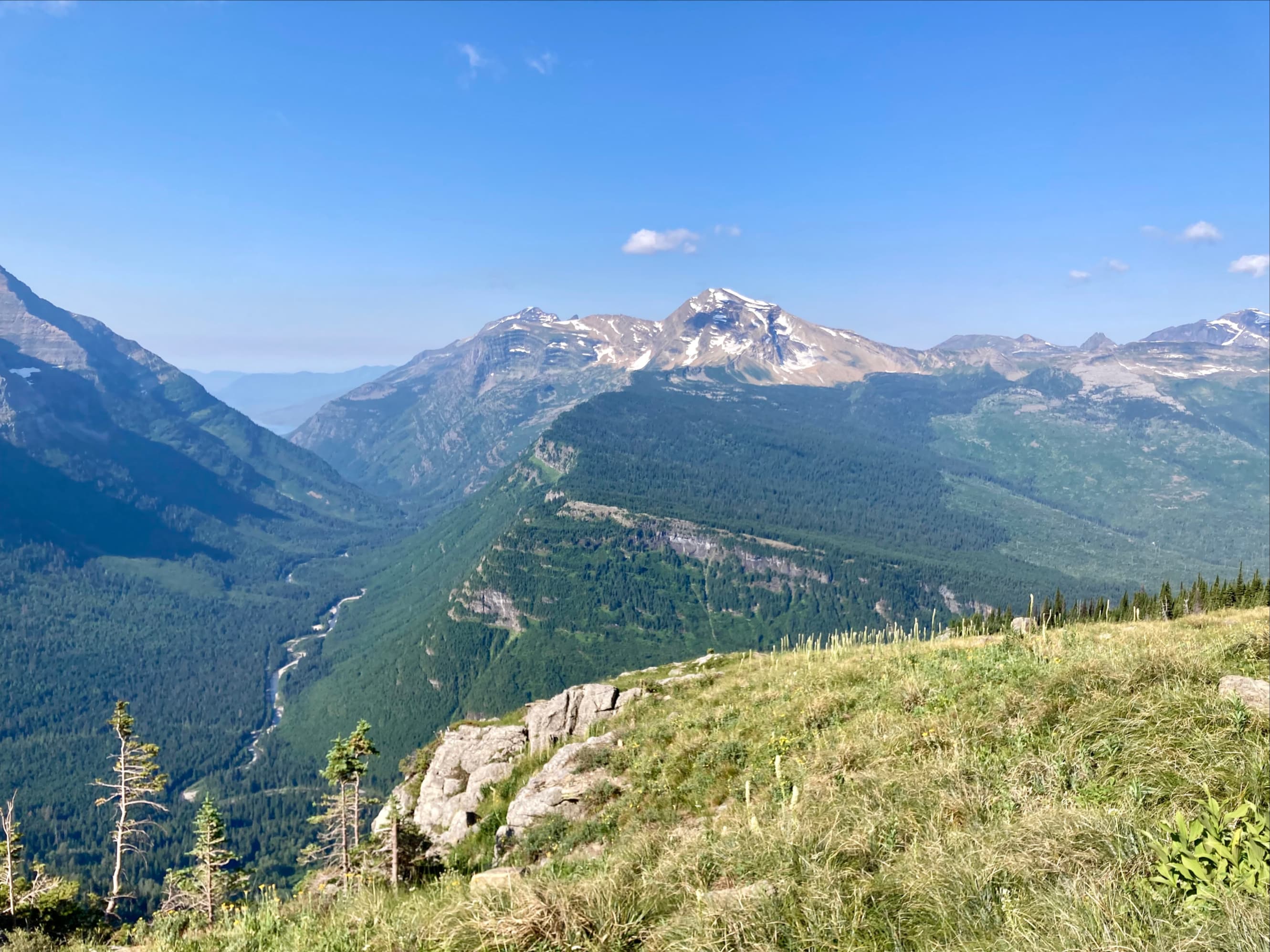
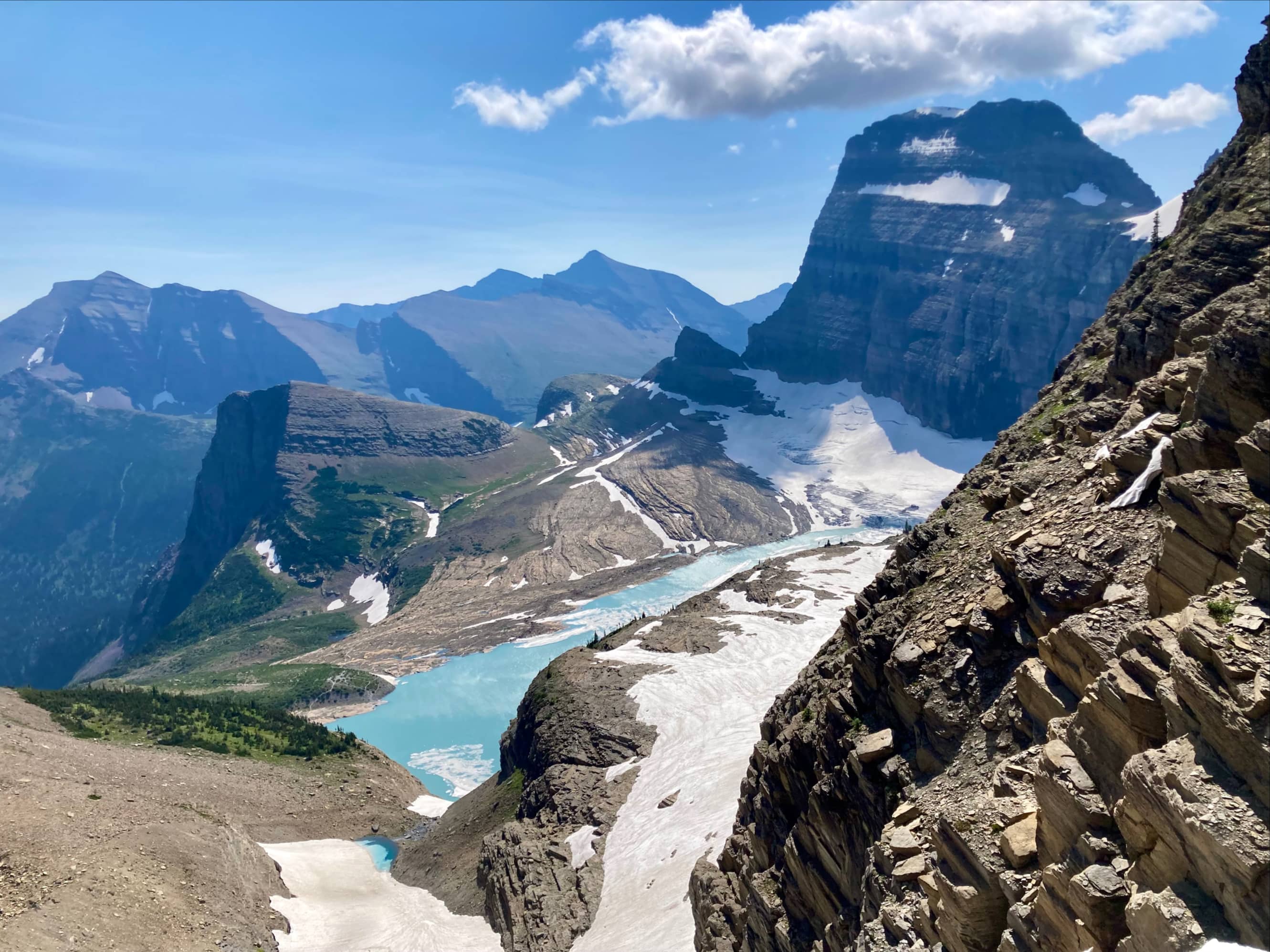
For the first few kilometres the trail is remarkably level, traversing horizontally on the eastern wall of the valley while west of the trail GttS Road steadily descends. Then there’s a gradual ascent leading to a single large switchback which takes the trail upward steeply to Haystack Pass. Beyond the pass there’s some continued gentle ascent as the trail continues its traverse. Roughly 7 km along, not related to any particular landmark, the trail reaches 2220 m elevation, which is the high point if you don’t visit the Grinnell Glacier Overlook. Thereafter, the trail gently loses elevation for several kilometres. At about 11 km, a branch trail departs the Highline heading southeast and steeply ascending to a col between Mount Grinnell and Mount Gould. This is the Grinnell Glacier Overlook.
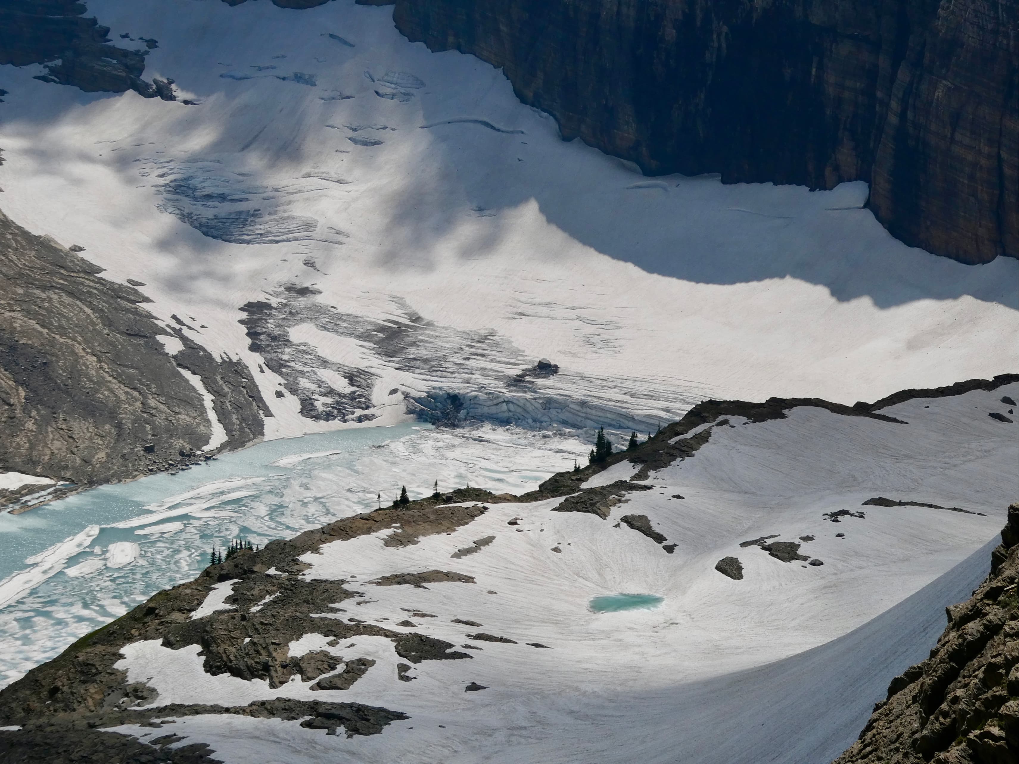
As side-trails go, I’d say this one’s a must-do for anyone who doesn’t mind a bit of a climb. The views along the Highline are great – a slowly unfolding vista of the peaks and valleys north of Logan Pass. Beautiful, but serene. The view from Grinnell Glacier Overlook is more of a punch in the face. Upon reaching the ridge, there’s a blast of wind and a sudden view of Grinnell Glacier and its crystal blue glacial lake. Salamander Glacier is directly below the overlook and the summit of Mount Gould stands behind it all. On the shores of the lake below us we could make out the tiny figures of hikers on the Grinnell Glacier Trail. We took a long break here to take it all in.
Upon returning to the Highline Trail we could see the final landmark along the trail in the distance – the Granite Park Chalet. This chalet was built by the Great Northern Railway company in 1914. It is still in operation providing backcountry accommodation for hikers. If you’re not a registered guest, you can still use the picnic benches and outhouses on the grounds. There’s also a small shop where you can buy snacks, though I don’t recall there being any cold drinks on sale.
Beyond the chalet, the fun part of the trip is over. The trail begins a long descent through forest until it reaches the hairpin turn on GttS Road referred to as The Loop. When we burst from the forest onto the road we found the small parking area completely full and lots hikers waiting for the shuttle to take them back to Logan Pass. The shuttle stops are on the southern limb of the hairpin. It’s important to make sure you’re getting on the proper shuttle – to get back to Logan Pass you get onto the shuttle seemingly driving away from Logan Pass (the hairpin caused me a bit of confusion).
We had an excellent day on this trail. I think anyone who is able to handle the distance of the Highline Trail should also be able to make it to Grinnell Glacier Overlook. It’s a steep-ish climb, but not particularly long and the views are worth it. Note that because of the high elevation there’s often still snow on this trail well into July. Check the official website for trail conditions.


One thought on “Highline Trail & Grinnell Glacier Overlook”