May 28, 2024. A day spent hiking the interconnected trails of the Bryce Amphitheater in Bryce Canyon National Park.
- Region: Bryce Canyon National Park. Traditional territory of the Southern Paiute, Hopi, Zuni, Ute, and Navajo peoples
- Distance: 16 km along the route we took, many variations are possible
- Total Ascent: 590 m along the route we took, many variations are possible
- Total Time: Approximately 6 hours
- Safety and Disclaimer
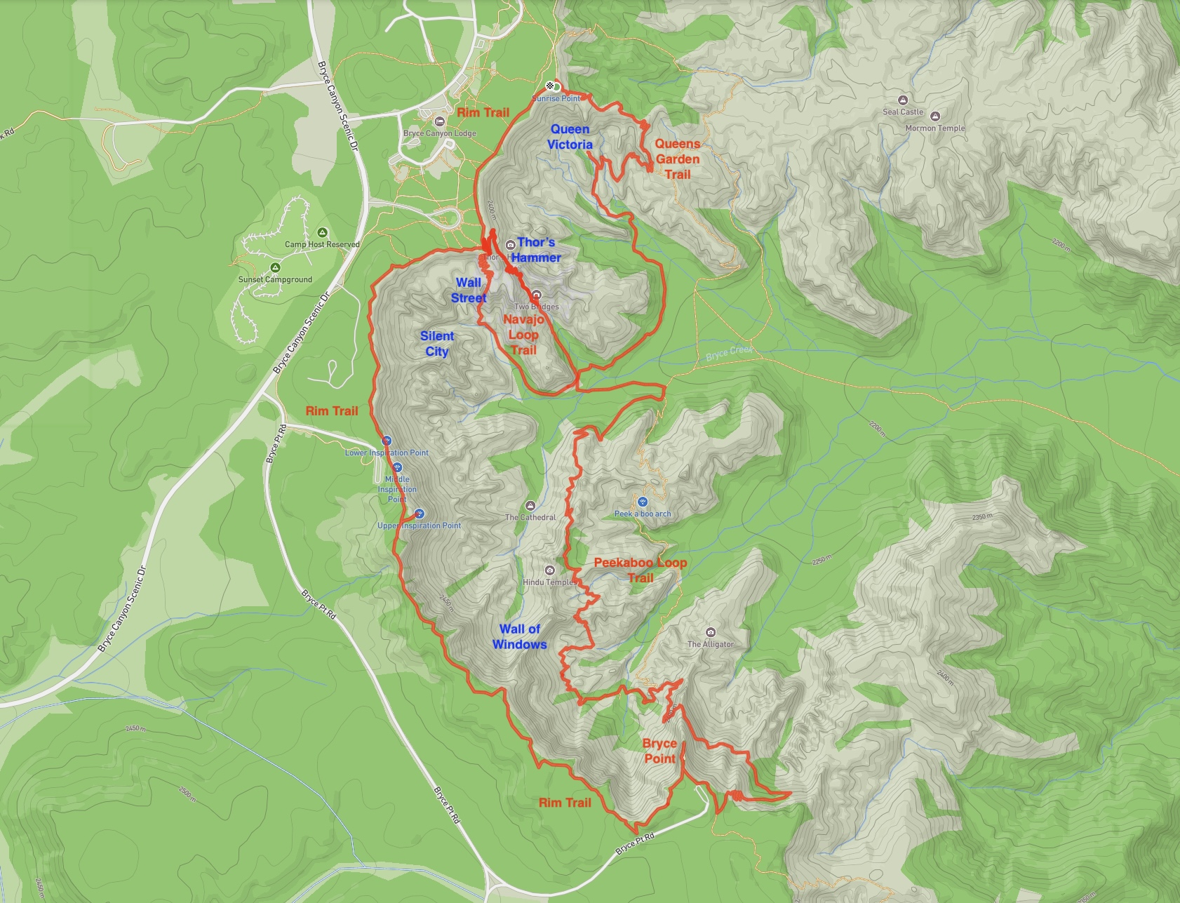
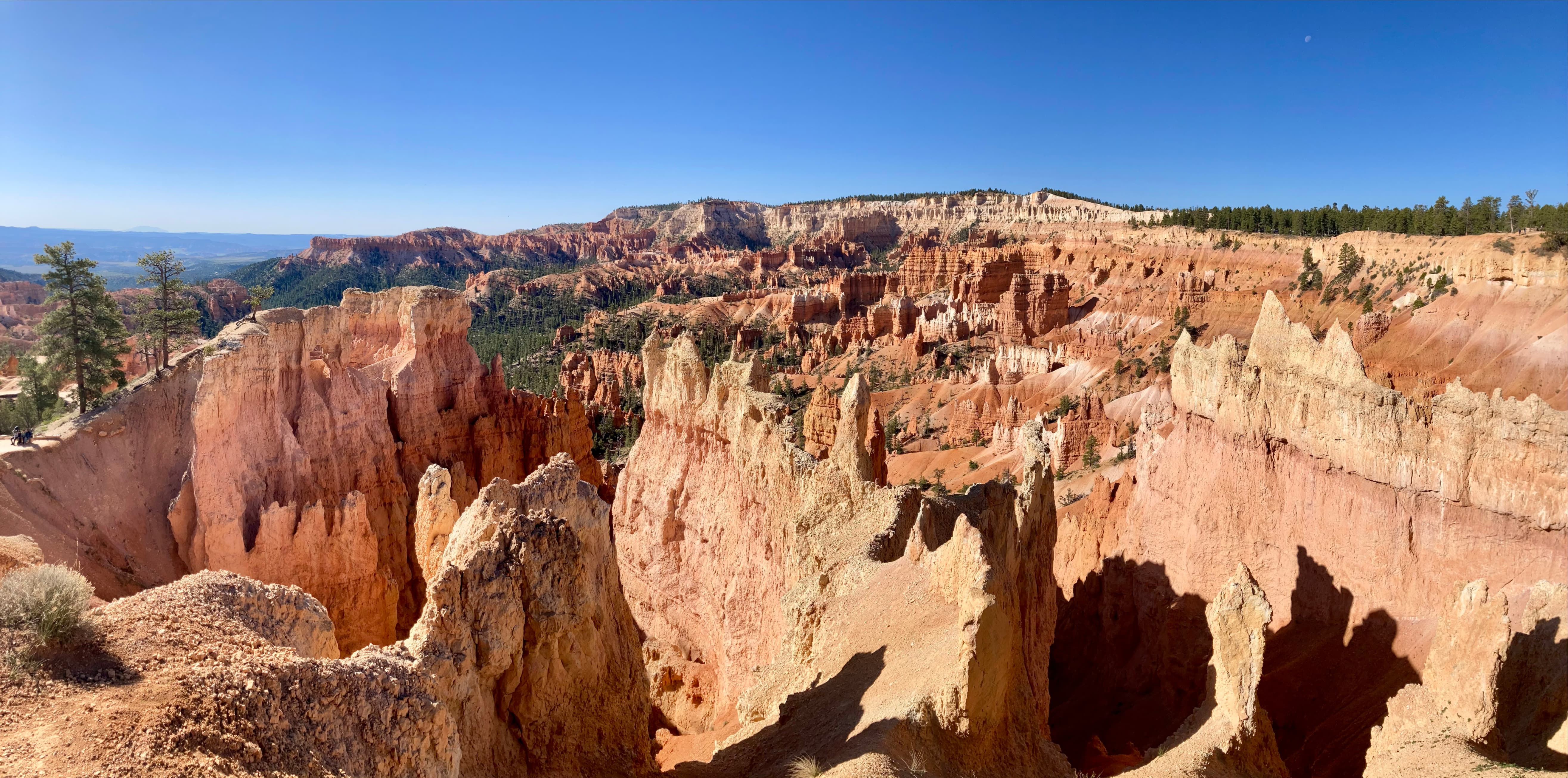
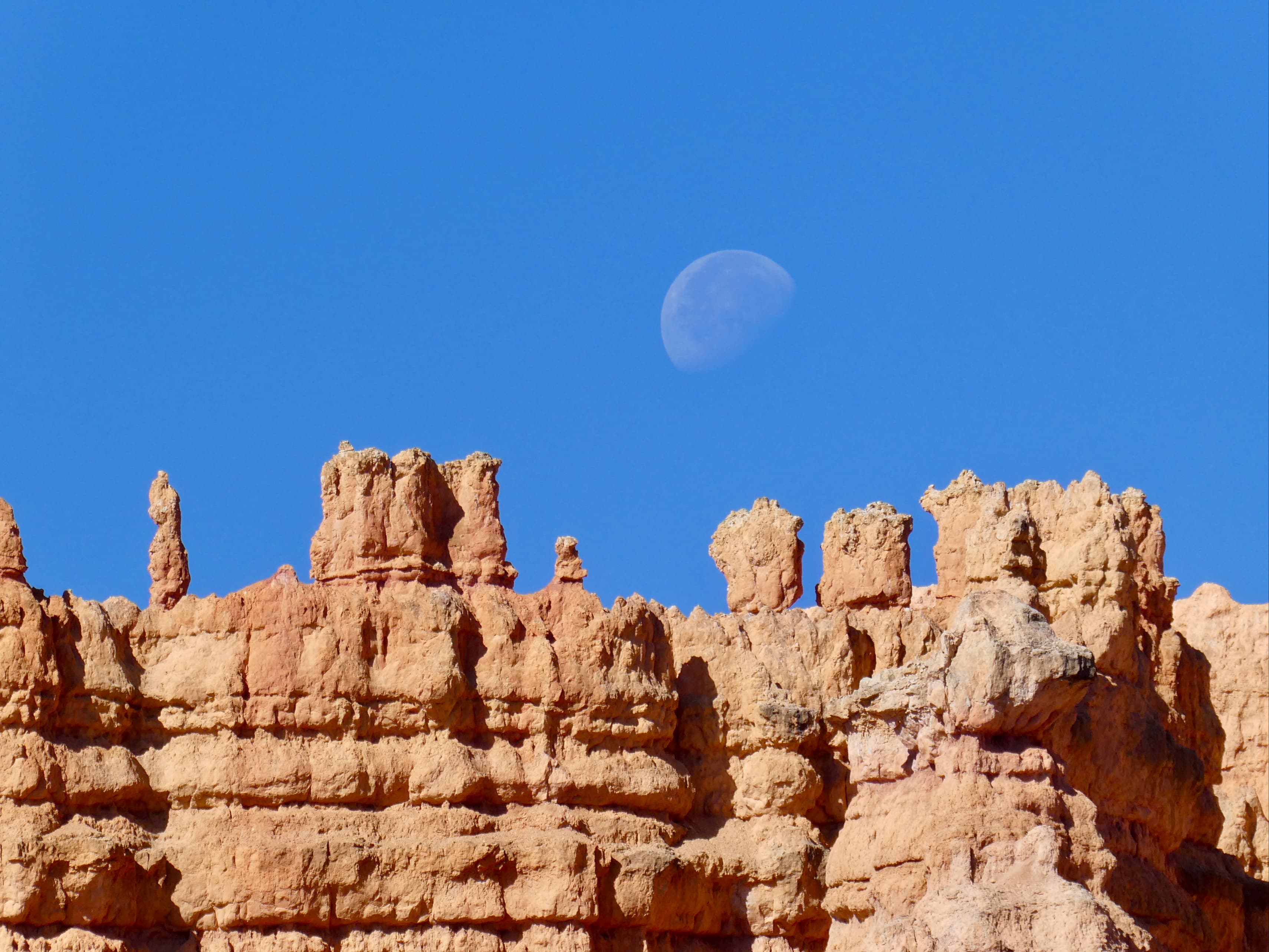
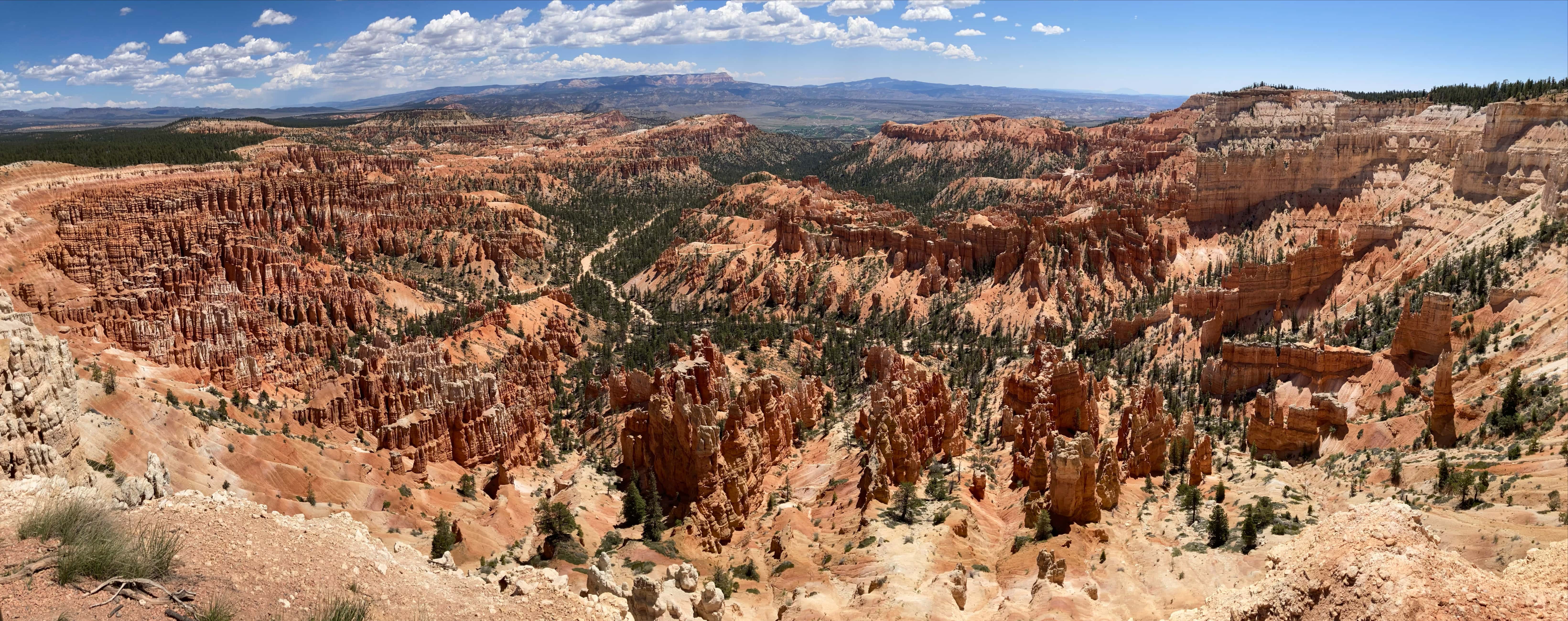
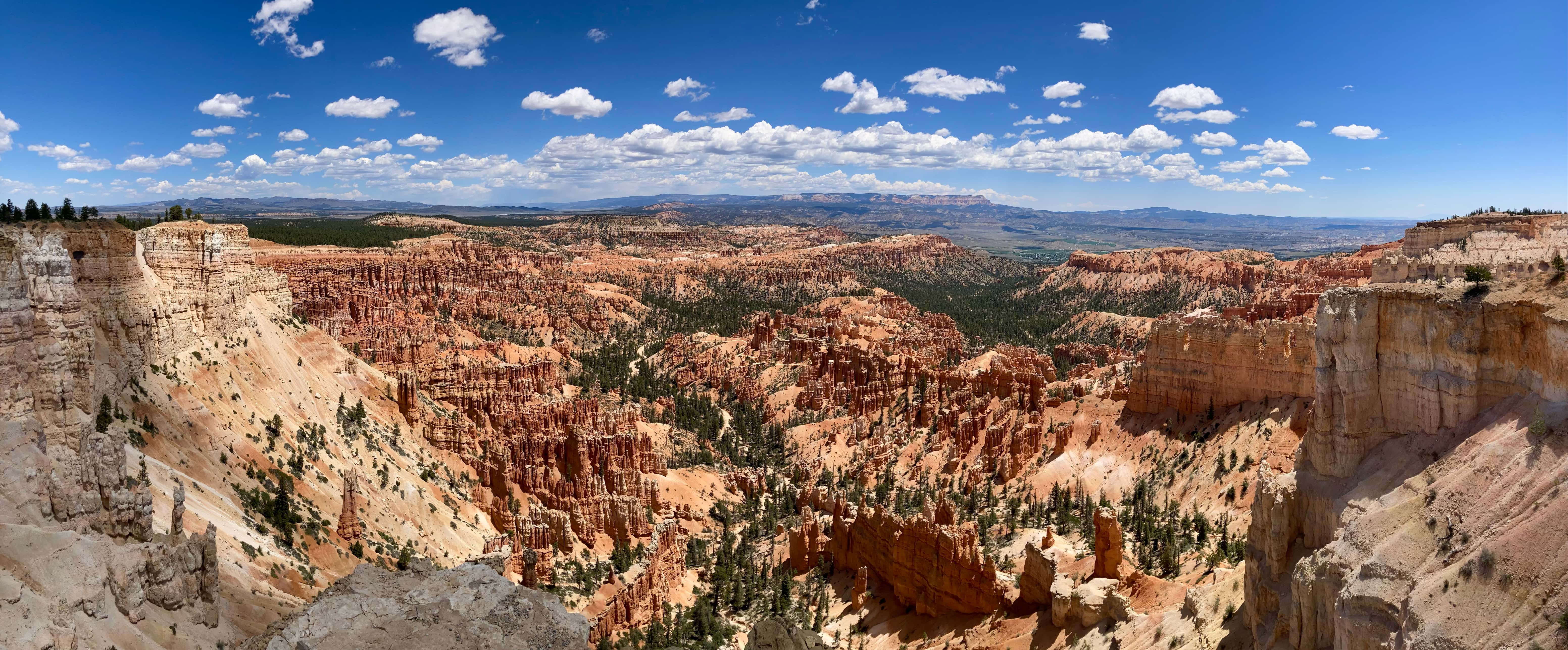
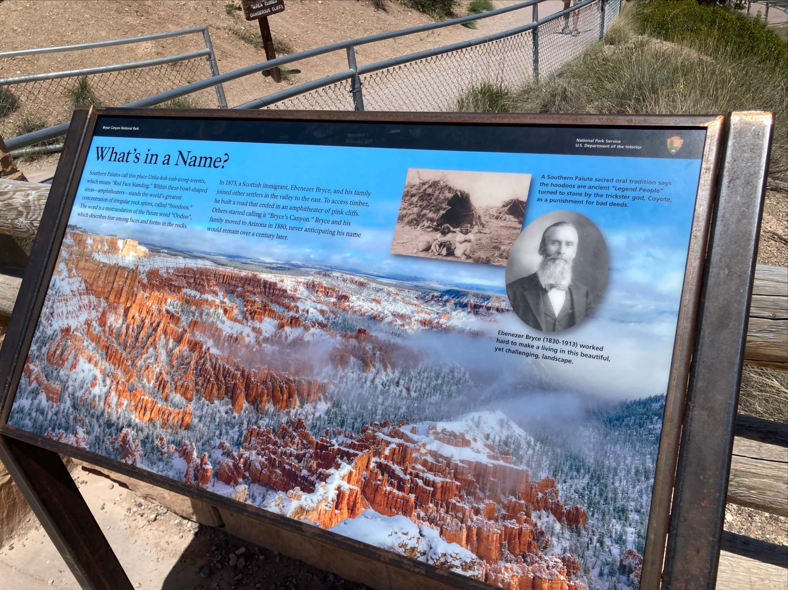
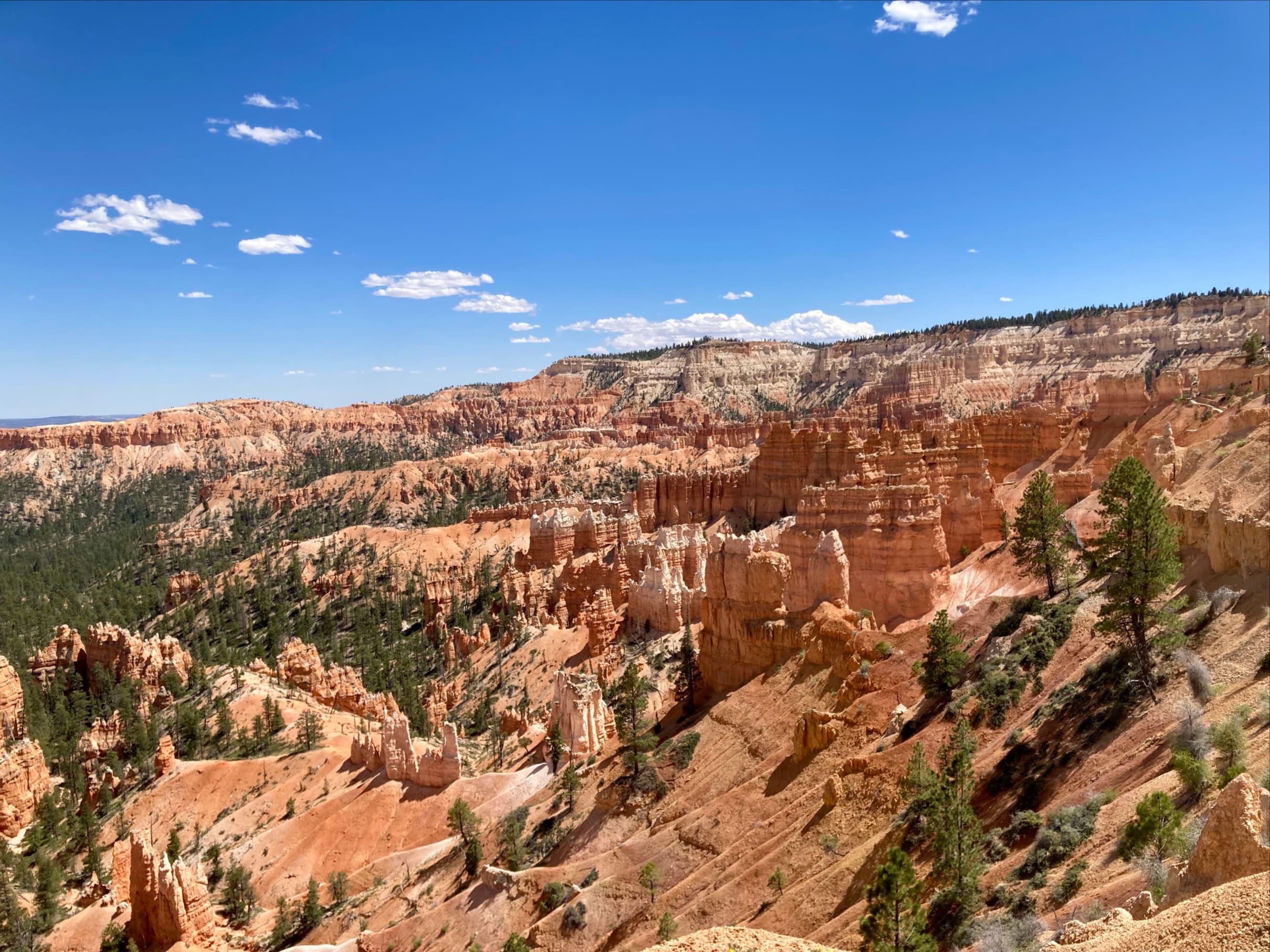
Bryce Canyon National Park is situated amongst the many National Parks, National Forests, and National Monuments in the south of Utah. Nearby Zion National Park is apparently a bigger draw for tourists, but Bryce is justifiably famous for the amazing hoodoo landscapes situated within massive natural amphitheatres. For the final day of our May 2024 excursion to the USA, Bhaskar and I decided to head to Bryce and wander the hiking trails. We started out planning to check out the Queen’s Garden Trail then perhaps drive to Bryce Point to hike some more. Instead, we hiked Queen’s Garden Trail, Navajo Loop (twice, by the end of it), the southern half of the Rim Trail, and half of Peekaboo Loop. All the while we were constantly snapping pictures and pondering the unique, evocative stone scenery.
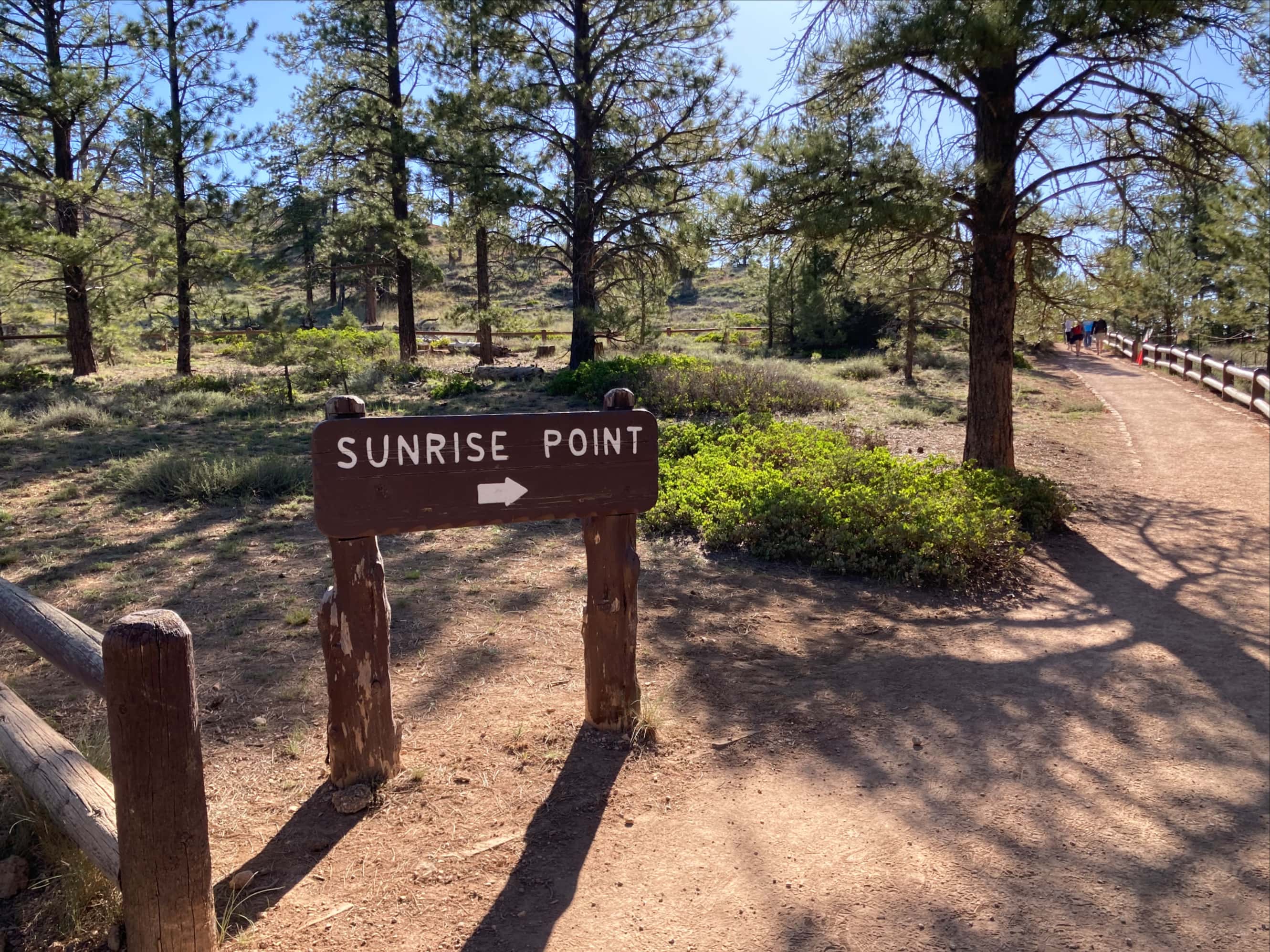
At the start of the day we stopped by the visitor’s centre to get some advice and check out the souvenirs (I had decided that I was going to start collecting patches from all the parks I visit). Then we drove a short distance and parked the car near Sunrise Point. It was a short walk to Sunrise Point and the start of the Queen’s Garden Trail.

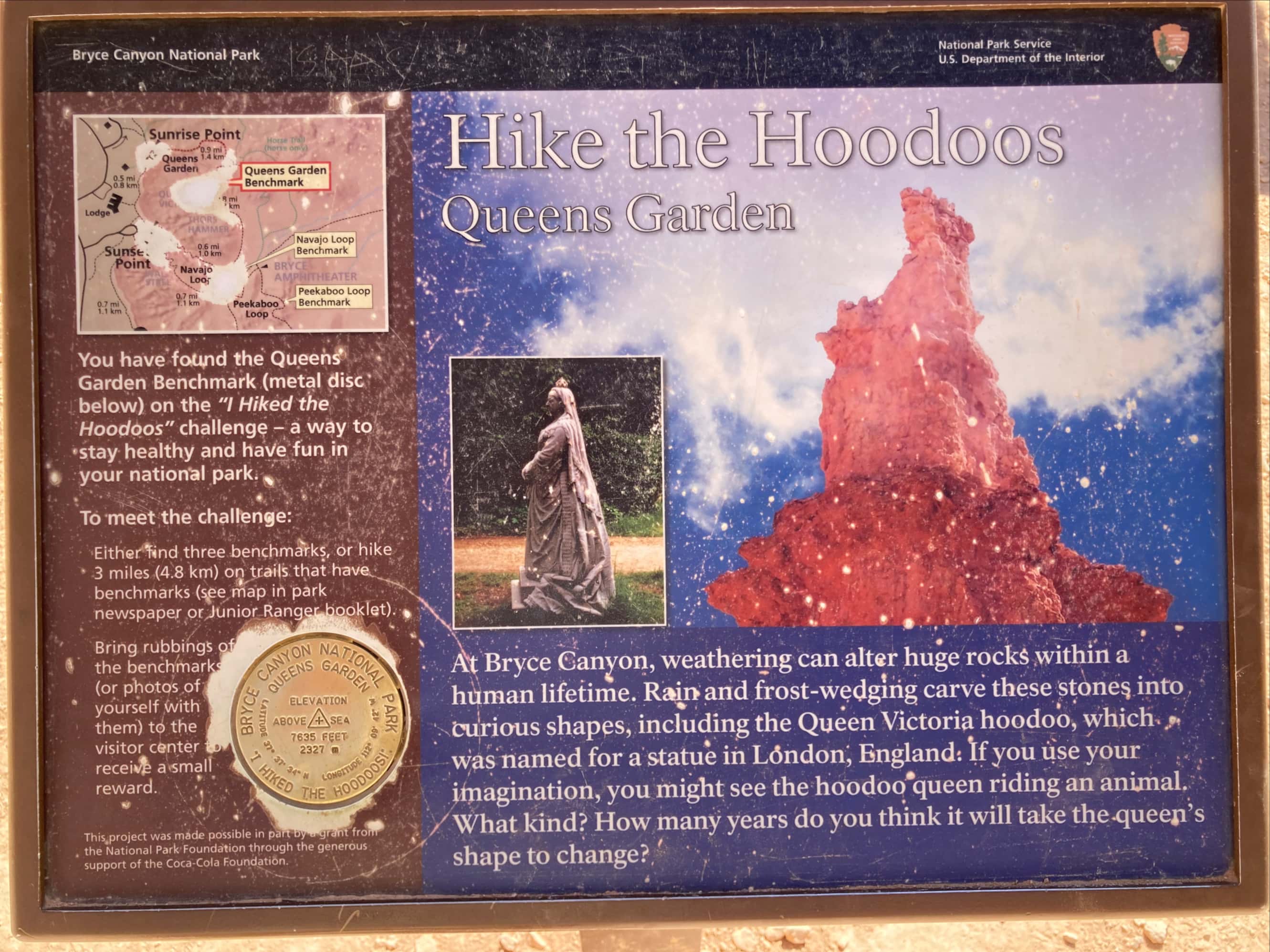
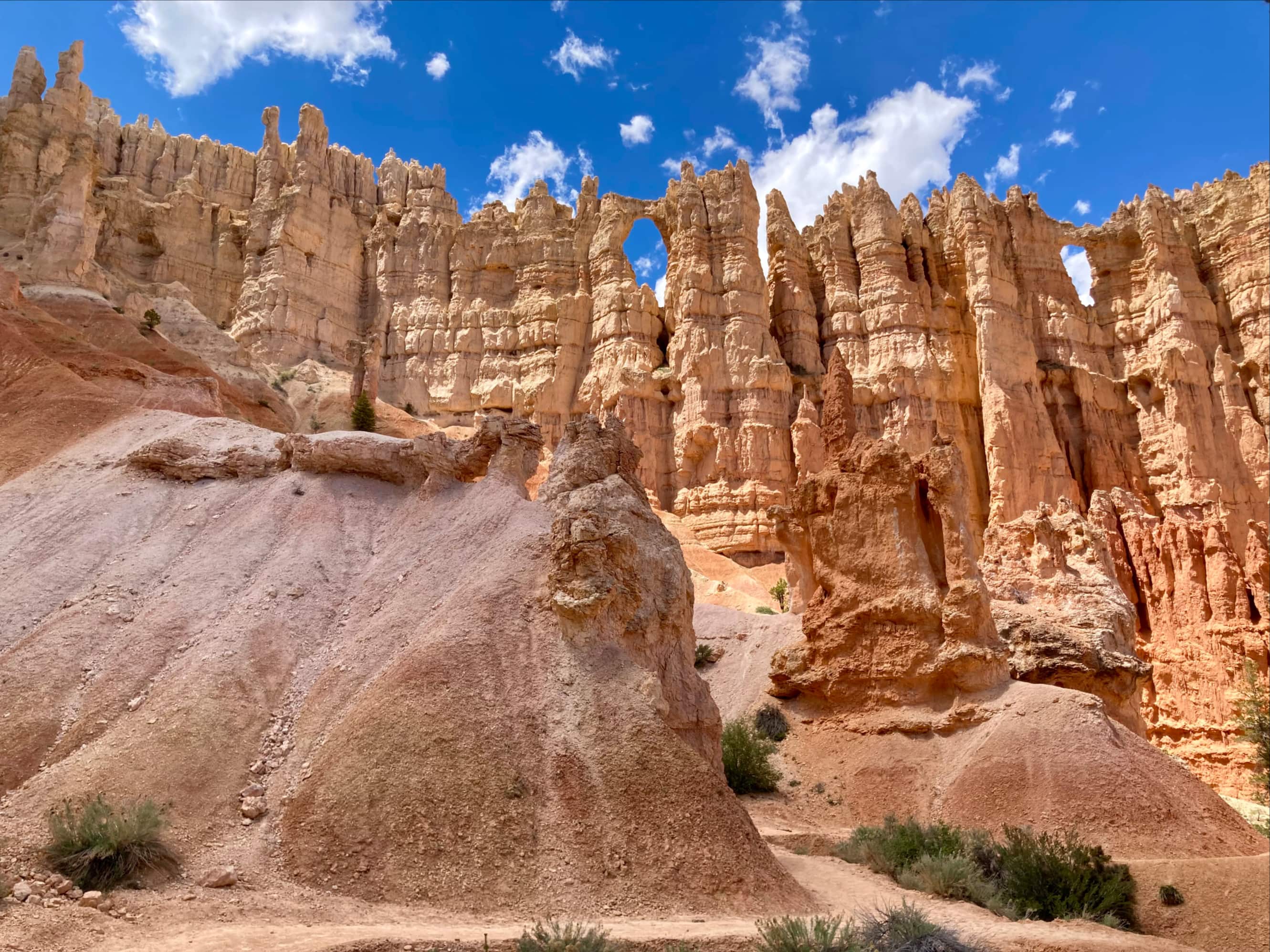
Queen’s Garden Trail takes its name from a rock formation that bears a striking resemblance to Queen Victoria out for a stroll in a garden of hoodoos. The trail is wide and well maintained. Here’s what the National Parks Service has to say about it:
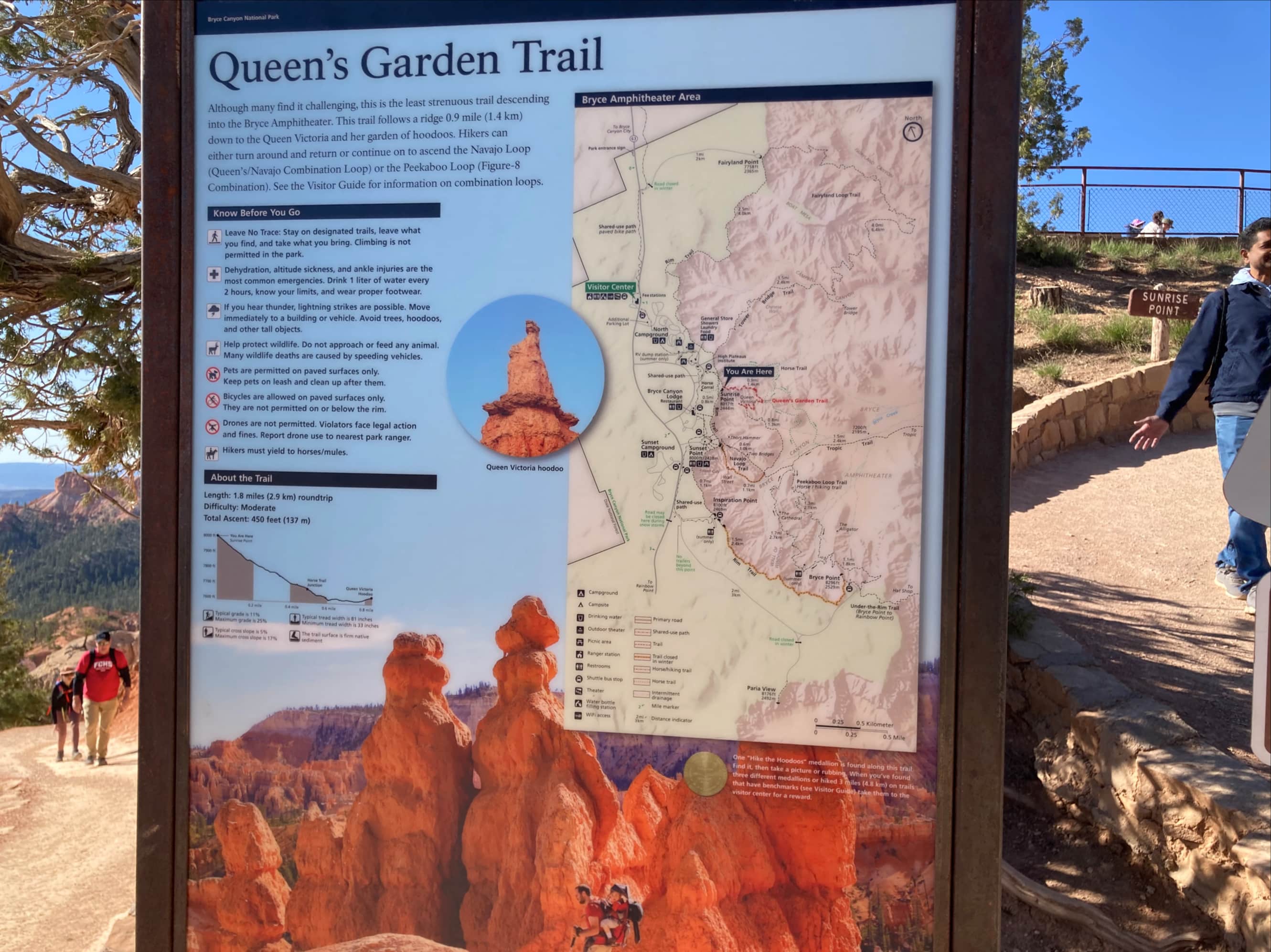
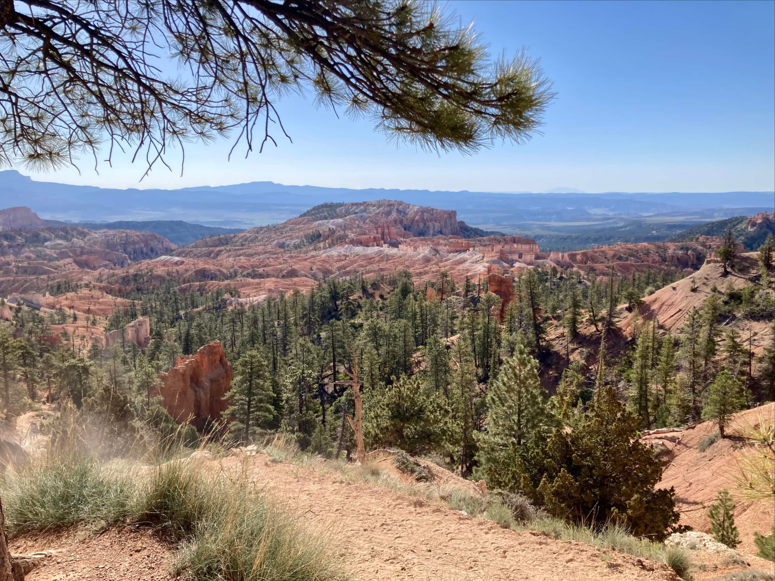
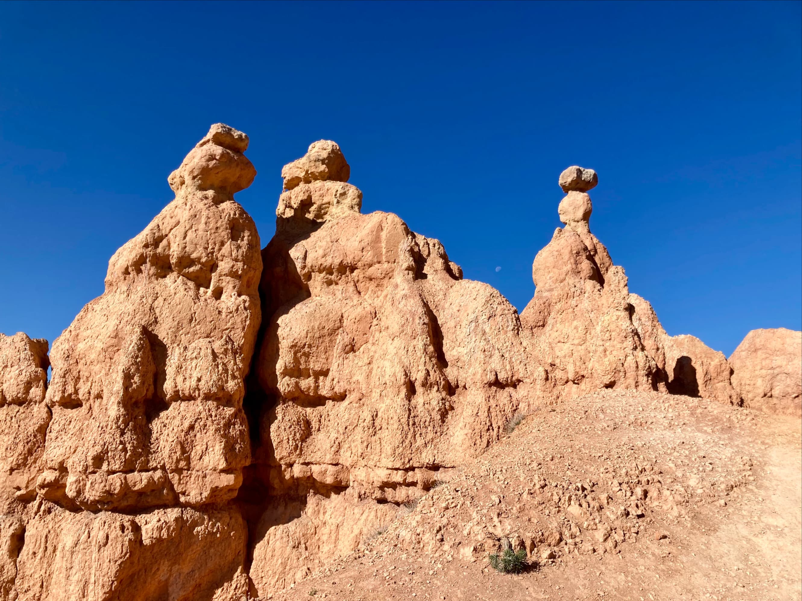
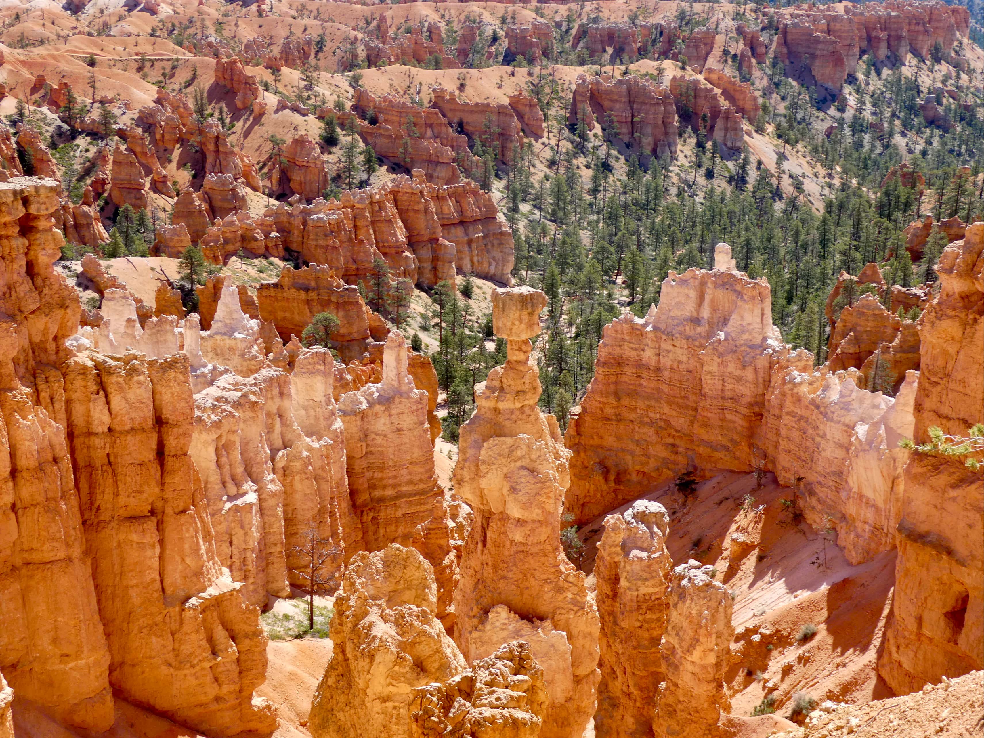
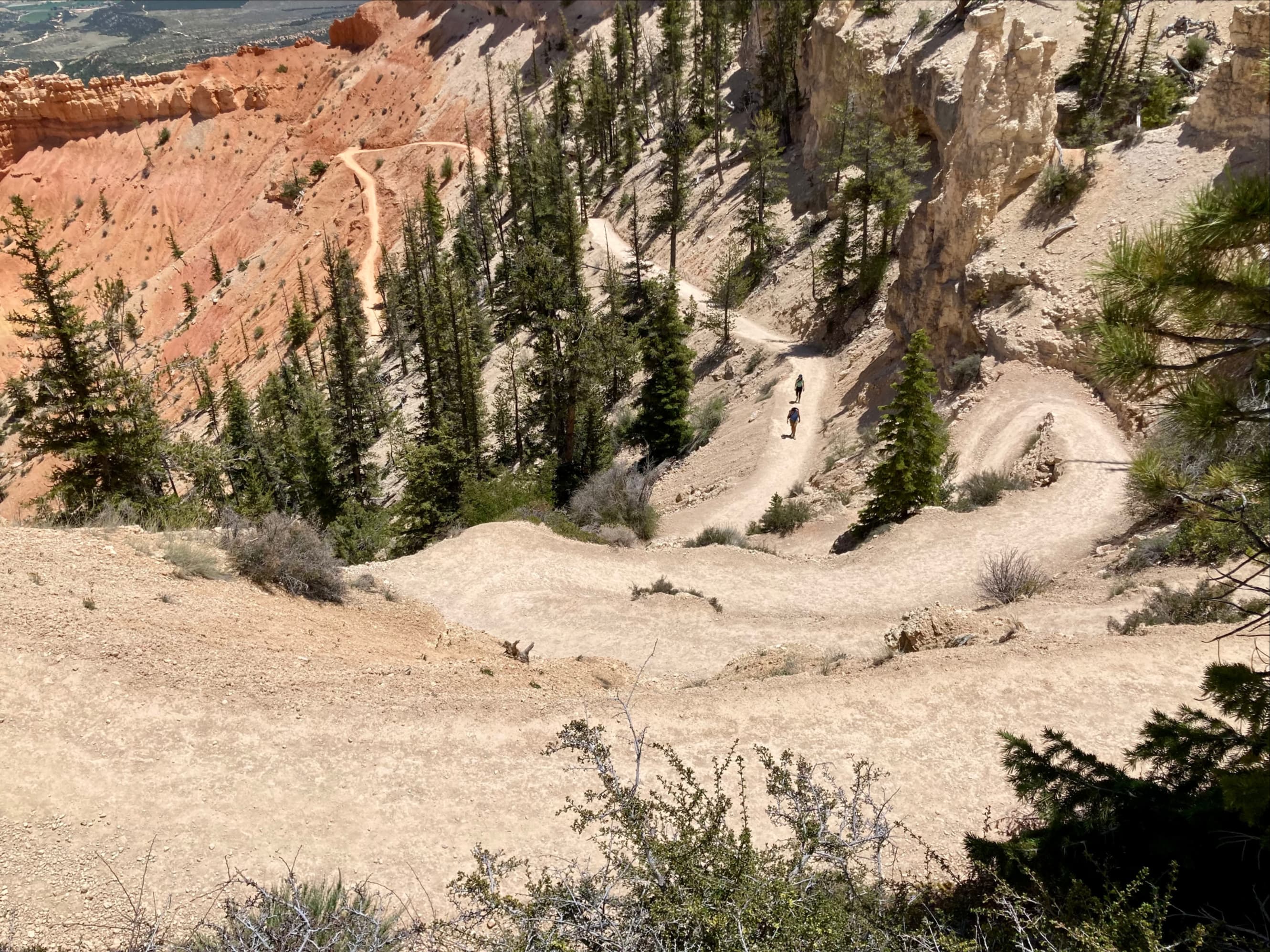
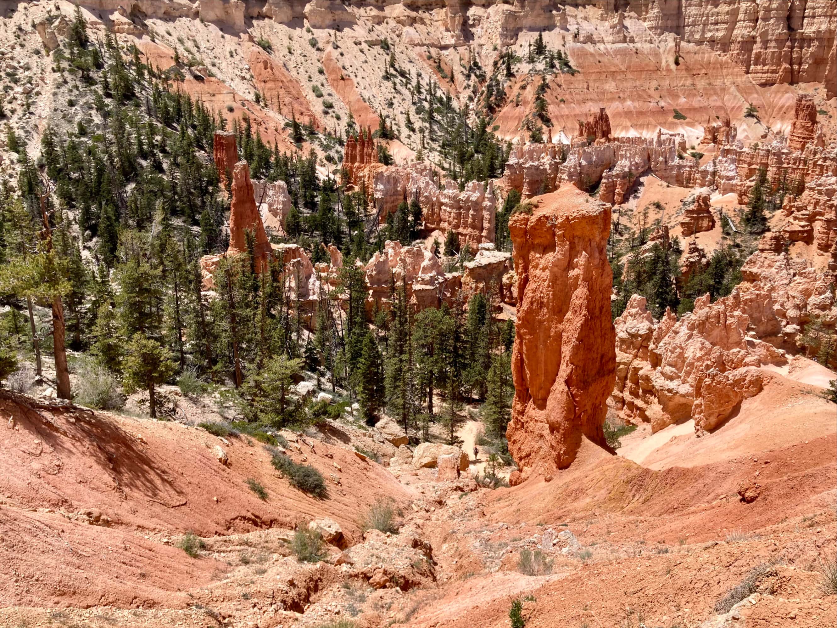
As we made our way down along the trail we finally got a true sense of the otherworldly terrain in the Bryce Amphitheatre. Being Albertans, Bhaskar and I were familiar with hoodoos and the associated fascinating stone formations found in hoodoo-strewn landscapes. Between Dinosaur Provincial Park and Writing-on-Stone Provincial Park we had seen plenty of them. Bryce Canyon’s landscape was like those provincial parks, but amplified by a factor of 10. So, our descent was slow as we kept stopping to take pictures. Once the trail had descended southeast, well below the rim, it hooked back towards the west and a small spur trail took us to see the Queen.
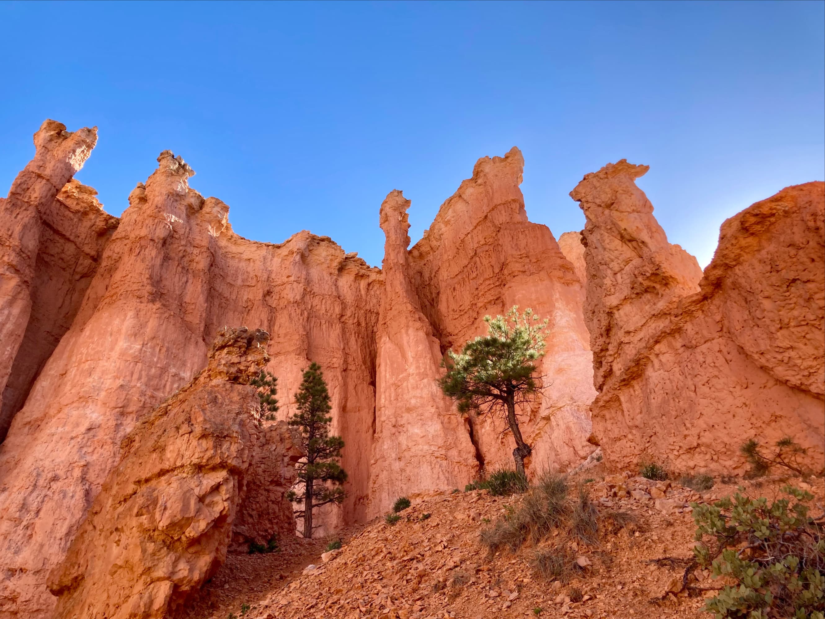
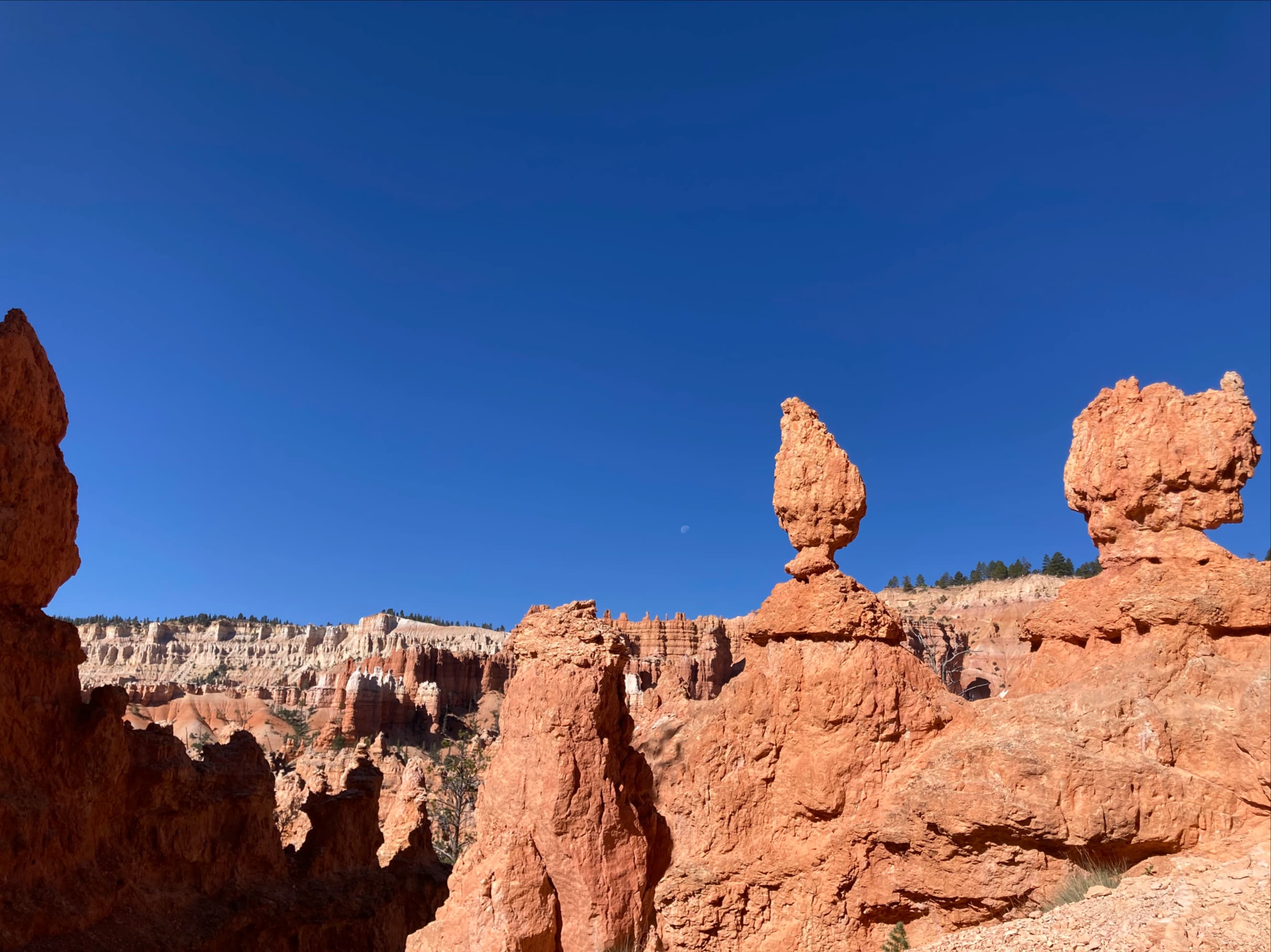

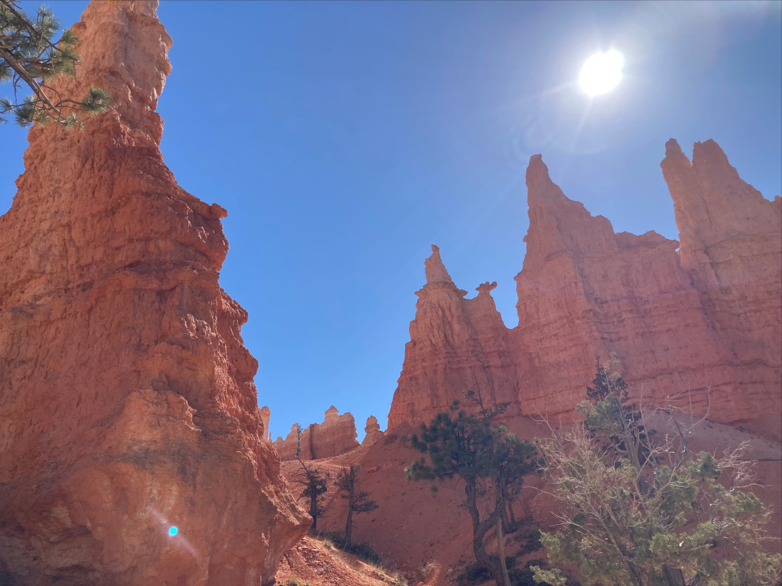

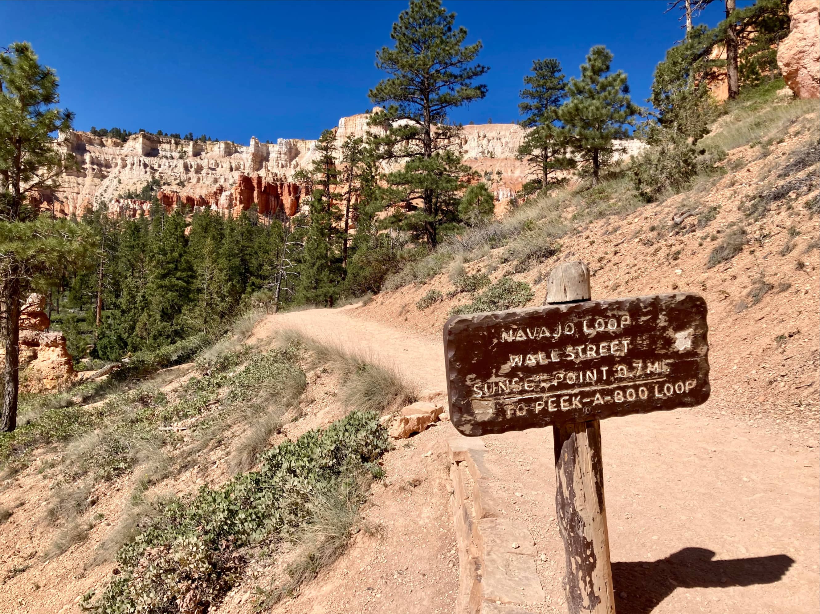
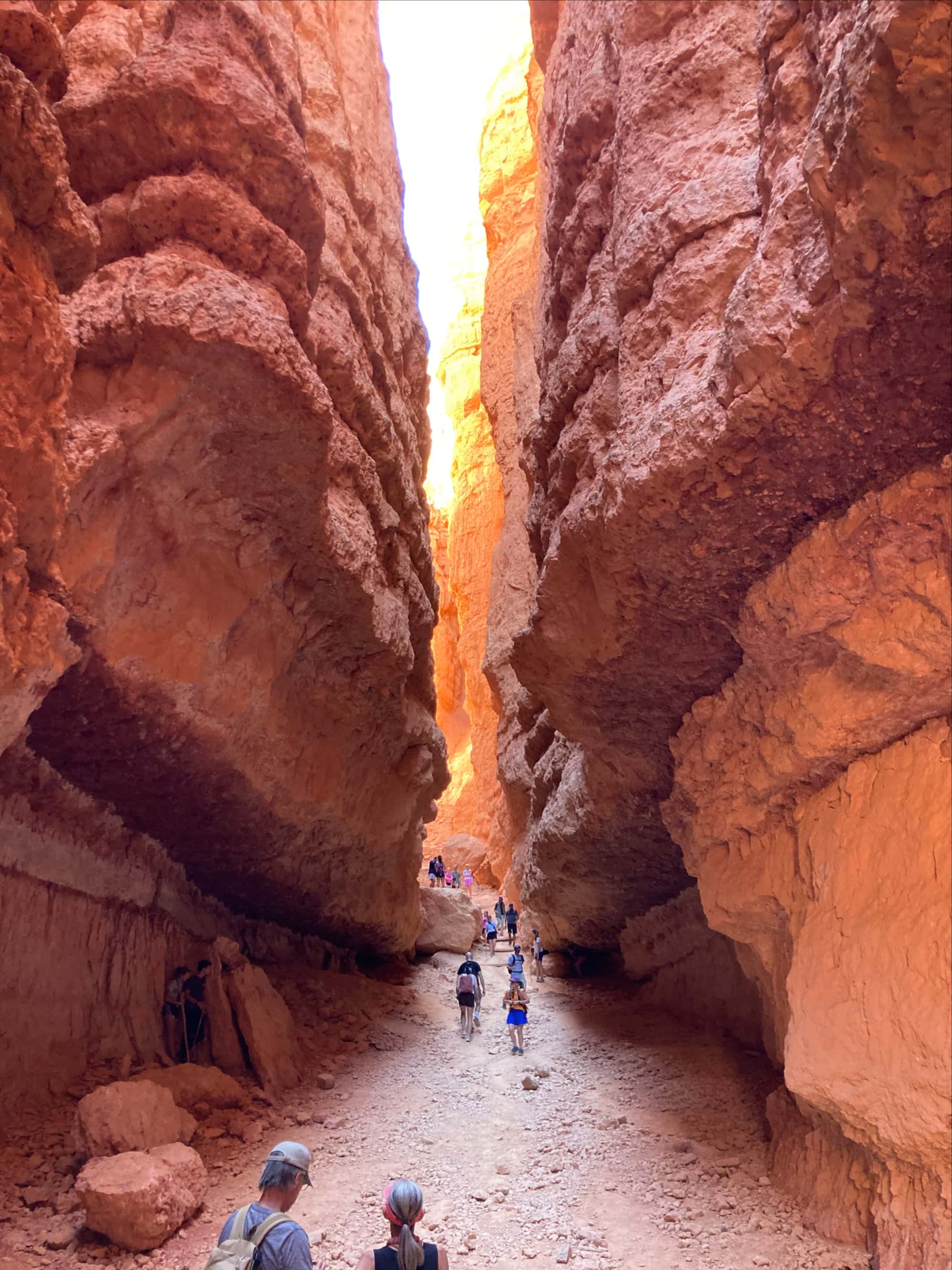
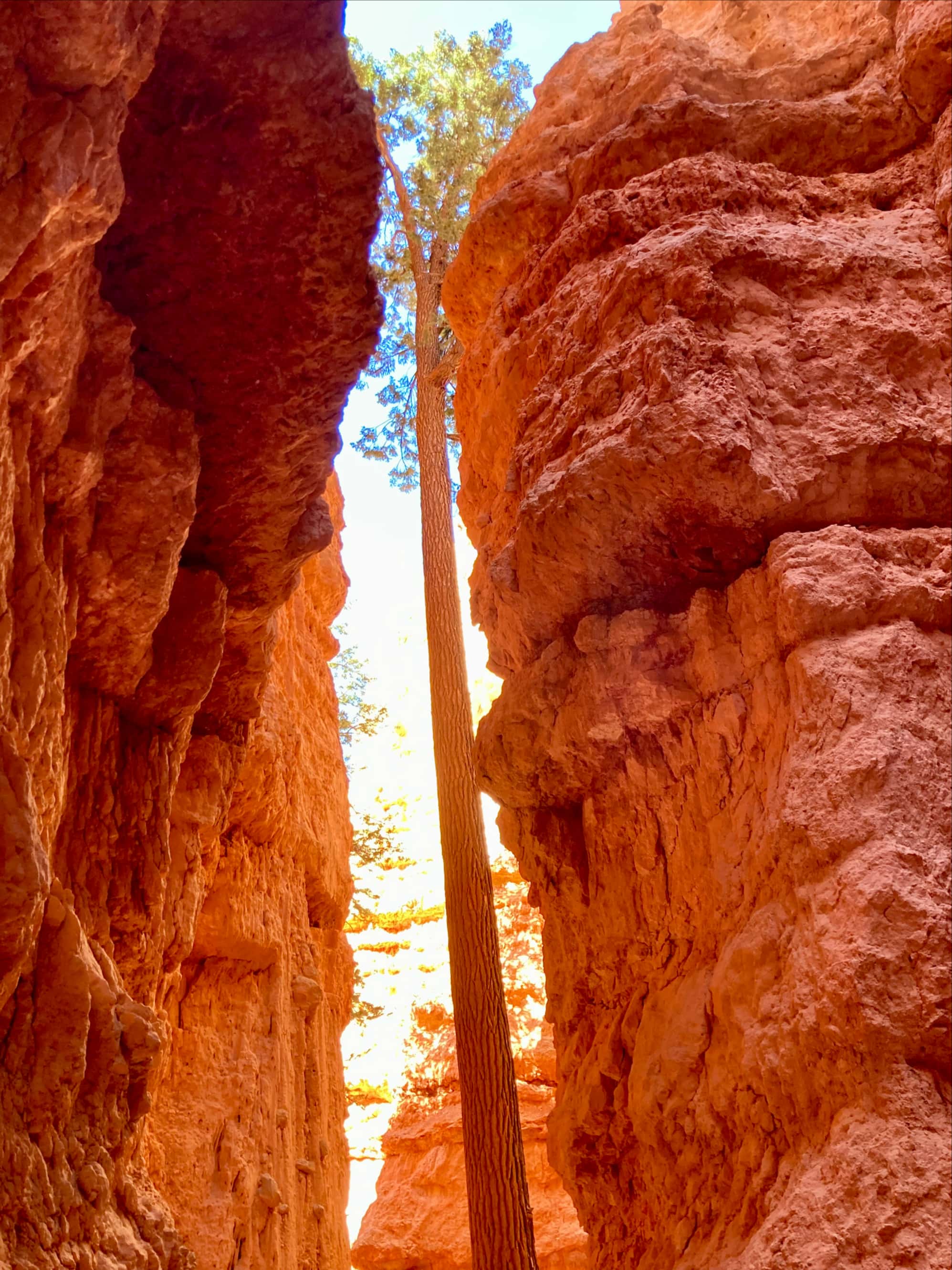
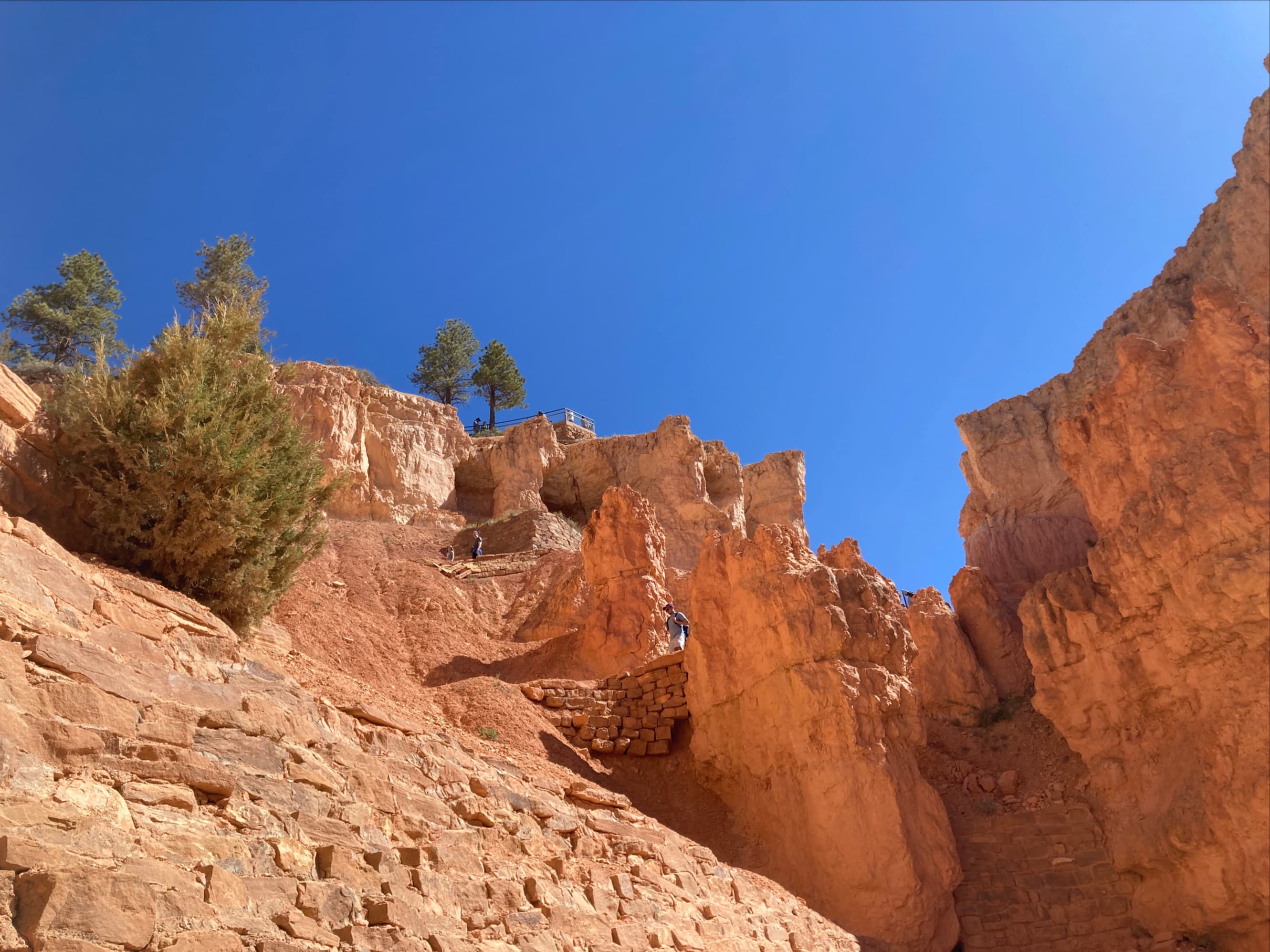
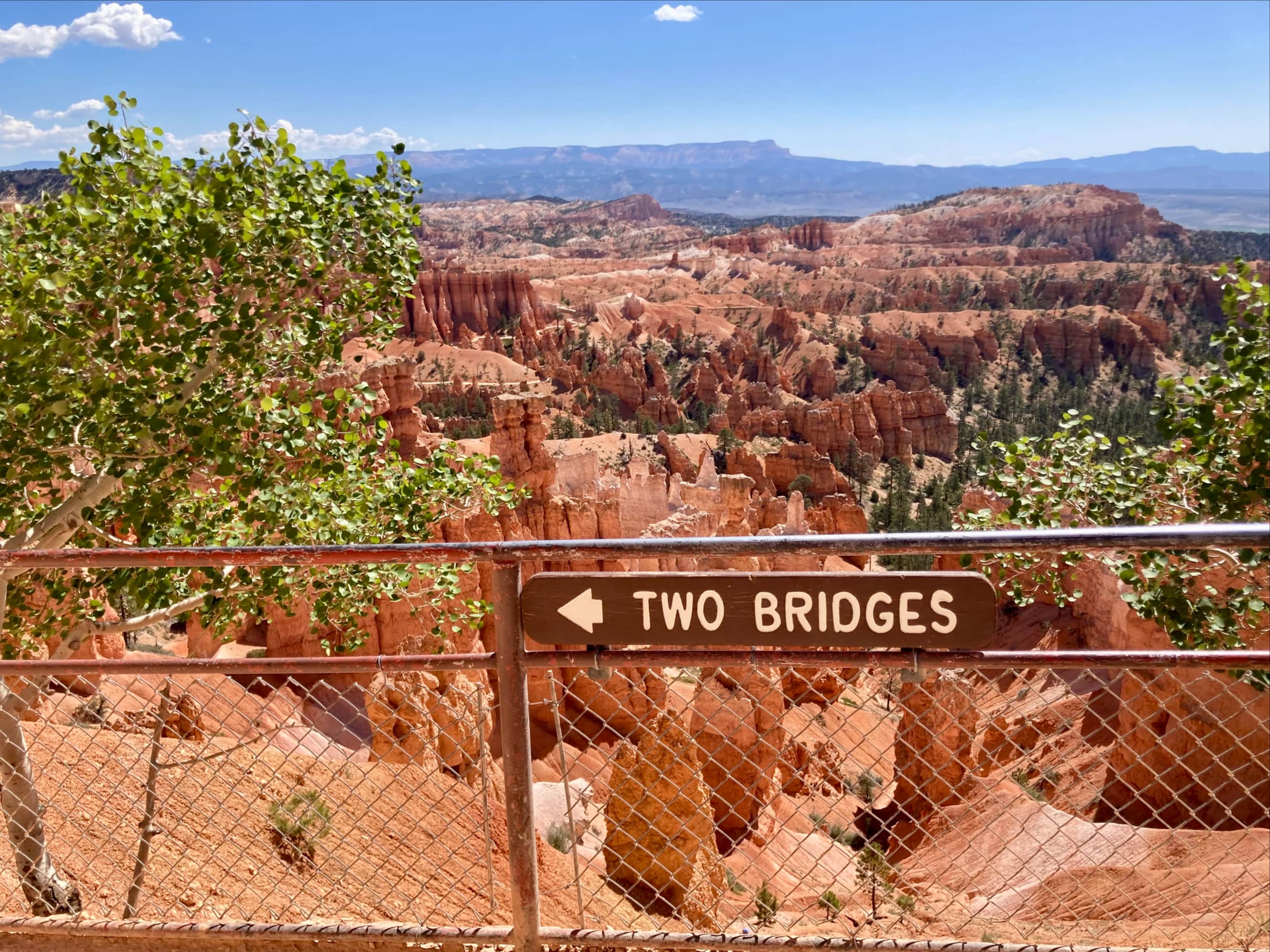
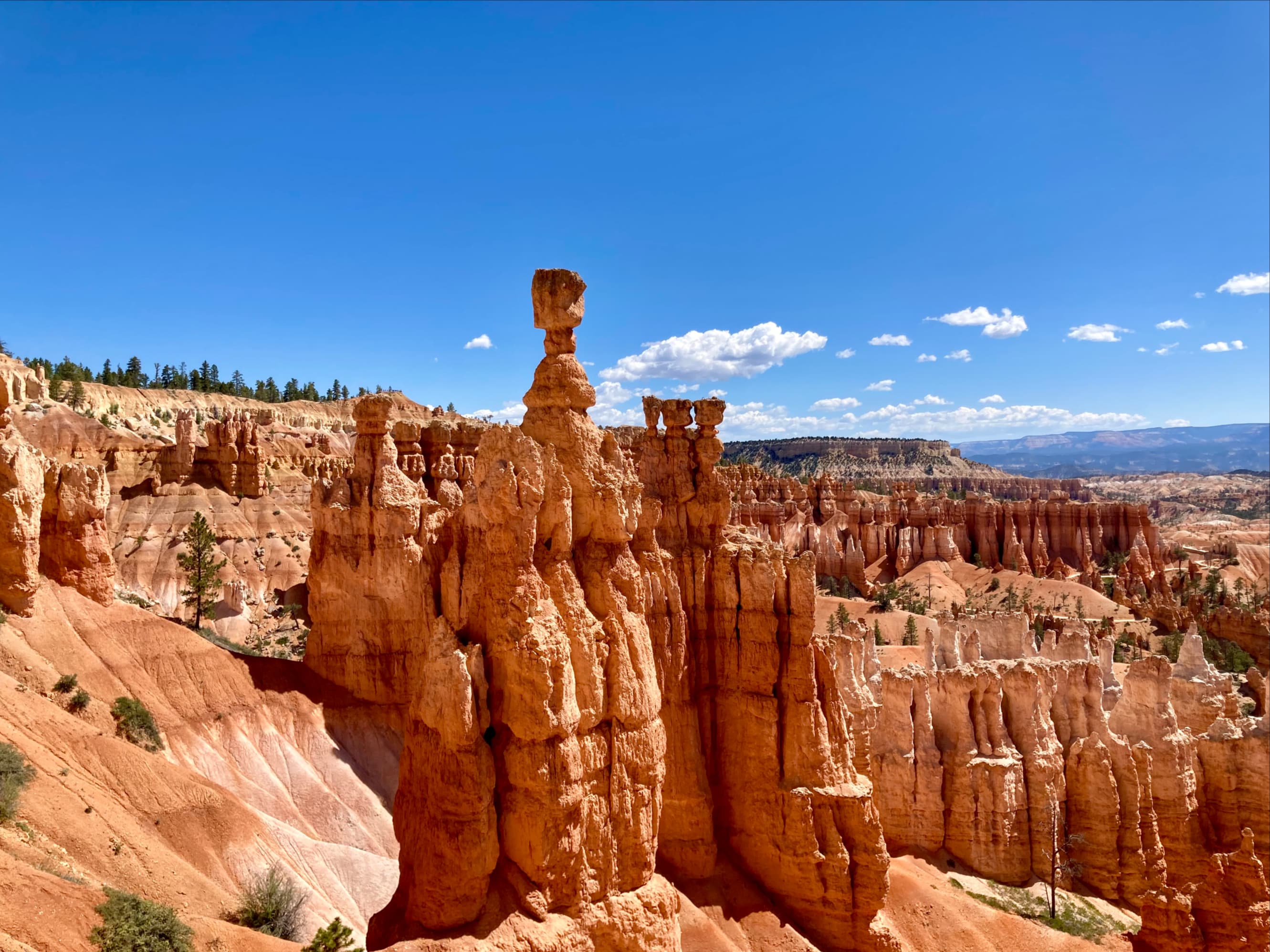
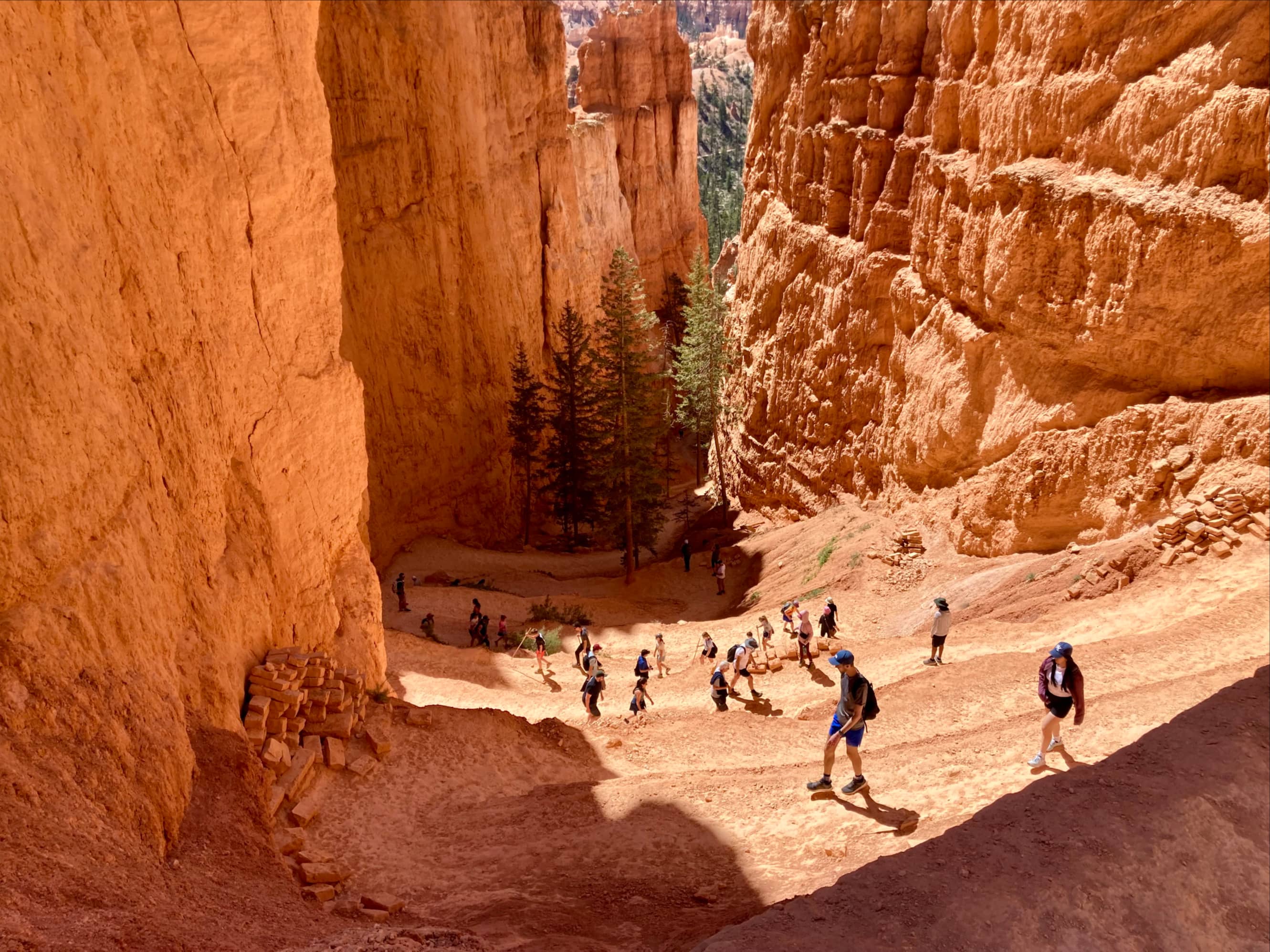
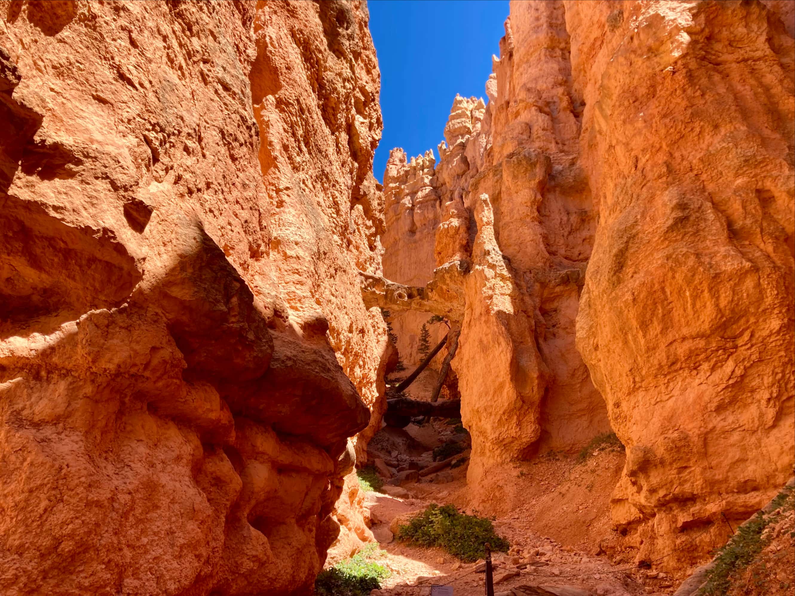
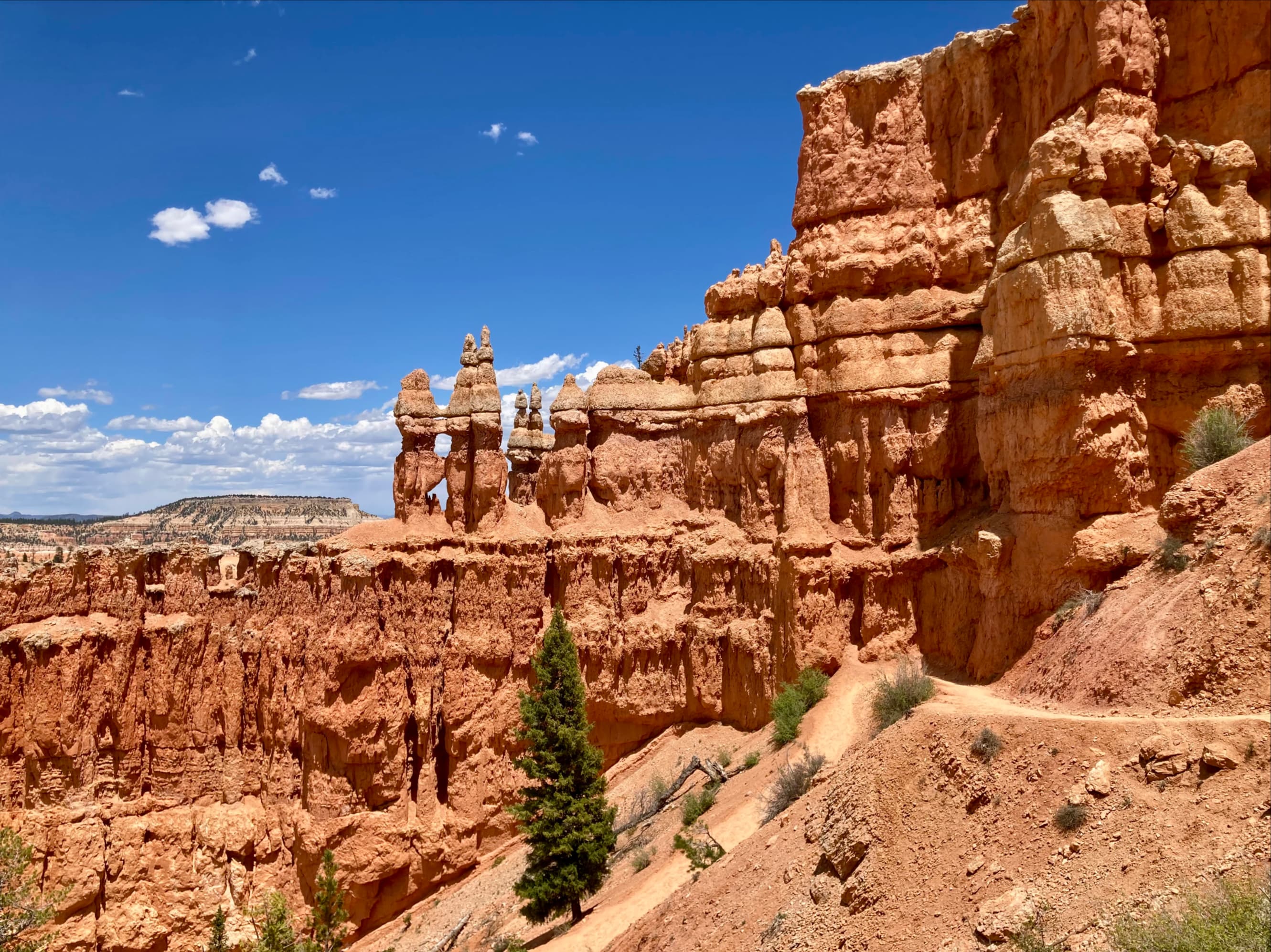
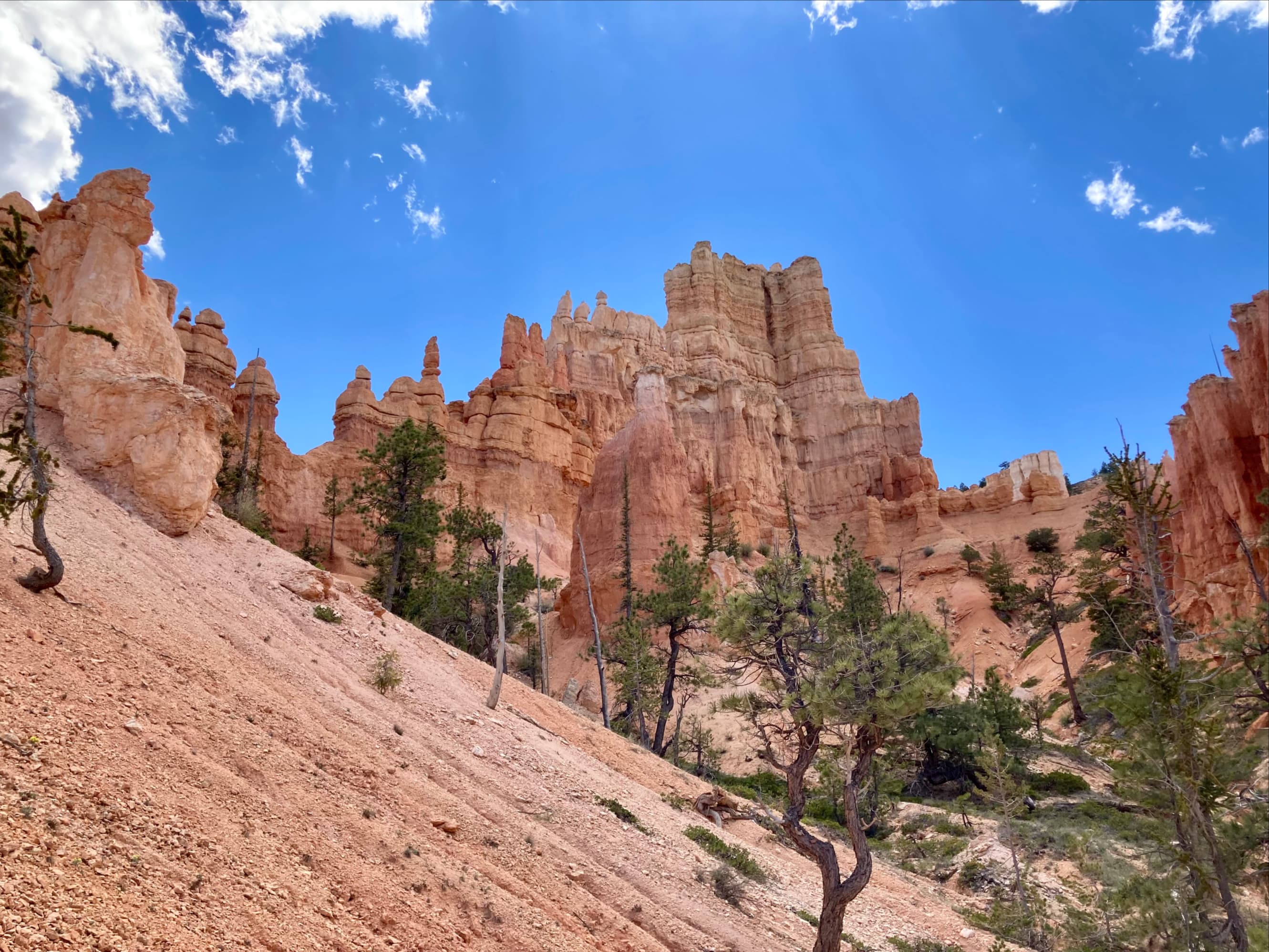
After leaving Queen’s Garden we followed the trail south then west towards Navajo Loop Trail. The Loop goes up and down from the canyon rim. Depending on which way one hikes the loop, you’ll have a steep ascent through Wall Street (a slot canyon) and a steep descent past the rock formations Thor’s Hammer and Two Bridges, or vice-versa. This clockwise direction is how we hiked it. After descending to Two Bridges we actually decided to climb back up to the rim, and from there we set out west along the Rim Trail.

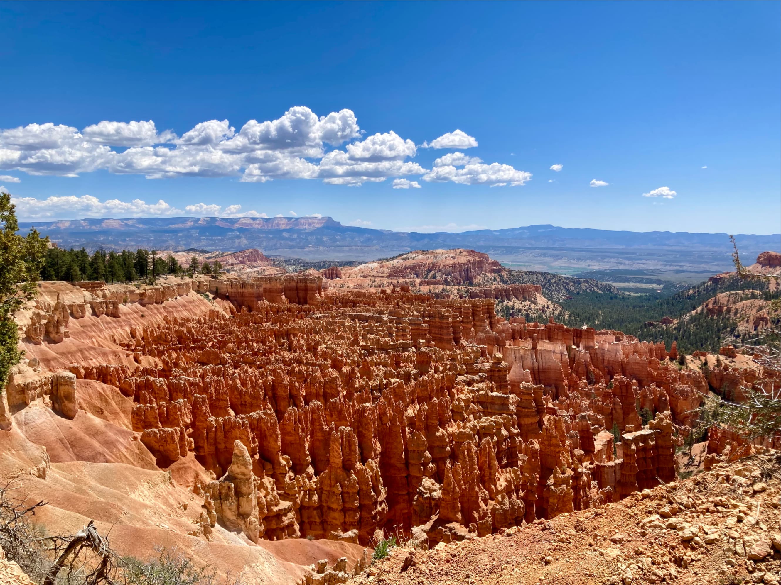
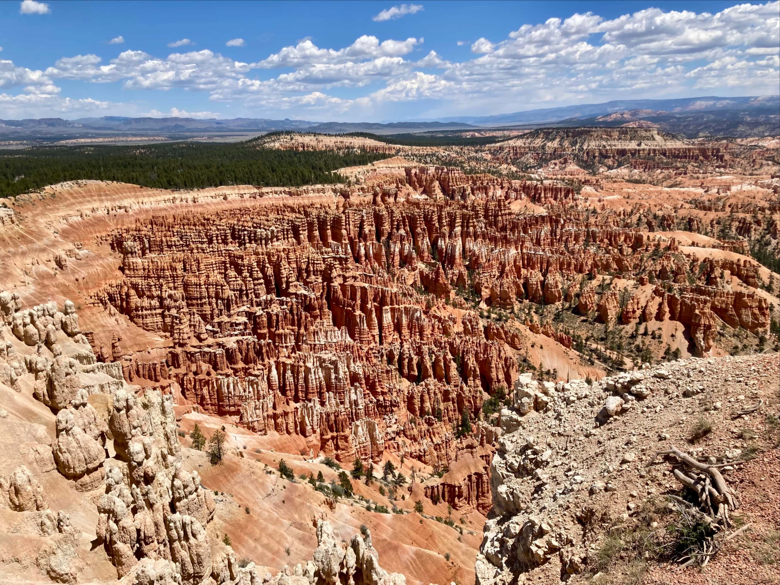
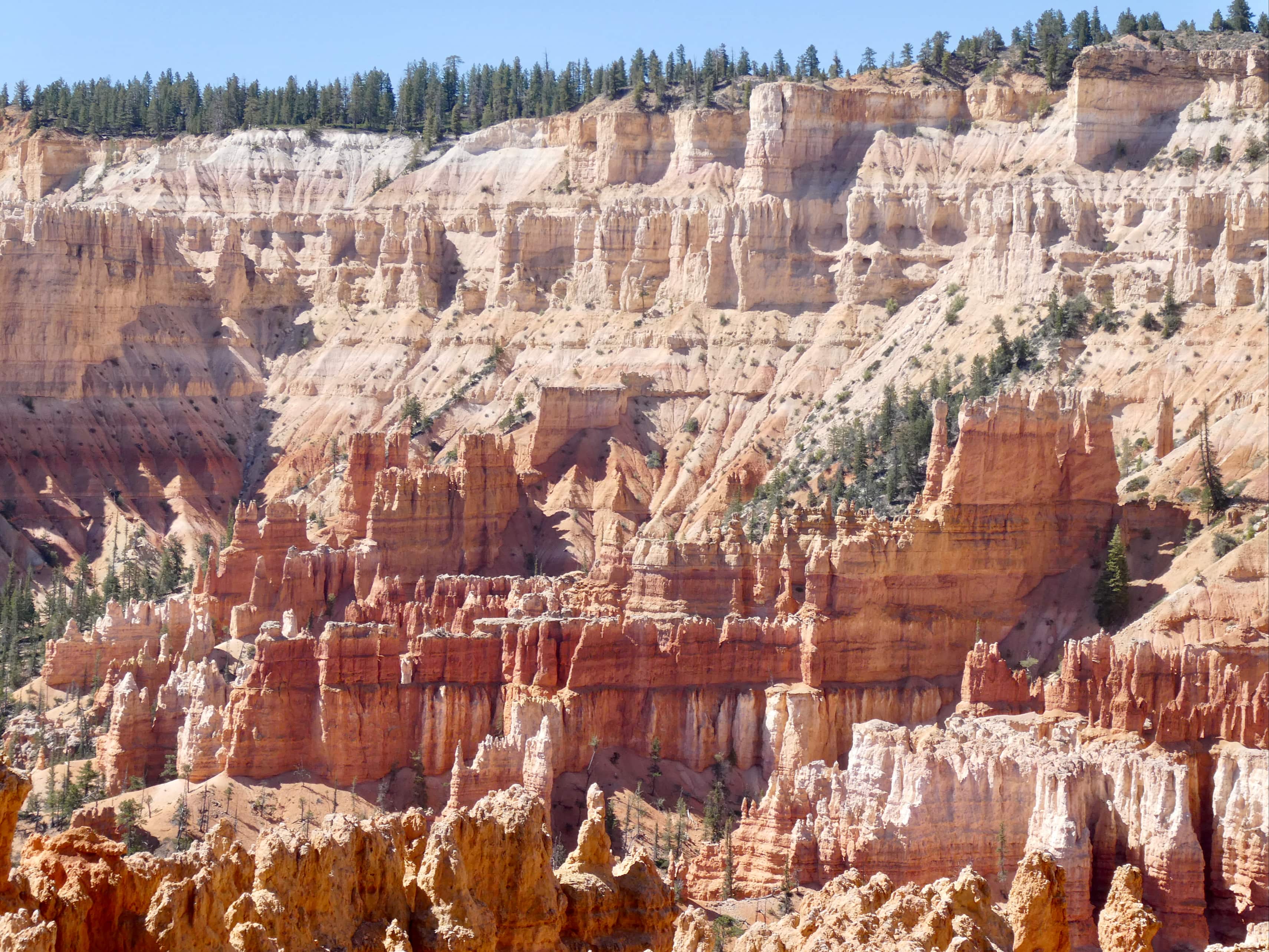
We followed the Rim Trail from Sunset Point, to Inspiration Point, and finally to Bryce Point. This was a distance of roughly 4 km with about 150 m ascent. This trail allowed for the best views down into the amphitheatre. An information placard showed that many of the stone formations had interesting names, like The Cathedral and Wall of Windows. My favourite name was The Silent City, given to the zone of hundreds of closely packed hoodoos sitting below the Rim Trail as it curves between Sunset Point and Inspiration Point.
The Paiute people have a fascinating legend about the hoodoos. They say that before the Paiute came to the land, it was inhabited by the To-when-an-ung-wa – the Legend People. They were not human but had the power to make themselves look human. Long ago, the Legend People were turned to stone by Sinawava, the Coyote God, as a punishment for bad deeds. The hoodoos are their petrified remains.
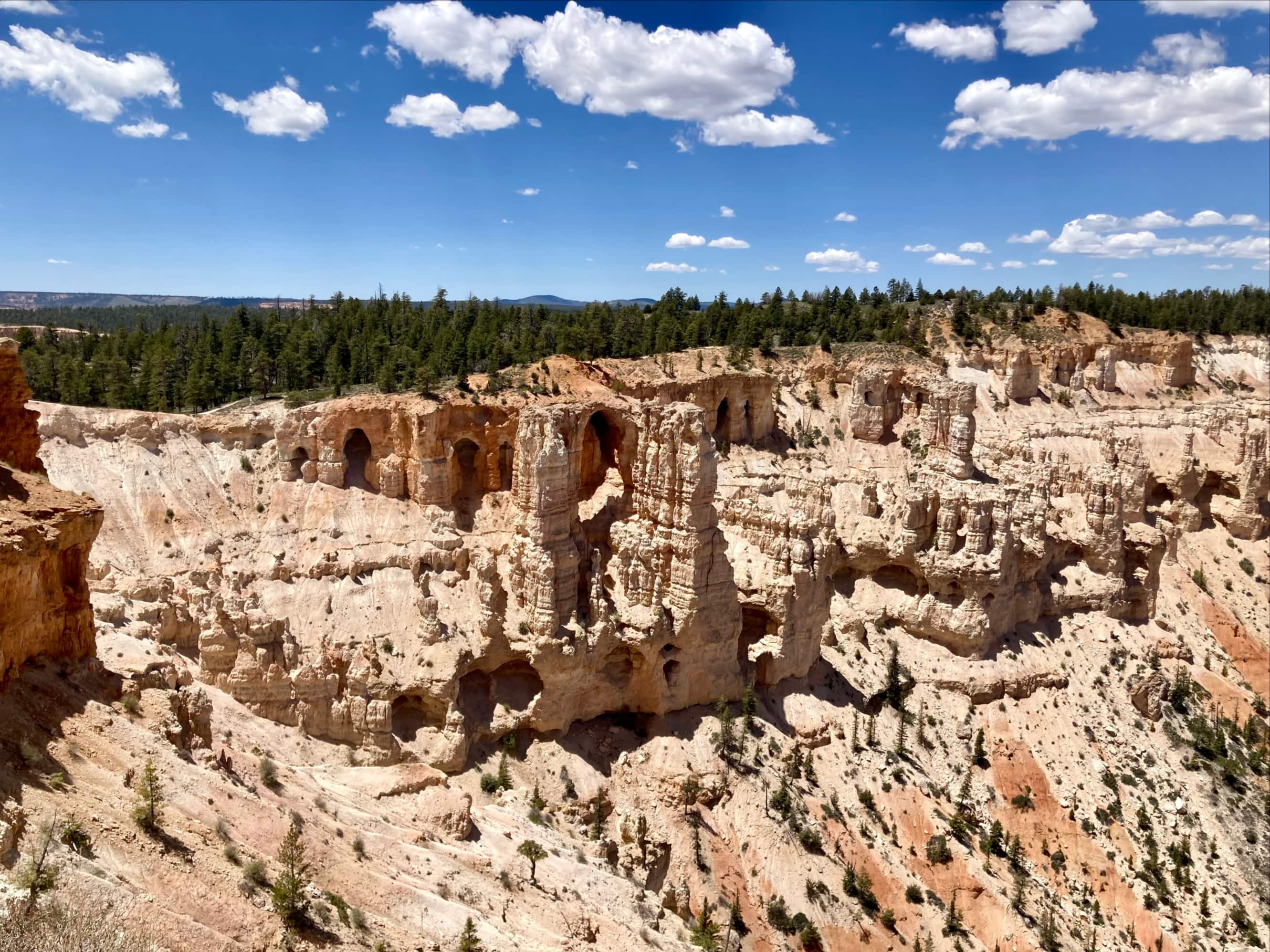
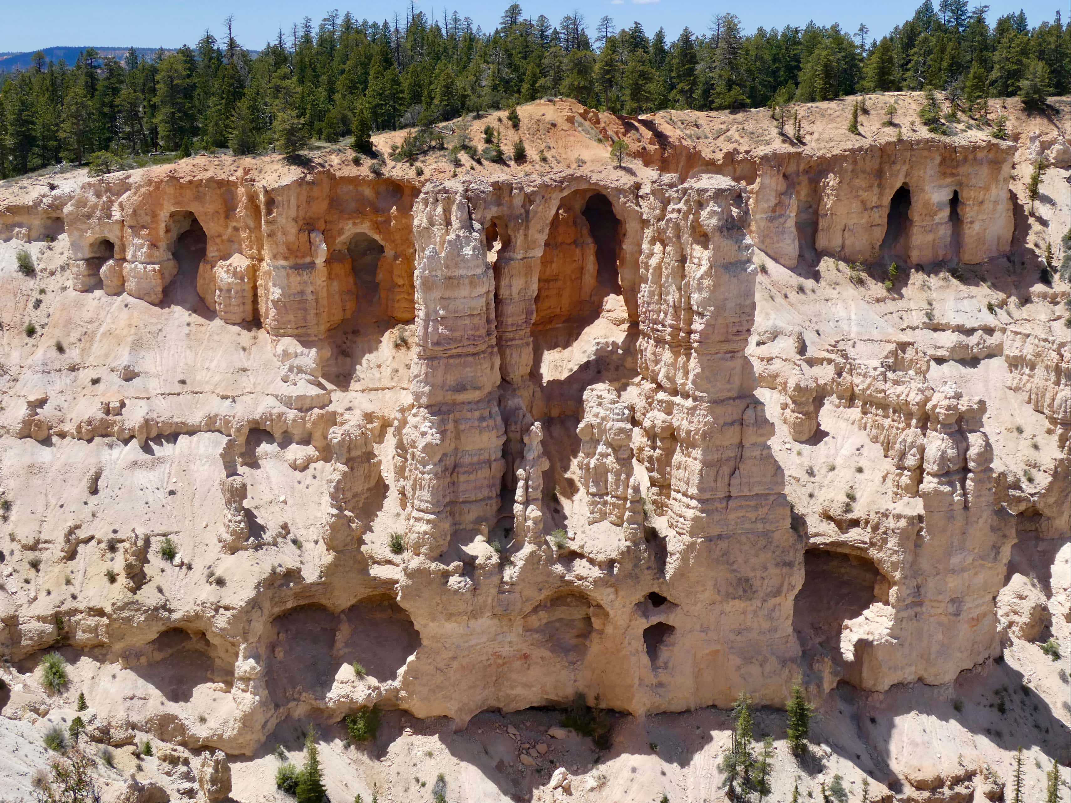
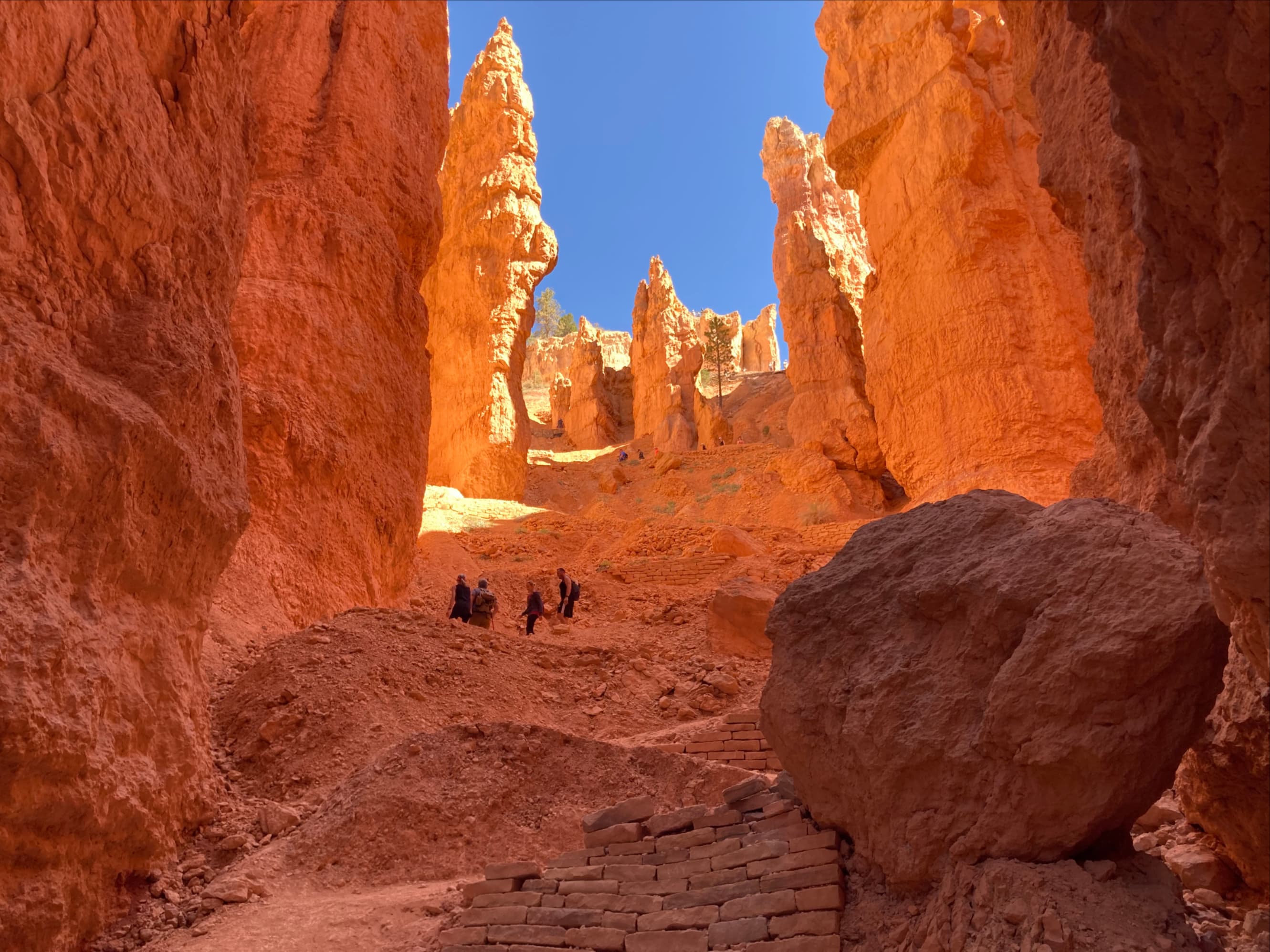
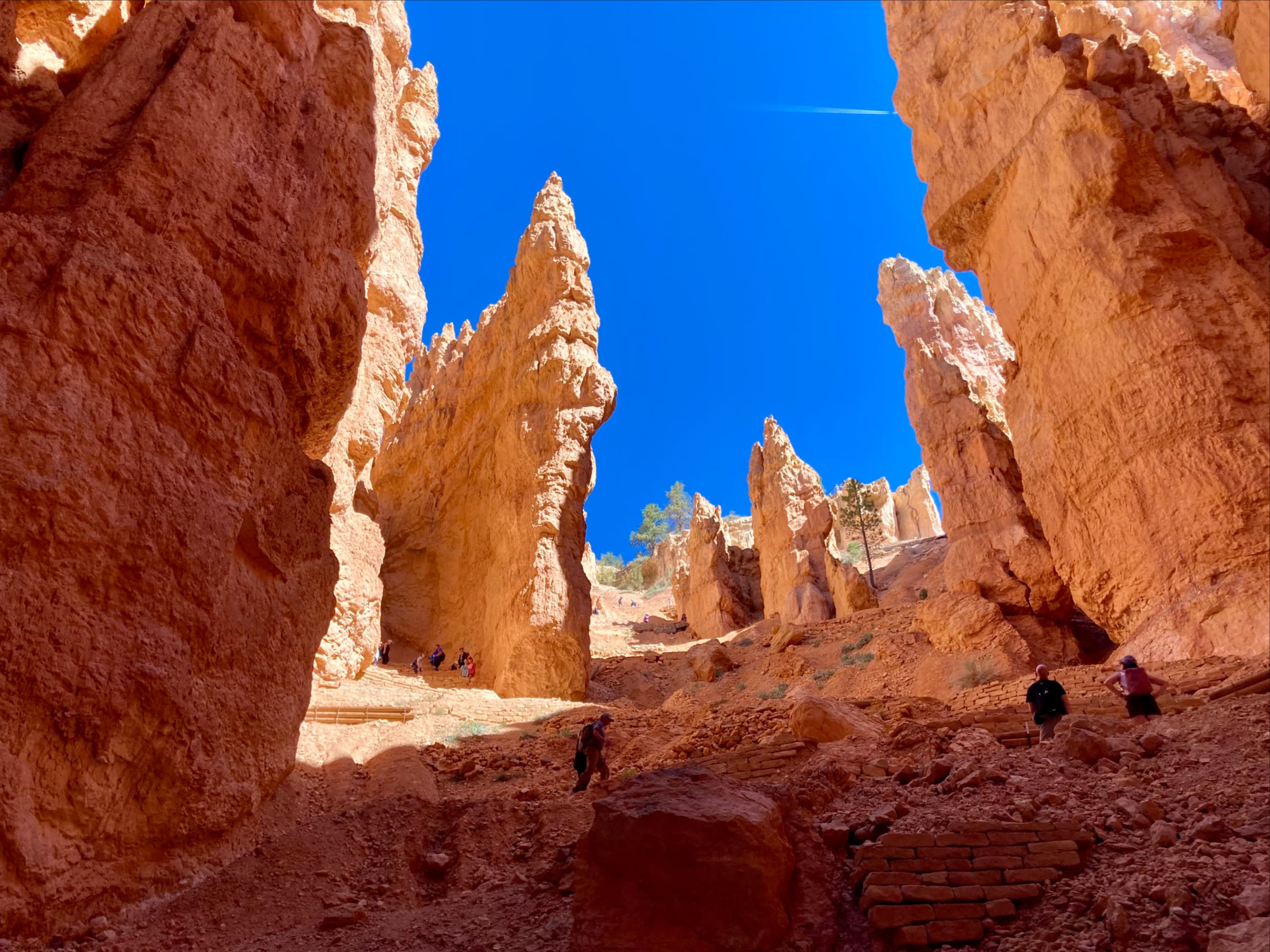
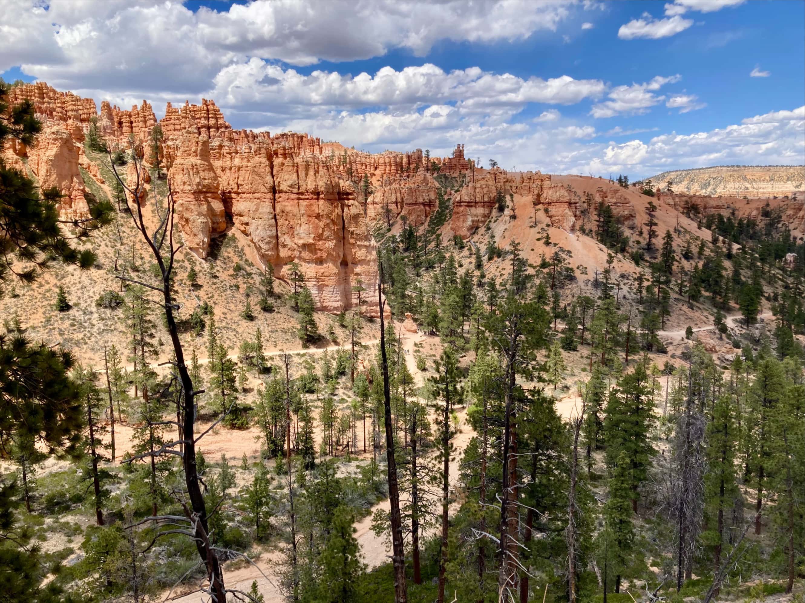
Once at Bryce Point we took a break for snacks and had a short chat with a friendly NPS employee. Bryce Point is directly accessible by road, and by that time of day there were lots of people making their way to the viewpoint. We decided to keep moving and descend back into the amphitheatre. In order to return to our starting point we decided to follow the Peekaboo Connector Trail to Peekaboo Loop. We followed half of Peekaboo Loop, going clockwise, from its intersection with the Connector Trail. At the north end of the loop we departed on Tropic Trail heading west until we reached Navajo Loop. We then climbed up via Wall Street to make our 3rd and final ascent out of the amphitheatre. We then followed the Rim Trail back to our car near Sunrise Point.
With the last hike of our 2024 Arizona/Utah excursion finished, we drove in hot, sunny weather back to our hotel in La Verkin to get ready for an early departure back to Las Vegas the next day. This trip was an eye-opener for me, being my first hiking trip in a hot climate. During those spring months when hiking conditions in Alberta are still hit-and-miss, conditions in Arizona and Utah are ideal…and there are so many parks to explore we’d never run out of trails to hike. We reminisced on the week gone by and pondered future springtime trips to the U.S. over a lovely Mexican supper in the town of Hurricane.

Thanks Par for sharing all your hiking experience and photos. It must be an awesome experience hiking the trails
LikeLike