Deadman Peak is an unofficial summit that’s described by Nugara in More Scrambles in the Canadian Rockies 3rd ed.Dave McMurray and So Nakagawa seem to have pioneered this trip in the scrambling blogosphere and their reports remain useful for anyone planning to ascend. A couple of weeks ago I retreated from this mountain because of incoming inclement weather, so when a sunny day with fair weather presented itself I made my return.
Access is from a clearing a short distance north of the Atlas Staging Area on the Atlas Road in the Crowsnest Pass. Drive west from Coleman and turn north onto the Allison Creek Road. Continue on the road past the turn-off to the camping area where the pavement ends. From here the road is rocky, rough, and rutted. Pass the Atlas Staging Area. Approximately 7.6 km from the highway a dirt road will descend slightly to the left (west) into a large clearing. Click here and Google will drop a pin on the turn into the clearing. This place is used for random camping and ATV staging. I parked at a convenient spot and set out from there.
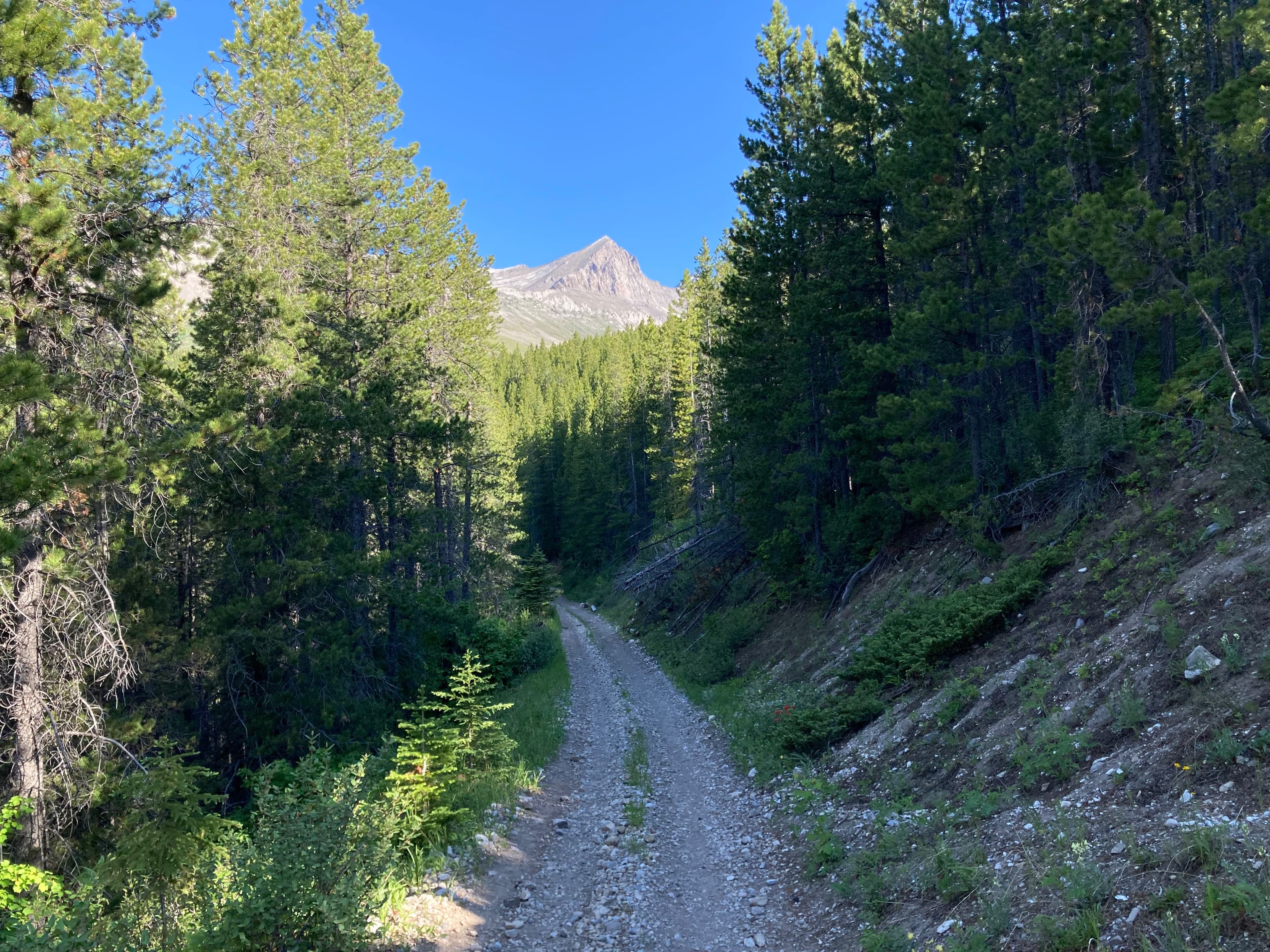
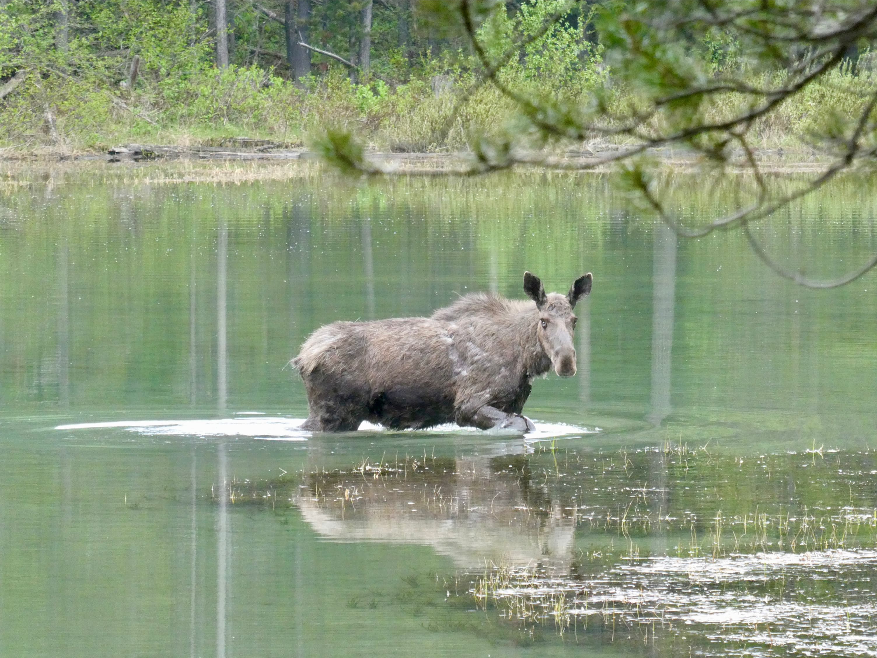
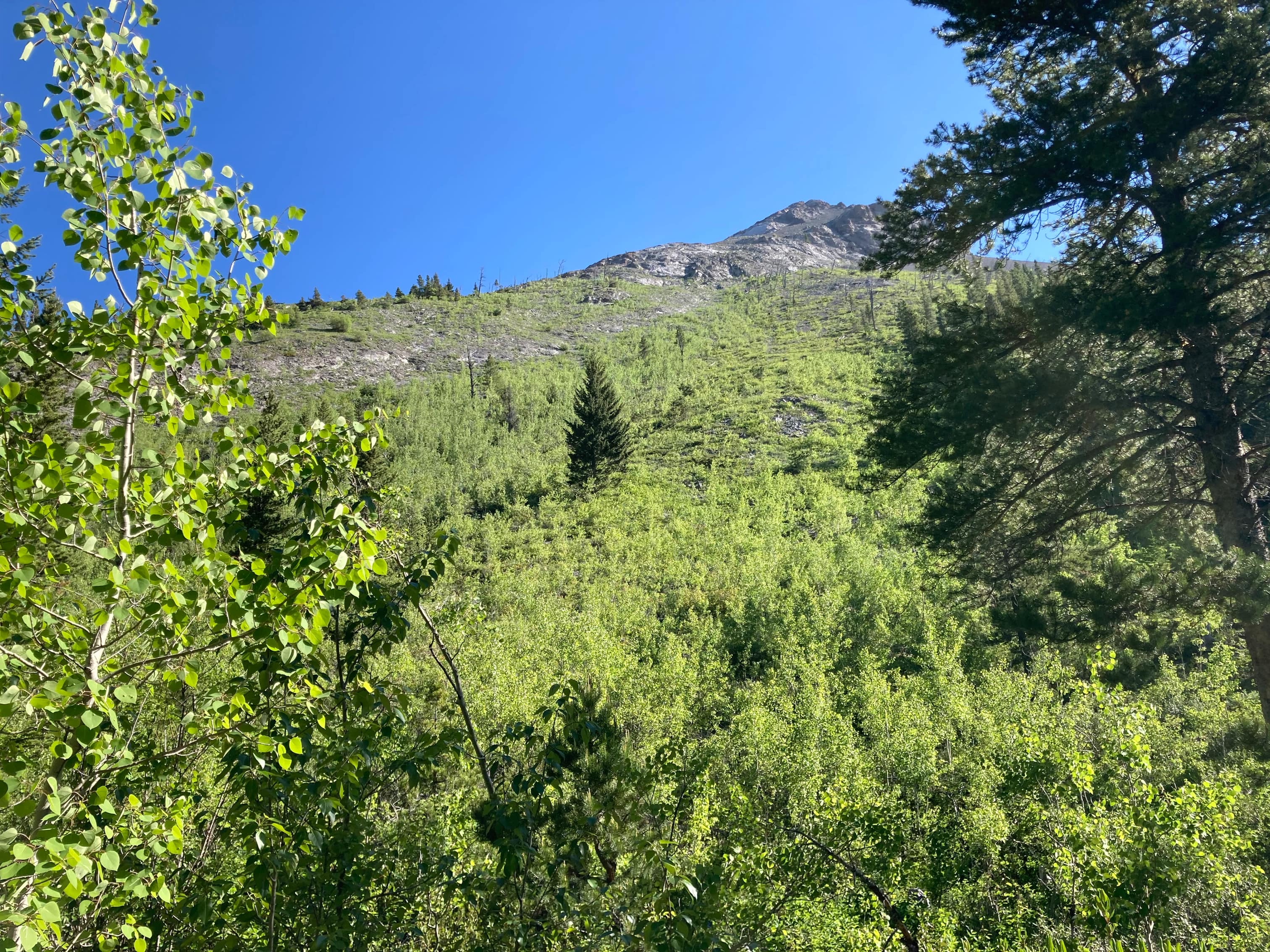
At the west end of the clearing is an ATV trail running north/south. This is the approach trail. I followed it north then immediately turned left and crossed a bridge at the first fork. After short intervals two more forks were encountered and I went left at both. After the 3rd fork the trail starts to descend a bit and is eventually crossed by another ATV trail. Continuing straight on, I soon encountered a large pond. Moose frequent this area, and during my aborted ascent a few weeks ago I was lucky enough to see one wading around. Not far beyond the pond, an avalanche slope appears to the right. This is after roughly 45 minutes of hiking. I know some people ascend here, but a very short distance beyond is another avalanche pathway. This gives a direct view to the ridge, so I started my ascent here.
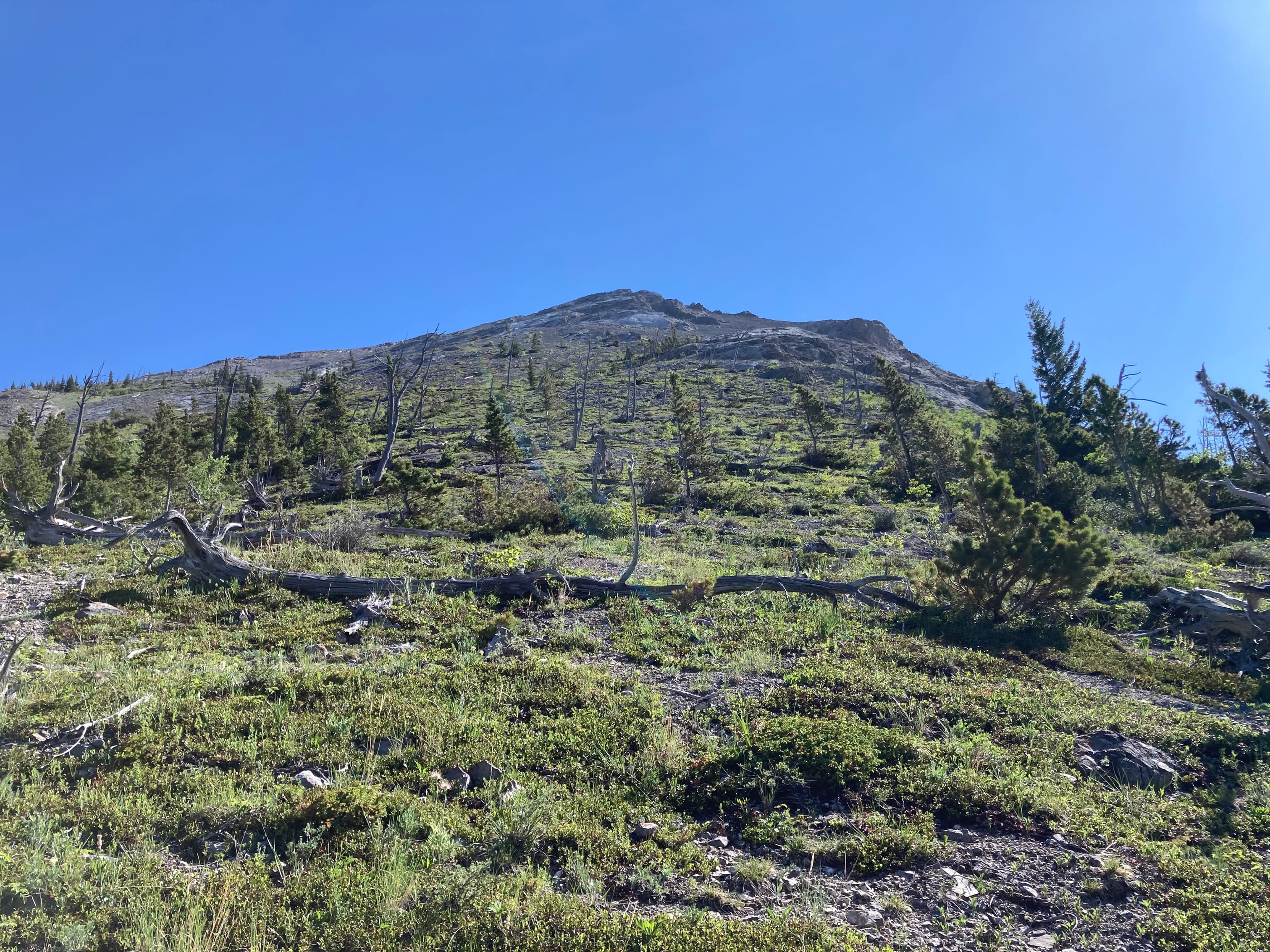
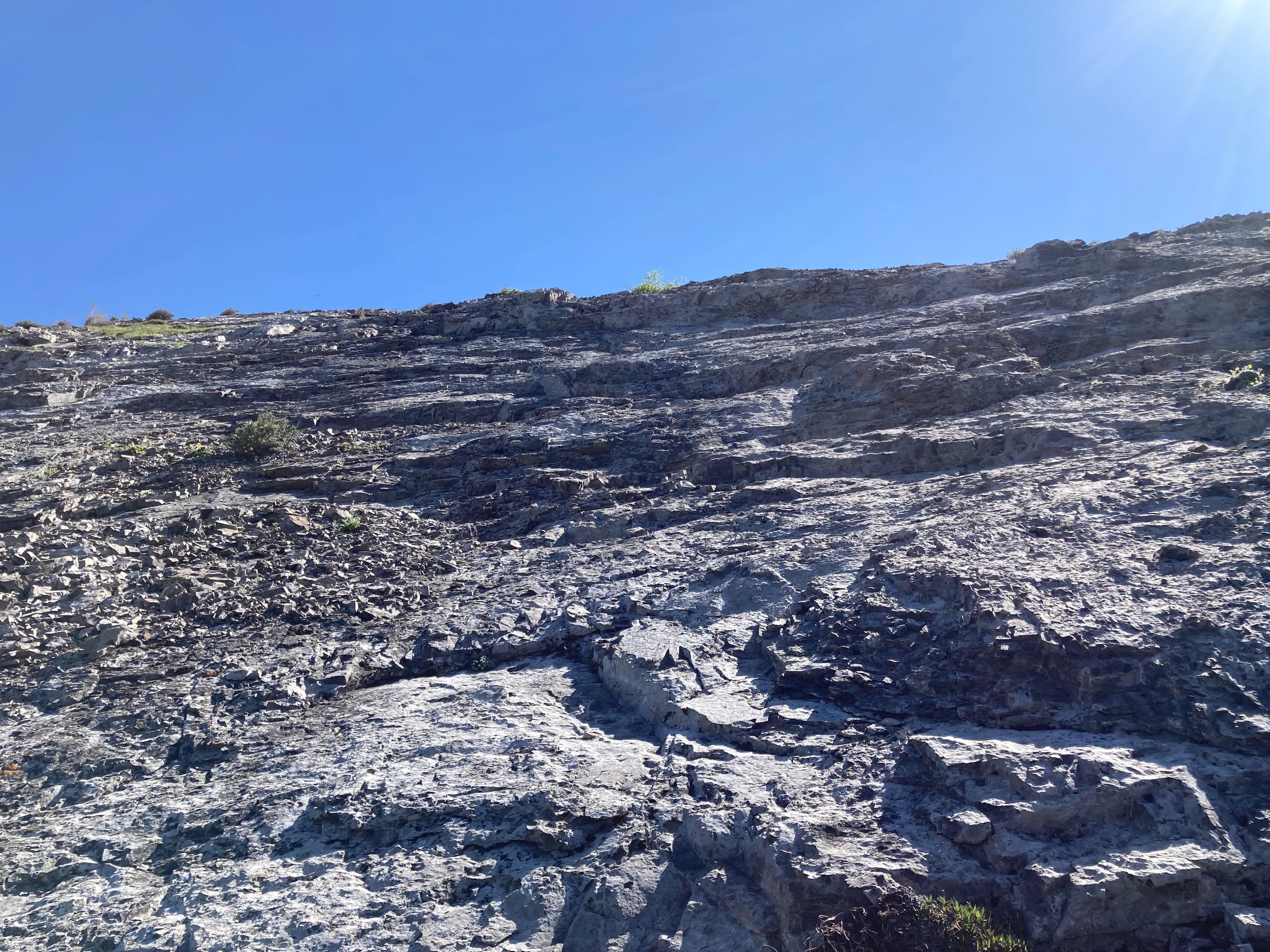
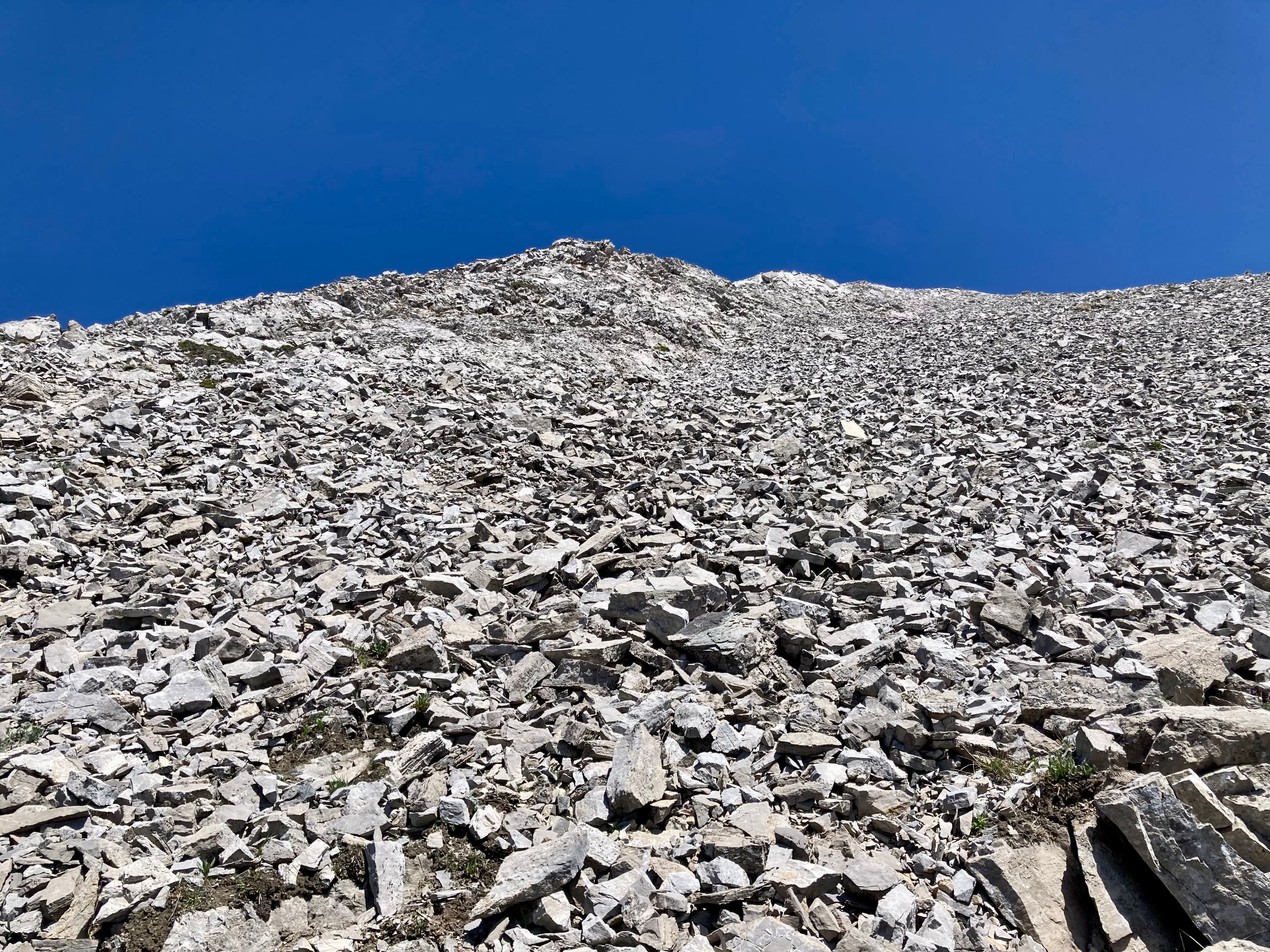
Ascending the avalanche slope was difficult for me. The terrain is very steep, not always supportive, and covered with bushes and small trees. A steep uphill bushwhack on bad footing is miserable. As I’d discover at the end of the day, a steep downhill bushwhack on bad footing is even worse, and dangerous. I fell pretty hard. In any event, I angled my ascent to the left and got onto the ridge as soon as possible. From there I toiled upward, trying to stay on supportive terrain or scramble up slabs as much as possible. Danger lurks in this area, too, with steep slabs sometimes just barely beneath a layer of loose rubble. Another thing to keep in mind for the descent.
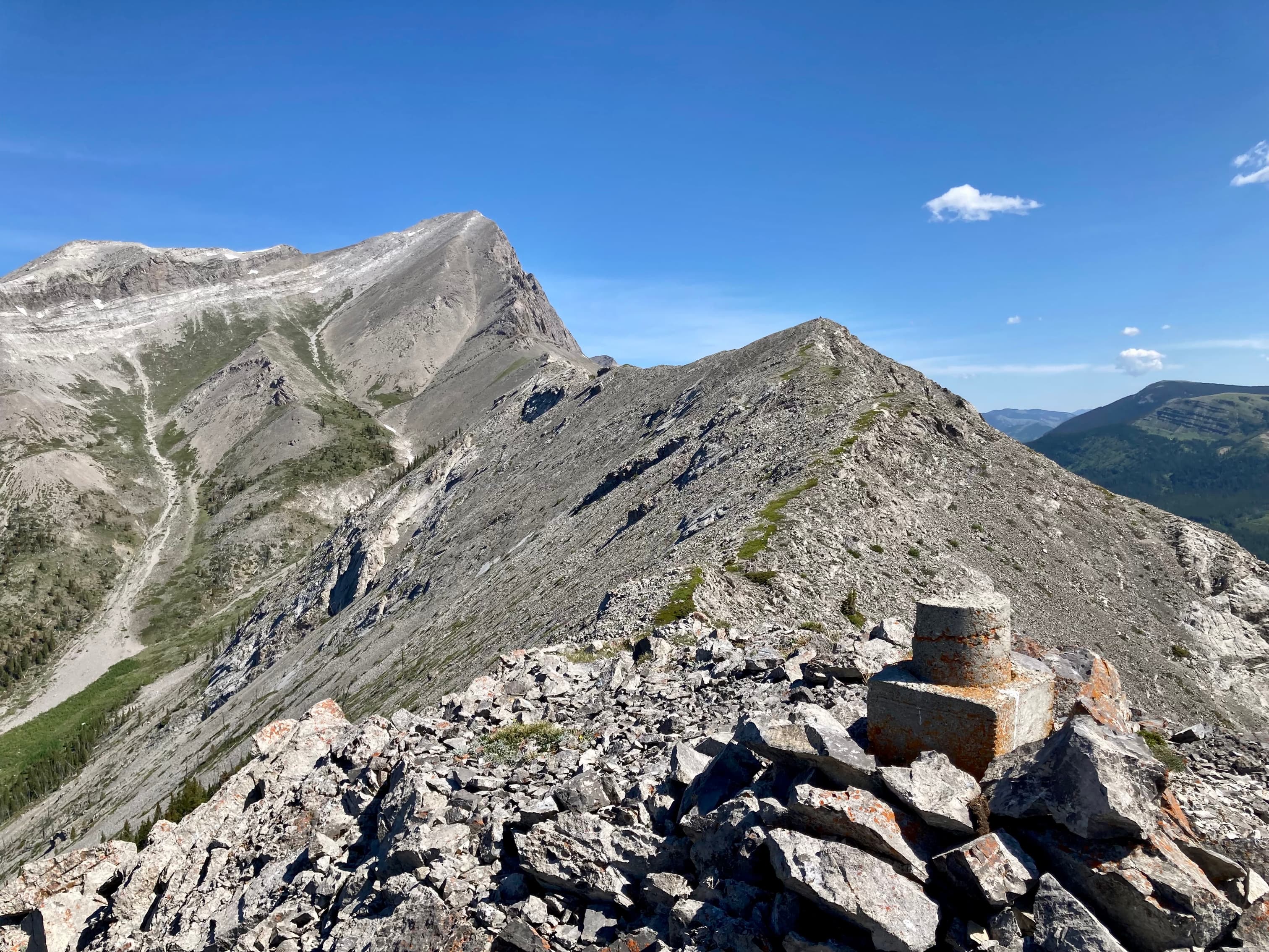
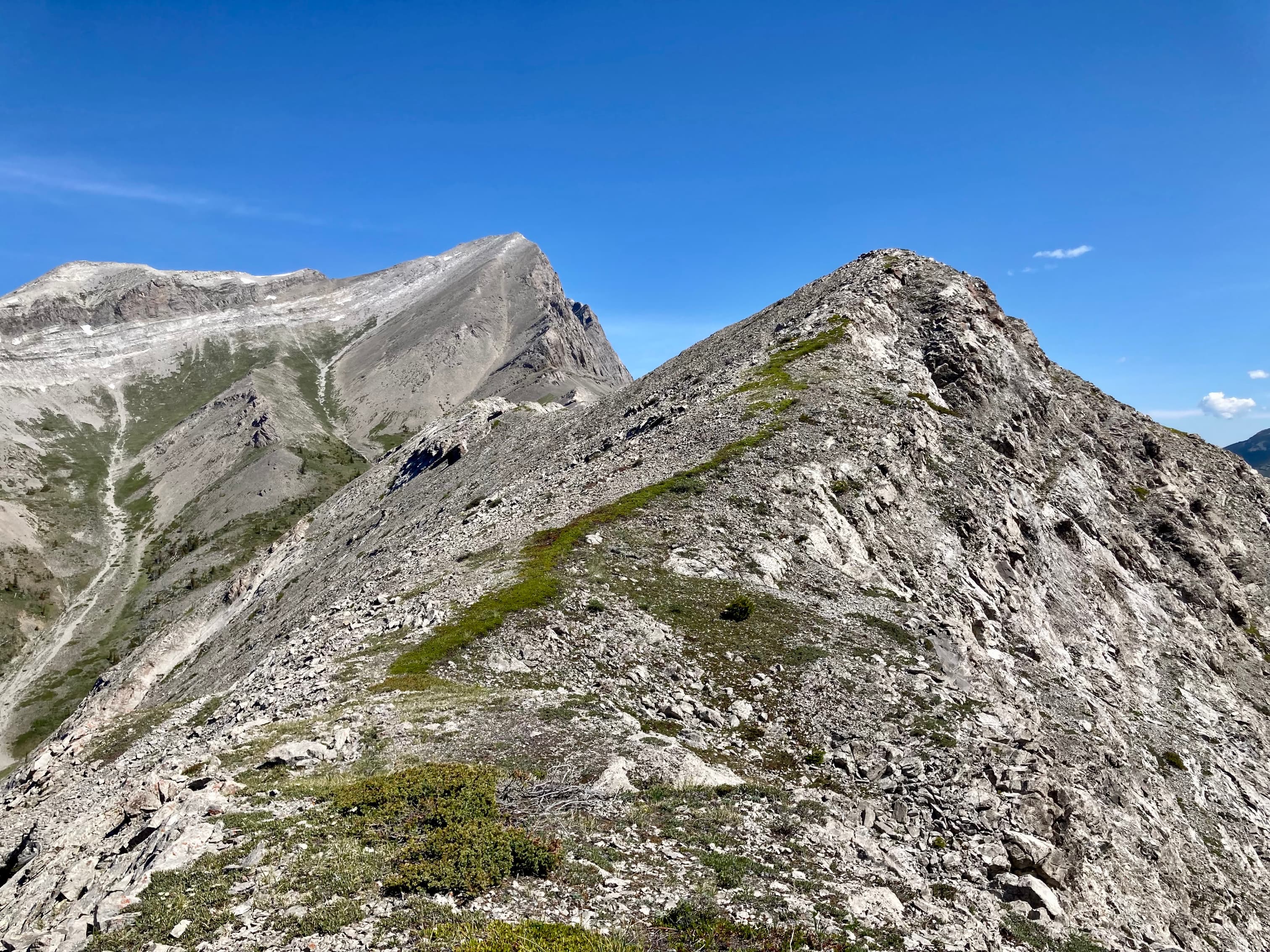
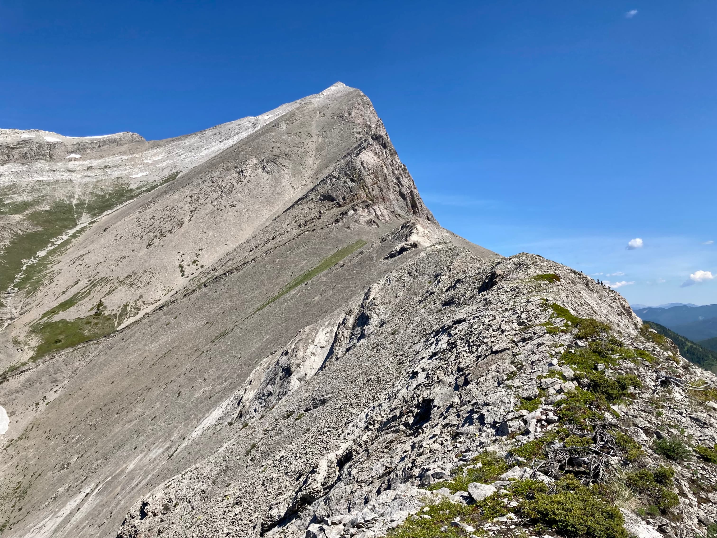
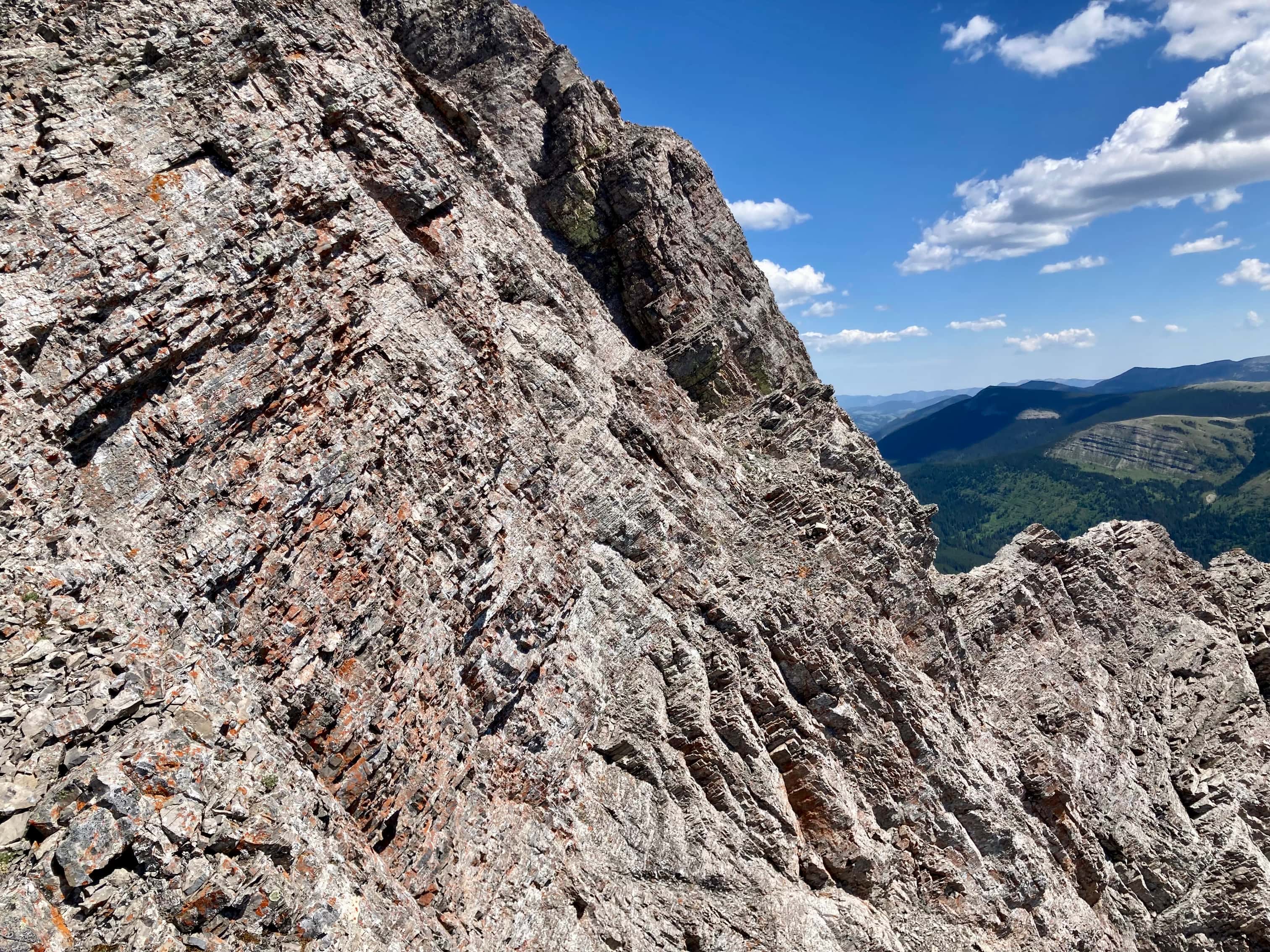
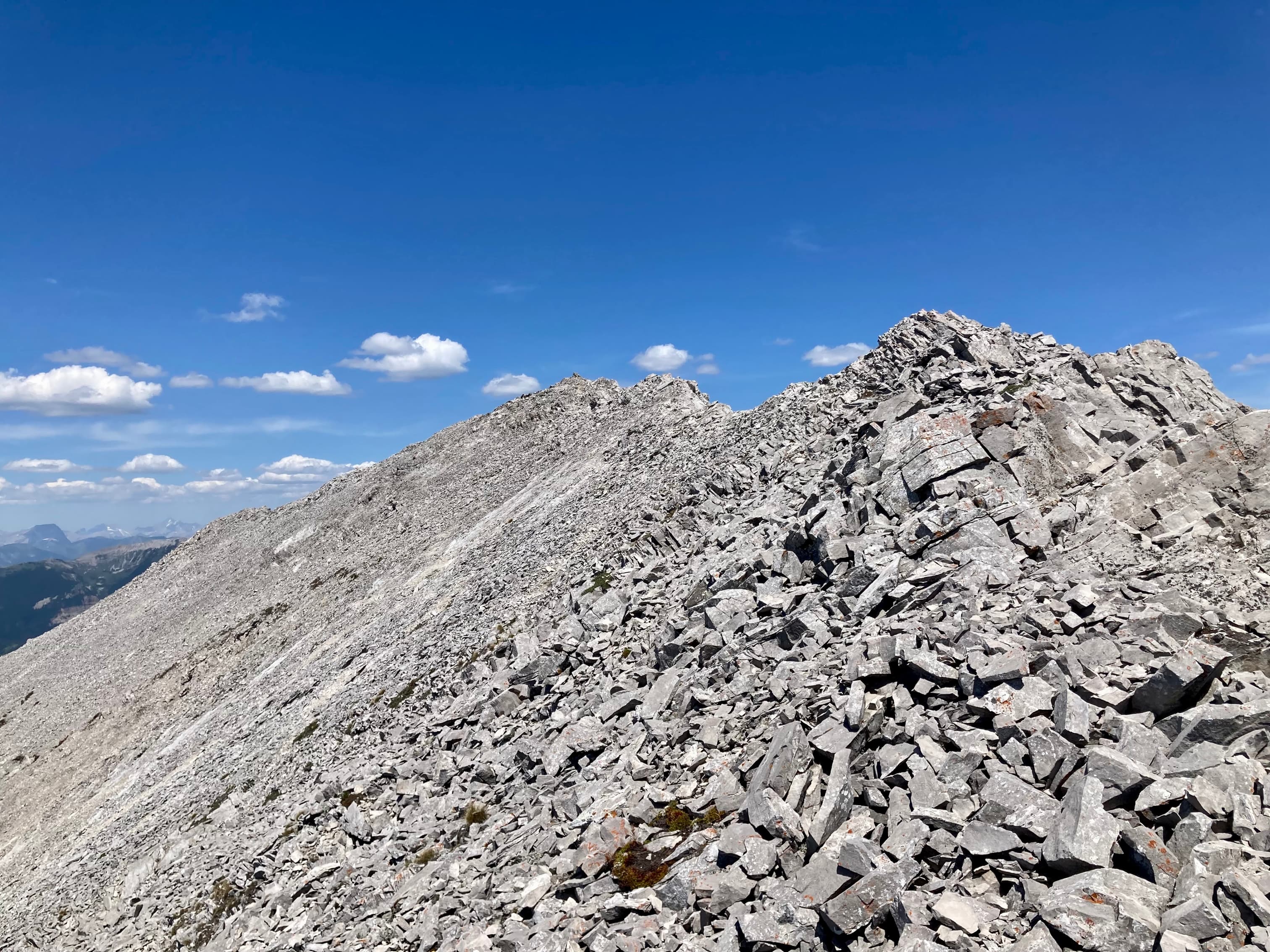
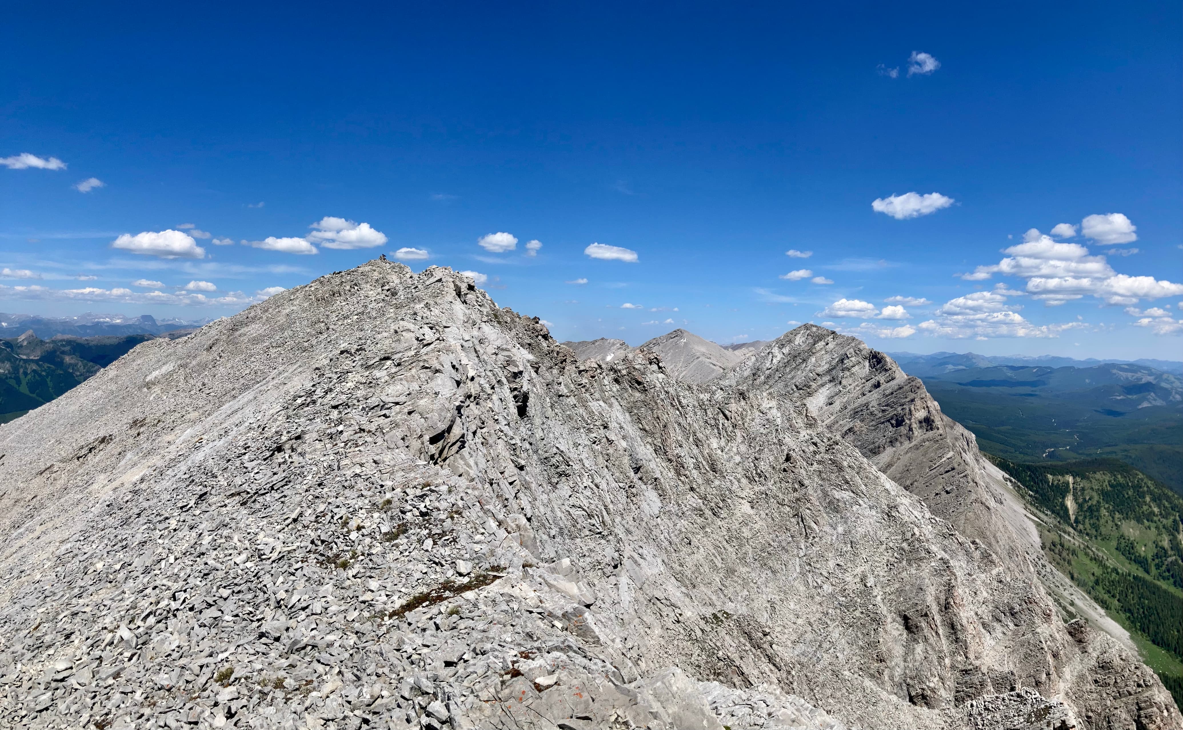
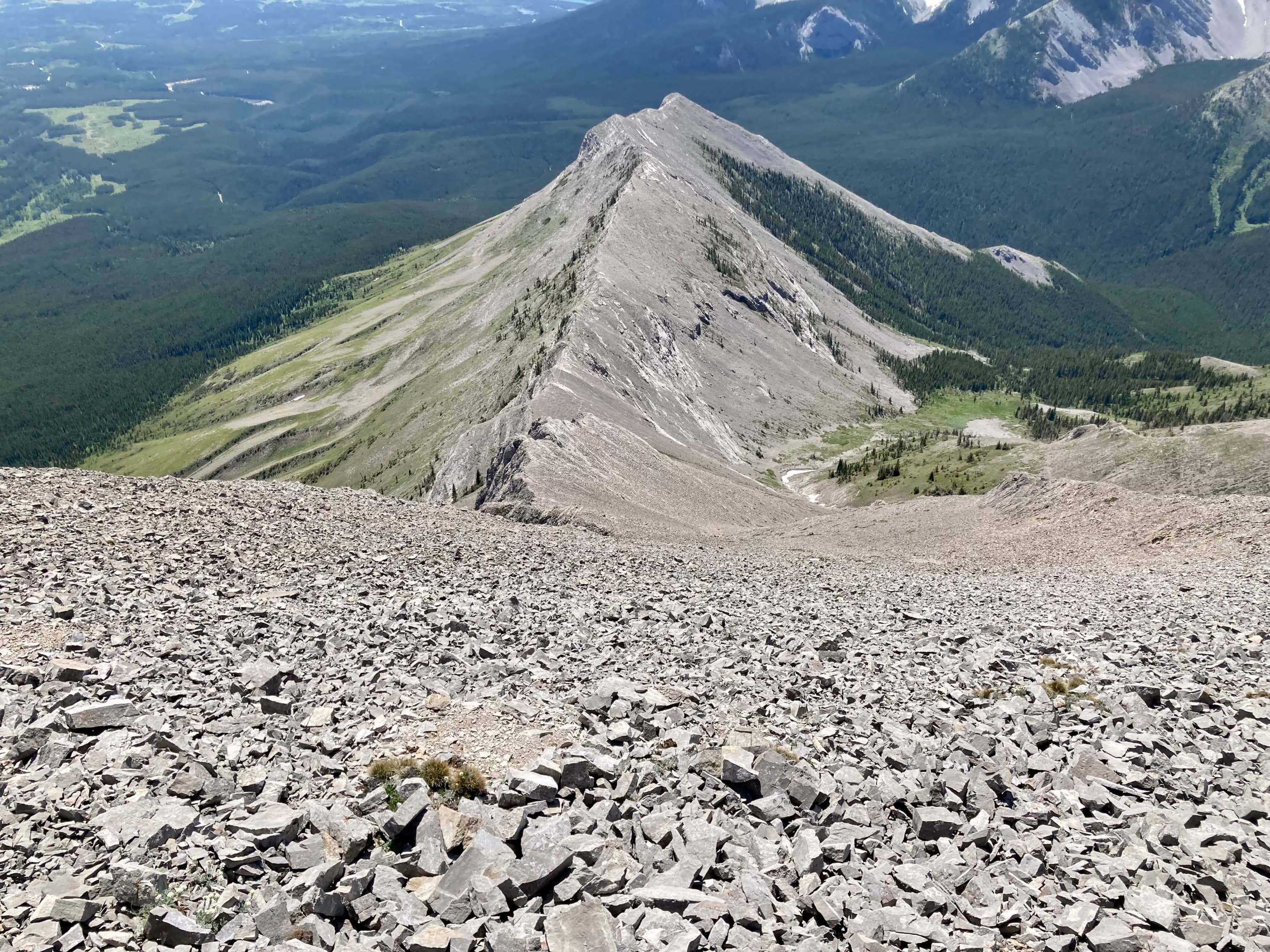
I eventually reached the ridge top and took in the view of the summit to the north. I followed the top of the ridge and enjoyed about a kilometre of great ridge walking. Eventually, I reached a small grassy col which marks the foot of the final ascent. Straight ahead were impressive rock bands. To the left was steep scree in a wide gully. I picked a route through the rock bands, drifting left whenever the terrain seemed to challenging but avoiding actually trying to climb the scree. Any time I did have to detour left I’d cut to the right again to stay close to the ridge. I was on “moderate” scrambling terrain for most of it. Just below the summit, the rocky ridge ends and a cliff wall beneath steep, loose rubble slopes is straight ahead. I veered left here, envisioning the nightmare of slowly sliding down that rubble slope and over the cliff. I could see a short rib or ridge of solid rock that appears at this point on the other side of the scree field. I made my way to it and climbed the rest of the way to the summit.
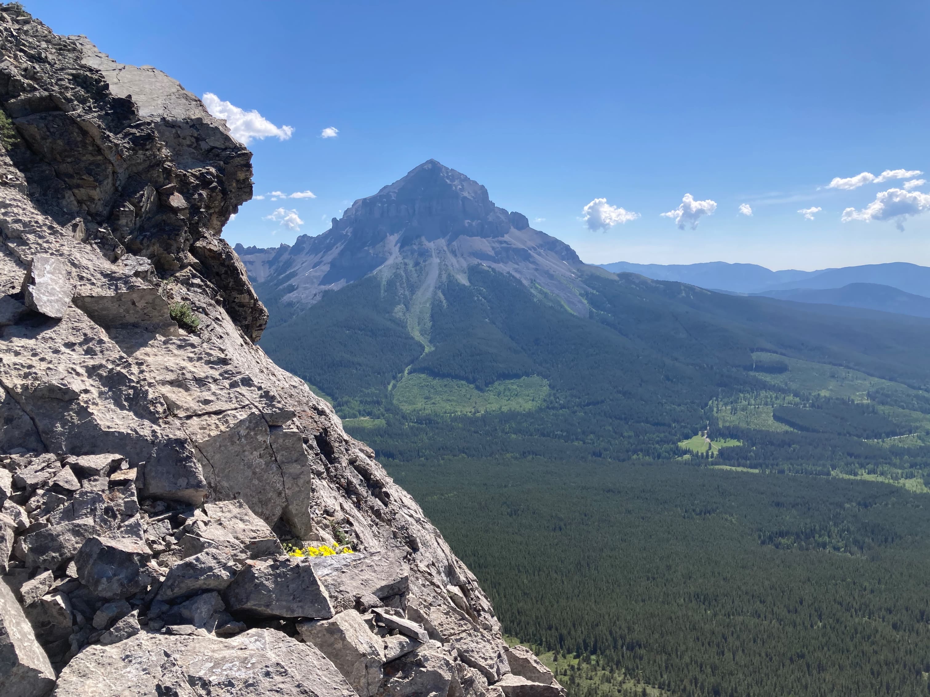
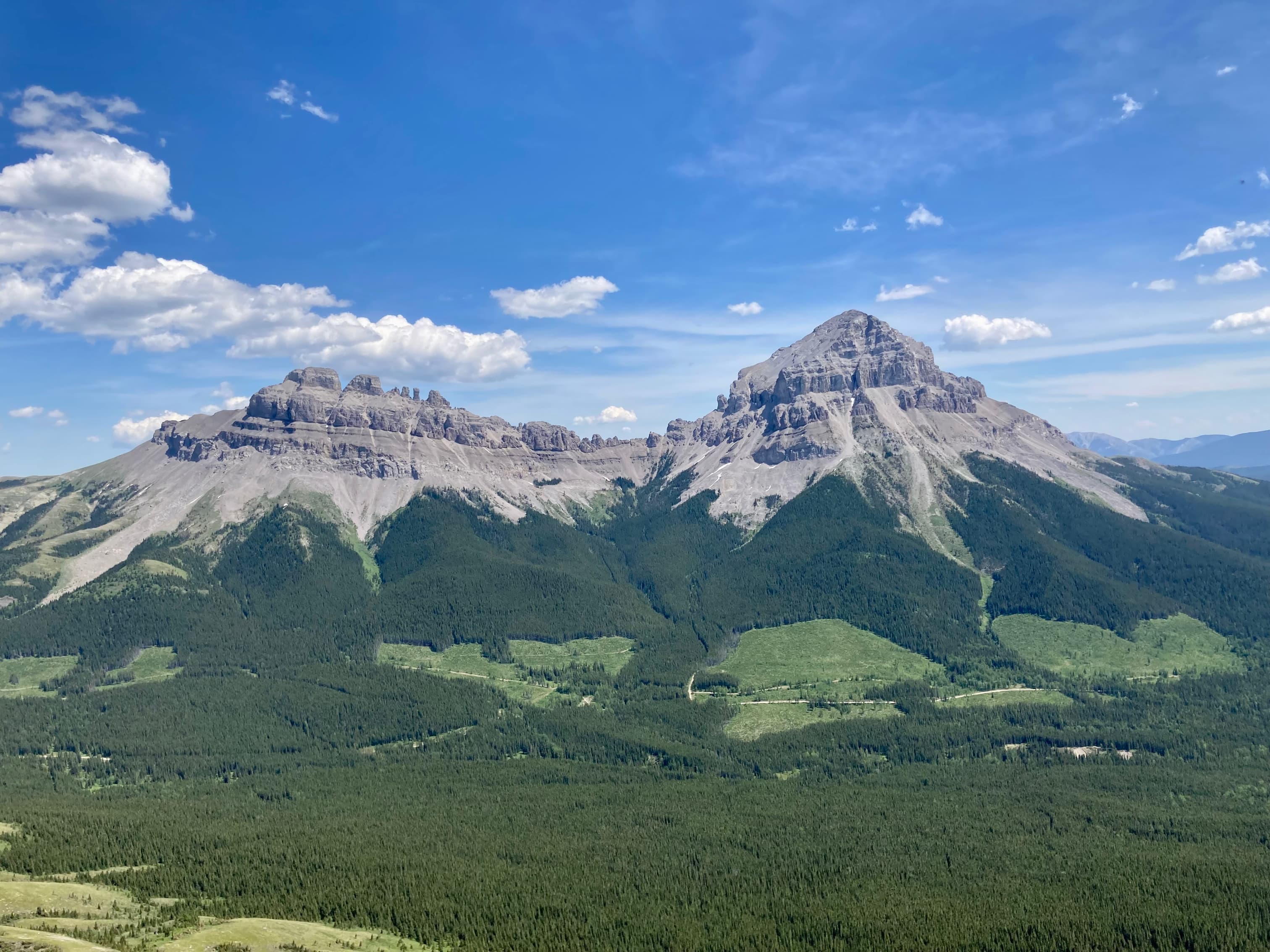
The summit was almost windless, and views were only slightly marred by thin smoke in the air. The summit is on the Alberta/BC border, so there are great views into the area of Fernie and even as far as Mount Fisher. Mount Tecumseh, Phillips Peak, Crowsnest Mountain, and Seven Sisters dominated the view closer by.
After a leisurely lunch, I returned along the same path. For my initial descent I stayed to skier’s right so I’d be nowhere near the cliffs. I avoided the rock bands or down climbed at easy spots. In retrospect, I might have been able to rapidly go down the middle of the scree gully and just kept my eye out for the grassy col, cutting over when it came into view. I then followed the ridge back to the avalanche pathway and got myself back to the ATV trail. I fell as I came off the ridge onto the avalanche pathway but managed to avoid major injury. After I picked myself up I imagine I looked pretty sad slipping, tripping, and sliding my way down to the trail. If there’s a graceful way to descend terrain like that I’d like to know what it is.
Click/tap on the images in the gallery below to access higher resolution pictures.
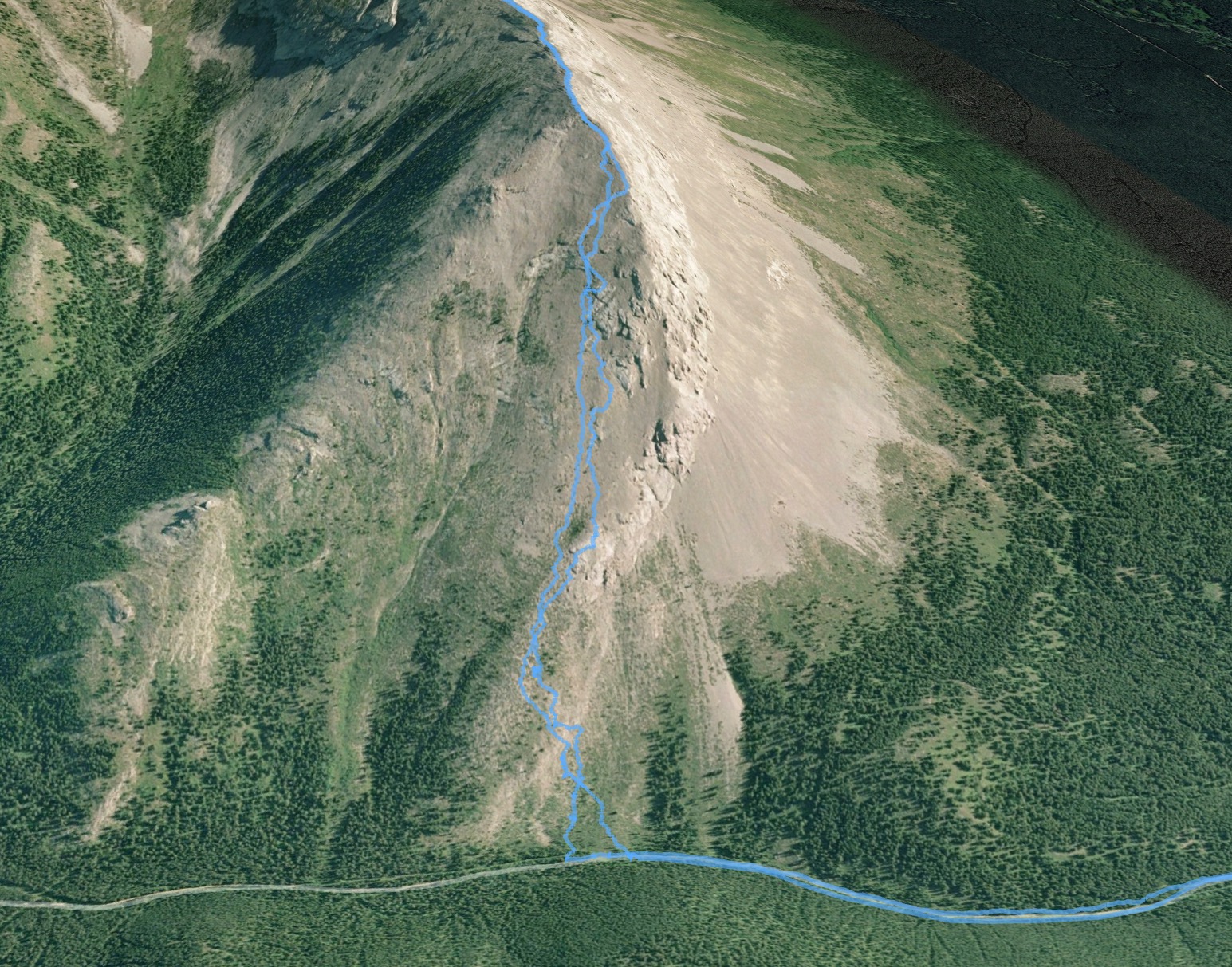
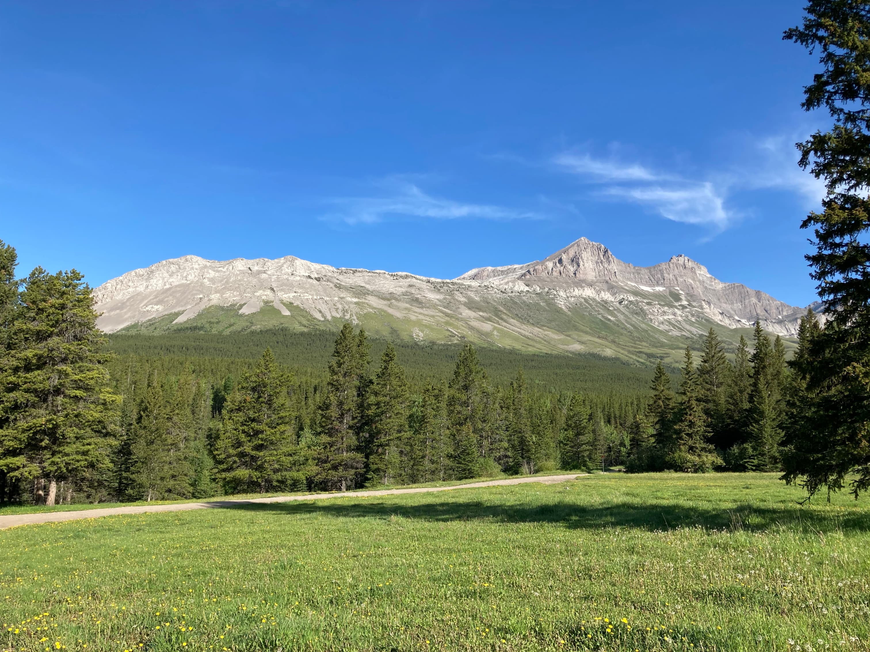
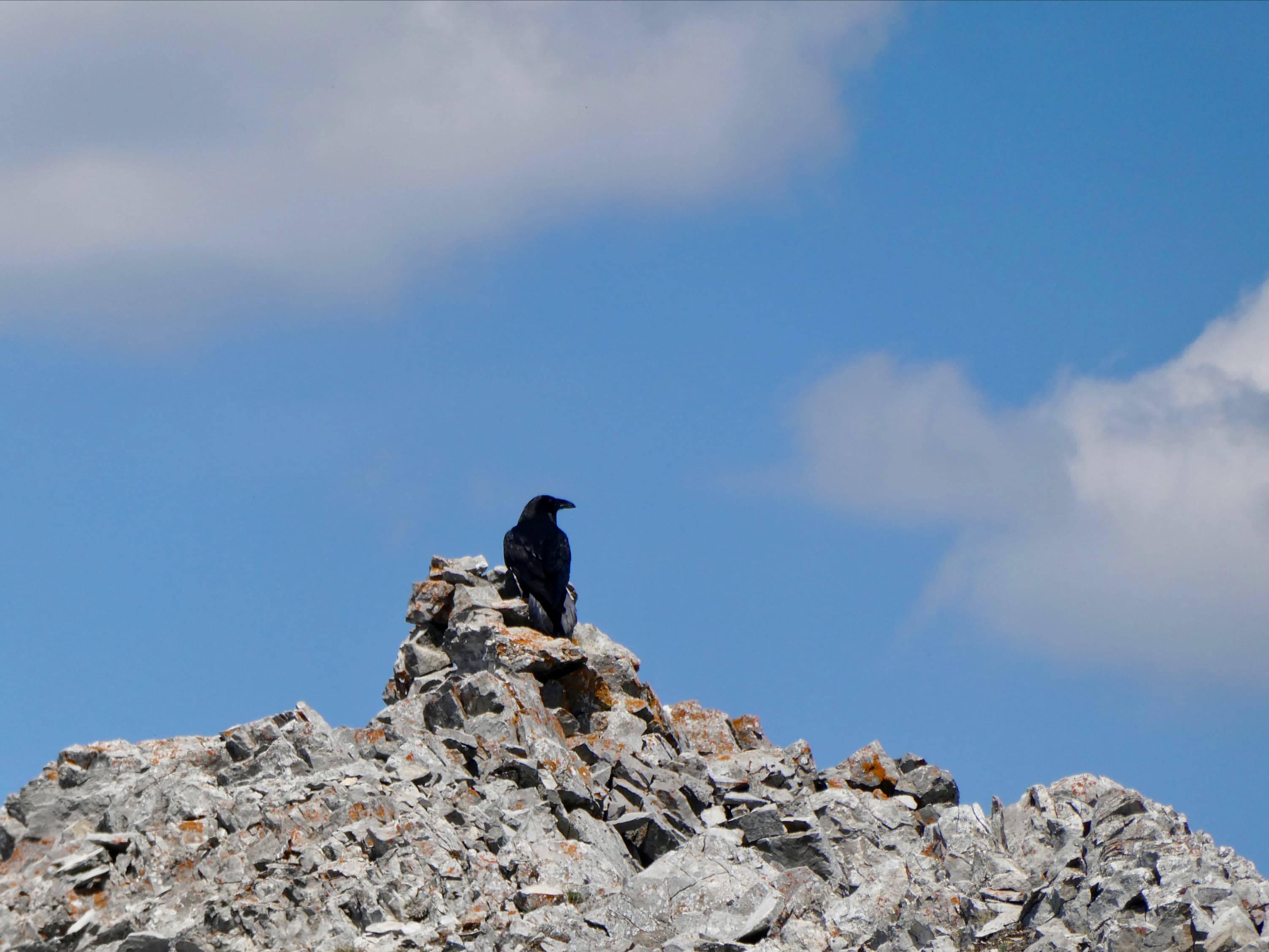
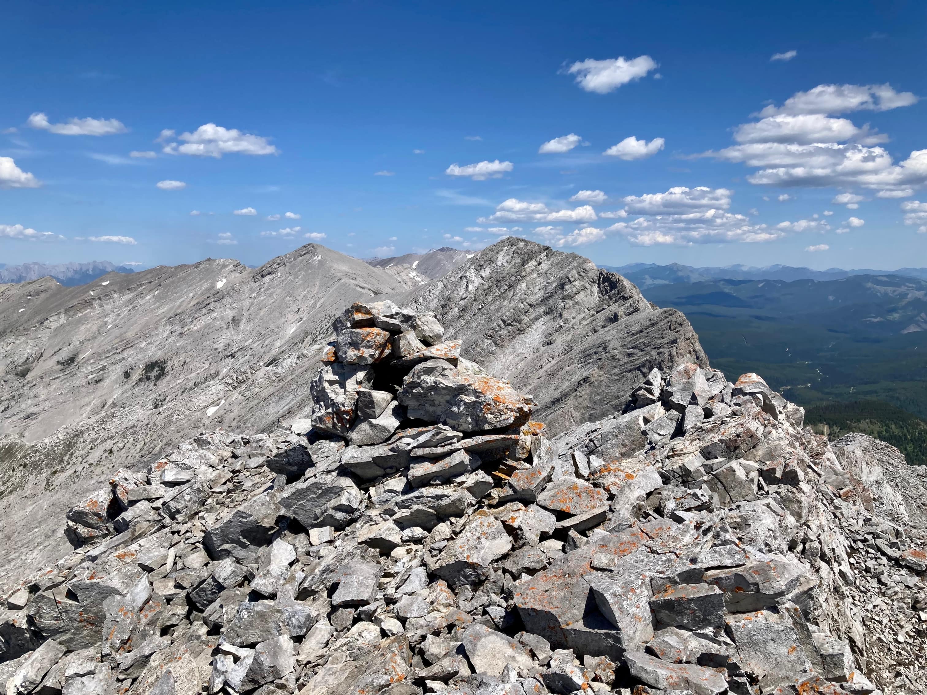
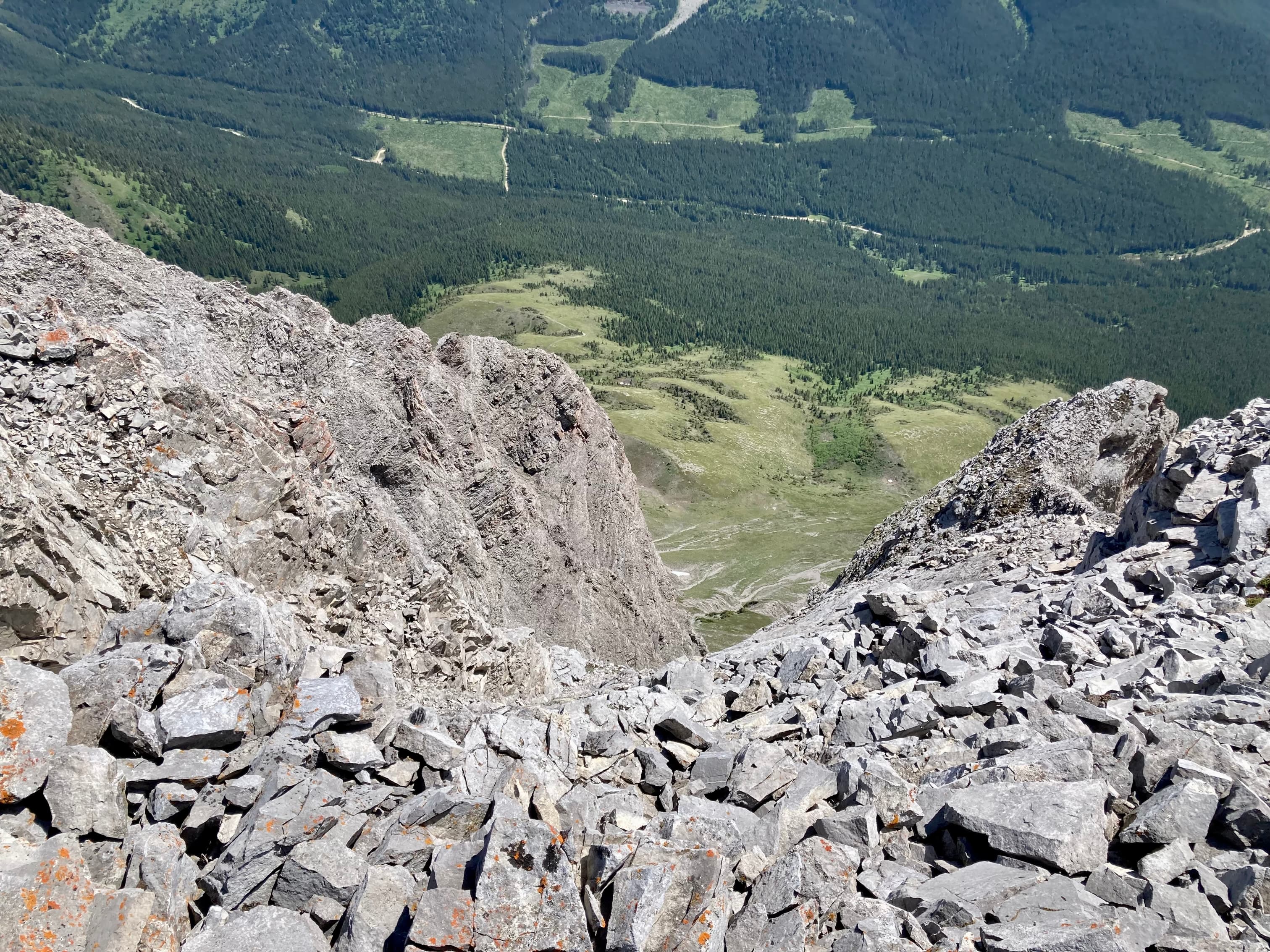
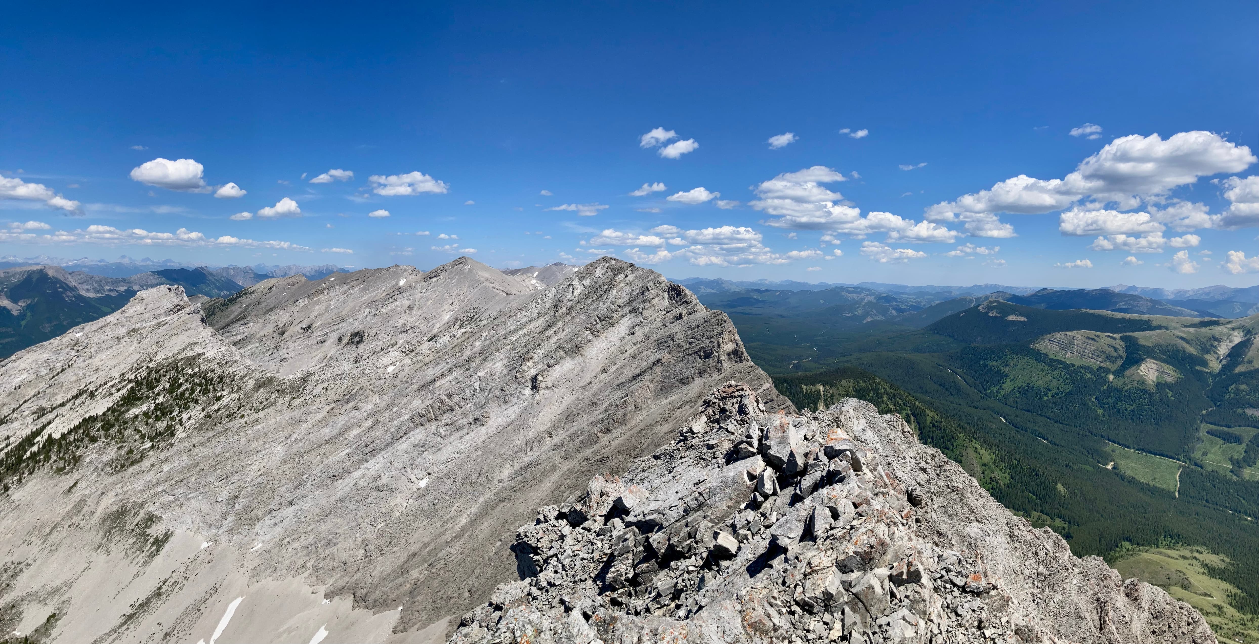
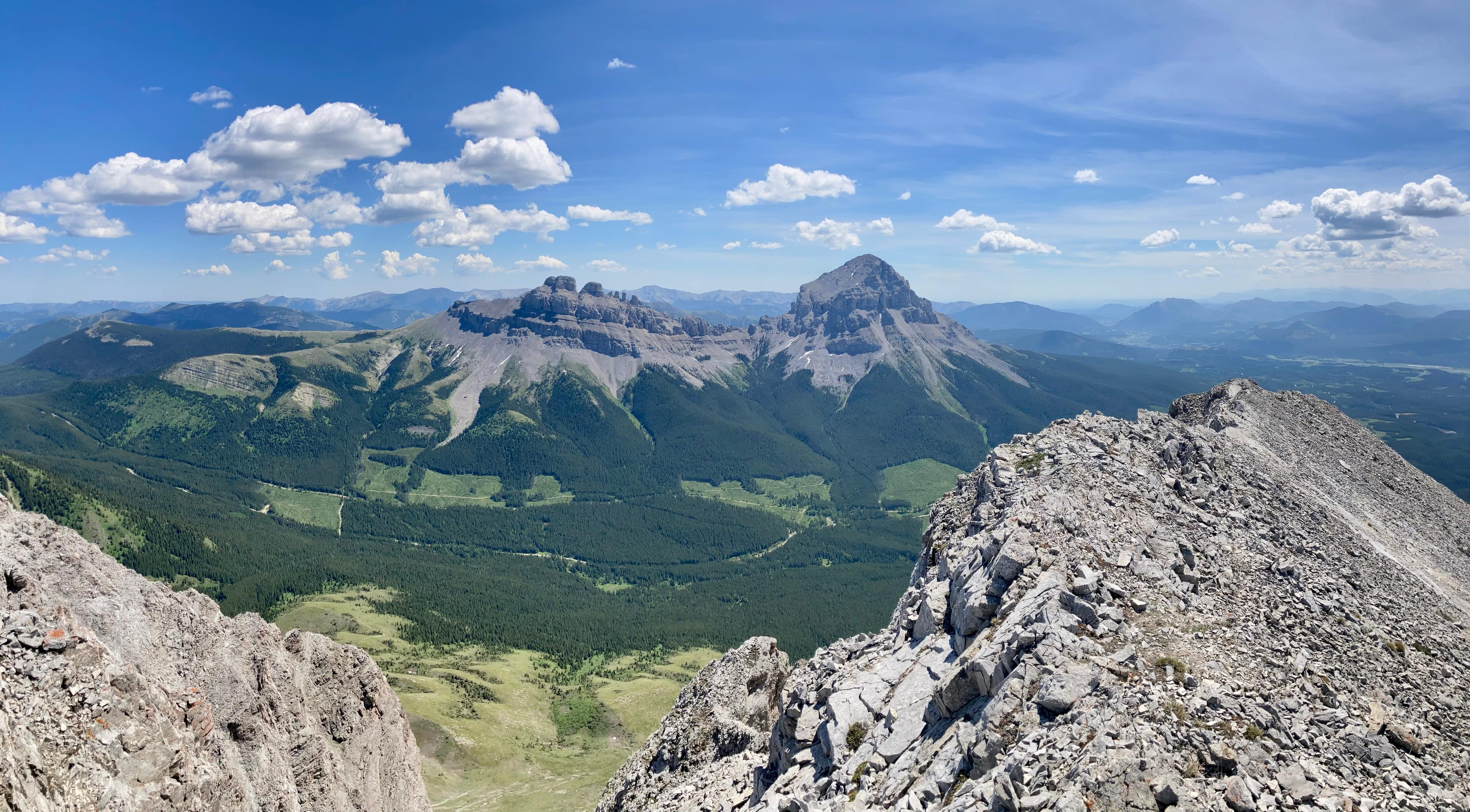
Route overview. The approach is fairly long, but it’s easy hiking.You can see how there are two avalanche pathways. The first one you come to (waking in from the right of this picture) is partly blocked off from the 2nd one by trees that stretch half way up the slope. McMurray went up the first one. Nugara’s book and Nakagama’s trip report show pictures of the 2nd one. I went up and down the 2nd one.The area of the mountain just below the summit. You can see where I moved off the main ascent ridge to the left, to ascend another ridge which was well away from the sheer cliffs.Checking out the objective from the parking area.Following the ATV trail north, I very quickly came to this fork. I went left over the bridge.The next fork – I went left again.The third fork. Left again.The trail descends a bit and the mountain comes into view briefly. A short distance beyond here another, slightly narrower ATV trail cuts across this one and goes steeply uphill. Continue straight ahead.The trail passes a pond before reaching the avalanche pathway. Moose tracks are visible in the area, including in the mud at the bottom of the pond. I was lucky enough to see more than the tracks.She noticed me, but didn’t seem too bothered.She eventually waded to the edge of the pond then wandered into the woods above the trail.The first avalanche pathway. I wanted to have more direct access to the ridge, so I walked another 30 meters to the next one.The second avalanche pathway. I decided to ascend here so I could more directly head to the ridge on the left. The terrain here was steep, crumbly, and covered in shrubs and small trees.Out of the avalanche pathway and onto the broad ridge.On the ascent, it was easiest to stick to the grippy slabs wherever possible. To the climber’s left there’s more scree and debris. Sometimes, a slab was lurking just below the scree which made the descent tricky in places.Looking to my right on the ascent.Looking back down.Continuing upwards. More slabs and rubble.As I got near to the ridge top, Crowsnest Mountain suddenly came into view.Finally at the ridge top. The long ridge walk and the summit are in view. There was a concrete marker here, which I assume was for surveying purposes once upon a time.Looking south from the concrete marker. Mount Tecumseh, Phillips Peak and an unnamed peak are across the valley.Setting off on the ridge walk. Conditions were very calm, and this was a very enjoyable walk.One of two cairns that I found along the ridge. This one was on a high point. The other didn’t seem to mark anything in particular.Looking south again.Continuing along the ridge.The grassy col eventually came into view at the base of the rock bands. I started to ponder how I was going to climb this thing.I took this shot at the end of the day, so the light is a little different. The route is approximate, but the main points are: There are decent scrambling paths through the rock bands. Difficulties can be avoided by going left, but it’s a good idea to go right again to stay close to the ridge. There’ an obvious place where the ridge crumbles away to a sheer drop and you can see steep rubble slopes above that lead directly to cliffs. At this point, looking left, there’s another ridge rising out of the scree across a shallow gully/scree field. It’s a good idea to head left and follow that ridge to the top. On descent, remember you’ll die if you slip and slide above the cliffs, so angle away.Looking at the start of the rock bands from the grassy col.Scrambling up the rock bands.Looking back.More scrambling up rock bands.Crowsnest Mountain through a gap in the ridge.Some more decent scrambling terrain.Above the main rock bands the summit comes back into view. It was pretty easy to stick near to the ridge here.Taking a peek at the sheer drop to the right.Some nice rock scenery.Here’s where the main ascent ridge changes character. Loose rubble and scree above this point seemed to lead directly to the cliffs – no more raised solid rock between scree and open air. I headed left towards a another ridge across the scree field.Cutting left across the scree towards another ridge.The summit finally came into view.Looking back down. You can see where the main ascent ridge (centre) is interrupted by a large crack.At the right of this frame is the ridge I used for the last part of the ascent.The final walk to the summit. A black bird (I don’t know if it was a crow or raven) was sitting on the cairn.He seemed to be enjoying his solitude before I came along. The summit of Deadman Peak. There was a register in a small Nalgene bottle in the cairn. Nobody else had recorded an ascent so far in 2023.Immediately adjacent to the cairn is this drop all the way to the valley floor. So don’t get too caught up in your picture taking and forget to look where you’re stepping.Panorama to the south.Panorama to the west.Panorama to the north.Panorama to the east.Telephoto view looking west at the Fernie area.The air quality didn’t lend itself well to such a distant shot, but I could see Mount Fisher far to the west.Time to descend. Making sure to stay right.Almost back to the grassy col.Taking a little break at the col.A C-130 passed over the area as I walked back along the ridge.There was a search-and-rescue training exercise in the area.Airplanes and mountains are my two favourite things, so this was pretty great.One more shot of Crowsnest Mountain and Seven Sisters.Descending back to the level of the avalanche pathway. On descent I stayed right and tried to steer away from rubble covered slabs. It wasn’t always possible.Back at the avalanche pathway. Descending this was actually really tricky. I fell pretty hard but didn’t do any major damage.I managed to survive the rest of the walk back to my car. Looking over my shoulder while I was packing my gear away, I had this great view of Crowsnest Mountain and a picturesque sky.
Awesome post. I went through that pass on an ATV 13 years ago. Bonus for the day to see a moose! Looks like you had a glorious day. you really were off the beaten path on this one!
Can you get to the base of the mountain using an overland vehicle? That route seems to lead from Alberta to BC. Can a small overland vehicle make it? From the satellite images it looks well maintained.
The approach is on an ATV trail. The current Livingstone Public Land Use Zone map shows the trail as open to “Motorized vehicles with an
overall width up to and including 1.8m (72″) in width.” So that’s ATVs and dirt bikes. A google search will allow you to access the map.


Awesome post. I went through that pass on an ATV 13 years ago. Bonus for the day to see a moose! Looks like you had a glorious day. you really were off the beaten path on this one!
LikeLiked by 1 person
Can you get to the base of the mountain using an overland vehicle? That route seems to lead from Alberta to BC. Can a small overland vehicle make it? From the satellite images it looks well maintained.
Please let me know 🙂
LikeLike
The approach is on an ATV trail. The current Livingstone Public Land Use Zone map shows the trail as open to “Motorized vehicles with an
overall width up to and including 1.8m (72″) in width.” So that’s ATVs and dirt bikes. A google search will allow you to access the map.
LikeLike