June 3, 2023. Route finding and moderate scrambling to the top of Bertha Peak.
- Region: Paahtómahksikimi/Waterton Lakes National Park. Traditional territory of the Blackfoot, Tsuu T’ina, and Ktunaxa First Nations
- Distance: 1.9 km one-way from the Bertha Lake campground
- Elevation Gain: 665m from the Bertha Lake campgournd
- Elevation of Objective: 2450m
- Time: 2 hours one-way from the Bertha Lake campground
- Safety and Disclaimer
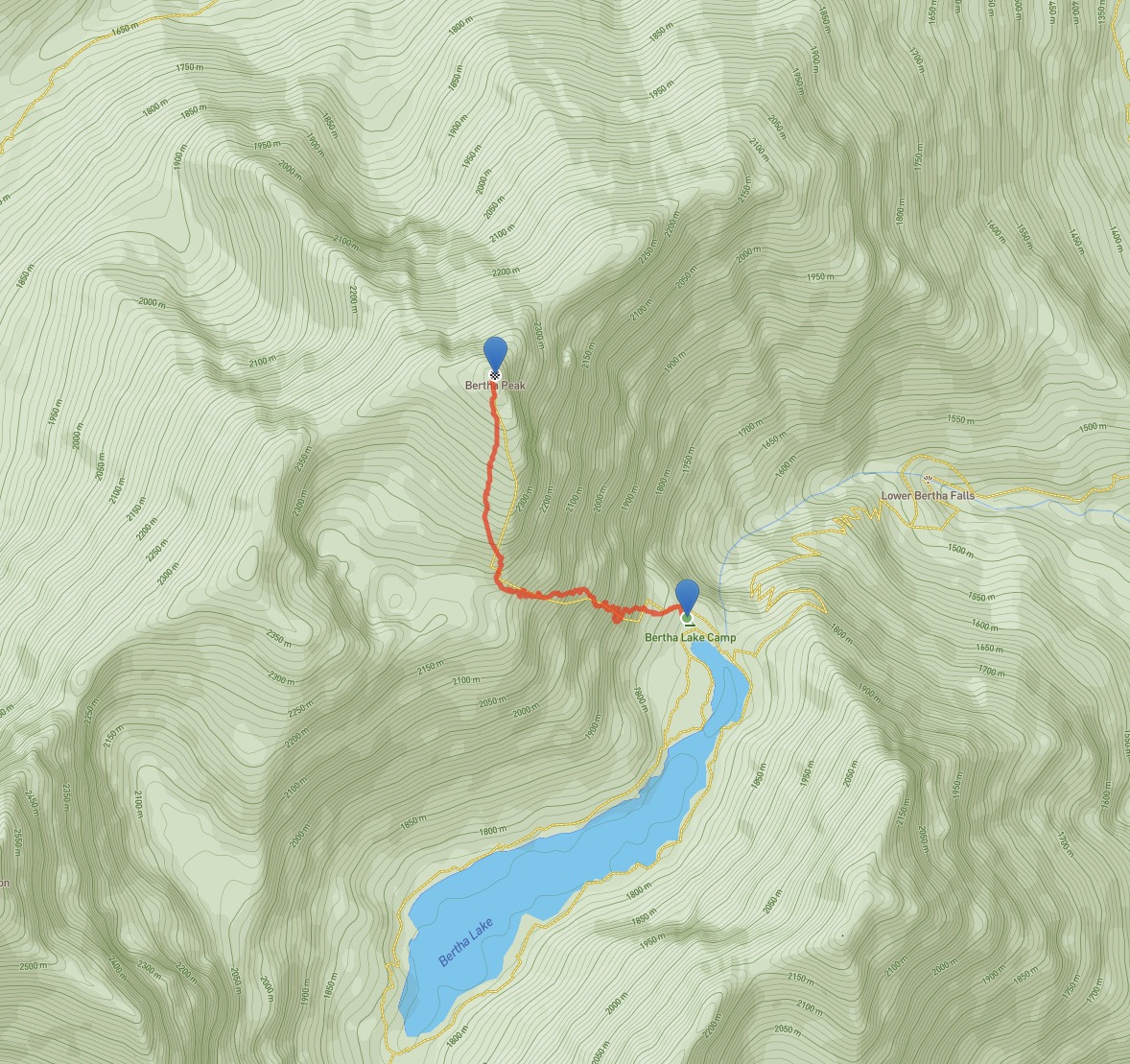
Alan Kane’s Scrambles in the Canadian Rockies describes a route to the summit of Bertha Peak which involves scrambling up gullies on the east face beginning at a spot somewhere behind the backcountry campground. On previous visits to the lake I’ve explored a bit, trying to figure out exactly where this route starts, but I’ve never really committed to trying it. The south ridge route is easy to find and quite a satisfying ascent so I figured, Why bother? This past weekend, though, I decided to commit to trying Kane’s route.
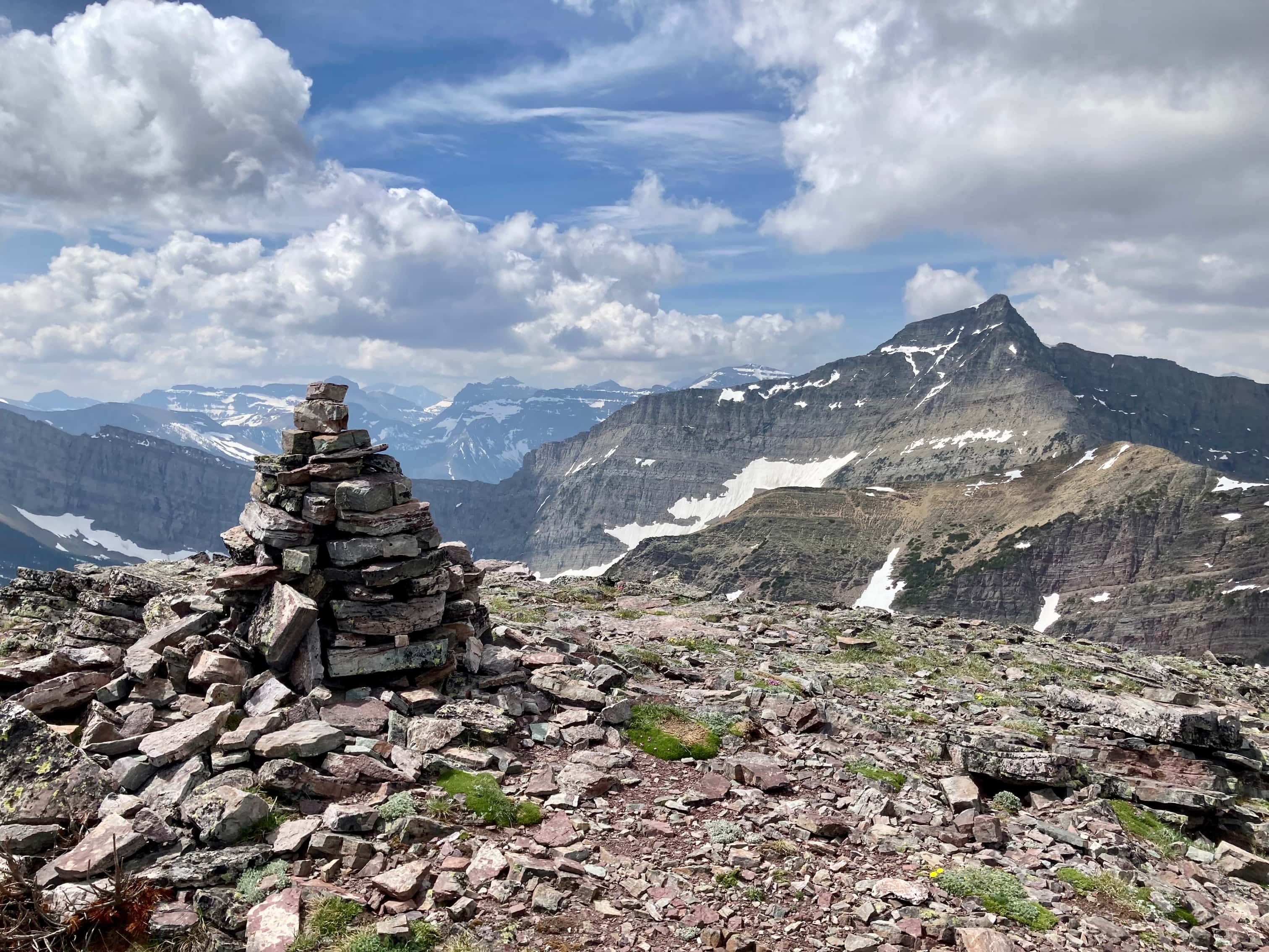
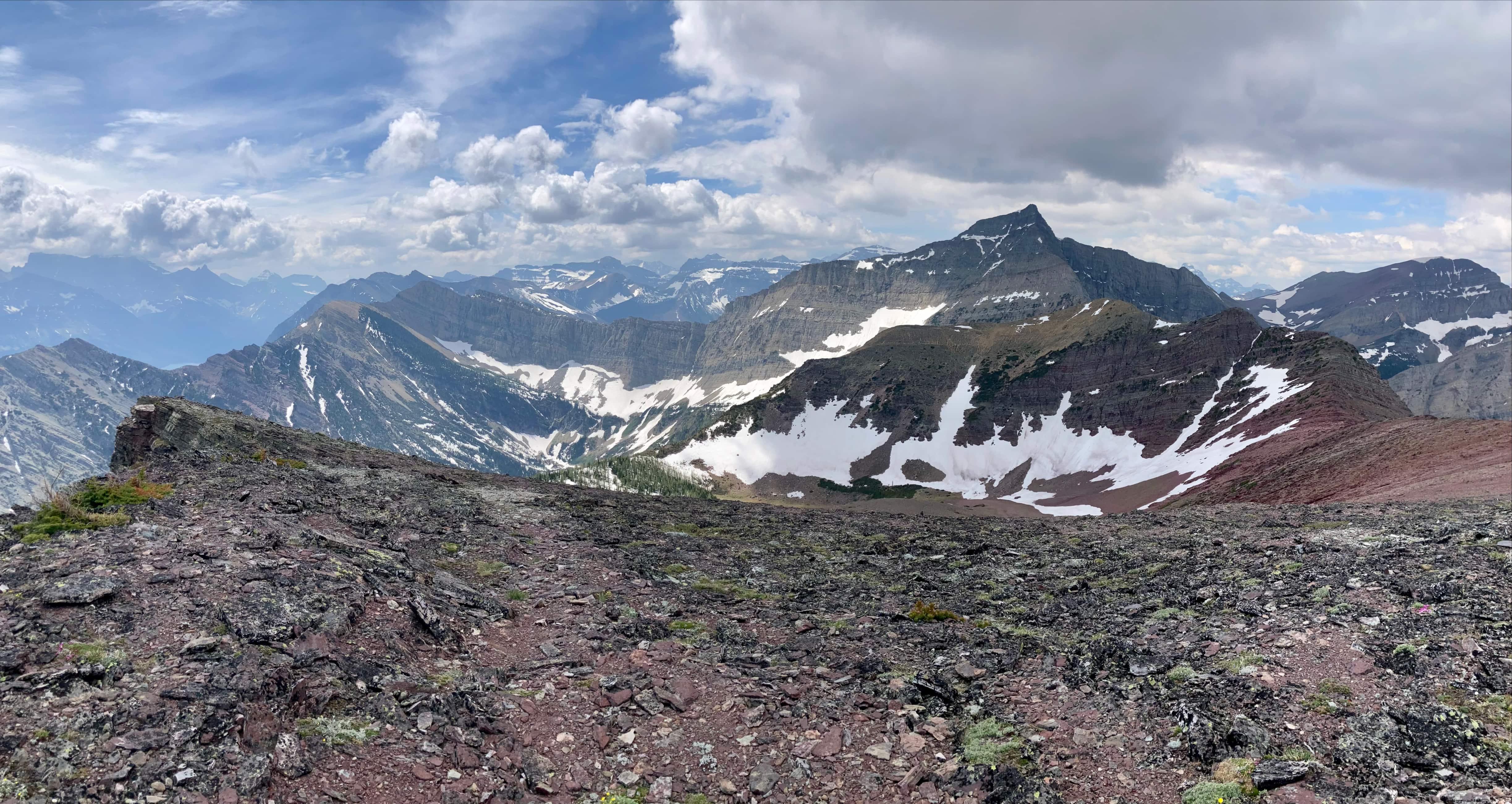
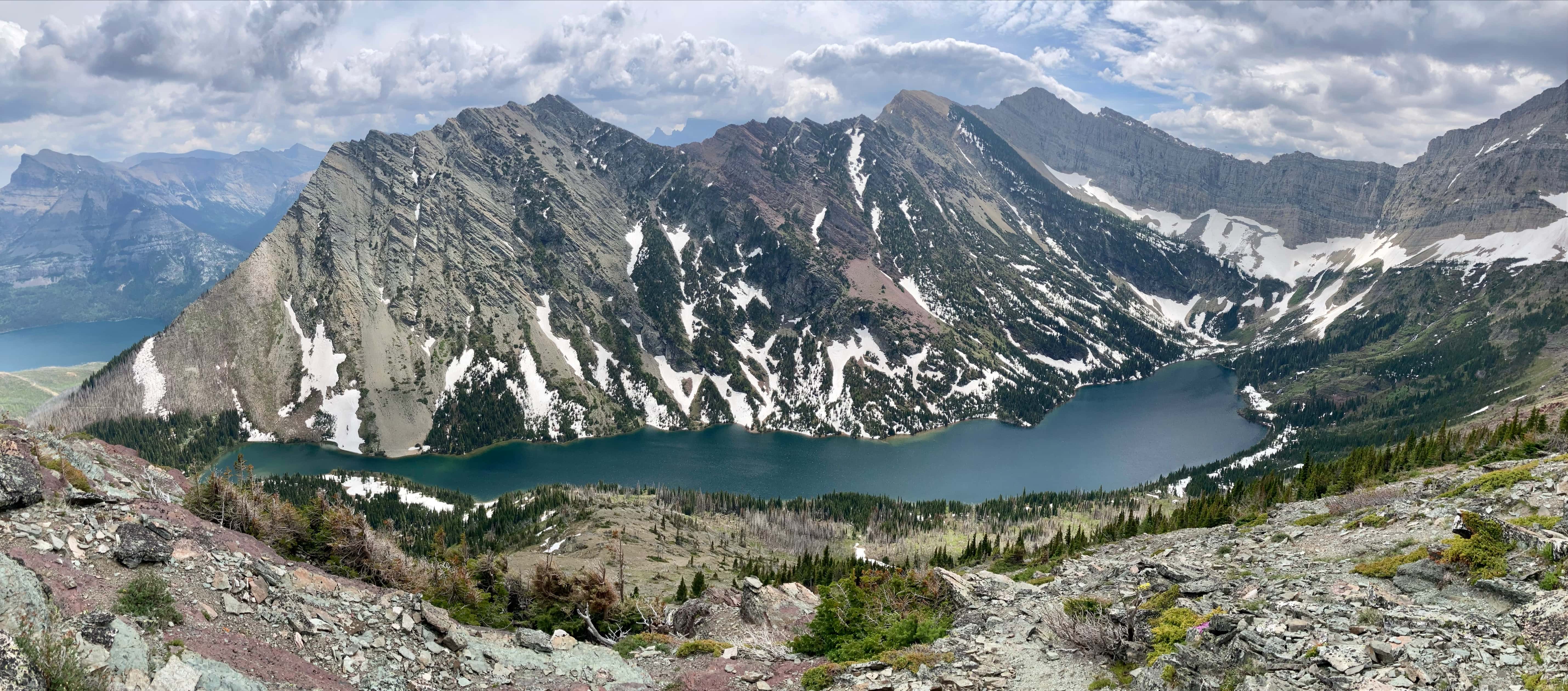
I’ll describe the route beginning from Bertha Lake. See my south ridge post for detailed directions on getting to this point. Also, the conditions for that trip were generally more favourable for photography. A lot of pictures I took on this trip amounted to duplicates from that trip, just with more clouds and haze. I’d strongly suggest you check out the south ridge post for an idea of how great the scenery can be up on Bertha Peak.
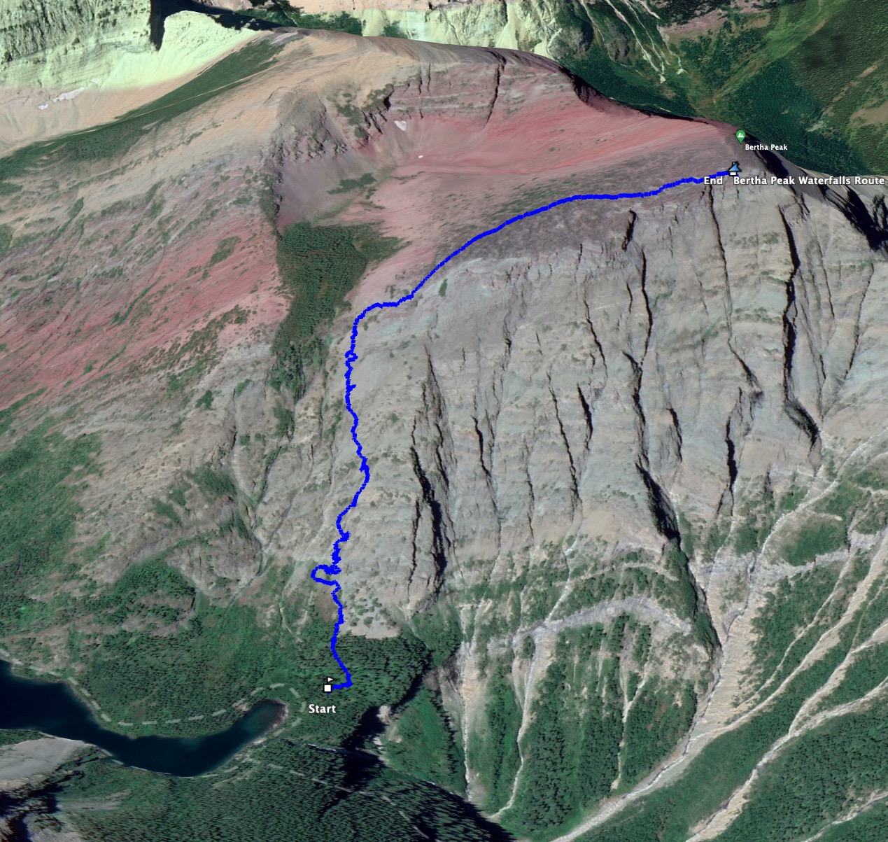
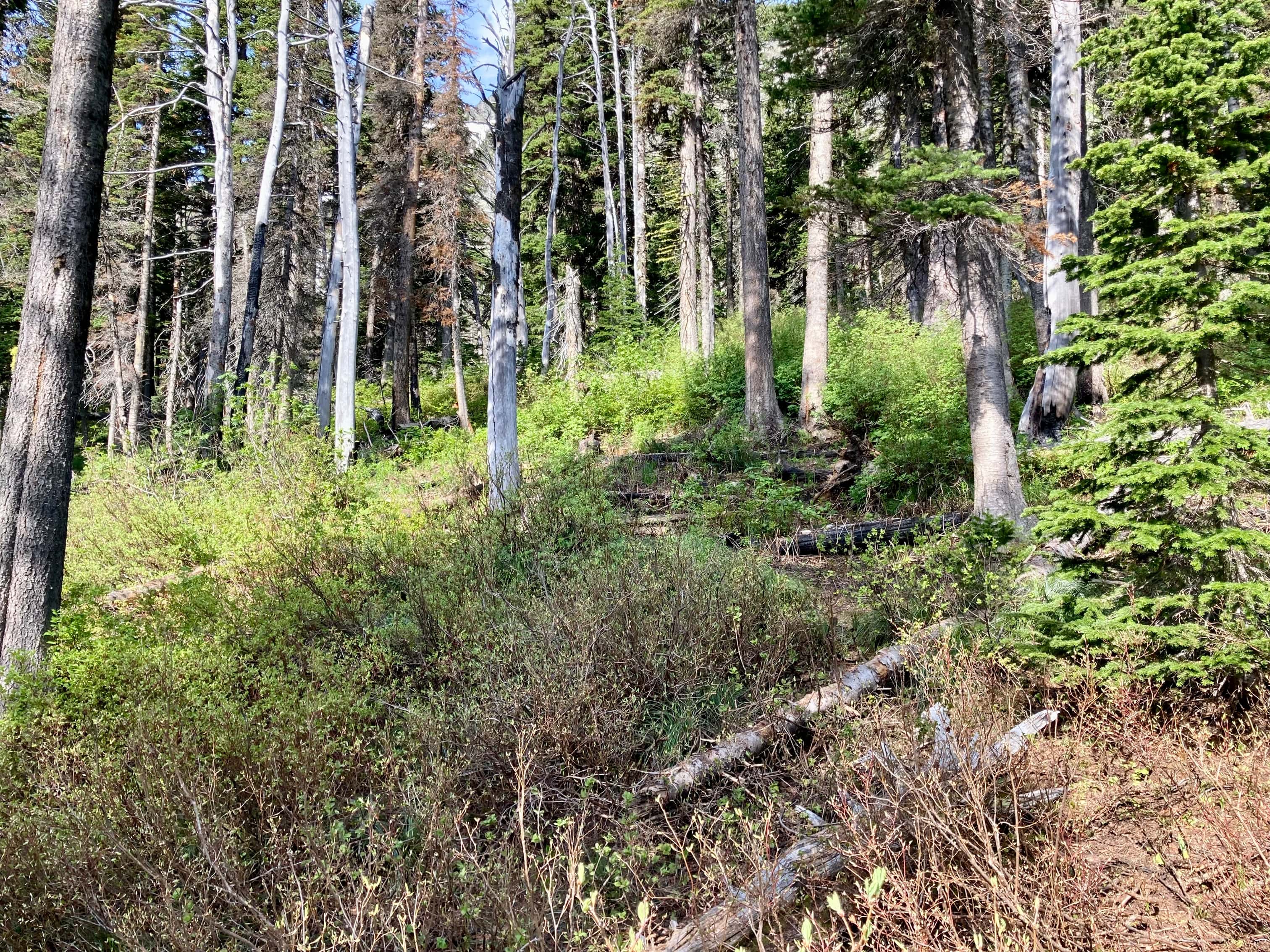
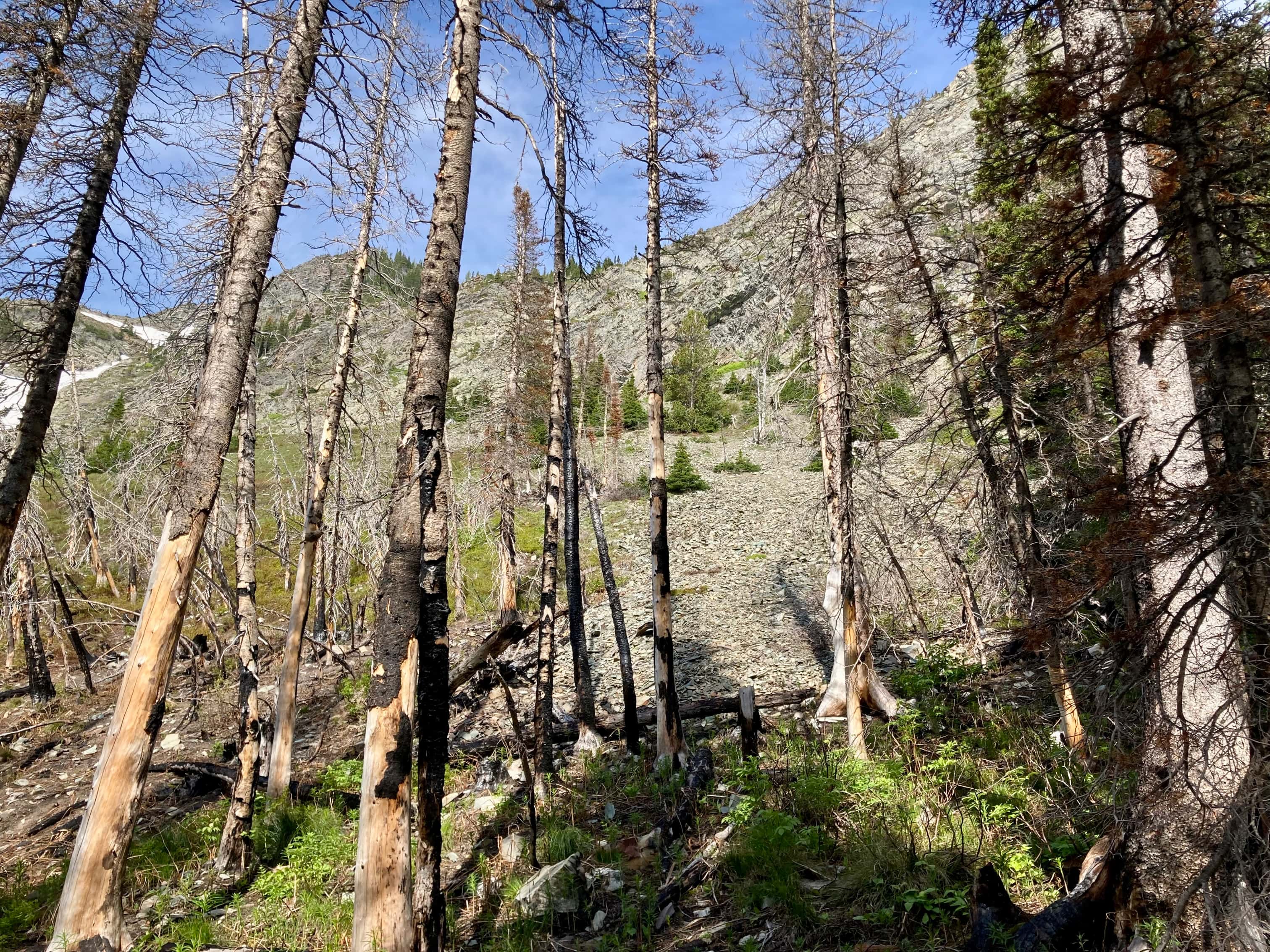
I had been told (years ago) that the place to start was a trail leading into the woods from behind the outhouse at the campground. I found that trail and followed it as it petered out and became quite faint, obstructed here and there by fallen trees. After a while I could see that I was drawing near a fan of scree coming down from the face of the mountain. I ascended that, then started traversing to the left along the rocks. I knew I was looking for a drainage or a gully to the right of the waterfall. I encountered a snow patch before finding any such gully, but I could see that the mountain looked like it was climbable at this point, so I started climbing.
Kane mentions that there are many possible routes, and Bob Spirko‘s 2004 report comments that there was more route finding than he expected. I agree with Bob. It’s hard to describe the route I followed, aside from saying I knew I wanted to find a gully and it was to my left, so I ascended while cutting to the left and eventually found a gully. Once in the gully, the going was easier for a while until it petered out and I picked a route up to a large scree field south of the summit. After slogging up this scree I headed to my right and made it to the summit. After enjoying having the summit all to myself for a while I descended via the south ridge route.
I’m not sure I’d recommend this route unless, like me, you wanted to check it off your list of routes to try. It’s “moderate” scrambling (as per Kane/Nugara’s rating scheme) with some route finding – but it wasn’t really that much more engaging than the south ridge. I think most people will happily stick to that route.
Click/tap the pictures pictures below to access full-resolution images.


One thought on “Bertha Peak – “Gullies” route”