August 19-26, 2025. A long backcountry adventure featuring spectacular scenery and challenging terrain in Kluane National Park.
- Region: Kluane National Park. Traditional territory of the Kluane First Nation
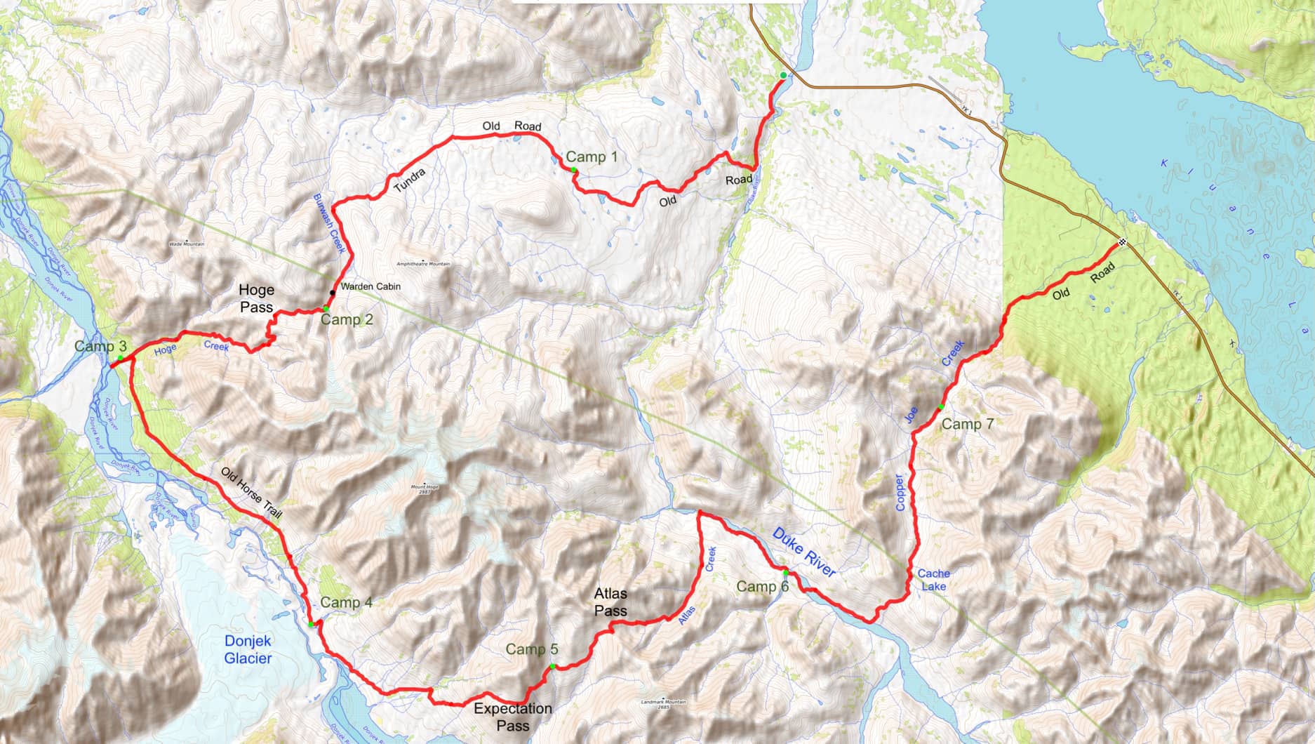
- Distance: 111 km
- Total Ascent: 3510 m
- Total Time: 8 days
- Safety and Disclaimer
“This is the law of the Yukon, and ever she makes it plain: ‘Send not your foolish and feeble; send me your strong and your sane-‘”
From The Law of the Yukon by Robert Service
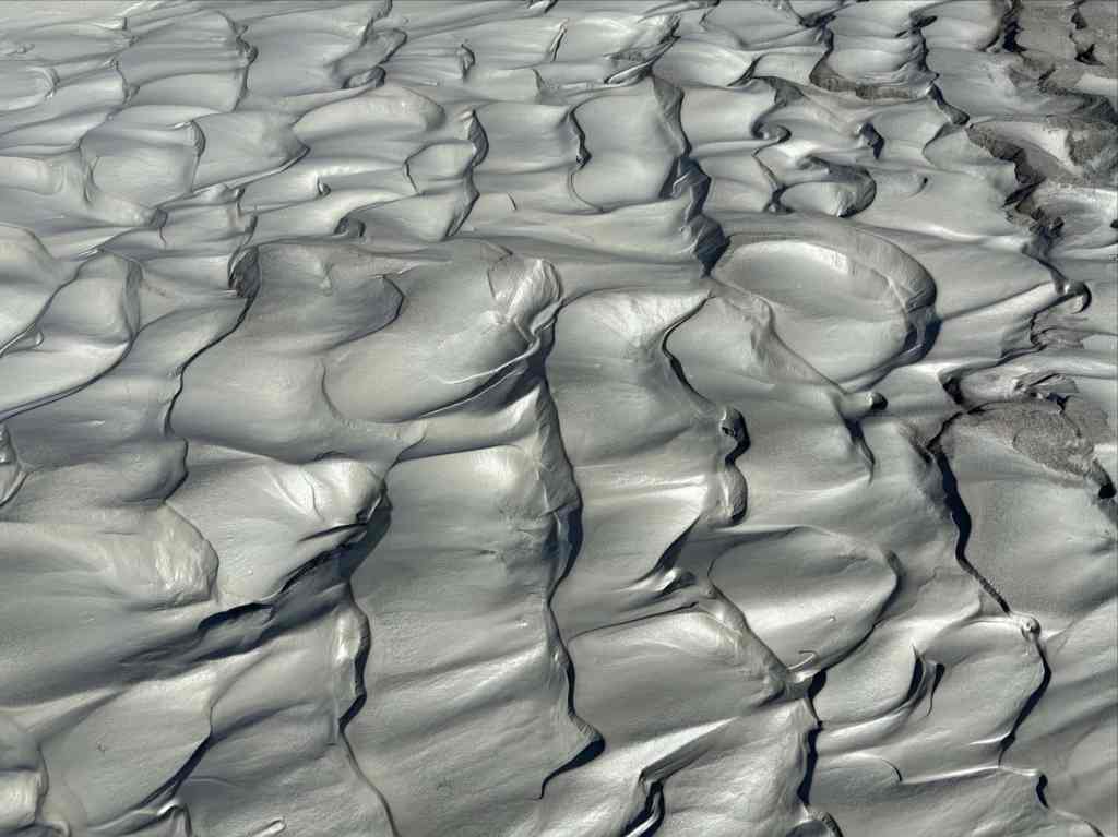
The massive Donjek Glacier is 25 km in a straight line from the Alaska Highway where it curves around Kluane Lake in the Yukon. It lies hidden behind the front ranges of the St. Elias Mountains, so no highway travellers can see it. No side-roads provide access and no official trail exists. To see it, you need to peek out the window of a passing airliner, book a ride on on a glacier sightseeing flight, or walk there along the remote Donjek (Dän Zhür) Route.
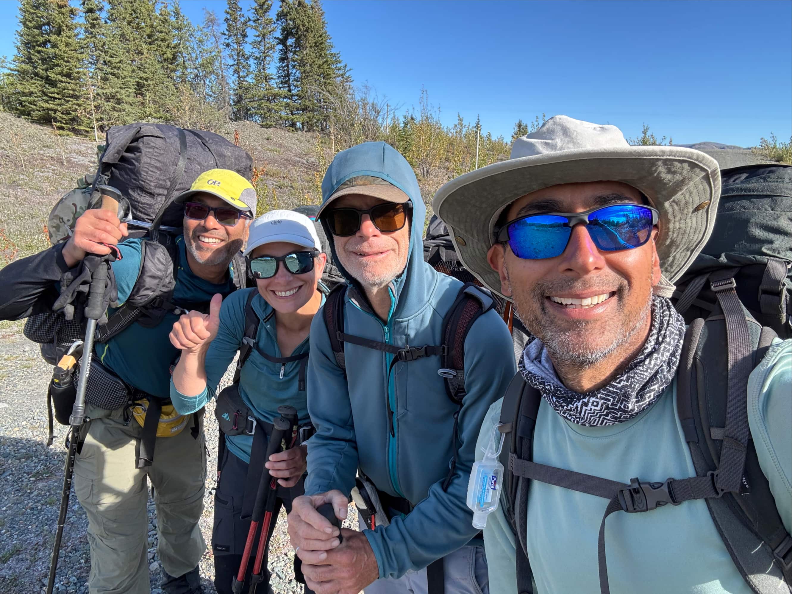
This August I joined Scott, Valentina, and Bhaskar — 3 experienced backcountry hikers — to journey on foot to the Donjek Glacier. The only other trip I’ve done that would be comparable would the West Coast Trail. However, that’s comparable only in terms of duration (and I spent one day less on the WCT). In basically every other respect, the two trips are nothing alike. The WCT is a worthy challenge and unforgettable experience. But it’s hugely popular, well-travelled, well-mapped, and (relatively) well-maintained. There are campsites with food lockers and pit toilets. There is a regularly updated book detailing the trail. Websites abound with trip reports and exhaustive preparation advice. All this bears little resemblance to the Donjek (Dän Zhür) Route.
For the Donjek, there’s a 6 page text route description on the Kluane National Park website. The description is sometimes open to interpretation. No detailed map is provided. There are no pictures. In bold type at the top it says, “A route is not a trail. Routes are not marked with signs or maintained in any manner. The route described here is only a suggestion that may help guide you on your trip. Self-reliance and wilderness travel experience are essential, including excellent route-finding skills, map and compass skills. It is the responsibility of individual hikers who choose to follow such routes to adequately prepare and be prepared to rely on themselves.”
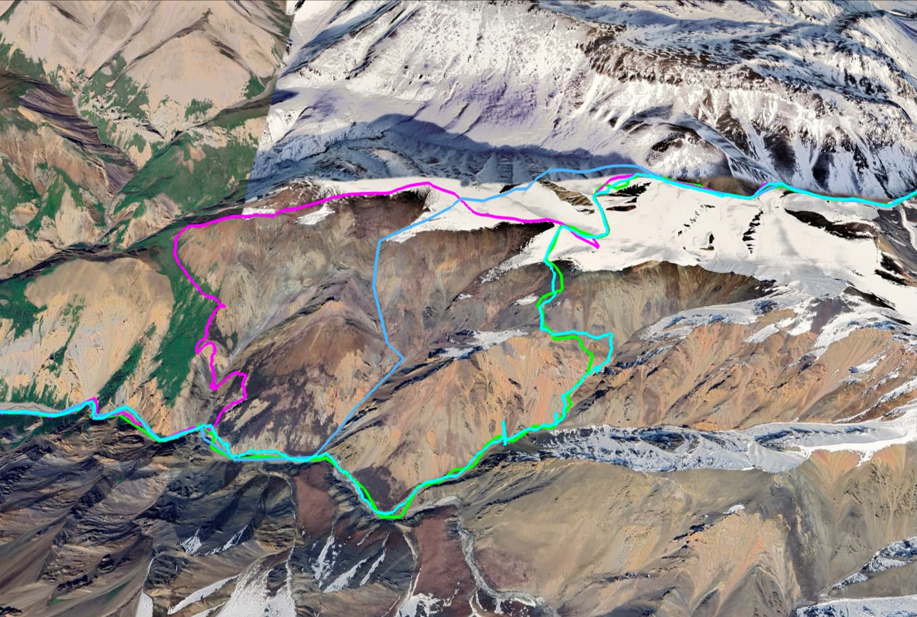
So that sets the tone. There is no maintained trail. There are suggested camping locations but no maintained campsites. There are no toilets or food lockers. You may see no other people — we went 6 days without seeing anyone else. For preparation, aside from the official description, there are a few videos on YouTube and a handful of websites you could reference. Many of the websites that come up in searches are advertising for guided trips as opposed to helpful planning resources. Luckily, there is the excellent Yukon Hiking website (and companion book, which I bought). They provide useful pictures and a good GPS track to use as a reference. I emphasize that point because on any given trip the exact route that’s best to follow might be slightly different. I should also mention that the official route description includes a couple of places where variant routes are possible. We chose what seem to be the most commonly travelled variants.
The route lies half in, half out of Kluane National Park. The parts outside are in the Kluane First Nation. The route is an open-ended loop and most people travel it counterclockwise. The start and end are 15 km apart on the Alaska Highway, roughly equidistant in either direction from the tiny community of Burwash Landing.
Arrival and preparation
“Wild and wide are my borders, stern as death is my sway; From my ruthless throne I have ruled alone for a million years and a day;”
We flew into Whitehorse from Calgary one day before we started on the route. Early the next morning we headed to Canadian Tire to pick up bear spray and camp fuel. Then we drove to Haines Junction, about 155 km west. There, we checked in at the National Park Visitor Information Centre to pick up our permit and get what information we could about the condition of the route. Check-in is required, but not check-out. As a result the Parks employees we spoke to could tell us surprisingly little about what others had been experiencing on the route that year. It seems very few (or none) of them came back to chat. After finishing up at the Information Centre we grabbed a bite to eat then drove to the start of the route, 9.5 km north of Burwash Landing (or 131.5 km from Haines Junction) along the Alaska Highway.
North of Burwash Landing there is a bridge over the Duke River. Immediately afterwards there is an unsigned turn-off onto a gravel road heading into the trees. Click here to see it on Google Maps. We turned there and immediately encountered a sign notifying us that we were on Kluane First Nation territory. It stated that visitors should notify the Kluane First Nation office in Burwash Landing. This was news to us – nobody had mentioned it when we checked in at the Parks centre. To be safe, we called and left a message with the Kluane First Nation office (luckily we were still in cell phone range). Then we drove a short distance up the road (less than 1 km) to a clearing where we parked. We could have driven somewhat further, but the farther we drove the farther up the road we’d have to go to retrieve the vehicle on the day we finished.

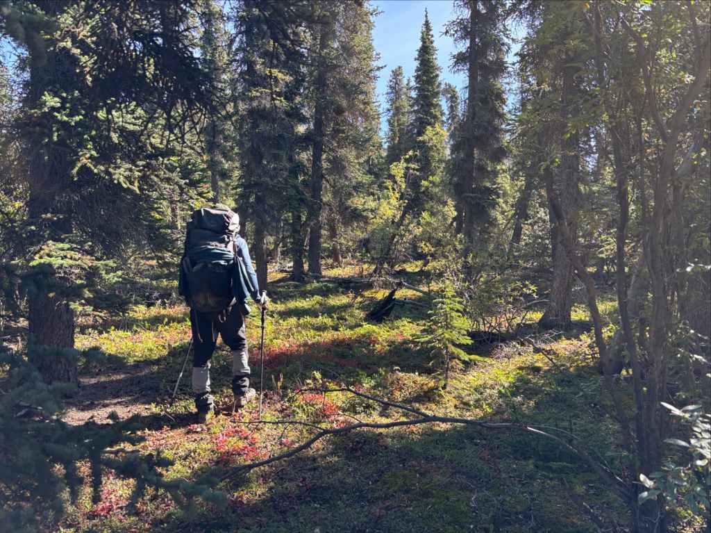
Day 1: Down the old Road
“One by one I dismayed them, frighting them sore with my glooms; One by one I betrayed them unto my manifold dooms.”
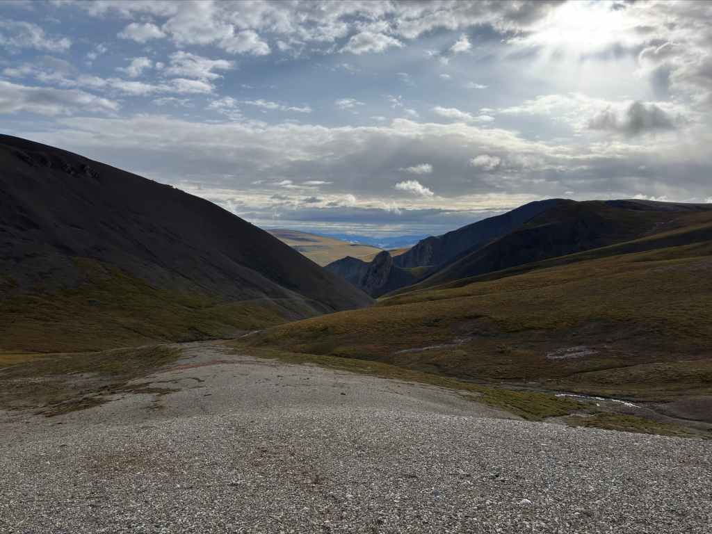
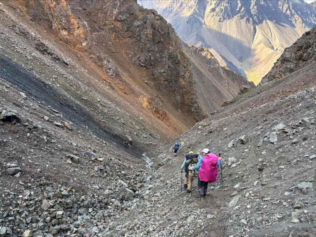
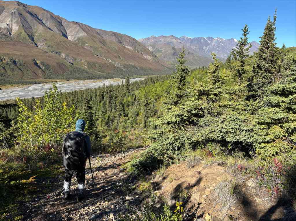
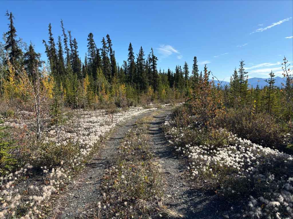
The first few kilometres of the route were easy hiking on an old road. The weather was fair as we set out, but the sky was quite lively and we knew that we had rain in the forecast that evening. About 5 km up the road we encountered the first landmark, an old horse camp. The road forked and we took the right fork, ascending steadily to the northwest for about 1.5 km before reaching another fork where we turned left (southwest).

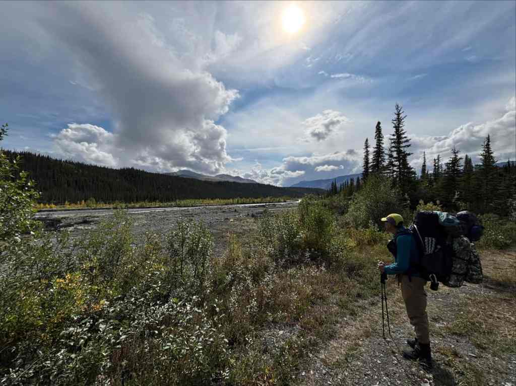

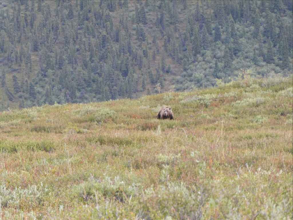
As we carried on, the road was steadily more crowded by the surrounding vegetation. We found that our line of sight was more and more restricted. Around here was where we had our first bear encounter. Luckily it was our only close encounter and not a particularly close one at that. We were bear-calling regularly as we moved along, and coming around a bend we glimpsed a grizzly on the road who seemed to be already turning and running away as we appeared. We took a moment to get the whole group together and let some time pass for the bear to hopefully move off. We then proceeded along the road, yelling all the while. We didn’t see the bear again.
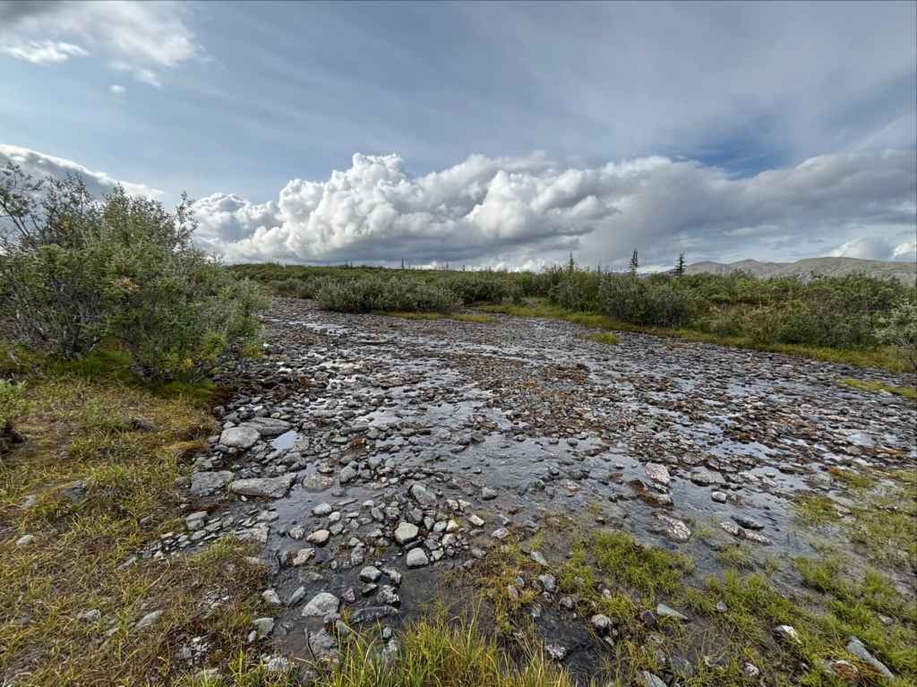
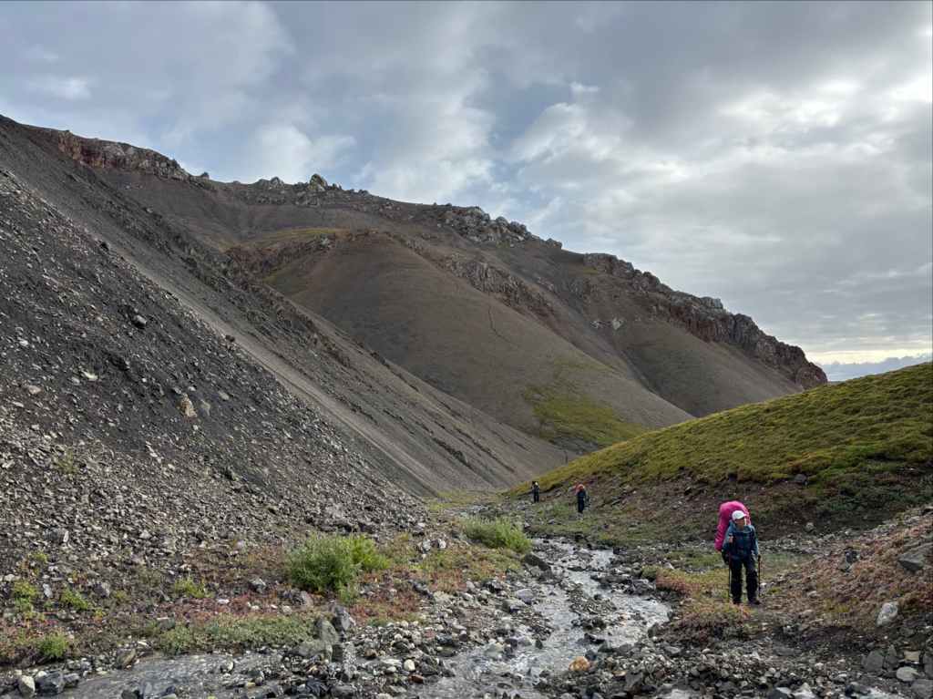
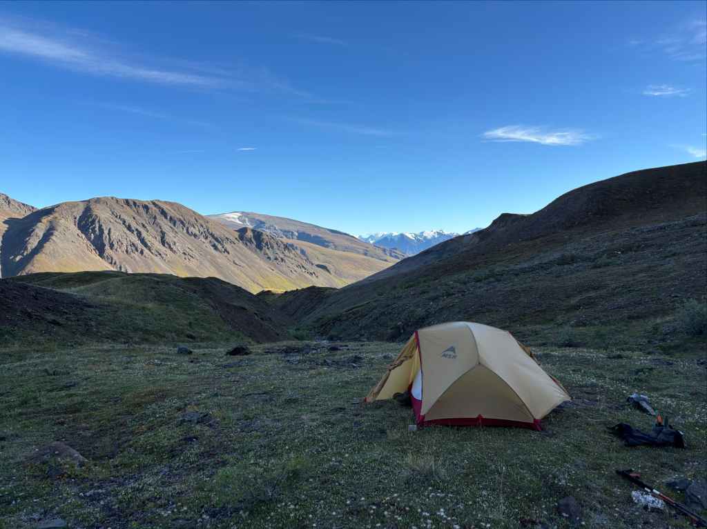
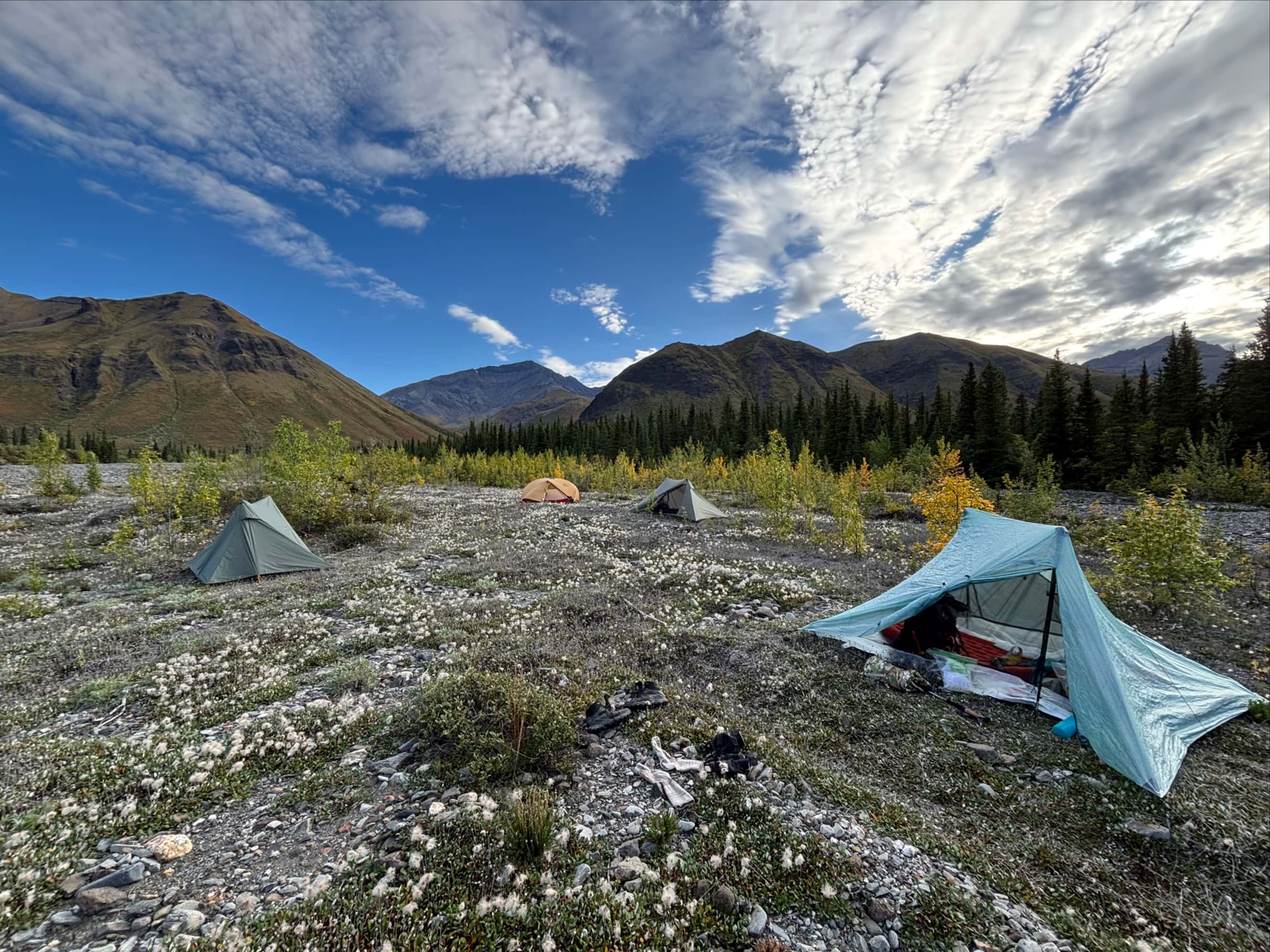
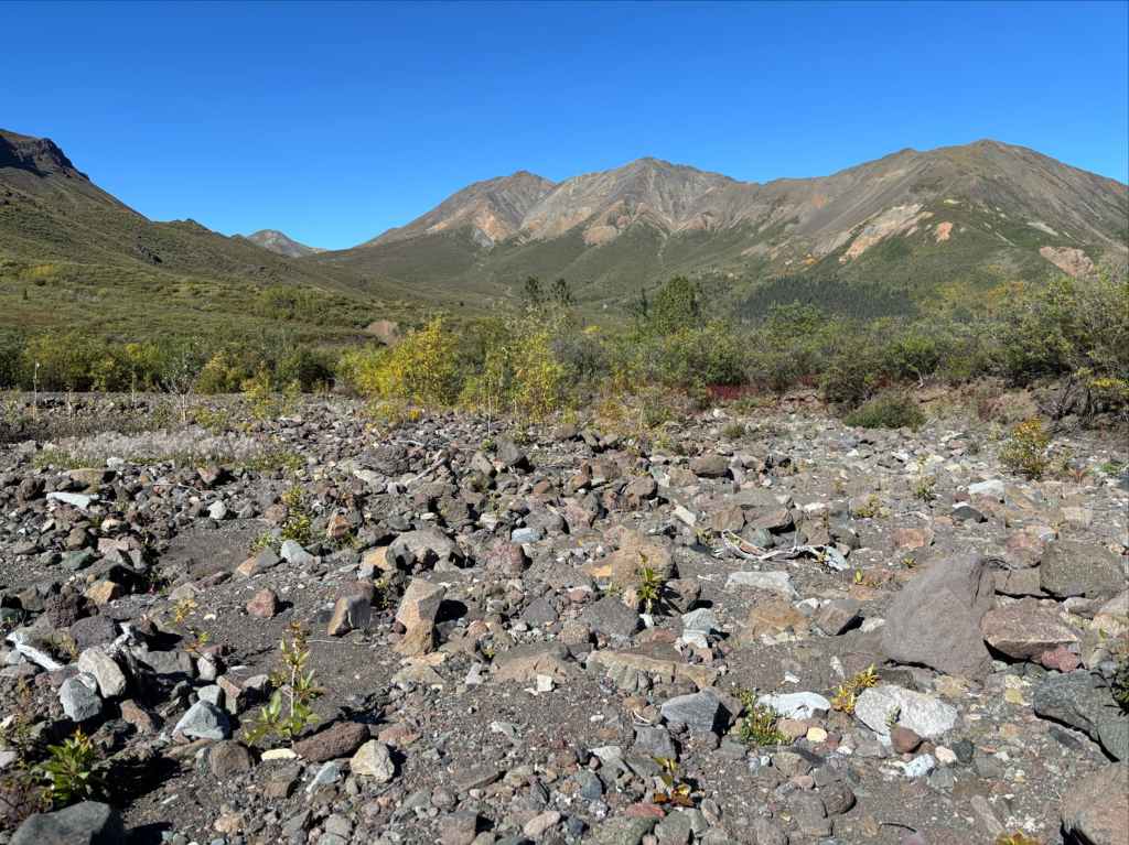
The old road was level for a while then climbed again. The trees thinned and we entered the subalpine. The condition of the road continued to deteriorate and we passed by a few small lakes. The terrain on either side of the road was often swampy. Ahead of us we could see a broad green hill. Roughly 13 km from our parking spot, the road hooked north and went over a narrow dry creek bed, then a broad low-flowing creek. On the northern shore of that creek we found the recommended camp spot – a reasonably large clearing with dry ground and not too many rocks. We knew rain was coming so we got our tents pitched quickly then filtered water and ate supper before retiring for the night. Just a few minutes after crawling into our tents, the rain began and continued on and off through the night.


Day 2: Across the tundra
“Featureless, formless, forsaken, scented by wolves in their flight, Left for the wind to make music through ribs that are glittering white;”
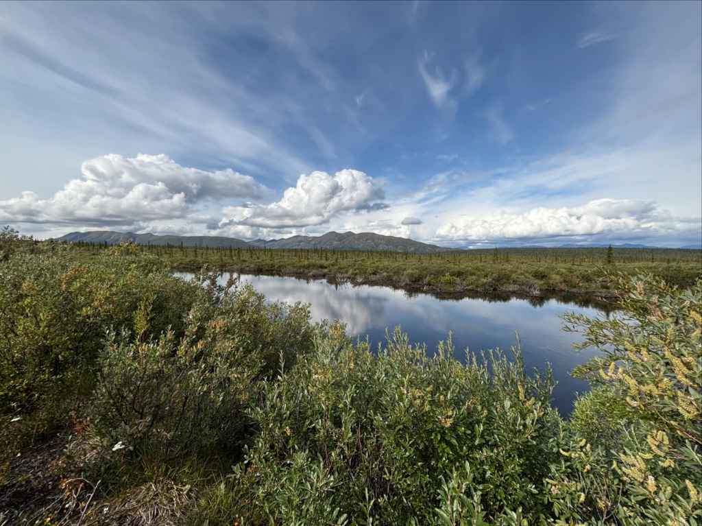
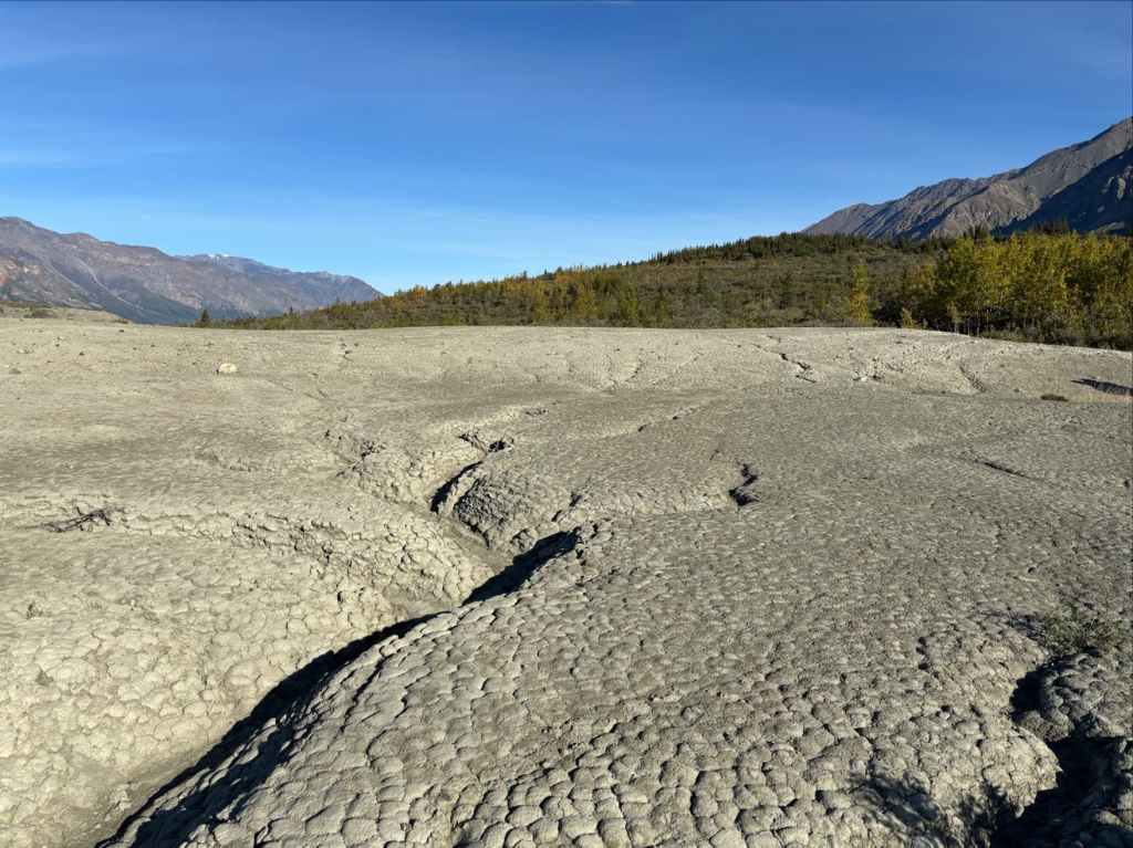
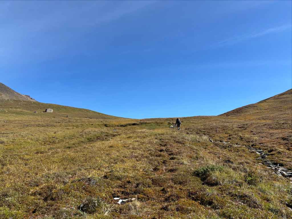
The rain had stopped by morning, and it was fairly cold. We packed up, returned to the road and followed it as it deteriorated even further. Though no rain was falling anymore we wore our rain gear, without which we would have been completely soaked by the water clinging to the vegetation we were pushing through. We went northwest, then due west, past more small lakes. A few times we had to briefly leave the road to avoid thick vegetation or standing water. Off the road, we acquainted ourselves with “hummocky tundra” – spongy, soft, uneven ground intermittently hiding standing water amongst grassy tufts.
Around 3.5 km from our campsite we encountered an even more decrepit road crossing north/south over our road. A little under 2 km beyond that our road hooked north and more or less disappeared. This was our cue to depart off the left (west) side of the road. We crashed through some vegetation and onto the open tundra. By that point we were thrilled to leave the old road – it was quite overgrown and having to constantly push through wet leaves and whipping branches was exhausting.


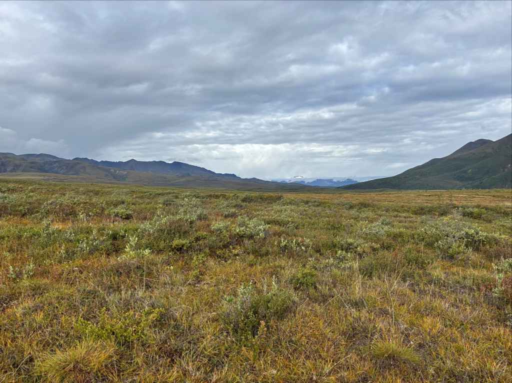
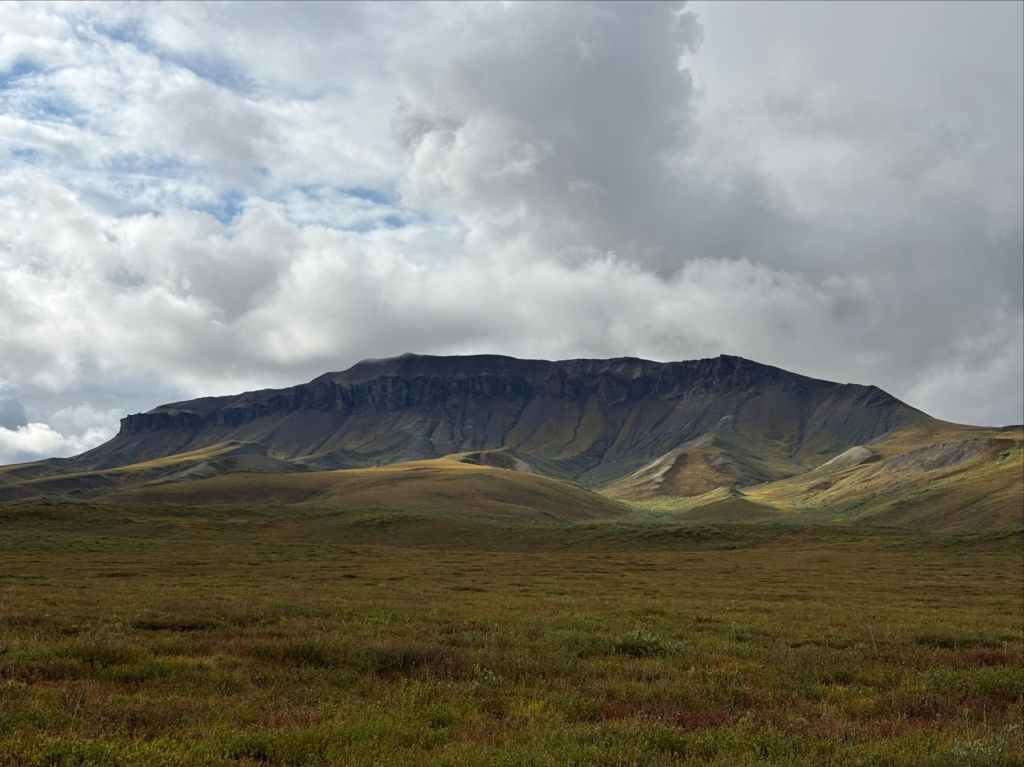
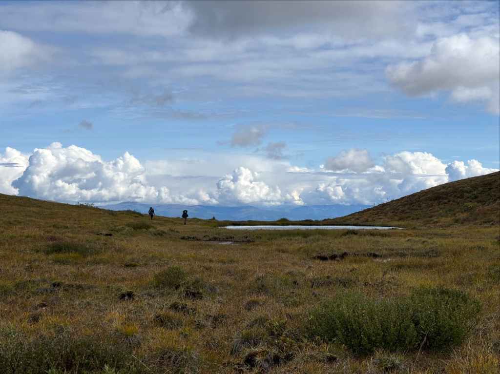
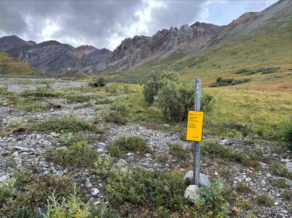
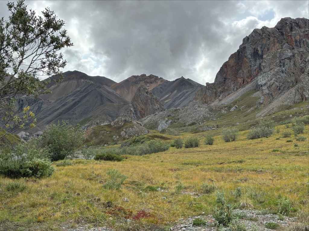
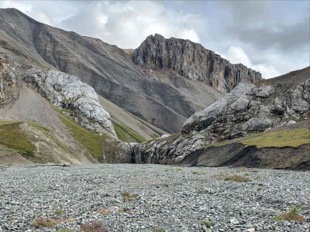
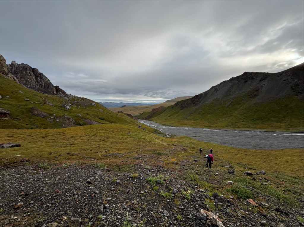
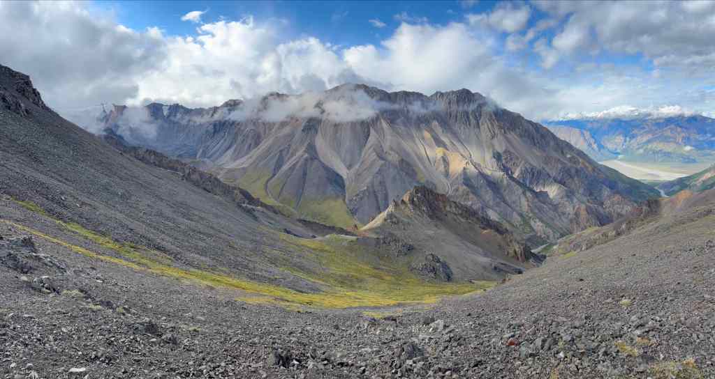
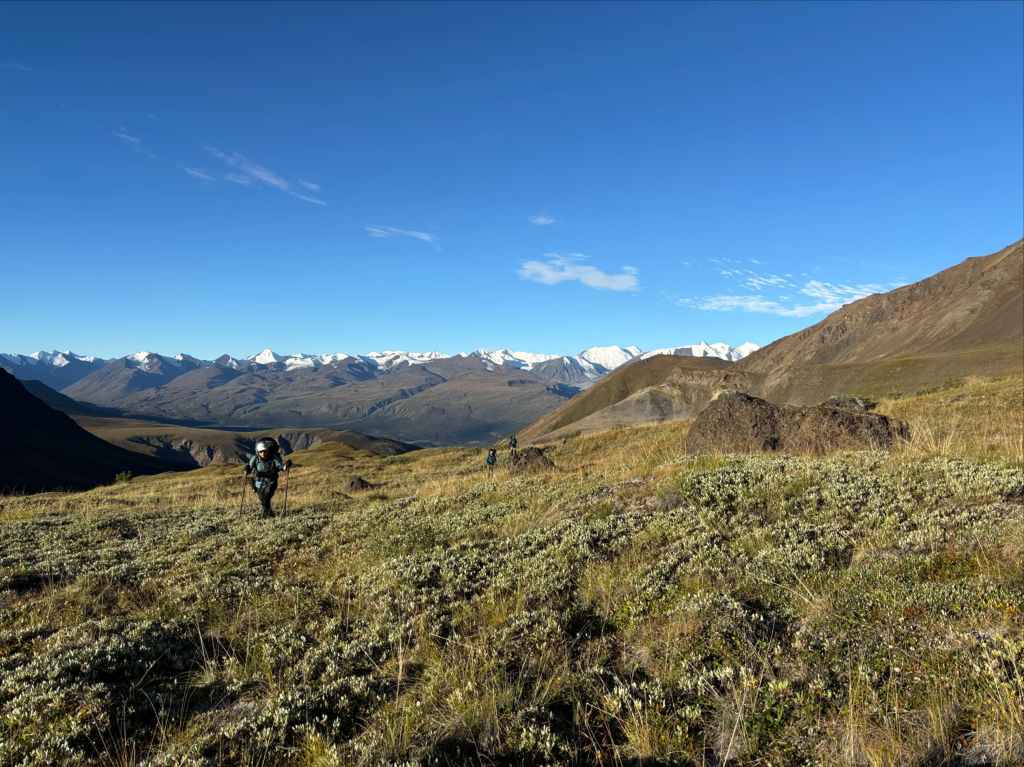
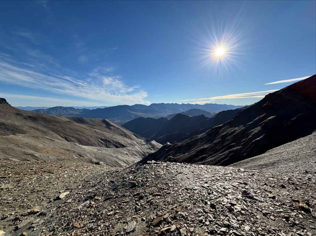
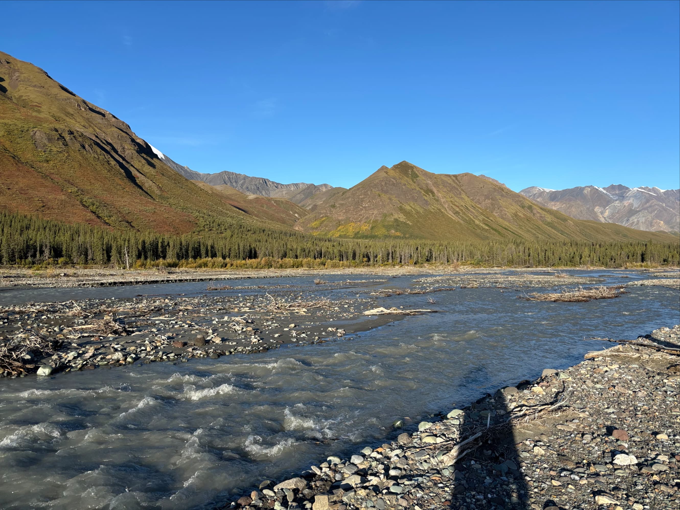
Out on the tundra, we turned west-southwest. Amphitheatre Mountain was obvious to the south. Its northwest ridge dropped down substantially beyond a low outlier, turning into hilly terrain. We could see an obvious cleft in those hills and directed ourselves that way, moving along the spongy ground and avoiding water as much as possible. On that vast open landscape we saw two more grizzly bears. Both were visible from far away, moving about with their heads down and presumably looking for something to eat on the tundra. Both ran away when we yelled to make our presence known. Once across the mostly flat expanse, we continued over undulating hills and valleys, passing a pond and a small lake, until we descended onto the rocky shores of Burwash Creek. We crossed to the far bank and followed it south, eventually passing a sign declaring that we were entering a National Park. Ahead of us and to our right were the front ranges of the mountains. Overhead, the sky was threatening rain.


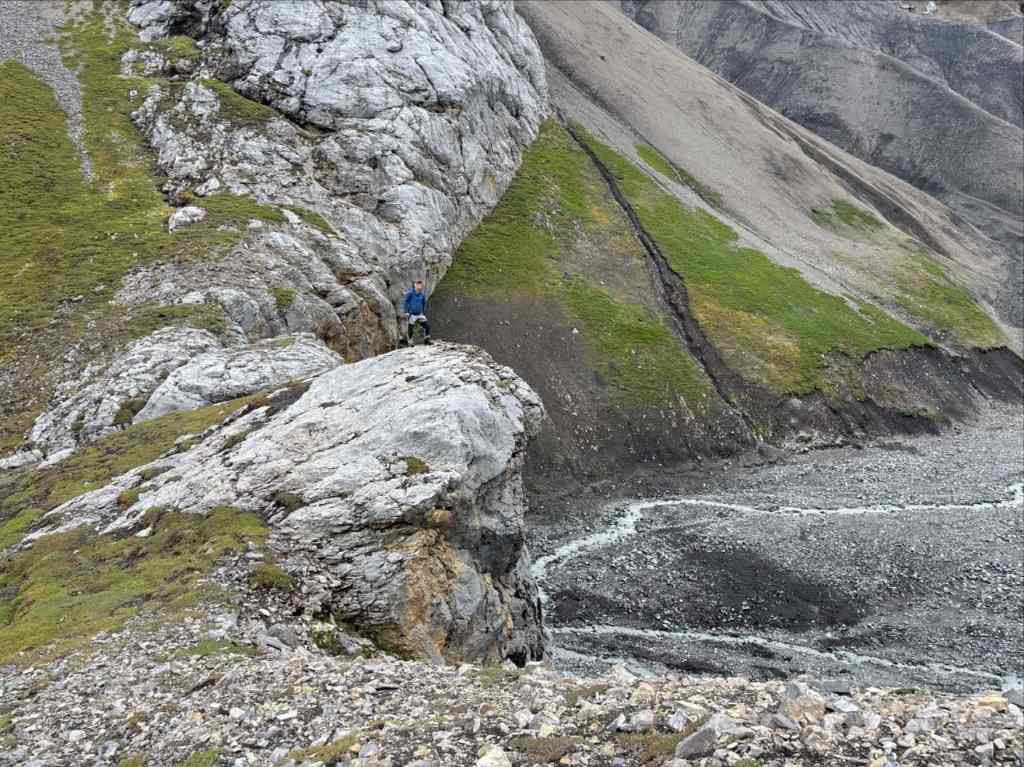
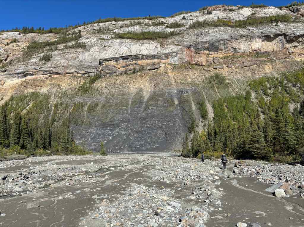
We moved quickly, hoping to get to our camp spot before rain started to fall. We could see distant rainfall ahead of us, moving over the mountains. We followed the main flow of the creek as it curved right. About 1 km beyond the Park signs we found a Warden’s Cabin. It was locked and unoccupied, but it let us know we were close to our camp spot. We continued 1 more kilometre and found a small, clear creek coming in from the right (west). A huge rocky spire towered over this place and we could see that we had reached the spot where an old mining road ascended towards Hoge Pass. We set up our tents on a remarkably flat shelf on the south side of the creek. Once again we hurried to filter water and eat before rain arrived and once again we were lucky that none fell while we were setting up camp. We even had time to explore the area before the rain came, climbing a large headwall that partitioned the valley to the south where a creek ran down from the Burwash Glacier. We retreated to our tents as the rain began. It continued through the night and into the morning.


Day 3: Over Hoge Pass
“Crimped with the crimes of the city, sin-ridden and bridled with lies, In the hush of my mountained vastness, in the flush of my midnight skies.”
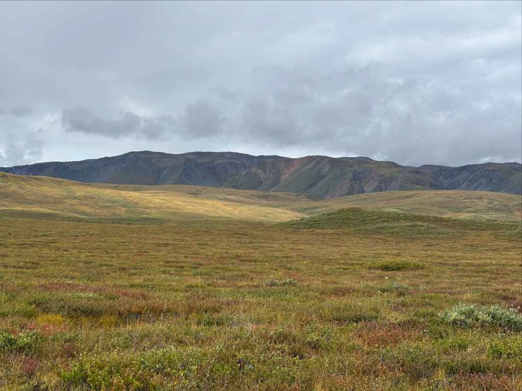
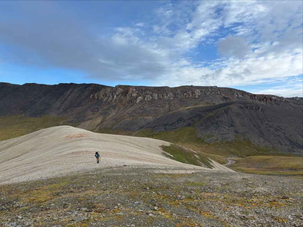
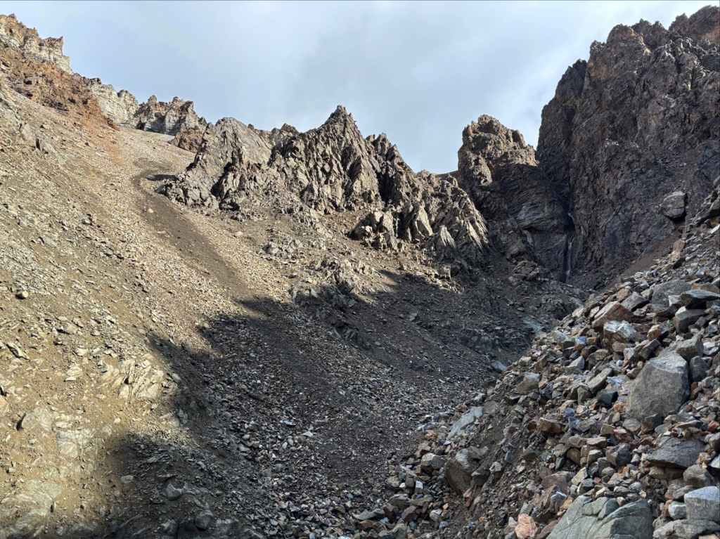
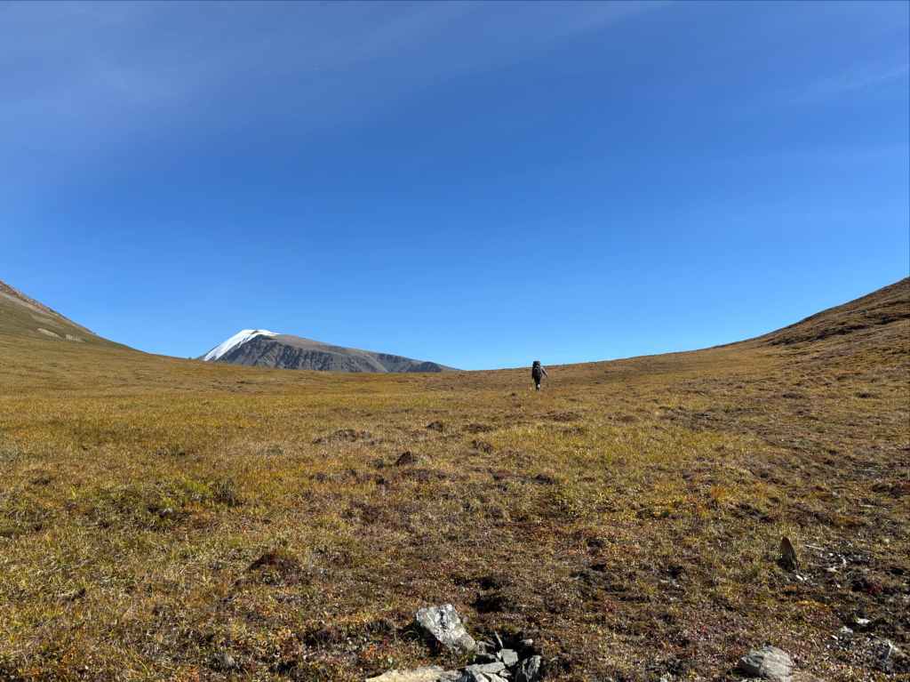
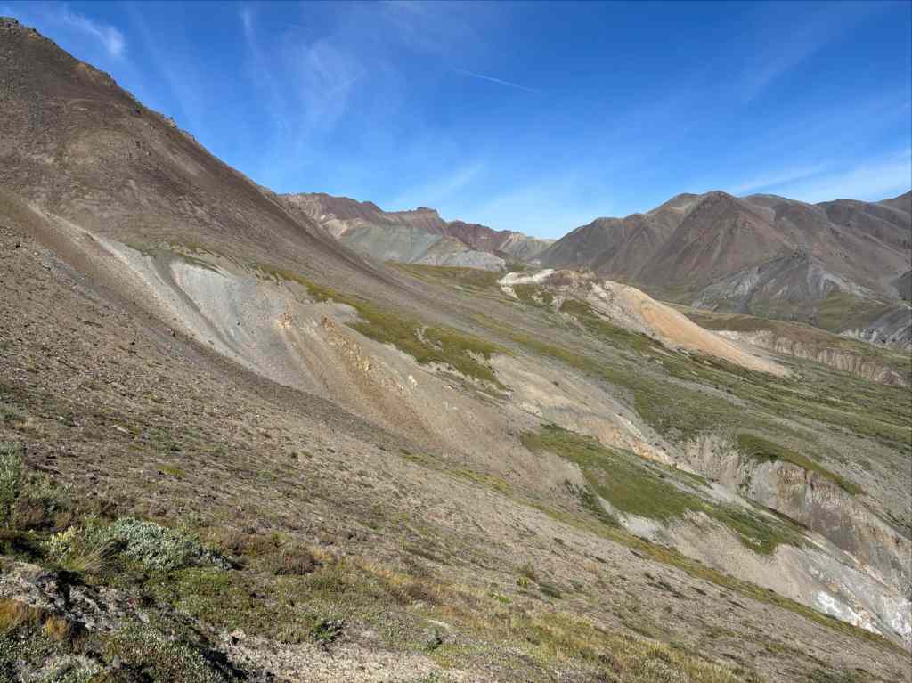
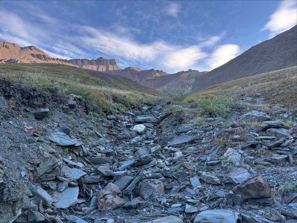
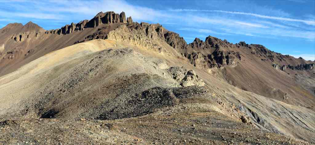
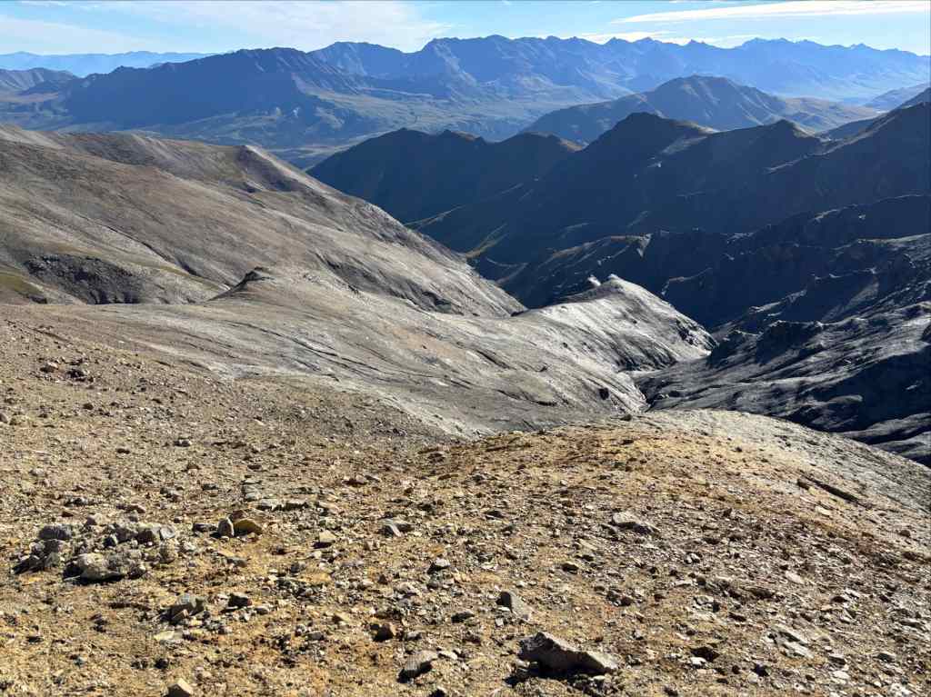
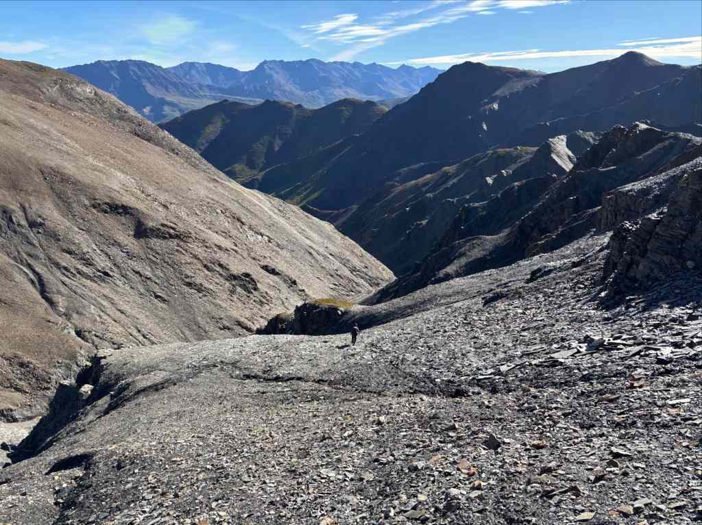
The next morning we delayed breaking camp until the rain settled down. According to forecasts from Garmin, this was to be our last night with any significant precipitation. That turned out to be accurate. Once we were packed and ready to go we got onto the old mining road. We followed this up a wide valley to Hoge Pass. This was some of the most enjoyable hiking of the whole trip. The grade was very manageable, there was no vegetation to fight through, and the footing was supportive. As we got nearer to the pass the road petered out. As per the route description we angled southwest and ascended a light grey coloured hill then contoured around a depression and ascended again to reach the top of the pass. I was surprised to find more hummocky terrain as we moved along. We would discover that this terrain was present in all the mountain passes, acting as a water sponge and seeming to be the origin of many creeks.
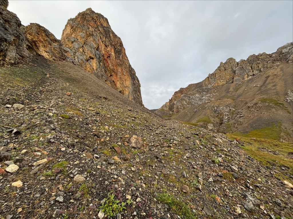
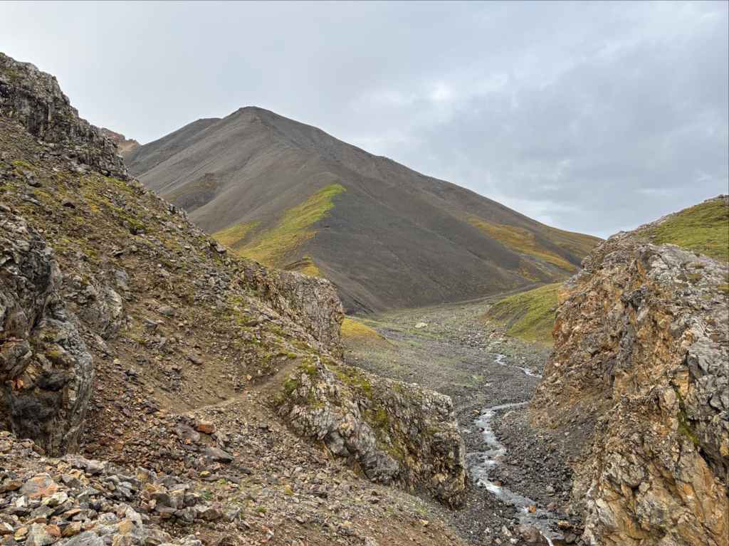
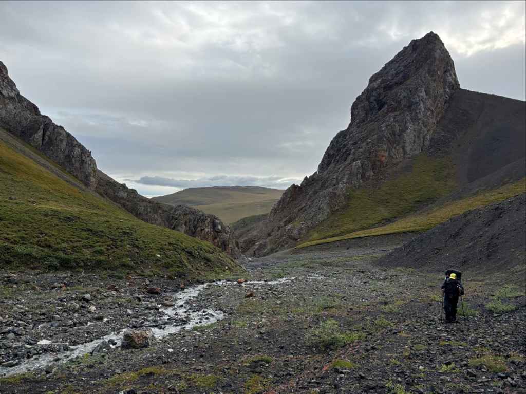
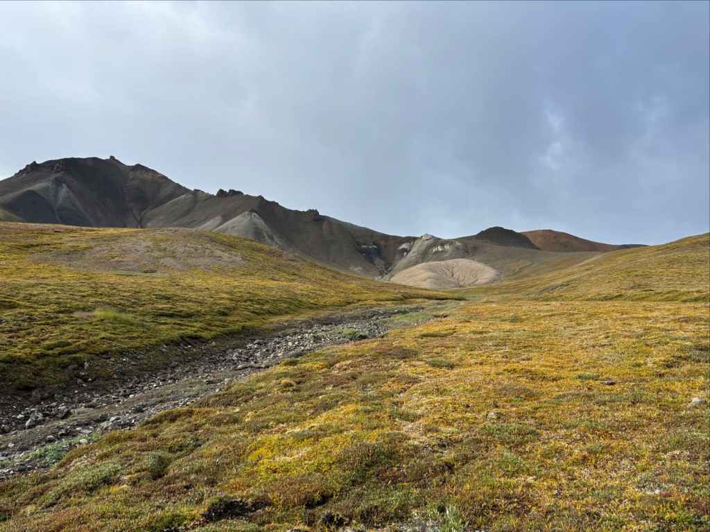
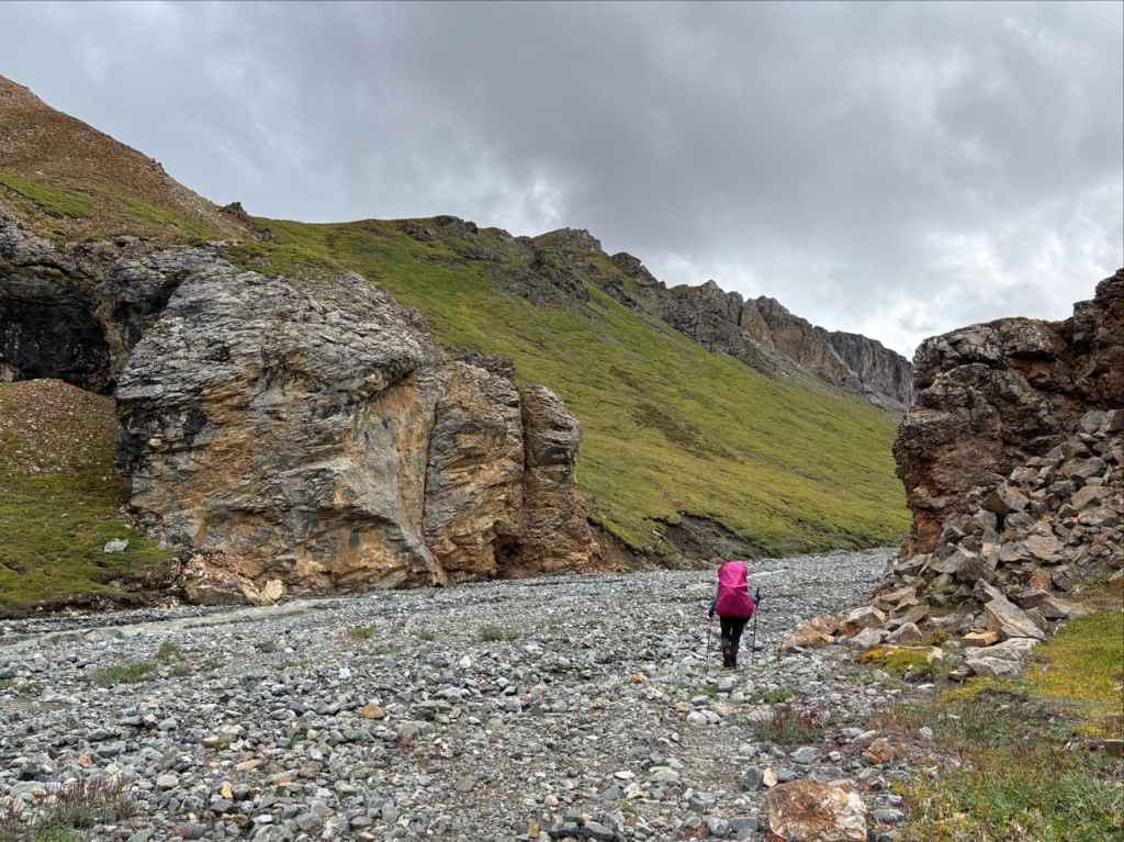
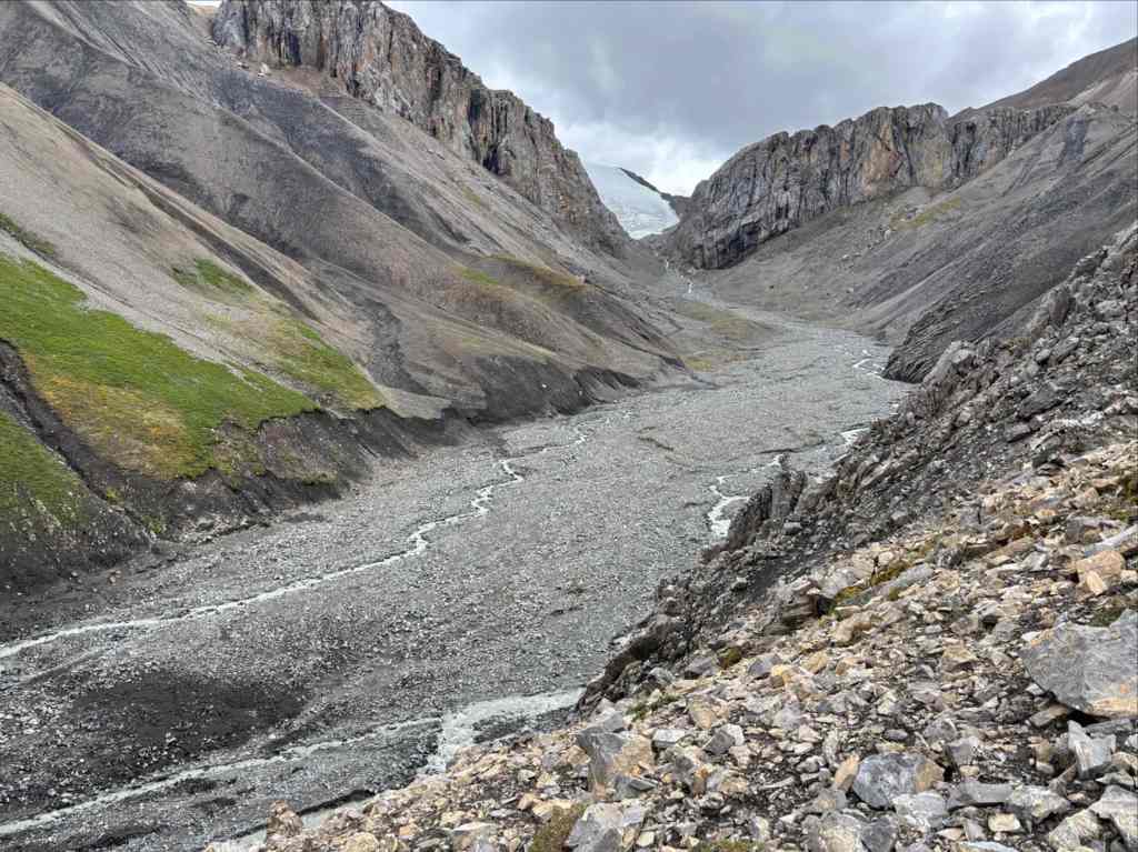
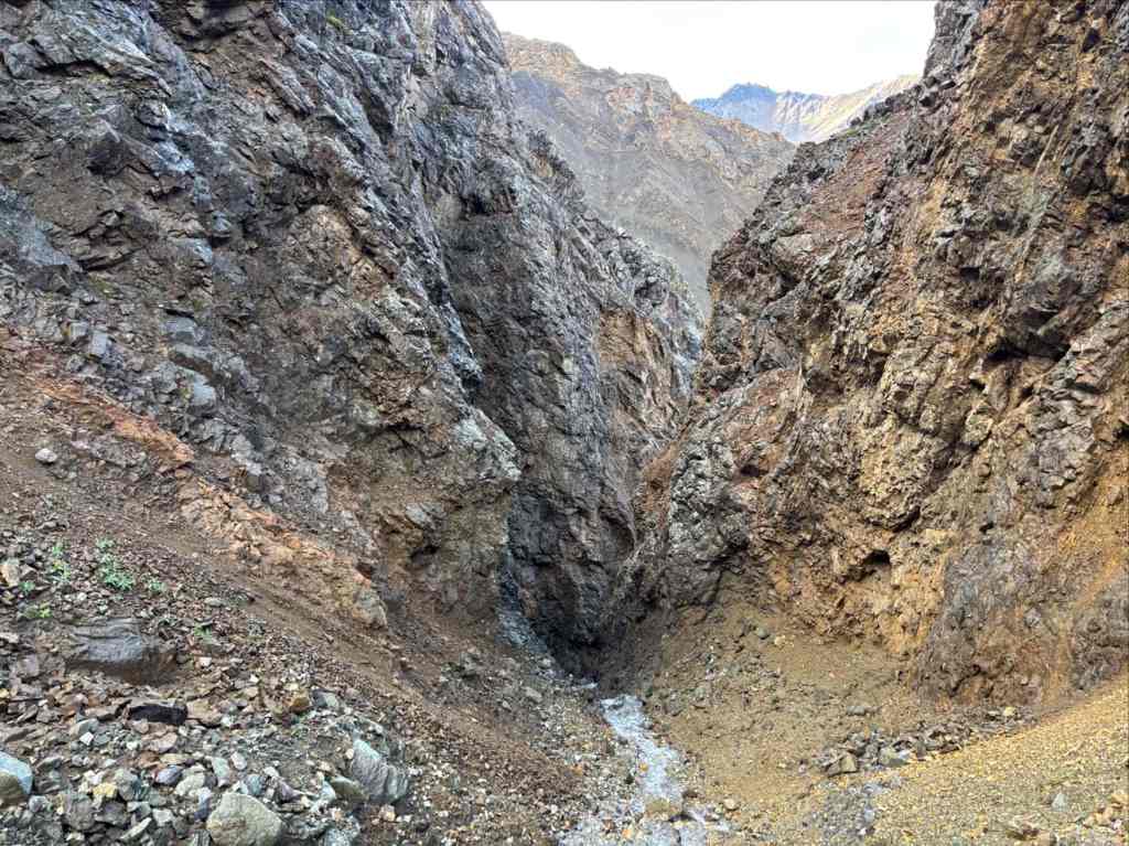
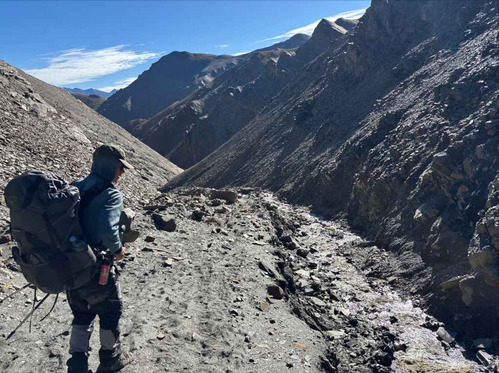
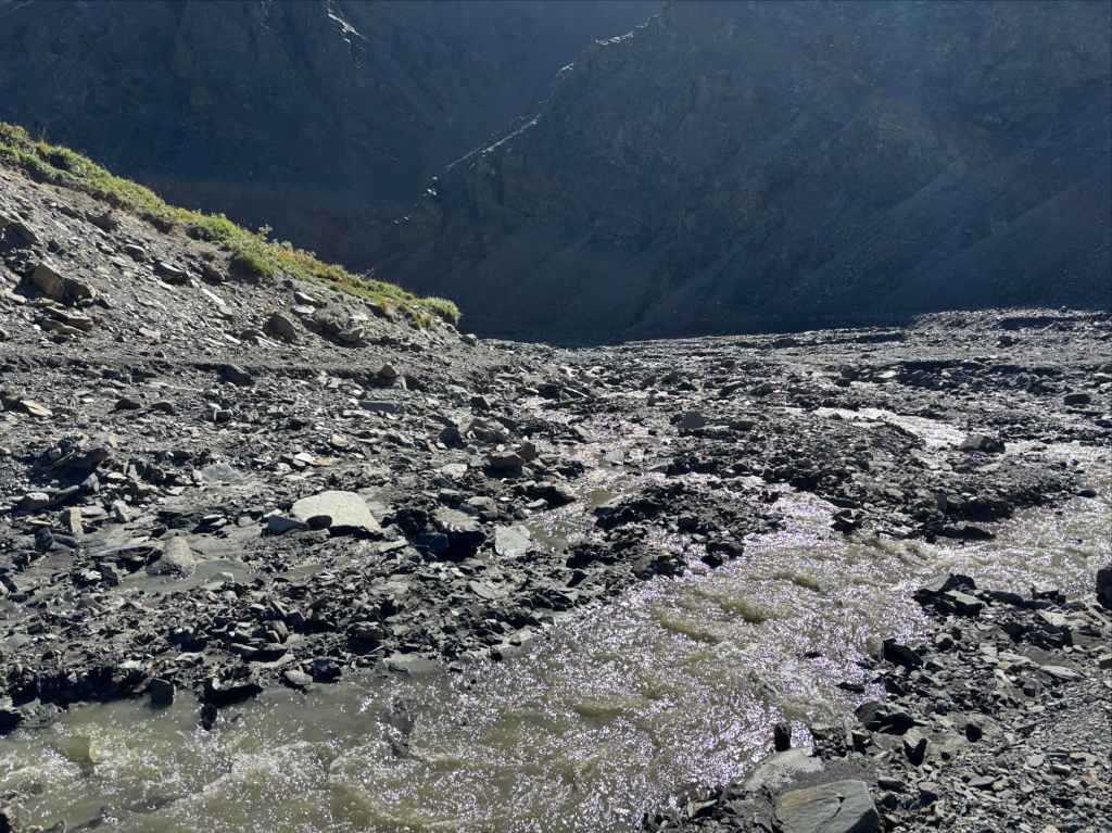
From the top of the pass we knew we had to pick a route down to Hoge Creek and follow it all the way to the Donjek River. There are many ways to get down, but there are apparently also many gullies that are impassable. We had tracks on our GPSs detailing a few different possibilities, but we also knew that year-to-year conditions in the different gullies might change. We ended up contouring to the south and then east, inspecting the gullies below us and deciding to stay above them. Eventually we were in the same valley/broad gulley as a tributary of Hoge Creek. We were able to descend to it without difficulty but after following it a short way we found that it entered a narrow chute then dropped over a waterfall. We had to struggle to climb up awful treadmill scree above a rock rib then traverse to a slope that led back to the creek beyond the waterfall. Thereafter we were able to follow the creek, making slow progress as we hopped back and forth. The valley eventually widened and we could see the huge valley of the Donjek River ahead.


Comparing our route to other possibilities on our GPSs I think we would have saved ourselves a lot of trouble if we’d stayed on a ridge heading northwest then due west from the pass, eventually dropping off to the south and picking our way down. We had one track that showed this, though parts of that route must be a little sketchy based on what we saw from the valley and the jagged appearance of the track. In any case, if we had successfully gone that way we would have saved a lot of creek-hopping down in the valley bottom and possibly made quicker progress (incidentally, this is the route shared by Yukon Hiking on their website).
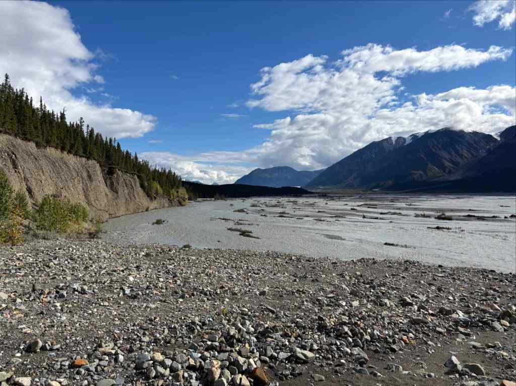
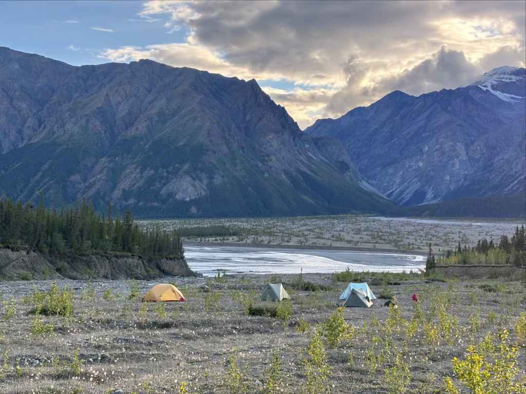
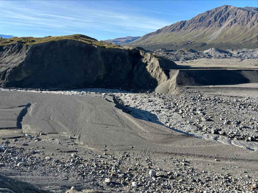
We had planned to make it down to the Donjek River, then follow its eastern shore south a short distance before entering the forest and locating one of several clearings to camp in. This plan was abandoned when we reached the valley of the Donjek and found that the river was running high, fast, and right along the eastern side of the valley. We couldn’t climb up into the forest alongside the river because of a 20 foot high dirt cliff hemming us in. The cliff extended roughly 1 km back the way we had come. At this point it was getting late and we were tired. We decided to camp in the valley on the north side of Hoge Creek on a scrubby flat region which looked as though others had camped there in the past.

This was the night that I went to sleep feeling the most uncertainty. Our difficulties descending to Hoge Creek, along with our discovery that not only was our way blocked by the river but that our obvious alternative was blocked by an unanticipated cliff, drove home that we could take nothing for granted on this trip. I went to sleep listening to the creek and the sound of airliners passing high overhead, indifferent to the struggles of those crossing the land on foot.

Day 4: The Donjek Glacier
“Searching my uttermost valleys, fighting each step as they go, Shooting the wrath of my rapids, scaling my ramparts of snow;”
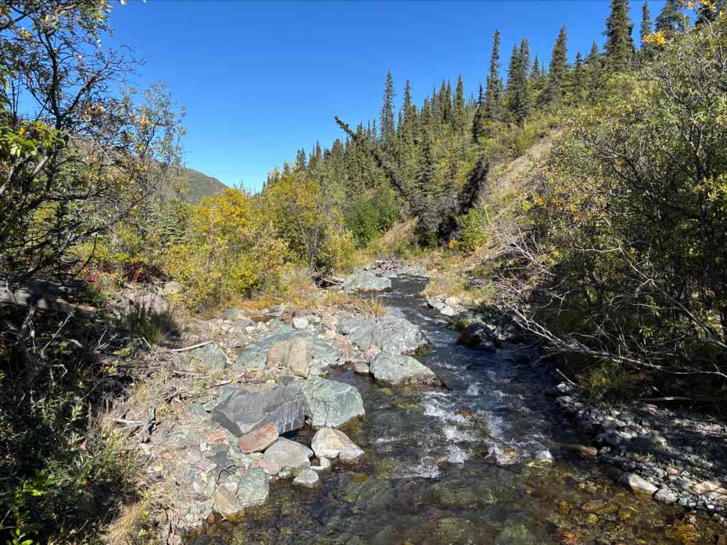
No rain fell on us overnight, but our tents were covered in condensation in the morning. They were more wet than after we’d actually been rained on. Luckily, we knew that the day would be sunny and we’d eventually get a chance to dry off. We backtracked along Hoge Creek to the point where the dirt cliff petered out and the forest was easily accessible. The official route description mentions finding game trails a couple hundred meters downstream of an old horse camp located on the south side of Hoge Creek, then following those to a more prominent horse trail. We found no horse camp. Entering the forest we did find a number of animal trails. We made use of our GPS maps to angle ourselves towards the expected location of the horse trail and after a short time found ourselves standing in it.
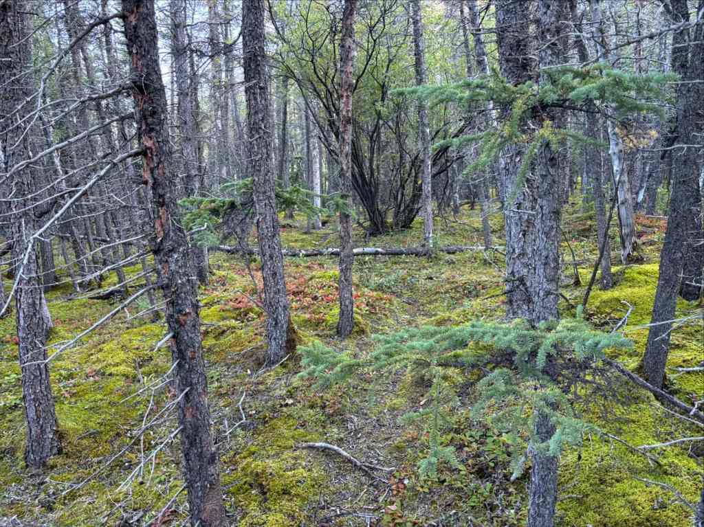
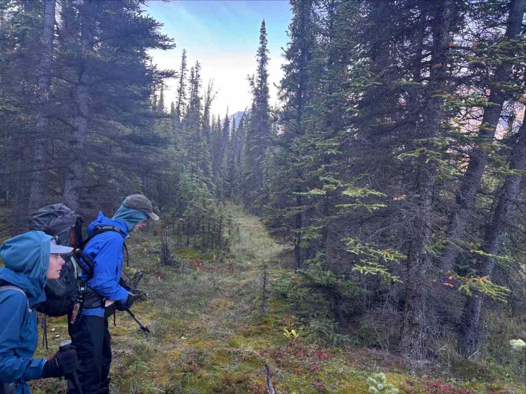
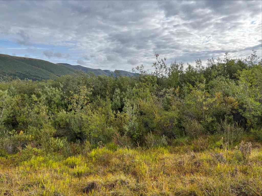
The horse trail was clear and easy to follow in some places, very overgrown and just a step above bushwhacking in others. In those places the vegetation clawed at us incessantly. It would be easy to have loose items pulled off your pack or out of a pocket (I read one account of someone losing a GPS that way). Our group lost the safety clip from a can of bear spray but nothing else, though one branch made a pretty determined effort to rip away a pair of sandals strapped to my pack. I kept my sunglasses on as much to protect my eyes from getting poked as to protect them from the sun. We followed the old trail across creek beds and through small clearings. Some of the clearings would make good camp spots if the creeks were flowing.
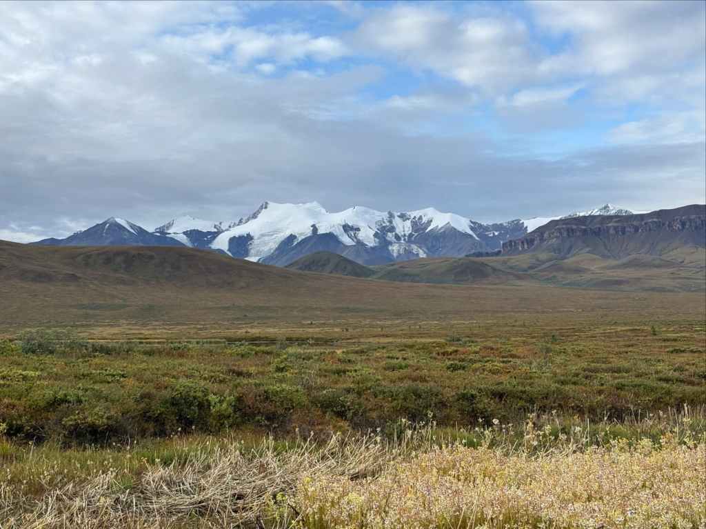
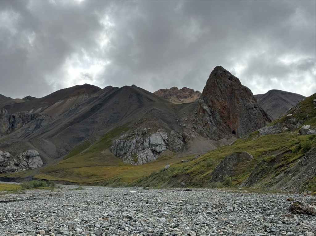
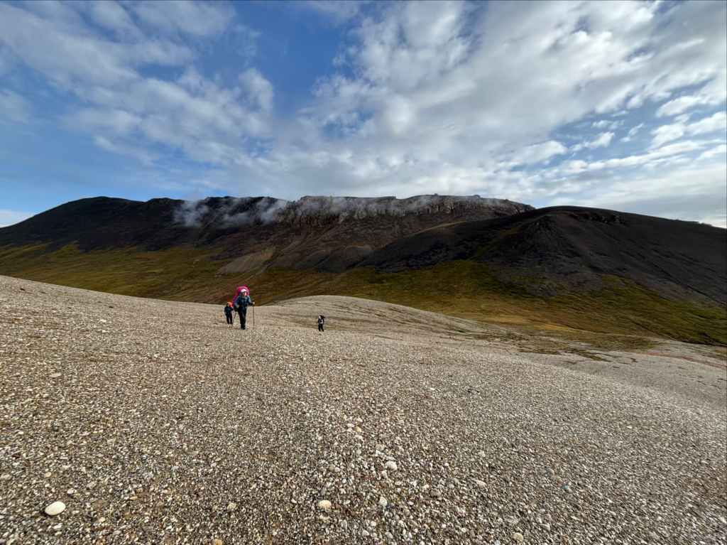
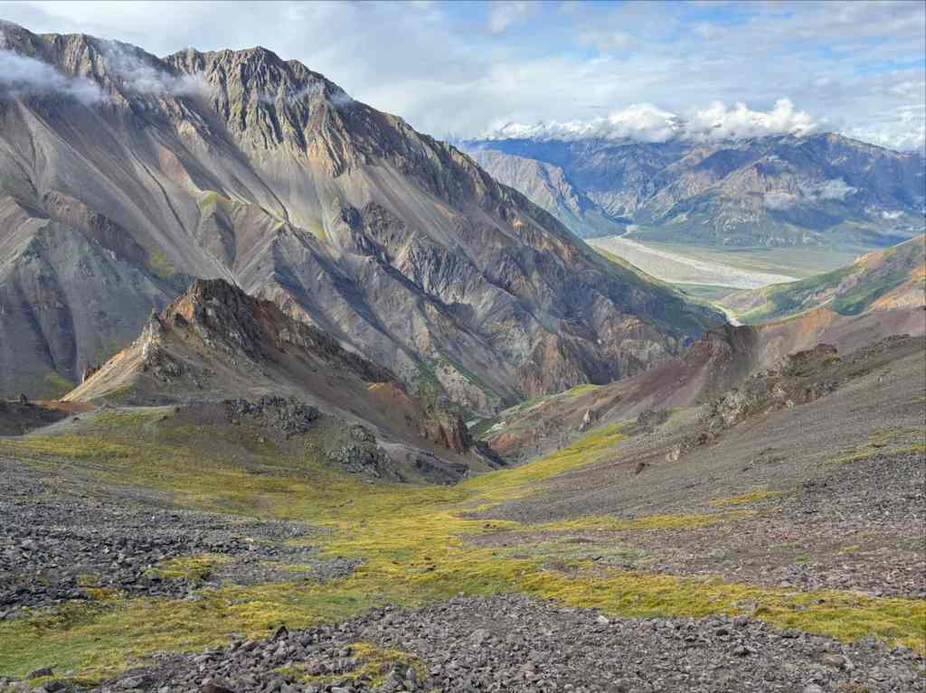
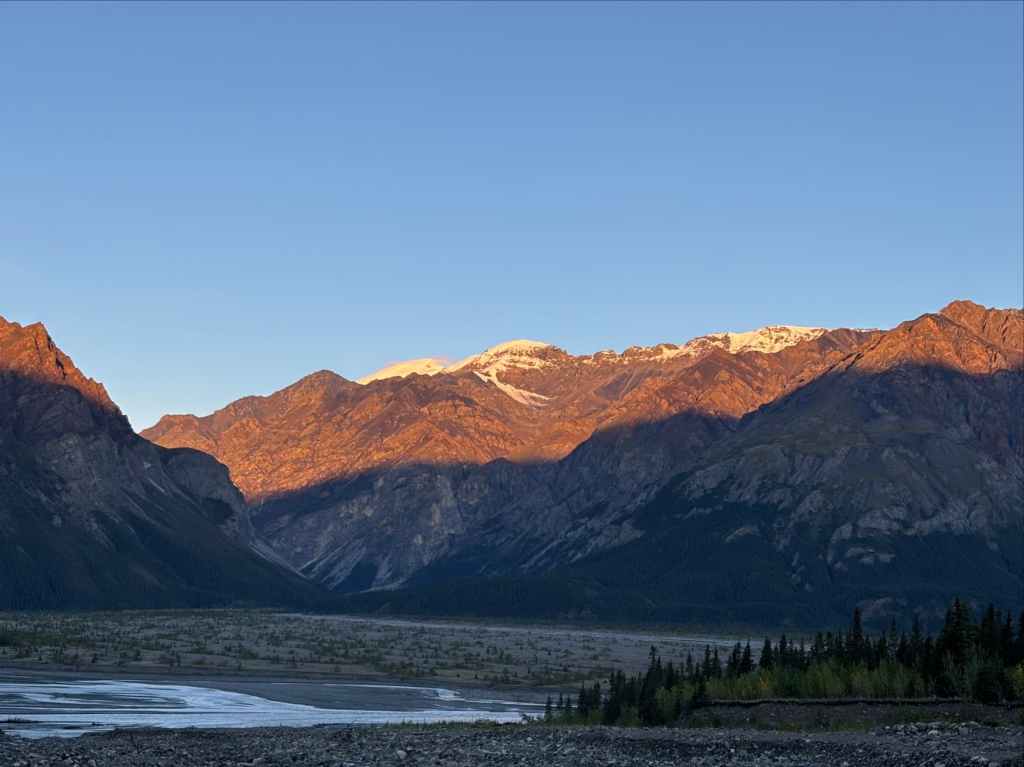
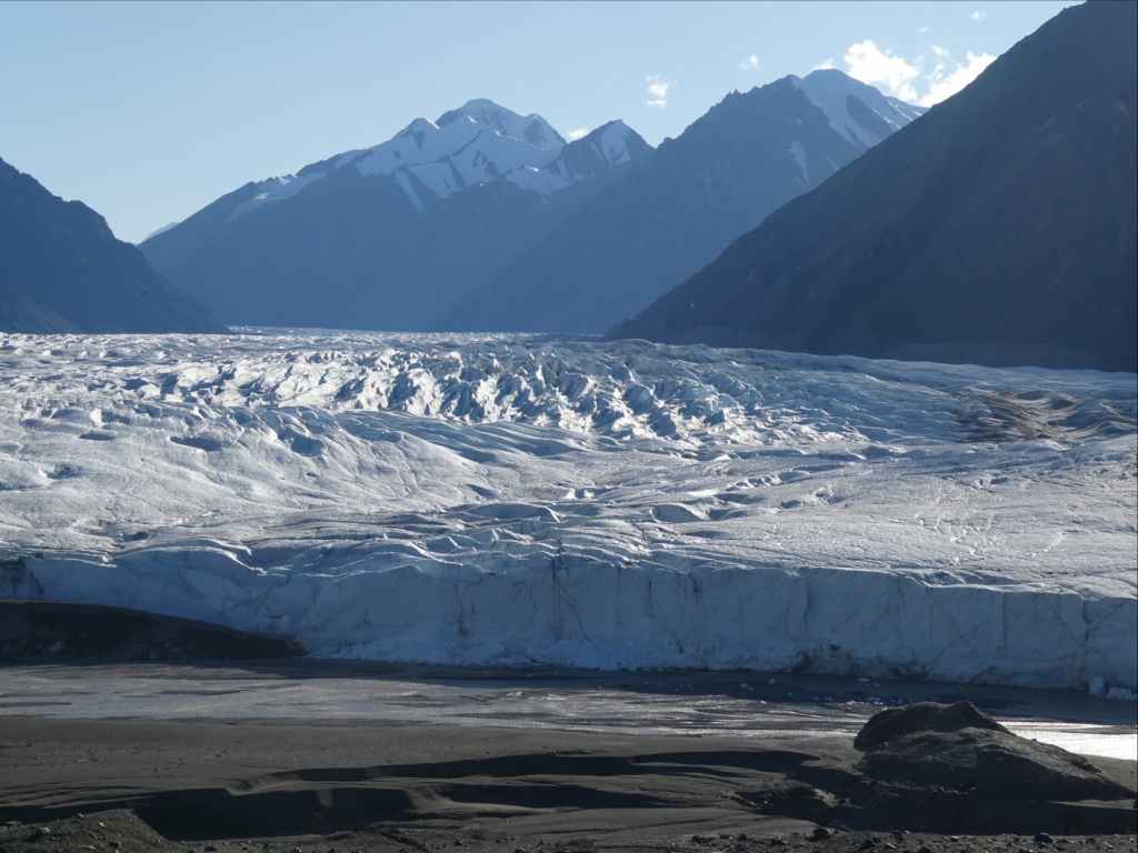
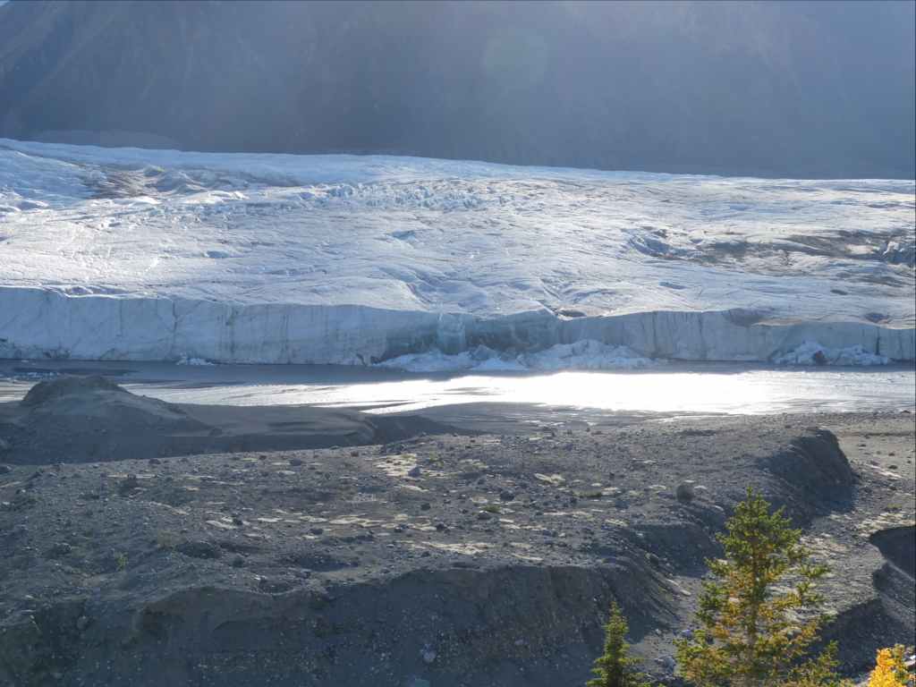
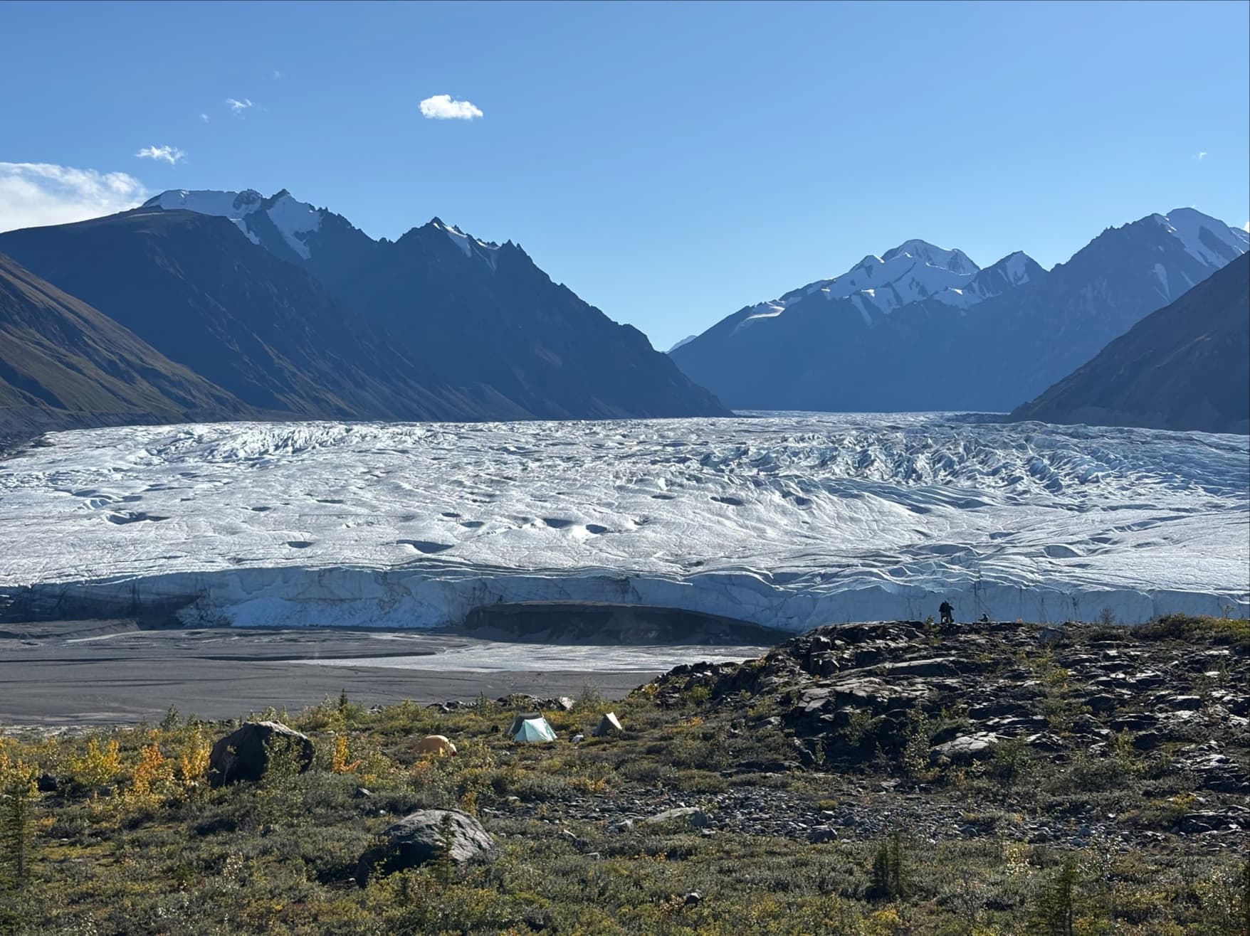
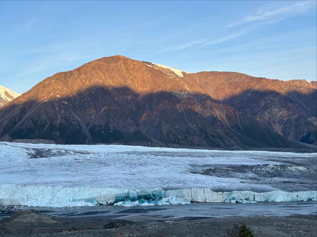
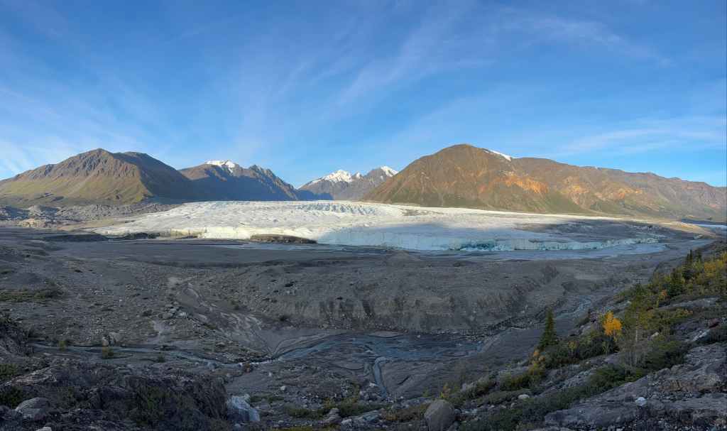
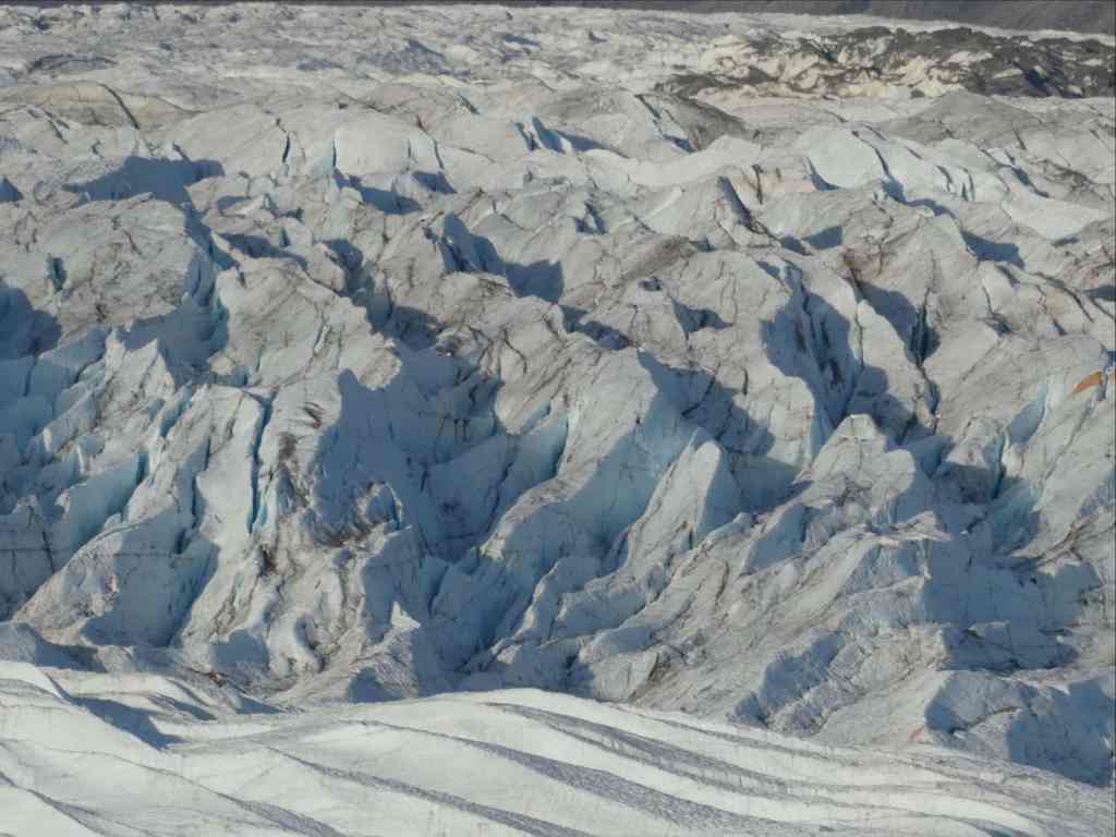
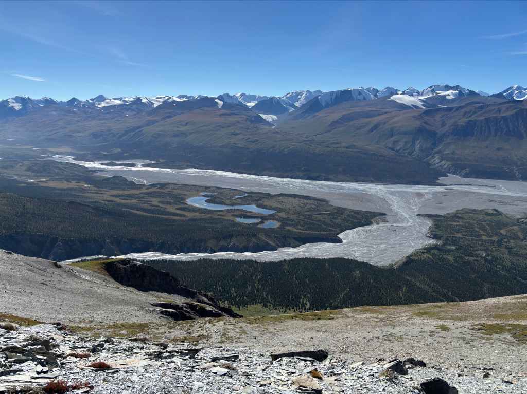
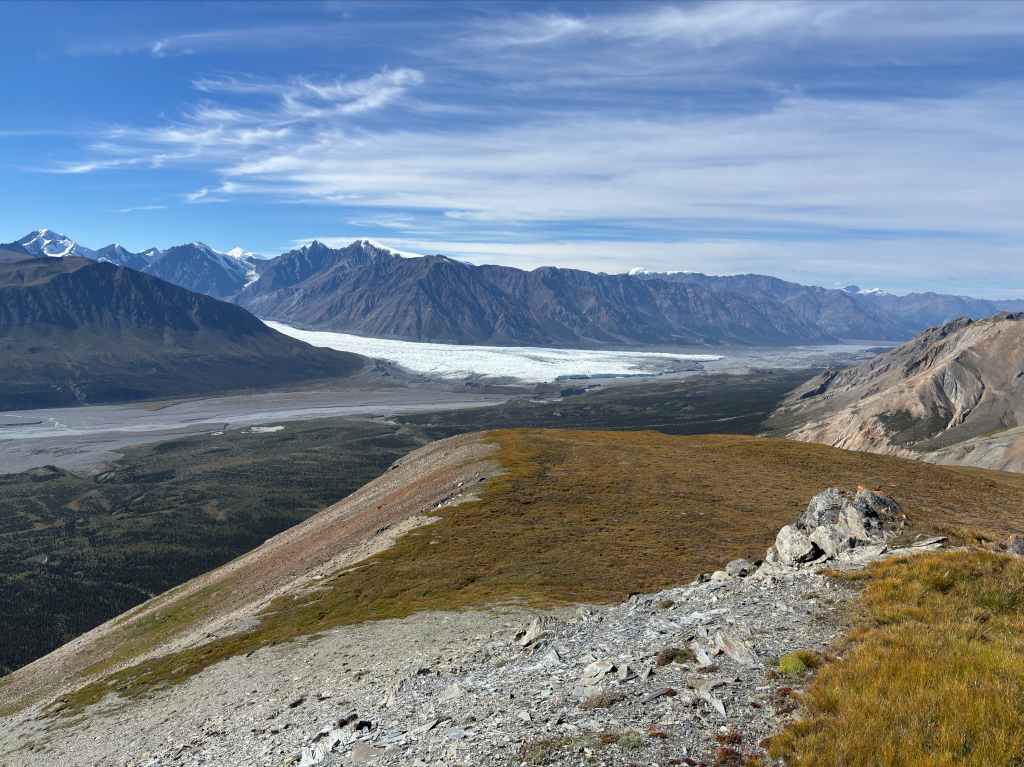
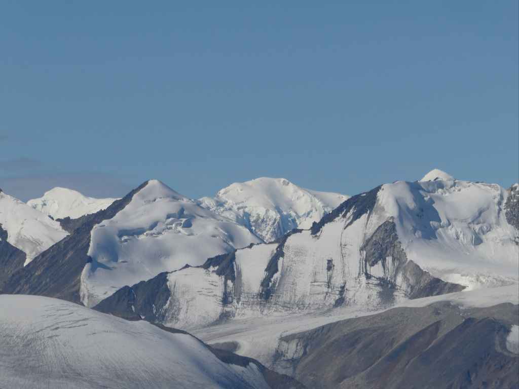
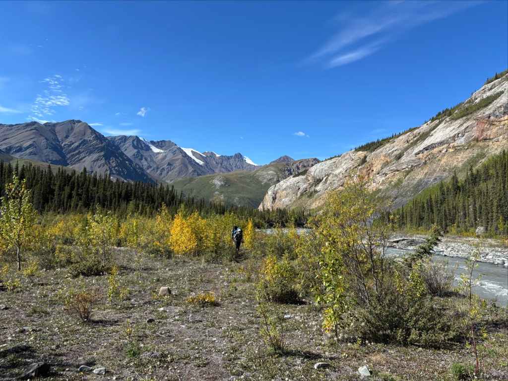
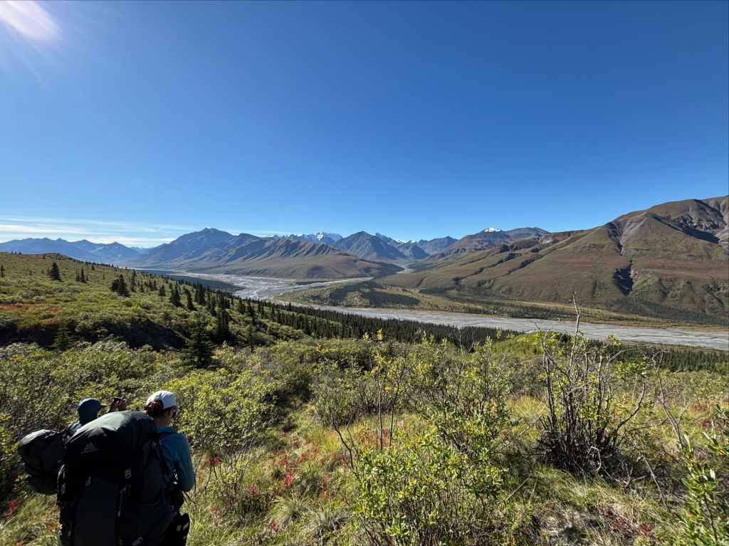
As we walked along we made a note of landmarks from the route description: a creek bed of pink coloured rocks, a “clear creek” near a balsam grove (though the water was very silty when we crossed) and a miserable 2 km section of “thicker shrubs”. After roughly 11 km the trail crossed a fan of creek beds (some with clear running water) and brought us to a large clearing with a clear view of the Donjek Glacier. We deviated west and to the edge of a steep drop overlooking the glacier and river valley. We followed this a little over 1 km to a rocky overlook with a magnificent view of the glacier and a good camping area adjacent to it.
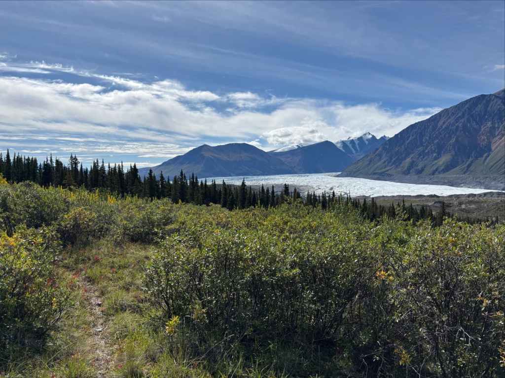
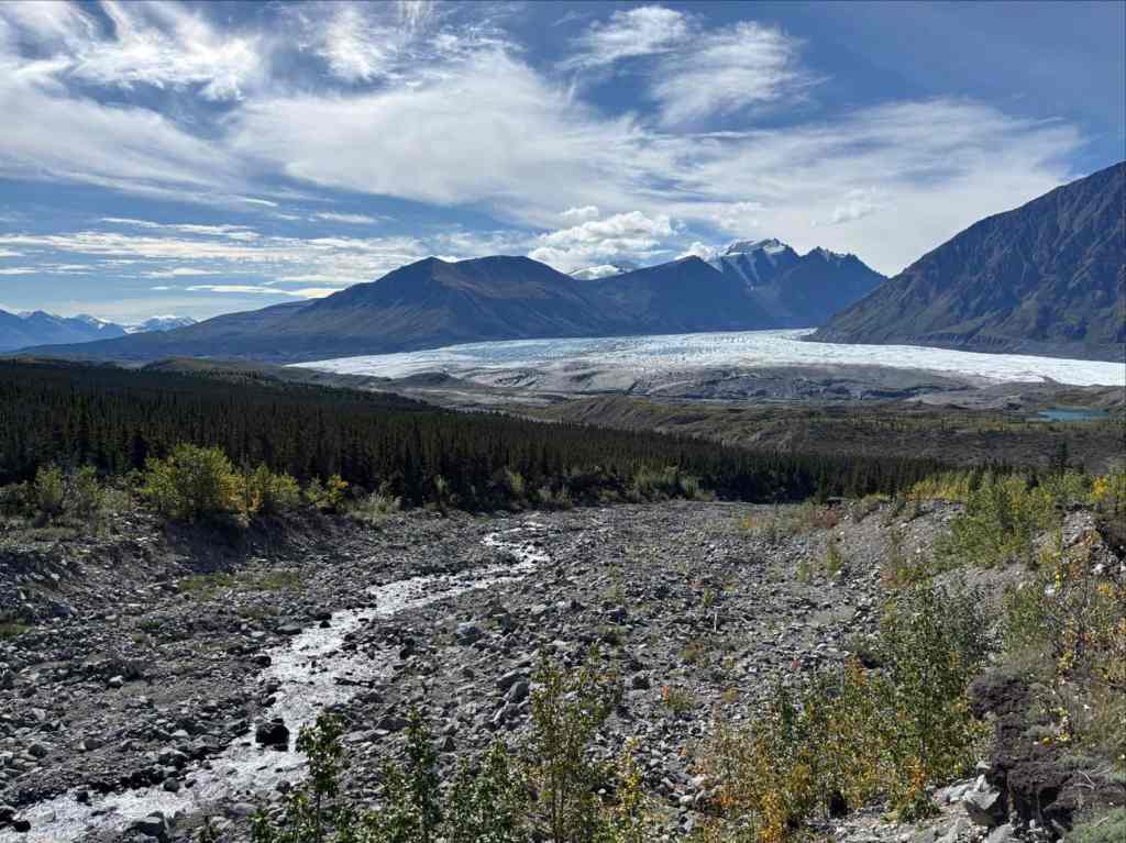


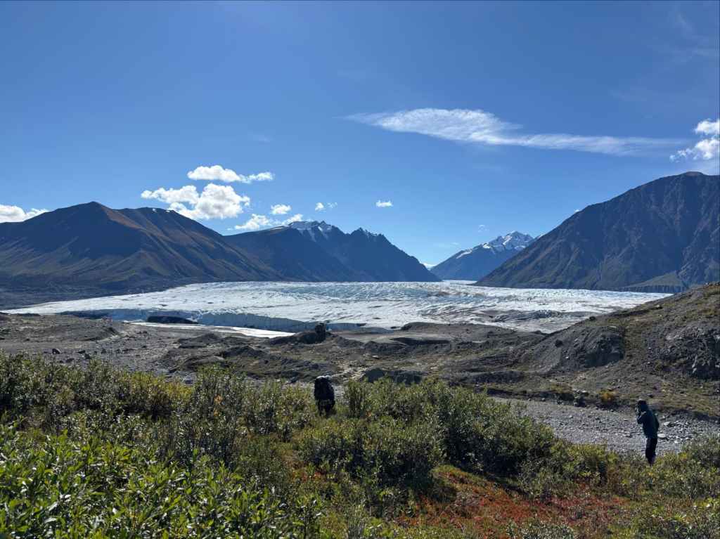
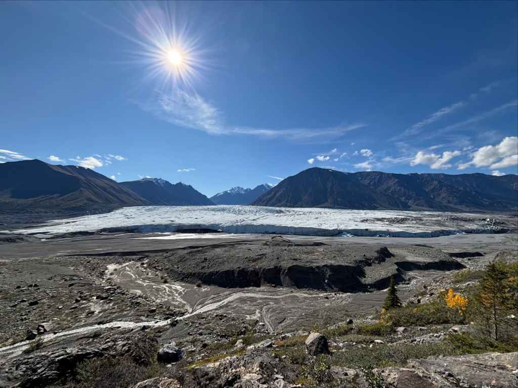
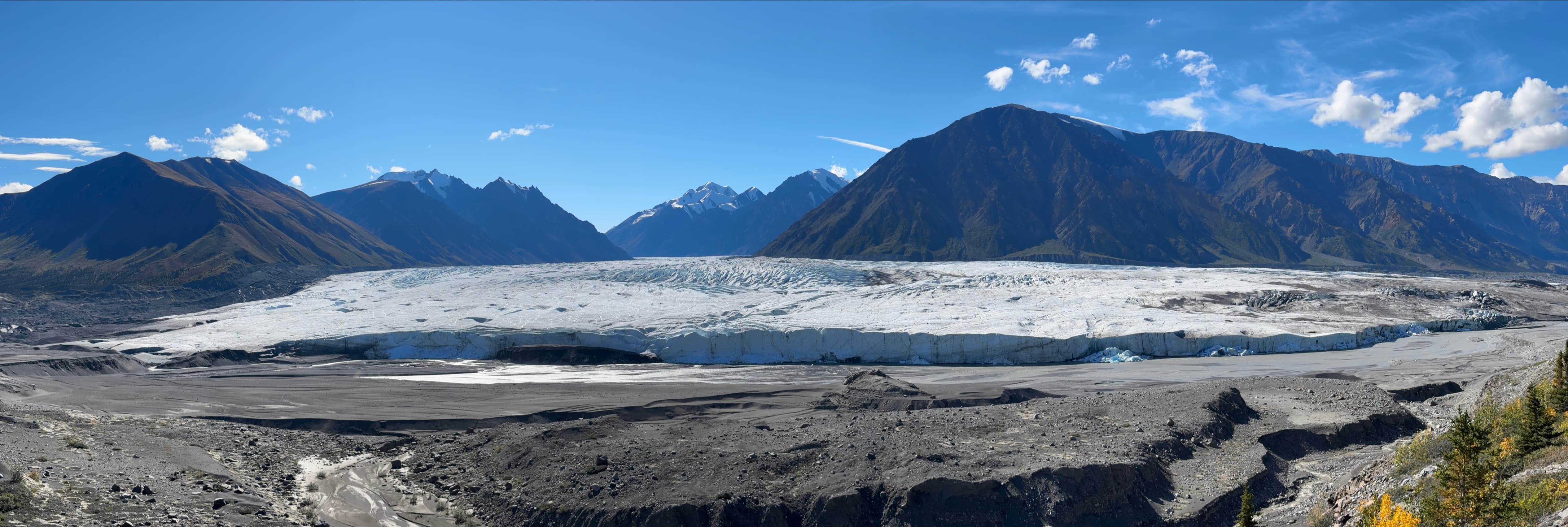
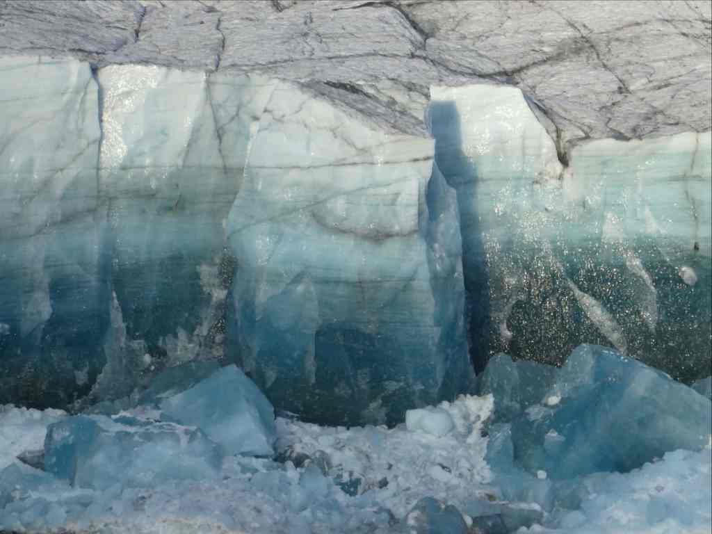
We set up camp next to the overlook. There wasn’t easy access to water, but luckily we had filled up at our last creek crossing. Unlike previous nights we weren’t racing incoming rain or fretting about our route. We ate a leisurely supper while gazing at the colossal ice river on the other side of the valley. There was the constant rumble of rushing water and shifting ice. We witnessed large sections of ice calving from the end of the glacier and plunging into the muddy Donjek river. Occasional thunderous booms echoed without a clear cause, probably from something shifting and cracking in the heart of the glacier. The sheer scale of the of the valley, the mountains and the glacier was unlike anything I’ve ever experienced and is something that even the best photographs cannot fully convey. We let the experience wash over us until the sun went down.
day 5: Over Expectation Pass
“I am the land that listens, I am the land that broods; Steeped in eternal beauty, crystalline waters and woods.”
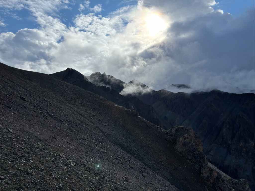
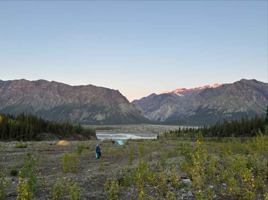
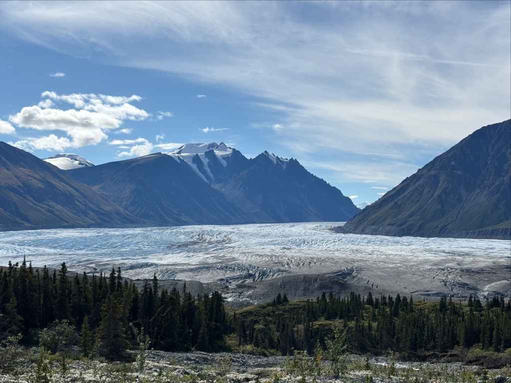
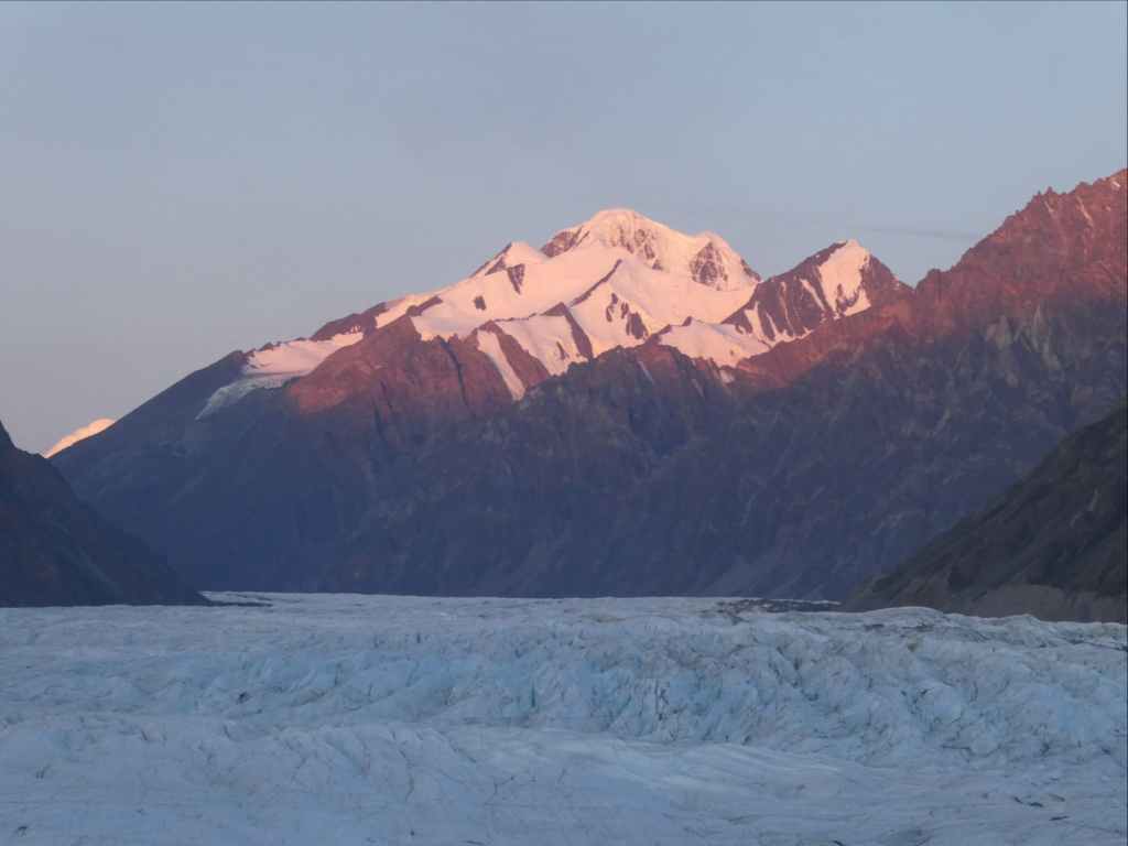
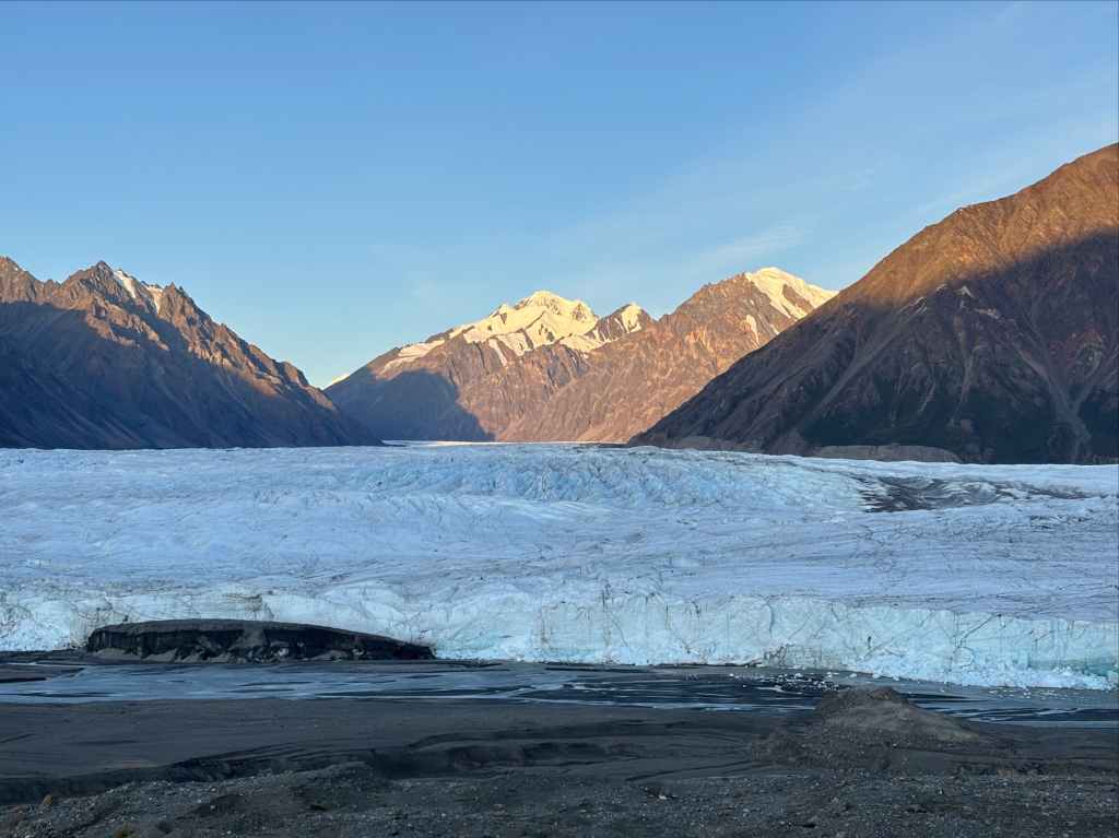
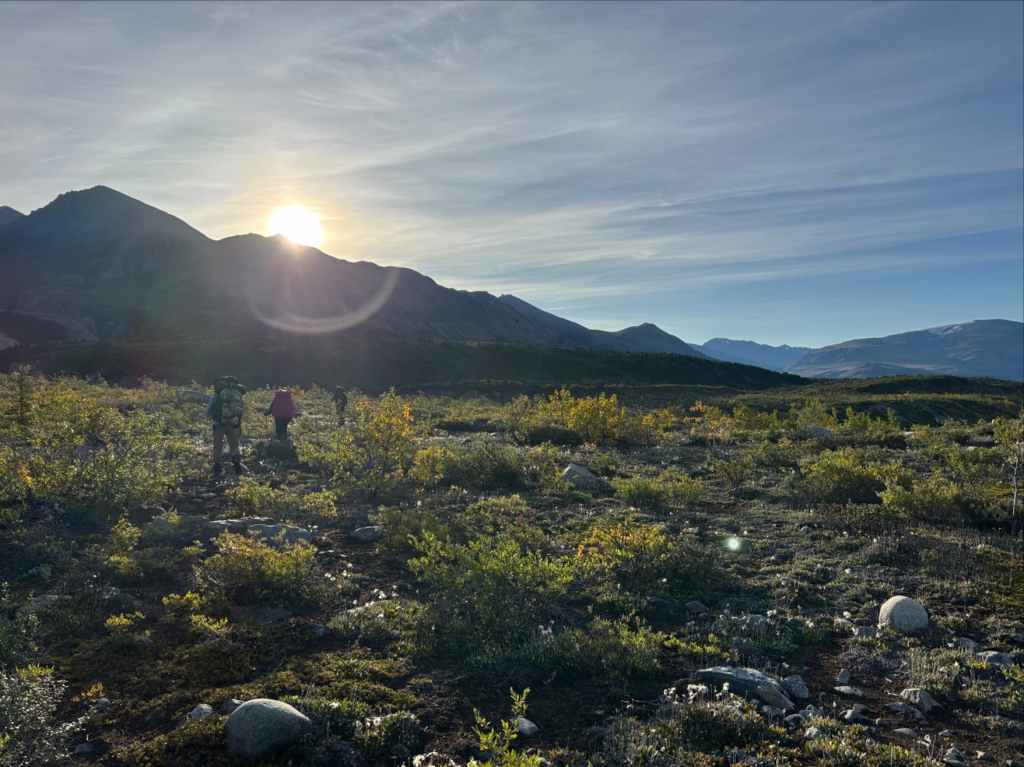
The night was peaceful, but not quiet. The glacier continued its endless booms and rumbles. The morning was clear and bright. Over breakfast and as we broke camp we watched sunrise light the peaks above the glacier then the glacier itself. We took many more pictures then finally set out on the return journey.

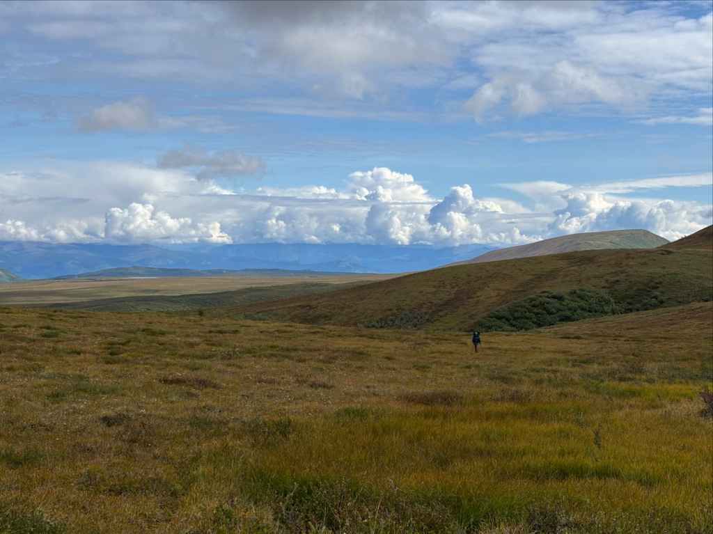
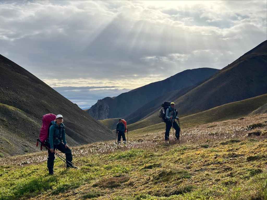
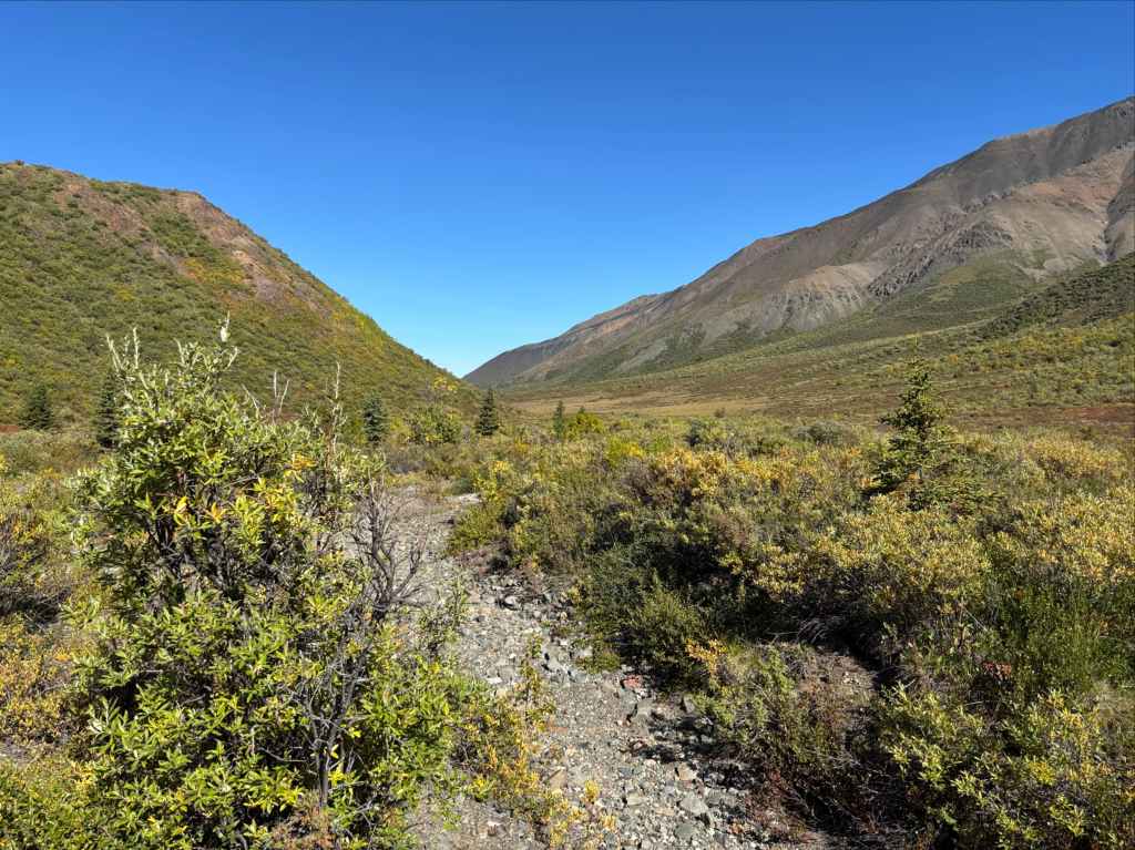
To begin with we descended to a wide gravelly creek bed southeast of our campsite. Hopping the creek we continued southeast, travelling across scrubby land, mud flats, and gravel. After 3.5 km we reached a wide gravel washout with a brisk clear water creek running through it. From here we could see Expectation Pass in the distance. Looking at the landscape and our maps we knew we had to reach a creek in an adjacent drainage to the southeast and follow that up to the pass. The Parks Canada description and Yukon Hiking’s description both say you have to bushwhack your way there. We followed the creek bed we were in for about 2 km (probably too far) then we cut right (southeast) into the forest and bashed through for 2 km until we found the proper creek. The forest here was dense enough to obscure distant landmarks so we had to navigate in simple ways (like keeping the sun on our right ear) and check our GPS frequently. Footing was poor and uneven. Our path drifted somewhat and travel was slow.


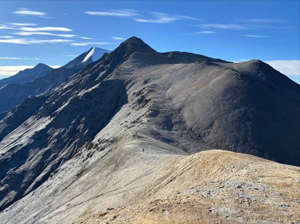
Once at the proper creek we ascended swiftly alongside it, thrilled to once again be out of the forest. We stayed right at a fork in the creek a short distance below the pass then found ourselves on hummocky terrain again as the creek petered out. We labored up spongy, sometimes wet ground until we reached Expectation Pass.


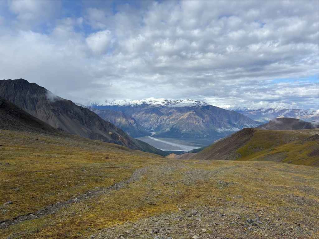
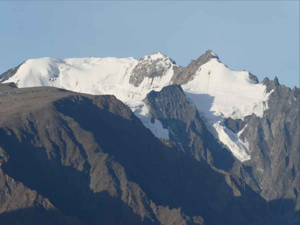
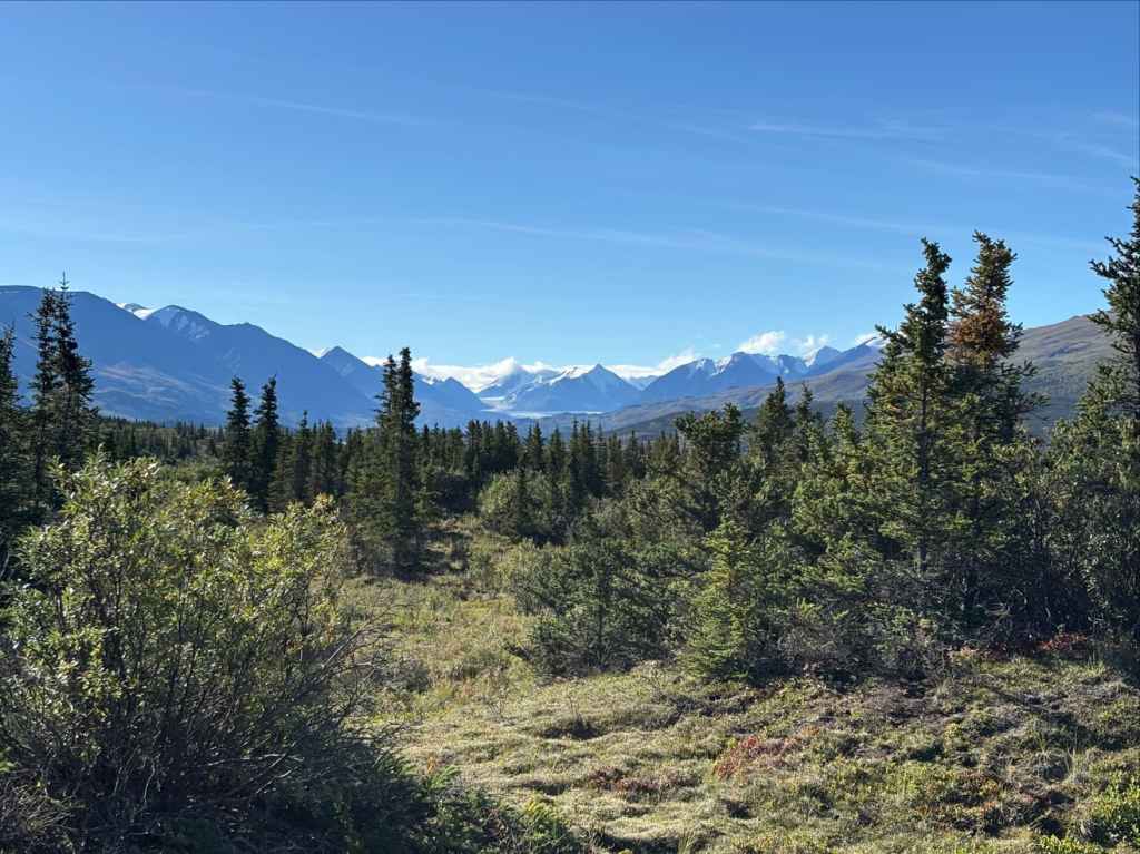
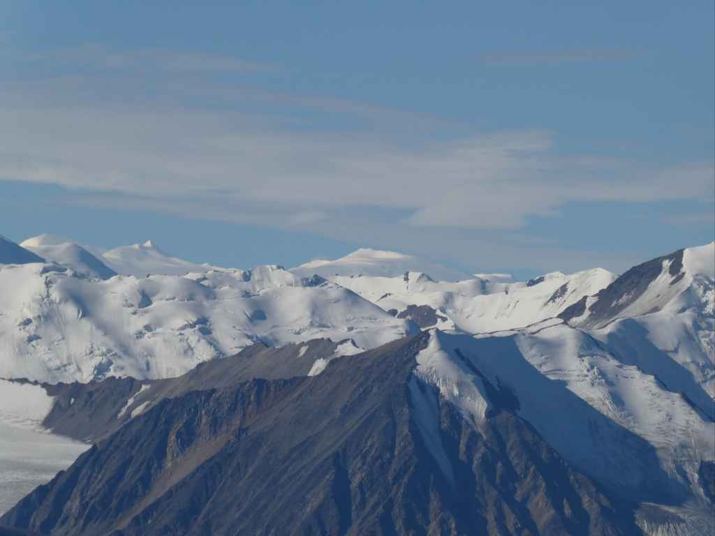
We dropped our packs at the top of the pass and ascended a rise to the south. At the top of the rise we found the best viewpoint of the entire trek. Below us we had an expansive view of the Donjek River Valley. The Donjek Glacier was to our right and to the left we had a clear view of the distant Kluane Glacier. In front, stretching to either horizon, were the peaks of the Icefield Ranges of the St. Elias Mountains.


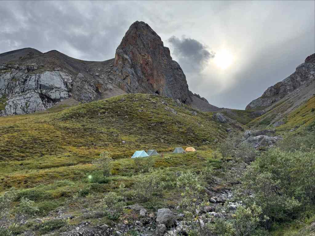
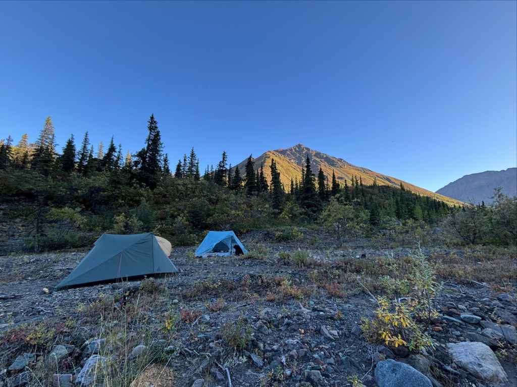
Afterward a prolonged break, we returned to our dropped packs and set out to find a place to camp beyond the pass. The first step was to contour northeast. This brought us to a large gully with a visible sheep trail traversing above it. The terrain was quite steep but the conditions were favourable and we had good footing so we crossed above the gully without difficulty. An alternate is to descend below it then climb back up. Beyond the gully we carried on contouring to the northeast until we descended a short distance to a clear-running creek. We hopped the creek and set up camp on fairly flat ground on the far side. The night passed uneventfully.
Day 6: over Atlas pass to the duke river valley
“Long have I waited lonely, shunned as a thing accurst, Monstrous, moody, pathetic, the last of the lands and the first;”
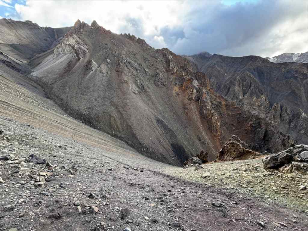
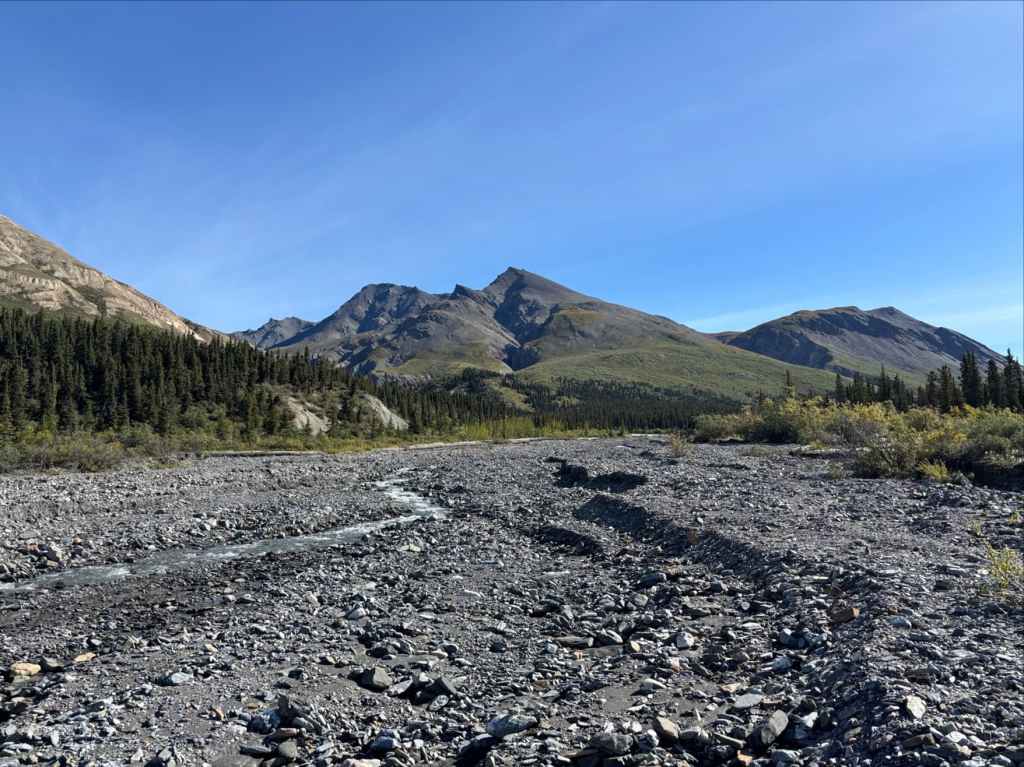
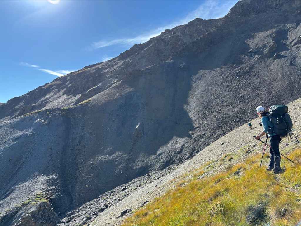
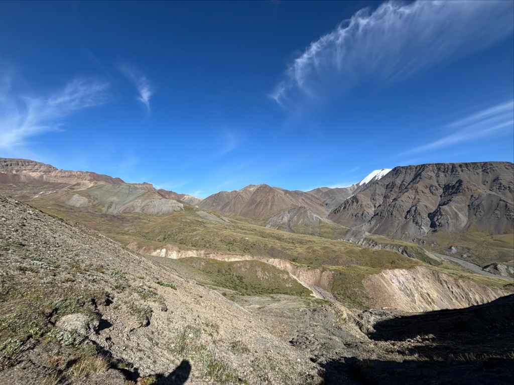
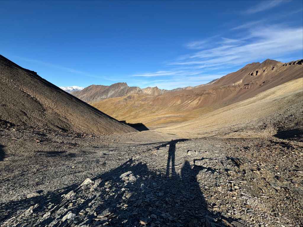
Our stretch of good weather continued and we broke camp in a clear, sunny morning. We set off to the east, continuing to maintain our elevation over uneven terrain and heading towards a creek that ran down from near the top of Atlas Pass. When we reached it there was no significant flow. We followed the creek bed as we ascended, eventually breaking off to the right when the top of the pass came into sight then toiling upward for the final few hundred metres. We rested there before ascending a short distance along the ridge to the north, which brought us to an bit of a view-point that gave a better angle than the pass itself for checking out distant mountains to the west.
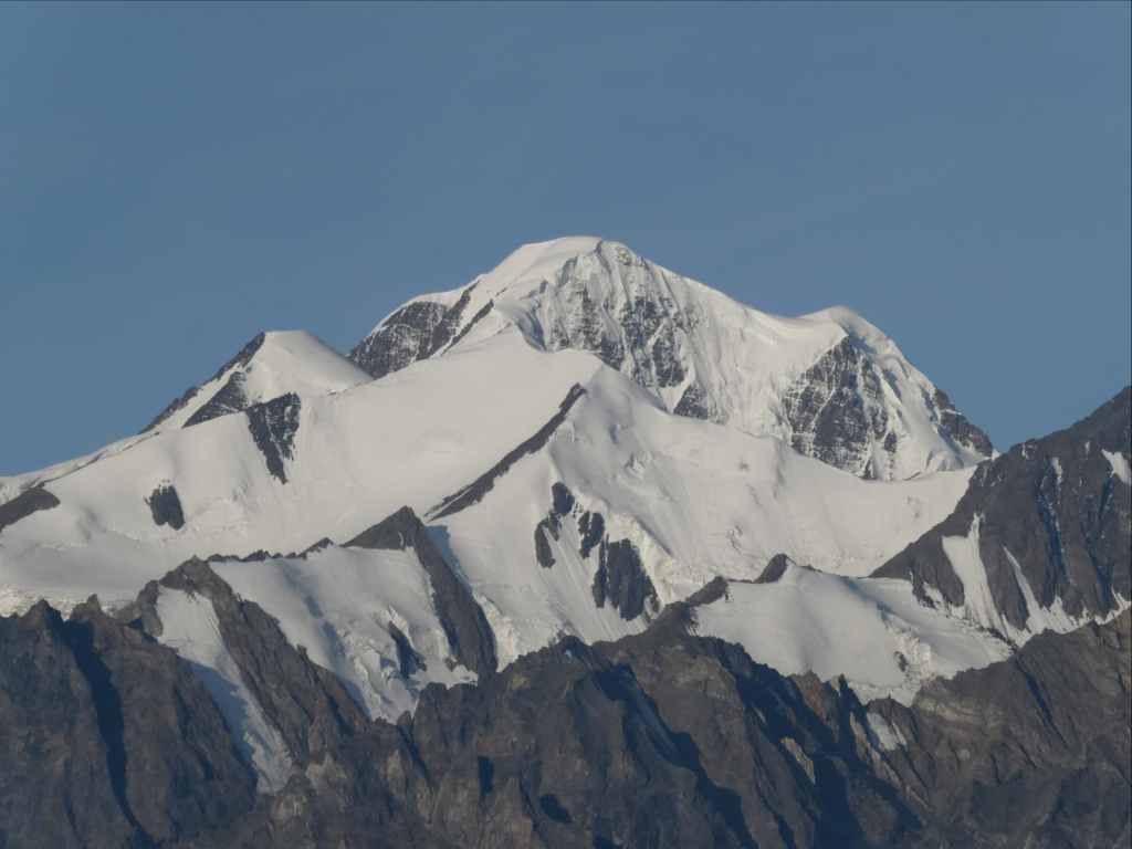
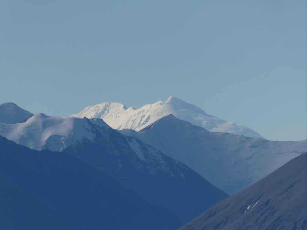
We had a beautiful clear day and as we scanned the peaks a broad mountain in the far distance caught our attention. It was only partly visible and off to the southwest. We referenced Peak Finder and our maps, and concluded that we might actually be looking at Mount Logan, Canada’s tallest mountain. More picture-taking ensued. Since returning home I’ve compared the pictures to different maps, taking into account the direction we were looking and the foreground peaks. In the end, I can’t be 100% sure we were looking at Mount Logan, but there’s a reasonable chance we were.


The descent from Atlas Pass is identified as a point of caution in Parks Canada’s route description. They state, “Simply going straight down the most direct route off the pass is neither inviting nor recommended.” Yukon Hiking says, “the descent is not challenging from the pass, but requires following a specific route down”. The specific route involves ascending the ridge north of the pass, skirting right (east) below a cliff and getting onto a gently curved ridge about 200 m from the pass descending steadily downward. Once at the top of that ridge a small patch of grass is visible on a little platform far downhill and to the left of it. The little patch of grass is referred to as “Hole #9”. This was our next objective. We descended to it easily enough. Once at the grass, we could see a clear path of descent to the right as we looked at it, heading directly to Atlas Creek. This short stretch was a little treacherous as the footing was sometimes poor and the pitch was very steep. After some thankfully minor struggles we found ourselves down at the level of the creek and hiking downstream.


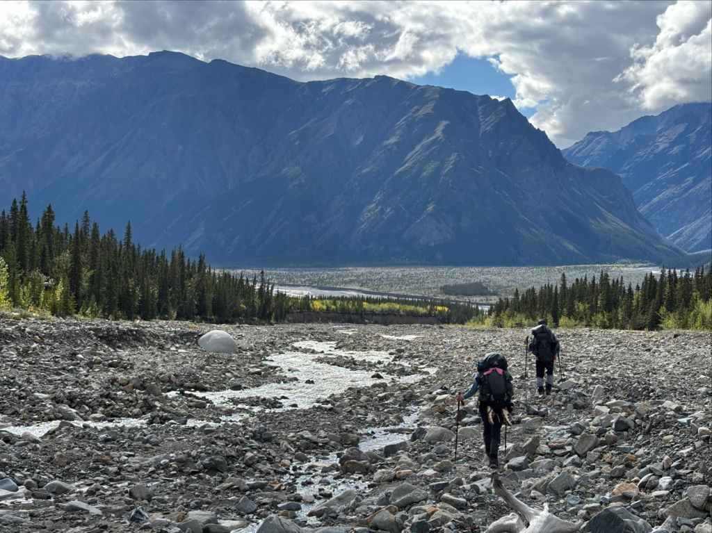
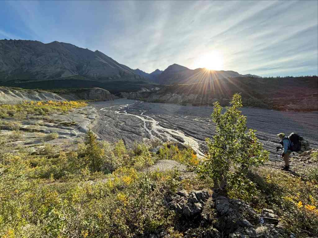
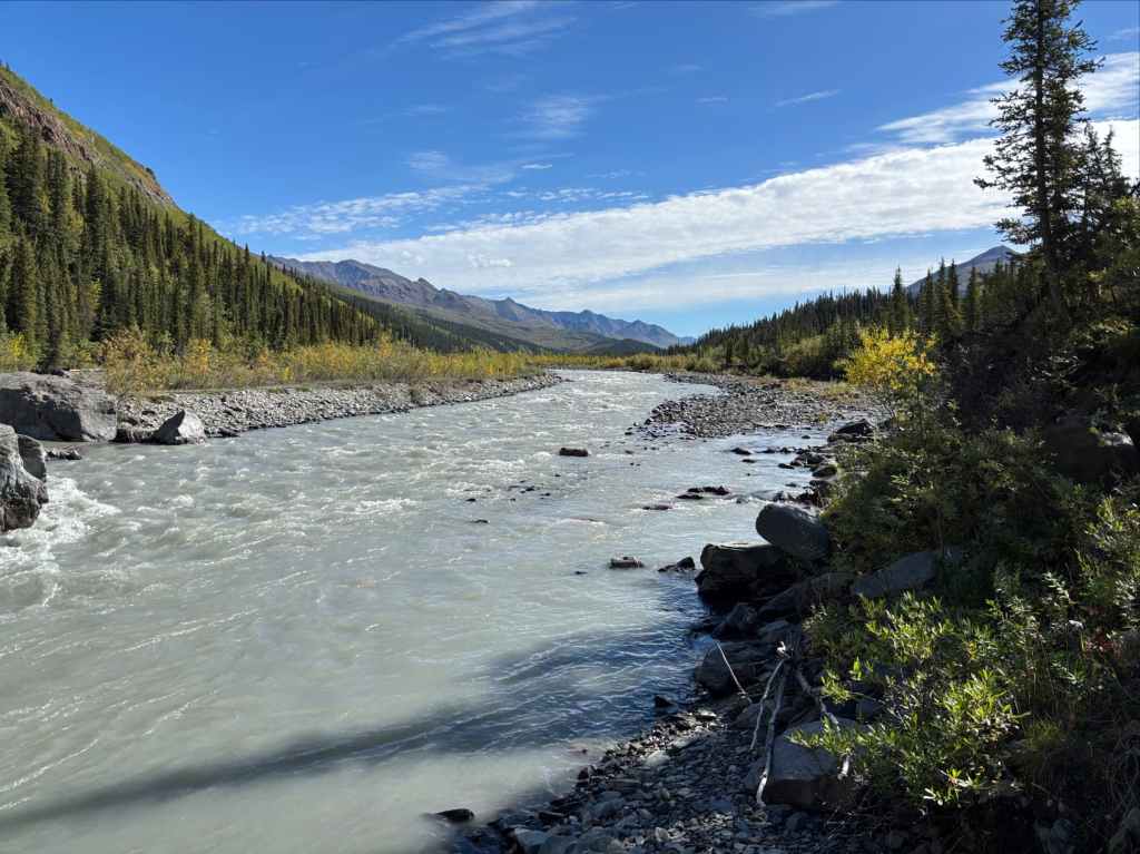
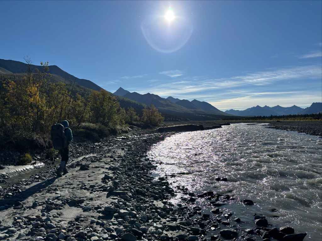
The narrow drainage holding the creek slowly widened into a broad valley as we headed east then north towards the Duke River. Travel wasn’t particularly fast over the rocky terrain and we looked for sand bars to walk along to ease the strain on our feet and ankles. When we finally arrived at the Duke River we took a moment to note the volume of the flow. We’d be crossing it the following morning and thankfully we weren’t looking at a raging torrent. Our actual crossing point would be about 5 km upstream where we expected the river would be braided and more amenable to crossing.
To reach our planned campsite adjacent to another broad creek bed about 4 km upstream we had to bushwhack into the forest again, picking up animal trails here and there and going down to the river bank when we could. Progress was once again fairly slow, but we finally reached the creek bed we were looking for about 2 hours later. The Parks description of the campsite in the area was “along the east shore of the creek about 100m upstream from the river, there is evidence of old and new campsites alike.” We didn’t find anything fitting that description but nevertheless located a nice area to camp west of the creek.

That evening, as we were getting ready to retreat to our tents, we encountered another hiking group. They were the only other people we’d seen in 6 days. It was a group of 3 young men, one of whom had hiked the route before. We chatted briefly and they carried on, planning to cross the river in the evening and camp on the far shore. We spoke amongst ourselves about our plan for the morning. We would be crossing the Duke River – the crux of the trip as far as we were concerned. We wanted to be up and moving early before melting of snow and glacial ice far up the valley raised the water level in the river. We agreed to get going a little earlier than usual and save our morning coffee until after we’d crossed the cold water.
Day 7 & 8: across the duke river and walking out along Copper Joe Creek
“Wild and wide are my borders, stern as death is my sway, And I wait for the men who will win me – and I will not be won in a day;”
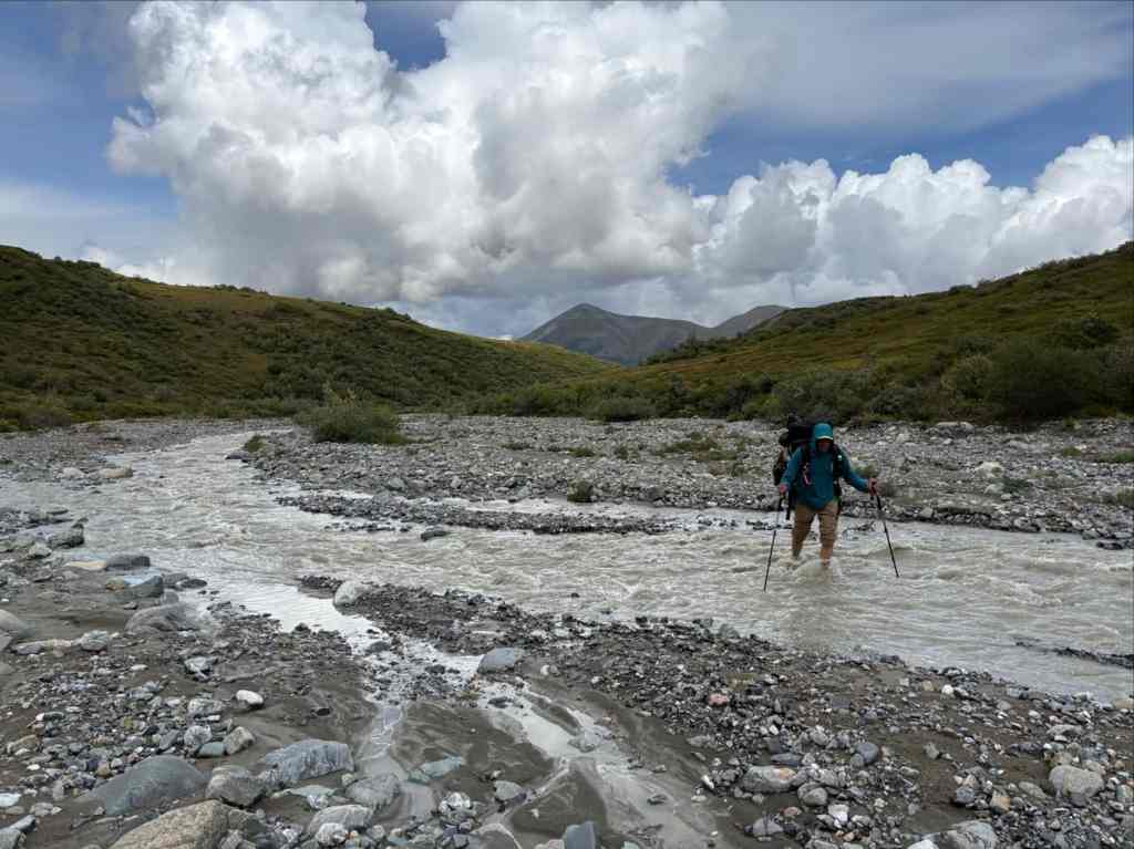
We had a clear day for the river crossing. Unfortunately there was a light but very cold wind. After breaking camp we returned to the river and went upstream roughly 1 km, popping in and out of the forest depending on the condition of the river bank. We found a spot that we felt was sufficiently braided and made our way across the river. We used a tandem crossing technique where the four of us linked together and this worked quite well. The water was roughly thigh deep on me, and I was the tallest member of the group. Though the depth wasn’t too bad, the water was flowing fast. This resulted in a very forceful flow which was also quite loud when we were in the middle of the widest span of water. Our technique held up, though, and we crossed without complication. On the far bank we removed whatever was wet and added dry layers as we got fuel cans and stoves out to boil some water. The sun was up but not shining in the valley yet, so the cold wind bit hard.
After we’d warmed up sufficiently we set off again, looking for the spot where we’d turn away from the Duke River and head up towards Cache Lake. We went a little over 2 km upstream to a spot where the vegetation began to thin and pull away from the river bank. Soon we identified what Yukon Hiking describes as a “small aluvial fan”. We entered the forest here and started to bushwhack uphill, trying to find an old road. This was a bit of miserable bushwacking, once again on poor footing. We knew the general direction we had to head in, and that combined with GPS waypoints got us onto an old road. When we arrived at it I was almost tempted to follow it downhill to see if there was a smarter way we could have found it. I didn’t, though, since we were so happy to have a clear path to follow and immediately continued climbing.
The old road took us uphill then alongside a creek where the way became overgrown again, but it wasn’t too hard to navigate. We followed the creek along the best path we could find and were eventually on an obvious trail taking us alongside Cache Lake. We were surprised to see two groups bathing and lounging on the far side. One was the young men who had overtaken us, the other seemed to be a separate group we had caught up with. They packed up and left soon after we arrived so we didn’t have a chance to chat. We took a break on the western shore of the lake and discussed our plans.
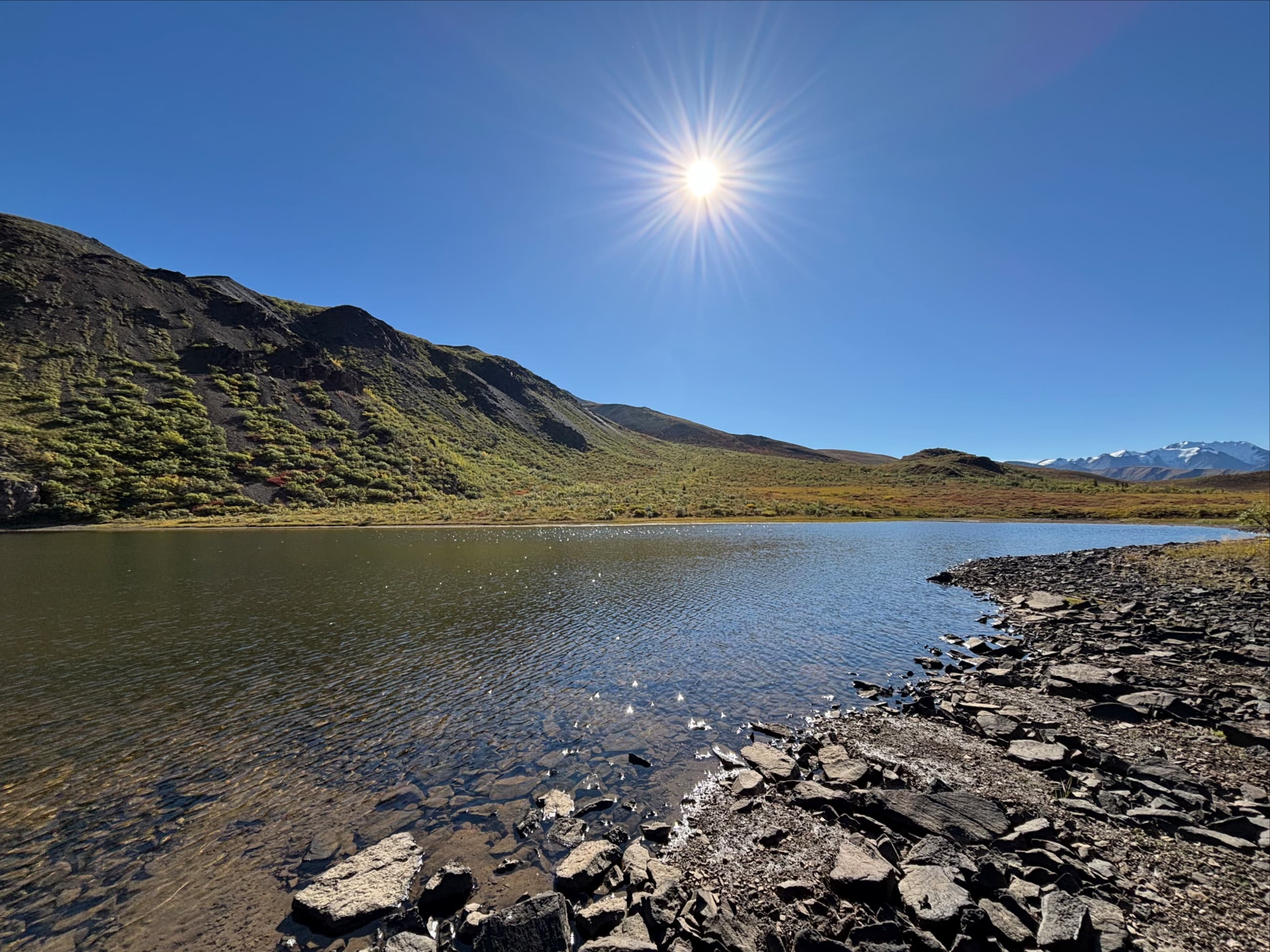
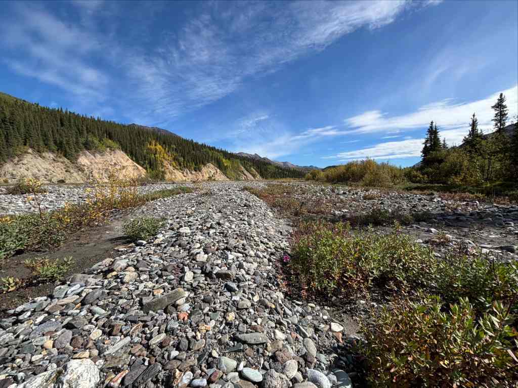
Cache Lake had been where we planned to camp, but it was only lunch time. It seemed a shame to waste half a day that we could be travelling. If we could go farther that day and shorten our hike on the final day we thought it might be helpful in facilitating the recovery of our vehicle (the plan was to have 2 people try to hitchhike back). The problem was that we weren’t sure there would be good places to camp past Cache Lake. The Parks Canada route description, which mentions good camping spots for every leg of the trip, mentioned none along Copper Joe Creek. In the end we decided to press on. We did find a good camp spot about 7.5 km past Cache Lake on a broad gravel wash adjacent to the creek where we passed a peaceful night. We rose on our final morning eager to return to civilization.
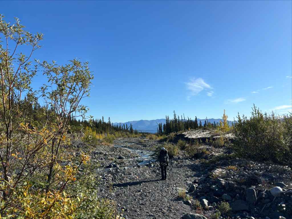
The journey past Cache Lake along Copper Joe Creek was a combination of bushwhacking, following animal trails along side the creek, or walking along stony uneven ground on the banks. It was slow going and we had to hop back and forth to either bank on a number of occasions. The route description states “at some points there is evidence of an old road, but in many places it has been washed away.” We did find bits and pieces of it but it was never present in any sustained way. As we got nearer to the end of the route, though, we knew we had to find a section of clear road that broke off right (east) from the creek which would take us to the end of the journey.
When Kluane Lake came into view in the distance we started to pay attention to the right bank of the creek. Eventually we came to a spot with a very tall bank and we climbed up on it. Though not immediately apparent, the road was up there. We got on it and made comparatively blazing fast time as we walked the final 4.5 km to the Alaska Highway and the end of our trek.

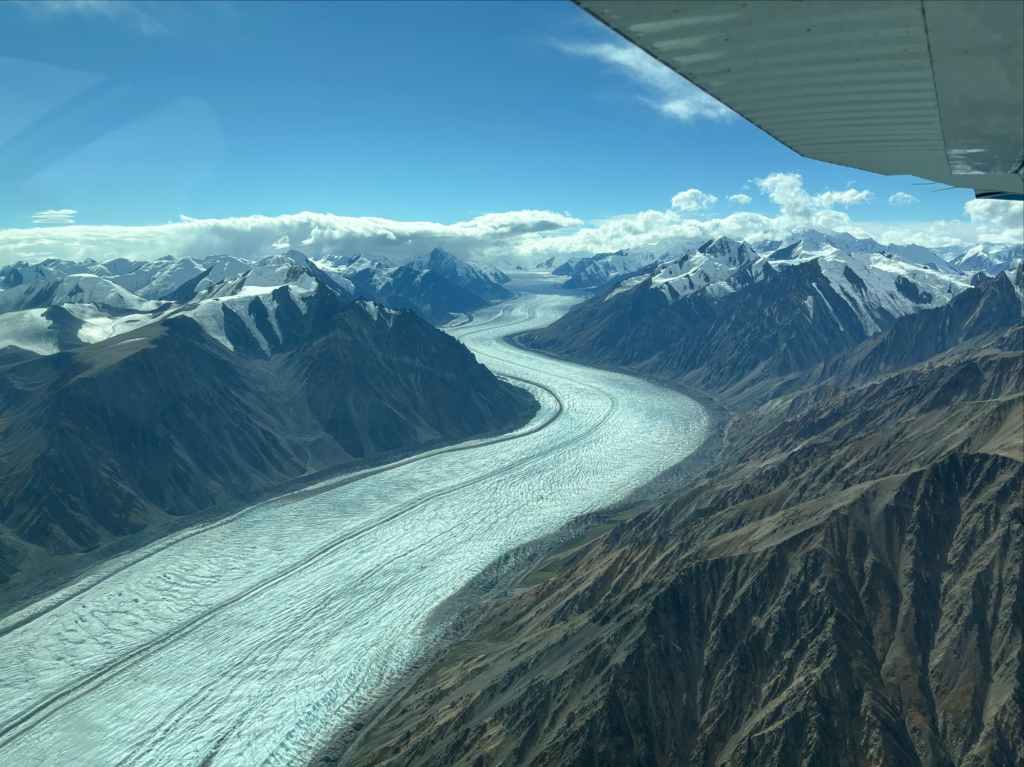
Our timing in getting back to the highway and trying to hitchhike back to our car worked, after a fashion. We sent the 2 of us that we figured would look the least threatening (Scott and Valentina) out along the highway to try to hitch a ride. It didn’t work. So Scott, an accomplished distance runner, left his pack with Valentina at Burwash Landing (roughly half way back to the car) and started to run. Amusingly, his running along the highway caught the attention of a local who found it very strange that someone was running along the highway “without a bear chasing them”. She stopped and chatted with Scott and in that way, without trying, he got a ride back to the trailhead and our car. The lady that picked him up was co-owner of Rocking Star Adventures, one of the local aerial sightseeing companies. We paid back her generosity by booking a sightseeing flight during one of our rest days, and it was spectacular.


Final Thoughts
“Lofty I stand from each sister land, patient and wearily wise, With the weight of a world of sadness in my quiet, passionless eyes.”
This was a big trip, not only in terms of distance but also mental challenge. It was very isolated and once we crossed Hoge Pass you could feel that you were far from help. The route finding added a dimension to each day that demanded attention to immediate surroundings that contrasted with on-trail hiking’s typical focus on distant views. I’ve mentioned above some particular areas where travel was slow – but it was slow basically everywhere aside from the initial and final walks on the clear areas of the old roads. It really felt that you had to earn your milage every day. It was, in other words, exactly what we expected, and in completing it I think every member of our group felt a profound satisfaction.
As an introduction to hiking in the Yukon, this route was a tour de force. An experience like this sits in your thoughts. The landscape, the duration, the remoteness — It all comes together to imprint itself deeply within you. Overcoming the challenges presented by the Donjek Route made me very aware of how small and weak a human is in the face of the vast wilderness. On the other hand, you realize how strong a thing a team can be. I had the chance to make this journey with Scott, Valentina, and Bhaskar. They all brought their own strengths and wisdom to the trek, and together we faced the wilderness. I’m thankful to have had the opportunity to share this experience with them.

What an amazing experience!
LikeLike
What an amazing hike for you all. Thank you for sharing, and, Par, your descriptive words are so amazing for each step of your journey, and all your journeys you share with us. I’m proud to be on your email list.
From Ron, with all my best wishes as a former gentle hiker in the Kootenays and Kananaskis.
Ron Fisher
LikeLike
Glad you enjoyed it — thank you for reading!
LikeLike
Great write-up! We did this trip last year, also in mid-August, and it was phenomenally challenging and rewarding. I don’t think we stayed at any of the same camping spots you did, and shows how many different variations there are in this choose-your-own-adventure route. We had rain/snow on Atlas Pass and the river crossing day, which really upped the ‘spice’ factor!
LikeLiked by 1 person
Thanks for reading! It’s fascinating to hear that you camped in completely different spots than we did.
LikeLike