September 1, 2024. A bumpy drive leading to a steep but straightforward ascent of Idaho’s 2nd tallest mountain.
- Region: Salmon-Challis National Forest, Idaho. Traditional territory of the Shoshone-Bannock people.
- Distance: 12.4 km
- Total Ascent: 1295 m
- Elevation of Objective: 3727 m
- Total Time: 7h 9m
- Safety and Disclaimer

The day after climbing Borah Peak we set out before sunrise to climb Leatherman Peak. Located several kilometres south of Borah, Leatherman has a few options when it comes to scrambling routes. We decided on the northern approach, which starts at the West Fork Upper Pahsimeroi Trailhead. Reaching this trailhead is actually the toughest part of the day. From the highway, we first travelled along the rough Doublespring Pass Road before turning on to a very, very rough forestry road full of potholes, big rocks, sharp dips and a water crossing. A high clearance vehicle and some skill at rough driving is needed to make the journey.
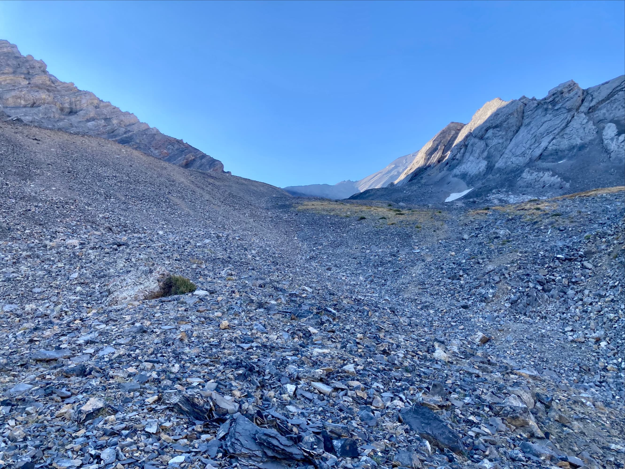
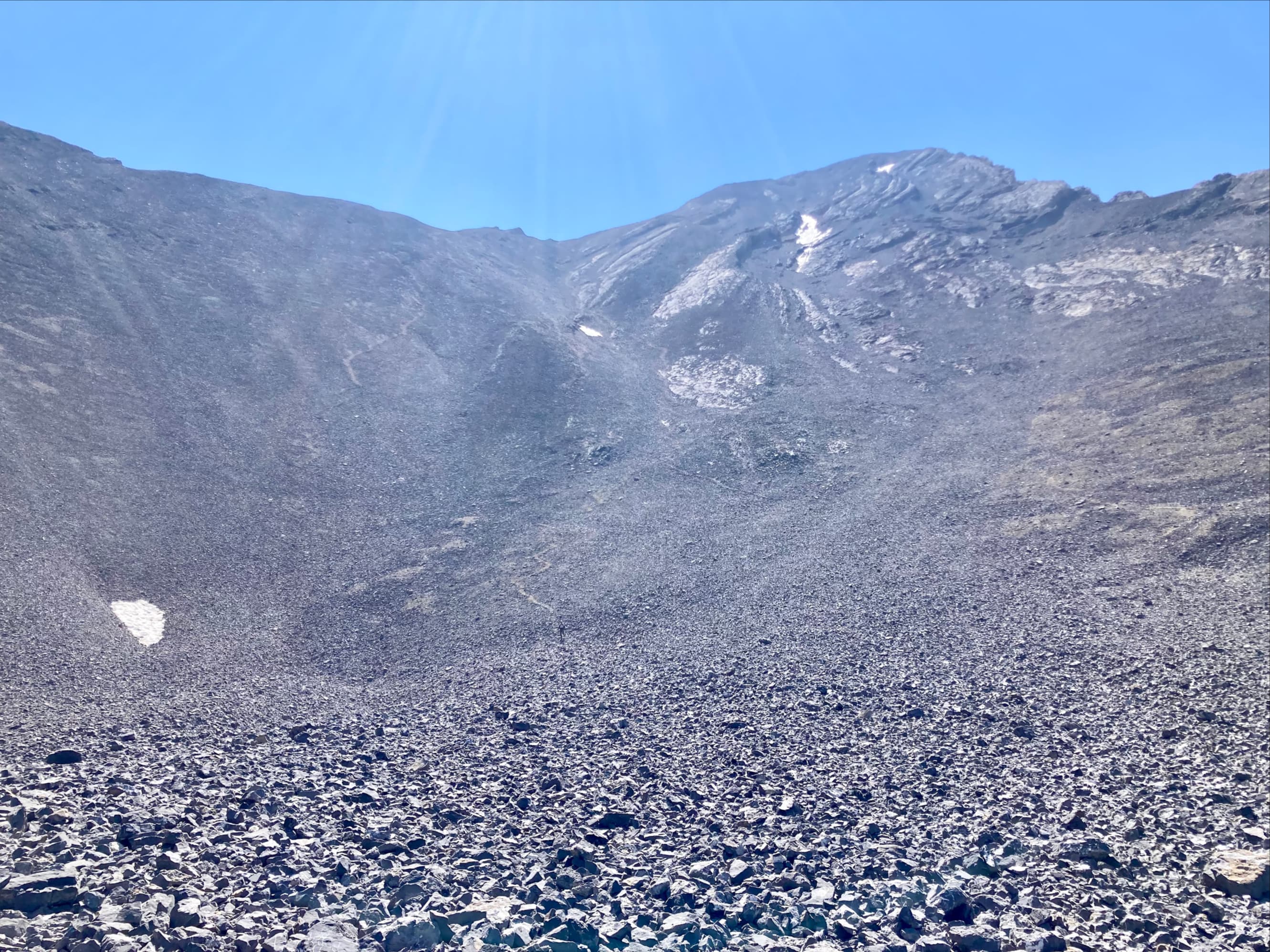
From the trailhead, we set out south along the Leatherman Pass hiking trail. This trail initially runs alongside a creek for a few kilometres before breaking out into a large clearing roughly 3 km from the trailhead. From the clearing we were able to see ahead to Leatherman Pass. To our left we could see the ascent gully on the northern aspect of Leatherman Peak. Faint trails were visible on the slope and the route was obvious. The gully lead to a cirque below Leatherman’s northeast ridge. We climbed straight up steep slopes above the cirque to reach the ridge. All of this ascent was on a giant field of scree and talus. Once above the cirque there were some grippy slabs that were welcome breaks from the tedium of rubble. Upon reaching the ridge we turned right and ascended a short scramble which brought us up to the summit.
We were fortunate that the dense smoke from the previous day had moved off. We had much better views than we did from Borah Peak – Borah Peak itself was clearly visible to the northwest. The weather was calm and warm, allowing for a long stay on the summit – we sat and chatted with another party, snacked, and took in the scenery for over an hour. We returned by the same route. The drive out was time consuming, but we managed to make it back to Mackay in time to get food and beer at L7.
This was a fun day out, though I can’t say I enjoyed all the rough driving. If I could do it again, I’d approach from Sawmill Gulch Road and hike up to Leatherman Pass. Then, instead of ascending the west ridge (which is apparently very loose and sketchy), I’d descend slightly and traverse east so I could enter the cirque from the south via a gap between the main bulk of the mountain and a high-point. I did find a GPS track for this route, but no trip reports. One YouTube video describes someone who tried this route and didn’t enjoy it, but I think he was off route and ended up descending all the way to the valley bottom then ascending from the base of the gully instead of traversing into the cirque.
Leatherman was the 2nd of our 2 objectives for our long-weekend in Idaho, so we returned home the next day. It was great fun to go somewhere new and there are definitely other potential trips in Idaho that I’d like to do in the future.