May 24, 2024. A one-day crossing of one of the 7 Natural Wonders of the World.
- Region: Grand Canyon National Park. Traditional territory of the Pueblo, Hopi, Navajo, Southern Paiute, Havasupai and Hualapai peoples.
- Distance: 38.4 km
- Total Ascent: 1320 m, following a 1750 m initial descent (the north rim is higher than the south)
- Total Time: 12h 14m
- Safety and disclaimer
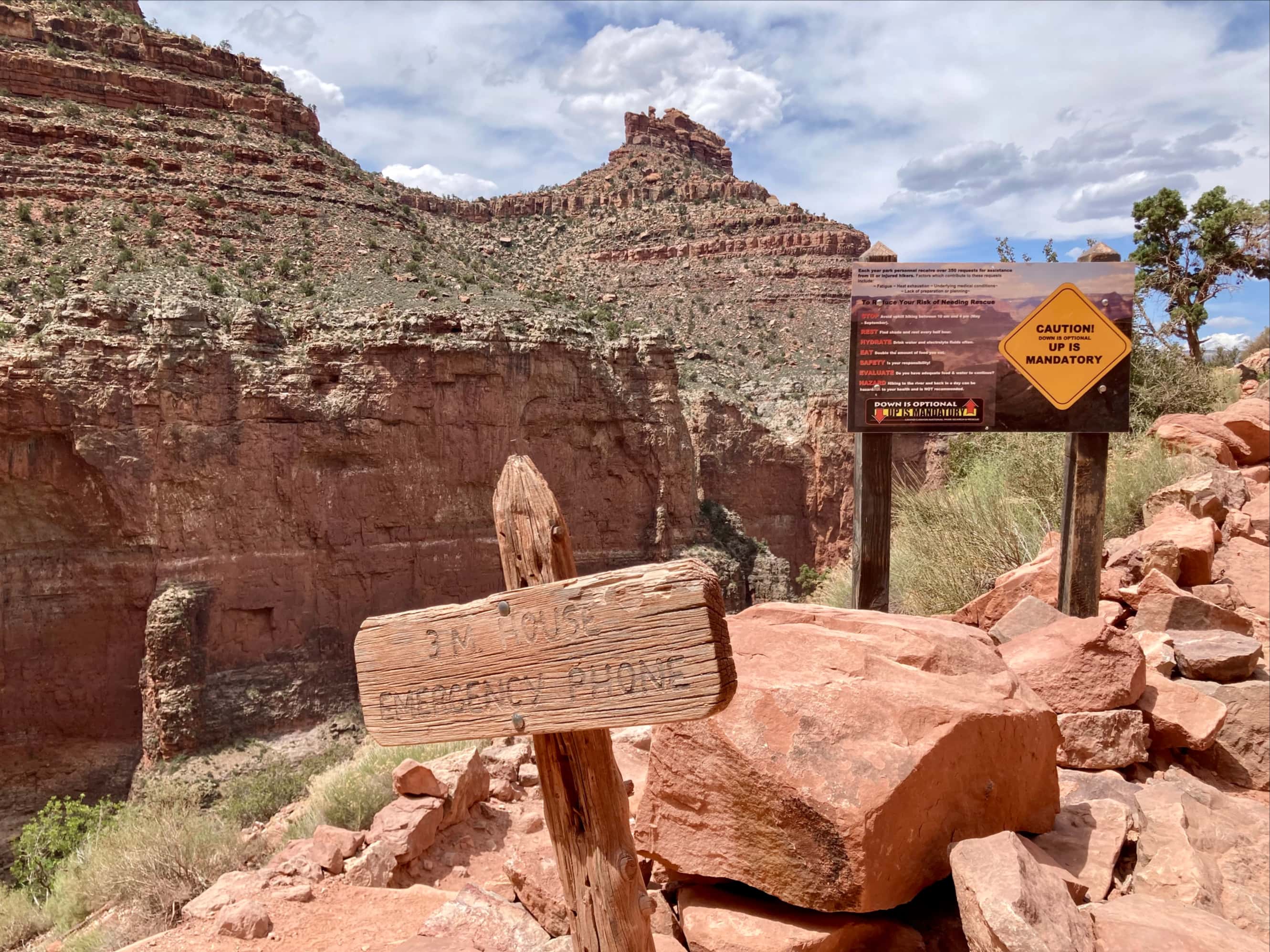
Something like 5 million people visit Grand Canyon every year, and if they set out along one of the trails descending from the canyon’s rim, they’ll soon come across one of these signs.
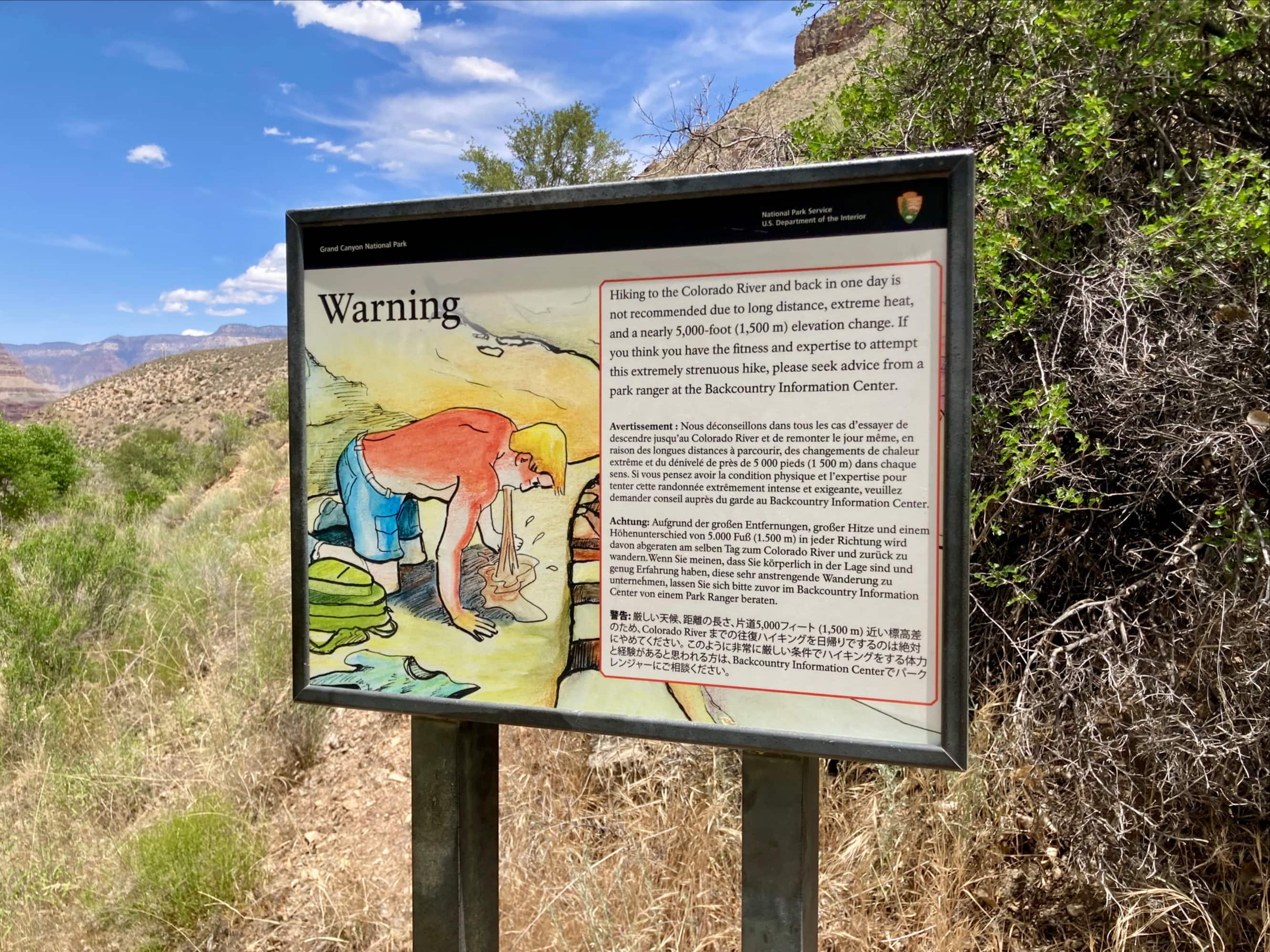
The signs are good advice, but a substantial number of strong hikers make a point of doing exactly what they advise against – either hiking from a trailhead to the Colorado River and back in one day (“rim-to-river”) or hiking from one rim across the canyon to the opposite side in one day (“rim-to-rim” or R2R). There are also quite a lot of people who trail run back and forth across the canyon twice in a single day (“rim-to-rim-to-rim” or R3). A few months ago I got invited along on a trip Arizona and Utah to do some hiking. The primary objective of the trip was a Grand Canyon rim-to-rim hike. The plan was to start at the North Rim. We would descend from the North Kaibab trailhead and journey along the bottom of the canyon to Phantom Ranch and Bright Angel Campground. Then we’d cross the Colorado River and ascend along Bright Angel Trail to the South Rim.
Gear and preparation
Planning for this hike was an interesting exercise in itself. Websites, YouTube videos, and Facebook groups abound providing advice on gear, training, nutrition, and logistics. I won’t duplicate all that information here. Check out HikingGuy’s Complete Rim to Rim Guide, which is a great starting point. From my point of view, I predicted (correctly) that the heat would be the greatest challenge. It was manageable, though, by drinking the appropriate amount of water and soaking my hat, bandana, and shoulders with water during the heat of the day whenever I got the chance.
For footwear I opted for light trail hikers (Hoka Speedgoats) instead of hiking boots. I paired these with Smartwool socks. This excellent combination resulted in only one hotspot on one foot by the end of the hike and no pain or actual blisters. The trail is wide and very well maintained – the stability and ankle protection of a hiking boot isn’t needed. For sun protection I picked up a long-sleeve sun shirt from MEC and wore a Buff bandana that I could pull up over my face and neck as much as needed. I found this approach preferable to repeatedly applying sunscreen on sweaty, dusty skin. I wore my usual wide-brimmed Tilley hat and polarized sunglasses. Since the early morning start from the North Rim would be in the dark and in cold temperatures (it was just above freezing), I packed a headlamp, toque, and light gloves. I brought my usual hiking poles to keep me stable during our descent in the dark and to help propel me during our ascent in the heat.
I used Nuun electrolyte tablets for flavour and extra salt in my drinking water. My main salt replenishment strategy, though, was eating from a bag of mixed pretzels and goldfish crackers. I also carried Cliff bars, beef jerky, and candies. For water I brought my usual 1L Nalgene to drink from and a 3L bladder to act as a clean reservoir. I completely refilled every chance I got since I didn’t mind carrying the weight. This was handy in a couple of situations where I could use my ample reservoir water to soak my hat and bandana between water sources on the trail. Having a clean reservoir you don’t drink from also helps reassure others on the trail if you need to help them out with some of your water.
With the hiking season not yet started in my part of the world, conditioning involved prolonged sessions on my treadmill at maximum incline while carrying a backpack with 20 lbs of weight plates. This was pretty dull, but YouTube and Netflix helped pass the time. A little under 2 weeks before the real hike I did a 38 km hike along the river valley trails in Lethbridge, repeatedly going up and down the hill sides to accumulate vertical ascent in excess of what I was expecting at Grand Canyon. I layered some weight training on top of this since it makes me more resistant to injury. On the day of the real hike I felt comfortable throughout, so I guess this approach worked.
Because our plan was to hike from north to south, we flew in to Las Vegas, rented a car, and stayed the night in Jacob’s Lake which is a reasonably short drive from the North Rim. On the morning of our hike we parked at the North Kaibab parking lot (which was already pretty full at 3:45 AM). To get back to our car we pre-booked seats on a shuttle for the following day.
part 1: the descent along north kaibab trail

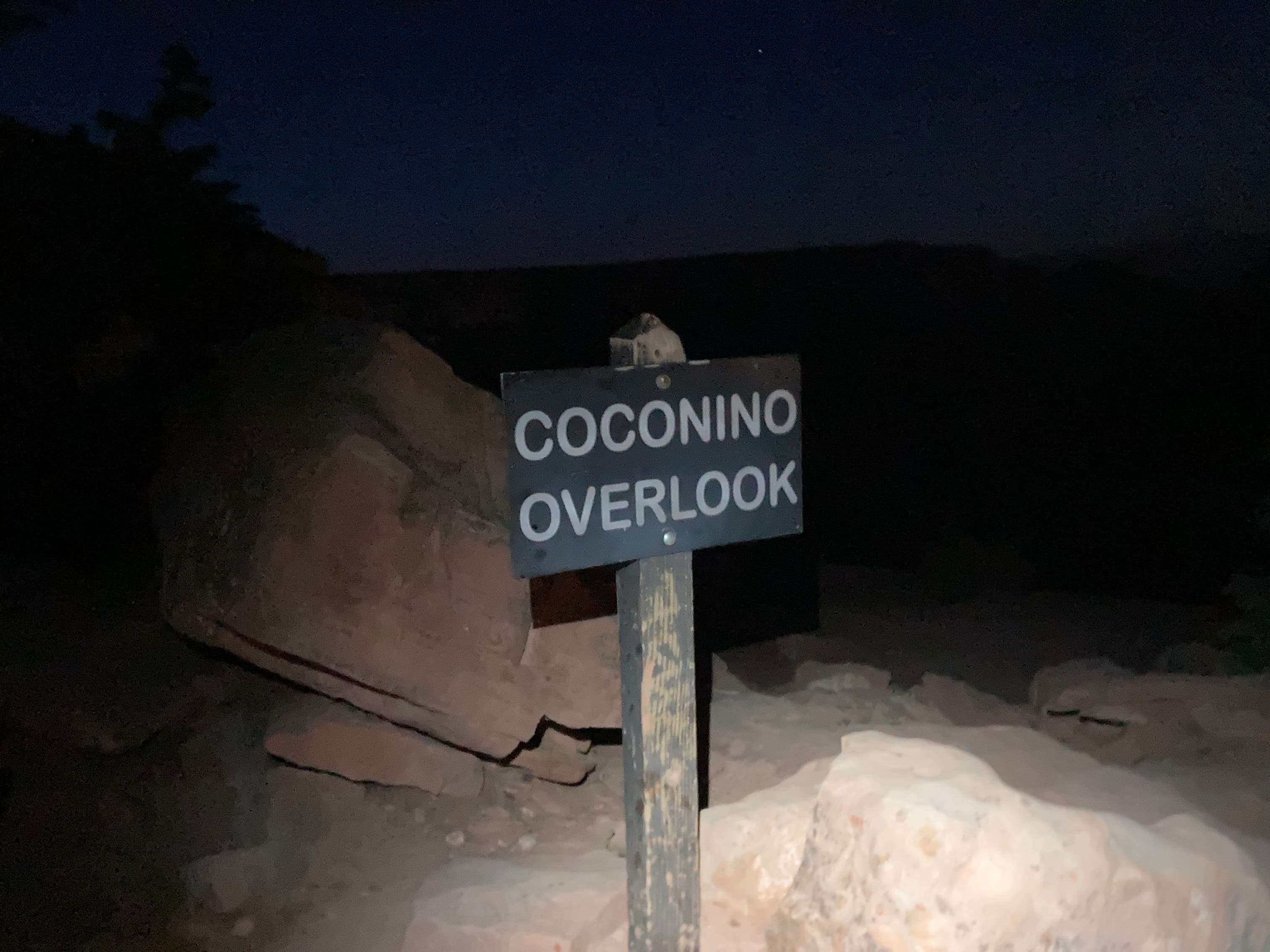
After arriving at the parking lot for the North Kaibab Trail we were geared up and ready to go by 4:00 AM. Other groups were already setting out by the time we arrived and there was a generally upbeat atmosphere. Headlamps lit our steep descent. It was still complete darkness when we passed the Coconino Overlook but the sky was beginning to brighten when we reached our first milestone – Supai Tunnel at 2.7 km. We’d already descended 425 m.


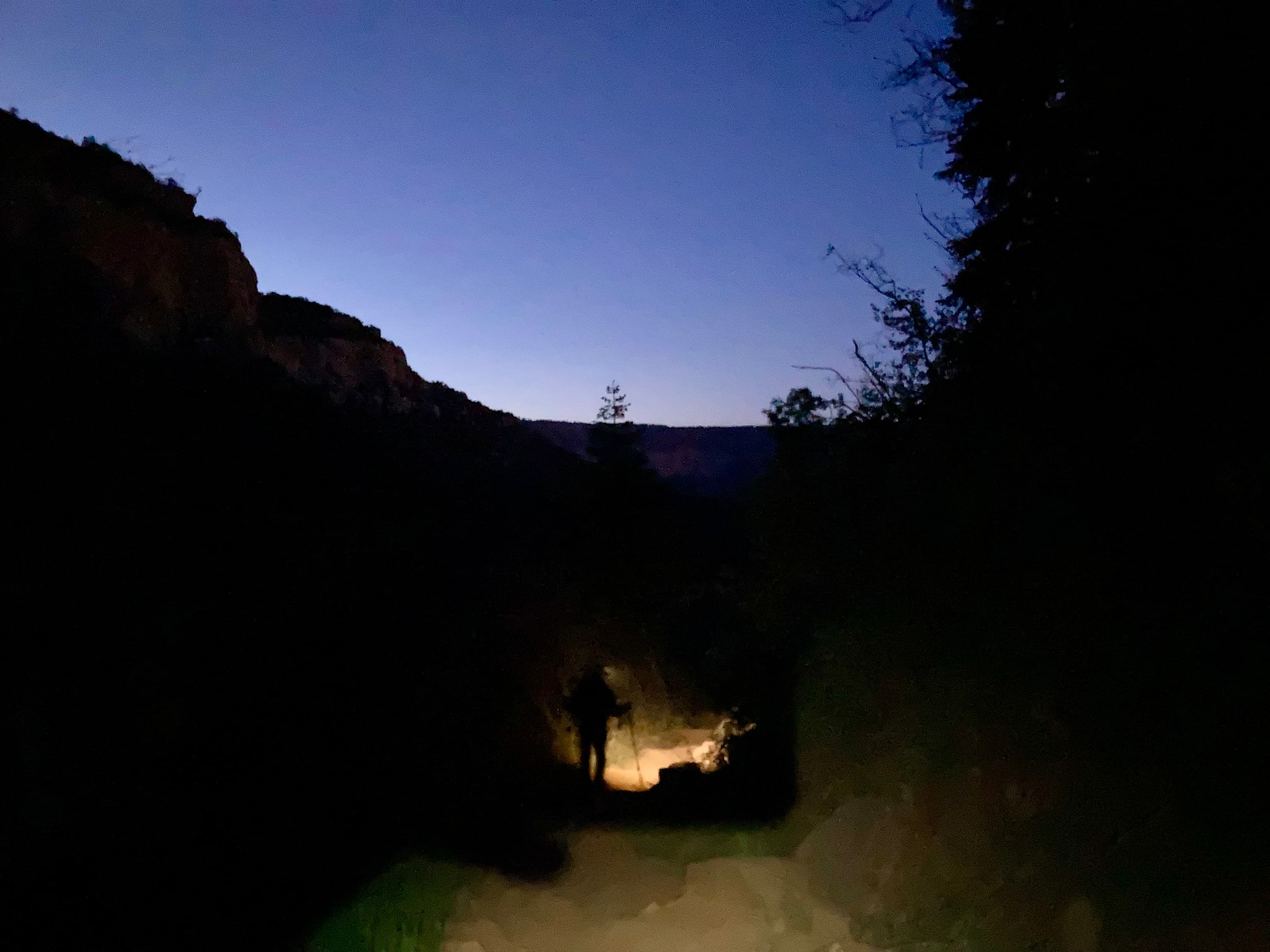

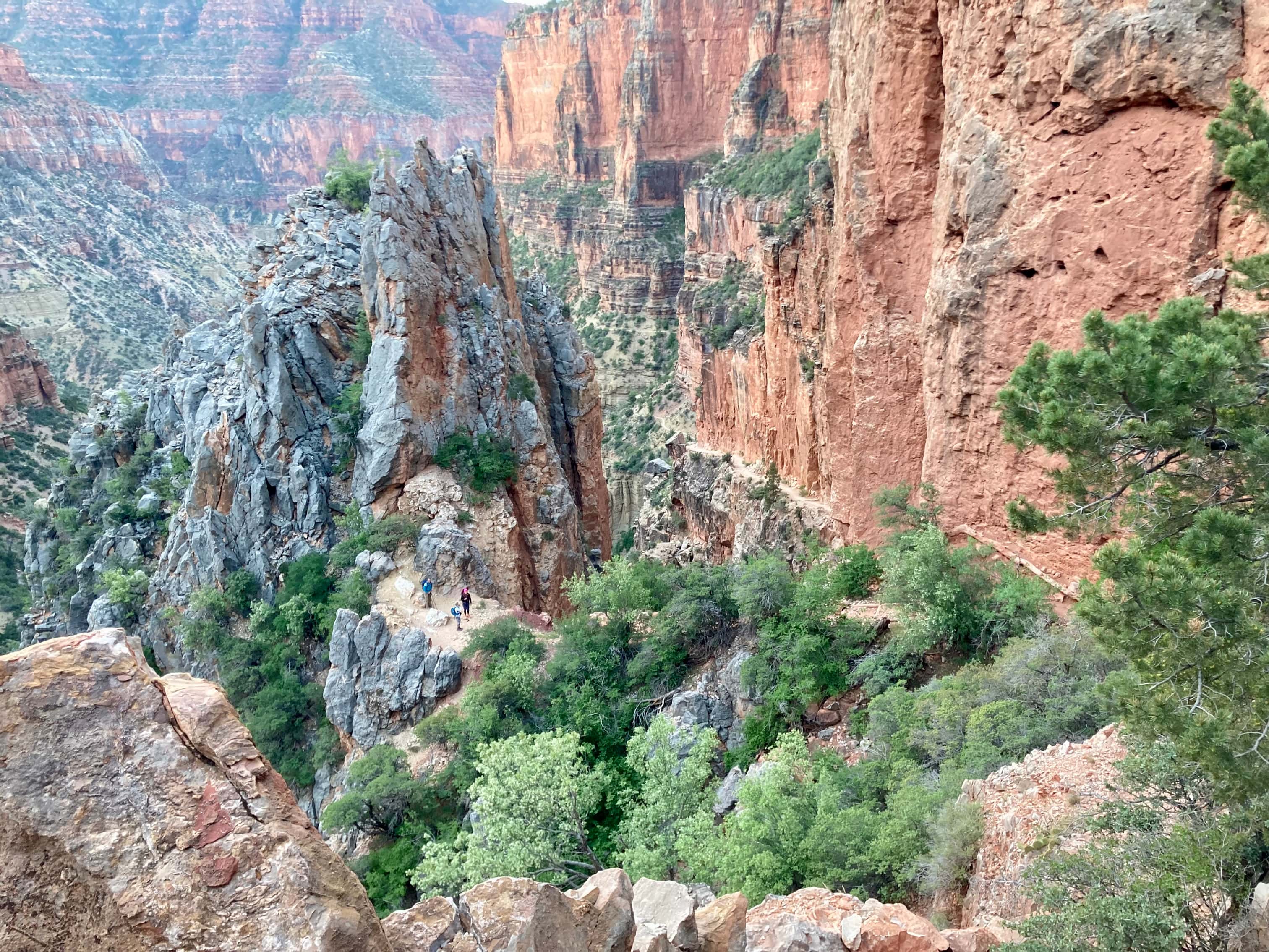
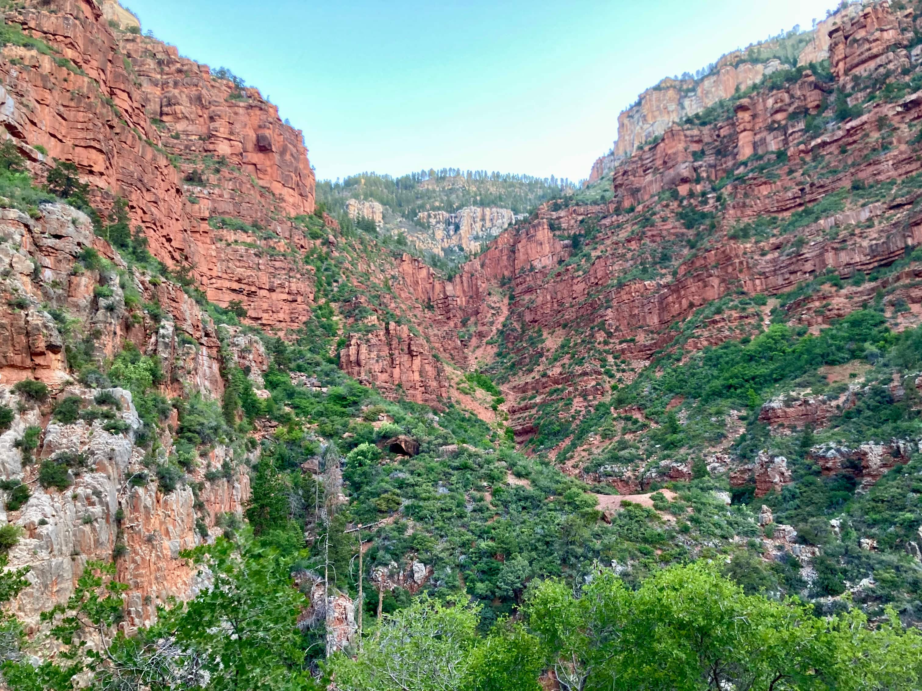
We were able to take our headlights off not long after passing through the Tunnel. Before that happened, though, we were treated to a high view overlooking the trail as it zig-zagged downwards. Twinkling headlamps of other groups were visible ahead of us. The overall effect emphasized how vast even that little spur of Grand Canyon was. Looking at my map I could see that the official name of that spur is Roaring Springs Canyon – and Roaring Springs was our next milestone. Further steep descent took us to a small footbridge, beyond which the grade of the descent moderated. At 7.5 km and 1000 m descent we were at Roaring Springs.
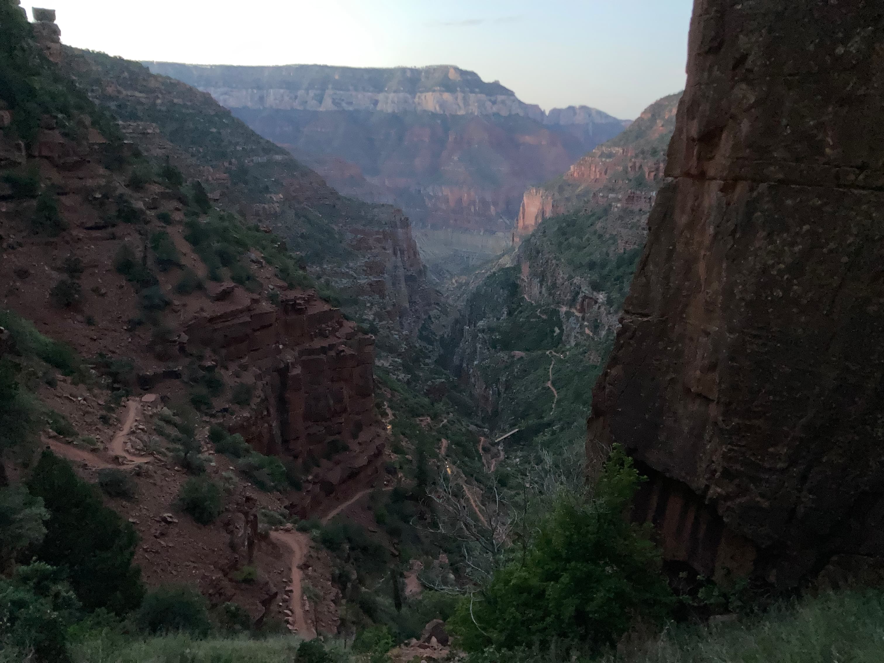


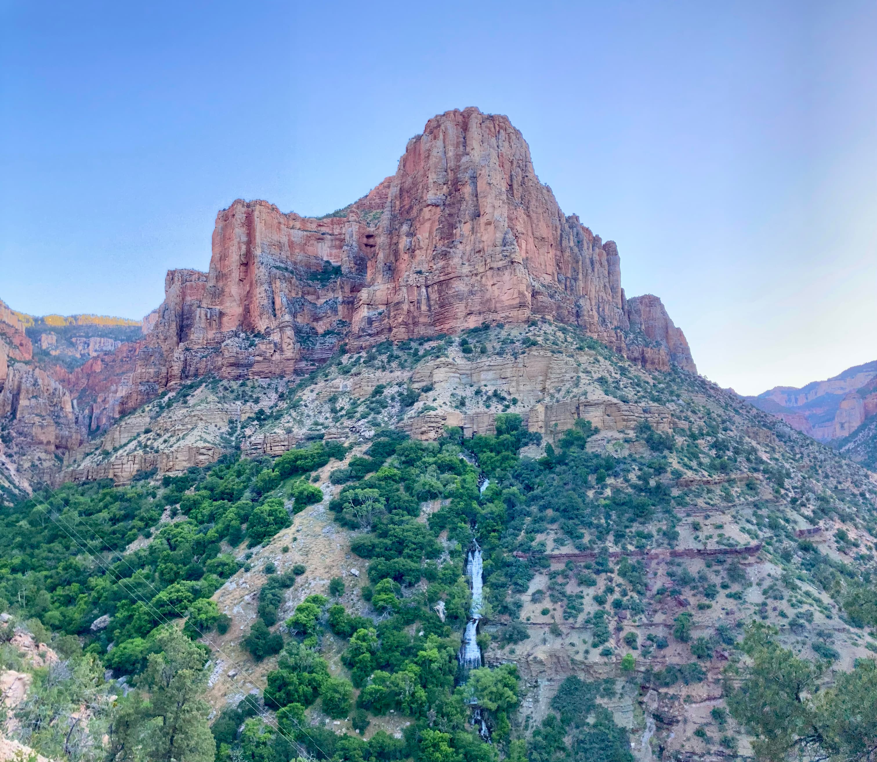
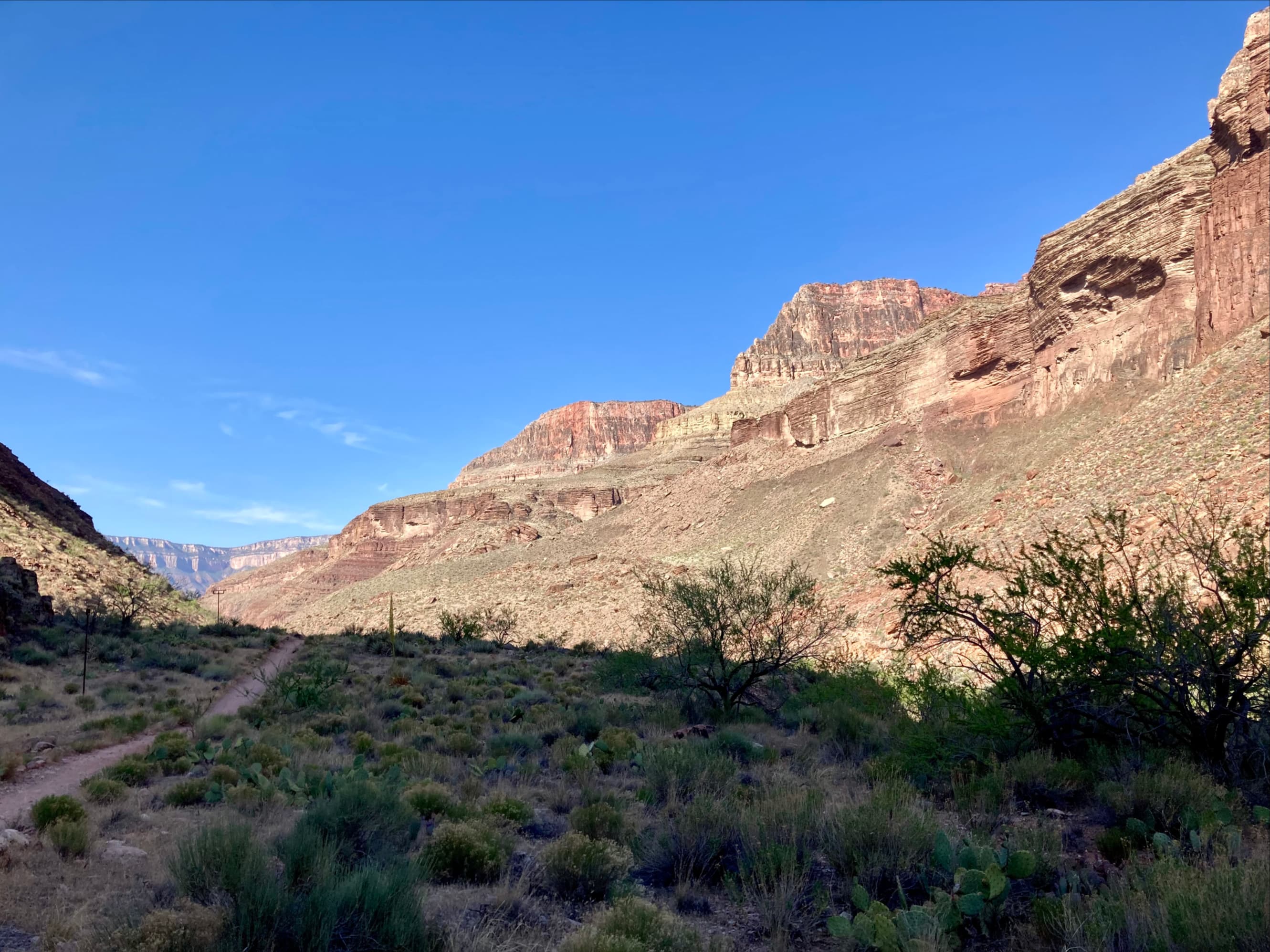
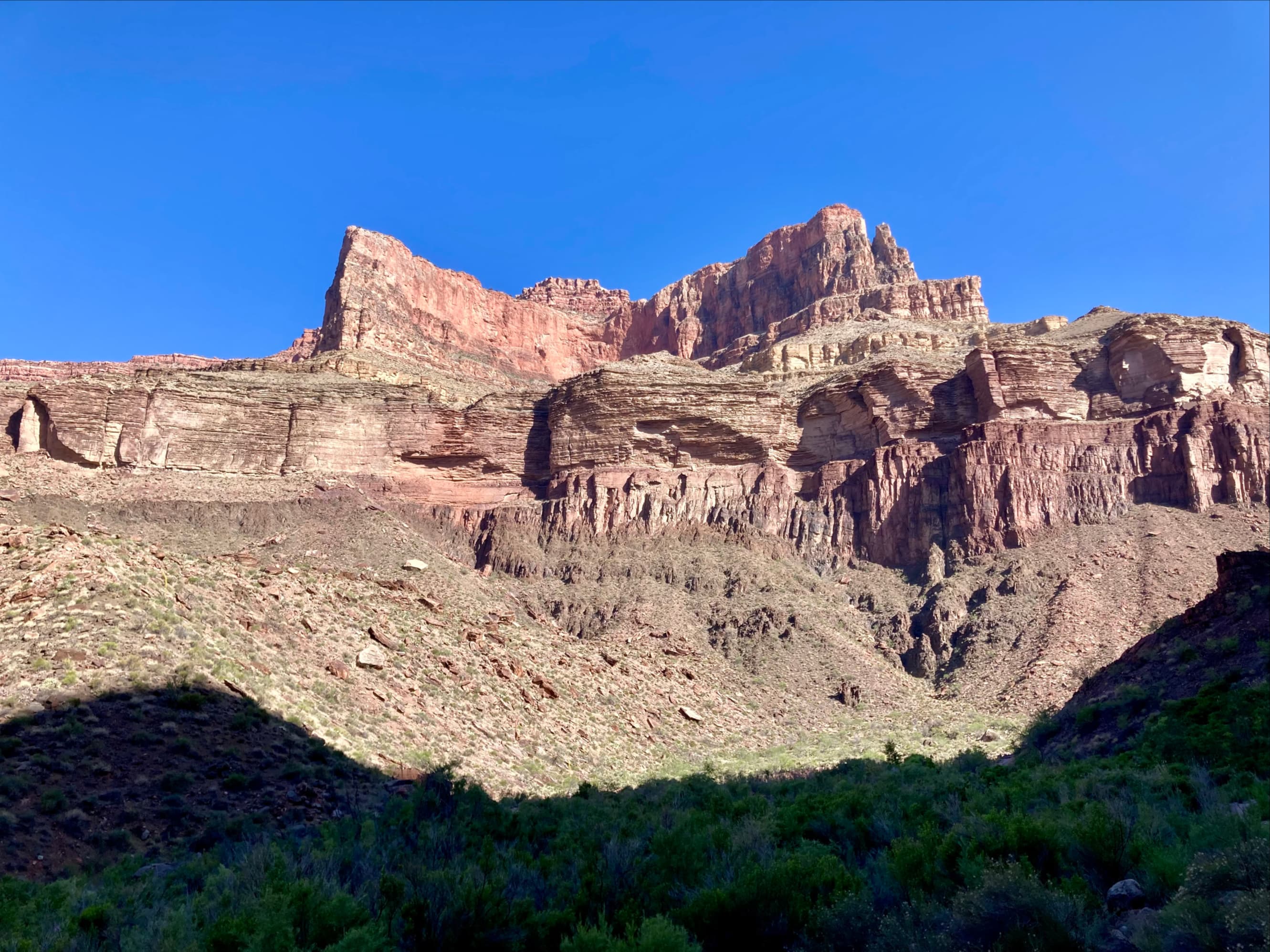
By this time direct sunlight was just starting to touch the tops of the highest buttes. In the 1800s, the grandest of these were designated “temples” of ancient deities by geologist Clarence Dutton in an attempt to capture the grand, otherworldly nature of the landscape. So as we hiked we were looking at Deva Temple and Brahma Temple in the far distance. We descended a further 170 m on the way to Manzanita Rest Area, 8.6km from the trailhead.
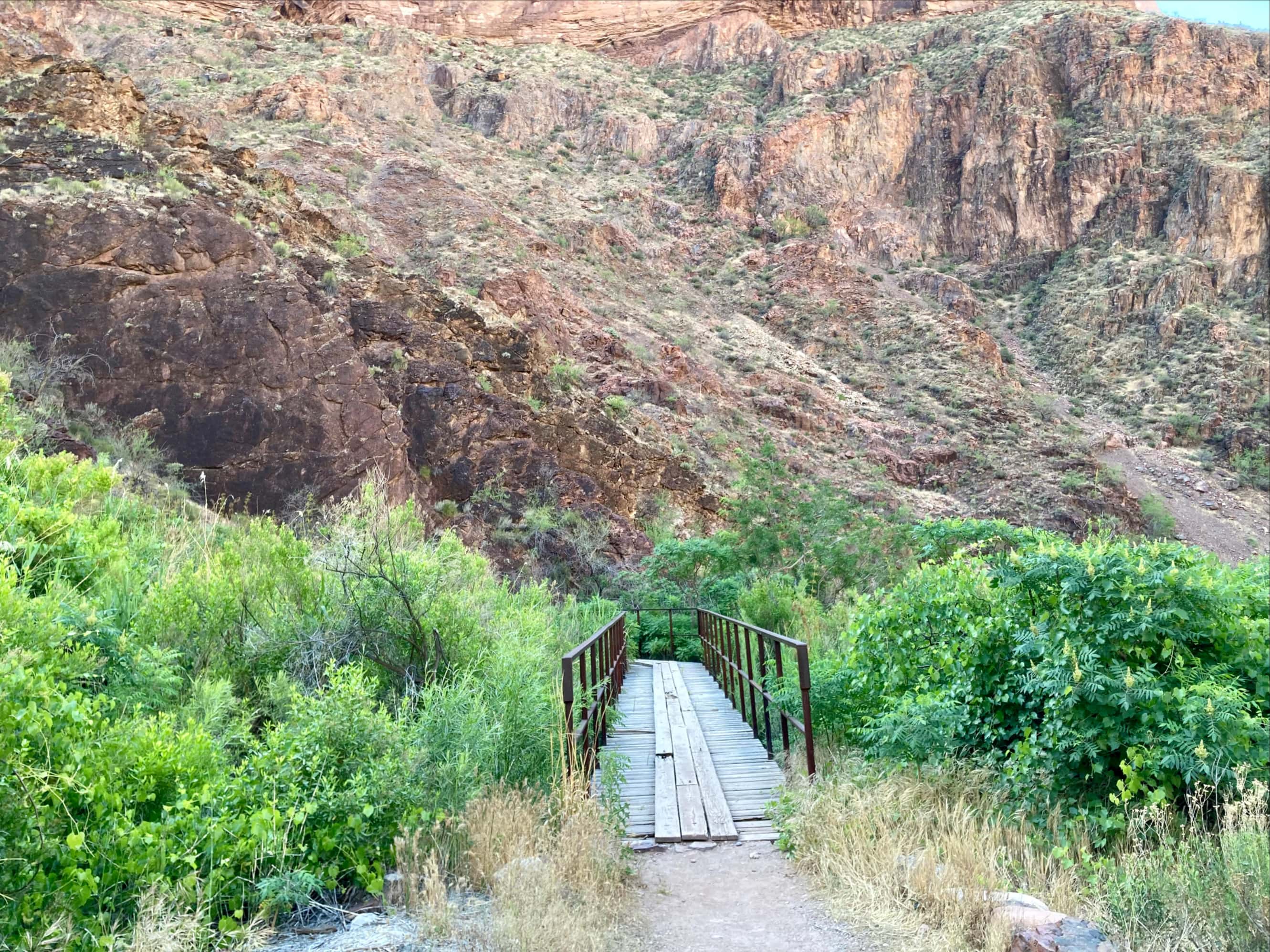
Past Manzanita the trail’s grade continued its descent, but almost imperceptibly. Our direction of travel changed from southeast to southwest and we emerged from Roaring Springs Canyon into Bright Angel Canyon, a major spur from the main body of Grand Canyon through which Bright Angel Creek flows. Down the length of Bright Angel Canyon we could finally start to see the South Rim in the far distance. Strolling along the trail we passed Cottonwood Campground 10.9 km from the trailhead and encountered the sign indicating the side trail to Ribbon Falls at 13 km.


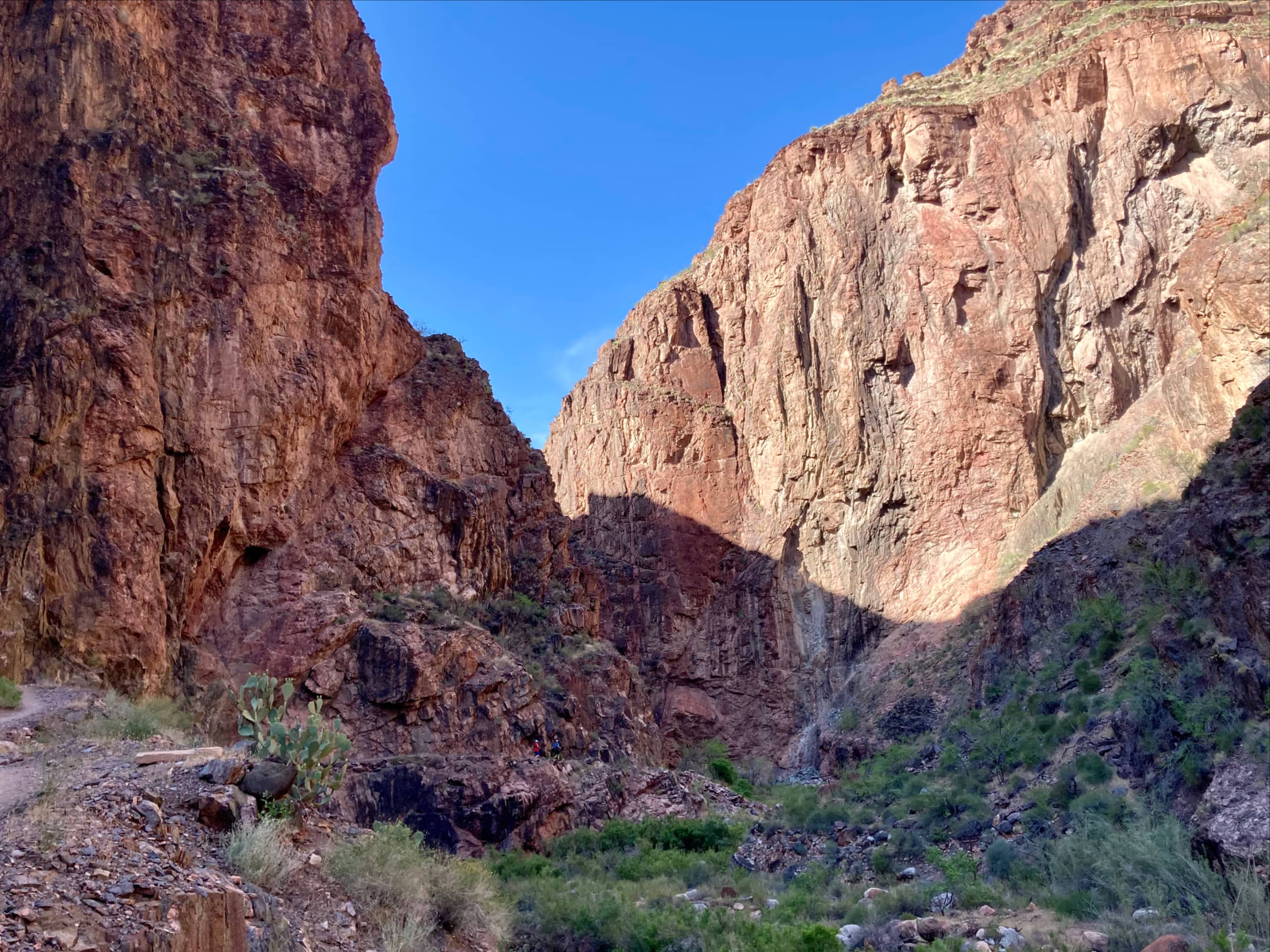
We didn’t detour to Ribbon Falls since we felt the need to cover as much distance as possible before the heat of the day set in. The next landmark we were looking for is referred to as The Box – an area where the canyon walls are close together and temperatures can rise far higher than in the surrounding canyon. It is also where Phantom Creek joins Bright Angel Creek from the west, flowing from Phantom Canyon. Incidentally, if one were to follow Phantom Canyon upstream they’d encounter Haunted Canyon. I haven’t been able to find a specific reason for this spooky set of names. We reached The Box well before the onset of the daytime heat and enjoyed the fascinating ambience of that section of trail before finally reaching Phantom Ranch and Bright Angel Campground. This was 22.7 km from the North Kaibab trailhead, and the end of our 1750 m descent.


We rested for 25 minutes or so at Phantom Ranch. There were plenty of other hikers there, mostly resting adjacent to the canteen building. We partook of the traditional glass of lemonade and also bought some postcards and stamps. There is mail delivery by mule from Phantom Ranch and many hikers will send a postcard to family and friends from this stop. I don’t recall all the exact prices, but did note that the canteen was accepting credit cards – older trip reports I’d read stated they only accepted cash. I had brought cash specifically for lemonade and postcards, though, and on reflection I’m glad I did. Payment network connections can be fickle and I wouldn’t want to be denied lemonade if their network went down. They sold other food, drink, and supplies aside from lemonade, too. I saw they even had cold beer – something that was tempting but would be foolish to drink with the hottest part of the day and toughest part of the hike still ahead of us. However, some people are lucky enough to get reservations to sleep at Phantom Ranch or camp at Bright Angel Campground. For them the hike is spread over two or more days and a few of them were enjoying a cold beer on a hot spring morning.
part 2: Across the colorado and the ascent on bright angel trail
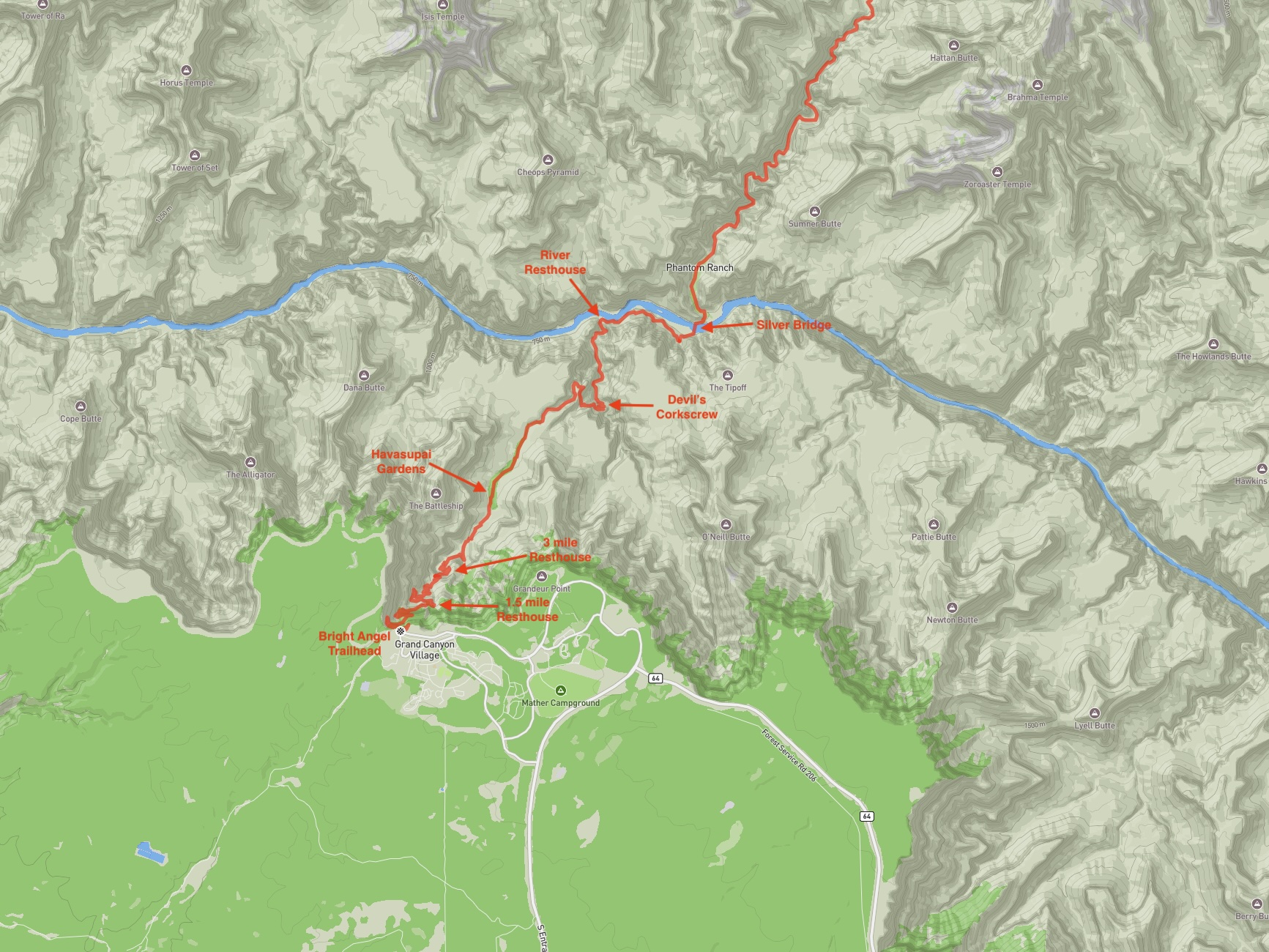
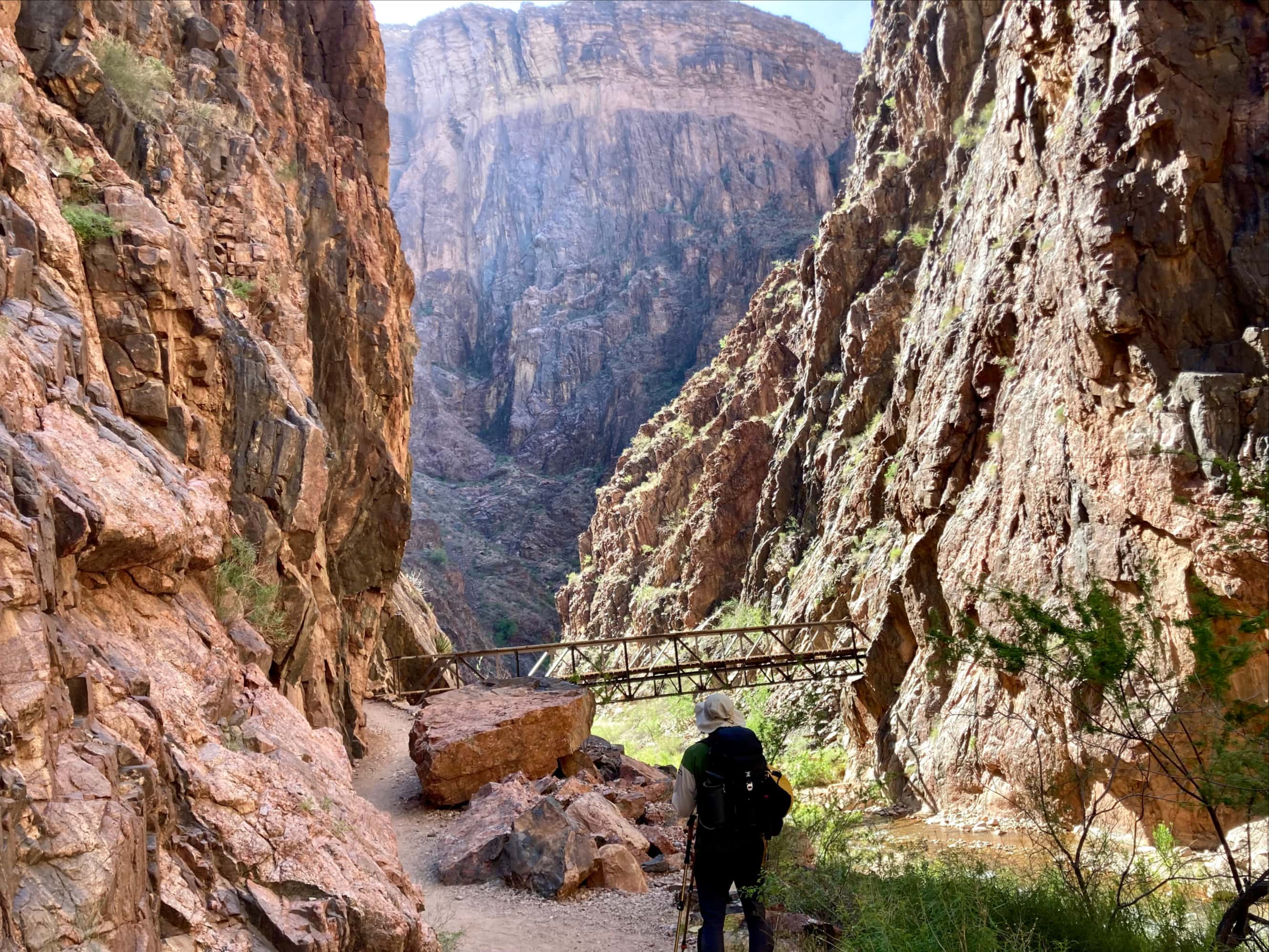
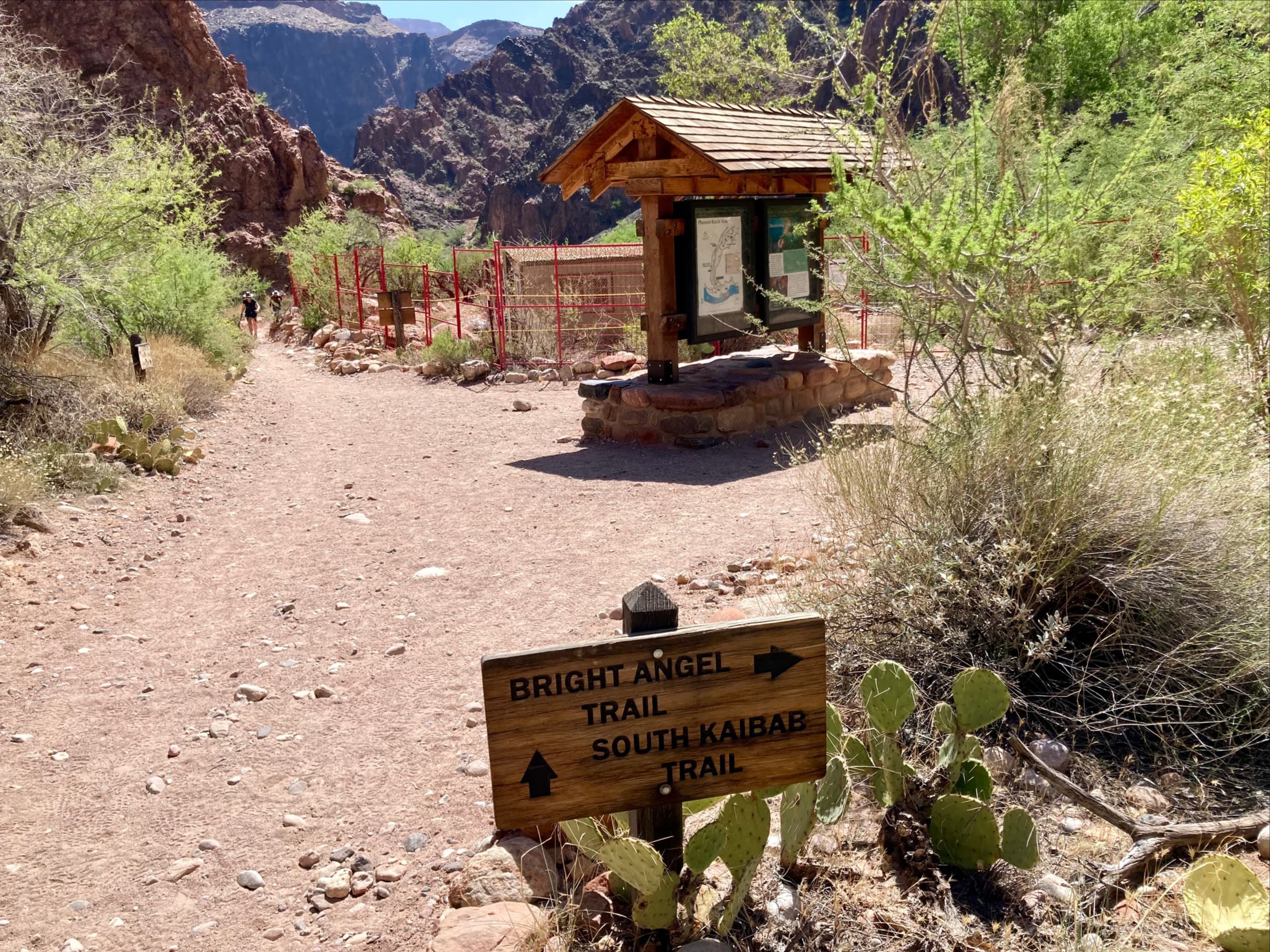
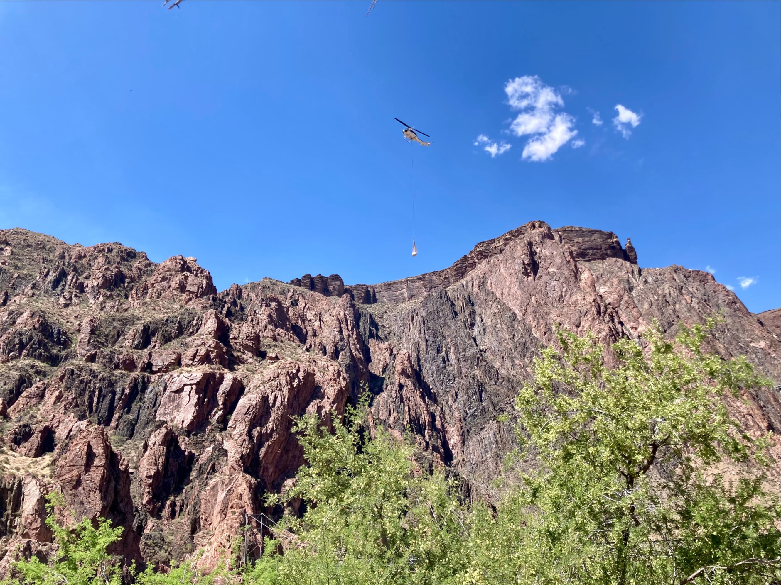
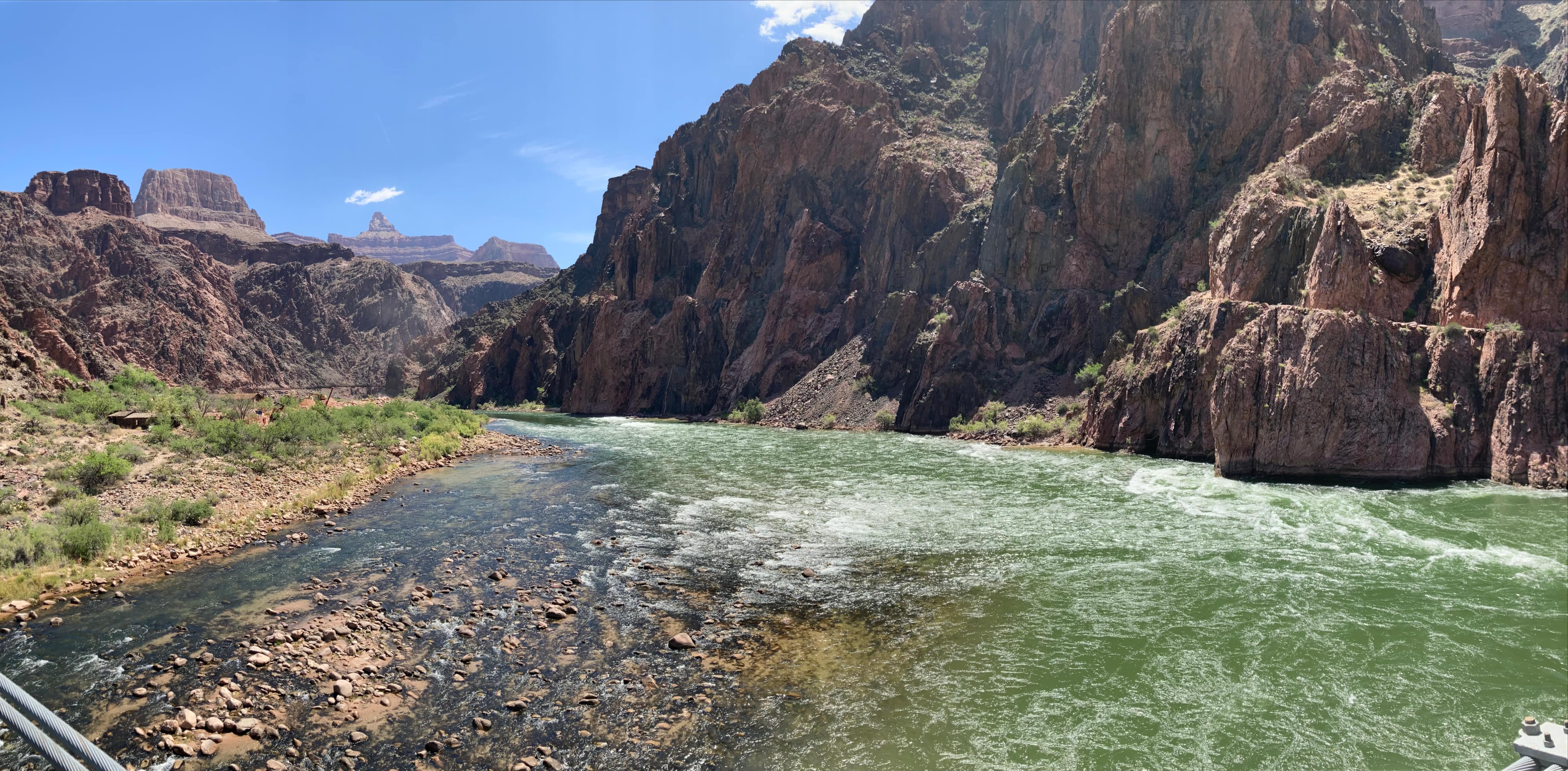
We had plenty of energy after the break at Phantom Ranch and we set out to get our first look at the mighty Colorado River. As we walked along we heard, then saw, a helicopter coming and going from a construction area nearby the river. We reached the place where North Kaibab Trail ended at a 3-way intersection with South Kaibab Trail and Bright Angel Trail. We followed the signage in the proper direction for Bright Angel, past a construction enclosure and got our first look at the Silver Bridge crossing the Colorado River.

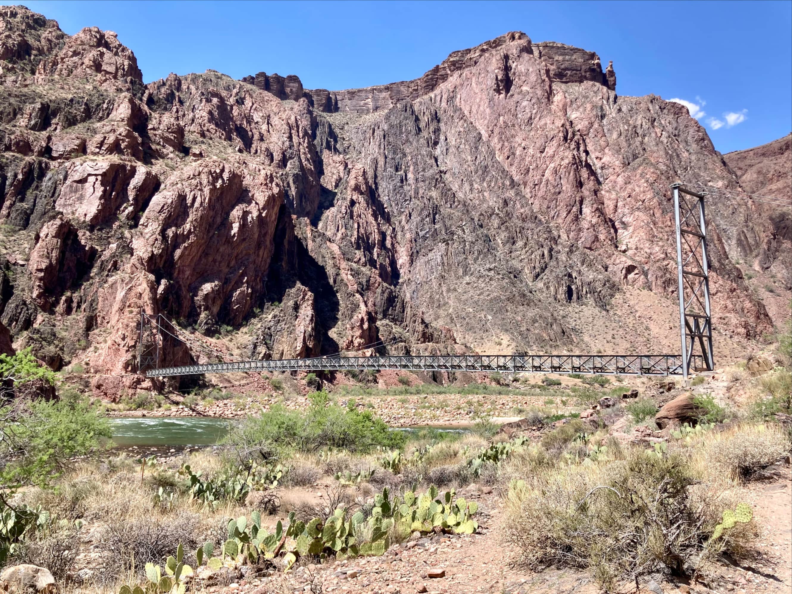
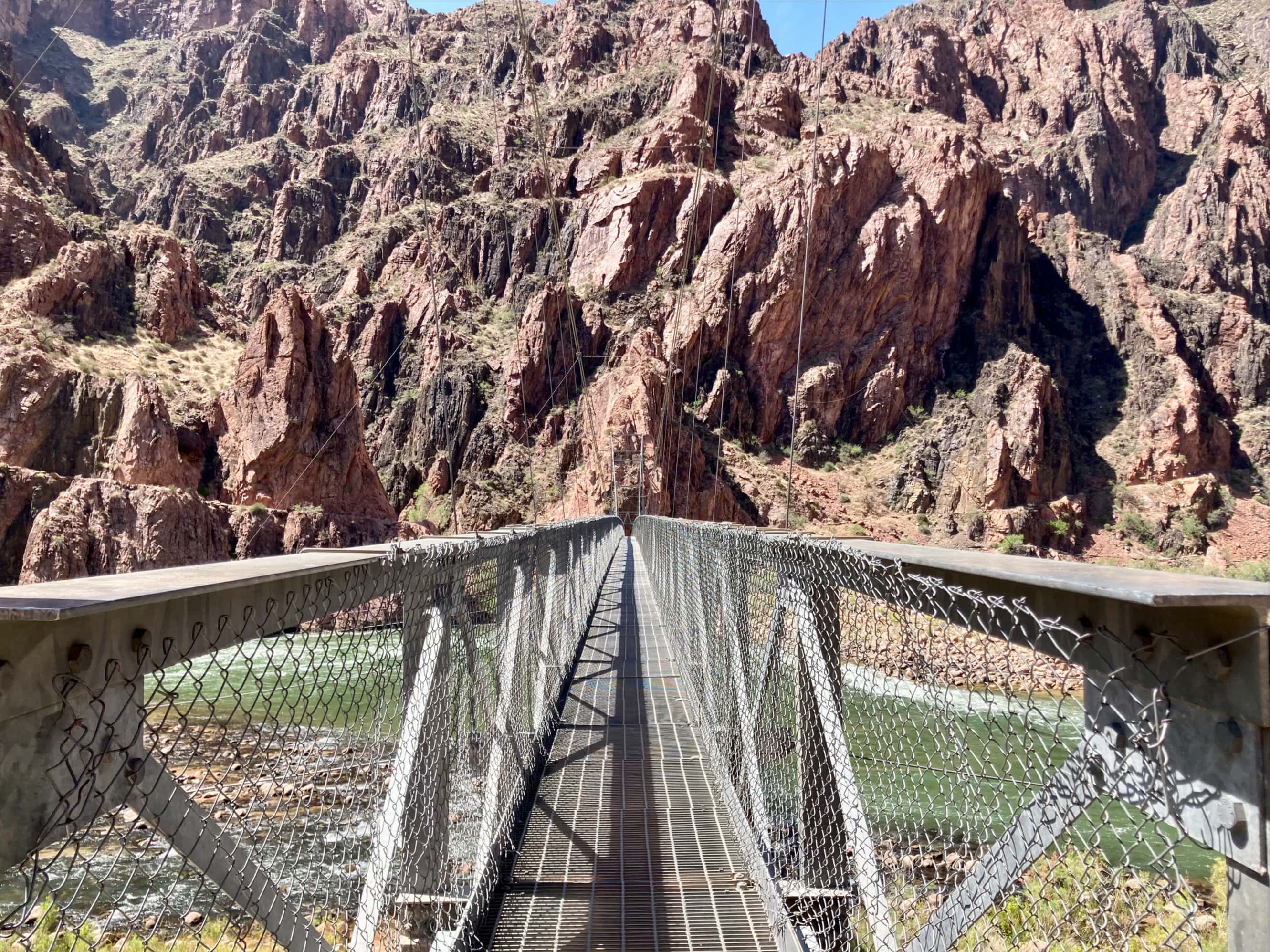

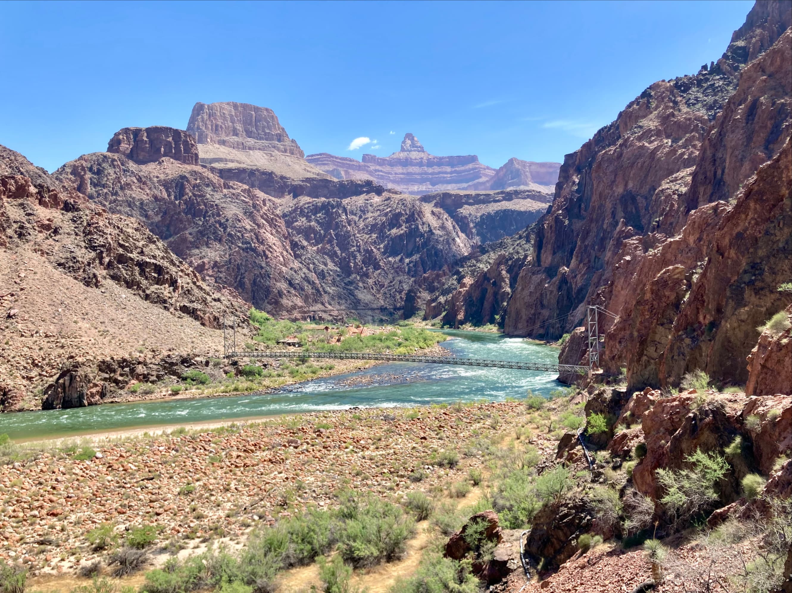
Beyond the bridge the trail was more or less level for roughly 2 km as it followed the south bank of the Colorado River heading west. Then it made an abrupt turn southwest and reached River Resthouse. We were now 25.4 km from our starting point, and at the bottom of a 1320 m ascent.


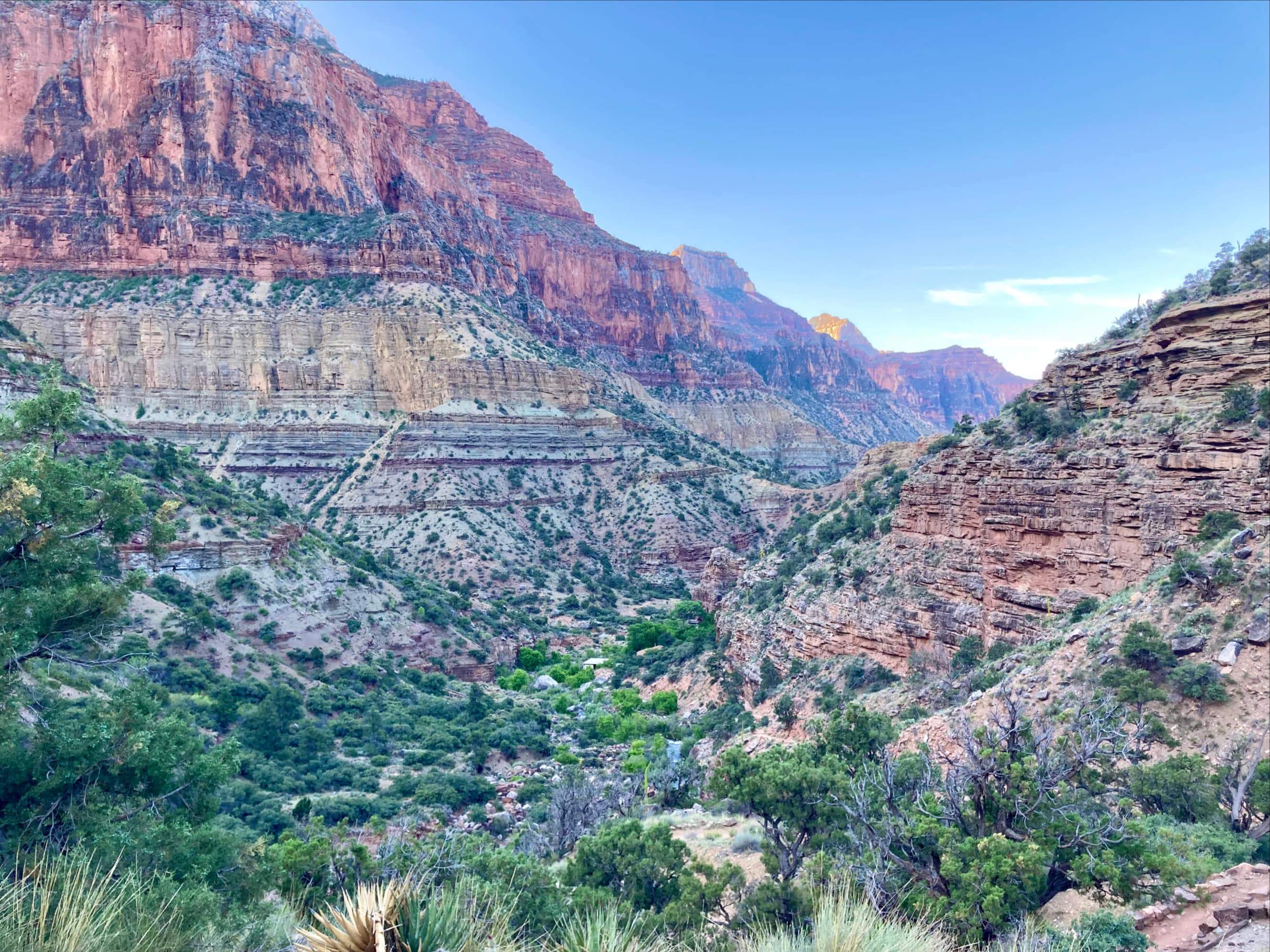
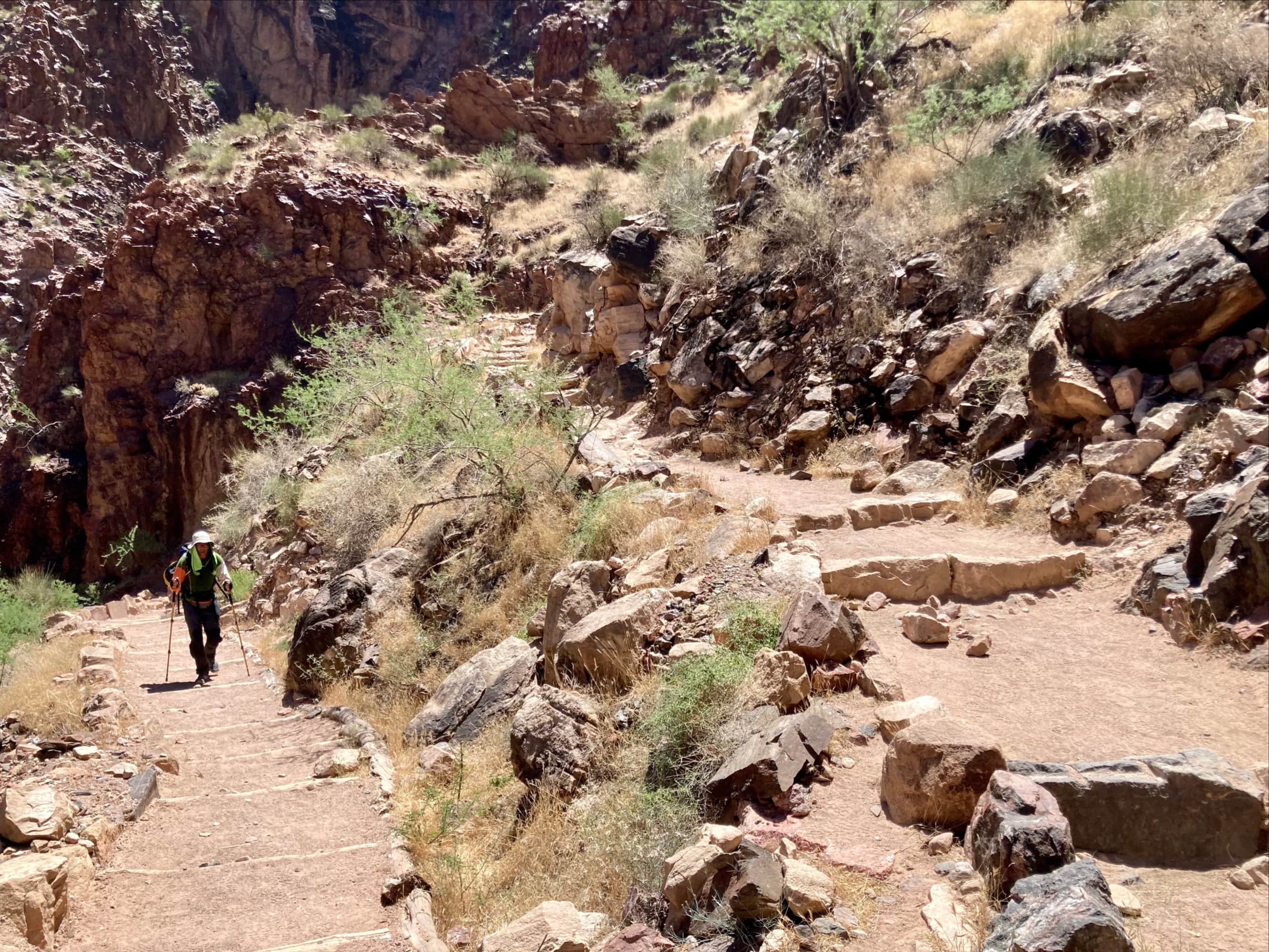
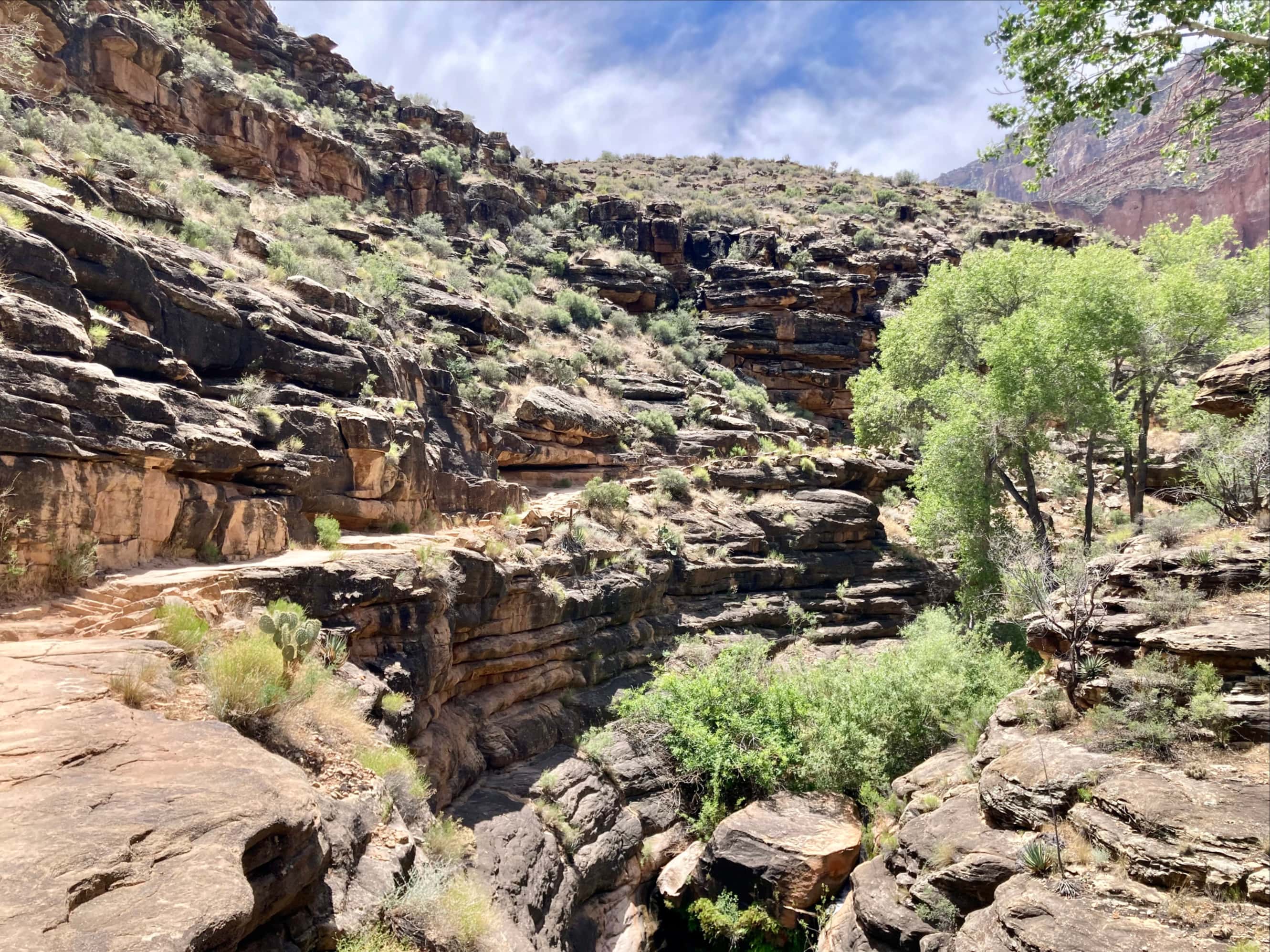
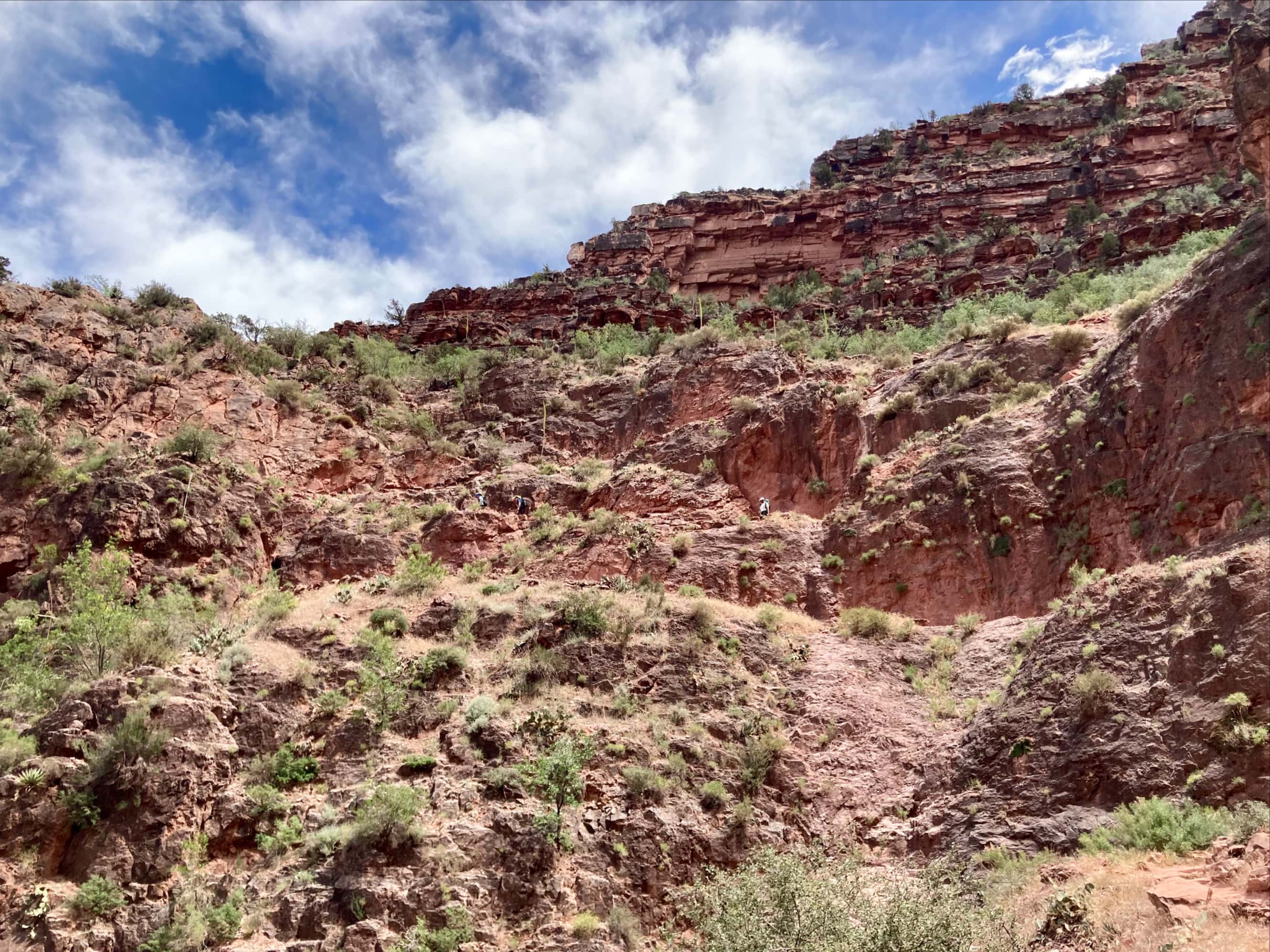
The next major landmark we were watching for is referred to as The Devil’s Corkscrew. Along with The Box, this area is frequently cited as being brutally hot. It is also an area of fairly steep switchbacks, ascending abruptly among black rocks.
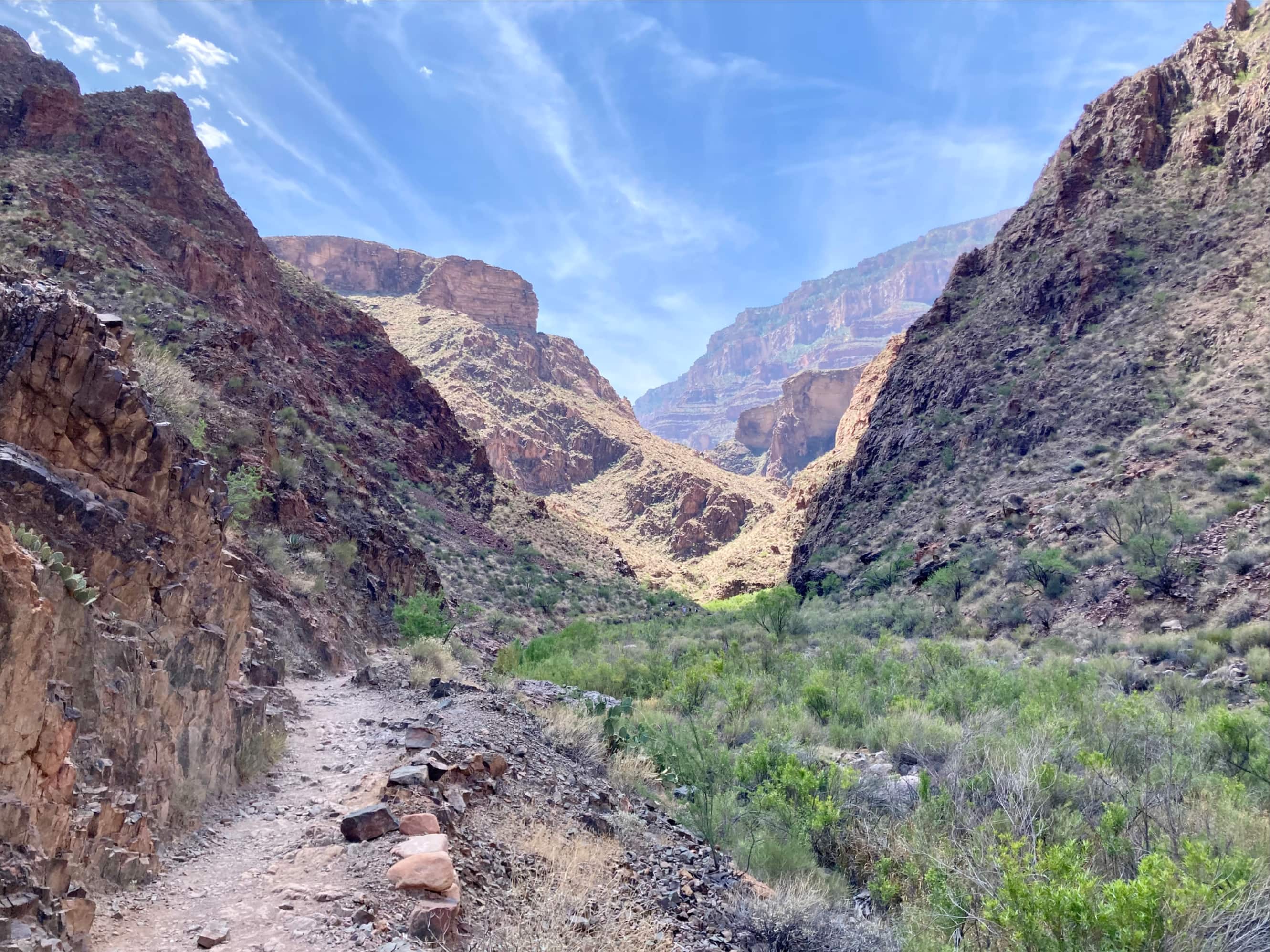


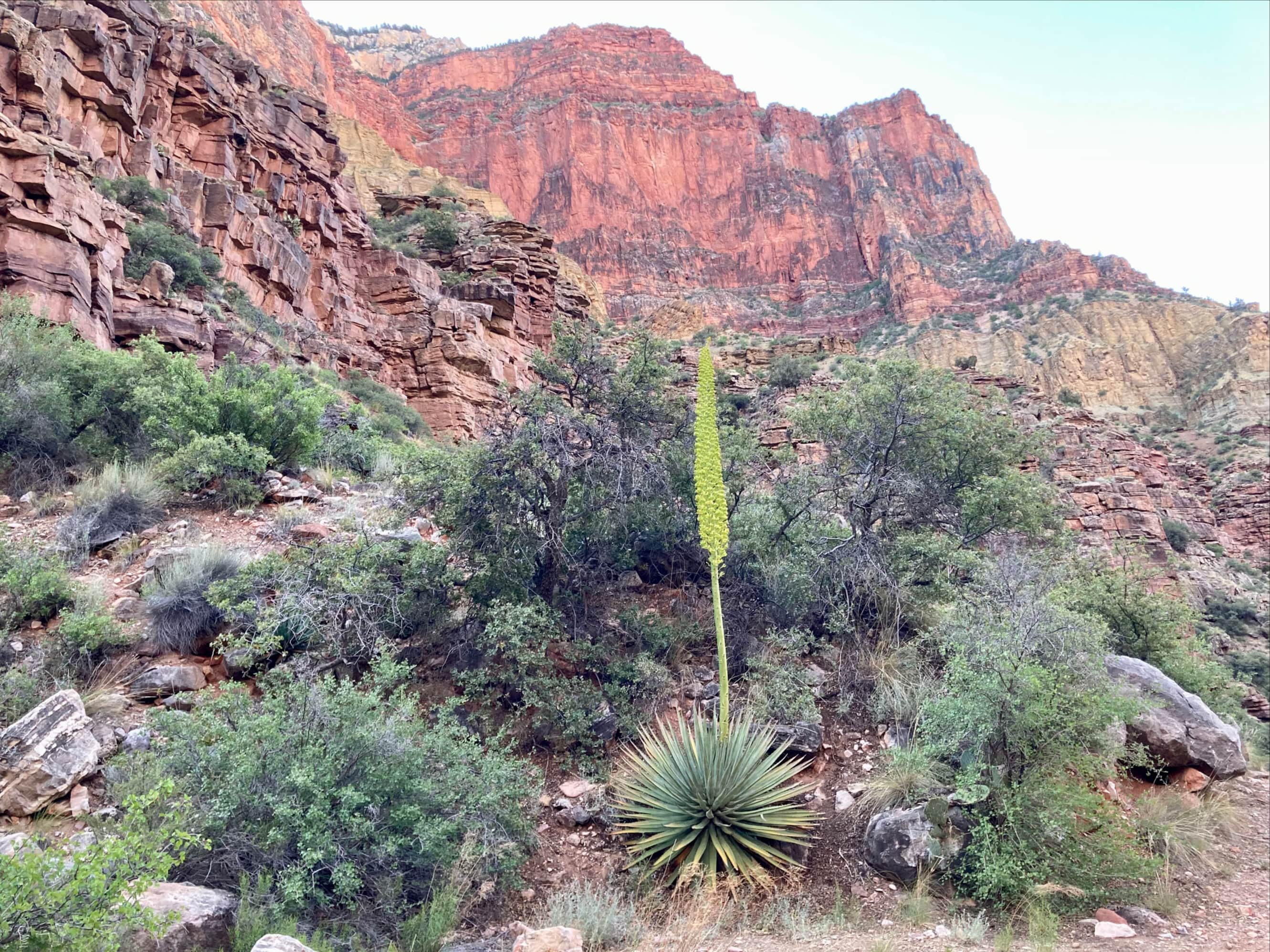
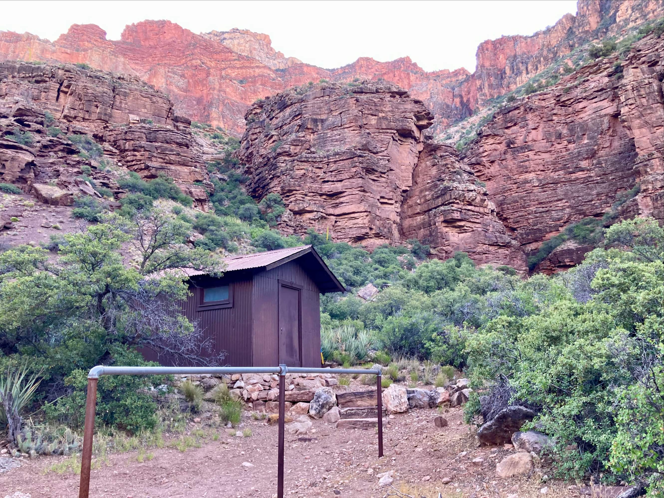
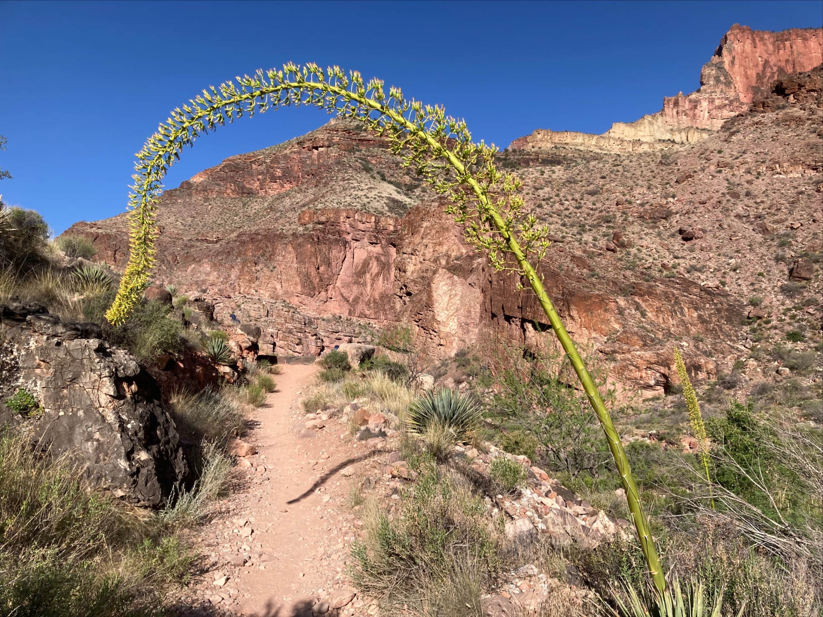
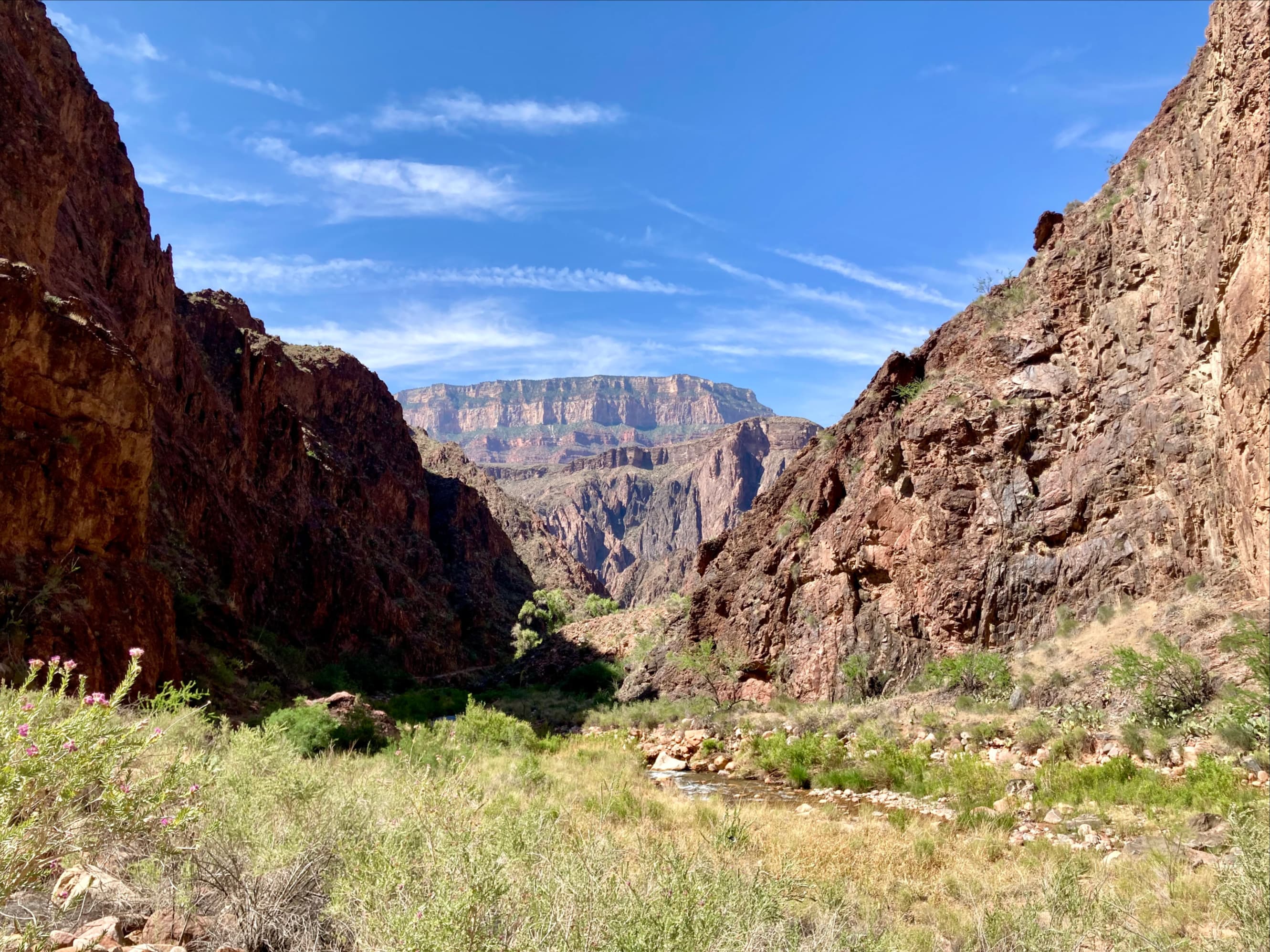
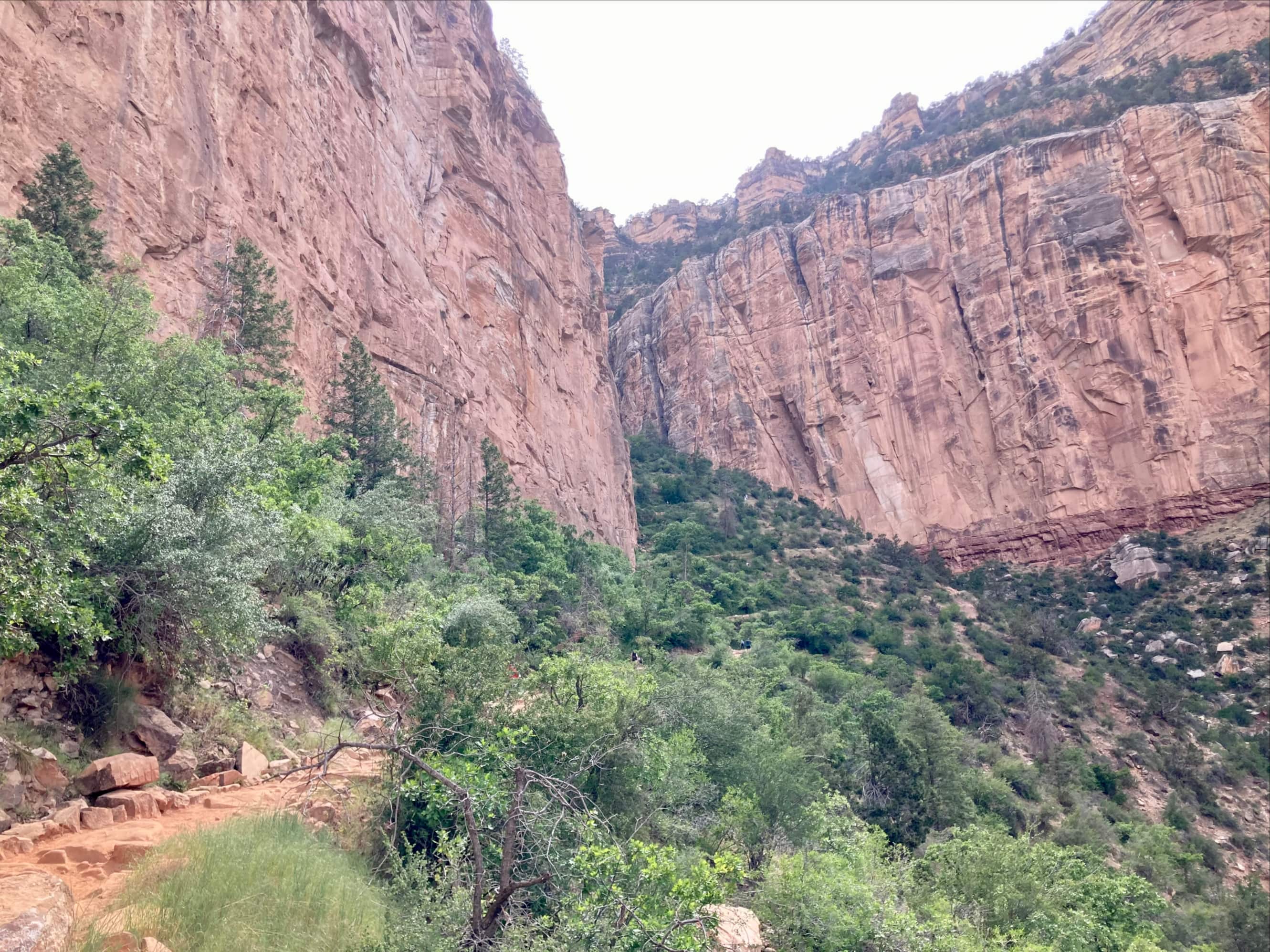
Above the Corkscrew the grade of the trail moderated somewhat and we were surrounded by increasing greenery. The trail came alongside Garden Creek. At the 30.7 km mark of our journey we reached Havasupai Gardens, about 395 m above the level of the Colorado River. There were more signs of construction here, with the same helicopter buzzing around. Signposts marked turn-offs for Tonto Trail and Plateau Point Trail, the latter of which was closed because of the construction.
Havasupai Gardens was formerly called Indian Gardens, and the official name change was in November 2022. Given how relatively recent that is (at the time of this writing) I encountered both names in various sources I read during preparation. The Havasupai people had lived and grown crops in that area, which they call Ha’a Gyoh, for hundreds of years. They were forcibly removed in the early 1900s when Grand Canyon National Park was created. On the official National Parks Service website there is this story relating to Ha’a Gyoh and the route of Bright Angel Trail: “Park employees kept noticing a Native man walking up and down the canyon walls to Indian Garden, and they began to call him Billy Burro. After all, he could hike up and down those walls just like a mule,” said Ophelia Watahomigie-Corliss, a member of the Havasupai Tribe and former Council member. “This man and his family were pushed out of Indian Garden, forced to leave the land they had farmed for generations so the national park could make it theirs. Billy Burro’s daily trail was turned into what is most of Bright Angel Trail today.”


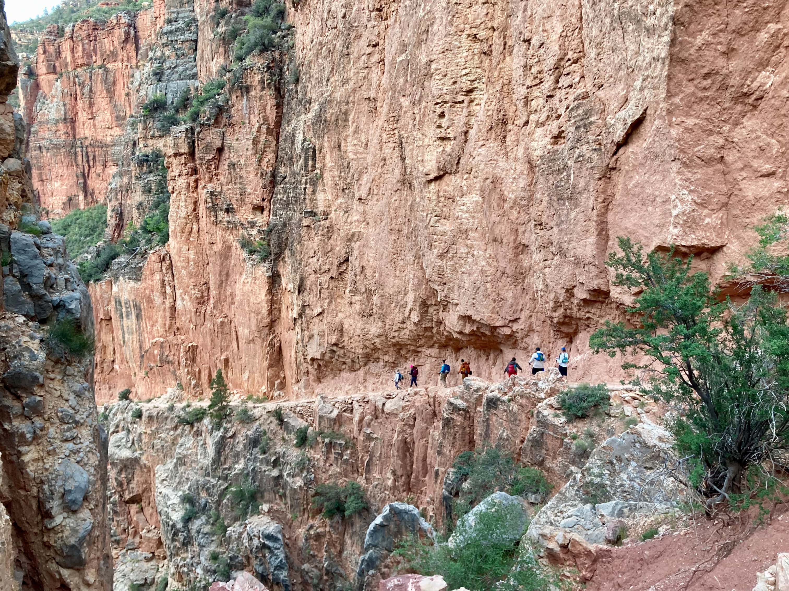
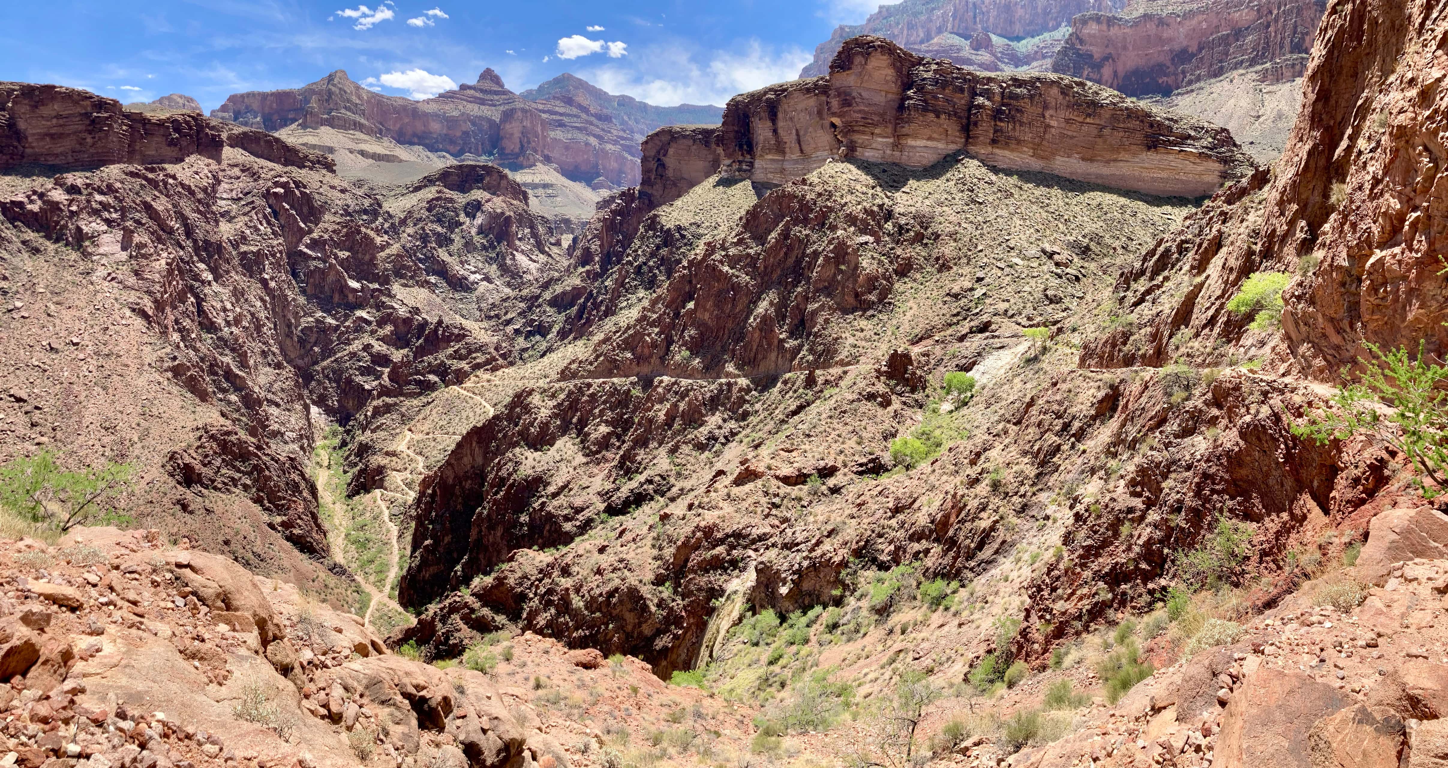
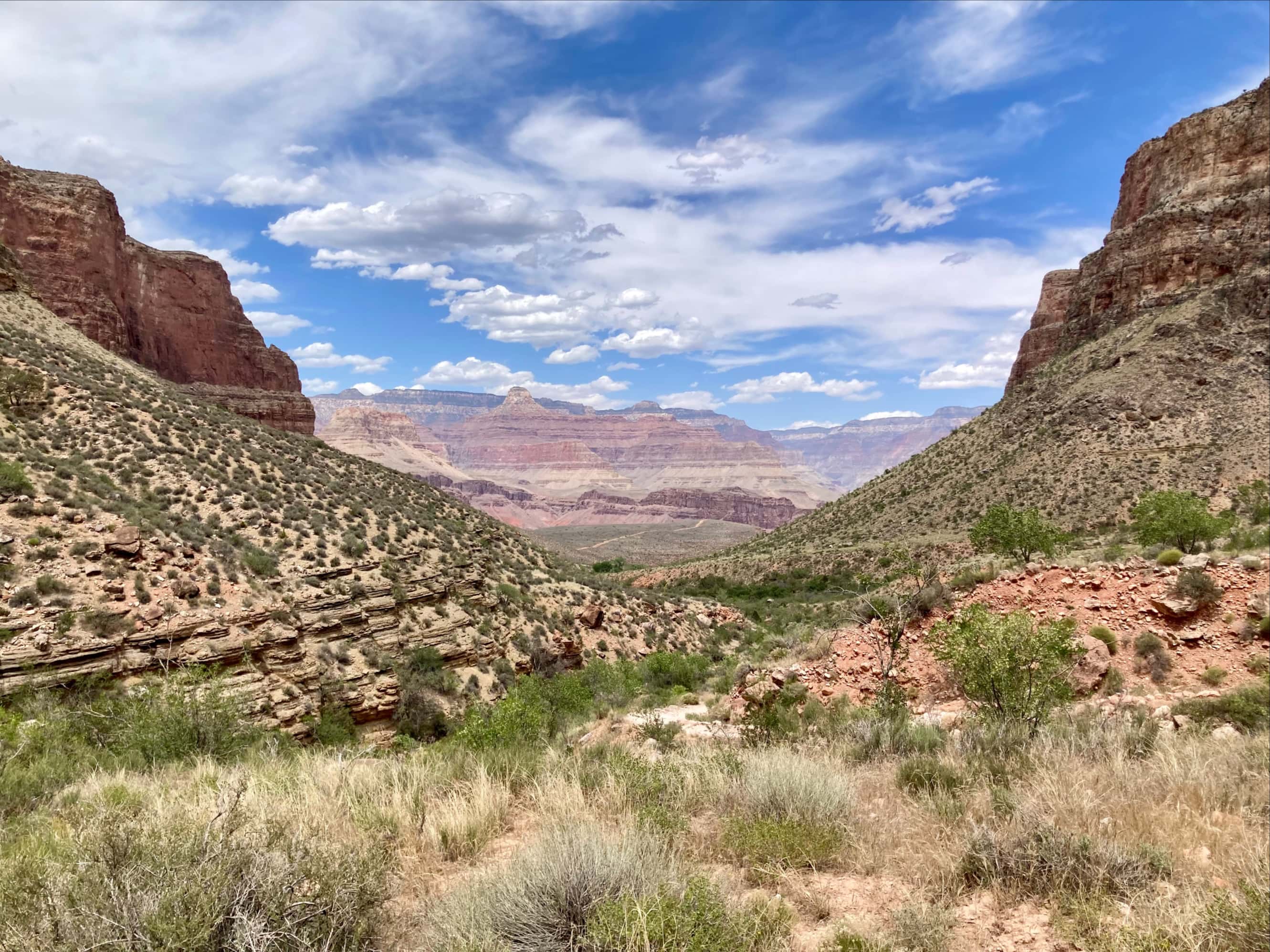
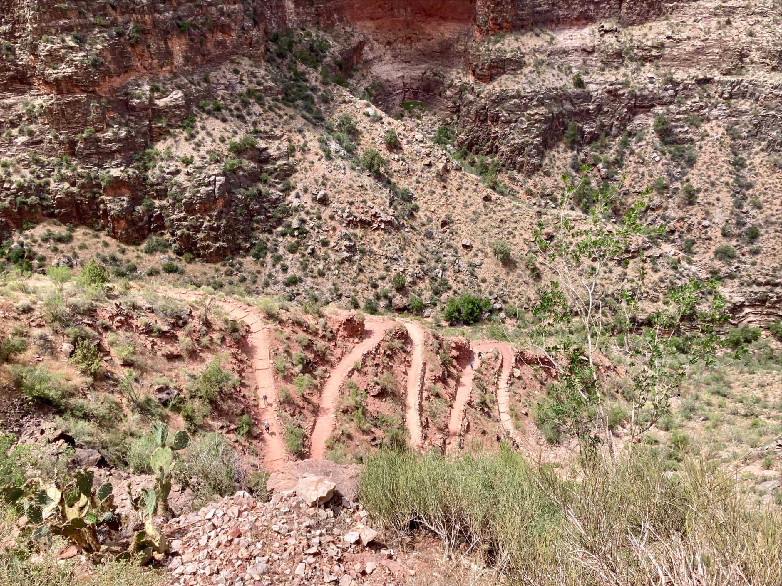
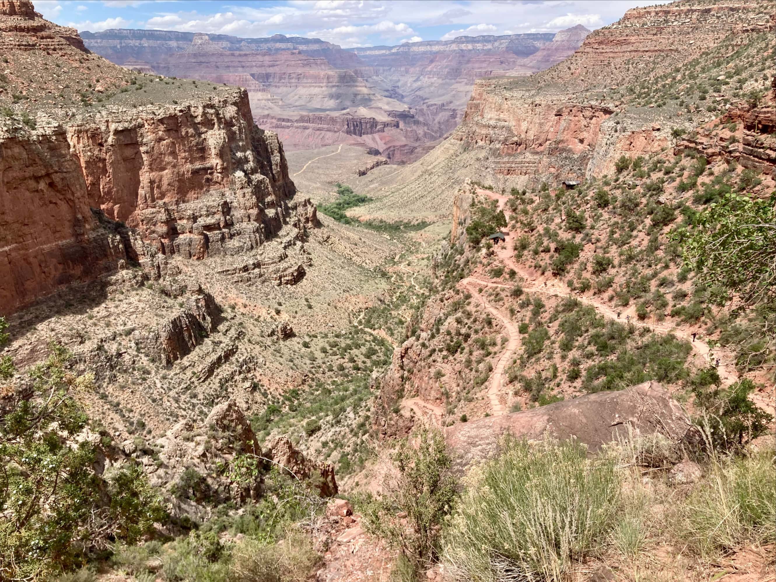
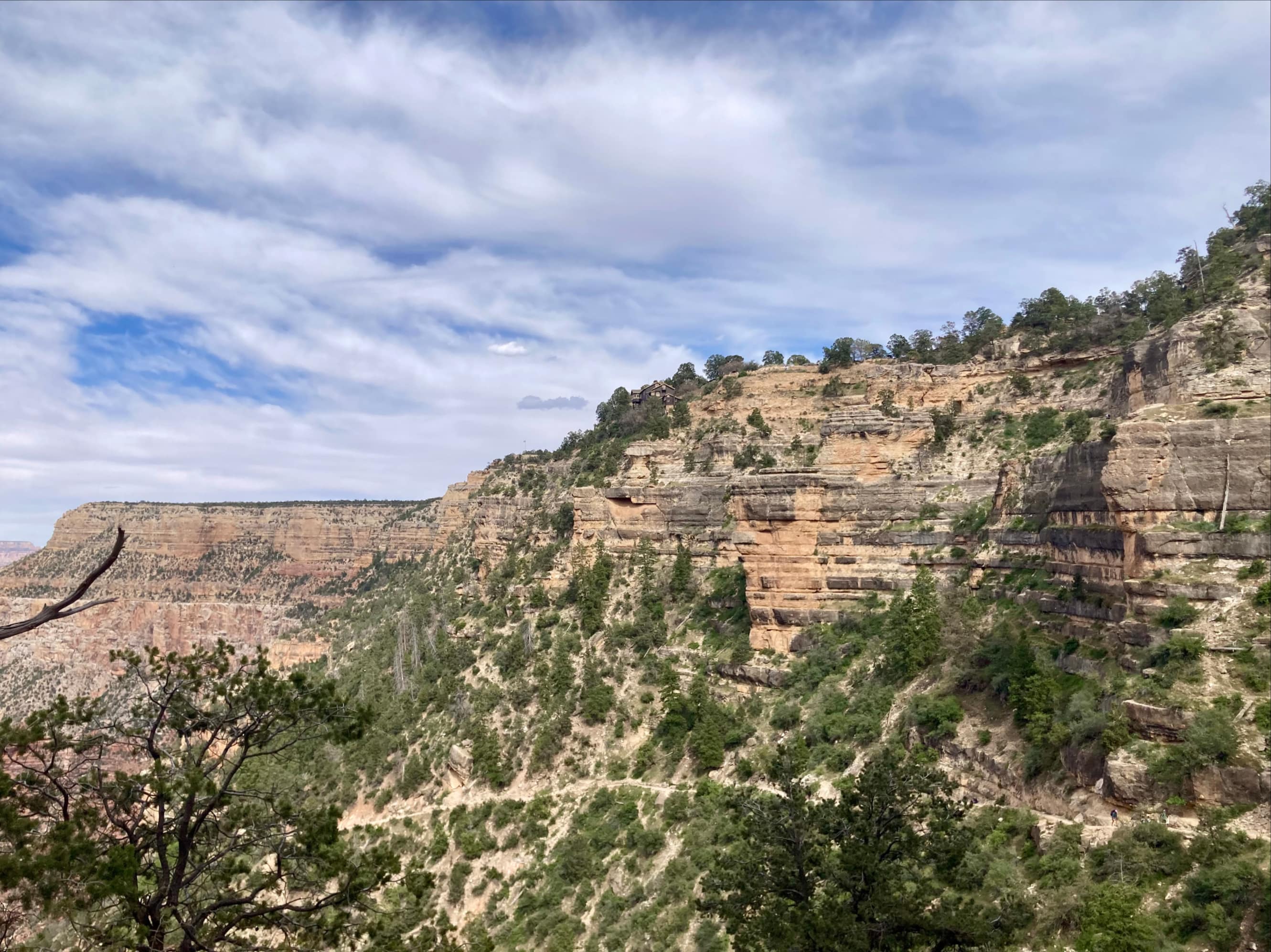
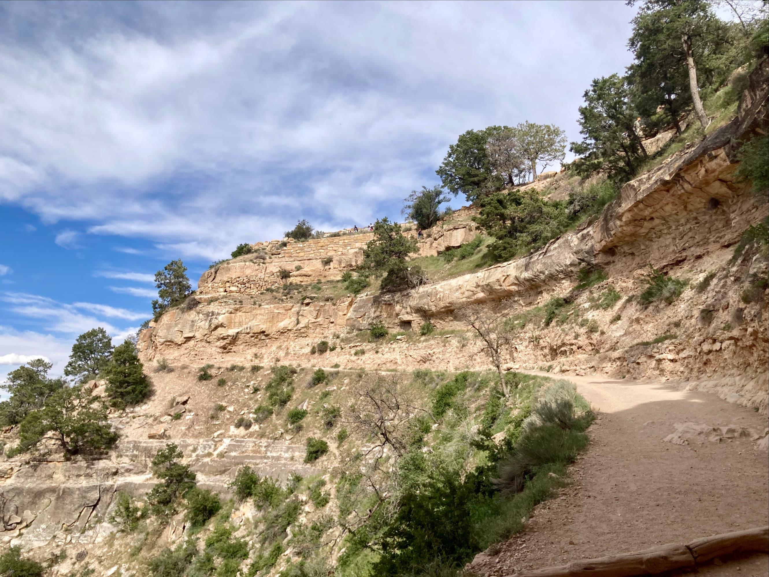
Beyond Havasupai Gardens was the final uphill grind to the South Rim. The heat of the day was more pronounced by this point, but the air kept cooling the more we ascended out of the Canyon. Along the way we took breaks at 3 Mile Resthouse and 1.5 Mile Resthouse. Typically there is tap water available at these points but the taps were off due to construction. We knew this ahead of time so we had completely refilled our water bottles at Havasupai Gardens. It was worthwhile stopping occasionally to look at the views behind us and to look down at the intricate zig-zags of the trail below us. Things began to get more busy on the trail as we were now encountering many people doing shorter day hikes from the South Rim.


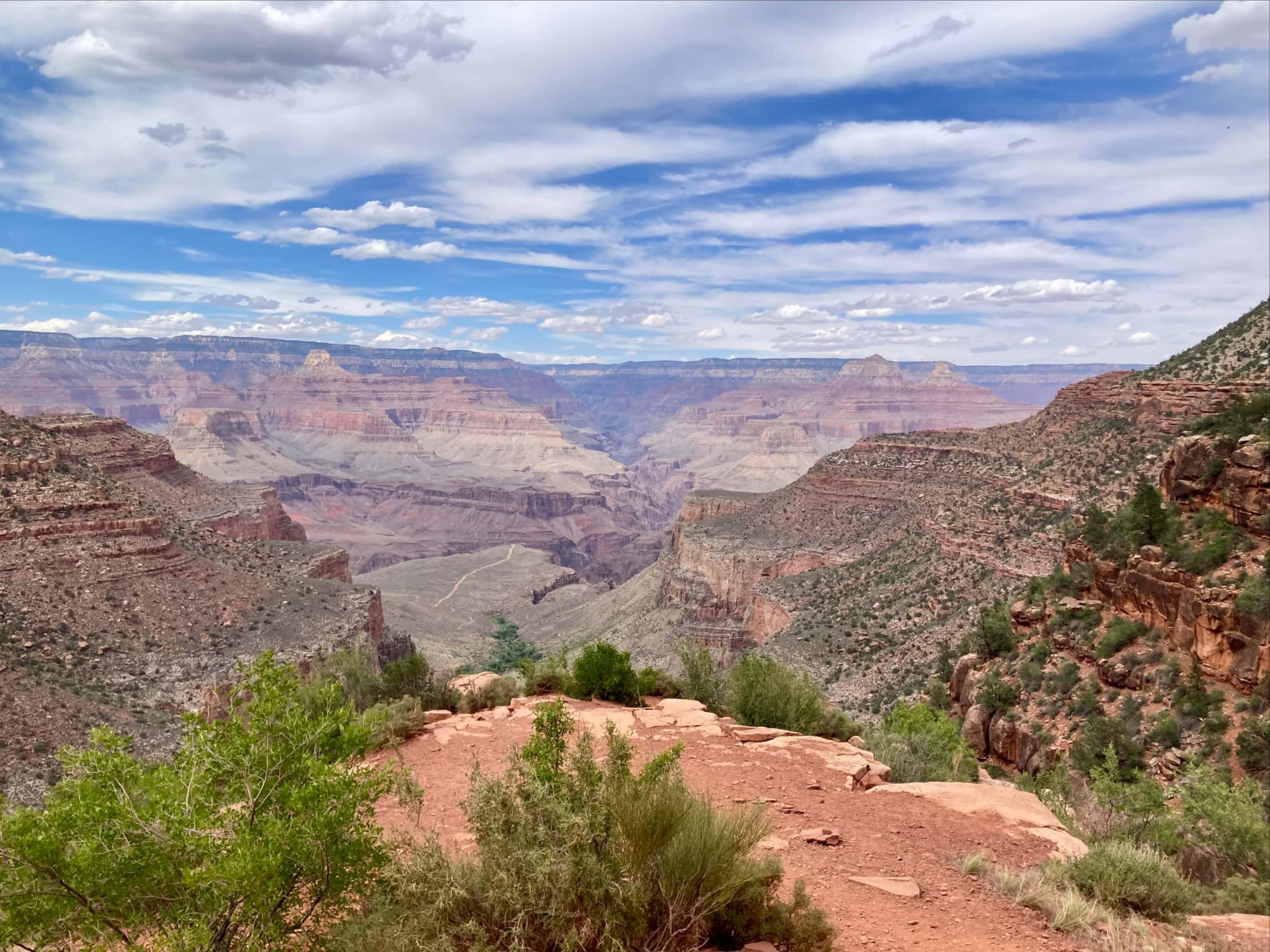
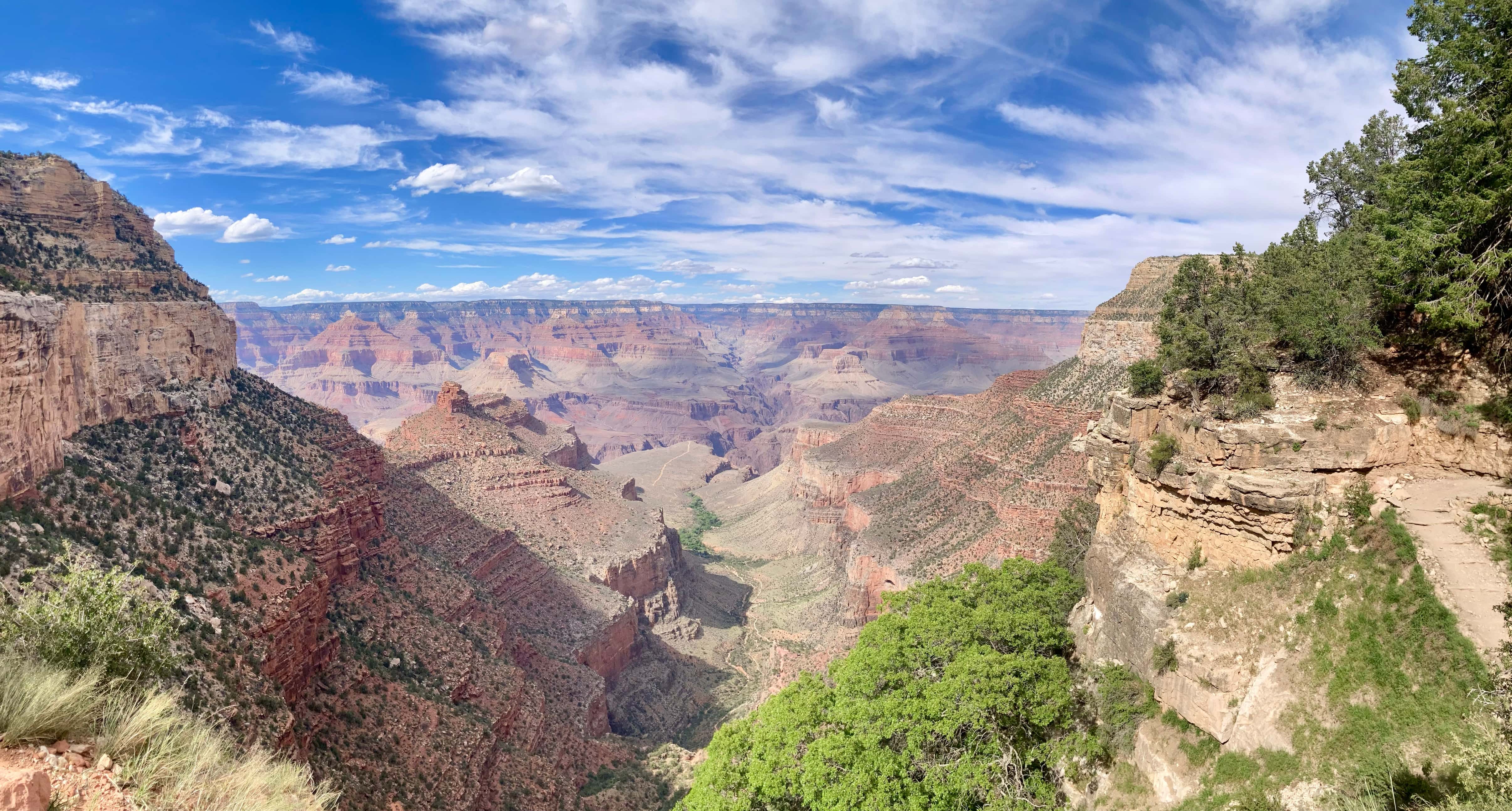
As upbeat as I generally feel when I’m ascending, I was glad to see buildings come into view as I neared the Bright Angel Trailhead, 1320 m above the Colorado River. Something quite notable was just how quickly the effects of the heat could hit you. I experienced this somewhere between 3 Mile and 1.5 Mile Resthouse. I was moving along quite fine but was then suddenly struck with light-headedness and fatigue. On the bright side, when the effects are recognized early you can take steps to cool yourself and recover pretty fast. I sat in the shade, drank some water, soaked myself down with water from my reservoir and slowed my breathing for a few minutes. That did the trick and I carried on without incident. We completed our 38.4 km journey at 12 hours 14 minutes after setting out.


Anticipating this hike, I wasn’t sure how I’d feel after finishing so I was pleased to find that, overall, I felt pretty good. I was very happy with my gear choices. I’m now definitely a convert to trail runners if a route doesn’t require ankle protection. My hydration and electrolyte strategy seemed to work well – I finished the hike awake and clear-headed despite all the salt caked on my shirt. My conditioning strategy worked just fine, too. Treadmill training and long hikes up and down the coulees seem to be good substitutes for long outings in the mountains.
Bhaskar and I celebrated the completion of our hike at the pizza pub in Maswik Lodge. We reflected on the main challenges of this hike for people accustomed to the Canadian Rockies, and it really did boil down to managing the heat. Hydration has to be intentional but not excessive, as does electrolyte repletion. Some sources we’d read made a big deal out of ensuring big caloric intake, but I found that I’d packed far more food than I needed. I didn’t find this aspect any different from hiking in cold or temperate conditions. Wetting yourself down works wonders – and the parks service has little signs suggesting you do this at many of the water taps on the route.
After enjoying some beer and pizza we turned in for the night. The next day we would shuttle back to the North Rim to pick up our car then find a short hike to do that evening. We decided to hike a portion of South Kaibab Trail, and I’ll describe that trip in the next post.
Aside from the official Grand Canyon National Park website and the other sources cited above, I also used the National Geographic Grand Canyon North and South Rims Topographic Map during trip planning and carried it along during the hike. For general background information and for getting a “feel” for the area, I read James Kaiser’s excellent Grand Canyon National Park: The Complete Guide 9th ed (2023).

Loved the detail of the hike!!
LikeLiked by 1 person
This looks so amazing… and so difficult! Congrats on completing it!
LikeLiked by 1 person
Thank you!
LikeLiked by 1 person