July 7-8, 2023. The second part of a 7-day trek along the world-famous West Coast Trail
You can read part 1 here.
- Region: Pacific Rim National Park Reserve. Traditional territory of the Huu-ay-aht, Ditidaht, and Pacheedaht First Nations
- Distance: Approximately 20 km for this segment (based on the official map, actual distance travelled is longer)
- Total Time: 2 days

Day 3: Camper Bay to Walbran Creek
Everyone in the group was up bright and early. Once everyone’s morning routine was complete and we’d packed up, it was time for one more thing: a dressing change for my hand. This was the first morning after my injury. The fact that the bandages hadn’t soaked through was a very positive development. I got some gear together and sat down with Steve to unwrap the dressings. The rest of the group peered down at us as we worked. Once the dressing was off I was a little shocked at the sight of the irregular gouge taken out of my palm, but I was mostly relieved – the bleeding was now barely an ooze and everything looked clean. We re-wrapped the hand and arranged all the supplies that we’d use for this task within one first-aid kit for easy access. Then it was time to return to the forest.
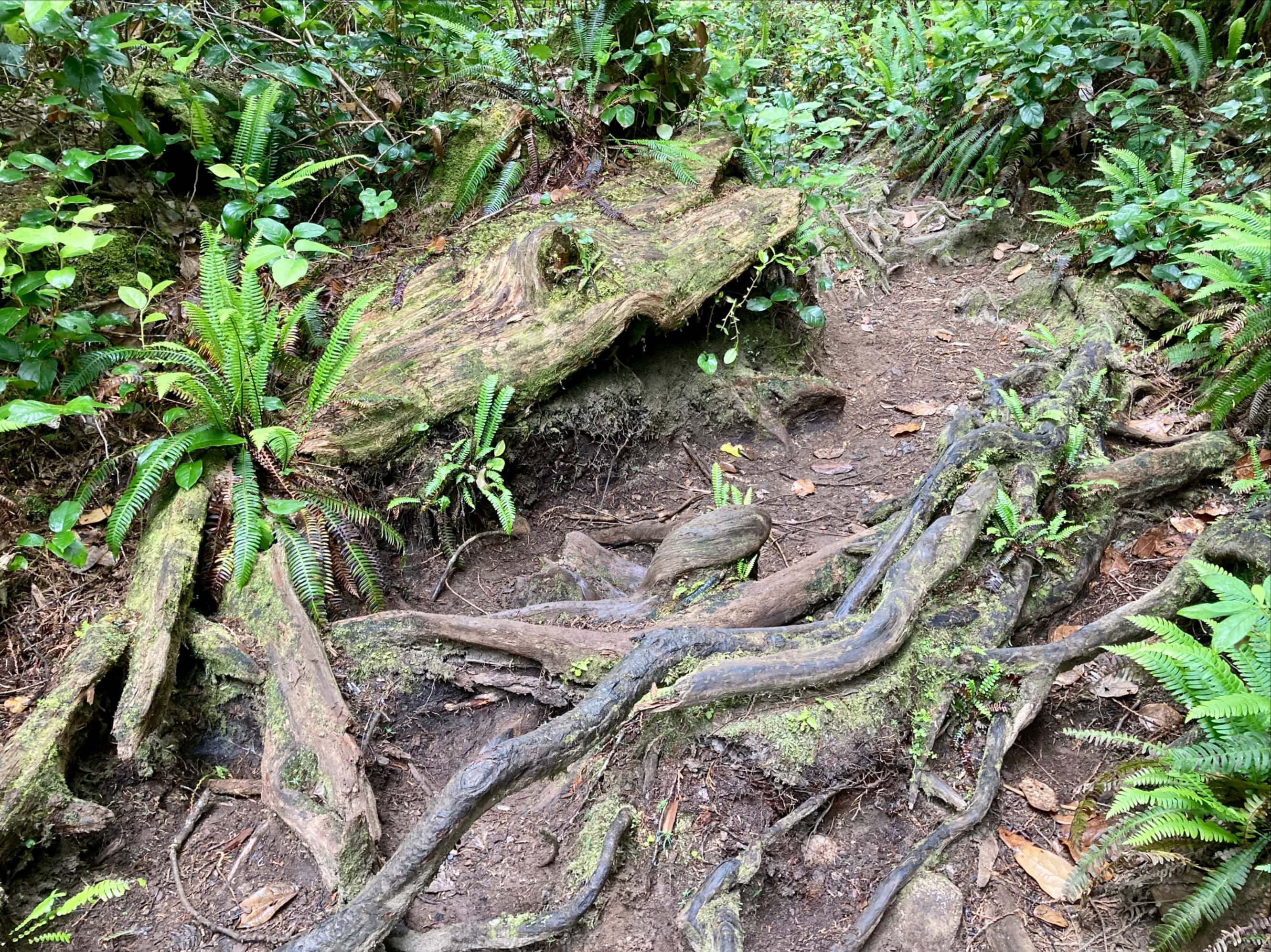
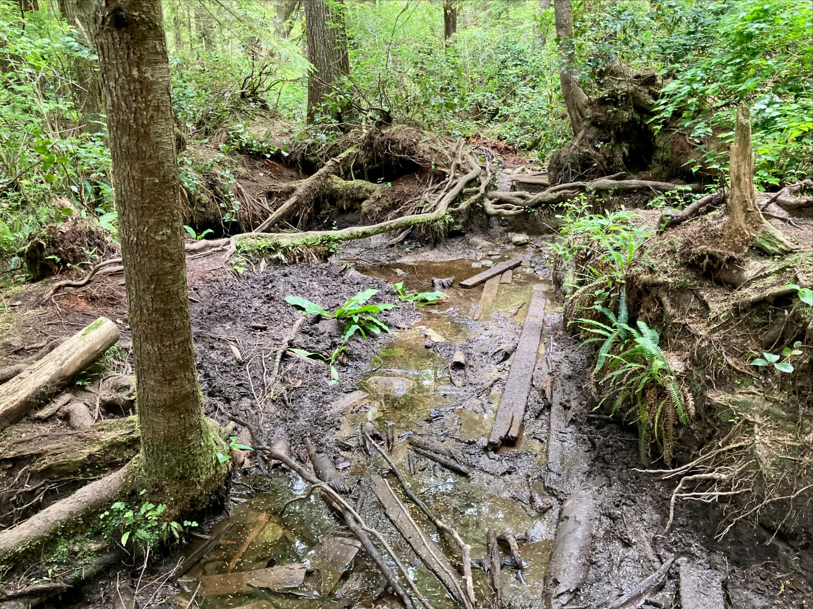
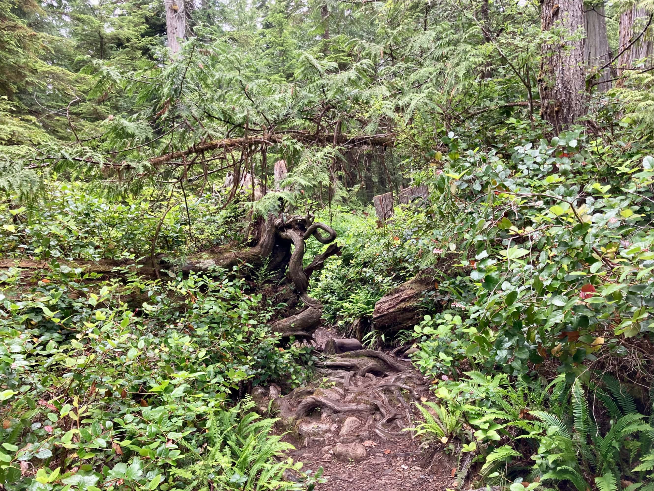
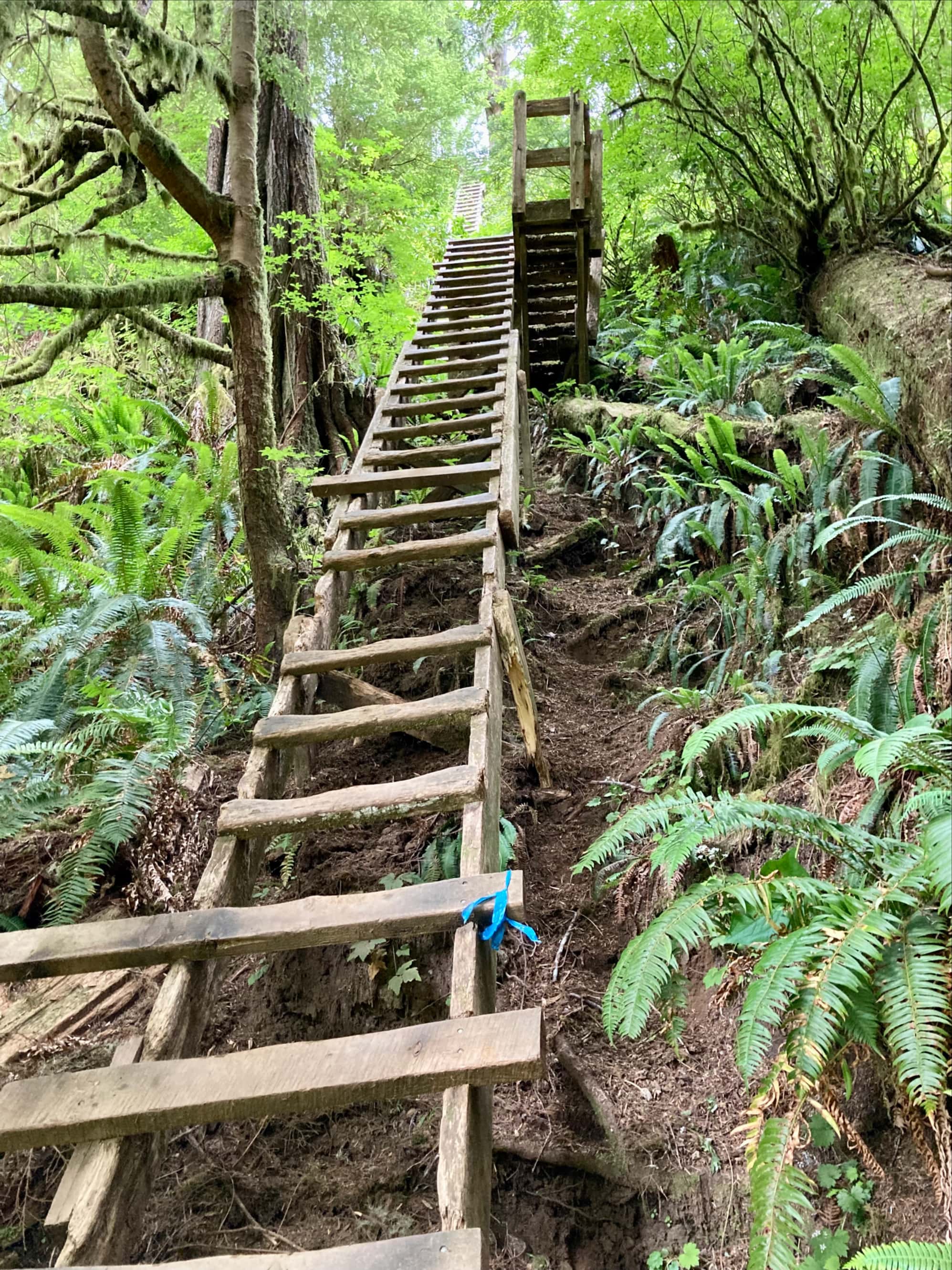
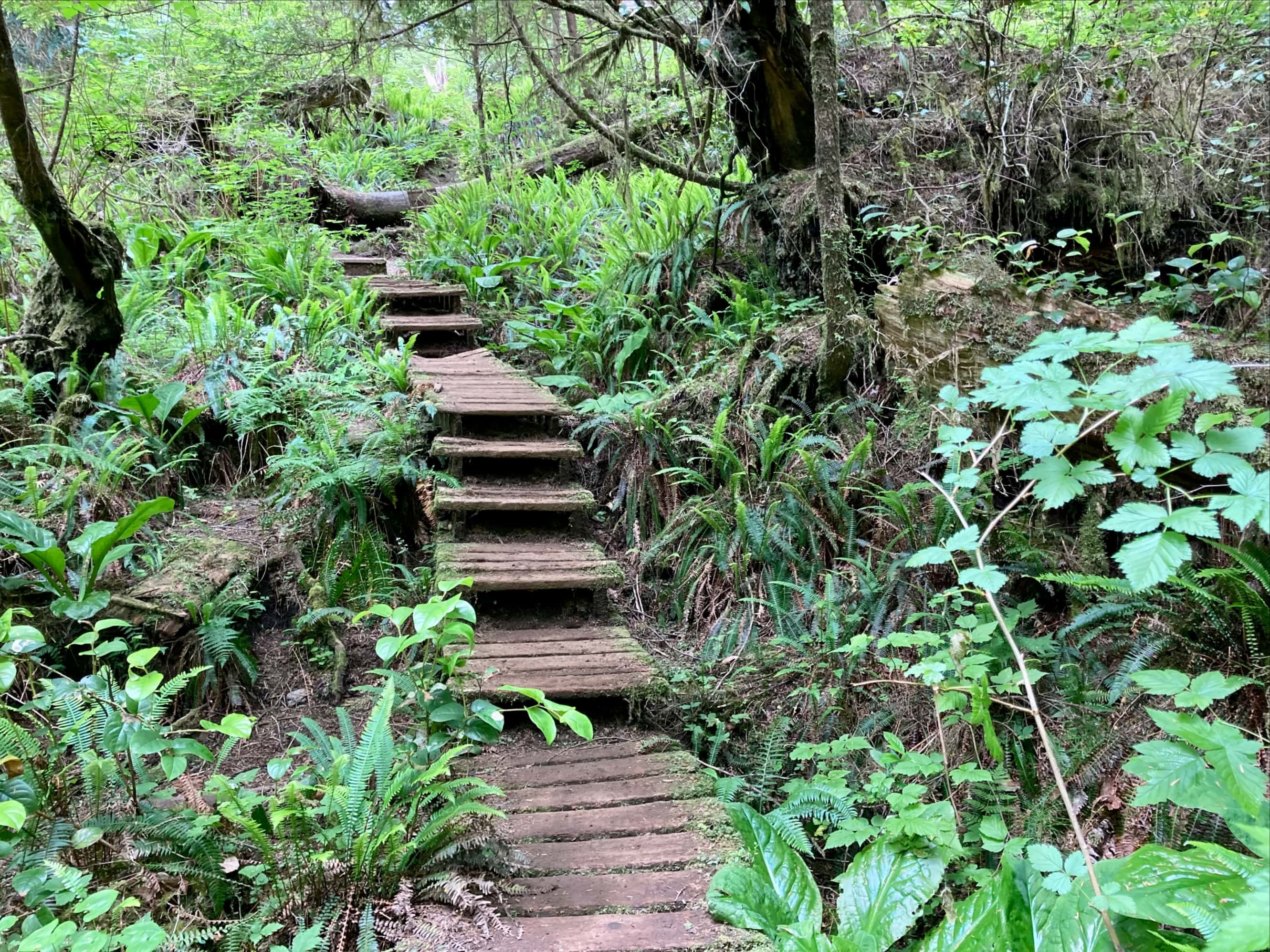
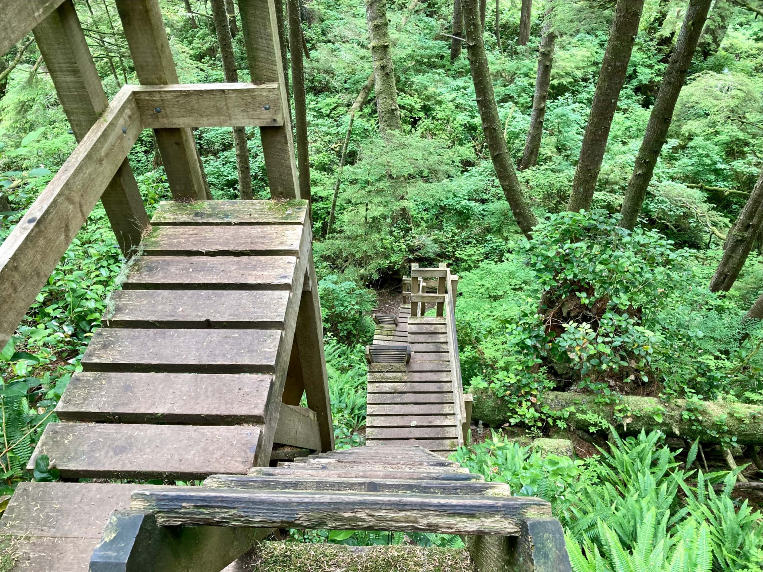
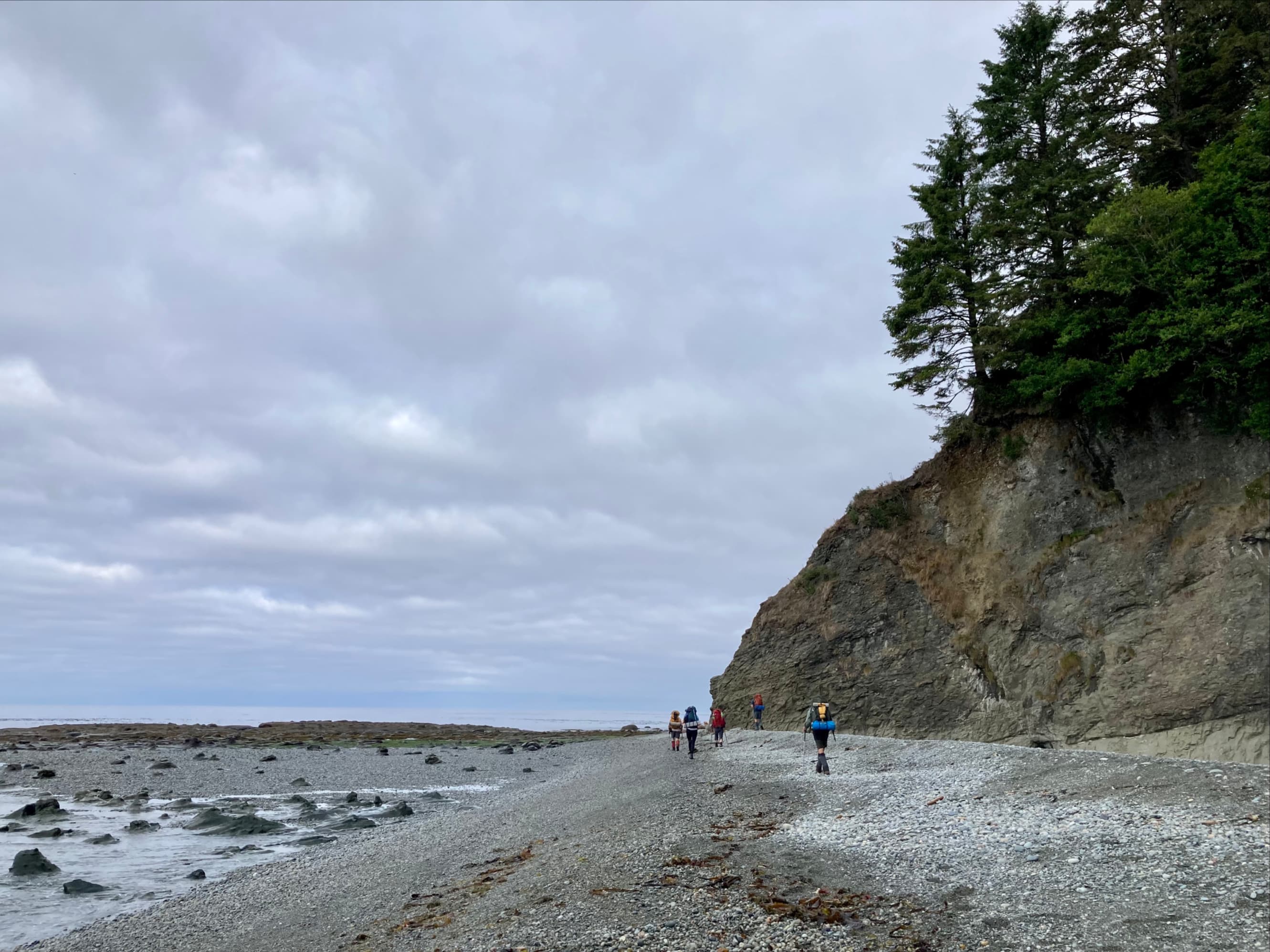
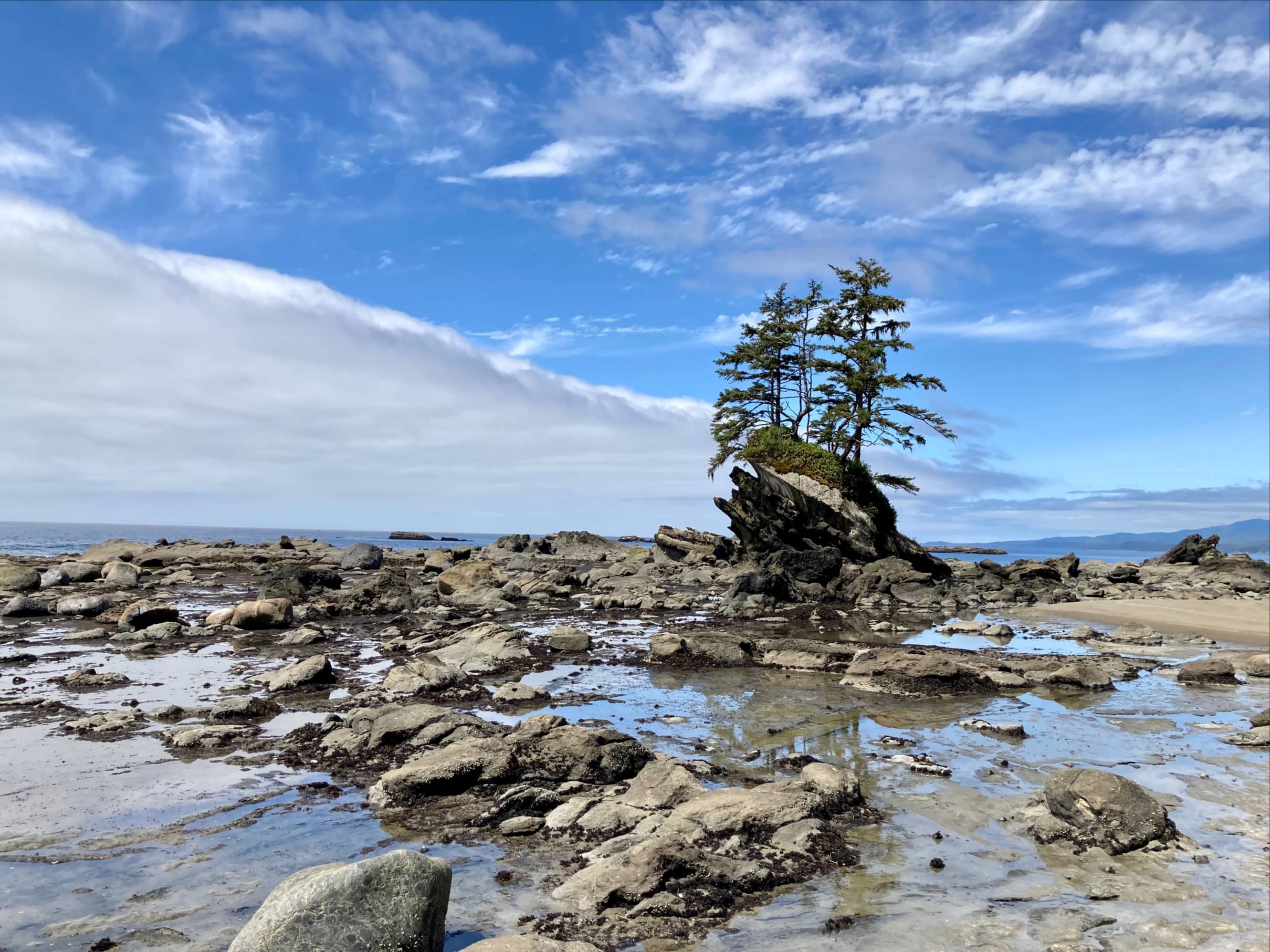
The portion of the trail to Camper Bay to Walbran Creek is notable because of its many, many ladders. It can also, apparently, become extremely muddy. Vancouver Island was in the middle of a drought during our visit, though, so while there were a few mud holes they were few and far between. Aside from the ladders, the other interesting thing about this part of the trail is the existence of multiple paths through certain areas. There might be a bit of a depression with more than one log plus a boardwalk traversing it, along with a path that descends into it and back out. Some places felt like a bit of a tumbled down playground lost in the rainforest.
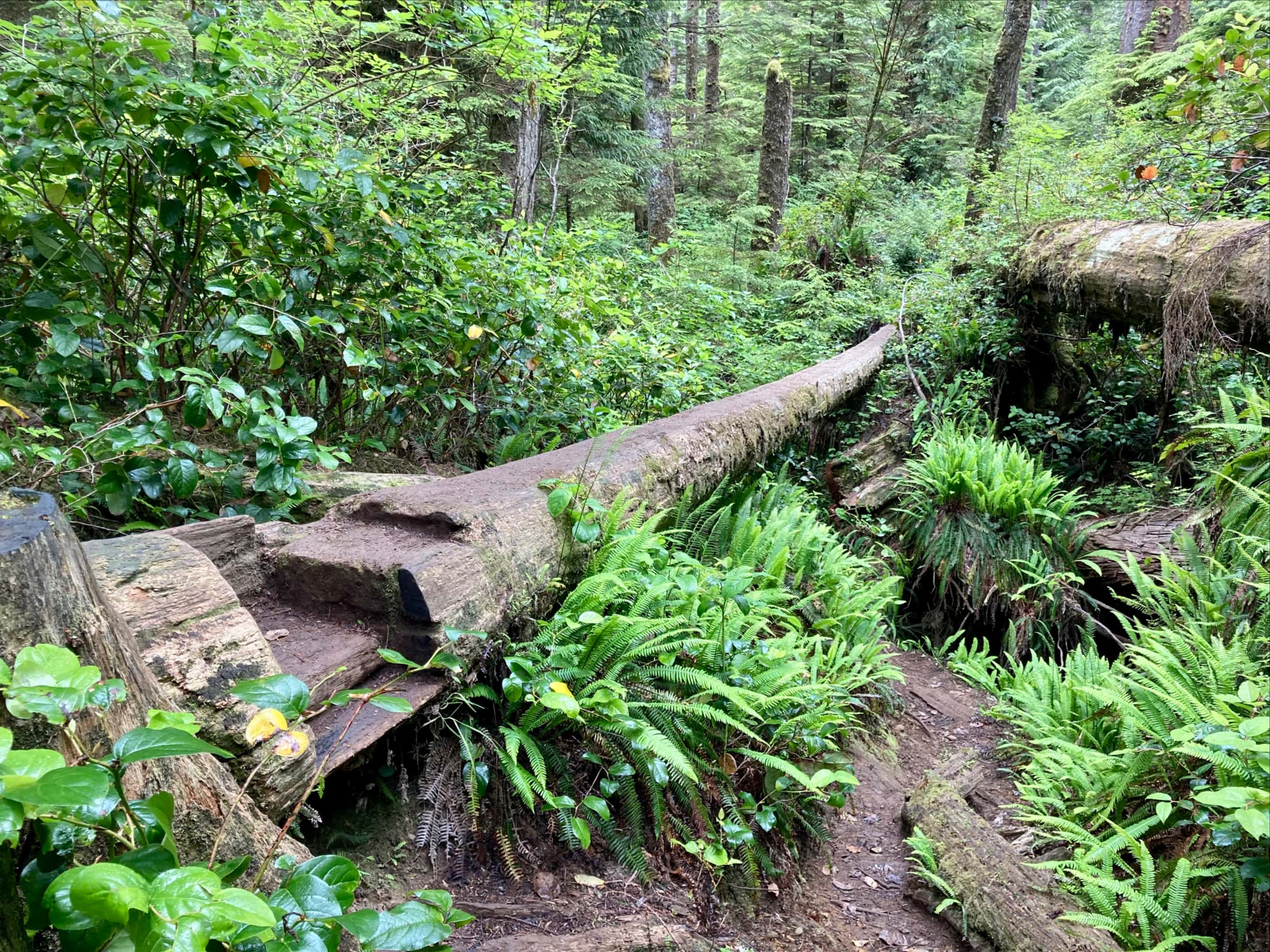


The ladders on this part of the West Coast Trail are integral. It’s hard to imagine getting up and down some of the slopes without them. I’m guessing that before the installation of the ladders the route was slightly different. In any event, the ladders get you up and down efficiently. Only one hiker at a time can be on a ladder and only two at a time on the landing platforms. Sometimes there were groups going the other way, and waiting at the ladders allowed for a bit of a rest. We encountered some of the tallest ladders on the trail in the area of Sandstone Creek and Cullite Creek. On one ladder, someone had carved sequential Roman numerals into the rungs.

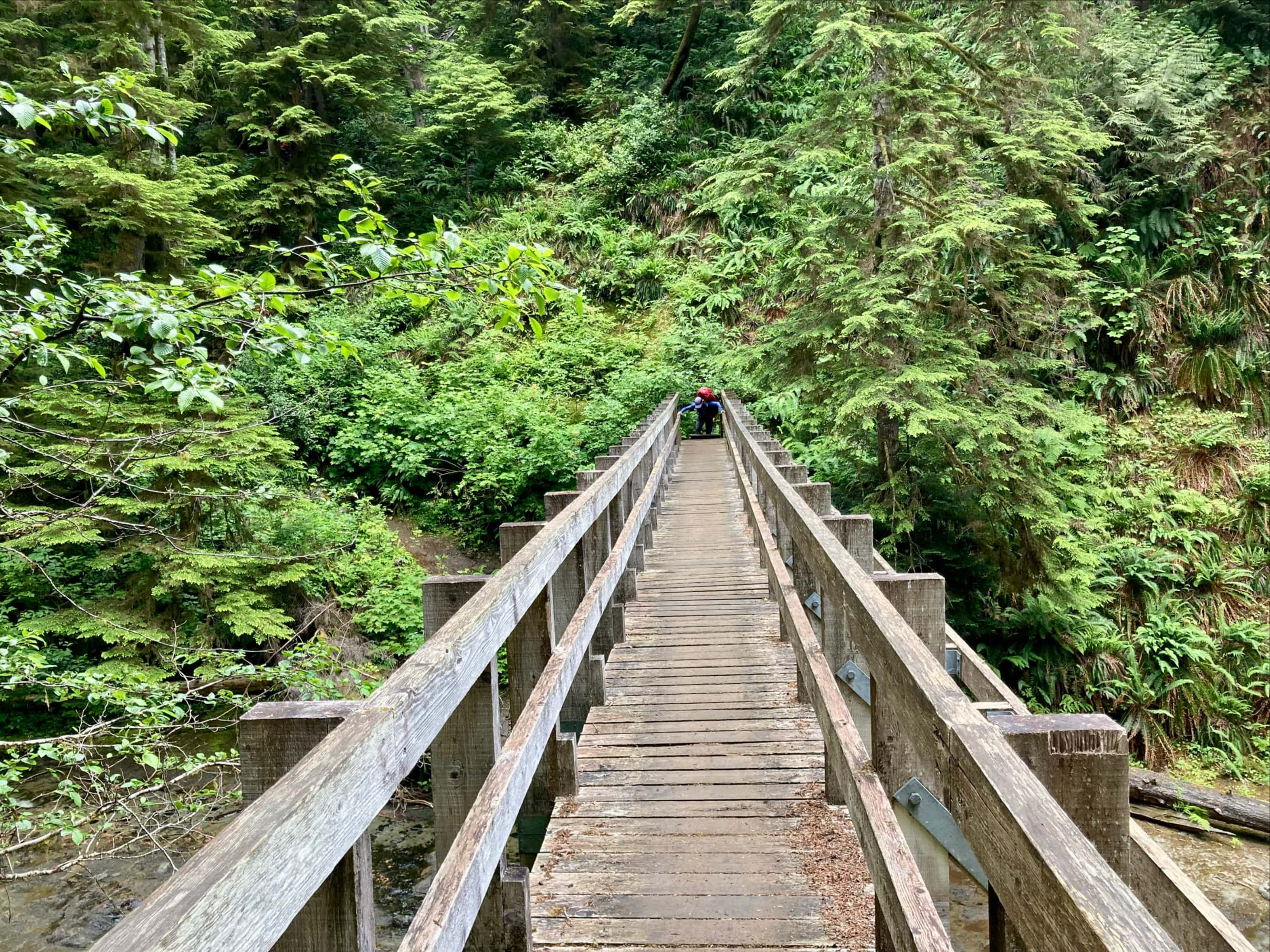


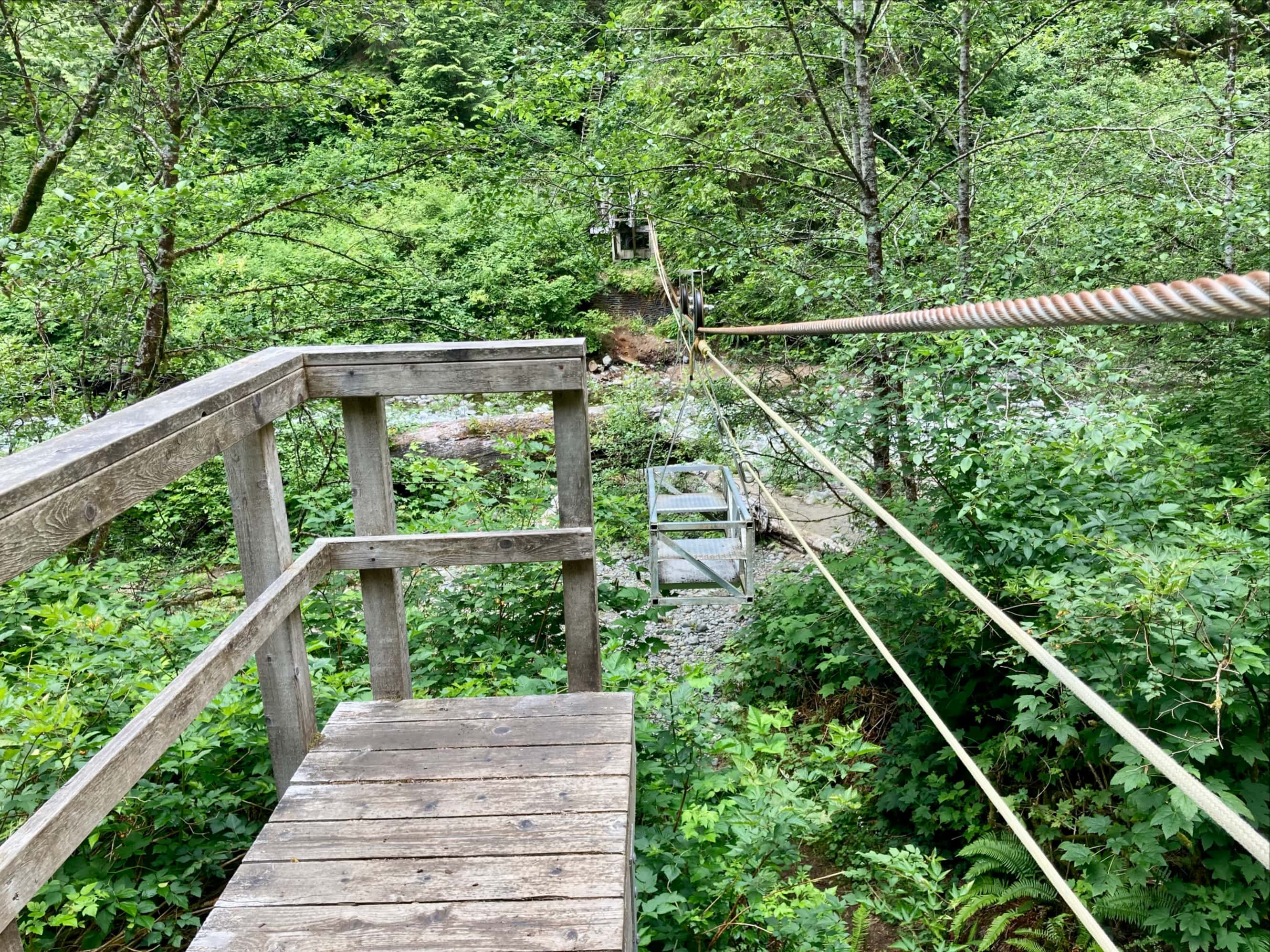

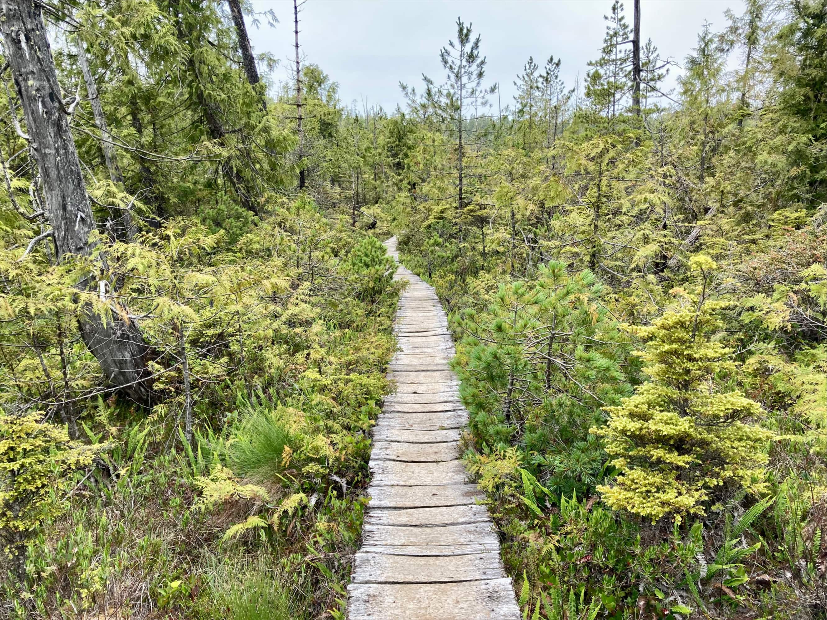
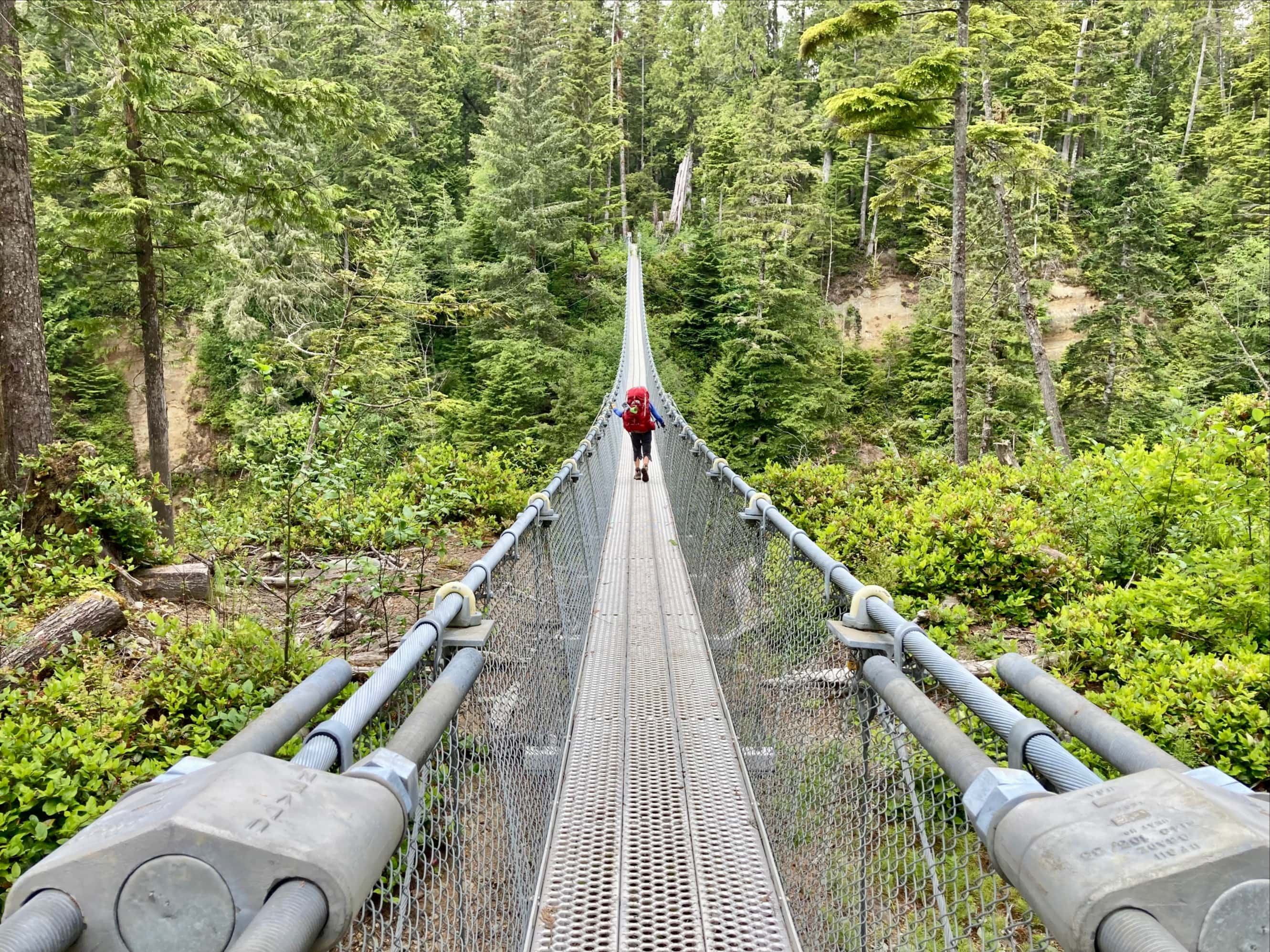
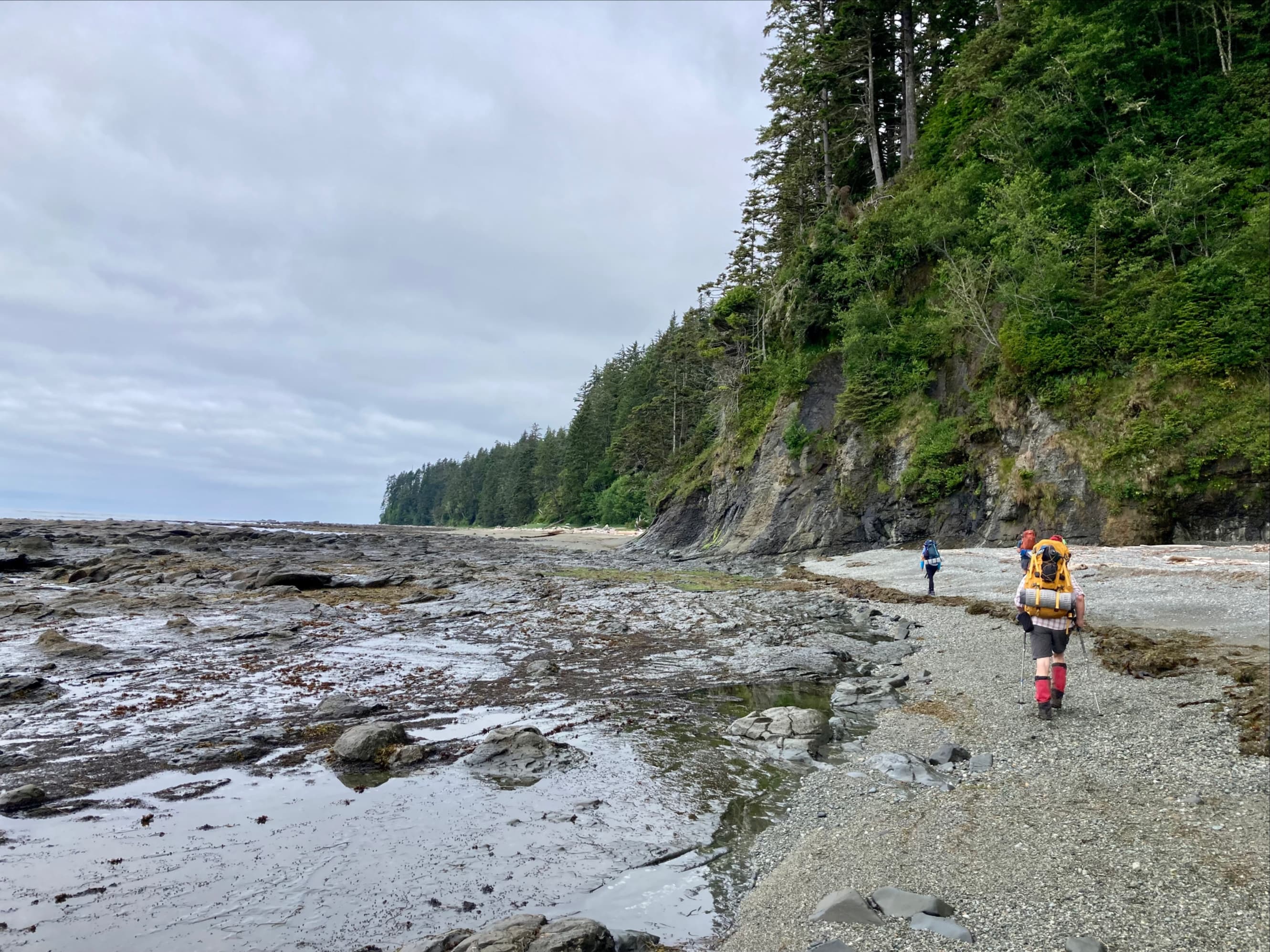
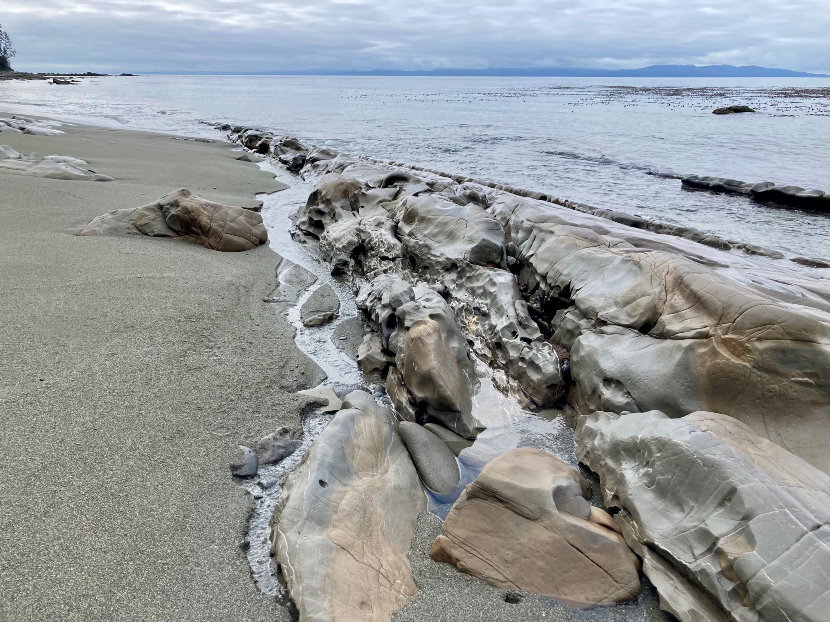
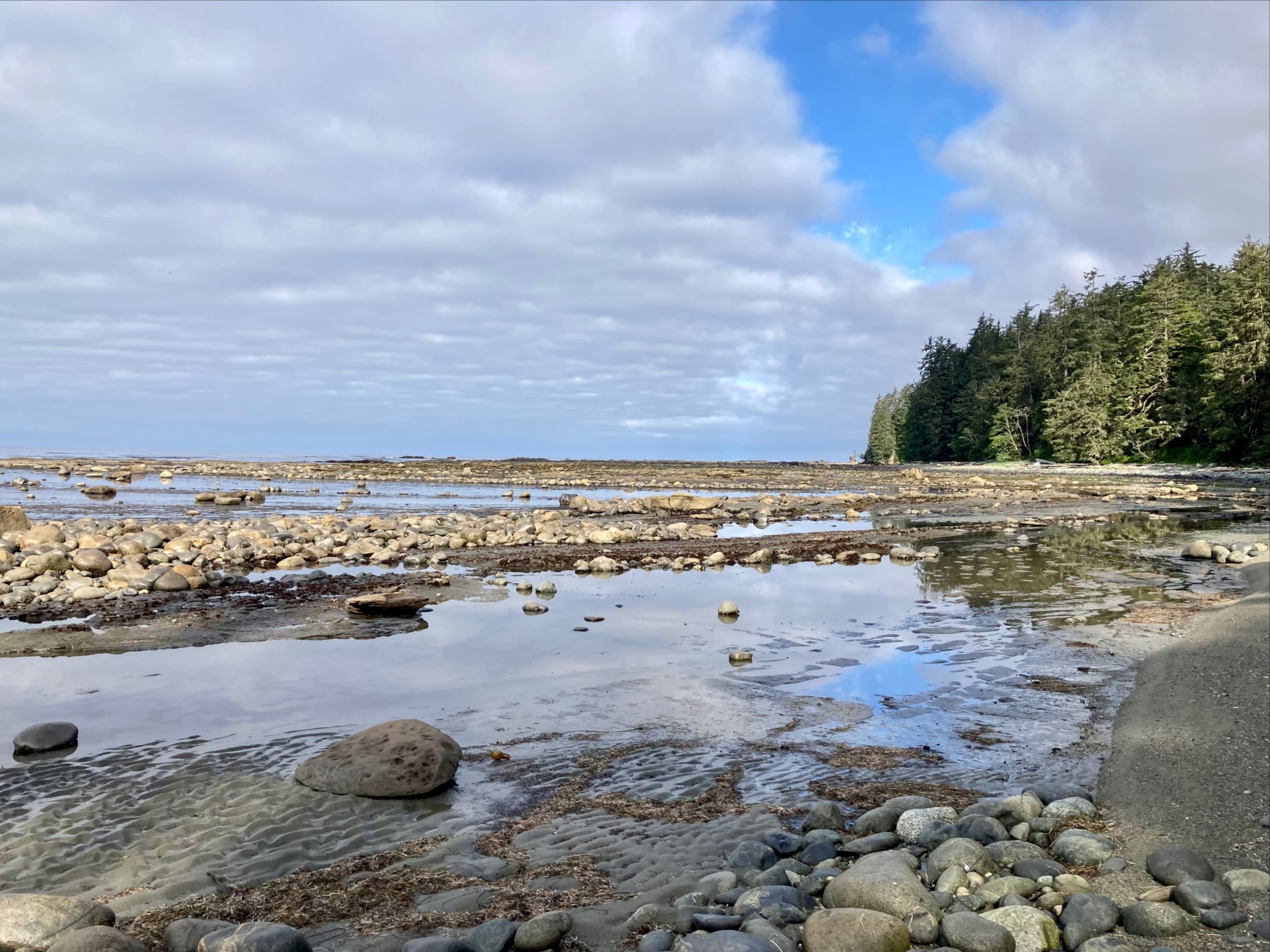
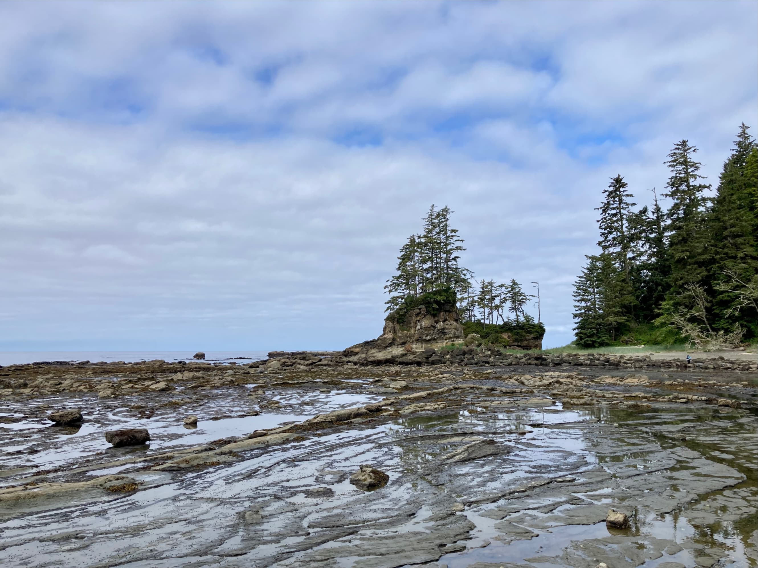
Beyond Cullite Creek we came to an area where the trees thinned out and a white-coloured boardwalk went on for a long distance over somewhat stunted vegetation. This area is apparently usually a bog. However, it was absolutely dry when we passed though. Along the way we met a group of young men coming the other way. We exchanged greetings and information about what lay ahead for each group. Most importantly, they told us that Nytom (the burger hut) at Carmanah Point and the Crab Shack at Nitinaht Narrows were both open. After the last 3 days of exertion, the thought of real food and cold beer helped keep my feet moving. We carried on, eventually reaching the spectacular suspension bridge over Logan Creek. A short time later we arrived at the Gordon Creek campsite.


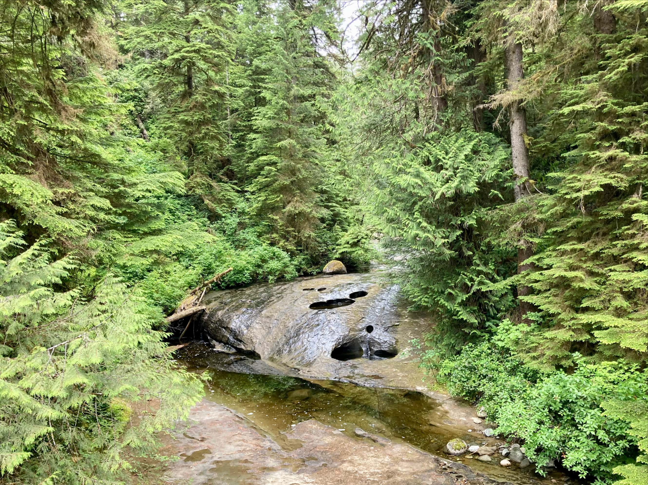
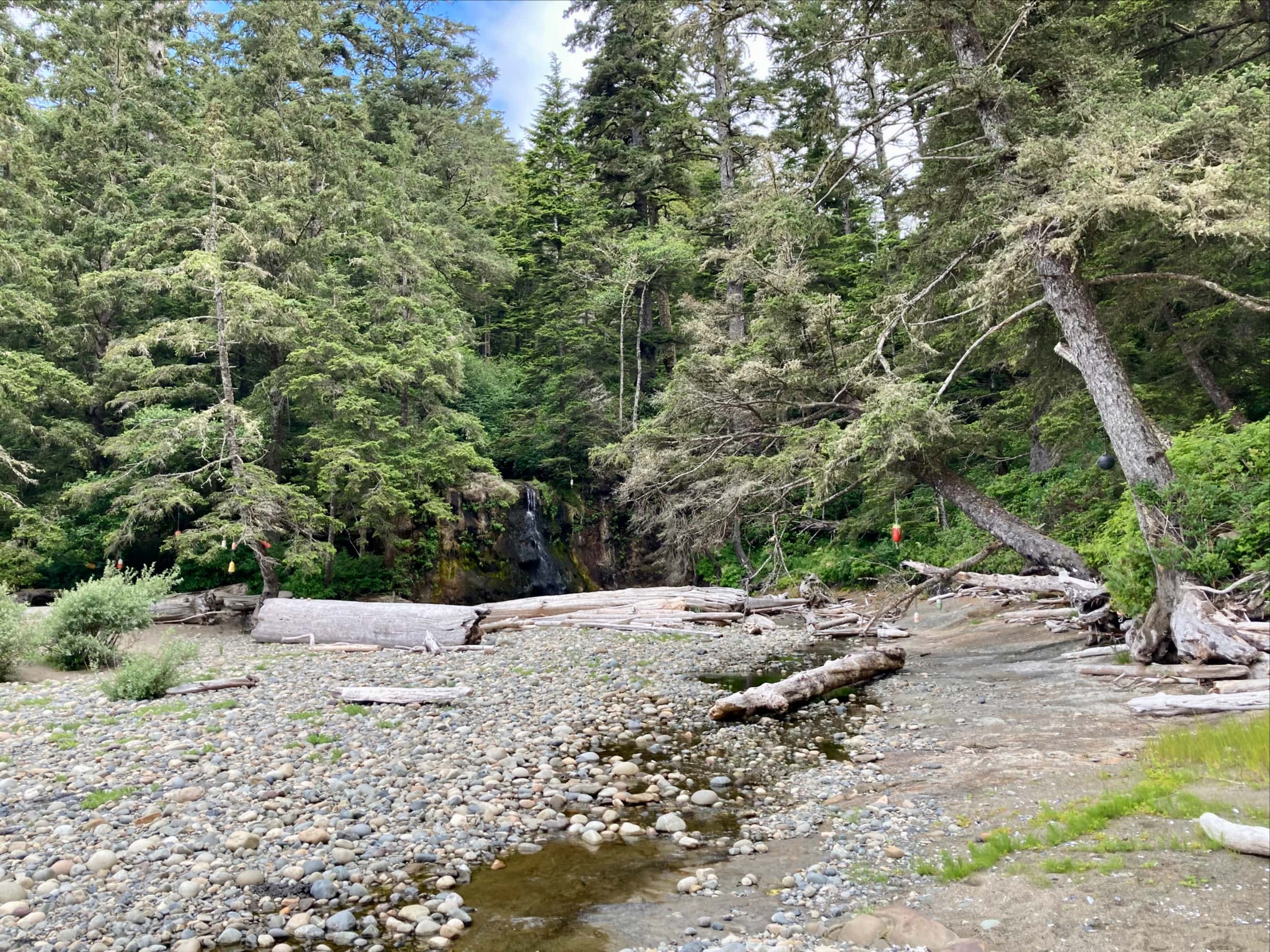
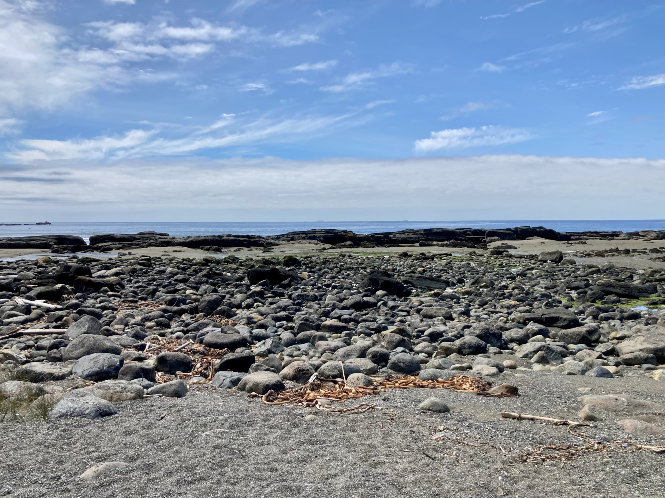
Walbran Creek was a very spacious campsite. A large, cold pool sat at the mouth of the creek that some brave folks took a plunge into. I wanted to keep my bandages dry so I had to skip out on swimming. A little upstream of there was a decent place to get drinking water. It wasn’t sunny, but it was warm so we had a chance to dry out some gear. At our evening meeting, we looked ahead to day 4. We were looking forward to it. At this point we’d left the most strenuous parts of the trail behind, and the tides were favourable for us to make the entire trip to Cribs Creek on the beach.

Day 4: Walbran Creek to Cribs Creek
Day 4 was planned out as our easy day, and that’s what it turned out to be. We got started relatively late, around 0800, and still reached the next camp by roughly 1300. Once everyone was packed up, Steve and I went through our bandage-changing routine then we were on our way. By this point we’d gotten to know Danielle and Morgan, close friends that had taken up hiking during the pandemic and who were moving along at the same pace as us. Danielle is a nurse and she kindly checked in on me to see if I needed any help with my hand. Andrea was also still moving along in sync with us.

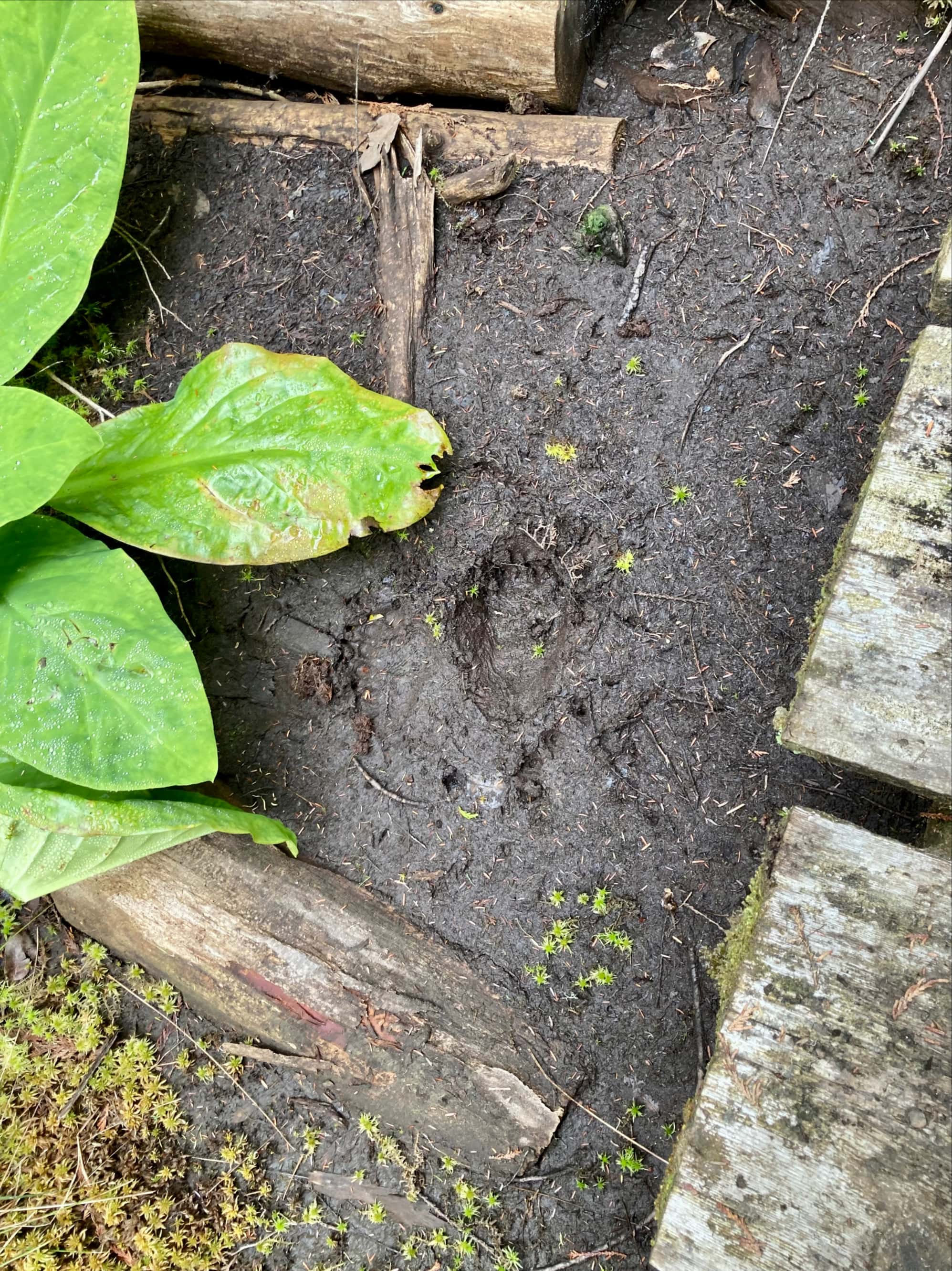
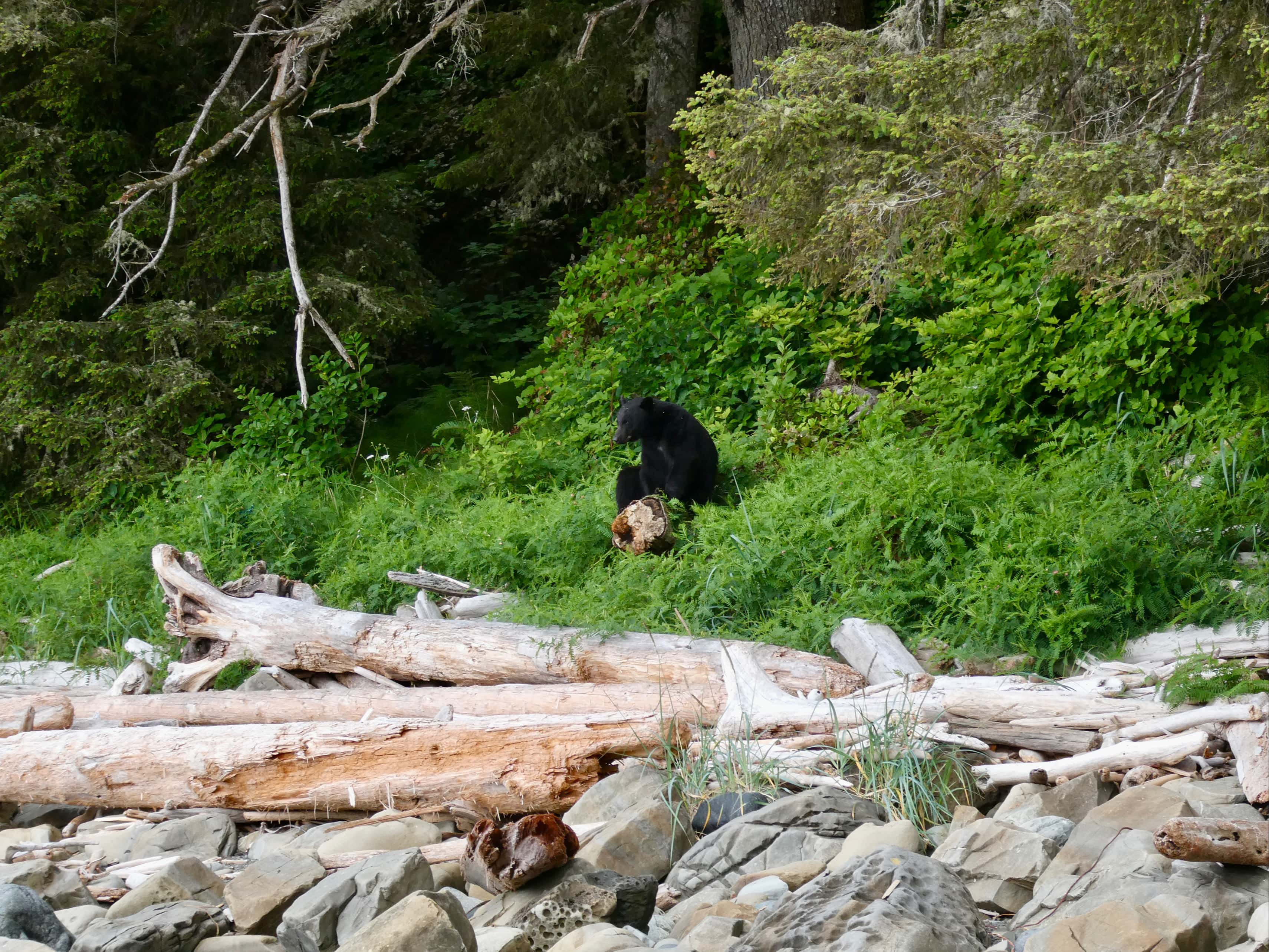
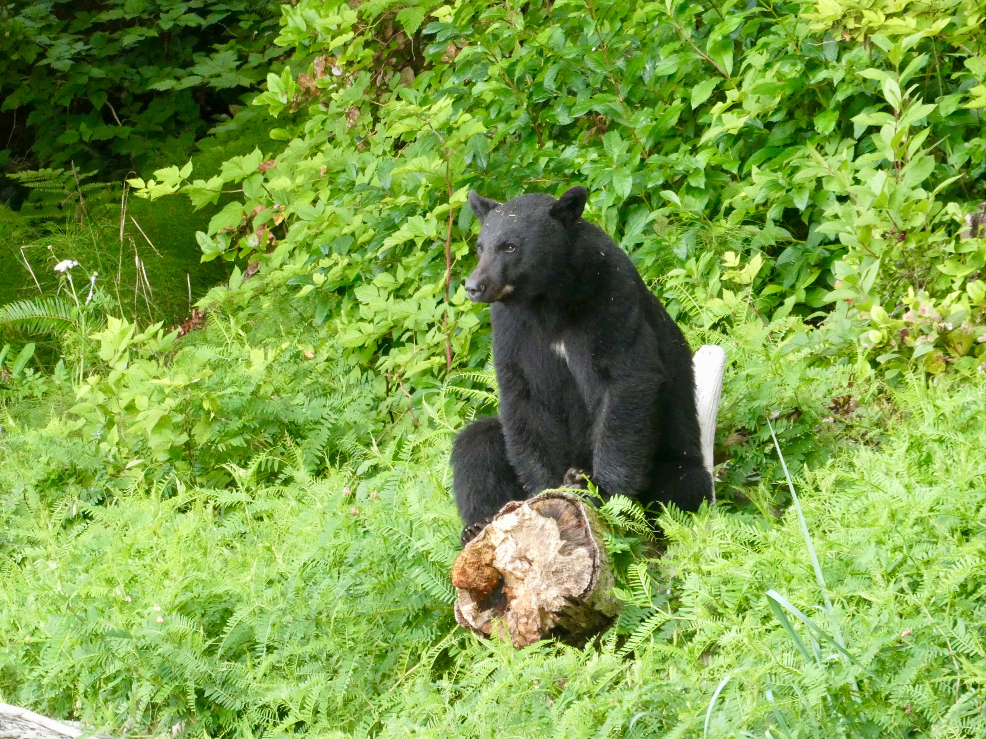
Within about half an hour of setting out, we came across a black bear perched on the end of a log at the edge of the trees. He seemed to be resting and watching the world go by. Anna, who was in the lead, walked by without noticing him. I happened to look up and there he was. I held up a hand and warned the group. Once everyone had their eyes on the bear we slowly moved past at a safe distance. I got my camera out as we did this.
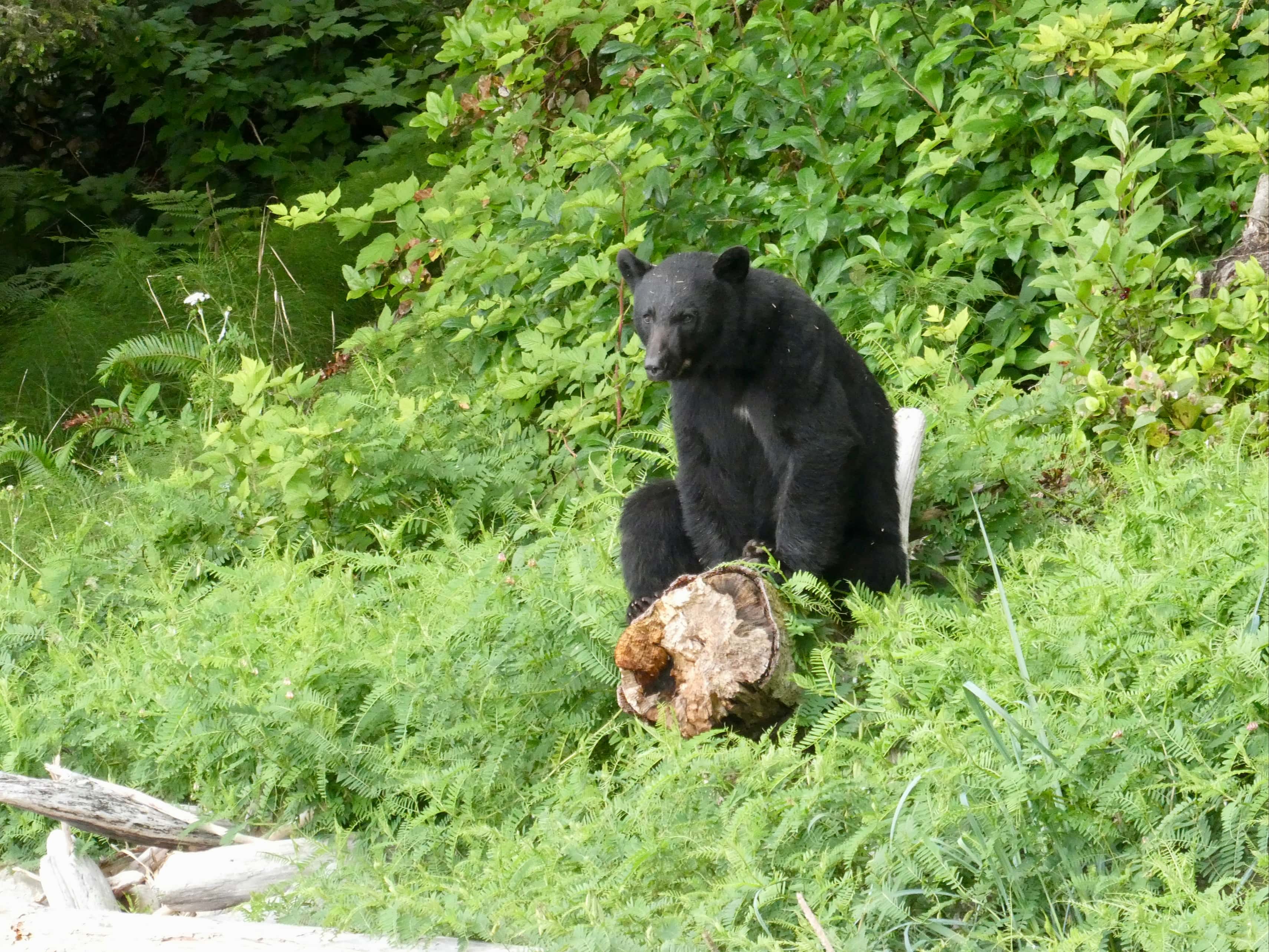
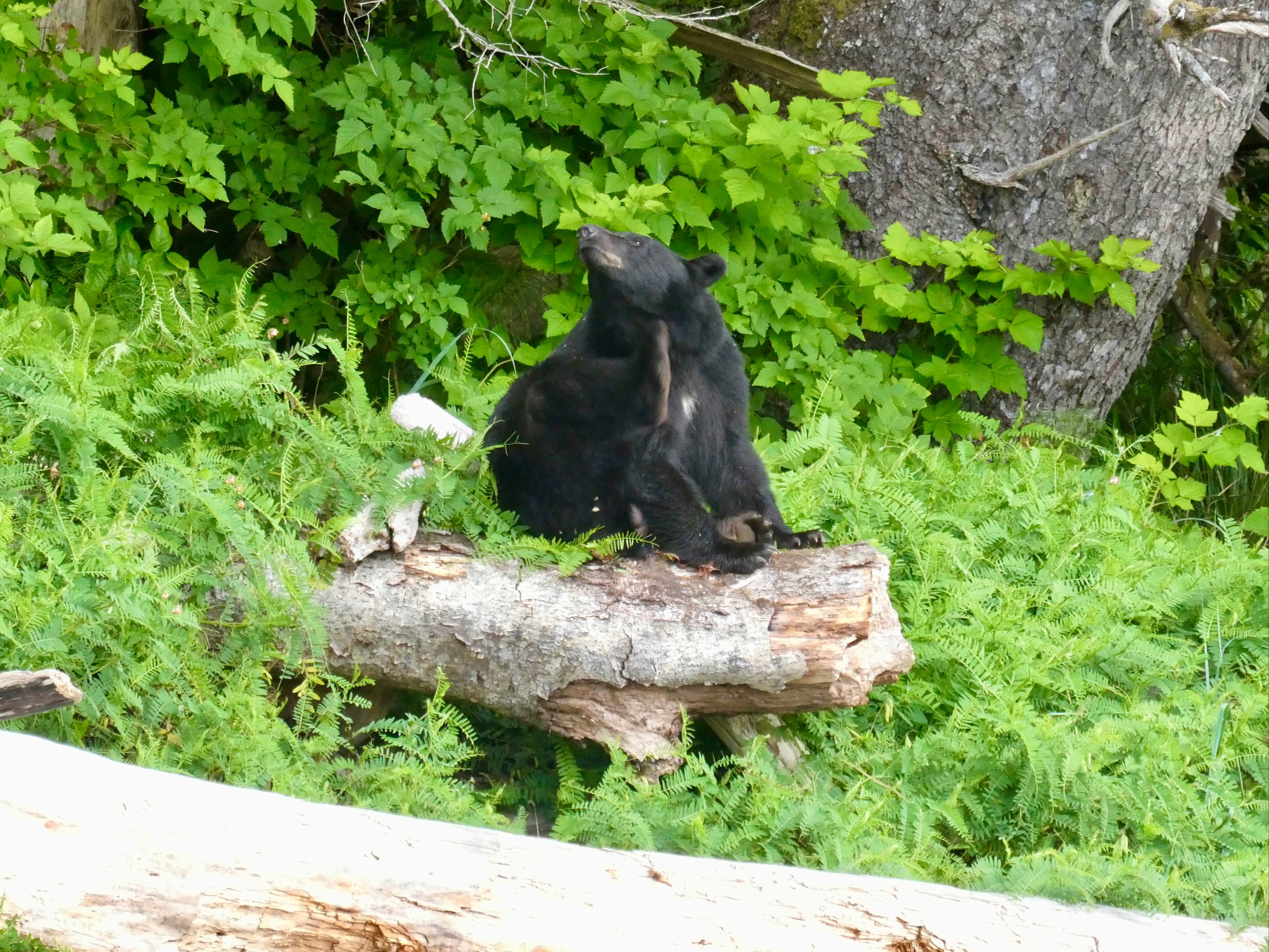
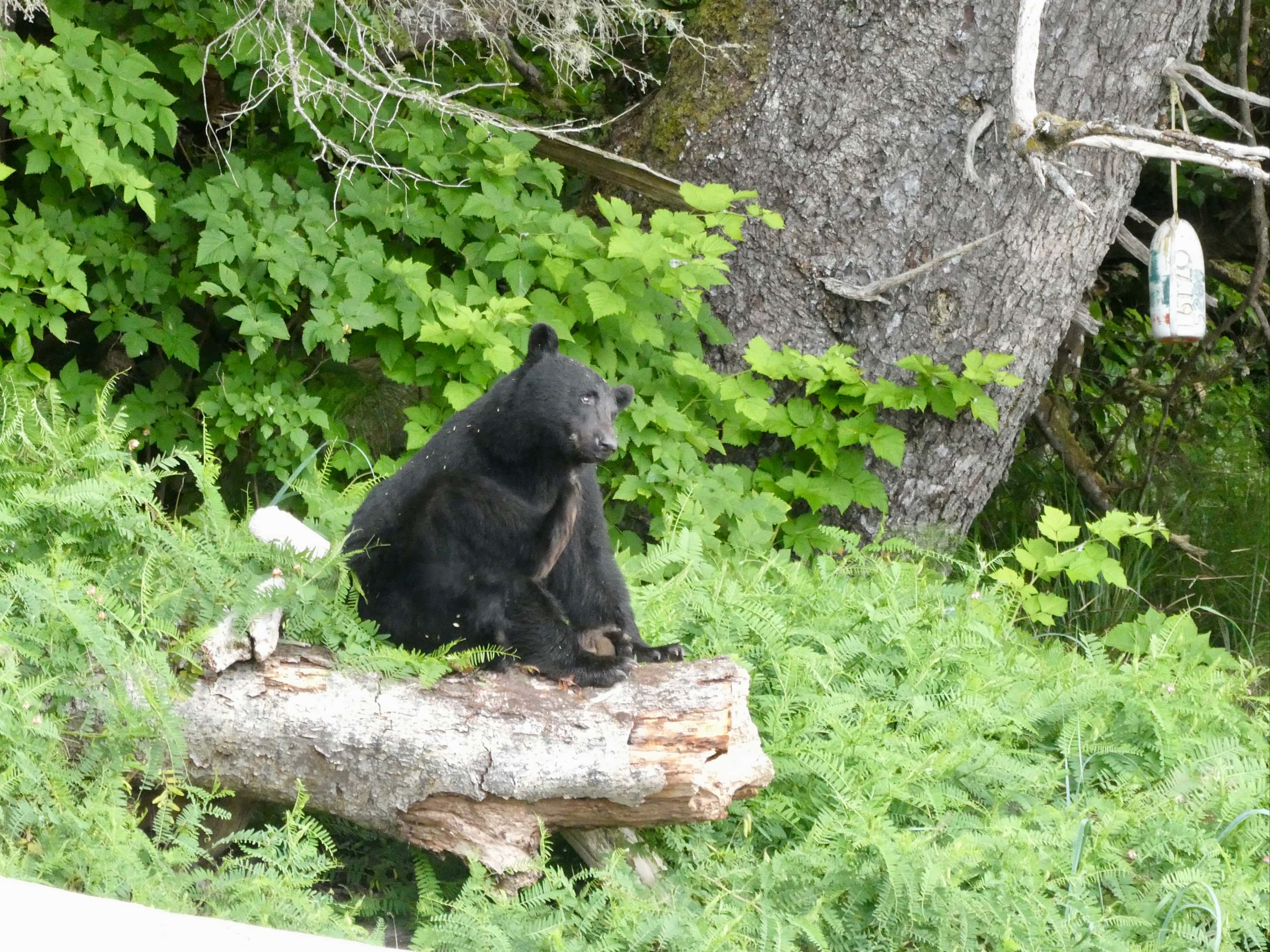

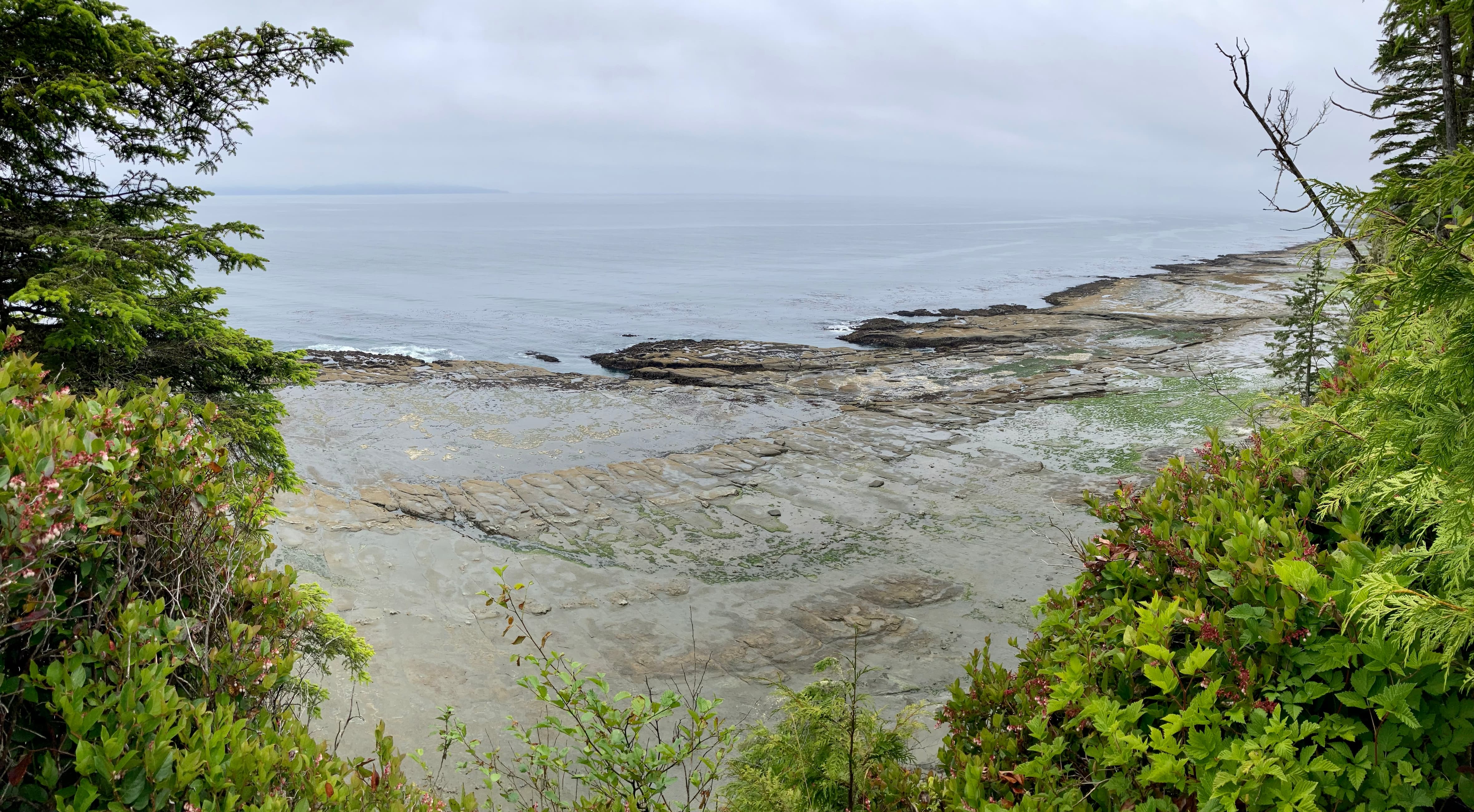
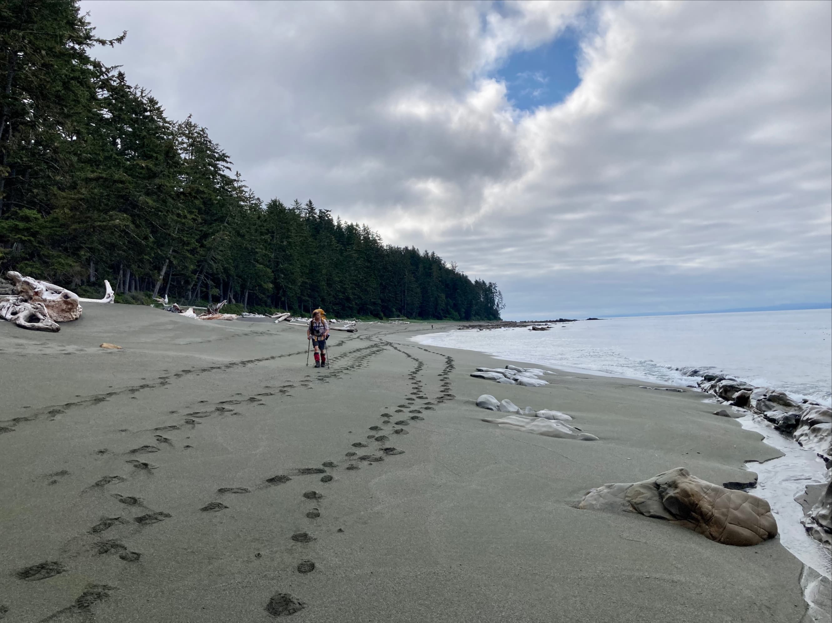
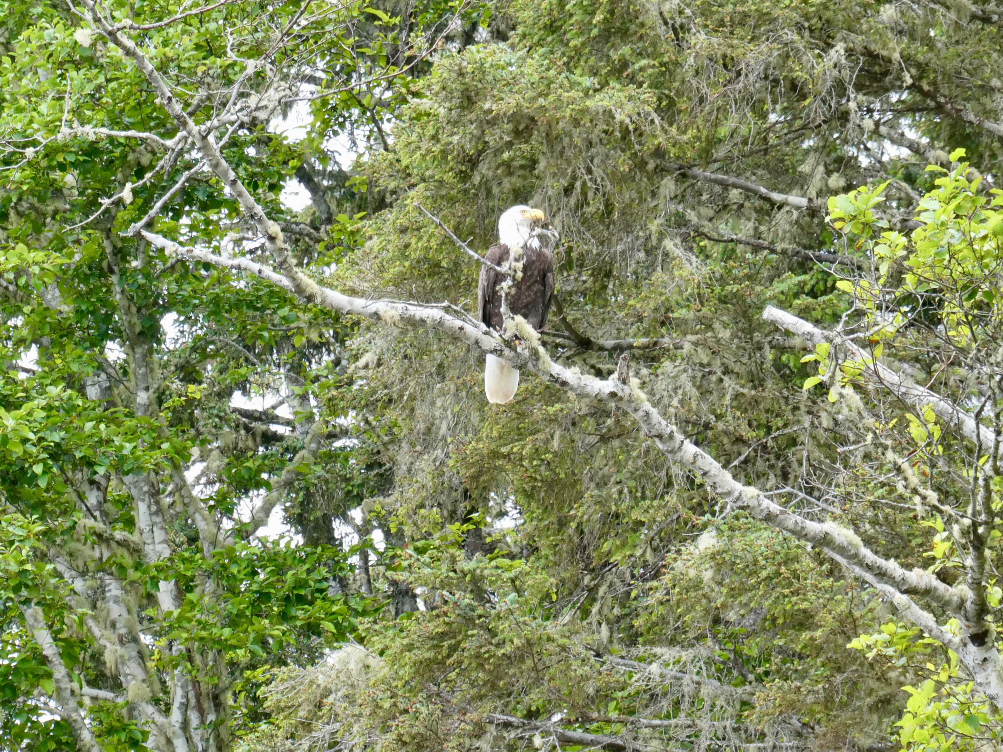
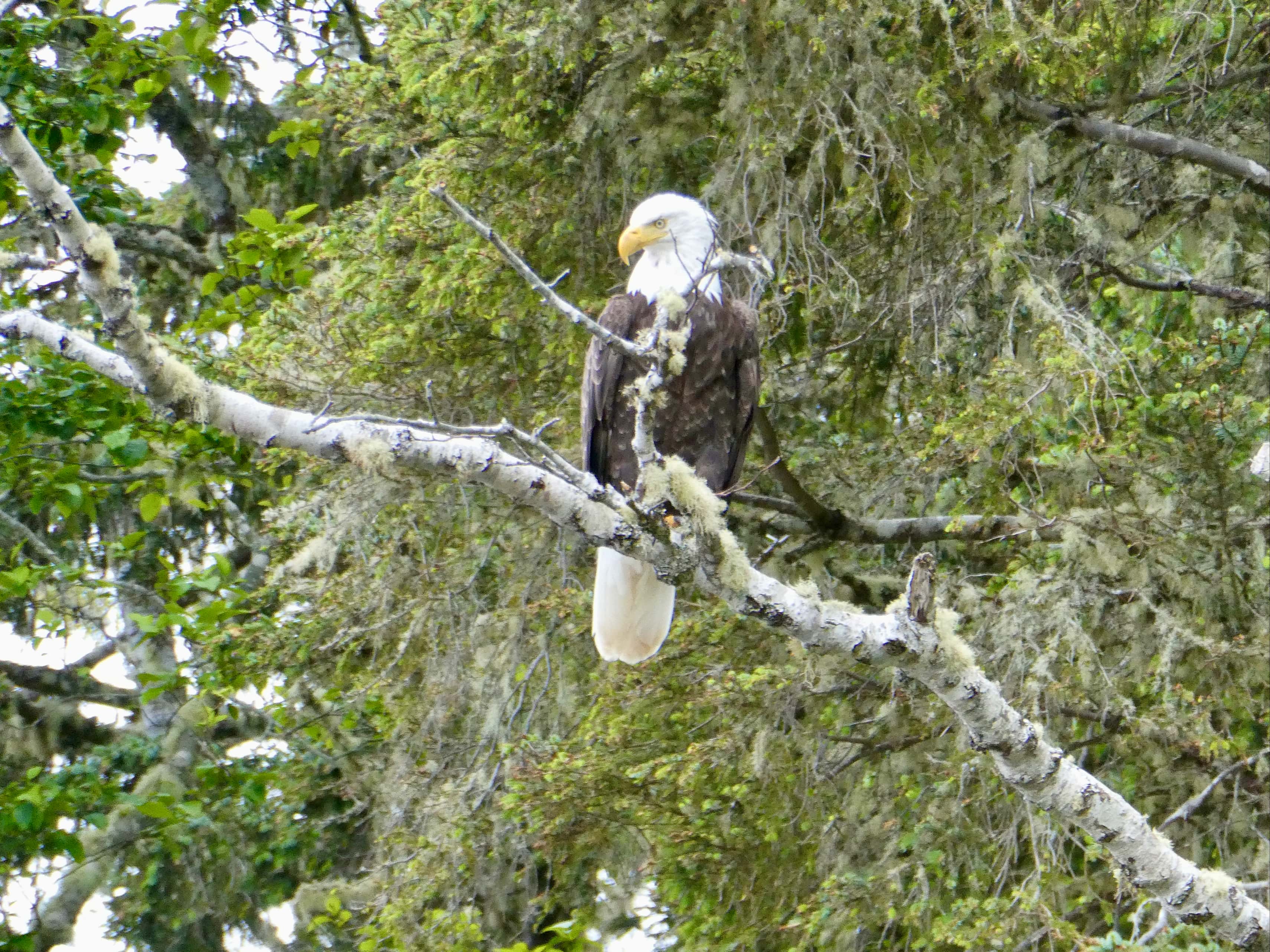
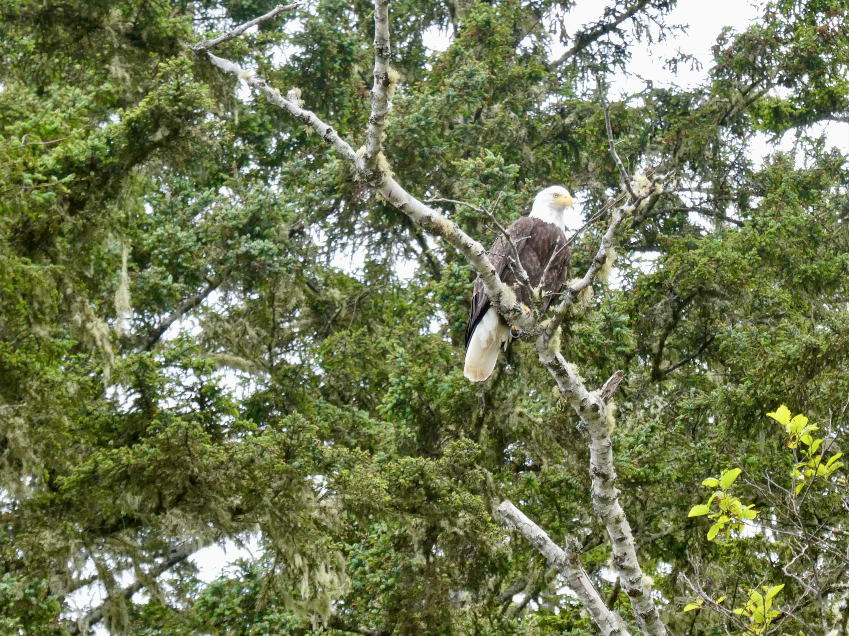
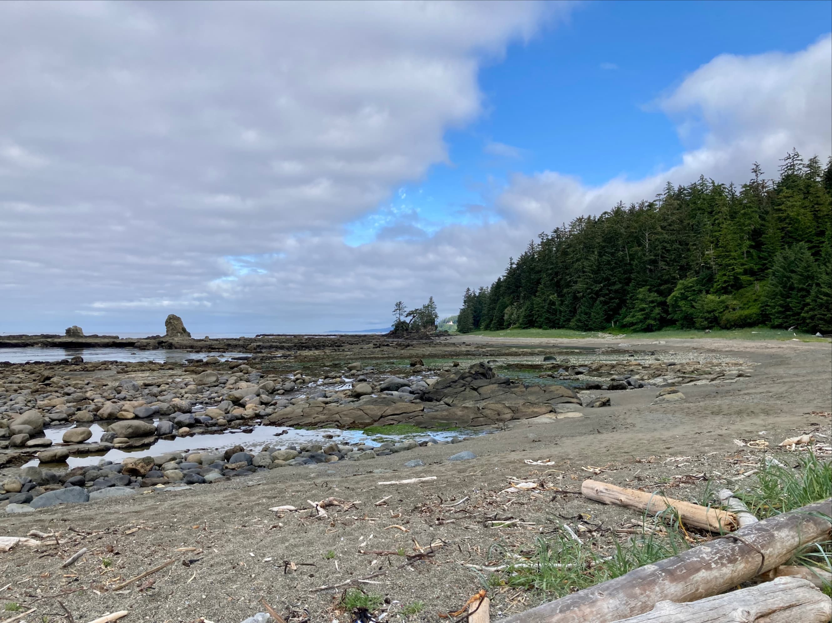
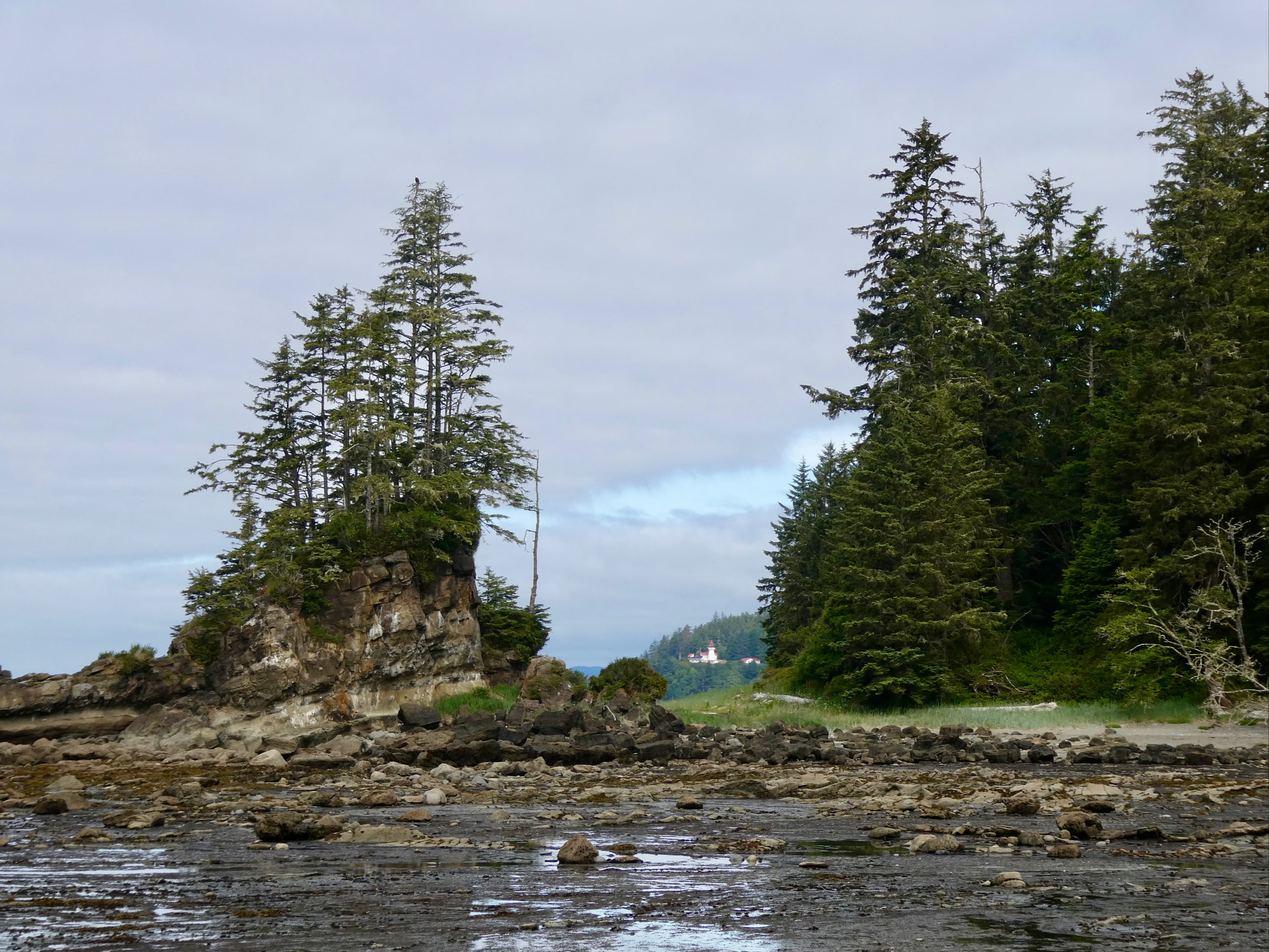
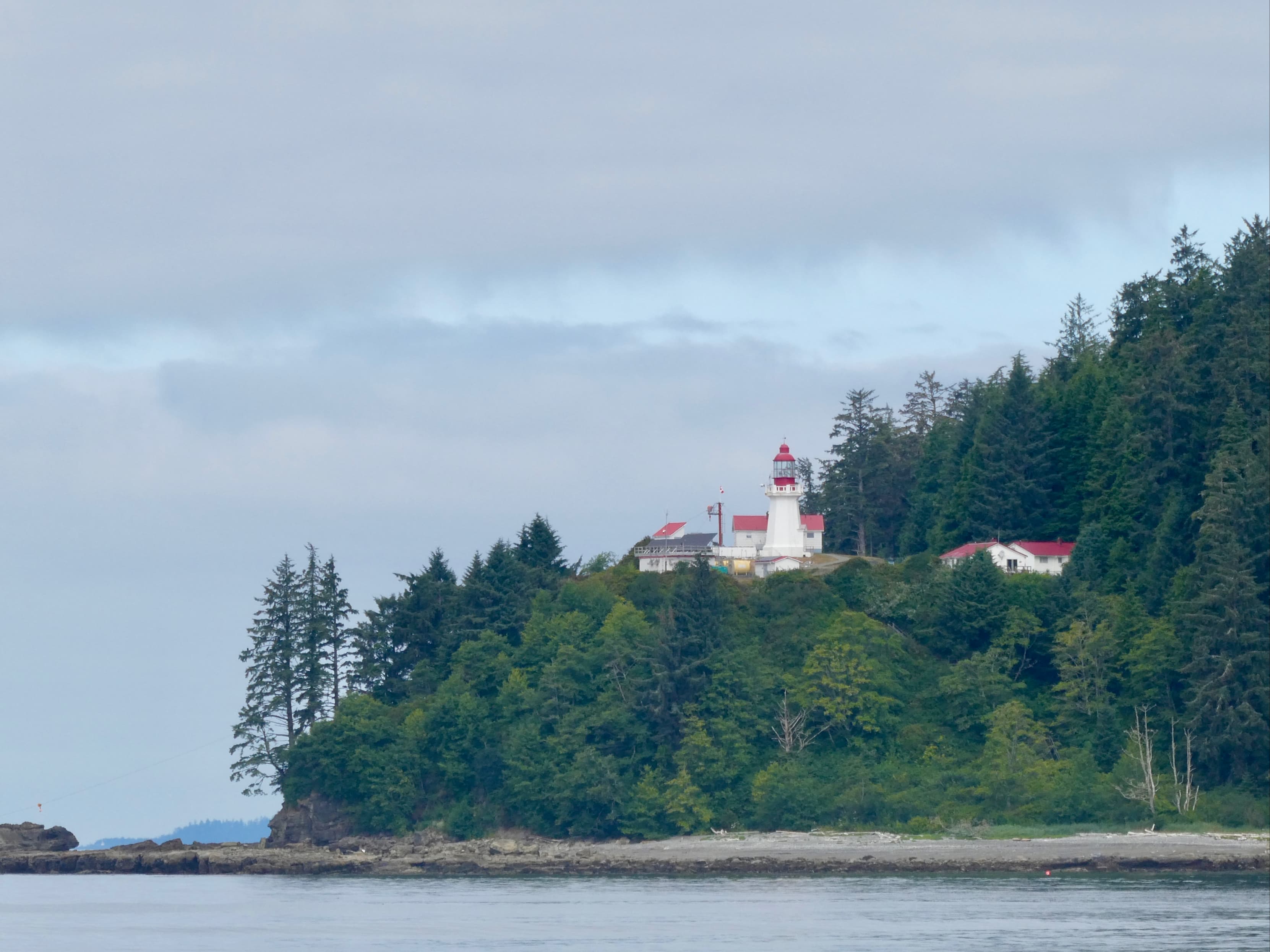
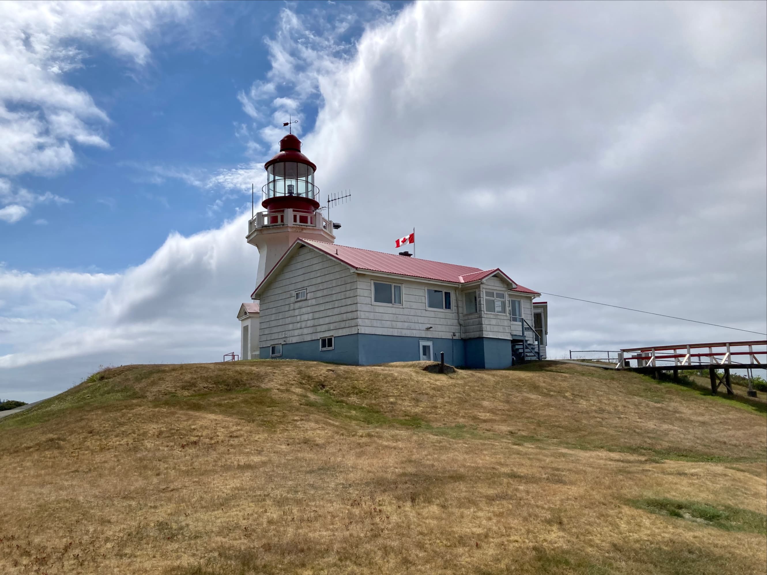
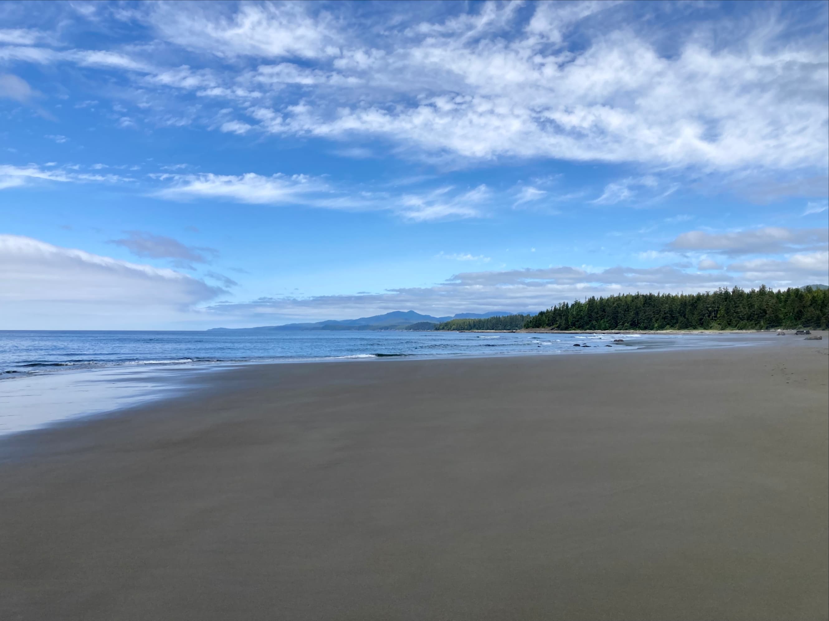
It turned out that the big lazy bear was just the first in many excellent wildlife sightings that day. We would see several bald eagles, a couple of otters, sea lions and whales during our hike and once we got into camp. We enjoyed easy beach travel past Bonilla Point, and the Bonilla and Carmanah campsites. The Carmanah Point lighthouse came into view as we approached Bonilla Point, red and white paint shining when the sun broke through the clouds.
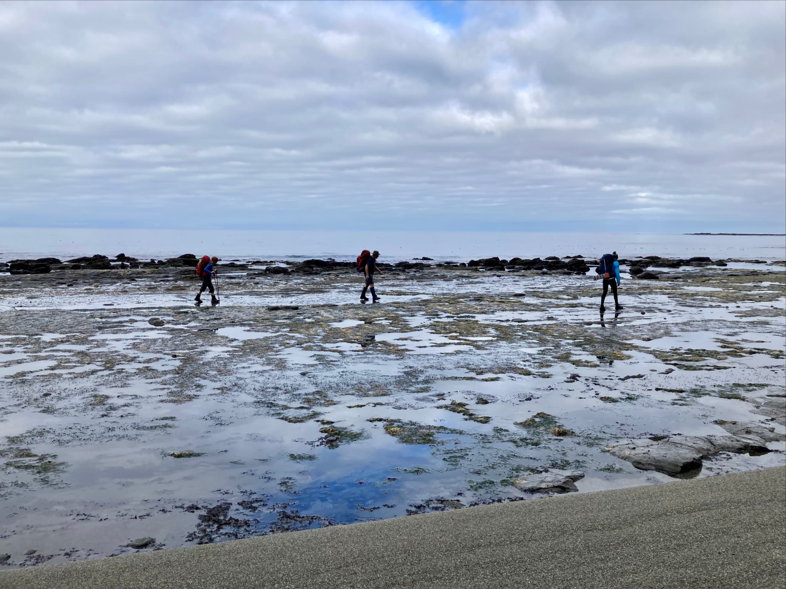


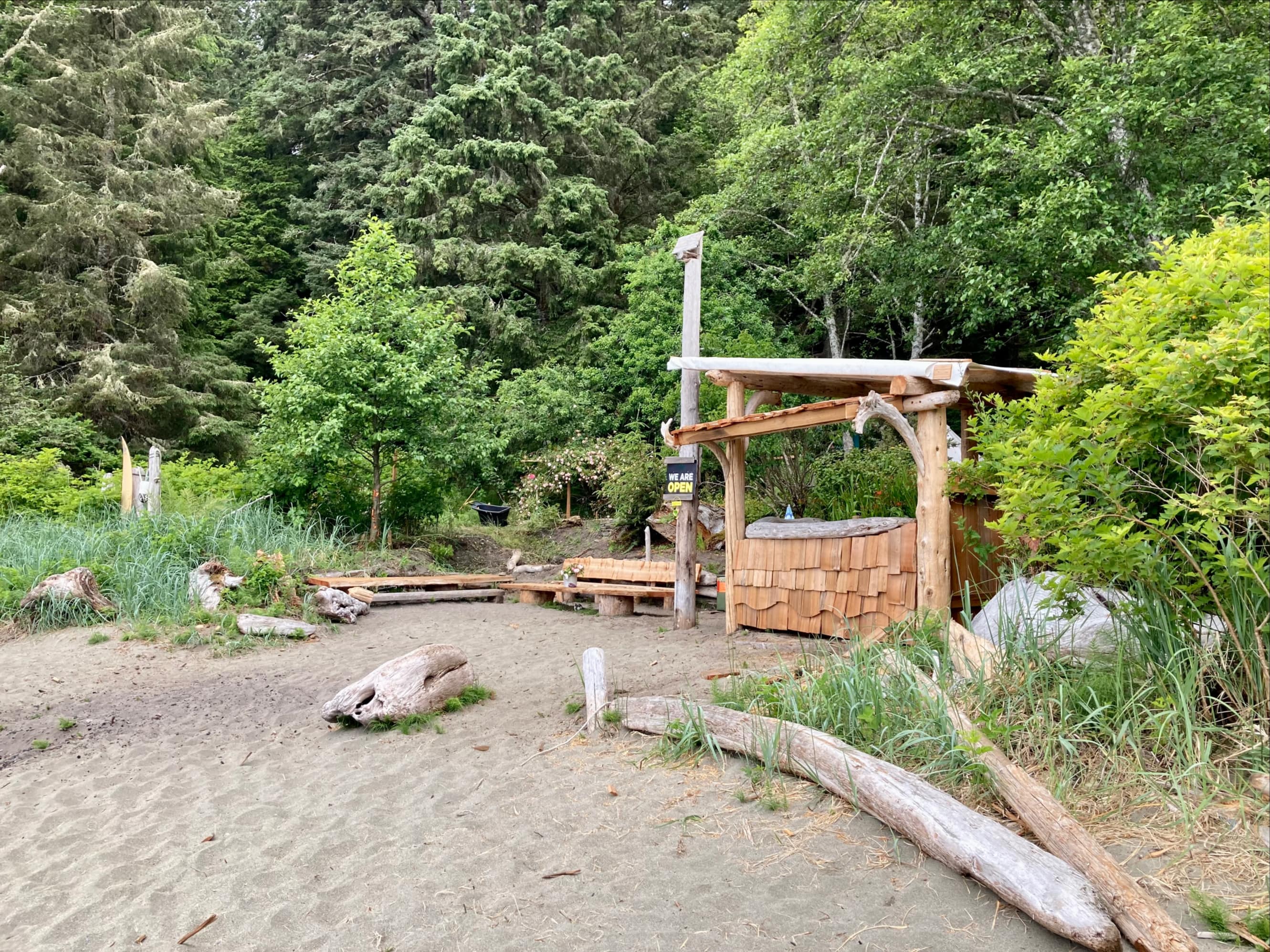
The beach seemed busier as we approached Carmanah point. Several parties passed us heading south. It was nice to chat a bit to exchange pleasantries and information. Before we got to the lighthouse, we stopped at Nytom. For many years there was a burger shack called Chez Monique’s operated by Monique Knighton on this spot. If you read older books or blog posts it’s frequently mentioned. Unfortunately, Monique and her husband, Peter, passed away a few years ago. However, new owners have got it up and running again this year. It was a very pleasant rest stop. It was early in the day so I didn’t get a burger, but I happily bought and devoured an Oh Henry bar.
While the rest of the group rested their legs, I made my way up to the lighthouse to check out the grounds and to see if the keeper had a bit more gauze that I could use. Once I found the lighthouse keeper she happily obliged.


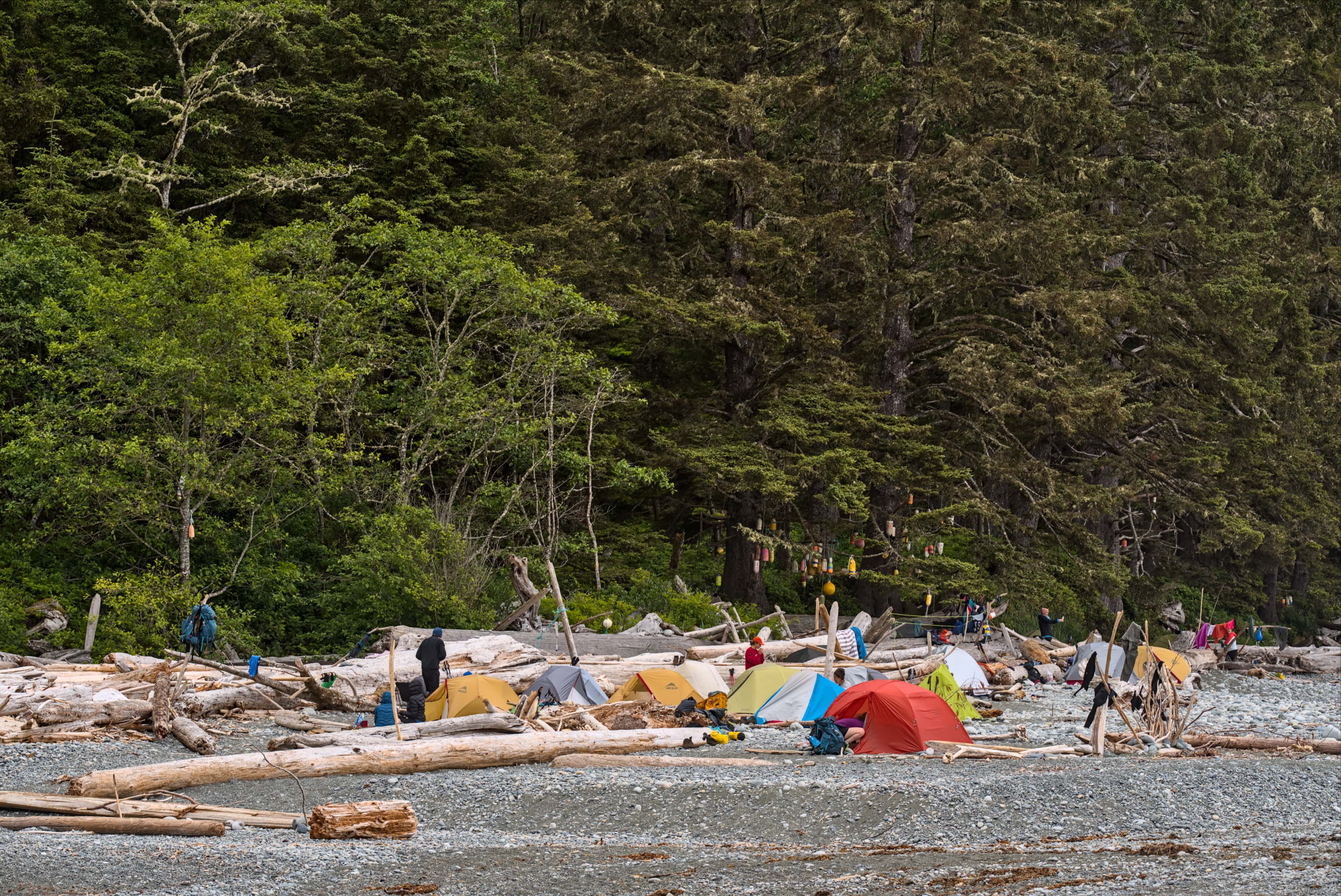
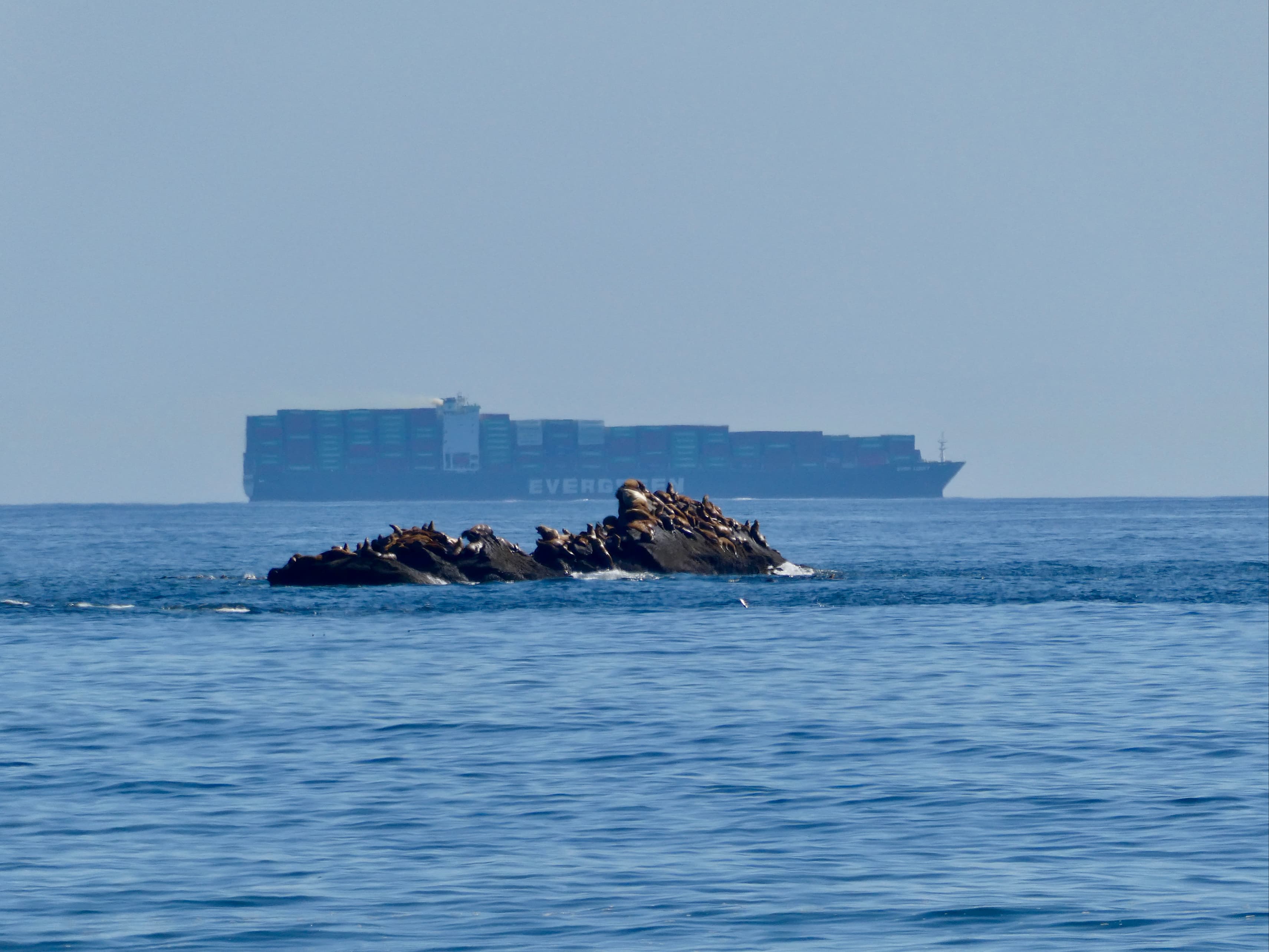
After visiting the lighthouse I joined up with my crew and we got back down onto the beach. As we walked the last short distance to our campsite we heard, then smelled, then finally saw, the large group of sea lions that live in the area. There were dozens of them up on a broad rock, croaking or roaring almost nonstop. The beach itself was lovely, and by that time the clouds had broken up. The rest of our hike and our evening in camp at Cribs Creek were sunny and pleasant.


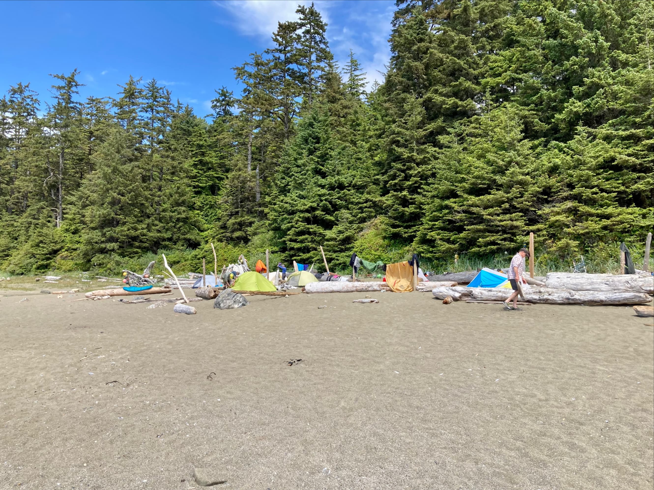
We were very lucky as we hadn’t been rained on during the trip to that point. However, the mornings were damp and misty. We took the opportunity to string up some drying lines and hang up tent flies and sleeping bags. I took advantage of the free time in camp to air out my wound a bit. Taking another good look at it in the daylight, I could see that there was some more tissue that had to come off. I had some good quality tweezers with me. I flame-sterilized them then did a quick wound debridement. All-in-all, it wasn’t looking bad. I wrapped it back up and enjoyed a very pleasant day exploring the area.
That evening we once again had our suppers then discussed the plan for the next day. Day 4 had been a pleasant day and a chance to re-energize. Day 5 was going to be a bigger day, covering about 16 km on the official map. We’d be making it to Nitinaht Narrows, which would be our 2nd ferry ride of the trek. The Crab Shack, with its promise of hot food and cold beer, was also at the Narrows. We agreed on an early start so we’d have plenty of time to take a food break and still make it to our next camp, Tsusiat Falls, at a reasonable time. We all crawled into our tents and were serenaded to sleep by the croaking roars of the sea lions.
Click here for the next post – West Coast Trail Part 3: Cribs Creek to Tsusiat Falls.

Wonderful stuff Par. 38 years ago I was there, but walking in the opposite direction. You’re making me nostalgic. Gotta go back before I’m dead.
LikeLiked by 1 person
I hope you get the chance! It’s only been 2 weeks and I already miss it.
LikeLike
Thanks Par for sharing your hike along the West Coast.
<
div>How’s your hand now?
Bal Boora
<
div dir=”ltr”>
<
blockquote type=”cite”>
LikeLike
It’s fine now.
LikeLike
It was so fun to read your reflections on our trip Par. Your attention to detail, pictures and storytelling make your blog so personable. Kathy
LikeLiked by 1 person
Thank you for the kind words, and thank you for reading!
LikeLike