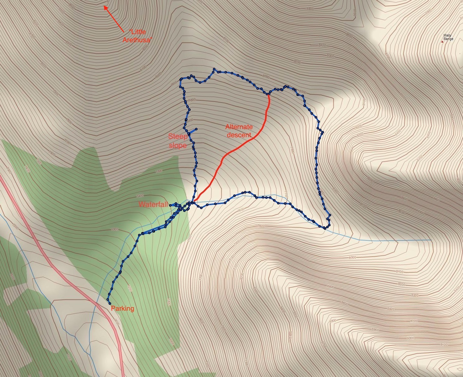
Topo map of the route. The pink map line is Hwy 40. Based on trip reports I had read, we hiked the route clockwise so we’d deal with the steep slope on ascent rather than descent. As described below, a counterclockwise direction with use of the alternate descent route may be the best way of approaching this trip.
There are 3 cirques clustered around the Highwood Pass. The most famous, Ptarmigan Cirque, is justifiably popular. Pocaterra Cirque is fairly well known, though nowhere near as big a draw as its neighbour across the highway. The third, Arethusa Cirque, seems to be the least well-known. Nevertheless it is easy to access and propels hikers into amazing mountain scenery with a minimum of climbing. Nugara features it in Family Walks and Hikes in the Canadian Rockies Vol 2 and I agree that it’s a good objective for motivated kids. My youngest is now 9, and she managed the ascent with a minimum of fuss. She ran out of gas before we completed the loop, though, so she and my wife took an alternate descent route that worked out quite nicely.
Access is from Hwy 40 in K-Country. Note that there’s a seasonal closure of this highway from December 15 to June 1 every year. The trailhead is not signed, but is easily found with reference to the extremely popular (and crowded) parking lot for Ptarmigan Cirque. About 1.4 km south of Ptarmigan Cirque’s parking lot there’s an unsigned pull-out to a large open area to the northeast of the highway – click here for the Google Map. We found this easily enough but did notice that the map in Nugara’s guidebook seems to be wrong – it indicates the parking area is west of Hwy 40 instead of east. There’s no signage here and no facilities. If anyone needs to make a pit-stop it would be reasonable to use the facilities at Ptarmigan Cirque’s parking area before proceeding here.
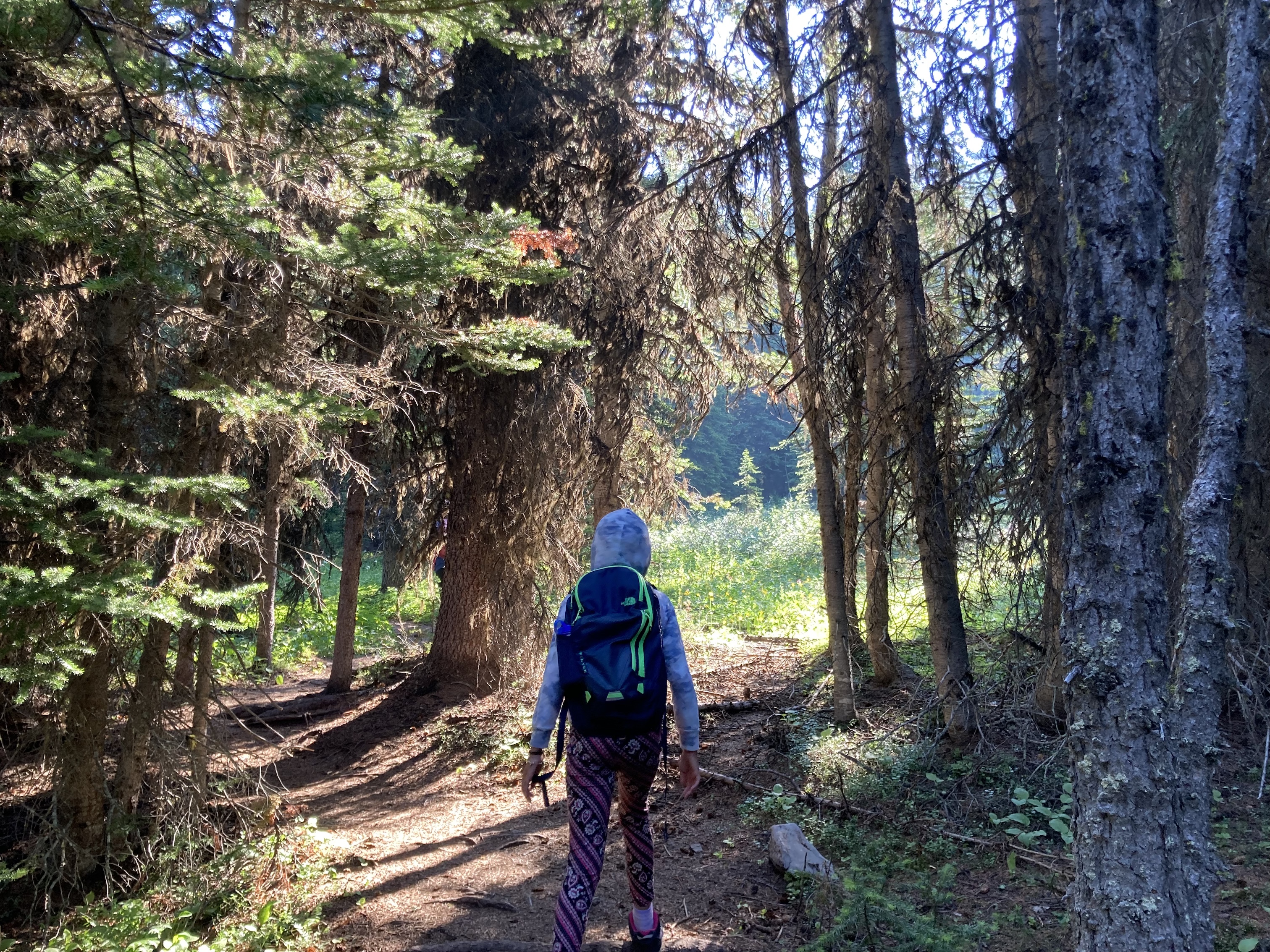
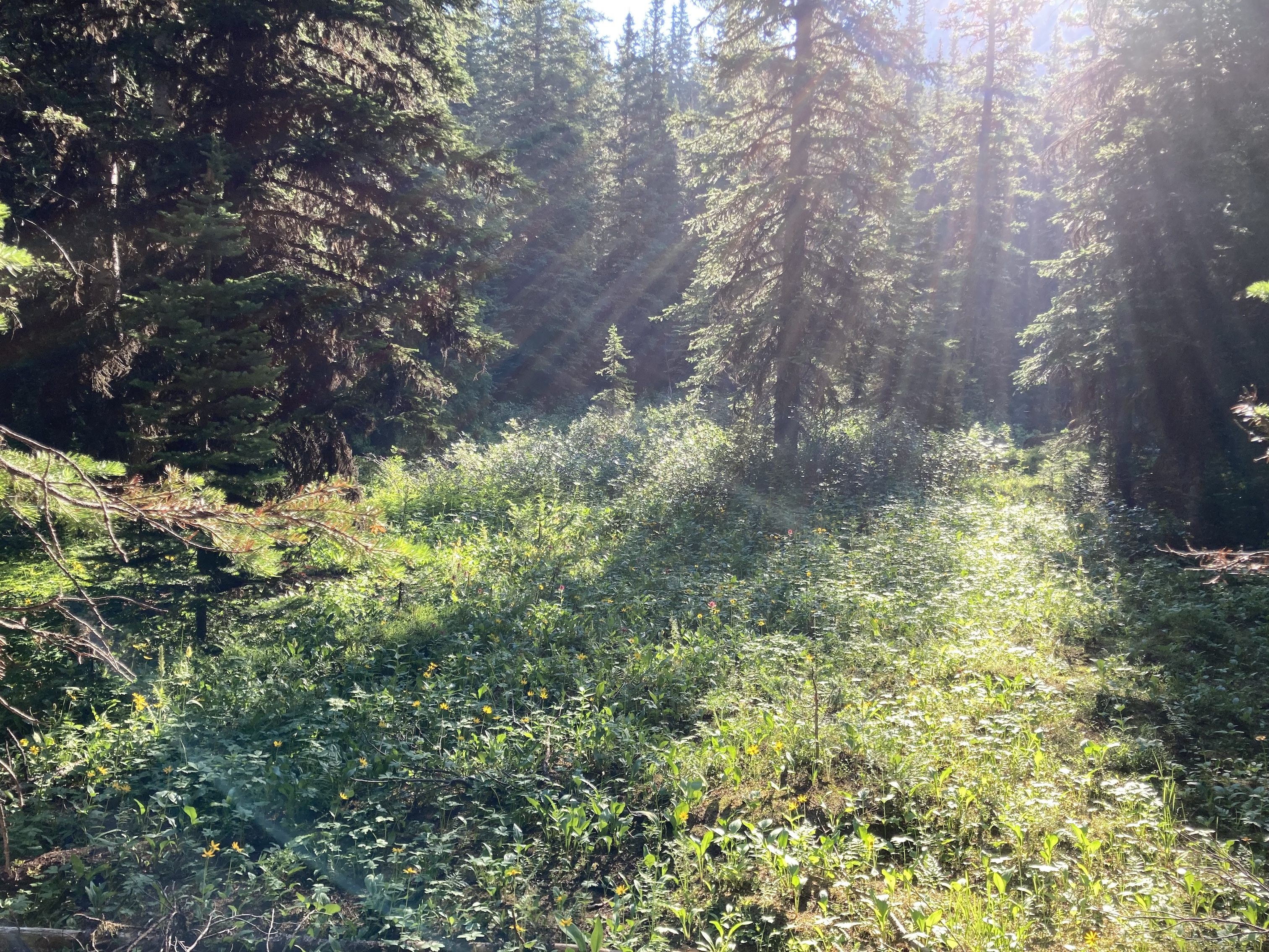
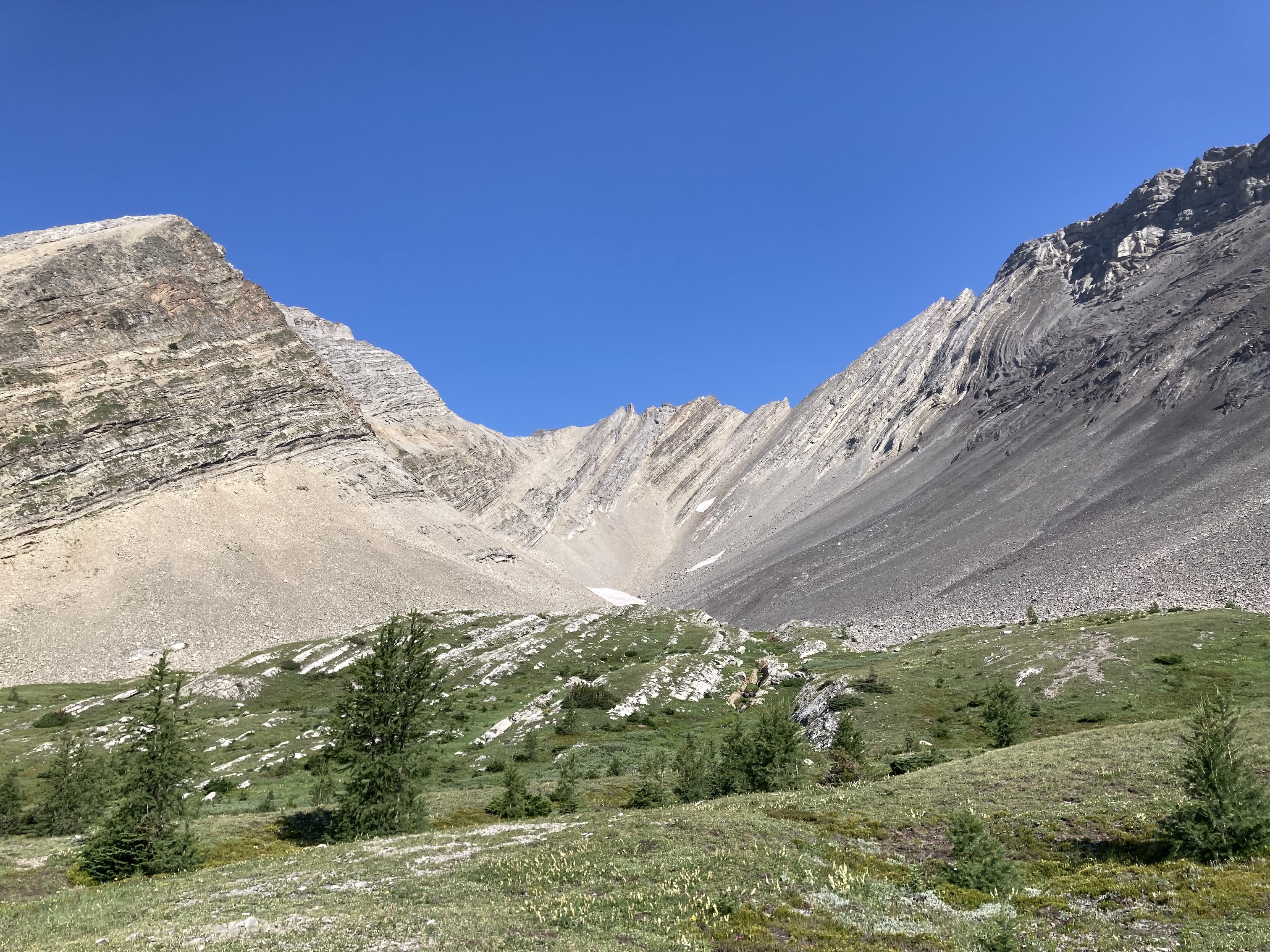
The trail to the cirque sets off from the north end of the open parking area into the trees. It’s very easy to follow and we enjoyed looking at the wildflowers as we ascended. Shortly before the trail breaks from the trees it passes a small waterfall. The trail then brings you into the cirque next to a creek above the falls. At this point the trail branches. Nugara recommends not crossing the creek and proceeding in a counterclockwise loop (or out-and back). Other reports I had read described a rather steep and potentially difficult slope they had encountered on the western part of the loop – they suggested going clockwise so as to ascend this rather then deal with a tricky descent. We decided to go clockwise.
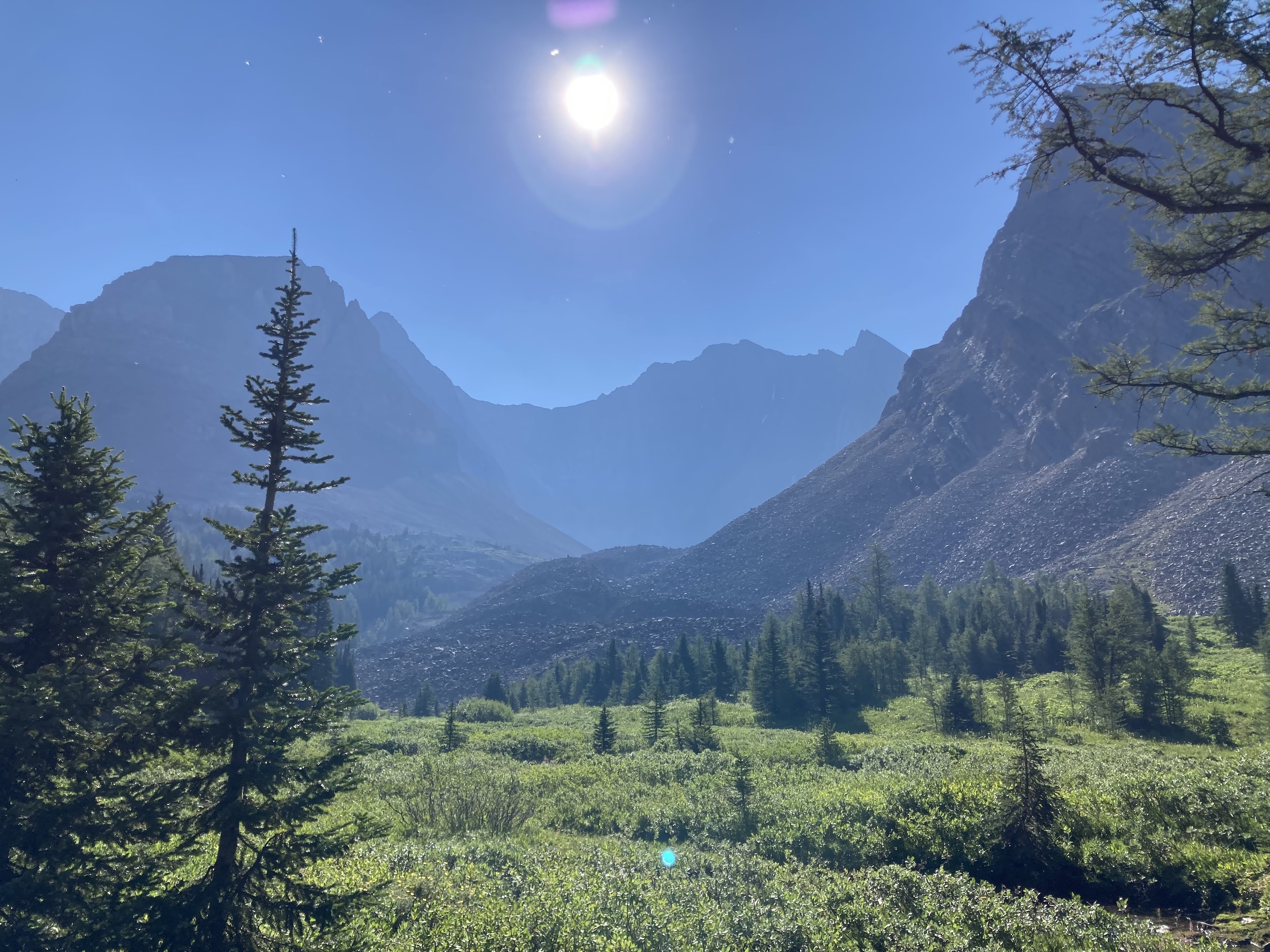
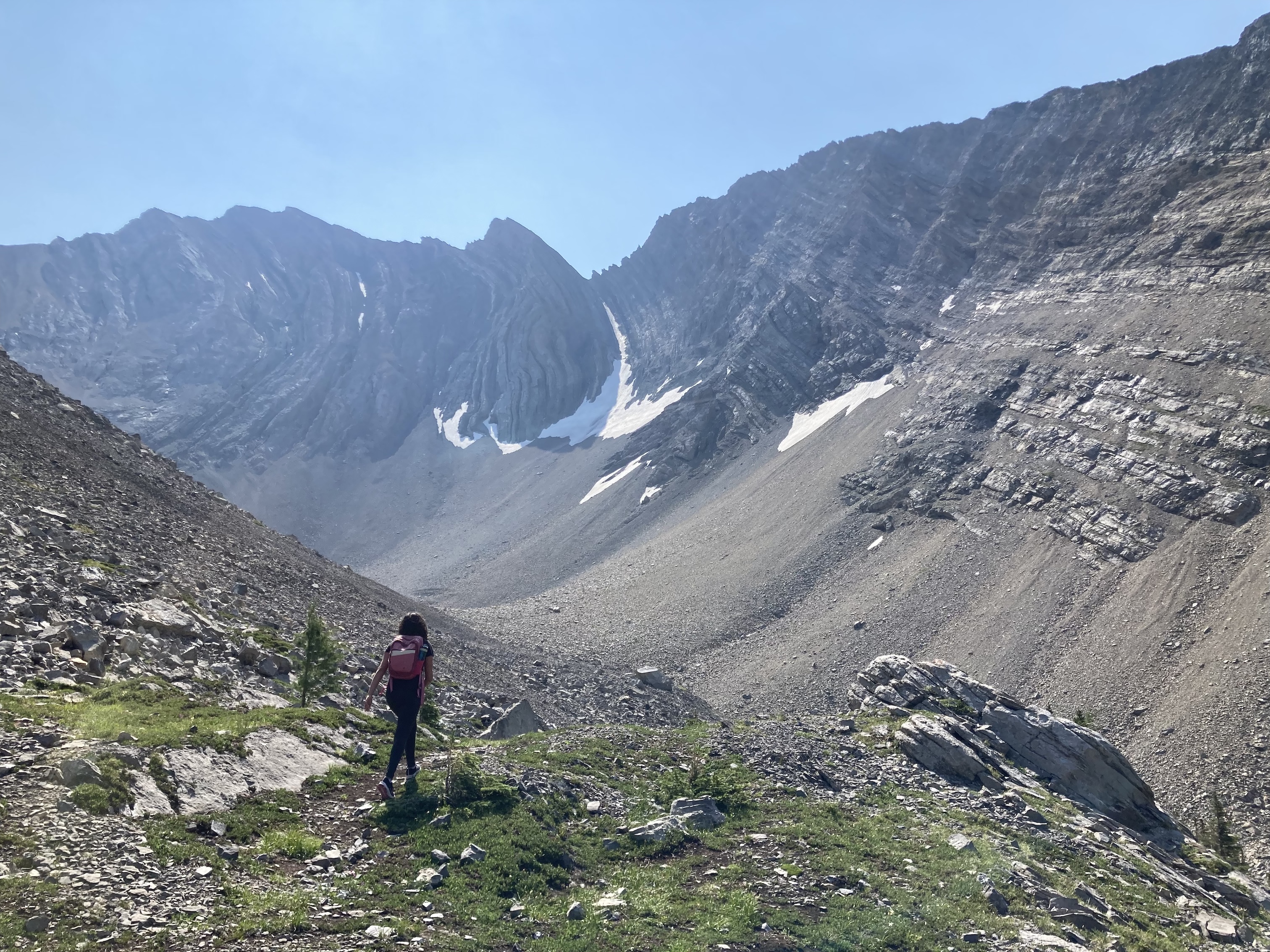
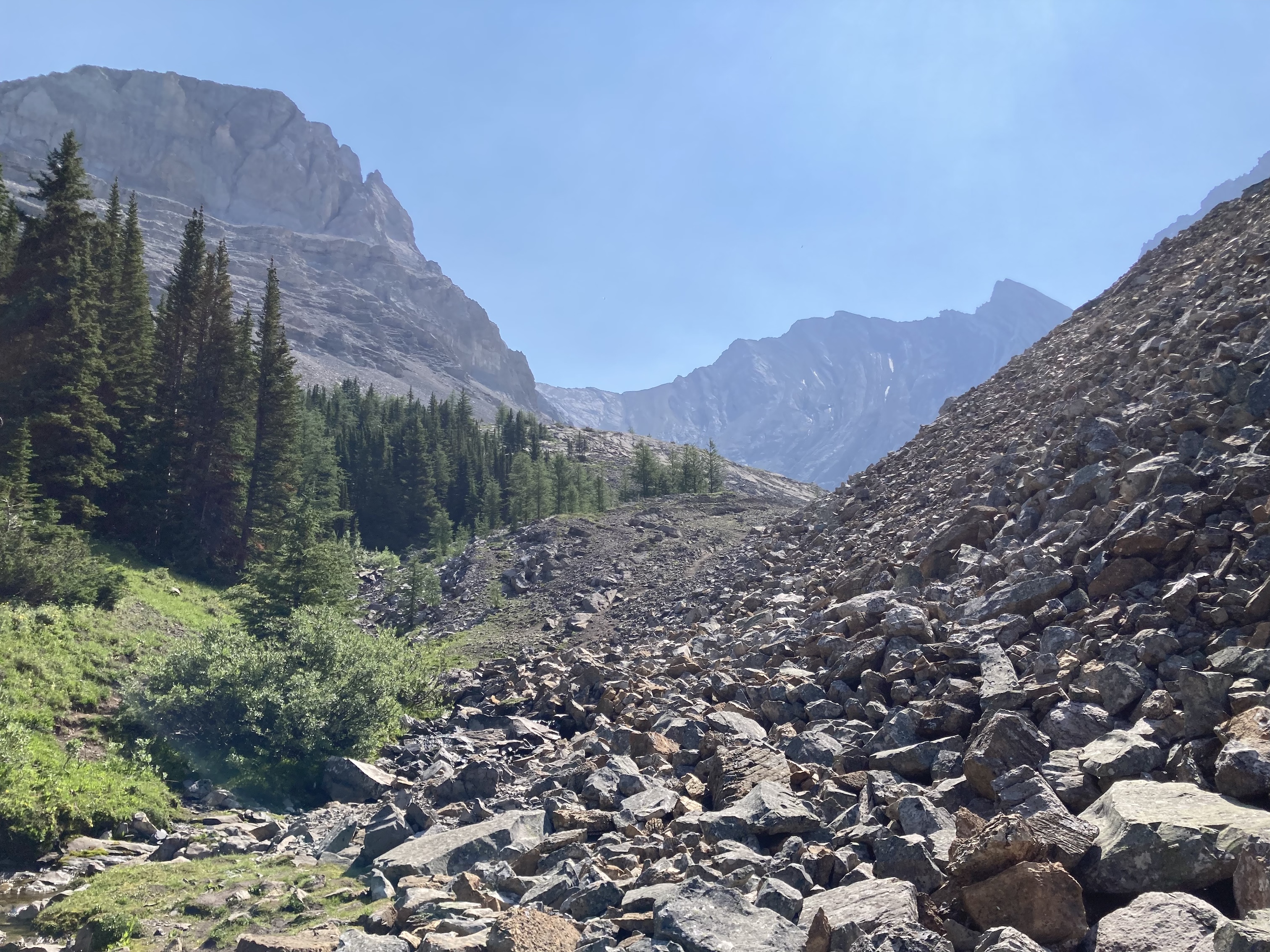
We crossed the creek and immediately encountered another fork. We went left – the right fork was a shortcut trail through the middle of the cirque that some of us ended up using to descend. After going left we were in the trees for a short time, then we encountered the sustained, steep climb. It wasn’t awful, but I’m glad we were ascending rather than descending it because it was a fairly smooth dirt trail without too much for our boots to grip. As we ascended, we were finally treated to steadily improving views of the cirque and of the mountains on the other side of the valley. At the top of the climb we were beyond the trees and in the rocky and mossy environs of the cirque.
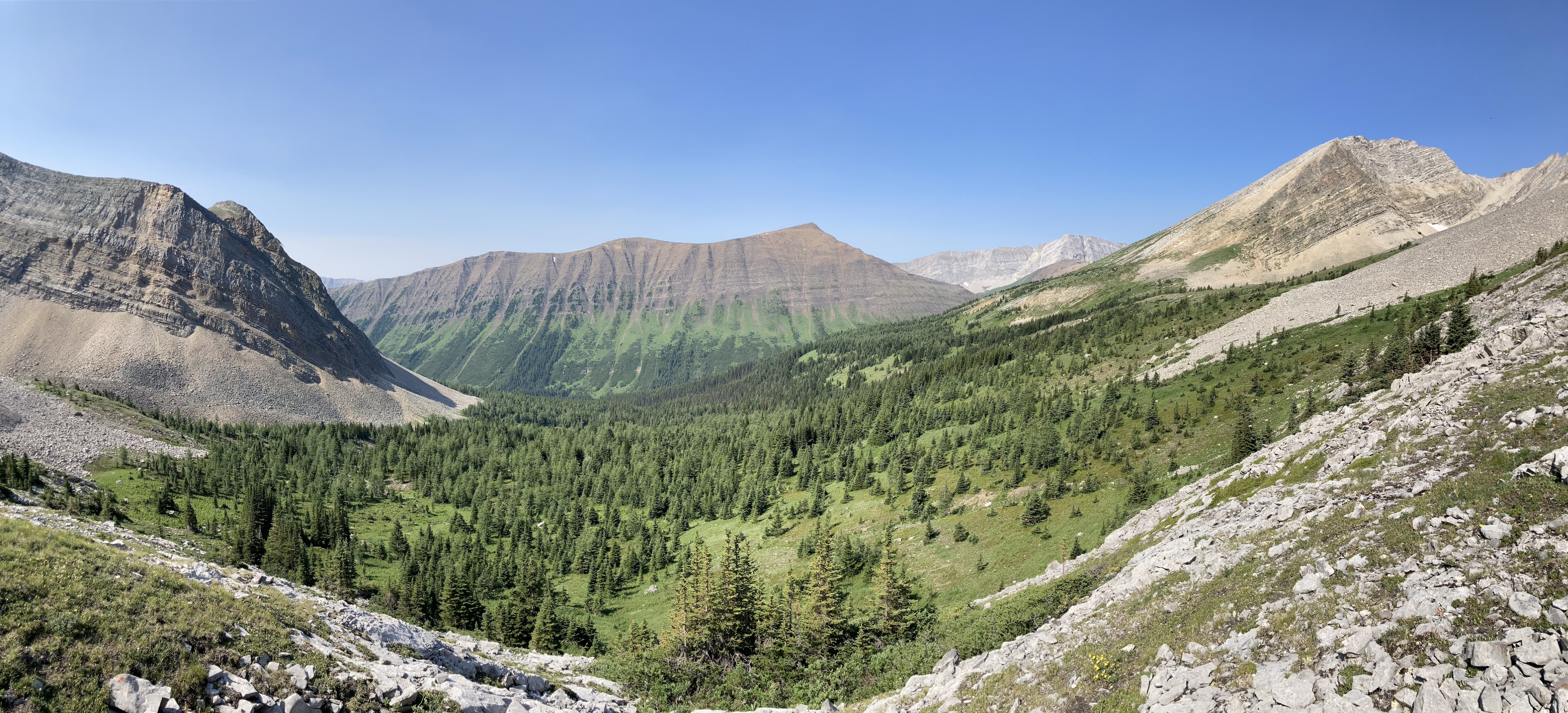
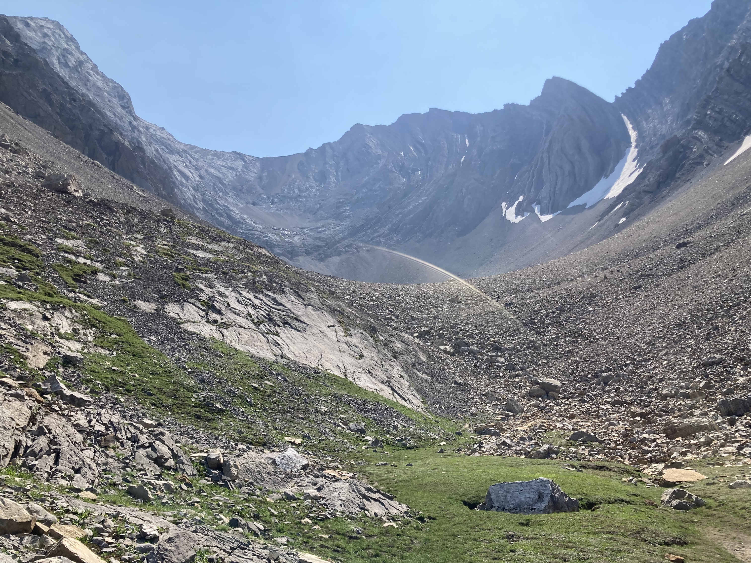
From the there the trail was less obvious, but not too hard to find. There was a lot of smoke in the air from fires in B.C., but the air cleared somewhat as the morning went on. We eventually got to a spot where we crossed the toe of a large rock fall. Here, my 9 year-old was ready to be done and my wife said she’d take her back down. Some flagging on a tree marked a trail that descended directly back through the trees and to the original fork in the trail by the creek (I had the benefit of the Topo Maps Canada app, which showed me where all these trails went). They descended without trouble and I carried on with my older two kids (now big lanky teens) and finished the very scenic loop through the rocky eastern portion of the cirque.
This was a great half-day hike. All of the smoke in the air was only a minor damper on our views within the cirque. Having done this trip, I think that if I were to do it again I’d proceed counterclockwise as per Nugara, but instead of completing the loop with the descent of the tricky slope on the west end, I’d backtrack after reaching the top of that slope (next to the outlier referred to as “Little Arethusa”) and then return to the shortcut trail and descend that way.
Click on the images in the gallery below to access full-resolution pictures.
Overview of the Highwood Pass area showing the relative positions of the 3 cirques. The parking area at the Highwood Pass is easily seen here and it’s clearly marked from the highway. This is the trailhead for Ptarmigan and Pocaterra Cirques. Arethusa’s parking area is also easy to see on this image but it’s not marked on the highway – you have to know where to look for it.A closer look at the route through Arethusa Cirque. Note that the landmark for finding the shortcut route is where the trail crosses over the toe of a rock fall.The parking area, looking south from the north end. It’s unsigned, but it’s immediately next to the highway and easy to find if you know where to look.The trail sets off through the trees from the north end of the parking area. The forest was pleasant, with plenty of wildflowers and some sunlit clearings. The bugs were pretty dense, though. Full-length clothes and some bug spray made the hike much more pleasant.Some flowers in the morning light. There was a fair amount of smoke in the air early in the day, which led to some interesting optical effects.The little waterfall just below the cirque.The fork where the trail enters the cirque. We went left, over the creek. The shortcut route splits off/joins up a short distance to the left. For a counterclockwise loop, one follows the easily discerned trail to the right.Conditions were quite smoky when we arrived at the cirque.The trail to the left was easy to follow. It soon went across this dried creek bed. This creek comes down from a steep gully which the trail would ascend alongside.Making our way up the steep ascent. There’s nothing really dangerous here – it’s just steep with poor footing so I was happy to ascend it rather than descend.As we neared the top of the steep portion our labours were rewarded with excellent (but smoky) views of Storm Mountain. The rocky tower to the left of centre loomed somewhat ominously in the hazy air.The Lord of the Rings quotes were coming fast and furious at this point in the hike.Almost finished the climb. The warped stone of Mount Arethusa’s south ridge comes into view.The trail tops out, then splits near the base of “Little Arethusa”. The path to the left carries on towards the scrambling route up this little outlier. Off-frame to the right is a bit of flagging on a tree showing the continuation of the route around the cirque. Incidentally, Bob Spirko’s trip report for Little Arethusa has almost this exact photo from 10 years ago. Click the link and scroll down if you want to compare.Looking south, across the valley toward Highwood Ridge. The summit of Mount Storelk is in the background.Some of the terrain in the northwestern portion of the cirque.More pleasant terrain. Little Arethusa is to the left. Mount Arethusa itself rises at the back of the valley.The party presses boldly onwards.Storm MountainMount ArethusaThe trail carried on around the cirque, heading towards the toe of the rockfall at the left of this picture. The trail was discernible as it crossed over those rocks, but it also split off and descended to the shortcut route before crossing the rocks.The shortcut route – note there’s a tiny bit of flagging on the tree next to the trail. My wife took our youngest down this way and reported that the trail was easy to follow and presented no difficulties. It brought them down the creek where we had originally entered the cirque. Myself and the teenagers continued left across the rockfall.The southern half of the loop through the cirque was much more rocky, so the trail was less obvious in places. The way was easy to find, though. We just stayed high, above the trees and traversed above the rock outcrop at the centre of this picture.Part of the ridge connecting Mount Arethusa with Storm Mountain.Looking back the way we came. The smoke had started to clear at this point.Panorama to the southwest, looking across the entire cirque.Making our way south, towards the last corner of our route.Looking up the valley at the final corner of our route toward the summit of Storm Mountain. From here we turned abruptly northwest and started to descend.The descent was easy, with the route paralleling a creek and passing through fun and rocky terrain.This was about as rugged as things got. You can see why Nugara suggests ascending this way – fun terrain and great views ahead of you.Down a little further. A couple of tributaries come together to make a little stream which the trail follows down to the original fork in the trail.A look back at our descent route.Almost back to where we started. The rest of our party was waiting by the log bridge over the creek.


Hi Par, This is very interesting landscape. The scenery is spectacular too. Thanks.
Bal Boora
>
LikeLiked by 1 person
an excellent trail report. glad i found your blog. thanks a big bunch.
LikeLike
Thanks for the feedback. Hope it’ll be useful for you!
LikeLike