There are 3 published routes that I’m aware of to the top of Mount Crandell. All 3 involve ascending the eastern aspect of the mountain. Kane describes them in the 3rd edition of Scrambles in the Canadian Rockies. One is considered easy (the usual descent route), one medium (‘Tick Ridge’), and one hard (via Bear’s Hump). Thanks to the Lethbridge Hiking Club Facebook group, I became aware of a 4th route to the summit. This one involves ascending the west side of the mountain and begins near Crandell Lake. It seemed to be an easy route, from a scrambling point of view, and I was pleased to discover that the GPS track for this route was among those included with the Topo Maps Canada app. On the last day of May I went to check it out.
Access is from the Crandell Lake trailhead on the Akamina Parkway. About 5.5 km from where the parkway leaves the Waterton townsite there’s a clearly marked parking area right by the start of the Crandell Lake trail. I followed the trail for about 1 km to where it was joined from the southwest by the hiking trail which returns to the townsite. I turned right and followed that trail for about 50 m, to where a small cairn marked the departure point of a faint path heading into the trees. The path was reasonably obvious, though from time to time there seemed to be options in terms of which way it went. The burned state of the forest made it pretty easy to see where I was going, though.
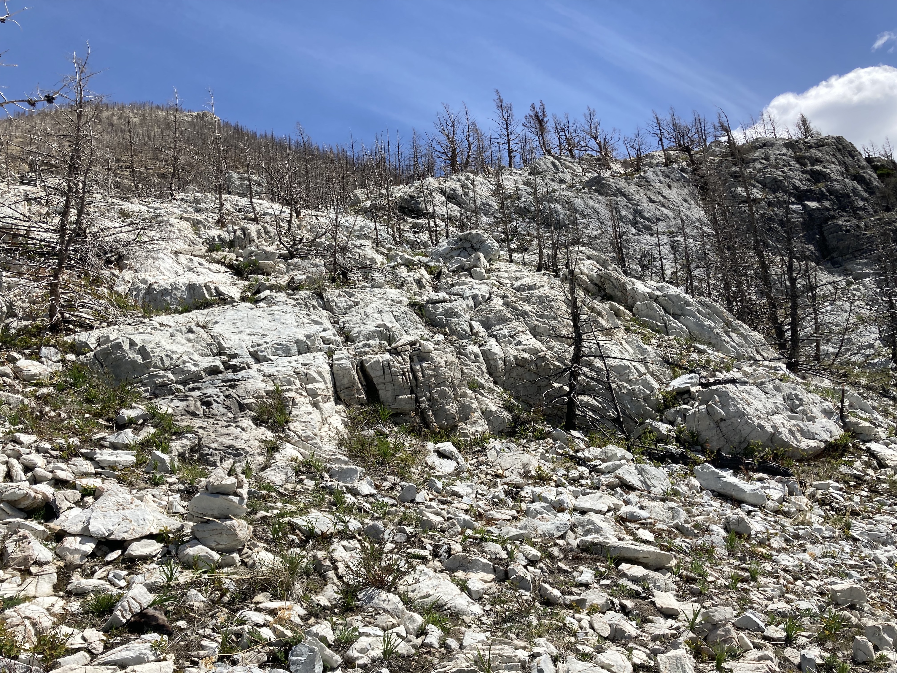
The path first went up to a small outcrop of exposed orange rocks, then deviated to the right and ascended towards an obvious interface of two cliff bands higher up. Ascending through that weakness, it then proceeded to the right (south west) near the edge of grey rocks. A few cairns were present here and there to prompt me in the right direction as the route periodically ascended and traversed. Eventually the trail stopped traversing on the grey rocks and proceeded more or less directly uphill through the remains of the forest. The peaked shape of the top of the ridge was in sight by this point. This part was a slog, but didn’t last too long. Another rocky area and another traverse followed, then a less steep climb through more trees. After passing above the treed area, the way to the ridge top was obvious and I climbed up.
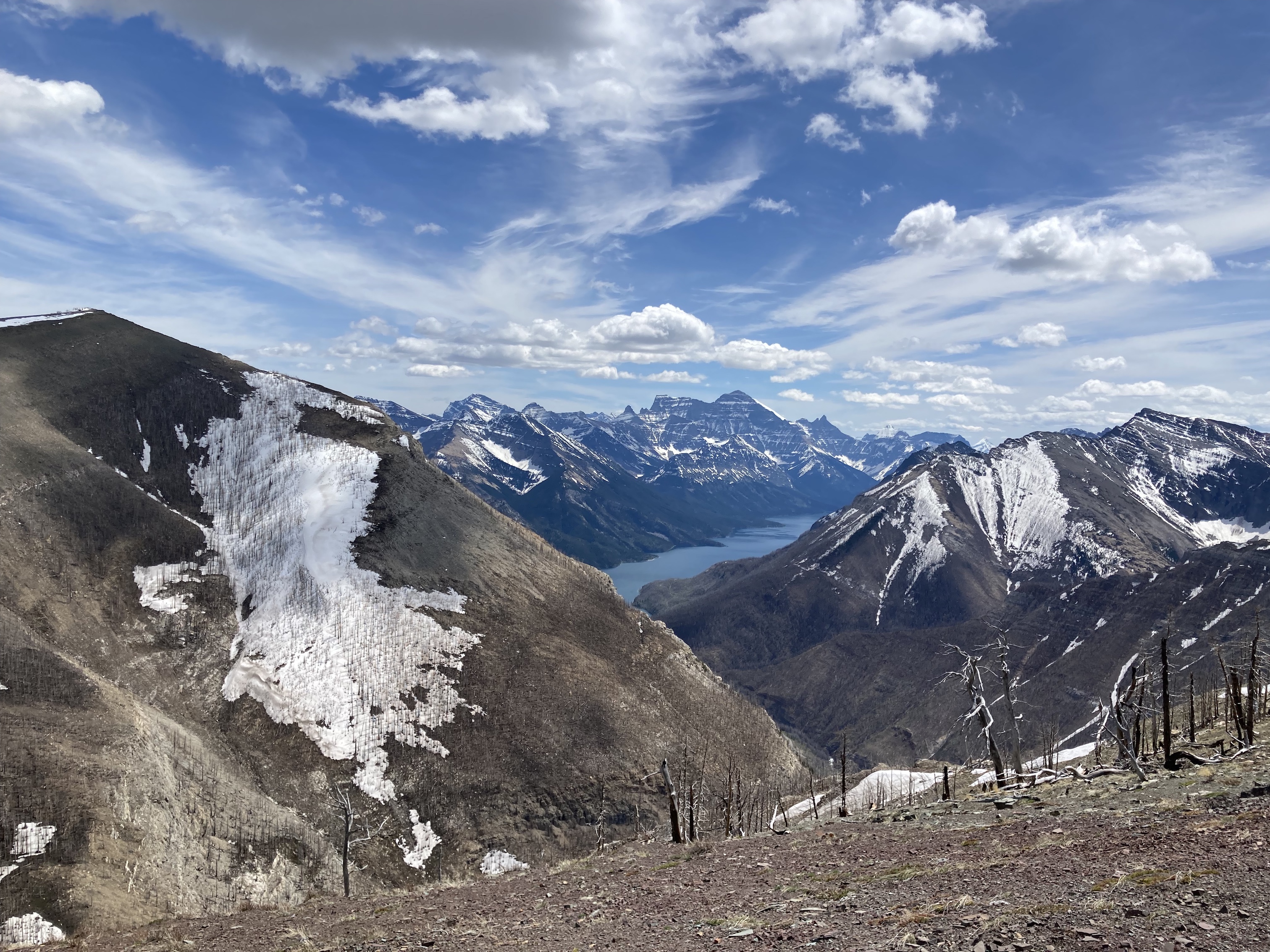
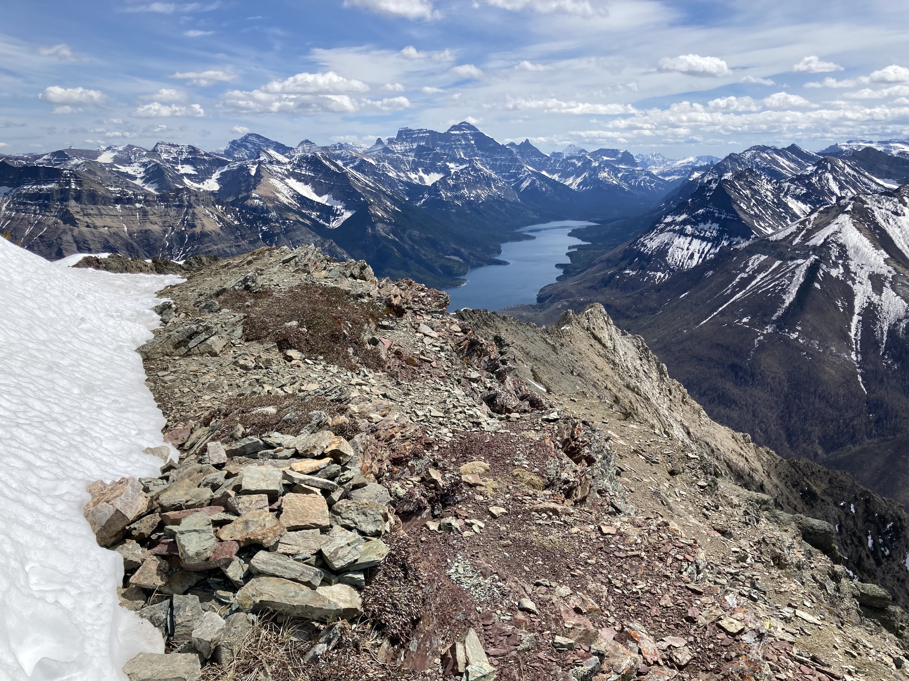
From the ridge top the way to the summit is clear though the summit itself is initially obscured. A pleasant 2 km ridge walk followed, which involved a little bit of altitude loss and regain. Views were excellent in all directions, encompassing most of the major peaks and valleys in the park at some point during the ridge walk. I reached the sensor station and wooden platform at the summit 2h 28m after setting out. After enjoying a nice long stay in fairly calm weather I returned the same way I came.
Scrambling purists will likely prefer Kane’s routes over this one, though there are several places along this route where one could engage in some hands-on scrambling. The main advantage of this route over the eastern approaches would be the views. The east approaches will not have the same views of the area around Mount Blakiston, or down the Akamina Valley. In addition, while the eastern approach puts the spectacular views of Waterton Lake and environs behind you as you climb, the western approach has it unfolding in front of you for some of the climb and all of the ridge walk.
Click on the pictures in the gallery below to access full-sized images.
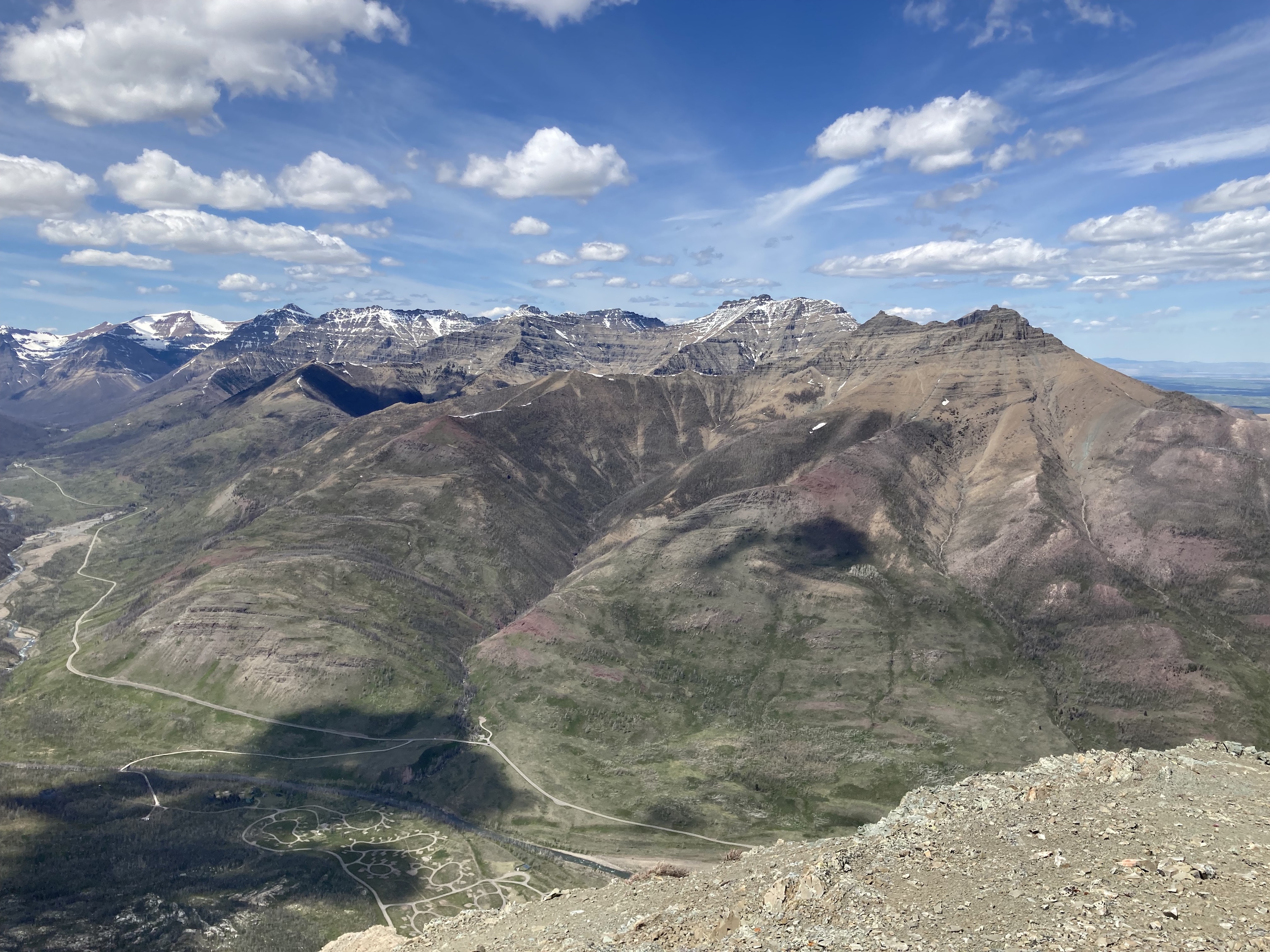
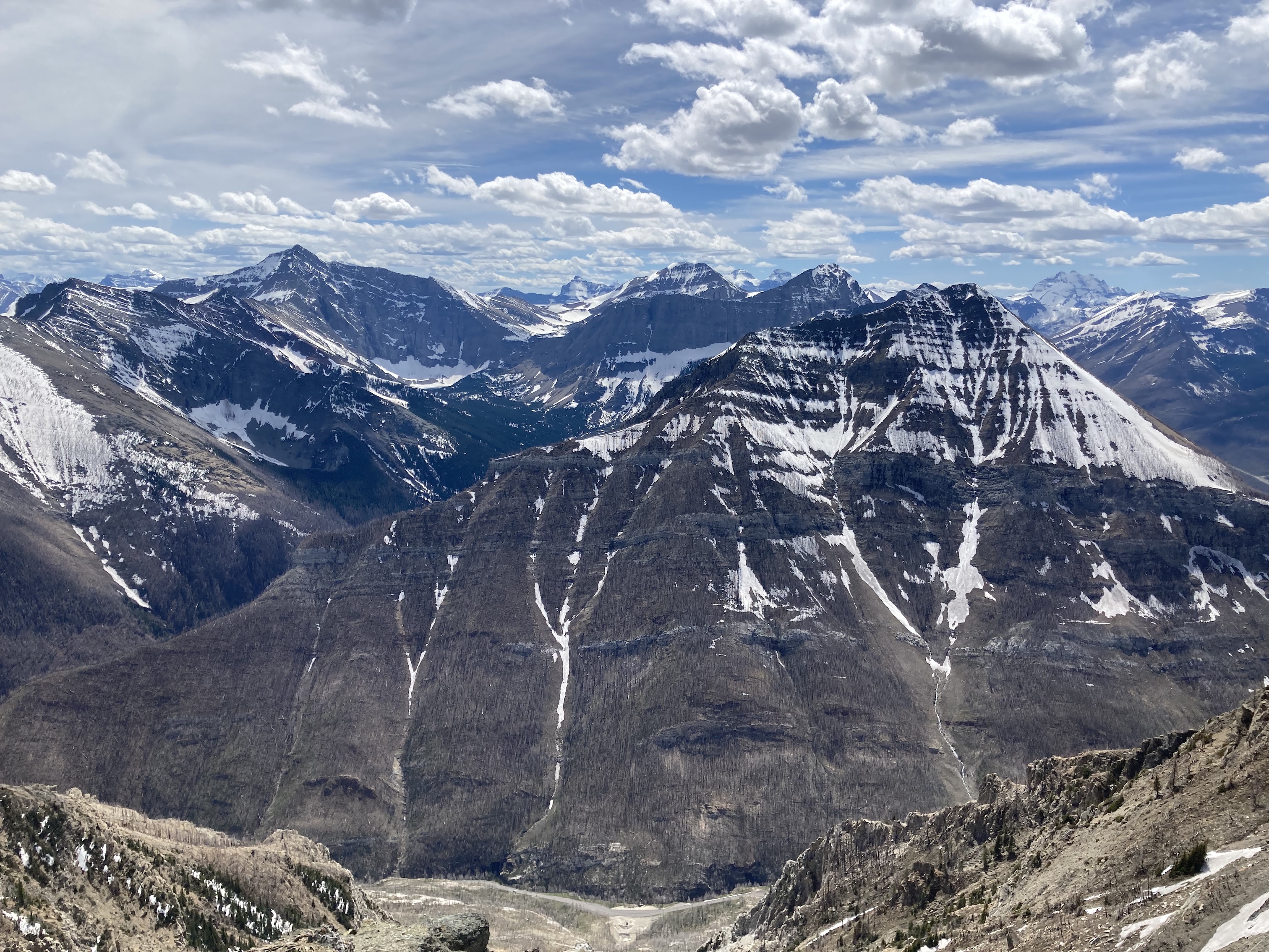
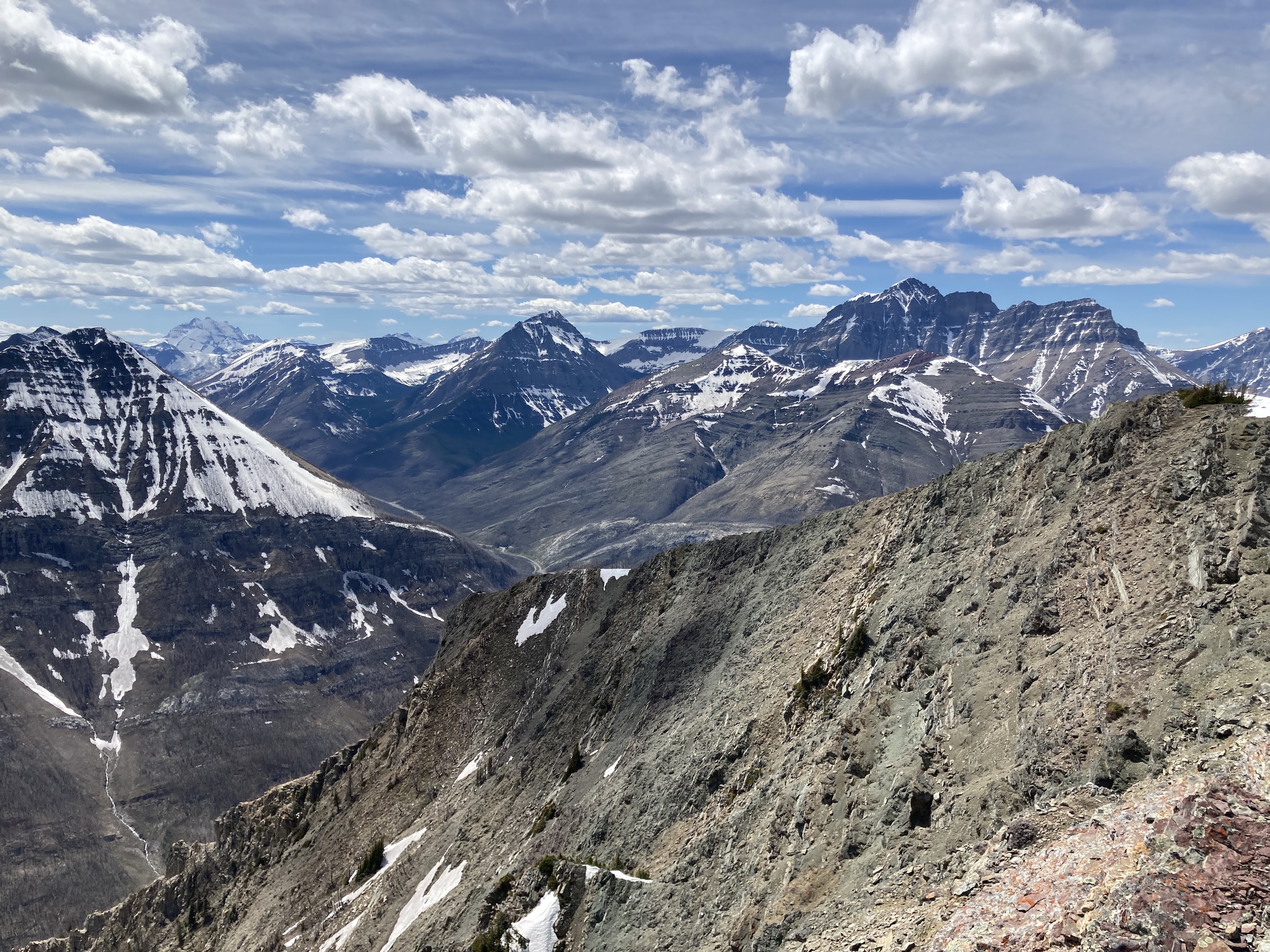
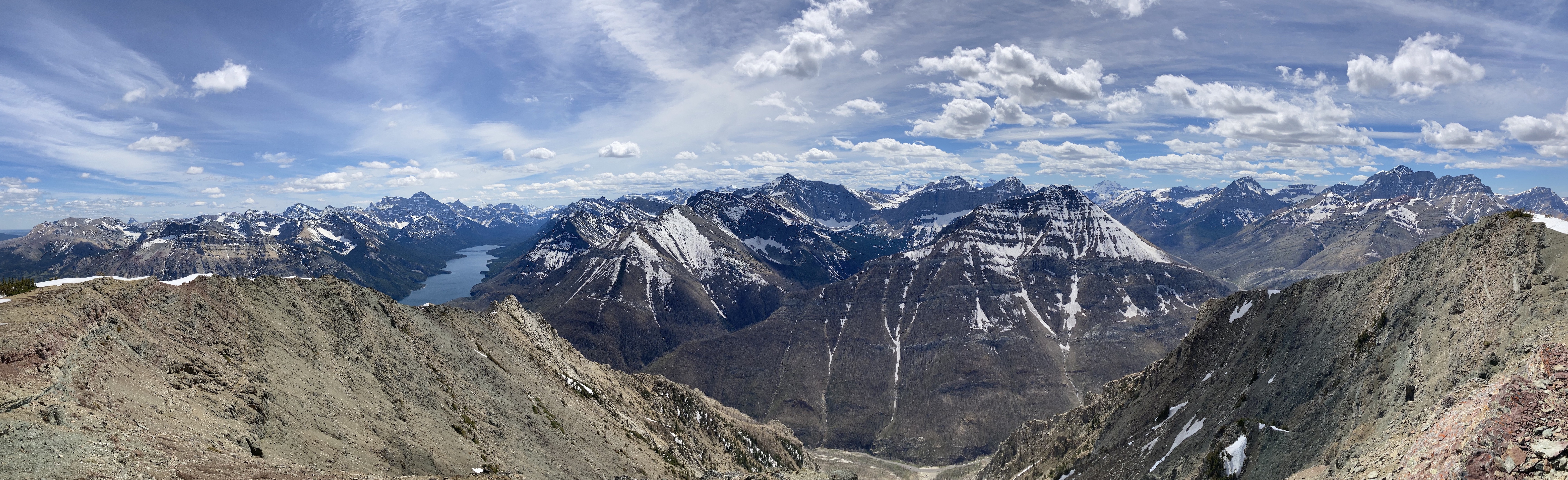
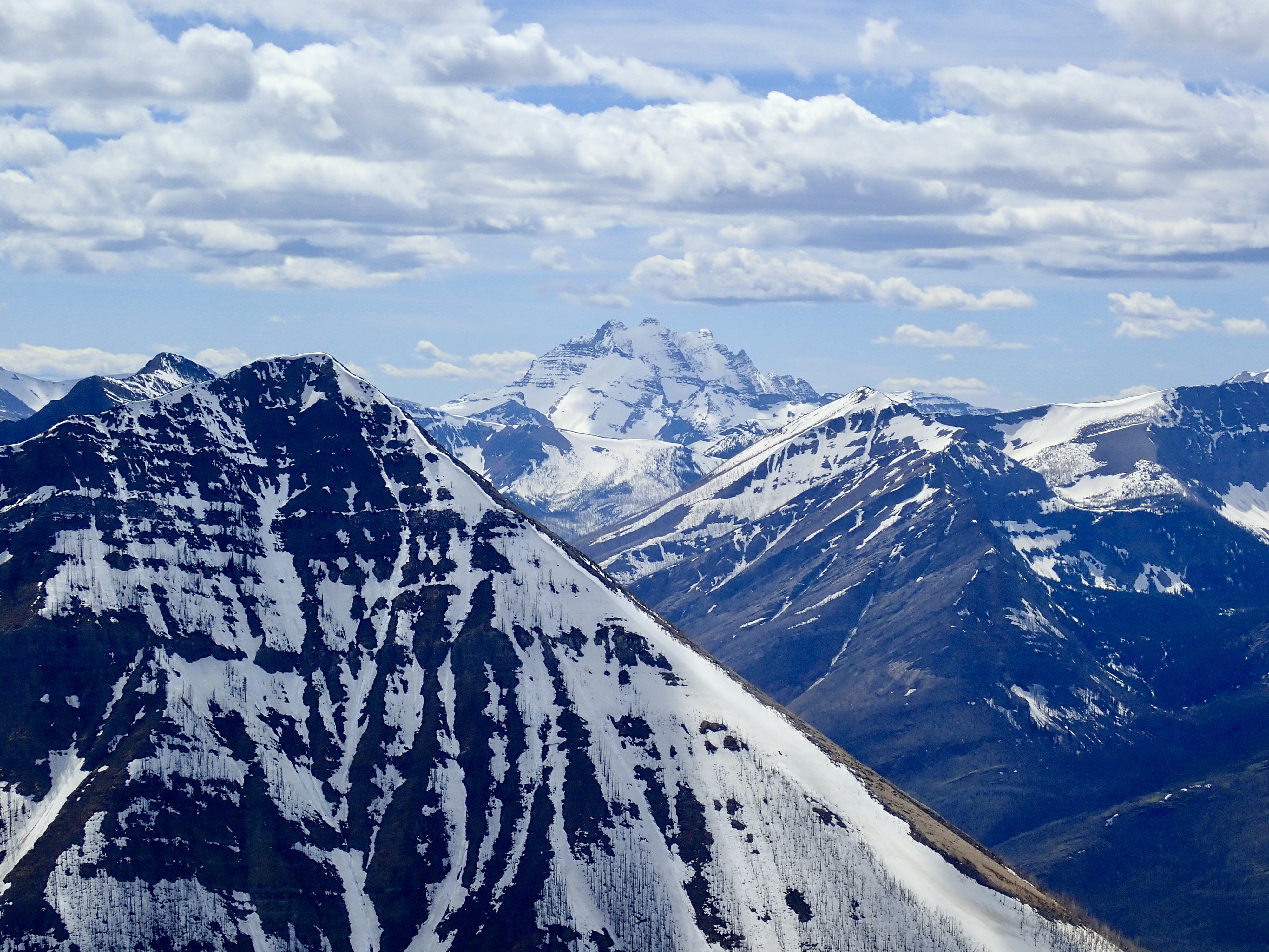
Route overview looking northeast. Google Earth doesn’t have cloud-free imaging of this area.A very rough sketch of the route.1 km up the Crandell Lake trail, there’s a signed intersection where I turned right. 50 m down the trail towards the townsite there’s a little cairn marking a trail into the woods.During the initial climb, an interface between two cliff bands is soon visible through the trees. The trail heads up to there and passes through in an area of rocky terrain. No tricky climbing is involved.The route ascends and traverses to surmount additional rocky outcrops and low cliffs.Eventually the terrain uphill starts to look like this. The faint trail in the rocks continues a short way beyond here, then turns to ascend straight up through the trees.This uphill grind doesn’t last too long, fortunately. Eventually the grade eases and the route is back on more solid rock terrain.Another bit of traversing on white rocks brought me to this distinctive spot with a small standing stone. It was a useful landmark for directing my descent.Looking down towards Crandell Lake from the landmark stone. Ruby Ridge rises behind the lake with Mount Blakiston towering behind.Ascending above the marker stone. The grade isn’t as steep anymore. After passing a few more rocky outcrops, I made it to the ridge top.Almost at the top, checking out some of the black rocks with green lichen that are characteristic of many summit blocks in the southern Rockies.On the ridge top, looking east. The summit isn’t visible at first, but soon pops into view.Looking west from the ridge. The Akamina Valley on the left heads towards Cameron Lake. Akamina Ridge beyond the spot where the valley turns. The valley on the right heads towards Red Rock Canyon. These are the views you won’t get if you ascend by the eastern approaches.Crandell Lake, with Mount Lineham, Ruby Ridge, Mount Blakiston, and Anderson Peak behind. The parking area at the trailhead is at the left of the frame.Upper Waterton Lake as seen from the start of the ridge walk. Mount Cleveland was looking great that day.From left to right: Avion Ridge, Mount Glendowan, Cloudy Peak, Mount Dungarvan, “Rogan Peak”, and Mount Galwey. The Crandell campground is in the valley bottom. At the moment it’s still closed for rebuilding after the fires.The summit eventually comes into view, featuring sensor station of some kind. Chief Mountain is in the distant background on the left.Closer to the summit the terrain becomes a little more interesting, and the views along Upper Waterton Lake continue to improve.The summit of Mount Crandell, looking south. Mount Cleveland dominates the view. The sensor station is to the left of this frame. It’s a big green cylinder with an antenna. Nearby there’s a wooden platform which is apparently a helicopter pad.Southeast. Sofa Mountain, Vimy Peak, and Mount Boswell are directly across the valley. Chief Mountain is in the distance to the left of centre.More mountains to the south. Mount Richards is to the immediate right of the lake. Bertha Peak is near centre, and Mount Alderson is to its right.Looking southwest. The end of Buchanan Ridge is directly across the valley. Mount Alderson, Mount Carthew, and Buchanan Peak are behind it. Portions of Mount Custer are visible in the distant background. The big snowy peak in the distance to the right is Long Knife Peak in Glacier National Park in Montana.Looking west. Long Knife Peak, Mount Rowe, Mount Lineham, Mount Hawkins, Ruby Ridge, and Mount Blakiston.Summit panorama.I finally remembered to bring my little tripod so I could get a picture of myself.Mount ClevelandMount Alderson. A sliver of Alderson Lake is visible surrounded by snow at the base of the massive cliffs of the northern face. The 2 Carthew Lakes are in the snow-filled hanging valley to the right. The very popular Carthew Alderson Traverse hiking trail descends through tis area on its way back to the townsite.Mount Blakiston and Ruby Ridge.Long Knife PeakPeering between Vimy Peak and Mount Boswell at the snowy valley containing Crypt Lake.Akamina Ridge. The summits of Kintla Peak and Kinnerly Peak rise beyond the ridge.Heading back along the ridge, enjoying excellent simultaneous views of Mount Cleveland and Mount Blakiston.
Thanks for reading! Long Knife is just over the border in the US – Montana’s Glacier National Park has some amazing looking mountains. I’ve never actually been there, though. Someday, when the world’s a little more calm, perhaps.
Thanks so much for posting a play-by-play of your ascent with photos! This is very helpful as I was wondering what the route was like and how easy finding our way up might be. Heading to Waterton tomorrow and this trail is on my list!


Once again a great post with some beautiful photos from your.
The Summit panorama photo is simply mesmerising with all these peaks in the background.
From your photos, I also like the Long Knife Peak.
Thanks for sharing
LikeLiked by 1 person
Thanks for reading! Long Knife is just over the border in the US – Montana’s Glacier National Park has some amazing looking mountains. I’ve never actually been there, though. Someday, when the world’s a little more calm, perhaps.
LikeLike
Beautiful views from the top. Time to visit Waterton again😊
LikeLiked by 1 person
Thanks so much for posting a play-by-play of your ascent with photos! This is very helpful as I was wondering what the route was like and how easy finding our way up might be. Heading to Waterton tomorrow and this trail is on my list!
LikeLiked by 1 person
Hope you enjoy the hike. Thanks for reading!
LikeLike
Thanks for the great post on Crandell. It helped me out so much and I was able to enjoy such a great hike. 👍
LikeLiked by 1 person