December 27, 2017. A snowshoe trip to the highest peak in Beauvais Lake Provincial Park.
- Region: Beauvais Lake Provincial Park, Traditional Territory of the Tsuu T’ina, Ktunaxa, and Blackfoot First Nations
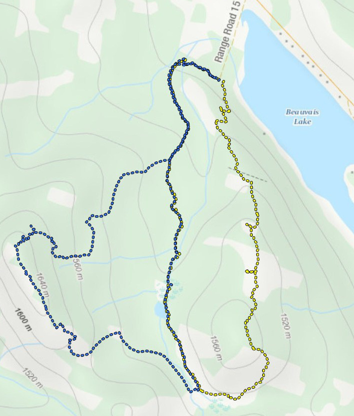
- Distance: 8.3 km
- Total Elevation Gain: 318 m
- Total time: 3h 43m
- Elevation of objective: 1690 m
The remnants of Southern Alberta’s first snowfall of the winter season vanished in Chinook winds in early December this year. At the beginning of last week, temperatures were well above freezing and I was afraid I’d have a Christmas break with no snowshoeing. That was a silly thing to worry about, as it turned out. The snow returned with a vengeance last week, along with bitter cold. I was watching the forecasts for the mountain regions closely, hoping to see a break in the constant “Extreme Cold Warning” notices from Environment Canada. Yesterday while Lethbridge was still under an Extreme Cold Warning, I noticed that Pincher Creek and the Crowsnest Pass were not. Mind you, the forecast high for those regions was still about -18 Celsius. But there was very little wind in the forecast, and there was snow coming on subsequent days. It looked like I had a narrow window of opportunity. I grabbed my gear and jumped in the car, heading back to Beauvais Lake Provincial Park to climb up Mount Albert.
My last outing was to Beauvais Lake PP as well, when I snowshoed a loop which went up to Piney Point and returned via the adjacent valley on the Christy Mines trail. At that time I noticed a couple of hand-written labels on trail markers near the end of my route, pointing the way to Mount Albert. On the Provincial Parks website, the trail is described as being 7.0 km in length with a 250 m elevation gain. My own measurements were a little different, but we’ll get to that at the end.
Access to the park is straightforward: follow Highway 507 east from Pincher Creek for about 10 km and turn south at the sign. Once in the park itself, park at the Beaver Creek Day Use Area. The access road to the Day Use Area had been plowed, so getting to the trail head was no problem in my car. I have been there before when only the main road into the park was plowed. On that occasion I parked up on the main road and walked down to the Day Use Area and trailhead, having almost got stuck in the snow trying to drive there.
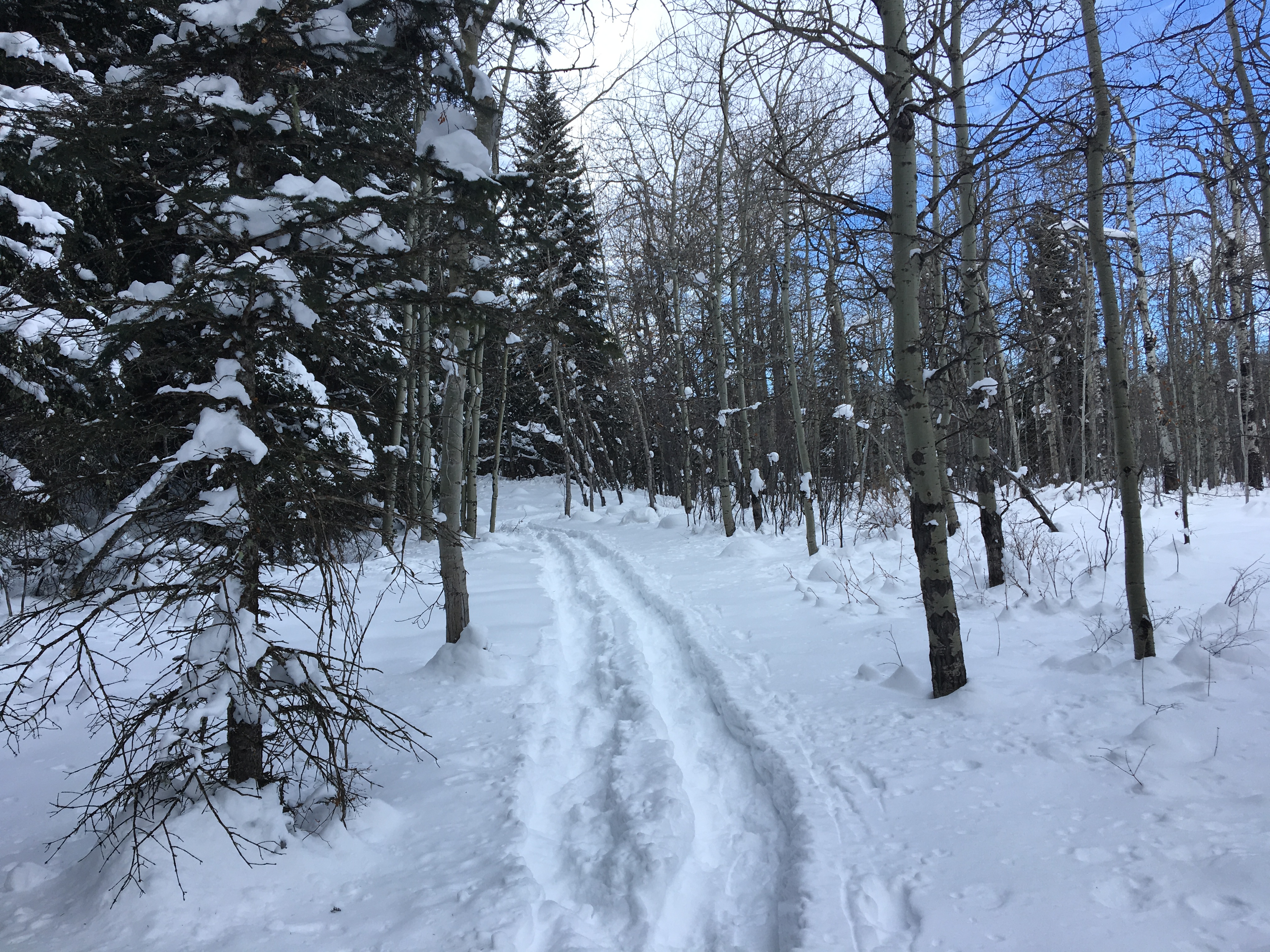
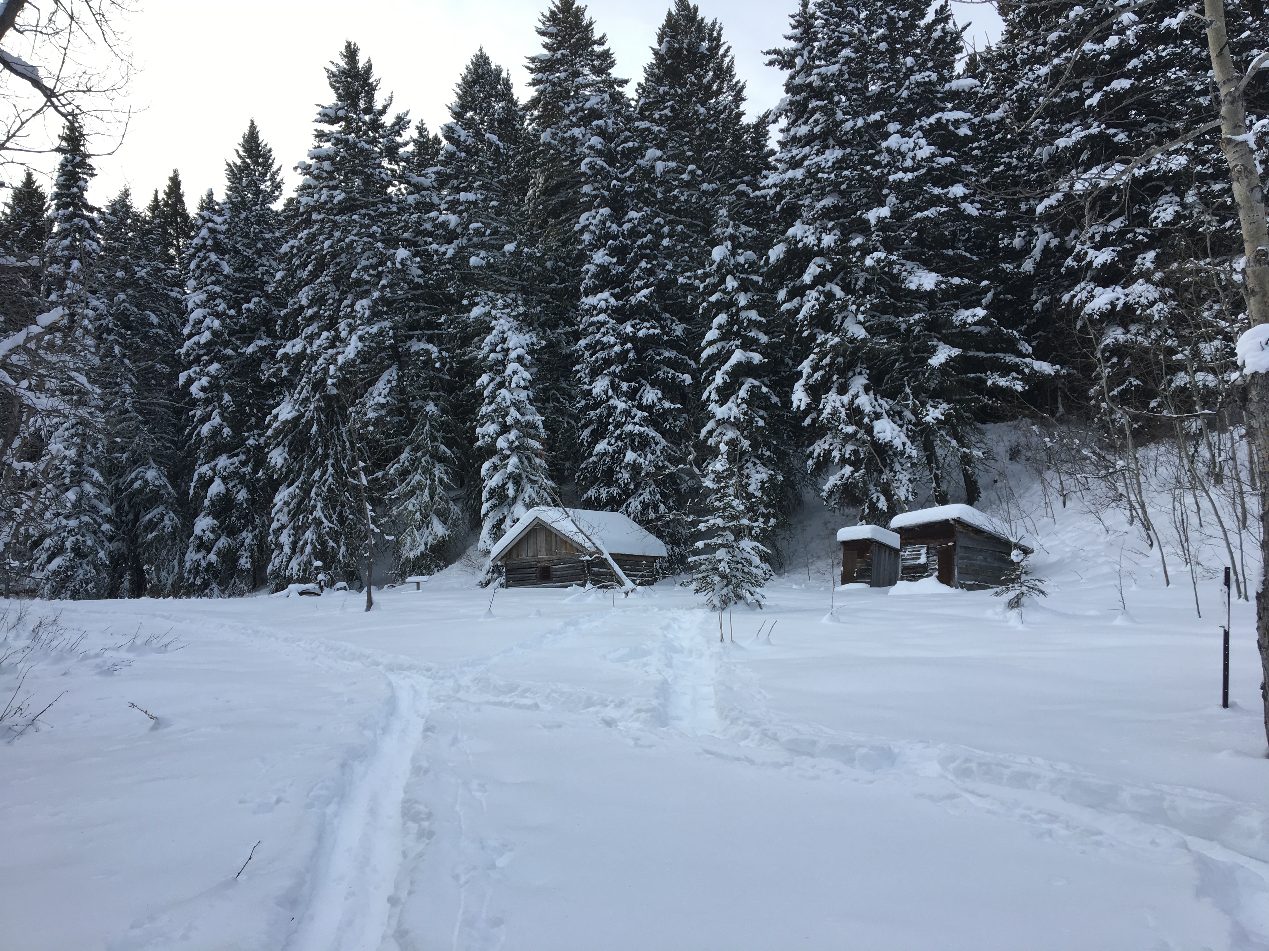
From the parking area, there are trails heading south (up the slopes to Piney Point) and northwest. I set out to the northwest, following footprints in the deep snow, through a short stretch of woods, across a bridge and into a clearing where the remains of the Lower Smith Homestead sit nearby the Group Use Area. Rising up behind the clearing is a wide, groomed trail which heads south and begins a slow and steady ascent.
The day was definitely cold, with the temperature at the parking lot -19 Celsius. Off the start, it was partly cloudy, but it cleared as the day went on. The wind was calm, and only notable for a short time while I was up on the ridge. The area had seen plenty of snow, and it was piled deep and soft along the whole route, with the exception of the short groomed segment. Based on the tracks, I could see that 2 others had been on the route up (or down) from the summit since the last snowfall. However, I had absolute solitude on my trip. I saw nobody at all on the trail all day.
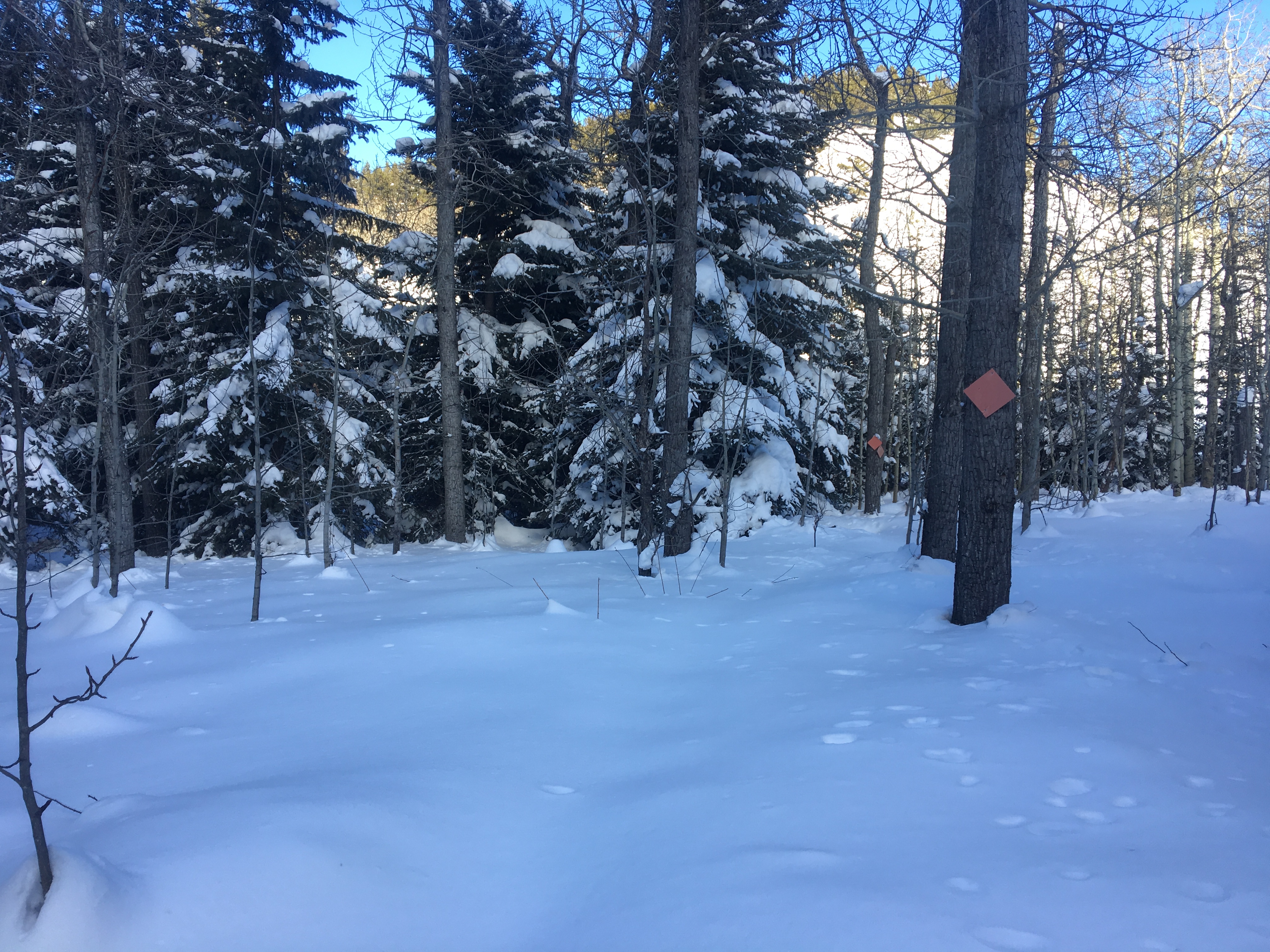
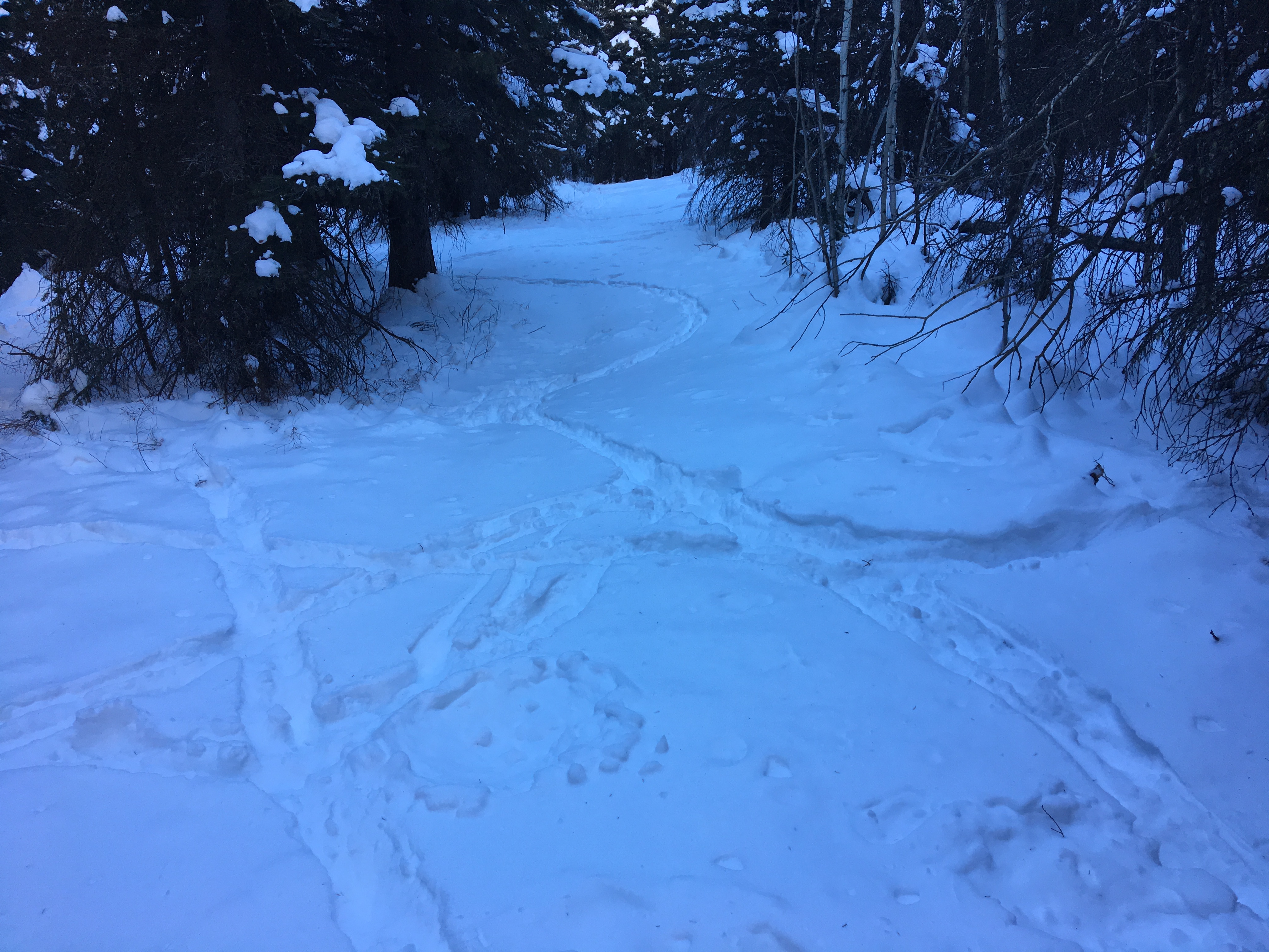
At 1.1 km this trail splits into 3. It’s a strange sight — 2 blank rectangular sign-posts on either side of the trail, and 2 triangular orange trail markers with directions scribbled on them in black marker: Beaver Ponds to the left (south) and Mt. Albert to the right (south-west). The Beaver Ponds referred to are the small ponds along the Christy Mines trail, not the “official” Beaver Ponds marked on the park map which are way back near the park entrance. It should be noted that the groomed trail also goes off to the right, but the route to the summit branches away and into the trees — it’s the left branch arising from the right branch (see the marked-up image in the photo gallery).
Beyond the branch the trail rises steadily. Initially there’s little to see, with thick forest all around. The trees slowly thin, and at about 2 km I entered a large clearing. I could see up the wooded eastern slope of Mt. Albert, and rising to my right the trail continued to a clear snow-covered ridge. A short, steep climb got me to the first expansive views on the route, looking back to the east over Piney Point and the prairie beyond. Up on the ridge there was minimal drifting of the snow, since the area was in the lee of the main bulk of the peak. I didn’t see any cornices, but stayed well away from the edge. Soon the trail re-entered the trees, and I once again saw orange trail markers.
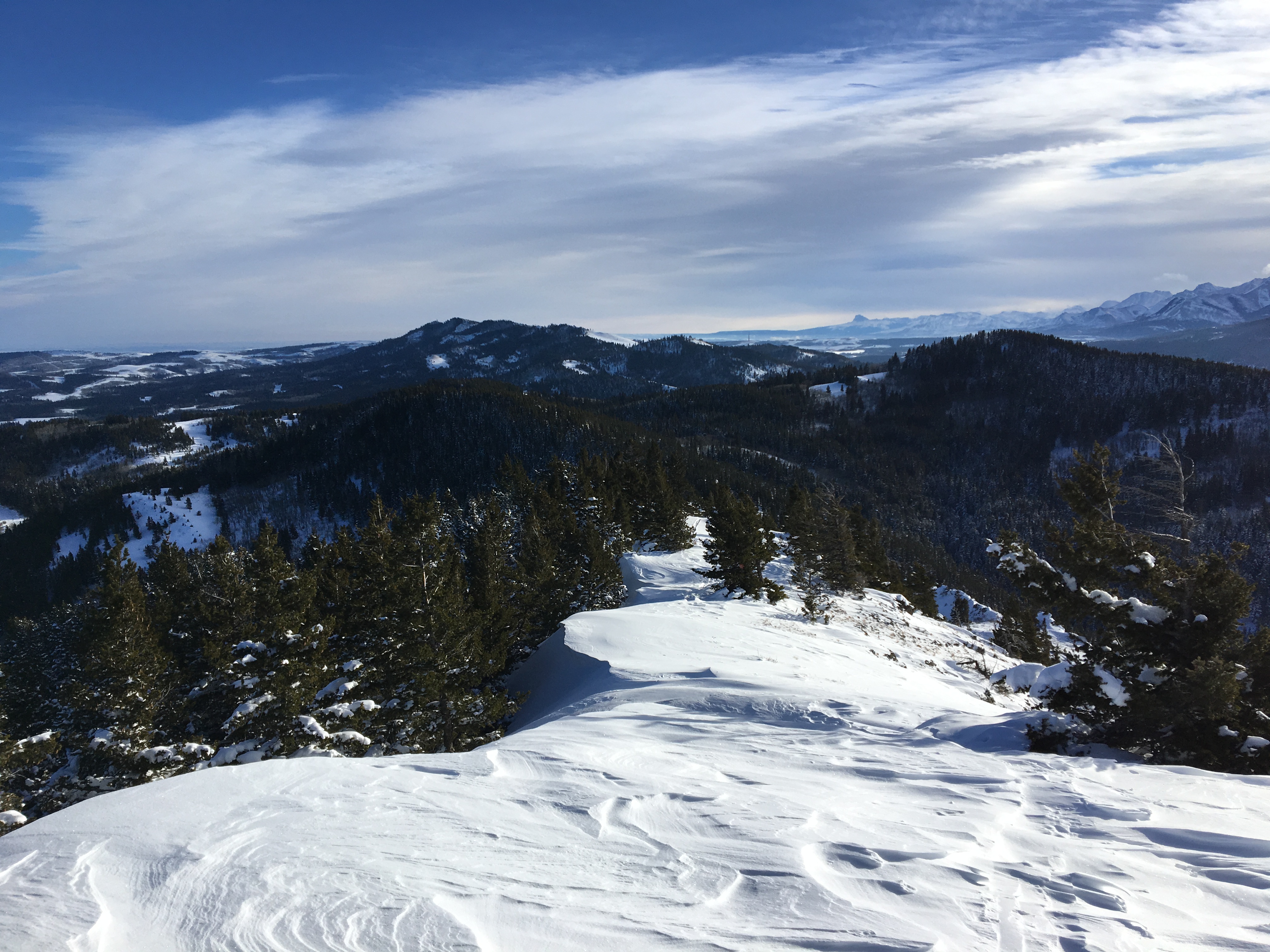
At 2.5 km there is an intersection with the unofficial connector trail to Mount Baldy. Yes, that’s its real name. Mt. Baldy is a nearby high point that has a antenna on it. People often hit that peak in combination with Mt. Albert, making a large counter-clockwise loop that incorporates other parts of the trail system. I had decided against that when I set out, since I knew my daylight was limited, I was in very cold conditions and I was by myself. I walked a few meters along this trail, though, so I could take my first break and admire my first views of the Crowsnest Range. By this time the clouds had cleared away and I was treated to an amazing view of Crowsnest Mountain in the far distance, with Turtle Mountain in the foreground.
From that point there was steep climbing in deep snow to reach the summit. The conditions were tricky due to the pitch and the depth of the snow. Slow, deliberate moves were required to get up safely. After a slog, the snow-capped summit came into view. A final steep scramble got me up onto the wind-swept peak. It had taken me 1h 23m to that point. My Topo Maps app recorded my track to the summit to be 3.4 km long with a 318 m elevation gain. The height at the peak was recorded as 1690 m, significantly higher than the official elevation of 1620 m. Others in the hiking blog-o-sphere have noticed a similar discrepancy.
The views from the summit were glorious. Mt. Albert is the highest point between the the Provincial Park and the true mountain ranges, allowing unobstructed views of peaks in the Crowsnest Pass, Castle Wilderness and Waterton. Chief Mountain in Montana was visible in the distance. The clouds had cleared away from my area and I had sunshine to light my views. I could see the clouds building up, away to the west behind the front ranges, ready to bring the next snowfall to Southern Alberta.
Up there I was exposed to a frigid, though not very strong, wind. I had been careful to keep my phone from getting too cold during the trip to the summit since smart phone batteries have a habit of freezing quickly and shutting down. As I went on a frenzy of photo-taking, sure enough my phone promptly shut down. Re-warming it in an inner pocket revived it, but my GPS app stopped recording my track and I had to re-start it, breaking my trip into two files. No big deal.
I then continued on my route, going south toward a 2nd high-point on the summit ridge. This southern “summit” is notably lower than the true summit on the north end of the ridge. The snow was scoured away from regions of the ridge, drifted and crusted in others, and very deep in others. Eventually I reached the southern extent of the summit ridge. There was a trail marker there, and a hard left turn got me on the path going down off the mountain.
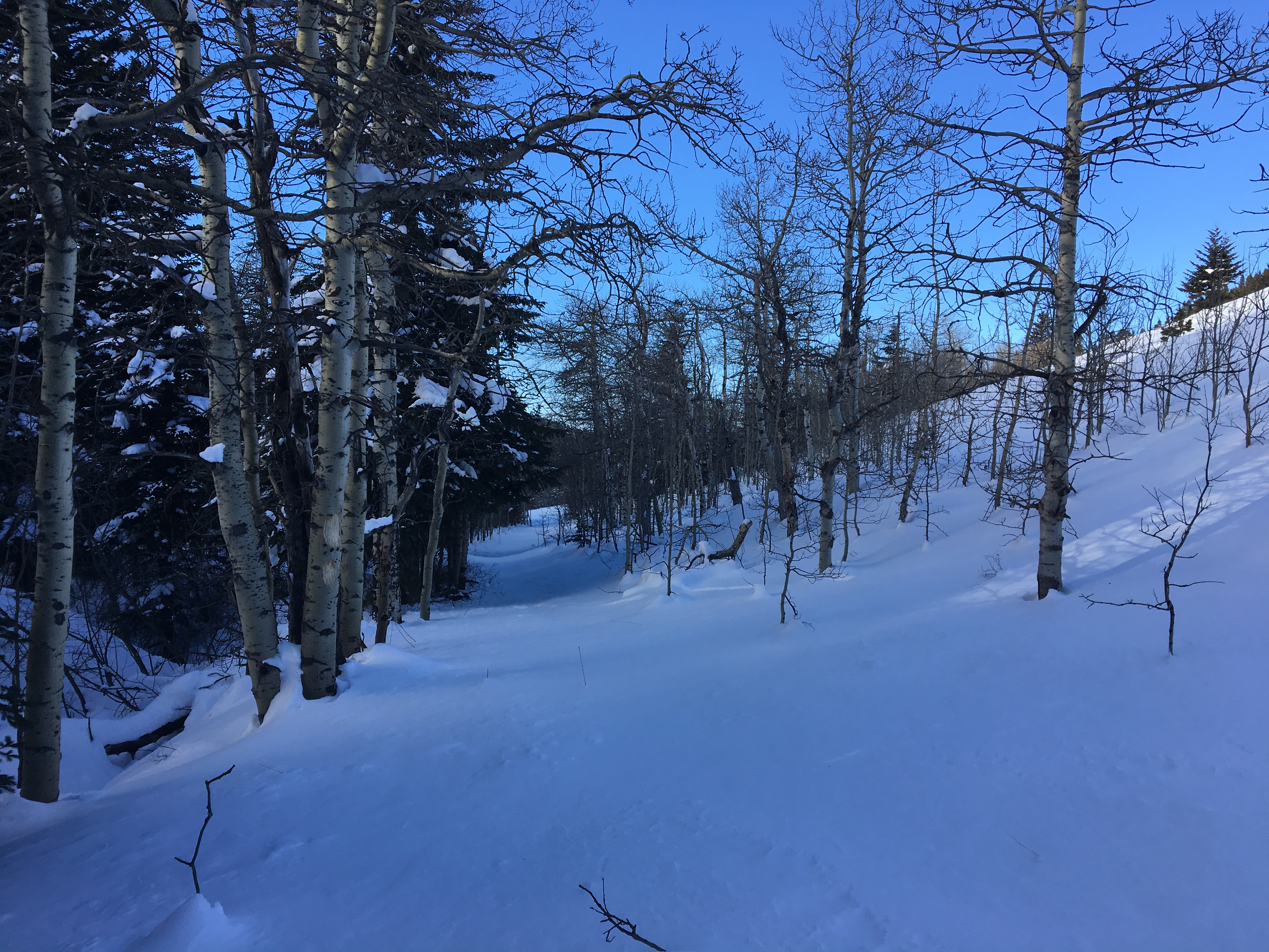
The descent was steep. It seemed steeper than my ascent route. The footprints that I had been following eventually deviated and disappeared from my route. I was trying to keep to the path shown by the orange trail markers. This path actually wasn’t always the same as the GPS path that was on my mapping app. It was clear that there were several ways down, and I sometimes added a switchback or two in steep areas where the snow as deep and I wasn’t sure of my footing.
For most of my return route, which was 4.9 km, I was moving through untouched snow. There’s a definite joy in being the first to break through fresh piles of snow. On the other hand, there’s a definite fatigue that sets in when you’re trail-breaking through very deep snow. I was really feeling it in my legs before the end. The route down into the valley to rejoin the Christy Mines trail requires a 600 m detour south in order to cross a tiny bridge. Once across the bridge and onto the proper trail, you promptly turn 180 degrees and head north, back down the valley. I imagine some enterprising people shortcut across the tiny creek so as to avoid this, but the creek wasn’t visible under the snow, and I had no desire to discover a creek bed or drainage by breaking my ankle stepping into one.
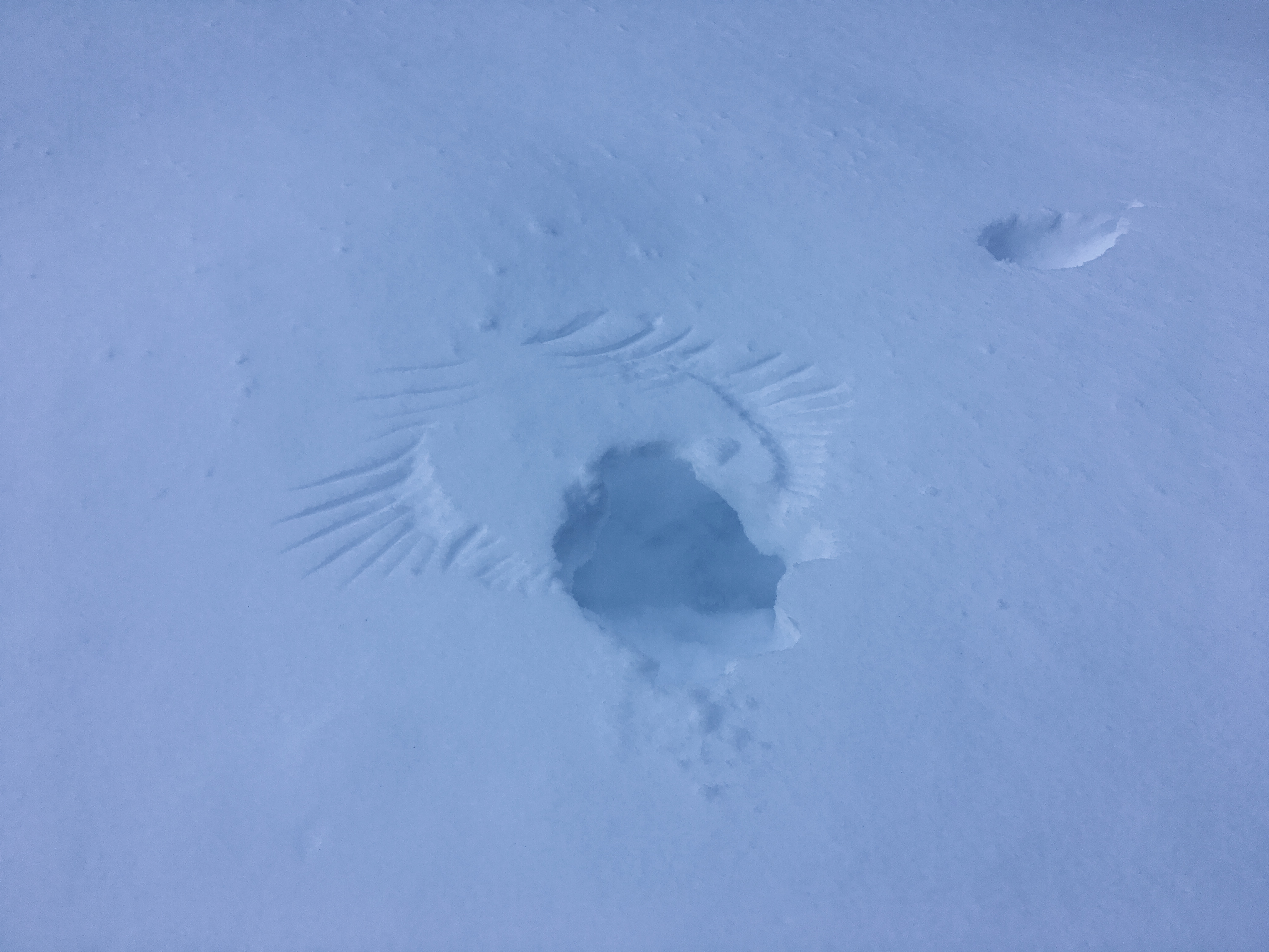
I saw no human tracks on the return trip in the valley. There were deer tracks now and again, but for the most part I was on totally untouched snow. My legs were really feeling the strain of trail breaking by the time I reached a bench next to one of the ponds. I figured I’d eat my sandwich there. Unfortunately it was frozen solid. I settled for some tea from my thermos, then carried on until I reached the intersection with the groomed trail, turned right and made my way back to the parking lot.
This was a great day out on snowshoes. I’d actually just got a new pair of Atlas 1030s, and this was my first opportunity to use them. They worked great and I was very impressed with the binding. No adjustments were needed and my feet felt secure the whole time. I was pretty tired by the time I got back to my car, and a lot of that was due to the cold and the deep snow. I would call this a moderate difficulty route for snowshoeing, but the caveat is that the trail onto and off of the summit was quite steep, and the snow conditions made it tricky in places. Along with this, the deep cold and trail-breaking in deep snow made the trip quite fatiguing. Shortly after 3pm the sun was behind the hills and I began to lose the light. It just goes to show that the particulars of snow conditions, weather and season can drastically impact the difficulty of a trip.
Click on the pictures below for full-sized images.


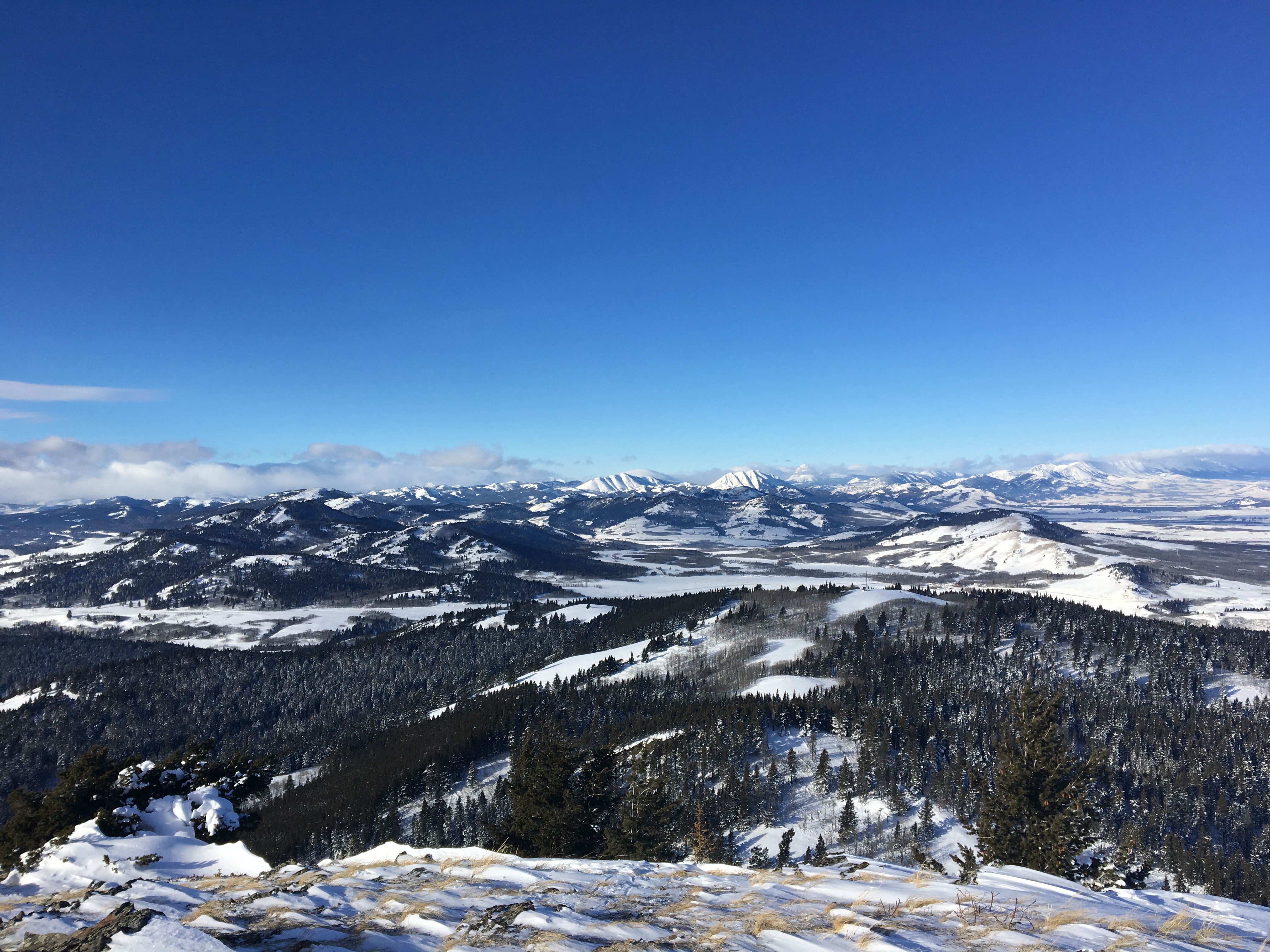


Really amazing views from the top!
LikeLiked by 1 person
Just attempted a cold weather hike here today too…at 11 degrees (albeit with wind and mist-like rain dragging the feeling a little lower). I cannot imagine how it feels to be hiking at -17, but your final photograph gives me some idea!
LikeLiked by 1 person